Monthly Archives: September 2022

20220928 – A visit to the Eastman Museum in Rochester, New York and lunch at the Red Fern nearby

WEDNESDAY 28 September

(All photos taken with a Google Pixel 6 Pro smartphone.)

I was in bed before midnight last night, unusual for me, so I was up this morning just after 7 AM.  Linda did not go to bed until 11 PM and got up around 7:30.  We had our usual two cups of coffee, but Linda made pancakes for breakfast, with a side of fresh bananas, blueberries, and strawberries.  A special treat, and a nice way to start the day.

The weather forecast for today was for cool, overcast conditions, with small possibility of rain, but was much nicer for the following three days.  We thought we would visit some of the wineries on Canandaigua Lake as we are camped just north of it, so we spent some time researching the six establishments on the Canandaigua Lake Wine Trail.

The conservatory as seen from the dining room.  The console for the pipe organ is at the far end and some of the pipes are installed in the 1st and 2nd floor walls beyond that.  Most of the house was dimly lit, but the conservatory was full of light even on this overcast day.  Like many wealthy individuals of the late 19th and early 20th centuries, George Eastman liked to hunt and had two hunting lodges.  George Eastman House / Museum, Rochester, New York.

One of them was not open today, one was basically a wine store in Canandaigua, one had what appeared to be fruit juice infused wines that could be used to make spritzers, and one was a “boutique” winery that required reservations, and all of them appeared to be tasting rooms, not the actual wineries.  So that was:  no go, no, no way, and not interested.  Most of them indicated what grapes were used to make each wine but some didn’t, an absolute non-starter for us, and most of them were based on grapes that fairly commonly used in the products we can buy at good wine stores at home.

It didn’t seem worth the time and fuel to drive down just for the other two wineries, so we scraped the wine trail idea for today and decided instead to visit the Eastman Museum in Rochester, New York, just a 30-minute drive northwest of our campground.  I took up photography as a serious hobby when I was 16, so I’ve been trying to be a photographer for some 54 years now and the Eastman Museum seemed like a good place to spend an otherwise dreary day.  We left the KOA around 11:30 AM and were at the museum by noon.

Part of the stair case between the 1st and 2nd floors of the George Eastman House.  This is the view from the landing.  The stairs to the 3rd floor are visible, but were closed to public access.

The Eastman Museum is located on the grounds of George Eastman’s Rochester, New York 10-acre estate on East Avenue.  East Avenue was obviously the place where the wealthy of late 19th-century Rochester built their magnificent homes and mansions.  A trip to that area just to look at the architecture would have been worth the time, but we were they to visit the museum.

The museum complex included his magnificent home and gardens which are open to tour with paid admission.  Indeed, the museum (galleries, archives, offices, and labs), theater, gift shop, café, and lobby are joined to the house to form a single building.  The collection, small pieces of which are periodically rotated into the publicly accessible galleries, contains over 400,000 photographs and 28,000 motion pictures, including the original negatives for Gone with the Wind and The Wizard of Oz.  The museum also has an extensive collection of photographic technology going back to the earliest days of photography in the 19th century.  It’s an excellent museum, and we spent about 2-1/2 hours going through the house and all of the galleries.

The East Garden at the George Eastman House as seen from his mother Maria’s bedroom window.  Eastman Museum, Rochester, New York.

When we arrived at the Canandaigua-Rochester KOA yesterday, Linda research vegan dining options and discovered that Veg News had rated Rochester, New York “the best small city in America for vegans.”  That did not automatically translate into lots of vegan dining options, but she did locate the Red Fern, just 0.4 miles from the museum, so we went there for lunch.

The Red Fern was a small place in a half-basement (the upper half of the dinning room was above grade level), in a nice neighborhood, with a nice selection of items on the menu.  Linda had the ABLT (Avocado Bacon Lettuce Tomato) sandwich with a salad on the side, and I had the Buffalo Blue Cheese Focaccia sandwich, also with a salad on the side.  My sandwich was huge, so I only ate half of it and got a to-go box for the other half.  Linda had a chocolate brownie for dessert, and I had a crumb-top apple cider jam bar thingy.  The brownie was huge, so she only ate half of it and got a to-go box for the rest.  Everything was very tasty and reasonably priced (in our opinion).

The ‘modern’ 4-manual organ console.  This console replaced the original 30-manual console after the organ was enlarged.  It was, and probably still is, the largest pipe organ installed in a residence in the U.S.  George Eastman House / Museum, Rochester, New York.

From the Red Fern we set our navigation system for the Wegman’s supermarket in Canandaigua.  It took about 45 minutes to get there, including long slow rolls through the town of Victor and then Canandaigua itself.

This was our first ever visit to a Wegman’s and all I can say is “Wow!”  The store was very large and the variety of items they stocked, including some we had never seen before, was almost overwhelming.  Their whole-foo, plant-based (vegan) offerings were as good or better than we had ever seen anywhere else.  They also had a restaurant (drinks and live music on the weekends), a sub sandwich shop, and extensive deli section that included a “burger bar”, an “Asian bar”, and a “Sushi bar.”  You could even order Food to Go and drop by to pick up your prepared meal.  We didn’t actually need anything, but we found a vegan parmesan cheese, and picked up a container of Just Egg, some vegan butter, and a pack of paper bowls.  We will probably go back on Saturday and restock the refrigerator and panty before heading to Hershey, Pennsylvania on Sunday.

This opening is in the ceiling of the 2nd floor just above where the staircase from the first floor reaches the 2nd floor.  George Eastman House at the Eastman Museum, Rochester, New York.

What we did not find was the specific Dr. Elsey’s cat liter than Linda likes.  There was a Petco across the street, so we went there and, voila!, there was the specific liter that we had not seen since leaving home in mid-June.  Our shopping done, we returned to camp.

Back at camp there was another airstream travel trailer in our row, in addition to the one three rows back.  Another one came later, making four in our section of the RV park, including ours.  There was another one in the far west section when we arrived yesterday.  We didn’t notice if it was still here, so there might be five of them here.  That would be a surprisingly high percentage of the total occupancy at the moment.

For dinner, I finished my sandwich from lunch while Linda had a cheese sandwich and finished her brownie from lunch.  After dinner, she read while I worked on the blog posts and photos for yesterday and today.  At 8:30 PM, we streamed the next episode of The Great British Baking Show.  Linda headed off to bed at here usual 10 o’clock hour.  I stayed up long enough to finish and publish the blog posts for yesterday and today and made it to bed just after midnight.

The West Garden at the George Eastman House as seen from the  parking lot entrance at the Eastman Museum, Rochester, New York.

20220927 – A travel day; Verona, NY (TVaTSRvPk) to Canandaigua-Rochester KOA Holiday, Farmington, NY

TUESDAY 27 September

Linda was up this morning around 7:15 and I got up at 7:45.  Since it was a travel day, we each had a cup of half-caff coffee as soon as we got up, and a slice of toast with Mango-Peach jam for breakfast.  Check-out time was 11 AM, and the check-in time at our next location, the Canandaigua-Rochester KOA Holiday in Farmington, New York, was 1 PM.  We had less than 100 miles to travel, and all but ~5 miles would be on the New York State Thruway (I-90) at 65 mph.  Linda called the KOA to see if we could arrive early.  There was someone in the site, but they were required to be gone by 11 AM, so no problem arriving after that.  We targeted a 10:30 AM departure in order to be there by 12:15 – 12:30, and started breaking camp around 9 AM.

I often do not have too many photos (if any) for travel days, and we rarely venture out after we arrive and set up camp, other than a quick grocery and/or fuel run.  That affords me the time (luxury) of being able to wax philosophical, to contemplate and reflect on the more general experience of being extended-time RVers.  Thus, I seem to have the most to say on the days where we have had the least to do.

This was our second of two, two-night stays in a row.  We had a very nice stay at The Villages at Turning Stone RV Park in Verona/Oneida, New York.  It was an attractive, and well-maintained park, and we were able to do our laundry in their nice laundry room.  There wasn’t much for us to do here, however, as we had no intention of visiting the casino, the resort restaurant, or the live music venue.  Still, we could have sat here another day, especially if the rain let up and the sun re-appeared.  But also, because a two-night stay is actually more work than a one-night layover.

We go through the same process, and the same amount of work, for a two-night stay as for one of much longer duration.  For a one-night stay, we can often leave the truck and trailer hitched together and just plug in the shorepower cord.  We always travel with enough water in the fresh water tank that we can easily run off of that for a night or more (depending on how full the fresh water tank is, of course).  We also do not need to dump waste water before we pull out the next day.  That’s not a complaint, just the reasons we prefer to stay three or more nights wherever we stop.  It helps if there are also interesting/accessible things to see and do in the area.

The Villages at Turning Stone RV Park was on a municipal water supply, so I did not hook-up our freshwater pressure regulator, filter, and water softener when we arrived.  I also did not hook up the sewer hose because it was raining, and it wasn’t necessary that it be done right then.  But the tanks needed to be dumped before we pulled out, and that was my second departure task.  (My first one was to pack up my laptop computer and move our technology to the truck.)  We had prepared the trailer/truck for departure enough times by now that we had a good handle on how much time it would take; 1-1/2 hours allowed for a deliberate, but leisurely pace.

It took me quite a few small adjustments to line up the truck/stinger with the trailer/hitch, but I got it done.  The problem was the way the site curved out, restricting how far I could pull straight forward in front of the trailer.  I do better when I can start from farther away.  Even so, we were ready to go by 10:30, but decided to walk over to the office building and use the restrooms, as much to stretch our legs as anything else.  We pulled out of our site at 10:45 AM.

The drive on I-90 was smooth and uneventful, just the way we like it.  We took exit 43 at Manchester and dropped down onto NY-96, headed west to County 28 / Macedon Road, and then south to Canandaigua Farmington Town Line Road, which only ran west from there.  It was just over a mile to the KOA.  I was disappointed in our fuel economy, 10.5 mpg average, but we did travel at 65 mph for most of the trip, and the transmission shifted down frequently as we climbed grades.

Our rig, slightly left of center frame, as seen from the other side of the pond at the Canandaigua Rochester KOA in Farmington, New York.

We pulled into the KOA at 12:30 PM.  As usual, Linda got us registered while I sync’d my phone app to the LevelMatePro+ in the trailer.  We were assigned site 18, a 50A/FHU pull-through with a patio (W3W=”hottest.sesame.dishing“).  (This was the second time we had site #18 on our trip.)  It was clear how to get to it and pull in, but a man from the campground insisted on leading us there and directing us in.  Neither service was necessary, but the escort to the site was appreciated, and he was helpful in getting me on the gravel with the truck somewhat aligned with the trailer.  He was surprised, however, that our trailer door was towards the rear and positioned us in the site where he thought we would want to be, with the door/stairs opening onto the patio.  He was wrong, but that was OK.  Sometimes the best/only thing you can do is say “thank you.”  I indicated that I needed to reposition the rig slightly, both to level, side-to-side, and position it so the truck would fit in front of it.  He returned to the office to help the next arrival.

As it turned out, I was able to back the trailer up to a position where it was level, side-to-side without having to use any of our leveling components.  And it was only 3.75” low in the front, so that was easily adjusted after we secured the trailer tires and unhitched.  As a bonus, this location put our shore connections exactly opposite the utility hook-ups.  Winner, winner, tofu dinner.  I plugged in the shorepower while Linda moved Juniper-the-Cat to the trailer.  This is always a necessary first step, as I have to lift the rear seat in the truck to get to the tools we use to for the hitching/unhitching process.

There was rain in the forecast for later in the afternoon, but for now, it was sunny with a breeze, so I went ahead and hooked up the water and sewer hose.  We had seen fire hydrants along the road, so Linda had asked in the office if the park was on a municipal water supply.  It was, so once again I did not hook up the fresh water pressure regulator, filter, and water softener.  I powered up our Verizon Jetpack Mi-Fi and moved it around the rig to find the best signal.  It ended up on the nightstand in the bedroom this time, with the Netgear flat panel antenna attached looking north towards Farmington, and the Thruway.  All told, it took us about an hour to “make camp.”

For lunch, Linda reheated the leftover risotto from Sunday night’s dinner, and served it with a banana and a slice of Italian bread.  Yum.  We went for a stroll around the campground after lunch, and watched as additional RVs rolled in every now and then.  The park was far from full, but also far from empty.

The center of the rear section of the park was clearly seasonal sites, with a variety of RVs that had obviously not been moved in a long time.  Most of them had wood patio decks, and the usual paraphernalia that clearly identifies a seasonal (permanent) RV/site.  But we understand that seasonal/permanent RVs provide an important and reliable income stream for an RV park, while requiring minimal park employee labor.  Also, seasonal sites almost always have metered electric, so the RV park does not have to be concerned with how much power they use.  They do, however, have to read the meter (usually once a month) and collect payment from the customer.

Our walk took us by the office, where we chatted with the woman on duty (presumed to be the owner).  She gave us a variety of pamphlets and brochures on things to see and do in the area, especially wineries, as we expressed an interest in those.

Back at our rig, we both set up our computers.  I checked e-mail and then started working on today’s blog post while Linda checked her e-mail and then worked on entering and reconciling our financial transactions.

For dinner, Linda made black beans & rice in the Instant Pot.  (She also used this for the risotto on Sunday.)  I always find beans & rice a tad bland, but Linda had anticipated that and put the Chipotle Tabasco sauce on the table.  She put a little on hers too, and agreed that it “kicked it up a notch” (‘props’ to Emeril Lagasse).  After dinner we relaxed for a bit with our iPads until our Tuesday evening FBI programs on CBS started at 8 PM.  Linda was off to bed as soon as the shows ended at 11 PM, and I was in bed before midnight.

We are not in “vacation” mode, because we don’t take vacations, but we have migrated into a kind of “tourist” mode, and a “returning-to-life-at-home” mode as we have approached the end of our summer/fall 2022 grand tour.  (I think this started with the Pirate Cove Adventure Mini-Golf in Bar Harbor, Maine.)  Indeed, one of our main foci in the Finger Lakes region of New York will be visiting wineries/meaderies.  This region is known for its Riesling wines, and related wines like Gewürztraminer, so we will certainly be on the lookout for those, but probably won’t buy very many bottles of either as they are common wines easily found at good wine shops.  We will be looking for wines that are a bit different from our everyday choices, but still to our taste and within the price range we are willing to pay for fermented fruit juice.  This will include “fruit” (non-grape) wines, meads, and grape wines like Cabernet Franc and Rivaner.  (Black Tower Rivaner is supposedly available at the State Liquor Store in Harrisburg, Pennsylvania, so I hope to buy some there if we don’t find another Rivaner wine before then.)

20220925&26 – Brookwood RV Resort (Ticonderoga) to The Villages at Turning Stone RV Park (Verona/Oneida), New York

SUNDAY 25 September

(The six photos in this post were all taken on September 26, under better weather and light conditions, with a Google Pixel 6 Pro phone.  Some of them are inserted into the post for the 25th because that’s where they apply.)

Today was another travel day for us, so we had one cup of half-caff coffee and a Kashi Honey Almond bar for breakfast.  This is only the third time we have had back-to-back two-night stays, but our next two destinations are five nights each.  Only twice have we stayed somewhere for just one night, but they were followed by longer stays.  We have one more one-night stay, followed by a two-night stay, just before we get home.

The camp ground we just left, Brookwood RV Resort, was selected as one of two convenient waypoints between Stowe, Vermont and the west end of New York’s Finger Lakes region, but we made good use of our one full day there, and it was simply a nice place to camp with wonderful owners.  Clearly there was much more to do in the area, including the Fort at Ticonderoga (which we have visited before) and the whole Lake George area.  For that matter, Lake Placid was about an hour’s drive northwest of the RV Resort, and we have not ever explored the enormous Adirondack State Park.  But we have a target date for being home, and there is only so much you can see if a 4-month trip through six provinces (Ontario, Quebec, New Brunswick, Prince Edward Island, Nova Scotia, and Newfoundland & Labrador) and six states (Maine, New Hampshire, Vermont, New York, Pennsylvania, and Ohio), not including our home state of Michigan on each end of the trip.

Today’s destination, The Villages at Turning Stone, was also a convenient waypoint enroute to the Finger Lakes region of New York.  But we had also stayed here at least twice before, so we knew it was a very nice RV park, and very convenient to the New York Thruway (I-90) while being far enough away to not hear any noise.  It’s part of the Turning Stone Casino & Resort complex, an Enterprise of the Oneida Nation.

This is the view of the office from the arrival lane at The Villages at Turning Stone RV Park.  It sets the tone for the entire park.

Our next destination had a 1 PM check-in time, so we targeted a 10 AM departure and set about getting ready to leave around 8:30 AM.  Because the service attachments were so conveniently located near the driver side tires of the trailer, we decided to use the black tank flush feature and fill the black tank to 85% of full (~30 gallons) and give it a good flush before dumping the grey tank.  The last couple of times we have dumped the black tank, the level sensor system went down to 10% and then jumped back up to 35%, and then went down to 5% and jumped back up to 55%.  RV tank sensors are notorious for giving erroneous readings (and then eventually failing altogether), but that is mostly due (I think) to the tanks never getting full before dumping and/or never getting cleaned.  While we would rather not “waste” 30 gallons of potable water, we would also prefer to have a correctly functioning tank level monitoring system.  And the only way to do that, without having a tank cleaning service or installing an aftermarket whirligig, is to fill it with clean water and then drain it, multiple times if needed.

Even with a bit of neighborly chatting, we were packed and ready go in time to pull out of our site at 10:15 AM.  We set the destination in the F-150 navigation system and selected “fastest” route, knowing that we were going to immediately not go the way it plotted, and that it was going to persistently try to put us on its calculated route.

Rather than head south on NY-9N we headed north, back through Ticonderoga, all the way to NY-74, and took that west to its terminus at I-87 in Severance; 21.1 miles with an estimated travel time of 29 minutes.  It was a beautiful, winding road through a valley with Eagle Lake and Pharaoh Lake to the north and the Pharaoh Lake Wilderness Area to the south.  It was mostly posted 45 mph, but got us through/over the mountains and was also the shortest way to get from our RV park to I-87.

From there we took I-87 south all the way to the interchange with I-90 just northwest of Albany; 87.76 miles with an estimated travel time of 1 hour 29 minutes.  The GPS was fine with that until we didn’t leave I-87 for the more direct (and presumably faster) route(s) it wanted us to take.  It tried to take us off I-87 at every southwest road option that we passed, and turn us around when we “missed” it.  (It eventually occurred to us that we had the navigation system configured to “Avoid Toll Roads,” and it was doing everything it could to keep us off of I-90 (the New York Thruway), which is how we planned to go.)

I-87 was posted 65 mph most of the way, with an occasional slow down to 55 mph, so I set the cruise control at 65 mph, and only backed off as traffic or speed limits dictated.  Although counter-intuitive, we get good fuel economy at this speed because the transmission can shift up into 9th gear and drop the engine rpm back.  (Except when climbing hills, where it downshifts and raises the engine rpm.)  Southbound traffic continued to increase the farther south we traveled, and was heavy, but manageable, by the time we came into the Albany area.  (We presumed that a lot of the southbound traffic was probably folks booking it back to civilization after a weekend “up north” in the Adirondacks.)  The transition onto I-90 west involved a keep-right, keep-right, keep-left in fairly quick succession, but we knew about it ahead of time and I was able to maneuver the rig without any issues.  (We study maps before making routing decisions, and zoom in to make sure we can see details such as interchanges.)

I-90 is the New York Thruway, and uses EZ-Pass for electronic toll collection.  (Indeed, we never saw any evidence of toll actual booths.)  We had our EZ-Pass stuck to the windshield and sailed through the full speed overhead readers.  (Before we left home, Linda had put money in the account and made sure it was linked to a valid credit card.)  From where we got on I-90 to the entrance to The Villages at Turning Stone RV Park was 112.7 miles, with an estimated travel time of 1 hour 49 minutes.  The total mileage for our drive today was 221 miles and the estimated travel time was 3 hours 47 minutes.  We arrived at 2 PM with an actual travel time of 3 hours 45 minutes, and we averaged over 12 miles per gallon.  Not bad.

This is the view that greeted us as we pulled away from the check-in lane into the RV Park.

The Villages at Turning Stone RV Park is a really nice RV park, and you see/sense that as soon as you turn in to the entrance road and pull up to the office building.  As usual, Linda went in to register us and I popped into the trailer to turn on the LevelMatePro+ and sync my phone app to it.  This was the first place on our trip where they offered discounts for membership in several RV groups.  Linda said we were members of FMCA and Escapees, but didn’t have cards in her wallet for either one.  They applied the discount, but said she needed to return with a valid membership card.

Just before the turn into the River Birch Village section of the park.  Our trailer is in site 102, center left.  The sites here were spacious pull-throughs with 50A/FHU services.

We were assigned Site 102, a paved, 50A/FHU, pull-through (W3W=”opened.delights.carries“).  The site was long enough, but had a curved entry from, and curved exit to, the roads.  This made it difficult to get the truck lined up with the trailer (it’s a hitch thing) AND get the combination position nicely on the pavement.  In the end, I opted for aligned over perfect position. (If the truck and trailer are not aligned fairly well we cannot lower the trailer tongue jack.)

We drove through off-and-on rain the last hour before reaching The Villages, but quit by the time we got there.  We started setting up without precipitation, but it started to drizzle lightly as I was hooking up the utilities.  I got the shorepower connected and just made a direct water connection (no filter or water softener).  (I left the sewer hose for the morning of our departure.)

We got set up inside (it was raining outside) and were glad to see that we had a decent cellular signal for our phones and Verizon Jetpack Mi-Fi.  Linda checked our travel wallet, and it turned out that we didn’t have printed cards with us for either FMCA or Escapees.  We were able to log in to both websites and “print” them to PDFs, which I then e-mailed to our phones.

Linda walked over to the office only to find that it had closed on 5 PM.  Indeed, that was when it closes Sunday through Thursday, staying open later on Friday and Saturday.  No problem, we would just deal with it in the morning.

For dinner, Linda made mushroom risotto with greens and we had a little wine to go with it.  After dinner I worked on the blog post a bit.  We then spent the evening watching a couple of shows on PBS, the new seasons of:  “Lucy Worsley Investigates – The Black Death” and “Van der Valk.”


MONDAY 26 September

Since this was just a layover stop for us, we had no plans to do any sightseeing or visit any attractions in the area.  We also had no plans to visit the casino, even though they run a free shuttle between the RV park and the Casino.  As such, we were in no hurry this morning.  We did, however, have chores and errands to attend to.

First up was laundry.  Check-out time was 11 AM and check-in time was 1 PM, so Linda figured morning would be the ideal time to do the laundry.  We both got showers and then gathered up the laundry, including towels and such.  We had enough for two baskets, but only had one basket with us, so we sorted the laundry into two loads.  We don’t normally bother, but I wanted to run a ‘hot’ load.

The front view of the office building at The Villages at Turning Stone RV Park.  The office and store are to the right, the laundry, TV room, and meeting room are to the left.  Linda is sitting on the bench in front of the laundry room door.

We carried one basket over to the laundry room in the main office building, which is relatively close to our site.  The laundry room was spacious, and had four washing machines, four dryers, and a large table for sorting and folding.  None of the machine were in use, so we split the first load into two washing machines and started them.  We then walked back (with the empty basket), got the second basket full and returned to the laundry room and split it between the other two washing machines.

In-between baskets, I opened up two windows and the ceiling/exhaust fan in the trailer to let it air out and some of the humidity.  The weather here has been rainy and cool, requiring us to keep the trailer closed up and run the furnace or one of the heat-pumps.  Somewhere in there I took some photos and we brought our iPads along to use while we waited.

As we were walking back to the trailer with all of the clean/folded laundry it started to rain.  It was light, but it was still rain.  I took the basket and made for the trailer, as I could move faster by myself than with both of us carrying it.  We made it back without getting the laundry wet (we had the dish drying mat on top).  The vent/fan had already closed (automagically) and I closed the two open windows.

This is a composite of four images showing some of the amenities located behind the main office building at The Villages at Turning Stone RV Park.

We also needed to do some shopping, but wanted to wait until we had a break in the rain, which had gotten heavy at times. Linda made ham and cheese sandwiches, with mustard and greens, a potato chips on the side.  I my case, however, it was also potato chips on the sandwich.  I’ve eaten ham sandwiches that way since I was a kid, and that is still the way I prefer to have them.

The rain had stopped (temporarily) by 2 PM, and we headed out.  Our first stop was the Walmart on the west end of Oneida for groceries.  Their organic produce was limited, but Linda picked what she could and got most of what she was after.  The one thing they did have was wine.

We have found the different way that each state and province handled the sale of alcoholic beverages very interesting.  In some places, just like in Michigan, we could buy anything in a grocery store.  I other places we could only buy alcoholic beverages in the official state/province store.  In other states, like New Hampshire and New York, we could only buy beer in the grocery store; anything with a higher alcohol content had to purchased at a Wine and Liquor store, but these were not official state-run outlets.  Finally, there were places where we could buy beer and wine at a grocery store, but anything stronger could only be acquired at a liquor store.

Linda stopped an older gentleman in the store and asked if knew where we could buy some wine.  He directed us to go east on NY-5 and look for the store on the left side near Main St.  We were headed that way when I spotted a Byrne Dairy & Deli filling station and pulled in.  We had passed on Lenox St. on our way to Walmart, so I knew what they looked like.  I intended to stop there until we took a different route back.

The rain quit and the sun came in to light up this scene behind our RV site at The Villages at Turning Stone RV Park.

Tomorrow is another travel day and, like always, I wanted to pull out of the RV park with a full tank of fuel in the F-150.  I had problems with the credit card reader, as three of them were “no read” or “chip not detected.”  I knew that wasn’t possible, so I figured it was a problem with the card reader at the pump and went inside to pay.  That resulted in the whole “how much” (gallons or dollars, I’m not sure) conversation, to which I could only answer, “I don’t know, I want to fill it up.”  But the clerk had to put in a number, so I figured 20 gallons at $5 per gallon.  “So, you want a hundred dollars?”  “Well, no, not really; I want to fill the tank whatever that takes.”  “$120 then?  If you don’t use that much it will only charge your card for what you actually purchase.”  “Oh, OK.  Make it $130.  I don’t want to have to do a small top up; it messes with the miles-to-empty calculation on the display screen.”

Back at the pump I realized that I had needed to insert the cards “upside down” with the stripe and chip (on the back) facing up.  Who designs and builds a machine like that?  I splurged and got 20.086 gallons of premium, NO Ethanol, fuel for $4.58/gallon; only $92/.38, and it was only 90-octane at that, but I wanted to get some in the tank.  Only time will tell if that’s what hits my Amex card or not.

Our next/final stop was the Oneida Wine & Liquor store a little farther east on NY-5.  We were at the top of a hill with a warmed-up engine when we left Byrne’s, and I basically coasted to down to the bottom.  At its highest, the information display showed a 78+ mpg average!  That was the first time I recall seeing a number at or above 30 mpg (average), and probably the last time I will see a number anywhere near that (unless I reset the display at the top of mountain with a 10-mile downgrade).

All we wanted from the wine & liquor store was bottle of wine so we could have some with dinner for the next couple of nights.  Linda had checked the weather/radar and we had more rain headed our way, soon      and possibly heavy, so we did not linger in the store.  We were looking at white wines and noticed shelf with a small selection of Gewürztraminer.  I was considering labels and prices when Linda said “get one with a screw top.”  Right.  That’s actually important; much easier to open and much easier to reseal and store in trailer’s refrigerator.  We selected a relatively inexpensive one, that happened to come from the Finger Lakes region, where we are headed next.

Back at the RV park, we unloaded and stored the groceries and settled in to work, read, or play games before dinner.  The rains came, as expected, which kept us inside.  But that was OK.  We needed a day to sit and relax, and I needed the time to work on the blog.

For dinner, Linda made Gardein ‘turkey cutlets’ that we had just bought at Walmart.  She uses a variety of Gardein products, but had never seen this one before.  She baked a few small potatoes as a side.

Now that we are back in areas where we can get over-the-air TV, Monday night is one of our two nights for CBS programs, the other being Tuesday.  (Saturday and Sunday are PBS nights.)

20220924(b) – Crown Point State Historic Site, New York

SATURDAY 24 September

This is the second of two posts for this date, the “B side” so to speak.  The ‘A’  post was about our very enjoyable morning visit to the amazing Original Series Star Trek Experience in Ticonderoga, New York.  We returned to the trailer afterwards to open it up and let it air/dry out as the forecast for temperatures in the upper 60’s and no threat of rain.  We then headed back up NY-9N all the way to the Crown Point State Historic Site (SHS) at the Lake Champlain Bridge to Vermont.

Crown Point SHS is both a historical landmark and archeological site that was gifted to New York State in 1910 for preservation.  Based on the brochure/map we received, it is jointly managed by New York State Parks, Recreation, and Historic Preservation, and the New York Department of Environmental Conservation.

The main reason the site exists is the presence of the ruins of two military fortifications:  Fort St. Frédéric (French; construction 1734–1737; occupation 1737–1759; destroyed and abandoned 1759), and His Majesty’s Fort of Crown Point (British; construction 1759–1763; occupation 1763–1775, 1776–

1783).  The site has a trail system that leads visitors to some of the outlying features, or just provides nice walking paths.  There is also a small museum building.  The site was free to enter, but the museum was $4 admission per person.  We skipped the museum, but not because of the cost.  The historical significance of this site, however, was older than just European powers vying for control of northeastern North America.  From the brochure/map:

“The Landscape before you has served as a boundary between cultures for hundreds of years.  It delineated territories between the Kanien Kehaka (Mohawk) Nation of the Haudenosaunee (Iroquois) Confederacy to the West and the Abenaki Nation of the Algonquian peoples to the East.

Samuel de Champlain was the first known European to travel this vast lake in 1609.  Waterways were the dominant transport routes in the seventeenth century, and command of this narrow channel could control trade and settlement between Montreal and New York City.  Since 1731, this area has been occupied by Indigenous, French, British, and Colonial forces all competing for strategic and commercial control of this corridor.”

I would add that the site occupies the northern tip of small peninsula with nice views of Lake Champlain, New York and Vermont.

Following are eight photos from our visit, all shot with the SONY SLT a99v (DSLR).  They are not a complete visual documentation, just a few photos that I liked.

Remnants of the double wall that outlined the French fort.  The grassy area in-between was a walkway known as a terreplein (pronounced ‘tear-a-plane’).

The circular brickworks were the bases of four bee hive bread ovens.  They had the capacity bake 900 loaves of bread every day.  The modern Lake Champlain Bridge in the background on the right.

Linda looks at a pile of rubble and the remains of walls that were the Tower Redoubt / Citadel in the north bastion of the French fort.  It had 12-foot-thick walls that were six stories high.

The west Bastion of the French fort.

Looking south through the entry to His Majesty’s Fort of Crown Point on the north wall of the fort.  The stone building on the far side of the parade ground was the ‘soldiers’ barracks (as opposed to the ‘officers’ barracks).

The soldiers’ barracks on the right (in shade) and the officers’ barracks (distant, in light).  The entry to the fort is to the left of the officers’ barracks.  The fort enclosed over seven acres, making it one of the largest forts built by the British in North America.

The stonework was very impressive.    According to the brochure/map, “It took more than 3,000 carpenters, masons, and soldiers four years to complete construction of the British fort.  Walls were constructed of squared logs that rose twenty-seven feet above the stone foundation.

The two stone columns and rubble lying along the west wall of the fort are the remnants of a second soldiers’ barracks that was never completed.  Part of Lake Champlain is visible, with some of New York’s Adirondack mountains beyond.  Crown Point is at the southernmost extent of the ‘wide’ portion of the Lake, which narrows at this point but extends farther south for a considerable distance to Whitehall, New York.  The Lake drains to the north via the Richelieu River which flows into the St. Lawrence River at Sorel-Tracy, Quebec, northeast and downstream of Montreal, Quebec.  The Champlain Canal connects the lake to the Hudson River to the south.


20220924(a) – Star Trek Experience, Ticonderoga, New York

SATURDAY 24 September

We had two very different things on our agenda for today.  The first one was the Start Trek Experience in Ticonderoga, New York.  The other was a visit to Crown Point State Historic Site on the New York side of the Lake Champlain Bridge.  This post only covers our visit to the Star Trek Experience.  There will be a second post for today’s date about the State Historic Site.

Most of this post is photos with captions.  All 30 of the photos were taken on my Google Pixel 6 Pro smartphone and processed with Faststone Image Viewer.  By way of introduction, however, the Star Trek Experience is a full-scale reproduction of the permanent set at Desi Studios that was used to film all the scenes that took place aboard the Starship Enterprise in the 79 episodes of the Original Series.  The reproduction was built from copies of the original blueprints for the set.  A second soundstage was used for all of the scenes that took place off of the ship.  As these were different for each episode, the were disassembled and replace for each one.

We had reservations for the 10 AM tour.  As you will see in some of the photos, our tour guide, whose name I failed to get, resembled and older William Shatner.  As a disclaimer, not being a Trekkie, I might have a few details wrong in the captions.  If so, feel free leave a comment with the needed correction(s).  According to our tour guide, there are about 200 things (devices, etc.) that were created for the series that did not exist at the time, and were considered very futuristic, but have since come to exist.  Think cellular communications and iPads.  We also found it interesting that William Shatner comes to this venue about twice each year.  As a final comment, the Reproduction was very well done, our tour guide was excellent (knowledgeable and funny), and we thoroughly enjoyed the experience.

This display was in the entrance foyer.


The Transporter.  The room also contained the operating consoles and devices on the walls.  While it was no doubt hard work in the props department, it must also have been quite fascinating place to be.


The main operating console for the transporter.


Linda prepares to be transported somewhere off-ship.  We learned that the special visual effect used when transporting people was glitter poured into a tube of water.  No CGI/FX back then; all of the special effects were done “old school” using established techniques or whatever they could invent and make work.


The Starship Enterprise had three decks, but this large circular hallway was used for all of them.  Note that none of the rooms on the set had ceilings, and ceilings never appear in any of the episode.  The open ceiling spaces were used for lights and other equipment.


The sick bay featured remote sensing and display of vital signs and other things that would become reality some years later.


The crew had “tablets” that they could write on and have the information transmitted wirelessly to the ship’s computers.  We were still in the sick bay for this photo.


The conference room where Captain Kirk would meet with the Department Heads (Engineering, Science, Medical, and others).  Note the 3-D chess set.  3-D chess did not exist at this time, but 3-D checkers and another 3-D game did.  Both of them are also on the conference table.

Spock’s Vulcan Harp was just a prop on the show.  This one was built many years later to match the show prop, but actually works.  The back side was heavily autographed by various cast members.


We think this was Dr. McCoy’s office, but are not sure if that is correct.


The science lab.  What is hard to tell from many of these photos is just how large (or small) these rooms are.  They seemed rather spacious to us, but by the time they were filled with actors, directors, and production equipment and crew, they probably felt small.


The bedroom portion of Captain Kirk’s quarters.


The office portion of Captain  Kirk’s quarters.


The access tube for one of the engine pods.


A view inside the engine access tube with all of the tools stored on the wall of the tube.


The Hyper-Drive in the engineering bay.  Very impressive use of perspective and lighting.  The actual drive space is only about 5 feet deep.


Some of the control panels in the engineering bay / engine control room.


The tour concluded in the best room of all, the bridge of the Starship Enterprise.

The navigation section of the bridge (I think).

Linda on the bridge listening to our tour guide, who was very knowledgeable.


The engineering section of the bridge (I think).

A view of the bridge looking forward from just behind the Captain’s seat.

A closer view of the helm station, just in front of the Captain’s seat.


Bruce takes a turn in the Captain’s seat on the bridge of the Starship Enterprise.  (Photo by Linda.)

Linda takes a turn in the Captain’s seat on the bridge of the Starship Enterprise.  The reason she’s smiling is her left hand.  (I can’t do that, and she knows it.)

Looking aft towards the helm from the front of the bridge.  This is what you might see if communicating with the bridge via the large screen at the front.

The lobby area had multiple display cases with costumes and props as well as a gift shop area.


20220923 – Gold Brook Campground (Stowe, VT) to Brookwood RV Resort (Ticonderoga, NY)

FRIDAY 23 September

Today was a relocation day for us.  Our next campground was the Brookwood RV Resort in/near Ticonderoga, New York.  We decided to take the faster/easier route, with an estimated travel time of about 2 hours.  Check-in time was 1 PM, so we planned to pull out of our current site at 11 AM.

Our F-150 and Airstream Flying Cloud in site T6 at Brookwood RV Resort in/near Ticonderoga, New York.  The sites here were very nice.

The temperature dropped overnight and we still had rain in the area, so we had the trailer closed up and one of the heat-pumps running in heat mode.  The rain had paused during the morning, so we did not have to contend with that while breaking camp, but it was cold enough to be uncomfortable handling all of the equipment, and we both commented that we needed to get some warm work gloves for this kind of situation.

We pulled out on time, and headed south on VT-100 towards Waterbury, where we picked up I-89 north towards Burlington.  This stretch of I-89 actually ran WWN until it got close to the Burlington area, where it turned north.  We exited at that point onto I-189 which ran west for a short way and ended at US-7.  We turned south on US-7 and took it as far as Vergennes, Vermont where we picked up VT-22a towards Addison.  At Addison, we turned right/west on VT-17 and followed that to the Lake Champlain Bridge.  The bridge connects Chimney Point, Vermont to Crown Point, New York.  At the border (on the bridge) the road became NY-185, which ran a short way and ended at NY-9N/NY-22.  We headed south on 9N and just stayed on it to Brookwood RV Resort.  Before getting there, however, we drove through the small town of Crown Point, and the larger town of Ticonderoga.

When we pulled in, Linda went to office to register and I got out of the truck to turn on the LevelMatePro+ and sync the app on my phone.  When I returned to the truck a man was waiting there.  It was Mark, one of the owners, and he was there to help us get into our site (T6).  The other owner is Buffy, who runs the office (they’re married).

We had the 50A full-hookup pull-through (W3W=”postings.universe.horsepower”) site we had requested.  It was easy to get in and the truck and trailer aligned.  We were actually completely level, side-to-side and front-to-rear.  I was pretty sure that was the first time that had every happened, and would have been perfect for a one-night stay, but we planned to do some things in the area tomorrow so we still had to unhitch the truck and re-level.  We ended up having to use our Andersen rocker levelers on the driver side of the trailer to raise it an inch.

One review we read said the camp store at Brookwood RV Resort was “the best camp store they had every seen.”  It had a “north woods” cabin interior, and was very well stocked.

Mark was friendly as well as helpful, and we chatted with him for about 30 minutes before we finished setting up camp.  He had some suggestions for things to do in the area, which we appreciated.  It was a sunny, but chilly afternoon, so our only activity was to go for a walk through the campground.  There were 85 sites on 28 acres, and few rental cabins.  Over half of the RV sites were in use as seasonal or permanent sites, but they were mostly in the back part of the property.    We met and chatted with several of the “residents,” and they were all very friendly.  Still, Mark and Buffy have been thoughtful about not arbitrarily mixing “residents” with “transients,” which we appreciated.

Nadeau’s Market on NY-9N.  We passed this Country Market just before arriving at Brookwood RV Resort and passed it again driving back into Ticonderoga the next day.  We finally stopped on our way back to camp to check it out.  We bought a couple of cider donuts because … cider donuts.

One of Mark’s suggestions was the Star Trek Experience in Ticonderoga.  Linda and I are not “Trekkies,” but were certainly fans of the original TV series as well as the movies and subsequent series.  We look it up online to find out more about it.  It looked interesting, and was certainly close by.  Reservations appeared to be required for the guided tour, so Linda bought two tickets for the 10 AM tour.

The weather forecast for tonight was for temperatures to drop to 41 (F), so we had another night ahead of us with the trailer closed up and one of the heat-pumps running.

20220922 – Teddy Bears, Wine, and Vegan Dining in Vermont

THURSDAY 22 September

(There are 9 photos in this post.  All of them were taken with a Google Pixel 6 Pro smartphone.)

I was up later than I intended last night.  As I was thinking about going to bed, it occurred to me to check for updates from Microsoft.  Normally these are available on the 2nd and 4th Tuesdays of the month (security and general, respectively).  I had installed the security updates last week (the 13th ) as soon as the were available (and I had enough Internet connectivity to do it).  The 20th was only the 3rd Tuesday, but there was an “optional” preview update available, which was effectively an early release of an update I was going to get eventually anyway.  Even with the relatively good Internet we have through our Verizon Mi-Fi hotspot, the download and installation took about 30 minutes.  I worked on puzzles while I waited.

We were both out of bed by 7:30 AM, had our morning coffee, and had some of Linda’s homemade granola with fresh fruit for breakfast.  We have managed to stretch the granola this far in the trip by not having it very often, so it’s a real treat when we do.

A view of the Vermont Teddy Bear Company factory and store.  (Photo by Linda.)

At the Vermont Teddy Bear Company, Linda finally got to meet Bernie Sanders (sort of).  Picture inserted on the left, of couse.

Even though we were here for one more full day and night, our waste tanks were starting to fill up, especially the grey water tank (75% full).  We both wanted to take showers before going out today, so I partially drained the grey water tank back to 35% of full.  We will get it back up to 70%+ before dump tomorrow as the tank rinse themselves out better the more water they have in them.

Today was our last full day in Vermont for this trip, and we had three and half-and-a-half things on our agenda, all in and around Burlington.  There was still a threat of rain, but the weather was otherwise acceptable, and the clouds were pretty amazing, so not a bad day at all for driving around and doing a mix of inside and outside things.  It was cool, however, and temperatures would be dropping from 4 PM on, so we dressed in layers and took our warm hoodies and raincoats.  Given the weather forecast and the timing for our last destination, we left camp at 11:30 AM.

Even though we were camped between Stowe and Waterbury, with the highest mountains in Vermont between us and Burlington, the area was surprisingly easy, and quick to access.  The first part of our route was VT-100 south to Waterbury (~7.5 mi) to get on I-89 N to I-189 (~19 mi), and then a short drive on I-189 to its terminus at US-7.  From there, about 8 miles south on US-7 and we were at the Vermont Teddy Bear Company in Shelburne, Vermont.  US-7 through Shelburne was 35 – 45 mph with lots of stoplights, but most of I-89 was posted 65 mph, so trip only took about 40 minutes.

I was fairly sure that the blue care on the left was a Lincoln Continental, but no idea what year.  The orange and white station wagon on the right was either a 1956 or 1957 Chevrolet Bel Air.  (My first car was a 1957 Chevy that I got from my parents in 1968 when I turned 16 and passed my driver’s test.  They got it from my maternal grandfather, who bought it new.)

The drive up I-89 was new for us, and was especially beautiful as it ran along-side the Winooski River through a long valley.  As a bonus we saw two mature Bald Eagles.  They were a mile or so apart, but we figured that was close enough together that they were probably a mated pair.

Like Ben & Jerry’s Ice Cream, the Vermont Teddy Bear Company is an iconic American business and a fun place to visit and shop.  You can buy Ben & Jerry’s ice cream in supermarkets, and you can buy Vermont Teddy Bears online, but it’s just more fun to do it in person if you can.  Our shopping concluded, we headed back to the truck and saw a couple of beautifully restored old cars in the parking lot.  (Over the course of the afternoon we saw several more classic cars, and figured they were headed to a meet, probably at the Champlain Valley Expo Center in Essex Junction, Vermont.  The Expo Center was the location for the summer 2016 Escapade rally (Escapees RV Club).  We were there as volunteer staff, Linda in the office and me as the official photographer.

The entrance to the tasting room at Snow Farm Vineyard & Winery, South Hero (Crescent Bay) on Grand Isle, Vermont.  The outside of the building had a very rustic charm, but the inside was modern.

Before leaving the Vermont Teddy Bear Company parking lot, we set our next destination in the F-150 navigation system; Snow Farm Vineyard & Winery on Crescent Bay in South Hero, Grand Isle, Vermont.  Our route was US-7 north to I-189 east to I-89 north to US-2 west, and then several small roads once we were on the island.  Grand Isle is one of the Lake Champlain Islands that occupy the middle of the north half of Lake Champlain, but are on the Vermont side of the border with New York.  Grand Isle was the southernmost of these islands, lying northwest of Burlington and east of Plattsburgh, New York.

I did my Air Force Reserve Officer Training Corps field training at Plattsburg Air Force Base in the summer of 1975 (ABIR), but have not been back to that part of New York since then.  The 5,000-acre base was decommissioned and closed in 1995, and then redeveloped.  This Wikipedia entry gives the pre-military, military, and post-military history of the base:

https://en.wikipedia.org/wiki/Plattsburgh_Air_Force_Base

The right end of the main building, with the vineyard beyond.  Snow Farm Vineyard & Winery, South Hero (Crescent Bay), Vermont.

We selected Snow Farm Vineyard and Winery to visit for several reasons.  A main one was that they were open every day from 11 AM to 6 or 7 PM (depending on the season), which allowed us to plan a visit.  (Many of the wineries we checked were closed Monday through Wednesday and opened at 5 PM on Thursday, which didn’t work for us.)  We had also looked at their wine offerings online, and saw that they used grape varieties with which we had little or no acquaintance.  We are not wine aficionados by any measure, but we know what we like and are always looking for something different that appeals to us.  Finally, we just thought it we be nice to visit the island, and maybe see one of the “fairy castles.”

Founded in 1996, Snow Farm was the oldest commercial grape vineyard and winery in Vermont.  They only sold wines that they made, and they only made those wines with grapes that they grew, and that as the kind of winery we like best.  Most of their wines were finished dry or off-dry, with a few slightly sweeter ones, as well as a late harvest Vignoles and an ice wine.

The wine flights at Snow Farm Vineyard & Winery were a bit different, but in a good way.

The wine tasting process was a bit different from what we usually encounter, but in a good way.  Four wines for $5 or eight wines for $9, selected from their available stock (with a couple of exceptions).  We each had a 4-wine flight; reds for Linda and mostly whites for me.  Suitably small quantities of each wine were poured into small, stemless wine glasses which were set in a “paddle board” with indentations for each glass, dry to sweet, starting from the handle.  This allowed us to carry the board to a table and sit down while tasting them.  Two of their wines were sparkling, fermented in the bottle (champaign style).  We did not include it in our flights because we thought we couldn’t (we were wrong), but they allowed us a small cup to taste (think ketchup cup at MikeyD’s.)  We bought a box of Carr’s table water crackers to cleanse our palette between wines.

On our way back to US-2 from Snow Farm Vineyard & Winery we saw this “Fairy Castle,” one of six on Grand Isle, most in the South Hero area.

We bought four bottles of wine:  Snow White (one of the original Snow Farm wines, a blend of Cayuga and Seyval Blanc grapes); Fox Hill Maple (a sweet blend of Seyval Blanc and maple wine produced from maple syrup made from the sap of the maple trees behind the winery) ; Pétillant Naturel, or Pet Nat, made with Seyval Blanc grapes and bottled before complete fermentation. It is unfiltered and the natural yeast sediment can be shaken into the wine and consumed, or the wine can be poured off the sediment., and; 2021 25th anniversary Late Harvest Vignoles.  They also gave a small sample of the Vignoles before we decided to buy it.  We have picked up an occasional bottle of wine at the supermarket or state/provincial beverage store to have with diner, but we are transporting all of the wines we have purchased from wineries back home to re-stock our wine refrigerator and provide a reminder of where we were when we tasted and purchased them.

A composite image from three photos of the Church St. pedestrian corridor, looking south from the north end at Pearl St.

Our final destination for today was Revolution Kitchen at 9 Center St. in downtown Burlington.  We left Snow Farm around 3 PM and were parked in the Main Street Lot at the intersection of Main St. and S. Winooski Ave, next to a Burlington Fire Department Station, by 3:30 PM.  It was a pay lot, $1.50 per hour.  Credit cards accepted.  Just enter your license plate, and get your receipt.

It was a short walk from there to the restaurant, but our reservation was at 5 PM, which was when they opened.  One block to the west, however, was Church St., which had been turned into a pedestrian corridor from Main St. all the way north to Pearl St.  Linda knew this corridor was here, and wanted to walk it before dinner.

It was not our first time in Burlington, but it was the first time we had time to walk the pedestrian friendly city.  The Church Street corridor was surprising devoid of people, but it was a somewhat dreary day.  There was an interesting assortment of shops, including food and beverage establishments, but most of the bars and restaurants were closed today, or did not open until 5 PM, which partially explained the light crowd.  We strolled through a few of the shops (to get out of the damp and cool for a few minutes) but spent some time in Fjallraven, a high end Swedish outdoor clothing store.  They sold the kind of clothes that made us wish we were young enough, fit enough, and adventurous enough to justify the price by actually using them for the purpose for which they were intended.  They were not busy, and we had a nice chat with the young man on duty.

The Church on Pearl St. at the north end of the Church St. pedestrian corridor.

This was not our first visit Revolution Kitchen.  We dined there with Norah and Howie Glover back in the summer of 2016 when we were all working as volunteers at the Escapees RV Club Escapade Rally in Essex Junction, and remembered liking the food and the place.  It’s a vegetarian / vegan restaurant that uses local ingredients.  It was as we remembered it; Linda even remembered where we sat last time.

It’s a “small, wood-accented eatery crafting innovative vegetarian & vegan dishes from local, fresh, sustainable and organic ingredients.”  While not an “upscale” setting, it’s a serious restaurant that required a reservation; not the bohemian sort of place that we usually find near college campuses.  For the record, the University of Vermont campus was just on the east edge of downtown Burlington, a short walk from the restaurant.

We both had hot tea, to ward off a little bit of chill.  For starters, we split the Kale Caesar Salad, which was very good.  For our main dishes, Linda ordered the Seitan Picata while I ordered the Wild Vegetable Ravioli, but we each tried some of the other dish.  Both of them were excellent.  For dessert, we split a slice of chocolate layer cake with black raspberry “cream” filling between the layers.  The cake was moist with a wonderful texture, even without the cream layers.  Simply amazing.

Our paid parking was set to run out at 6:35 PM, but we were back at the truck from 6:20 PM.  Main St. was also US-2, which was our route eastbound through the University of Vermont campus back to I-89 north.  Sunset tonight in Stowe was 6:48 PM, so it was dark by the time we got back to camp around 7:20 PM.  We were a bit later than that as we drove past the campground a couple of miles to the Irving filling station to top up the fuel tank in the F-150.  We were back in our trailer by 7:45 PM and settled in for the night.  For me, that meant processing the photos and writing the blog post for today, as well as putting the finishing touches on the post for yesterday.  We noticed on the way in to the campground that it was considerably busier than it was on Monday and Tuesday.

20220921 – Moss Glen Falls, Smuggler’s Notch, and a Rare Treat, Stowe & Waterbury, Vermont.

WEDNESDAY 21 September

(There are 13 photos in this post, all shot on a Google Pixel 6 Pro.  As always, they are captioned and distributed throughout the text. )

We did not see the beavers on our short, ~1/4-mile, hike to the Moss Glen Falls, but we did see this evidence of their handiwork at felling trees.  The park service dropped the tree to prevent it from becoming a hazard to visitors.

I stayed up last night to publish a couple of blog posts, and did not get to bed until 1 AM.  Nevertheless, I was up at 7 AM, did my morning chores, and heated the water for coffee.  I was quiet, as always, and Linda got up at 7:45.  We nowhere we had to be during the morning, and I would have slept longer if I could.

With no blog posts to work I, worked a few Pic-a-Pix puzzles on m iPad.  Small, easy ones at first, and then a larger and more difficult B&W one.  We try to keep up with updates for our devices and I had another nine for my phone.  Two apps wouldn’t update (Android System Intelligence and Private Compute Services).  Both apps were Android components from Google, and the list of things to try resolving the problem was annoyingly long.  We really liked our Google Pixel 2 / 2XL phones, and we have really liked our Google Pixel 6 / 6 Pro phones so far, especially the camera and image processing, but this kind of thing is just plain annoying and, frankly, stupid for a customer to have to deal with.    Arrrgh.

We had to hike/climb up to the designated viewpoint to actually see the waterfall.  This is most of it.  Safety ropes and signs prevented getting a slightly better shot.  The overcast day actually made for a soft light with less contrast; excellent for shooting in deep woods.

This is a view, looking upstream, of the river that flows away from the bottom of the Moss Glen Falls.  There is a beaver pond nearby, so I suspect that not all of the water from the falls is flowing out on this river.

We had bagels for breakfast (with butter and cream cheese) and fresh fruit (bananas, black raspberries, and strawberries), with some orange juice.  On a recent walk around the campground, we were able to chat with one of the three people who work here (and probably own it).  We mentioned how empty it was on Monday and Tuesday.  He assured us it was very busy all summer, would be busy again by the weekend, and in another week or so, when the fall colors finally appear for real, it will be full.

We finally got a neighbor on our driver/left side this morning, which seemed odd at first as it was way before the 1 PM check-in time.  We chatted with the them briefly before leaving for the day.  It turned out that they were already in the campground yesterday but decided to extend their stay through Thursday night, which resulted in them having to move to a different site.  They were from S. Carolina and were driving a 2008 Winnebago Destination but did have a “toad.”  It turned out that they were traveling with friends, who were parked about 10 sites down and were towing a car behind their motorhome.

The view of most of the Ben & Jerry’s factory building in Waterbury, Vermont as we walked down from the guest parking area.

A visual pun at the Ben & Jerry’s factory visitor center.

Our first destination today was Moss Glen Falls.  The Falls trailhead was approximately a mile east of VT-100, about 5 miles north of Stowe, Vermont.  Most of the road after leaving VT-100 was gravel.  Just before reaching the trailhead parking lot, the road was being worked on and was down to one lane.  The construction zone was only about 30 feet long, so the workers also acted as traffic control.  The parking lot was small, and about 70% full, but I had no trouble finding a spot.

The trail to the Falls was ~1/4 mile, with almost no elevation change until the end.  It followed the river from the outflow of the Falls, but also traversed a lot of marshy area.  A very nice system of boardwalks kept our feet dry.  The area had an active beaver population, and while we did not see them, we did see evidence of their tree felling activities.  Towards the end of the trail, we had to hike up about 75 feet to get to the viewing area for the Falls, which drop about 125 feet.

Linda finishes her non-dairy ice cream cone at Ben & Jerry’s factory ice cream shop.  The ‘Road Trip’ background seemed appropriate.

Our visit to Moss Glen Falls concluded, we headed back towards Stowe to pick up VT-108 to Jeffersonville via Smuggler’s Notch and Smuggler’s Notch State Park.  As we were coming into Stowe we saw a sign for VT-108 and turned.  A short distance later, we had to make a decision to turn left or right.  We went right and almost immediately were on a gravel road.  We were supposed to be on the main road to the ski resorts west of Stowe, and my instincts told me this could not possibly be that road, which is open all winter and sees a lot of traffic.  Still, It took us a few miles to figure out (convince ourselves) that we were not where we had intended to be.

We doubled back to the intersection where we had turned the wrong way, and thought we were now on track, but soon realized we were still not back on VT-108.  Linda was navigating on her phone by this point, and could see that we were at least on a track that would eventually lead us to VT-108.  Besides, we got to drive somewhere we hadn’t planned to visit, and see nice mountain side homes on large properties.  Some days are like that.  (Stowe is a small, but upscale iconic Vermont village, and driving around in a residential area of the mountains underscored that there was a lot of money in here.)

The main gift shop at the Ben & Jerry’s factory is only available to guests who have taken the factory tour (they exit through the gift shop).  There was a small gift shop outside, however, for anyone who wandered in, especially those (like us) who just came for the ice cream shop.  I know the Ben & Jerry’s ice cream is pretty good stuff (it’s the number one ice cream brand in the U.S.) but I was amused by this combination lock collar that you can (apparently) buy to secure your pint against unauthorized use.

VT-108 is the road to the well-known Stowe, Vermont ski area.  As expected, the road was in excellent condition.  As we climbed up towards the base of the ski slopes, we saw more and more, and nicer and nicer, B&B’s, Inns, Lodges, Resorts, and vacation homes, as well as the ski slopes and lifts.  Mount Mansfield, at 4,393 feet AMSL, is the tallest mountain in Vermont and anchored the Stowe Mountain Resort.

All of that was nice, and interesting of course, but the main reason for coming up here was to drive through Smuggler’s Notch and the State Park that encompasses it.  Megan and Scott, from Timberland CG in Shelburne, New Hampshire, had strongly recommended that we do this drive; and they were right.  At 2,162 feet AMSL, Smuggler’s Notch is not the highest auto-drivable road in the State.  That honor belongs to the Lincoln Gap, at 2,424 feet AMSL, between Lincoln and Warren, Vermont.  But that road is not open in the winter, whereas VT-108 is open year-round.  And Lincoln Gap is not Smuggler’s Notch.

From:  www.vermont.com/cities/smugglers-notch/

“Smugglers’ Notch, Vermont is a mountain pass located in Lamoille County. The notch separates Mount Mansfield, Vermont’s highest peak, from Spruce Peak and Sterling Ridge. Some locals refer to the area as “the quiet side of the Mountain,” and the road through the notch, Route 108, is one of two officially designated scenic highways in the state.”

The entrance to the Ben & Jerry’s “Flavor Graveyard.”  A few of the “headstones” are visible through the entrance.

It was an amazing road through the notch, and the scenery was also amazing.  The sun had come out and there were just enough clouds to be interesting, with some still hanging around the peaks of the mountains.  The road was narrow often barely one lane wide, with no shoulder and with tight hairpin turns, some of which had huge boulders on the inside of the curve and a sheer rock face on the outside of the curve.

In fact, this stretch of VT-108 is length restricted; fixed wheelbase vehicles cannot exceed 40 feet, and articulated vehicles cannot exceed 45 feet.  And there are hefty fines if you ignore these limits and get caught.  (If you get stuck, the fine is $2,400, but having driven it, I wouldn’t take a fixed wheelbase vehicle over 25’, or a travel trailer of any kind or size, through the notch).  Alas, all of the places to pull off the road or park were taken, so we just drove through.  But that was OK; we enjoy a nice scenic drive, and this was one of only two designated scenic roads in all of Vermont.

VT-108 intersected VT-15 in Jeffersonville and we took it east towards Johnson and on to Morristown to pick up VT-100 south back to camp.  There was a truck route to bypass downtown Morristown, but we stayed with the main route as we wanted to see downtown.  Morristown was actually fairly large, and VT-100 wound through what seemed like three separate downtown area.  (This was another example where we “be a truck” if we had been towing the trailer.)

The setting sun illuminated the underside of a cloud layer and lit up the sky like it was on fire.  Our truck and the front part of our trailer in the foreground.  I wasn’t the only one who noticed this; somewhere between 6 and 12 RVers were also trying to photograph this.

Coming back into Stowe from Morristown, we saw the same sign for VT-108, but this time was also saw the “ALT” on the sign. “ALT” makes all difference.  Going through downtown Stowe, we finally saw were VT-108 actually came off of VT-100.

As we were getting close to our campground, we decided to keep going and visit the Ben & Jerry’s Ice Cream factory in Waterbury.  We had been there before, but it was a long time ago.  Reservations were needed to tour the factory, but we did not feel the need to do that again.  What we wanted, and what we got, were ice cream cones.  We sometimes have non-dairy ice cream at home, and have had it in the trailer a few times on this trip, but actually going out and getting an ice cream cone was a rare treat.

We got in line at the Ice Cream Shop and waited 20 – 30 minutes before ordering.  They currently make 18 different non-dairy “frozen desserts” but the only one available at the window was “Colin Kaepernick’s Change the Whirled.”  We wanted waffle cones, but they weren’t vegan ☹  The sugar cones were, however, so we each one ?

A different shot showing some of the other RVs in the campground.

Most of their non-dairy products were made from almond milk, but the “Colin Kaepernick’s Change the Whirled” was one of only four that was made from “Sunflower Butter.”  We had never heard of this but, based on our experience, it was the best non-dairy “ice cream” we had ever had.

We had just finished our treats when we ran into our neighbors from the campground and their traveling companions, and chatted with them for a bit.  They had made a day of visiting the Cold Hollow Cider Mill, Lake Champlain Chocolates, and a few other places between Stowe and Waterbury.  Ben ^ Jerry’s was their final stop for the day.  We then visited the “Graveyard of Retired Flavors” on our way back to our truck.  Set up like a cemetery, each retired (discontinued) product had its own “headstone” with a clever inscription (as some headstones are want to have) and the first and last year of production (as all headstones have).  A few of them had been “resurrected” and then retired again (something not seen on most headstones).  One had been in and then out of production three times.

This sunset went on for a long time and, as sometimes happens, just kept getting better until it was suddenly done.  (This photo is 1198 by 674 pixels; click to view full size.)

Back in camp,  Linda e-mailed Revolution Kitchen in Burlington to see if we could get a reservation for 5 PM tomorrow.  Her request was answered in the affirmative, so our plans for tomorrow fell into place.  I copied photos from my phone to my laptop computer and started working on this blog post.  We were eventually hungry enough for dinner and got the WeberQ grill out of the truck.  Linda grilled the vegan kielbasa and roasted some mixed fingerling potatoes on the grill, and heated up some sauerkraut in the microwave oven.  We had Barefoot Riesling wine with our meal and piece of chocolate for dessert.

Linda needed an S.O.S. pad to clean the roasting basket and I suggested we drive up to the Shaw’s in Stowe.  I noticed some nice color in the western sky, but when I looked closer I found an amazing sunset in progress over the mountains.  I grabbed my phone to get pictures, and I wasn’t alone.  At least a half-dozen other campers had come out to do the same thing.  Pictures taken, we loaded the grill back into the bed of the truck and headed off to Shaw’s on the north end of Stowe.

PHOTO – PXL … stitchh4_1680x404_sunset-1 …  This is a composite of four images.  (It’s 1680 by 404 pixels; click to enlarge.)

This is a composite of four images.  (It’s 1680 by 404 pixels; click to enlarge.)

The Stowe’s Shaw’s was not nearly as large, or as nice, as the one on the north end of Waterbury, but it had what we needed, and more.  We always go up and down the isles in a new-to-us supermarket, and we inevitably find things to buy.

It was dark by the time we got back to the campground, and I mean really dark.  The entrance sign F-150 navigation screen.  We had also driven this road enough by this point that I knew where it was.

This is a composite of eight images. (It’s 1414 by 34 pixels; click to enlarge.)

No TV tonight; just reading and writing and photo editing and puzzle playing.  I got this post mostly written, and the photos selected and edited, but did not get them placed and captioned.  I hope to get that done in the morning before we head out for the day.  The weather forecast was calling for rain overnight and into tomorrow, with the possibility of thunderstorms after 1 AM.  The temperature was predicted to hover around 60 (F) until 4 PM and then fall to 43 (F) by 8 AM on Friday.  Before heading to bed, I checked that all of the windows in the truck where closed and that the windows and exhaust fan vents were closed in the trailer.  The sky was dark and clear, the only light pollution coming from the exterior lighting on many of the RVs.  Both the Big and Little Dipper constellations were visible, which is often not true for the Little Dipper, as was the Milky Way.  Not bright, but clearly and distinctly there.  This was only the 3rd or 4th time during our entire trip (to-date) that I have seen the sky this dark and clear.

20220920 – Local Stuff

TUESDAY 20 September

I was up a bit later last night, but managed to get the blog posts for the 17th and 18th uploaded and published.  As a result, I slept in until 7 AM, and Linda was actually up before me.  We had coffee and some fresh fruit, but held off on anything else to eat as we planned to go the Cold Hollow Cider Mill for their apple cider and cider donuts and some hot apple cider.

Linda checked the vegan restaurant in Burlington (Revolution Kitchen).  They were closed M-Tu-W, and are only open for dinner, so our first opportunity to dine there would be Thursday evening.  I spent some time searching for wineries near us, and the best option I could find was the (Snow Farm Vineyard and Winery.) in South Hero on Grand Isle, an island in Lake Champlain between Burlington, VT and Plattsburg, NY.  It was only 52 miles away, and it was actually open every day starting at 11 AM.  We made a tentative plan to go there on Thursday and then go to dinner in Burlington.  Most of the wineries in the area were closed during the week and re-opened on Thursday for the weekend.  Some appeared to be closed for the season, which seemed very odd to us as the fall color show has yet to really begin.

Linda in front of The Barn at Cold Hollow Cider Mill.  The Barn is actually the cidery (hard cider) tasting room and café.  We did not go in on this visit.

Our first stop was the Cold Hollow Cider Mill.  We got six of their ‘legendary’ cider donuts (cake style) and two small apple ciders for $8 + tax.  The hot (or cold) cider was unlimited refills, so we took advantage of the bargain.  Both products were fresh and tasty, as there were a lot of people there and they move a lot product.

As long as we were going out to get cider and donuts for breakfast, we decided to do a little grocery shopping.  Our next stop was the Farmers Market, at little closer towards Waterbury.  It was a small grocery with a mix of fresh and processed items.  We just looked around, as we were also headed to the Shaw’s supermarket farther in towards Waterbury.

At the Shaw’s location, there was also a True Value Hardware Store.  I needed an adjustable wrench or pliers to keep with the water system components, so I went in search of one.  I ended up buying a Vise-Grip channel lock pliers.  Not too large, but with adjustable jaws that could open wide and lock shut.  Perfect.

This is the Cider Mill and Donut Shop building.  It also housed a gift shop and bakery.  An alcove with windows allowed us to view the pressing of the apple mash to extract the cider.  A sign said the spent mash was used to feed pigs.

When I rejoined Linda in the supermarket, she was almost done shopping.  We checked out and headed back towards camp.  We were near the Ben & Jerry’s factory at this point, so she checked online about tours; reservations required and they had to be made online.  No reservation needed if you just want to visit the “graveyard” (of retired flavors) and by ice cream at their shop.  But we were not done yet.  We stopped at the Farmers Market again, and Linda bought some mushrooms for tonight’s dinner.  But we still had one last stop to make before getting back to our trailer; the Lake Champlain Chocolate factory outlet store.  We were only out for a couple of hours, but accomplished what we had planned to do, and the rain had held off during that time, so it worked out well.

Back at the trailer, we had hummus and Fritos as a quick, easy lunch/snack.  Perhaps due to the dreary weather, we both decided to take naps during the afternoon.  After my nap I continued working on a Multi-Sudoku ‘combo’ puzzle I had started earlier.

For dinner, Linda made a pasta dish with Garofalo Lumachine pasta, mushrooms, onions, greens, and vegan meatballs in arrabbiata sauce.  We had a few pieces of the chocolate we bought earlier today.

Now that we had access to TV signals, and the new season has started on CBS, we spent the remainder of the evening watching the three FBI shows.  Linda headed off to bed as soon as they were done, and the cat followed her, as she does every evening.  I stayed up long enough to post the blog entries for yesterday and today.

20220919 – Shelburne, New Hampshire to Moscow (Stowe-Waterbury), Vermont

MONDAY 19 September

I was tired and went to bed around 10:30 PM last night; early for me.  I was awake by 4 AM this morning, of course, but managed to stay in bed until closer to 7 AM.  I put away the dishes and cutlery from last night, and put the kettle on to boil (filled and pushed the START button).  I think I also fed the cat, as that is usually part of my first-thing-in-the-morning routine.

Today was a travel day, and we had our sights set on a 10 AM departure.  If I was going to have coffee and something to eat, I had to do it right away.  I one of the scones that we got yesterday at the Village Vegan in Conway, New Hampshire.  I was part way through my cup of coffee when Linda got up.  She made her cup of coffee and ate her scone right away as well, and then we each had a cinnamon twist pasty.  All vegan, and very tasty.

I took a break from working on the blog last night, so after breakfast I picked up from where I left off.  I was inserting all of the photo references into the text for our Mt. Washington Cog Railway trip yesterday, including writing the captions, and realized I had not yet finished writing the post.  I had set it aside yesterday to start the post for our drive to Conway, New Hampshire and had not returned to it.  As the clock on the microwave convection oven counted up the minutes towards 10:00 AM, it was obvious I was not going to get the post finished and published before we left.  We really wanted to be on the road by 10 AM, so at 8:30 AM we started our final departure preparations.  Priorities, even (especially?) when camping.

While I was moving our technology from the trailer to the truck I had a chance to chat briefly with or neighbors on either side, both of whom had pulled in yesterday early evening, one behind the other.  That turned out to be coincidence, as they were unrelated and unacquainted prior to arriving here.  The older couple on our passenger side was from Ontario, and were also leaving today for Vermont; Waterbury, specifically.  The younger couple on our driver side was from the Cleveland, Ohio area, and were staying through tomorrow night.

Our destination today was Gold Brook Campground in Moscow, Vermont (south of Stowe and north of Waterbury).  The reason we were so focused on a 10 AM departure was:  a)  Check-in time was 1 PM;  b) We estimated it to be a 3-hour drive, and;  c) A massive rain system was forecast to move through that area during the day, but it looked like we might have a window from 1 to 2 PM to set up camp with little or no rain.

We looked at, and considered, various routing options, but opted in the end to just take US-2 all the way, except for a detour around St. Johnsbury, Vermont, and the last 7.6 miles on VT-100.  Our current campground was literally on US-2, so it was a matter of exiting the campground, turning right, and staying on the designated route.

Rain was forecast for last night, and through this morning, with high percentage chances but, as has often happened on this trip, it did not pan out exactly that way.  It rained, but not between 8:30 and 10 AM this morning; we’ve been lucky that way.  We were hitched up and ready to go by 9:45 AM.  Linda took the trash to the dumpster by the office and returned our gate card in exchange for our $20 deposit.  While she was in the office, Megan and Scott gave her a list of places we should be sure to visit in/around Stowe and Waterbury, as they used to live in that area.  We both made use of the campground restroom, and were finally pulled out of the campground onto US-2 at 10:04 AM.

The view out the front window of our Airstream travel trailer, a couple of hours after we arrived at the campground.  We were set up and snug inside.  Rainy days and Mondays.

The weather was heavily overcast, with low clouds obscuring the tops of all the mountains, including many of the lower ones.  US-2 was still a wonderful drive, however; up and down, left and right, alongside rivers, and through small towns and villages.  We were even high enough in elevation at a few points to drive through the clouds.  The rain was moving in from northwest and we eventually drove into it.  It was heavy enough at times that visibility was low and water was ponding on the roads.  No problem, though; lights on, wipers on, slow down a bit.  The truck-trailer combination handled flawlessly, for which the Propride 3P WD Hitch got a lot of the credit.

Our only deviation from US-2 was getting around St. Johnsbury, Vermont.  We had seen on the map that the route through town involved a number of sharp turns in a downtown area; not ideal for a 50’ long articulated vehicle.  I commented that, if I saw a sign for a truck route around St. Johnsbury, I was going to take it.  And sure enough, there it was as we came into the edge of town.  (Once again, the concept of “when are we a truck and when are we not a truck,” which was especially important with the converted bus, but still applies to any RV.  At issue are weight, height, width, and turns.  If a tractor-trailer, can make it, so can we.)  The US-2 West Truck Route took us a short way south to I-93 north, which ended a few miles later at I-91, where we continued north and finally exited back on to US-2 West.

As we got to the west side of Montpellier, we almost had a navigation error.  I saw a sign at the last minute for US-2 West and made the right turn (from the through lane), but then wasn’t sure I should have done that.  Just after the turn ,there was an area on the left where it looked like I could turn around, so I pulled in.  It turned out to be Montpellier High School.  Linda figured out fairly quickly that I had, in fact, turned when/where I needed to.  I looped around in front of the school and back to the road, made a left to continue our direction of travel, crossed over the river, and then almost immediately turned left again to stay on US-2 West.  The “detour” cost us a minute or two of travel time; no big deal.

This photo is from the next afternoon, when the clouds parted briefly and let the sun shine through.  This is what is behind out site.  VT-100 runs just in front of the distant tree line.  It’s busy, but we didn’t hear the traffic.  Stowe is about 8 miles to the left (north) and Waterbury is about 8 miles to the right (south).

By the time we reached Waterbury, the rain had basically quit.  We turned north on Waterbury Road (VT-100) for the final 7.6 miles to our campground, just shy of the small town of Moscow.  Along the way we passed the entrance to Ben & Jerry’s Ice Cream factory and the Lake Champlain Chocolate outlet store (not the factory, which is near Burlington).  Shortly after that we passed a ‘Welcome to Stowe’ sign and then saw the sign for our campground, pulled in, and followed the signs to the office.

While Linda went to the office to register, I went in the trailer to turn on the LevelMatePro+ and sync the app on my phone.  The office was locked, with a note on the door directing arriving guests to a mailbox for their information packet.  Our stay here was fully pre-paid, so this approach worked just fine for us.

The interior roads were gravel, but in decent shape, and the sites were all grass, with a bit of gravel in evidence.  We had been assigned site #66 (W3W=”encircling.gadgets.submerged”), a 50A, full-hookup, back-in.  The campground was mostly empty, with maybe 12 sites in use out of 79, so we had open sites on both sides of us.  The utilities were set up side-by-side, which is generally not a good arrangement, but we noticed that all of the RVs were spaced out.  Closer examination revealed that all of the trailers had been assigned even numbered sites, which allowed them to back in and have the hookups on the correct side, whereas the motorhomes had been assigned odd numbered sites, which allowed them to pull in and have the hookups on the correct side.  I thought that was both clever and thoughtful, but something they would be unable to maintain at full occupancy.

It was a rainy Monday, of course, but it still seemed strange that the place was mostly empty as it was a nice enough campground, with good utilities, and was located about half-way between Waterbury and Stowe.  We noticed more trees changing color on the drive here today, but were probably still a week or two from the kind of fall colors that draw millions of visitors to the Northeast U.S., and perhaps 3 to 4 weeks from peak color.

Another photo of our rig in site 66 at Gold Brook Campground.    Not a fancy place, but very nice with good utilities.

Knowing that heavy rain was on the way, possibly as early as 2 PM, we were anxious to get set up.  It always takes me a few tries (if I’m lucky) to get the trailer backed into a site the way I want it AND with the truck lined up with the trailer.  We did pretty well this time and lucked out, once again, in finding a place for the trailer tires that was level side-to-side.  We were only off level by 6.5”, front-to-rear, well within the range our equipment could handle.

I got the shorepower cord out of the trailer while Linda moved Juniper-the-cat into the trailer.  We then got the trailer tires chocked, the truck unhitched, leveled the trailer front-to-back, and put the stabilizer jacks down.  After we moved all of technology from the truck to the trailer, Linda set about getting the inside ready to use while I hooked up the shorepower and got the fresh water components connected.  I was going to hook up the sewer hose as well but, as I was finishing the fresh water setup, there was a loud rumble of thunder and it started to drizzle.  It started to rain harder just as I closed the trailer door behind me.  It was 1:45 PM, so we had completed most of our arrival preparations in just 45 minutes from when we pulled in off of VT-100.  By 2:06 PM it was raining hard, so we had done very well taking advantage of the break in the rain.

While setting up the interior, Linda found a small steel ball on the floor.  It was a ball bearing, which I figured had to come from a drawer slide.  There are only six drawers in the trailer, so I will have to try and figure out which one this might have come from.  (The drawer under the dinette seat by the entry door was open when I went in to turn on the LevelMatePro+, so that would be my starting point.)

The other new issue I noticed this morning was water dripping from the exhaust fan in the shower.  The inside of the housing was wet, suggesting the water was not getting in around the outside of it.  I checked it while it was raining, and it didn’t seem to matter if the vent was open or closed, so I wasn’t sure what had happened.  We didn’t bring a ladder with us that was long enough for me to get up high enough to examine the vent cover from the outside.  I had to replace the vent cover on the bathroom exhaust fan before our trip as the foam seal around the inside of it was crushed, so perhaps this was a similar issue.  The vent covers are held on by two screws, so perhaps one of them had come loose.  But at the moment, there was no way to know for sure.  Fortunately (?), it was the vent fan in the shower, and not the one in the bathroom.

This is also a photo of our site at Gold Brook Campground from the next afternoon.  Lots of room on both sides of us.

We had Amy’s Alphabet Vegetable Soup for lunch, along with crackers (with butter and peanut butter) and red grapes.  After lunch, I set up our Verizon Jetpack Mi-Fi and my computer, and got back to work on the blog posts, including this one.  Around 4:00 PM we checked the weather.  It wasn’t raining at the moment but more was on the way.  I fed the cat and then set up the sewer hose.  I was just finishing that task around 4:25 PM when it started raining lightly.

When I came back in, Linda showed me the radar.  We were right at the eastern edge of A Big Yellow Blob, which was moving east towards us.  Missed it by ‘that’ much, again.  Rain was in the forecast for all four nights we will be here, but wouldn’t spoil our fun, as we were not planning on hiking here.  Instead, we planned to do more “touristy” things, like go to:  Ben & Jerry’s (they make vegan ice cream); Lake Champlain Chocolate (no explanation needed); the Vermont Teddy Bear Store; the Cold Hollow Cider Mill and Donut Shop that Megan and Scott recommended (which we also passed coming up VT-100), and; other such “points of interest.”

When we were in Essex Junction, Vermont in the summer of 2016 for the Escapade Rally, we went to a vegan restaurant in Burlington.  Linda did a search and thought she found it.  We are not that far from Burlington, so we might go there for lunch or dinner one day.  (I was looking at the map for this area, and we are actually not that far from Montreal, Quebec, Canada.)  She also scanned for TV signals (not that I’ve missed TV that much) and found quite a few.  Being Monday, the important channel was CBS, and we ended up watching the first episodes of the new season for several of our favorite shows.  I worked during the TV programs, and managed to get the blog posts for the last two days uploaded, assembled, and published.

20220918 – North Conway, New Hampshire

SUNDAY 18 September

We did not have to be up early today, so we slept in a bit.  We had our usual morning coffee when we finally got up, but did not have breakfast.  Our plan for today was to drive to North Conway, New Hampshire.  We had two destinations in mind; Valley Vegan (café and bakery) and the White Mountain Winery tasting room.  The winery was our original reason for going.  With Sunday hours from noon to 4 PM, Linda checked Happy Cow to see if we could also find somewhere to eat.  She found Valley Vegan, and one other place that had a few vegan options.  Valley Vegan was open from 9 AM to 3 PM, and had breakfast and lunch items in addition to bakery items.  Our plan morphed into going to Valley Vegan at 11 AM for breakfast and then going to the winery.

We left around 10 AM and had an easy drive down NH-16 from Gorham through a long, winding river valley with the Presidential Range on our right/west side.  The road was in fabulous condition, was posted 50 or 55 mph most of the way, and traffic was light, so it was a fun drive as well.  It was overcast, the distant views were misty, and some of the mountain tops were shrouded in clouds, but that sort of weather just shows the mountains in a different, mysterious light.

Across the street from the Valley Vegan was this Adventure Suites Hotel.  Linda looked it up online and that it was (or claimed to be) one of the top 10 “themed” hotels in the U.S.  More than just a cute front façade, every guest suite was decorated in a different theme.  On our drive down to North Conway, we passed the Storyland Amusement Park.  It was quite a place from what we could see.  Based on the number of vehicles in the very large parking lot, we guessed that there had to be at least a thousand people there, maybe double that number (or more).

We arrived at Valley Vegan, on the north end of Main Street (NH-16), a little before 11 AM.  The only person working there was the owner, and he was busy.  It was a carry-out place (we knew that before we arrived), with a few picnic tables outside.  It was also a “new age” shop with crystals, stones, and other such things.  Fun to look at, but we were there for the food.  Several orders were already in the queue when we placed our breakfast order; oat flour waffle with chaga maple syrup for me, and a breakfast sandwich for Linda (just egg patty and sausage patty on an English muffin).  We also got two triple-berry scones and four flaky cinnamon twist sticks “to go.”  We sat outside and ate two of the sticks while we waited for our main dishes, which took about 30 minutes to get.  The sticks were very good and so were our meals.  A bit overpriced, in our opinion, but we did not mind supporting a small, all vegan (and partially gluten-free) business.

The Valley Vegan café and bakery with The Original Cigar& Bar behind to the right.

We finished our breakfast at noon and then drove into the main area of North Conway.  It was an unapologetically upscale tourist town, chocked with vehicles and with lots of people on the sidewalks and in the shops.  We lucked out, and got an angled parking space on the street not far from where the winery was supposed to be.  We did not see it on Main Street and figured it must be around back somewhere.


It was, and it was definitely a tasting room in a city, as we saw no evidence of the actual wine production.  They had a bewildering variety of offerings—reds, whites, and fruit “flavored”—all bearing their label.  I told the lady behind the counter that we were looking an actual blueberry wine and was informed that all of their offerings were made from grapes; the fruit (flavored) wines were infused.  We’ve had less expensive versions of this approach to wine, and they were terrible so, no thanks.  (The exception would be Sangria and mulled wines.)

Since we were there, we spent a little time looking at what they had.  I spotted a Caménère, which I had never seen or heard of before.  Linda looked it up online, and found that it was a grape variety originally from Bordeaux, France but now mostly associated with Chile, although it is also grown in Italy, California, and Washington State.  What that said to me was, these grapes did not come from anywhere near here, (and maybe the wine didn’t either).  In any event, we were both turned off by the large number of fruit infused wines on offer.  Indeed, the labels said “natural fruit flavor,” whatever that meant.  We left without tasting or buying anything and returned to our truck by way of the front entrance, which was on a small courtyard connected to the street by a small pedestrian alley.

Linda checked their website again on the drive back, and it indicated that they ”made” all of their wines, so I guess we have to take their word for that.  We were in agreement, however, that we like tasting rooms that are part of the actual winery, especially ones where we can see the tanks, or tour the building where they located.  Even better, is when we can see the vineyards where the grapes came from to make the wine we are tasting.  (All of our favorite wineries in Michigan’s Leelanau and Old Mission Peninsulas meet those criteria.)

Rain was in the forecast for Shelburne starting mid-afternoon, with the percentage chance jumping from 17% at 2 PM to 47% at 3 PM, and going up from there.  Once it started, the chance remained high through the night and into tomorrow morning.  That left us with the choice of possibly breaking camp in the rain tomorrow morning, or getting some of that done today before the rain started, and operating off our fresh water tank and pump.  We had encountered this situation several times already on this trip, and opted every time to partially break camp ahead of time.  Our choice was the same today, which required us to be back in camp not later than 2 PM.

When we got back to US-2 in Gorham, we headed west towards the Walmart.  Linda wanted to get some more paper towels, and a couple of inexpensive bath towels to put on the rug in the trailer when we stored the shorepower cord there for travel.  Before getting there, Linda spotted the Dollar Store and I pulled in.  As a bonus, the NH Liquor & Wine Outlet store was in the same building.  I went there to see if they might have the Black Tower Rivaner that we discovered at the Masstown Market in Nova Scotia.  They had a lot of different wines, but only four from Germany, all of them Rieslings.  They did, however, have two Taylor Fladgate Tawny Ports, a 10-Year-Old ($23) and a 20-Year-Old ($42).  I opted for the 10-Year-Old.  Taylor Fladgate is Portuguese and has been making port since 1692.  They also make a 30-Year-Old and a 40-Year-Old, with prices to match.

On the way back to the campground, I pulled in to the Irving fuel station and topped up the tank.  On the short drive back from there, the fuel economy calculation reached 29.9 MPG.  That was as close to 30 MPG as it has ever been.  The slightest uphill grade, however, and it dropped back down, but was still above 28 MPG when we pulled in at 1:30 PM.

We had driven through rain coming up NH-16, but it had not yet reached Gorham or Shelburne.  I got busy with my outside tasks, and enjoyed not having to rush or do them in the rain.  Linda cleaned the interior and mopped the floor while I worked outside.  I dumped the black and grey waste tanks, put the sewer hose back in the storage compartment in the rear bumper of the trailer, and put the hose support accordion back in the front storage compartment of the trailer.  I then disconnected all of the fresh water components, drained them and stowed them for travel in their designated places.

I removed the covers from the hitch and WD jacks, put those away, and then put the stinger back in the truck receiver.  I backed the truck up to the trailer and had to make 2 or 3 minor adjustments to get the stinger lined up with the hitch.  (It usually takes me quite a few more adjustments.)  At that point, I had done everything I could until we were ready to hitch up in the morning and leave.

I was still intrigued by the Caménère grape wine we saw at White Mountain Winery, so I did a bit more research online.  One wine review website described it as having a distinctive taste, but went on to mention “smooth tannins” (no thanks to tannin) and “green pepper” (yuck).  (I like bell pepper, but not the green ones.)  Another wine review website said it had found a particularly good home in Chile, and was poised to surpass Merlot as Chile’s number one wine.

I spent the rest of the afternoon working on blog posts.  The first rain drops came about 4:30 PM, but were light and did not persist.  Linda planned dinner for 6:30 PM so I stopped at 6 PM, and put my computer aside.  Dinner was a green salad, baked potato, and Gardein Stuffed Turkey roll (vegan, of course).  We finished the Ménage à Trois Midnight red wine blend with the meal and had a few cookies for dessert.  The rest of the evening, Linda read and I worked puzzles, as I wanted to take a break from working on the blog.  And that was our day.

20220917 – Burrr, & Mt. Washington, New Hampshire

SATURDAY 17 September

(There are 17 photos in this post, distributed throughout the text.  All photos taken with a Google Pixel 6 Pro smartphone.)

I got up around 0615 this morning.  The zone 2 heat-pump blower had just shut off but the compressor sounded like it was still running.  It should have shut off before the fan.  I needed to get up anyway, but, the change in sound/behavior of the unit got my attention right away, at which point I was wide awake.  The overnight low was forecast to be ~40 (F), but when I checked my phone it indicated 38 (F) in Shelburne, New Hampshire.  I had set the thermostat to 63 (F) before going to bed, so the heat-pump was trying to maintain a 27-degree difference with the ambient temperature outside.  It had cycled on/off all night without any apparent problem.

Our first view of the Mt. Washington (NH) Cog Railway.  As we arrived at the base station, the steam train was already chugging its way up the mountain.

I was not sure what the lower temperature limit was for the heat-pump (in heating mode) so,  out of an abundance of caution, I turned off zone 2.  I then went about the business of clearing the kitchen counter of last night’s dishes so I could fill and start the kettle.  Linda was awake by then, so I put zone 2 on furnace mode and proceeded to make our morning coffee.  (The furnace is loud.)  By the time she got up, both of our phones indicated the ambient temperature was 36 (F).  We have been in below freezing temperatures with our trailer before—so we knew the trailer could handle it as long as we had propane and did not let the water hoses freeze—but it’s not something we choose to do on purpose.  I saw 35 (F) briefly, but the temperature started rising once the sun was up.


Three bio-diesel trains were loaded and run at the same time.  The first train in line was ‘A’, the second was ‘B’, and the third was ‘C’.  The passenger waiting areas on the loading platform were marked accordingly.  The ‘A’ train is going over the bridge and the ‘B’ train is waiting its turn.

By 7:30 AM our phones were indicating 41 (F) with a forecasted high of 69 (F).  The forecasted high temperature for the summit of  Mt. Washington, however, was 46 (F) under sunny skies, with moderate winds under 20 mph.  And that mattered, because that was where we were headed today to ride the cog railway to the summit.  Assuming this all went to plan, it would be our second visit to Mt. Washington.  The first time, many years ago, I drove our Taurus station wagon to the top.  Linda made it clear that she would never do that again, then and now.  We were not going to hike up (to 6,288 feet), thus the cog railway.  Besides, it the rail line has an average grade of 25%, with sections as steep as 37.4%, and we wanted to ride it just for the experience.

All three bio-diesel trains starting up the mountain.

Linda was checking the route to get there, and discovered that Hwy-16 out of Gorham was NOT the way to go.  Both her iPad and phone indicated that we had to go west out of Gorham and around to the west side of the mountain.  She checked the website, and it clearly stated the many GPS mapping apps do not know how to find the train station, which “is in a remote mountainous area.”  The key was to select Fabyan Station (Restaurant) in Carroll, New Hampshire, as the destination.

Towards the top of the mountain, the cog railway tracks run next to the Appalachian Trail and close to the edge of the deep , closed end of a cirque.  He tracks in this section run on a wooden trestle know as Jacobs Ladder.

I thought I recalled, from our first visit year’s ago, driving north on some road and turning left to get in.  We saw a sign on US-2 going into Gorham that said to go left/south of ME-16 for the “Mt. Washington Auto Road.”  We eventually figured out (read somewhere) that the auto road and the cog railway are on opposite sides of the mountain.  Mystery solved; memory still pretty much intact.


From its base at Marshfield Station, elevation 2,700 feet AMSL, the cog railway passes through four distinct climate zones on its way to the summit, at 6,288 feet AMSL.  Our conductor provided excellent narration on the trip up, and pointed out each zone as we entered it.  The changes between zones were fairly distinct.  (This photo is 1198×902 pixels; click to enlarge.)

Yesterday, Linda made reservations for the 1 PM bio-diesel train.  (The steam train was already fully booked.)  The website said they board 15 minutes before departure, but suggested we check-in an hour ahead of time.  We left at 10:45 AM for the 50-minute drive.  We were there and parked in plenty of time.  The steam train had left just before we arrived, and we watched it chug its way slowly up the mountain, belching great quantities of black smoke and white steam condensation, before going into the Station.

This is not a trick photo; the camera was level.  Notice that the trees behind Linda and vertical.  The average grade on the Mt. Washington Cog Railway is 25%, but the steepest portions are 37.41%.  The locomotives and the seating (benches) in the passenger cars are designed with this in mind, so the ride up, and down, is comfortable.  Passengers were free to stand up and move around except when going through switches.  Several people on our train did that just for fun.

In the station, we got our boarding passes and then went back outside to the loading platforms and watched the three noon trains, all bio-diesel, load their passengers and pull out.  The trains were lined up, nose-to-tail, and there was a designated loading area for each one.  These areas were referred to as Platform A, B, and C, and each passenger car had a corresponding sign on it.  (I noticed later than the signs were part of a flip-board system, so any given car could be designated A, B, or C as needed.)


A second rail line was eventually installed from the base   station to the mid-point (approximately).  The switch at this point allows trains to leave the base station and the summit station at the same time.  We were on the upbound ‘A’ train.  There was a delay in the downbound train(s), and we had to wait about 15 minutes at this switch for them to pass.  The ‘B’ and ‘C’ trains were waiting behind us.

Back inside, we passed the time in the gift shop and museum.  There was also a café, but we were not in need of food.  The museum was small, but big enough to tell the story of how the cog railway came into existence.  Construction started in 1866, and it was opened to the public in 1869.  It was the first cog railway ever built.  The first one in Europe was opened in Switzerland in 1871.


The Sherman Adams building at Mt. Washington State Park.  It includes a visitor information desk, restrooms, cafeteria, gift shop, museum, “pack room,” access to the main meteorological station, and a U.S. Post Office branch.  (Linda had some post cards with her, and mailed them from here.)  The State Park encompasses ~ 60 acres of the summit.

As the 3/4-hour mark approached, we moseyed out to Platform A.  Many of the passengers for our car were already there, but no worries about being at the front of a line; all seats were reserved.  We had seats A/11 and B/11 for the round-trip.  The passenger cars were all set up with two seats on one side of the aisle and three on the other, much like a smaller airliner.  When boarding a conveyance, one would normally look for their row (11) and then their seat (A or B).  For whatever reason, the railroad company printed their boarding passes with the seat and then the row, and this seemed to confuse a lot people (rightfully so).  People also seemed to be confused about the fact that if “A” is by the window on one side (it was) then “E” would be by the window on the other side.

The view looking west (approximately) from the top of Mt. Washington.

One of the things we wondered about was how the seats would work, given the steepness of the grade and the fact that the passenger cars could not be turned around at either end of the track.  The answer was reversing (flip-over) seat backs.  Brilliant!  Each time a load of passengers disembarked, the engineer went through the car and flipped all of the seat backs.  Thus, the passengers were always facing in the direction the train was moving.

Just a couple of days before our visit, Mt. Washington had 60+ MPH winds with hurricane force gusts above 90 MPH.  Temperatures dropped into the 20s (F) and caused a sudden freezing of the moisture in the air.  Remnants of that event were still very much in evidence, even though it was clear and sunny, with the temperature in the upper 40s (F).  This ice was on a wooden door to a small building.

The bio-diesel trains left Marshfield Station (usually three at a time) on the hour from 9 AM to 3 PM.  (The steam train was slower and left at 8:30 AM and 3 PM.), and operated in such a way that passengers got exactly 1-hour at the summit.  We had seats A/11 and B/11, on the 2-seats side of the passenger car, for the 1 PM, Platform A train.  The ride up took about 45 minutes (approximately 3 miles at 4 mph), plus a 15-minute delay at the switch for downbound trains to get on the second/parallel track to Marshfield Station.  As soon as we disembarked, at 2 PM, the conductor called “all aboard for the noon train.”  These passengers had left Marshfield Station at noon and arrived at the State Park at 1 PM.  Their 1-hour visit was up, and it was time to go back down; same boarding pass for the same Platform and seats, but a physically different passenger car.  One hour after our train arrived, a conductor called “all aboard for the 1 PM train.”  All of the seats were reserved, so no need to stand in line or jostle for position.


Southwest from the top of Mt. Washington is the Lakes of the Clouds Hut and trails.  About a half dozen trails converge here (depending on how you count), including the Appalachian National Scenic Trail.  Hikers can spend the night here and get food and some other supplies.  The supplies are airlifted in by helicopter several times a year.

The ride up was wonderful.  The cog railway itself is an engineering marvel.  Started in 1866, it opened to the public in 1869.  It was the first cog railway in the world, and has been in operation ever since.  It’s been updated over time, of course֫—most of the trains now use the bio-diesel engines, and the passenger cars are enclosed with operable windows and heaters—but it is genuinely historic, and the operation retains much of that flavor.  And the views … “on a clear day you can see forever.”  Maybe not forever, but we had a very clear day, which was unusual in and of itself, and we could see a long way, up, down, and out.

If you drive up the Mt. Washington Auto Road (which we did years ago), this is where you park.  The view is looking approximately southeast.

On our visit many years ago, we were told that on a really, really clear day, you can see the Atlantic Ocean.  We didn’t then, and we didn’t today.  A sign today said that on a clear day, you can see 60 miles in every direction.  There was distant haze today, ad my guess was that that we could probably see about 50 miles, at least in some directions.  I remembered from our last visit that those kind of viewing conditions exist less than 30 days each year, so twice lucky.

The highest (sustained) winds ever recorded on earth, 231 MPH, occurred here on 12 April 1934.  Mt. Washington is the highest mountain peak in the U.S. east of the Mississippi River and dominates the Presidential Range in the White Mountains of New Hampshire.  The extreme weather here is not just due to its elevation.  The mountain in the path of three major, and three minor, storm tracks.  Visibility at the summit is only good about 30 days out of the year, but we have been lucky enough to be here twice with excellent visibility and relatively pleasant weather.  The highest temperature ever recorded at the summit was 72 (F).

An interesting fact about this whole operation was that 60 acres at the top of the mountain was the Mt. Washington State Park.  Two interesting sub-facts were that this property was acquired from Dartmouth College, and there was no State Park entrance fee.  (My guess was that it was included in the price of , our tickets.)  Another interesting fact was that a large number of trails lead up to and around the summit, one of which was the Appalachian National Scenic Trail.  Besides train and car visitors, there were a lot of hikers on top of the mountain, and we saw many more on the various trails below.  The facilities in the Sherman Adams Building were very much in use by the hikers, whether mailing a post card or letter, or getting something to eat.  There was even a “pack room” where they could leave their packs while they were there.  They could not, however, stay overnight.  The only people who get to stay on the mountain overnight are the meteorologists that work there.


Linda pauses on the observation platform (roof) of the Sherman Adams Building at Mt. Washington State Park.  The white stuff is the remnants of the flash ice event that occurred a couple of days earlier.  The view is looking approximately northeast.

While we were “up top” the air temperature was ~47 (F) and the wind was very modest at under 20 mph.  But the recent flash ice event was still very much in evidence, and 20 mph at 47 (F) has a bit to it.  We had anticipated this, and dressed in layers.  Indeed,   Mt Washington is known for its extreme, and changeable weather.  Hikers need to know what they are doing, have the right gear, check the weather forecasts, and pay attention to them.  Above the 4,000-foot level, cover starts to get thin, and above the 5,000-foot level it is non-existent.  The trails at this level amount to picking your way through  rocks between cairns, which are placed about every 30 to 40 feet.  Visibility can get so low, that hikers cannot see much beyond the next cairn, and there are places where the trail is near the edge of 2,000-foot cliffs.


Proof that we were there.  (I’m not good enough with Photoshop to fake a photo like this.)

There were things we did not do at the summit.  There is an actual summit rock with a sign, and there was a long line of people waiting to take a picture there.  Our conductor had suggested we not waste our hour waiting to do that, which was god advice.  We did not get anything to eat, and we did not visit the museum.  Linda did, however, make use of the U. S. Post Office.  She had a couple of post cards with her, and stamps, so she used a pen at the State Park Visitor Information Desk to fill them out, and dropped them in the USPS mailbox.

Back at the Marshfield Station, one of the steam trains was preparing to board its passengers and head up the mountain.

Although the Mt. Washington Cog Railway seemed a bit pricey at first ($87 for each ticket), by the time we got back to Marshfield Station it felt like it was worth the price.  It’s a large, complicated, and no doubt expensive operation.  It was also unique and it is a private enterprise that needs to make a profit.

On the drive back we started to take the Old Cherry Mountain Road, but changed our minds.  As soon as we turned onto it, we could see that it was gravel and narrow.  Our F-150 XLT 4×4/FX4 could have handled it easily, but we were not up for more adventure at that moment.  We returned to our campground via the reverse of the route we took to the Mt. Washington Cog Railway Marshfield Station through the stunning Presidential Range.

The Marshfield Station building as we were headed back to our truck.  The summit of Mt. Washington is behind the chimney.

Back at camp we settled in and I started working on photos from our train trip.  For dinner, Linda grilled hot dogs and corn-on-the-cob, with fresh fruit on the side a some more of the Menage a Trois Midnight wine.  After dinner, Linda scanned for TV channels but didn’t come up with anything.  We had a good enough Verizon signal that she was able to stream the first episode of the new season of The Great British Baking Show.  It was thoroughly delightful, as always, and a nice change of pace.

20220916 – Bay-gells & Fru-it

FRIDAY 16 September

We were both up just before 7 AM.  I switched the zone 2 controller from heat-pump to furnace.  The heat pump was dropping the voltage from 118-119 to 108-109; not ideal, but it ran all night (off and on) without the Hughes Power Watchdog disconnecting the trailer from the shorepower.

We did not have any specific plans for today so we used our iPads and were not in a rush to have breakfast.  When we got around to eating, we had bagels and fresh fruit (bananas, blueberries, and strawberries).

Linda really wanted to ride the cog train to the top of Mt. Washington and re-checked the weather forecast.  Today was still a “no go” but the forecast for Saturday now looked promising.  She got online and made reservations for tomorrow on the 1:00 PM bio-diesel cog train at Mt. Washington.  (The steam train was sold out.)

Our rig in site 18 at Timberland Campground in Shelburne, New Hampshire.

Scott came over and I went out to meet him.  He pointed out that the 50A electrical outlet was in the meter box.  Duh.  (Sometimes it feels like my parents wasted their money on my EE education.)  We had a nice chat; he was a former boat mechanic with a lot of electrical experience.  He and Megan just bought the campground this past May, and plan to be open for approximately 5 months every year; mid-May to Columbus Day (October).  The wiring to our site, and the one on either side of us, was new/upgraded and he said voltage drop should not be a problem.  (I later confirmed that this was, indeed, the case.)

I learned a few interesting things.  The campground was built starting in 1970 and opened for business in 1972.  All utilities were buried, but the tree roots are starting to push them close to the surface, which is a problem, especially for tent stakes.  The increasing demand for 50A electrical is also problematic for them, and will require some effort and expense to address.  He said the previous owners also did not keep up with tree maintenance, so they have quite a bit of work ahead of them in that department as well.  Megan runs the “front of the house” and Scott takes care of the “back of the house.”  They are experienced campers, whose camping aesthetic does not require 50A power (or any shore hookups at all).

Our driver-side next-door neighbor was out preparing their rig for departure, and he joined the conversation for a few minutes.  They are headed to the Bar Harbor KOA.  Our best guess was that they are headed south after that, as it starting to get cold here at night, and they have yet to visit the Southeast U.S.

Timberland Campground is an interesting piece of property.  It lies between US-2 and the Androscoggin River, but an active train line runs through the park lengthwise.  About 35% of the campground is on the other side of the tracks, and fronts the river.  The River Walk (trail) winds through that section and we took a break in the afternoon to check it out.  Scott had mentioned that there was bear scat on the trail from last night, and it was pretty obvious when we got to it.

Linda decided she wanted to get a haircut, and her online searched turned up a salon at the local Walmart.  So, our big plan for the day was to drive the ~3 miles to Gorham, NH and take care of that.  She called to see if she needed an appointment, and was told there was presently a 5-minute wake for walk-in.  We made quick to depart, and were on our way to town.

Linda was happy with her haircut, after which we did a little grocery shopping.  We pickup up two bottles of wine, nothing special by brands and style we like (Ménage à Trois Midnight Dark Red Blend and Barefoot Riesling).  (The red one went in the refrigerator when we got back to camp, to chill down for later.)

The Androscoggin River as seen from the Timberland Campground River Walk (trail).  We were surprised by how fast the water was moving.

We thought we might do some sight-seeing, but with fresh and frozen food in the truck, we decided to return to camp and didn’t feel like just driving around anyway.  Linda had looked for wineries in the area last night, but didn’t find any nearby.  (We would really like to find a bottle of blueberry wine, and should have bought one while we were in Bar Harbor, Maine.)  We searched again this morning, and found that the closest winery was in North Conroy, about 40 minutes south of Gorham on NH-16.  Their website said they had “fruit wines” (not made from grapes).  And there were open on Sunday, noon to 4 PM.  Linda also found two vegan café/bakeries!!!  One of them was open 9AM –  3 PM on Sunday and served breakfast.  Bonus!  The weather forecast for Sunday was favorable, so a trip to North Conroy on Sunday for breakfast and wine was the plan.

We found this very unusual looking mushroom along the River Walk.  Google Lens could not identify it.

Mid-afternoon, we explored the River Walk (and found the bear scat Scott had told me about this morning).  The campground starts at the level of US-2 and drops slightly towards the River.  Behind the last, long row of sites, the terrain drops off sharply and then flattens out for the train tracks before dropping off again to get down to the flats by the River.  The area by the River is where most of the River Walk is located.

The rest of the afternoon I worked on the blog and Linda read.  It was beautiful, but chilly outside, and we were content to stay at home and stay warm.  The 50A electric service was a winner; maintaining 119 Volts AC or better with the larger heat pump running and the electric element for the water heater turned on.  We enjoyed a cup of tea and didn’t have to manage our power in order to use the kettle to boil the water.  I guess that meant we were “glamping” (glamor camping), but to us it’s just the way we camp these days.

Dinner was baked potatoes with all the (usual) fix’ins of sauteed vegetables, vegan cheese and sour cream.  We each had a small glass of the Ménage à Trois Midnight Dark Red Blend with dinner.  We had Oreo cookies later for dessert.

The forecasted low temperature for tonight in Shelburne was 40 (F), with a Frost Advisory from 0200 to 0800 Saturday morning, so we were glad to have the 50A electric service as the zone 2 heat-pump was going to run quite a bit overnight.

By 11 PM, I was ready to upload the blog posts for the previous days and appeared to have a robust enough Internet connection to get it done efficiently.  I had them both published by 11:35 PM and turned in for the night.

20220915 – Hadley’s Point CG (MDI, Maine) to Timberland Campground (Shelburne, New Hampshire)

THURSDAY 15 September

(There are no photos for this post.)

Today was another travel day, but with slightly different timing than usual.  Yesterday morning, we signed up for the “honey wagon” service for this morning, as it would be a lot more convenient than stopping at the sewage dump station on the way out of the campground.  The campground provides the service, and they start emptying waste tanks at 8 AM.  They prioritize rigs that are pulling out that morning, but could not tell us more specifically when they would get to us.

As an aside, it is the 15th of the month.  We started this trip on the 15th of June, and this was our 93rd day/night on the road.  We will be home in 25 more days (24 more camping nights after tonight).

We had an estimated 4-1/2- to 5-hour drive to our next campground, which had an earliest check-in time of noon.  We would have had to leave at 7:30 AM to be there by noon, but there was no reason to do that, and we needed to have the waste tanks emptied before we pulled out.  There was a chance we would be the first rig they emptied, so we wanted to be up and ready in case they got to us early.  Linda set an alarm last night on her Fitbit for 7 AM, but we were both awake and out of bed a little before that.

We each had one cup of coffee, half-caffe for me and high-test for Linda, and I had a banana for breakfast.  We then started working on our departure preparations.  While Linda started getting the interior of the trailer straightened up and battened down, I started on outside tasks.  I moved the hitch stinger from the back seat floor of the F-150 to the receiver and secured it.  I then packed up and moved our technology to the truck for travel, along with our wine box.  (All of that sits flat on the floor in the back seat.)

Linda had finished the dishes, and our fresh water tank was at 56%, so I started disconnecting and stowing our shore water components.  I hadn’t gotten very far when the honey wagon showed up around 8:15 AM.  It was one of the older guys who works at the campground.  He was very pleasant, and hoped we had enjoyed our visit to the area and our stay in their campground.  Except for the initial problem with our original site (#24) we had, in fact, had a very nice stay.  (The annoying things, like $4 for a load of laundry and pay showers, weren’t actually annoying as we did not need to use them.)

I finished disconnecting the shore water components and Linda helped drain the hoses.  With all of that stowed away, I positioned the truck in front of the trailer with the stinger lined up with the hitch.  I got it close on the first try and close enough to work on the second try.  It usually takes more tries and adjustments than that.  Linda turned the LevelMatePro+ on and I used the app on my phone to recall the hitch height for connecting the truck and trailer.  It was only slightly off from the hitch so I adjusted it by eye, and proceeded to back the stinger in with no problem.

We secured the hitch and connected the safety chains, breakaway switch cable, and umbilical cord.  When then set the WD jacks to the pre-determined height that we have used the whole trip (3-1/2” protruding).  We pulled the rubber chocks and removed the X-chocks, and stowed them in their respective places.  I then needed to pull forward to get the Andersen Levelers out from under the driver side trailer tires.  Unfortunately, we had done some things out of their normal sequence and had stopped referring to our hitching list, which resulted in me pulling forward without raising the trailer tongue jack.  That was a big mistake that could have had very undesirable consequences.  Thankfully, it didn’t, but it was a mental lapse on both our parts, and the first time we had made this particular mistake.

The last steps were to move Juniper-the-cat from the trailer to the truck (Linda) and disconnect and store the shorepower cord (me).  A final walkaround, inside and outside, and we were ready to go.  We pulled out of our campsite at 0920 with an ETA of 1348.  Five miles, and 10 minutes later, we crossed the bridge on ME-3 over the Mount Desert Narrows and said goodbye to Mount Desert Island and all that it had to offer.  We had thoroughly enjoyed our visit, but we had a schedule to keep and had to move on.

Our destination today was Timberland Campground in Shelburne, New Hampshire.  We had looked at routing options last night, and initially thought we would travel north from Mount Desert Island to Bangor, and then SW on I-95 to Augusta, and then head west on ME-219, picking up US-2 in Bethel, Maine.  The detailed directions, however, seemed to involve more road changes than that, and I wanted to simplify the navigation today.  We decided to take ME-3 north to Ellsworth, pick up US-1A north/west to Bangor, and get on I-395 west.  At the interchange with I-95, I-395 ends and becomes US-2.  Timberland Campground is on US-2, so that should have been the end of that.

To get the navigation system in the F-150 to go the way we wanted, we had to choose the “shortest” route option.  We should have known better, as that inevitably leads to some strange routing decisions where it takes us off of a main road, like US-2, onto smaller backroads (or through subdivisions) in order to save 0.1 miles.  Linda was following along on her phone, and spotted most of these diversions, but we both missed one for lack of a road sign indicating how to stay on US-2.  No worries, though; the system knew our campground was on US-2 and took us back to the highway.  My reason for wanting to stay on US-2 was that US highways are usually truck routes, which means then have the height clearances and weight capacities needed for semi-trucks. And if they can make it through, we can make it through.  In this case, I was also trying to minimize the number of different roads we would have to navigate.

We were still driving through low mountains for most of the day, so the roads had lots of curves and lots of up and down.  The entire drive was very nice, however, with partly cloudy skies, cool temperatures in the low 60’s (F), and signs of fall in the colors of some of the trees.  We did, however, have strong, gusty winds that made us feel like we were back in Atlantic Canada.  It also reminded us how well the Propride 3P hitch works, and how glad we were to have it.  Did I feel the wind?  Sure, just like I feel bad road surfaces.  Did the trailer ever give any indication that it might sway?  No, it did not; because it can’t (it’s mechanically impossible).

Timberland Campground is owned/operated by a young couple, Scott and Megan.  Linda registered with Megan in the office while Scott moved a picnic table out of our site (#18).  (W3W=”digesting.cheaper.reached”.)  The campground is gated, and required a $20 (cash) deposit for a Gate card, but we were aware of that ahead of time, so Linda was prepared.  Scott also told her to not leave any trash or food outside the trailer, as “the bears are real here.”  (There are black bears in this area.)

Our pull-through site was another one of these sites where you “pull-through” an open grassy area to get in or out.  (In our case it would be out, and won’t be a problem.)  It did not look promising at first, but I managed to easily position the trailer so it was level, side-to-side, and only 3/4″ off in the front.  Linda moved Juniper back to the trailer and put out her food and water bowls, and then rejoined me outside for the unhitching process.

Following our unhitching checklist, we put the tongue jack down to take some of the tongue weight and proceeded to install the rubber chocks and the X-chocks on the trailer tires.  We then disconnected the safety chains, breakaway cable, and umbilical cord.  I set the hitch height for disconnecting using my usual technique of feeling and watching for the trailer tongue to pull away from the hitch and the ball hitch latch lever to move.  The over-center-latches (OCLs) released without the truck or trailer moving, which is usually an indication that I have the trailer tongue height set correctly.

However, when I pulled the truck forward, and pulled the stinger out of the hitch, the trailer dropped an inch or so.  I never let things like that pass without trying to figure out ‘why.’  My analysis of the situation was that the truck was sitting over a high spot.  As I pulled forward, the front/steer axle was going slightly downhill and the rear/drive axle was going slightly uphill, raising the rear end of the truck relative to the trailer and lifting the hitch.  Linda would not have seen that unless she was looking for it.  Again, no harm, no foul.  I adjusted the tongue jack to  get the hitch opening height aligned with the stinger height, and saved the setting in the LevelMatePro+ app.  I then adjusted the trailer tongue jack to level the trailer, front-to-back.

Linda went inside to start preparing lunch, which was a hot dog, potato chips, and red grapes, while I connected our shorepower.  Our “50A” full-hookup site turned out to be a 30A full-hookup site.  Not a problem; I have 30A(shore)à50A(trailer) adapters and have used them a lot on this trip.  But we booked and paid for a 50A electrical service, which this clearly was not.  The price difference was $3/day, so not a big deal for a 4-night stay, but as a matter of principle, Linda went to the office to get the $12 refund.

Scott had left the campground to run errands, but Megan walked down to our site.  Megan was surprised that it was only 30A as Scott had assured her that there were outlets for both 50A (4-wire) and 30A (3-wire) service, and she understood the difference.  We have managed on 30A service quite a bit over the last 3 months, but were looking forward to the convenience of the 50A service.  She said Scott would look at it tomorrow, which was fine with me.

Our driver-side neighbors were a somewhat younger couple with two younger children, but apparently retired and on the road full-time for the last 18 months.  The husband noticed the Propride 3P hitch and offered his approval.  A quick glance confirmed that he also had one on his F-250 and travel trailer.  They also had X-chocks, Anderson levelers, and a Hughes Power Watchdog.  He approvingly told Linda later that we “had all the cool toys,” as did he.  They were pulling out tomorrow morning and heading to Mount Desert Island where they have reservations at the Bar Harbor KOA.  I told him about the Island Explorer bus service, downtown Bar harbor, and the Pirate’s Cove Adventure Golf.

With the trailer set up, and lunch taken care of, Linda stripped the beds and added the bedding and towels to what was already in the laundry basket.  The laundry room here had four functioning washing machines and four functioning dryers.  That is not a given in many RV parks.  The washers were $1.75 per load (there were $ 4 at the last place) and $1 for a 30-minute cycle on the dryers.  Very fair pricing.  I set up our Verizon Jetpack Mi-Fi and got my computer set up to use.

The high temperature here never made it much above 60 (F), and started dropping well before sunset, so we never opened any of the windows in the trailer, and closed the door sooner than we normally would.  I turned the furnace on, and set it for 68 (F), but still traded in my shorts and short-sleeve shirt for my sweat pants and shirt.

Dinner was Amy’s frozen entrees, Indian this time, with mixed vegetables, dahl, and basmati rice.  Quick, easy, and tasty, but not large servings.  We had popcorn later.

The only thing we had discussed wanting to do while in this area was take the cog train to the summit of Mt. Washington, New Hampshire, but it appeared that might not be possible or desirable, due to the weather.  Winds of 60+ mph, with hurricane force gusts, were pummeling the summit and forecast to continue tomorrow.  Temperatures were dropping into the 20s (F) and ice was forming.  We have “warm layers” in our clothing arsenal, but we were not outfitted for those kinds of conditions.   The weekend looked to be warmer and less windy, but overcast with a strong possibility of rain.  If that forecast holds up, we won’t go but, as has been the case through our trip, the weather/forecast often changes by the time we get close to an event or destination.  We will look at this again tomorrow for Saturday or Sunday.  Otherwise, we will likely take the truck and go sight-seeing, and possibly search out a winery and/or vegan restaurant.

20220914 – Acadia National Park by Bus, and Pirate Golf; Mount Desert Island, Maine

WEDNESDAY 14 September

(There are 20 photos in this post, distributed through the text.)

Our rig in site 21-22 at Hadley’s Point Campground in the early morning sunlight.

Today was our last full day, and our last night, on Mount Desert Island, Maine.  The weather was forecast to be good, partly cloudy with cool temperatures, the best of our short stay here.  Having used the Island Explorer bus system on Monday, we thought that would be an ideal way to re-visit Acadia National Park.  There are lots of routes with frequent buses, several places where they cross and we cold transfer, and it was all free.  After studying the Island Explorer bus schedule last night, our plan was to tour the one section/road we had already visited, and another section/road we had not yet seen.


We saw these mushroom at the Wild Gardens of Acadia at Sieur de Monts in Acadia National Park.  From Wikipedia:  “… this first national park east of the Mississippi River and the only one in the Northeastern United States.  Acadia was initially designated Sieur de Monts National Monument by proclamation of President Woodrow Wilson in 1916.  …”

We decided to take the 9:25 AM #1 Bar Harbor bus from our campground to the Hulls Cove Entrance Visitor Center.  We walked up to the bus stop, which was at the campground office, at 9 AM and stopped in the office to see about signing up for a waste tank pump-out tomorrow morning.  The cost was $12, which was fine, and they started at 8 AM, which sounded great, so we signed up.


We saw these mushrooms while waiting for the next bus at Wild Gardens of Acadia in Acadia National Park.  A park person new just what they were and that they were poisonous, but I don’t recall the name (because I couldn’t pronounce it anyway).

The #1 bus arrived right on time, and pulled into the Visitor Center parking lot around 9:40 AM.  There were already a lot of vehicles there, but not as many as on Monday, and it didn’t matter anyway as we were riding the bus!  We disembarked and walked up to the Visitor Center building (52 steps) and had a look around.  I picked up another hang tag pass holder, as a spare.  We spent a few minutes in the small gift shop, but did not see anything that we wanted to buy and carry around with us all day.  I had also chosen to leave the SONY SLR behind, and just capture images with my Pixel 6 Pro smartphone.


View looking WSW from the west end of Sand Beach in Acadia National Park.  The beach itself is a fine sand.  These rocks, not so much.

From the Visitor Center (parking lot) we caught the 10:20 AM #4 Loop Road bus.  We had driven the Loop Road on Monday when we drove up Cadillac Mountain, but parking was insane and we did not even attempt to stop along the way.  Our main interests on the Loop Road today were Sand Beach and Thunder Hole, but first we got off the bus at Sieur du Monts (finally, some French again) to visit the Wild Gardens of Acadia and the original/old (closed) Abbe Museum.

We got off the bus just before Thunder Hole and walked down a trail to these rocks.  Actually, it was an opening in the vegetation, and we climbed down to these rocks and back up.  It was obvious that a lot of other people had done the same.  If the Park Service doesn’t want you to go someplace, they rope it off and put up signs.

The Wild Gardens of Acadia had not been on our radar at all, but what a wonderful stop it turned out to be.  It is a private operation that has been run/maintained by volunteers for the past 50+ years.  The gardens are laid out in sections, defined by meandering paths, for the various environments and their plant communities found within the park.  The old Abbe museum building dates back to the 1920s and is permanently closed, all of the artifacts having been moved to the newer/larger museum in Bar Harbor.


Linda did not go as far down as I did, so had a chance to get this shot looking back in her direction.

The #4 Loop Road bus runs on a 20-minute schedule, so we boarded the next available one to continue our journey to Sand Beach.  Like much of Maine, much of the shoreline of MDI is rocky.  Sand Beach, however, was an exception to the rule.  Located in a cove with unique natural conditions, it had a fine sand beach.  It also had a 12’ tide swing and water that was 45-55 (F) year-round.  But the weather was lovely and, in spite of the water temperature, someone was in the water swimming.  The south side of the cove had some dramatic rocks, and I took a few pictures.


The view looking northeast from the stairs leading down to Thunder Hole in Acadia National Park.

Another photo looking northeast from the stairs leading down to Thunder Hole in Acadia National Park.  This is essentially the same as the previous photo but slightly different.  I could not decide which one I liked better.

A panoramic view of Jordan Pond and the Jordan Pond House restaurant and lawn, from the upper deck.  We sat by one of the main floor windows to have our popovers and tea.

Another ubiquitous “we were here” selfie.  Taken at the southern tip of Jordan Pond with “The Bubbles” (twin peaks) behind us.

We reboarded the next available #4 Loop Road bus for the short drive to Thunder Hole.  This is one of the most popular “attractions” in the park (along with Cadillac Mountain) for non-hikers, and non-bikers.  (Hikers and bikers have a LOT of options for what to do in the park.)  We spent some time there, and I got a few more photos, but our timing was off.  The best time to experience Thunder Hole is ~2 hours before high tide, especially with strong waves out of the ESE.  Neither of those conditions were present, but a lot of people had taken up position anyway to see the phenomenon.  (Water pours into a cave and traps air which then gets blown out in a dramatic spray and makes a sound like thunder, hence the name.  Under certain weather conditions, the area becomes dangerous and the Park Service closes it off to visitors.)

My eye continued to be drawn to the green palette of Acadia National Park.  We were still at the southern tip of Jordan Pond waiting for a table at Jordon Pond House.

Back on the next available #4 bus (we never had to wait long) we rode past Wildwood Stables to the Jordan Pond House, and the southern tip of Jordan Pond.  We did not have a reservation, but decided we would try the Jordan Pond House Restaurant for Popovers and Tea, which has been a tradition here since the 1890’s.  The restaurant had both indoor and outdoor seating, and the “grand thing” to do here is have your popovers and tea “on the lawn.”  We added our name the waiting list at 12:50 PM for “first available,” and were given a pager.  The wait time was one (1) hour, so we used the time to walk down to the Pond and take a few photos.

The view towards the lawn from my seat at our table by the window at Jordon Pond House.

Back at the restaurant we studied the menu and the bus schedule while waiting to be paged.  We were seated at 1:50 PM, and would like to have had lunch, but wanted to make the 2:40 PM #6 Northeast Harbor bus.  We each ordered the “Two popovers and beverage” special, and each got blueberry iced tea.  The popovers came with butter and strawberry jam, which we both used.  We asked for the bill when the drinks were delivered, and our waiter took care of it right at the table.


Another selfie, with the interior of the Jordon Pond House restaurant behind us.

The #6 bus went south from Jordan Pond House to Seal Cove, where it picked up Hwy-3 going west along the coast and then followed the east shore of Northeast Harbor to its northern end where it took a spur to the southwest into the Village of Northeast Harbor.  According to our bus driver, Northeast Harbor is where the money is on MDI.  (He mentioned names like Rockefeller, Stewart (Martha), and Travolta (John).)  We had a 10-minute layover at the marina which afforded the opportunity for a bathroom break.

This was our lunch; two popovers each and blueberry iced tea.  Overpriced, of course, but tasty enough, and it was really about the experience of having popovers and tea at this old/iconic location.

The bus returned to Hwy-3, and continued NNW up the east side of Somes Sound to its terminus at Hwy-233 near Mt. Desert Campground.  The drive from Jordan Pond House to here was the part of the Park we had not yet seen.  We headed east on Hwy-233, going past the MDI High School, ANP Headquarters, the north end of Eagle Lake, and through North Ridge, finally arriving at the Village Green in Bar Harbor.  At the Village Green we only had a short wait for the #1 Bar Harbor bus and were on our way back to our campground.


I have mentioned the Island Explorer bus system on Mount Desert Island in several blog posts, but I think this is the first photo of one of them.  A propane powered transit bus, but with very comfortable seats (they even had seatbelts).

It was still early enough in the day, and not that long after our diminutive lunch, that we decided to drive a few miles back towards Bar Harbor to Pirate’s Cove Adventure Golf (mini-golf) before dinner.  PCAG had two 18-hole courses; The Captain’s Course, and Blackbeard’s Course.  Bluebeard’s Course had more obstacles and was considered more difficult.  A ticket for one course (either one) was $10.  A ticket for both courses was $15.  We were not sure we were up for 36 holes of miniature golf, so we chose to play Blackbeard’s Course.


The Office at Pirate’s Cove Adventure (mini-) Golf.  It was located between our campground and the Hulls Cove Entrance to Acadia National Park.  It only took a few minutes to get there

Pirate’s Cove Adventure (mini) Golf is one of the larger themed mini-golf franchises in the U.S.  Just like Jellystone RV Resorts, KOA Campgrounds, and Chinese restaurants, all of the elaborate decorations had to come from someplace that could have them manufactured.  Even the course layout was elaborate enough to have required a very detailed design and construction plan.  I do not know if each franchisee has a unique course layout or not.

The facility was in very good shape, generally, and the two courses were cleverly intertwined.  There were other people there, but it was not crowded.  All of the pirate themed stuff was fun.  I had one hole-in-one and Linda had two.  Our worst hole for both of us, was 15, a Par 3 that took her 5 strokes and took me 11 strokes.  It was a Par 42 course that took me 56 strokes and took Linda 51.  But it was not a competition, and we enjoyed the hour it took to play through.


The character of Pirate’s Cove Adventure Golf comes from constructions such as this tower.  The course we played also had a story board at each “tee” with the continuing story of Blackbeard’s (Edward Teach’s) life/career as a Pirate.

Back at camp, we got the Weber-Q propane grill out of the back of the F-150 and set it up.  Dinner was a simple affair of hot dogs and grilled corn, with mixed fruit cups.  We had So Delicious Vanilla Bean non-dairy ice cream with pineapple topping for dessert.


The two 18-hole courses at Pirate’s Cove Adventure Golf in Bar-Harbor, Maine were intertwined.  It was a complicated piece of construction and made me wonder if each franchise had a unique course layout to fit their property and, if so, was part of the cost of building such a franchise the design and construction of said course(s)?

Linda had been texting with Nancy about their return to our part of Michigan on Friday to pick up their Winnebago BOLDT.  They planned to spend the night in it, in our driveway, and then visit with their son and daughter-in-law, as well as our son and his family, on Saturday.  They will have access to our house as they have things stored there, as well as in our shed, and will need access to some of the facilities.  I shut off the water to house when we left in June, so I called Paul after dinner to go over how to turn it back on, maybe.  It’s been three months since I turned it off, so we agreed that he would take a photo and send it if what I was describing didn’t match the reality in front of him.

The Pirate ship at the far end of the courses.  Our course did not take us onto the ship, but it might have been a hole on the other course.  The place was a tiny bit like Walt Disney World, and we enjoyed being in that environment for the hour we were there.

At some point in the evening, I copied photos from my phone to my computer and began looking at them.  I deferred editing them in favor of sketching out the blog post before I forgot the details of our day.  We needed to be up by 7 AM tomorrow morning, so Linda set an alarm on her Fitbit before going to sleep.

Of course, all good stories involve pirates, so this post ends with a picture of a pirate ship.


20220913 – Western Mount Desert Island and a trip to Ellsworth, Maine

TUESDAY 13 September

Breakfast was toasted slices of Rob’s walnut date bread with butter and fresh blueberries.  (I think I have referred to this in previous posts as cranberry walnut bread.  It’s not; it’s walnut date bread.)

We had woken up to fog hanging above us in the campground.  After checking the weather forecast, we decided that today was not the day to use the Island Explorer bus service to re-visit Acadia National Park (ANP).  We looked at our map of MDI/ANP and decided to drive to Southwest Harbor and up the western side of MDI and on to Ellsworth.  I worked on the blog post for yesterday but did not get finished before we left to go explore more of Mount Desert Island (MDI).

The tree-covered hill on the east side of Echo Lake at Echo Lake Beach.  Our impression of Mount Desert Island generally, and Acadia National Park in particular, at this time of year was a palette consisting of shades of green, with occasional hints that fall is just around the corner.

We left around 10 AM and drove back into Bar Harbor on Hwy-3 where we picked up Hwy-233 over to Hwy-3/Hwy-198 and on to Hwy-102, bearing left to Somesville.  We did a slow roll through town, because there was a lot a traffic and pedestrians.  It looked like a cool place to stop, with galleries and shops, including food and coffee, but parking looked to be a problem.

The west side of Echo Lake as seen from Echo Lake Beach, with the hilltops still shrouded in mist.

We continued traveling south, parallel to the west edge of Somes Sound, and stopped at Echo Lake Beach where I took a few photos.  There were two people swimming in the Lake wearing wetsuits.  A sign warned that the water was “wicked cold.”

We continued on to Southwest Harbor, which impressed us a working harbor in a working town; definitely not upscale MDI.  The harbor, however, really caught my eye as it was shrouded in mist.  I turned in to a small roadside pull-off and spent a few minutes looking at the scene.

We then took Hwy-102A to the left through Manset, and on towards Bass Harbor.  We turned south onto Lighthouse Road, which led down to the Bass Harbor Head Lightstation; a 19th-century cliffside lighthouse that is still in operation as an aid-to-navigation at the southernmost point of MDI.  We had encountered very little traffic up this point in our drive (except in Bar Harbor) but the way-too-small parking lot was full with a few vehicles waiting to get in, and no easy way to turn around.  When we were finally first in line, I managed to turn around and we left.  It was practically fogged in, so we weren’t really going see much anyway, and the building is not open to the public.

Southwest Harbor, Mount Desert Island, Maine, shrouded in a fine mist.  (My attempt at a ‘high key’ photo, which is not something I do very often.)

The U.S. Post Office in Seal Cove, Mount Desert Island, Maine.  We think the postmaster lived in the matching house off-camera to the right.

We continued on Hwy-102A into Bass Harbor, which ended at Hwy-102 at the north end of town, and continued west and north past Bernard.  We continued north as far as Seal Cove, where we stopped at the US Post Office so Linda could mail two postcards.  The post office was a small white clapboard building that shared a parking lot with a somewhat larger adjacent white clapboard house.  We presumed that postmaster lived in the house.  We continued north and east on Hwy-102, eventually going back through Somesville.

The drive up to this point took us in and out of the western part of ANP.  It seemed less crowded than what we experienced yesterday, although the parking at major trailheads was full to overflowing.

We eventually rejoined Hwy-3 just before crossing the Mount Desert Narrows, and drove through Trenton enroute to Ellsworth.  Our destination was John Edward’s Market on Main Street in downtown Ellsworth, Maine.  Main street was quaint and busy; very different from the impression we got just driving through the new part of town on ME-3.  Street parking was in full use but there were large free public parking lots just behind the stores on either side of the street.  Finally, free public parking!  We walked through the space between two buildings, looked to our left, and there was the store!  (IMO, there should be a nationwide designation for “tourist/visitor friendly city” and one of the requirements to get this designation should be a LOT of FREE parking.  Other requirements should include pedestrian friendly, etc.)

The lobby door to the Seal Cove Post Office.  The ZIP Code is just above the right edge of the door.

The John Edward’s Market specializes in organic food, has an amazing spice department, and a small but very good wine selection, including vegan wines.  (Mostly wines are not vegan because of the way they are filtered.)  Our only disappointment is that they only had grape wines, and even then almost nothing from Maine wineries.  We were hoping to find a selection of good blueberry wines, which seem to be available in regular supermarkets.  We bought a few onions, some non-dairy cheese, some fresh and dried fruit, and a few other things, and opined how we wish we had a market like this close to our house.

It was approximately 13 miles back camp.  We through about stopping in Somesville to grab a bit to eat and something to drink, but somehow missed the very quaint downtown area.  (We studied maps later and still had no idea how that happened.)  We were hungry by this time, so we had the left-over pasta from last night for lunch.  The foggy, overcast weather had persisted all day, and we closed up the trailer against the slightly chilly, humid air, and the misty drizzle that eventually developed.  We each had two cups of decaf tea between lunch and dinner.

I worked on the blog post for yesterday and finally finished it.  I started assembling it in WordPress, and was about half-way to done, when Chuck-the-barn-builder, called.  We had a long chat and pinned down some important details about the barn.  We also agreed to deal with the added cost of the roll-up doors for the RV bays in a way that was acceptable to both of us.  We have had a great working relationship with Chuck, and have complete confidence in the barn being built while we are away, and I wanted to make sure we maintained that to the end of the project, and beyond.

We wrapped up our conversation and I finished assembling the post and published it before we sat down to eat.  Dinner was Amy’s “chicken” noodle soup (vegan) and crackers with vegan butter and peanut butter.  Dessert was pear wine and cookies.

The rest of the evening involved reading for Linda, and some photo processing and writing, for me.  Today was “patch Tuesday” for Microsoft products.  I had checked several times throughout the day to see if updates were available.  They were not, but I checked again and there they were!  There were four of them, and I went ahead and initiated the update process.  We had both been seeing a lot of app updates on our iPads as well.  That usually means an iPadOS update is imminent.  I also saw a news item about the recent annual Apple product event, which covered the new features in upcoming release.  I checked for the update, and there it was!  We are very glad to have our Verizon Jetpack Mi-Fi back in service (it doesn’t work in Canada) as it has an unlimited data plan and it’s generally pretty fast.  Even so, all of these updates took quite a while and kept me up latter than I intended.  I started working on a new multi-sudoku puzzle, but was too tired to concentrate, and finally went to bed.

20220912 – Acadia National Park and Bar Harbor, Maine

MONDAY 12 September

(There are 11 photos in this post, distributed throughout the text.)

I woke up around 3 AM to the sound of light rain but went back to sleep.  We were both up by 7 AM and had one cup of coffee each.  Breakfast was fresh blueberries (jumbo size) and a slice of Rob’s Cranberry Walnut Bread, lightly toasted and buttered.

This is how much of the top of Cadillac Mountain in Acadia National Park looks.  Because of the micro-climate (altitude, winds, moisture, sunlight, temperatures, etc.) there are some flora found here that are only found much farther north into New Brunswick, Canada.

Our main activity for the day was a visit to Acadia National Park.  The Hulls Cove Visitor Center is on Hwy-3 (Bar Harbor Road) on the NE coast of Mount Dessert Island (MDI).  Hadley’s Point Campground is also on Hwy-3, at the northern tip of MDI.  We left at 9:45 AM and it took ~5 minutes to get the Visitor Center.  The parking lot was very full, but there were spaces at the far end (of course), where we prefer to park anyway.  The Visitor Center was mobbed, and there was no way we were going to get to the front of the line and still make our timed entry onto Cadillac Mountain Road.  Linda got one of the park staff to give her a map, but he didn’t seem very happy about doing it.

The view to the south from the summit of Cadillac Mountain in Acadia National Park, Maine.

We headed into the park on Paradise Hill Road, which became the Park Loop Road a little way before we arrived at the Cadillac Mountain Road Entrance Station at 10:30.  (Our timed entry reservation was for the 10:30–11:00 AM window.)  We were cleared through at 10:40 AM, and picked up a plastic park pass “hanger” in the bargain.  (The hanger holds one of our Senior Pass cards and hangs from the rearview mirror so it can be seen through the windshield.)

The view to the SSE towards Otter Cove as seen from the summit of Cadillac Mountain in Acadia National Park, Maine.

Cadillac Mountain Road was very cool to drive.  It had some nice scenic pullouts, but we passed those by on our way to the top.  The parking at the summit was already crowded, since once you are there you don’t have to leave until you want to. We pulled in to a spot in a small parking area just before the main lot, and walked the short extra distance to the summit.

This is a composite image of six photos take from the summit of Cadillac Mountain in Acadia National Park, Maine.  The left edge is north and the right edge is southeast, more or less.  The compositing was done with Microsoft Image Composite Editor (ICE).  The photo is 1198×234 pixels, but displayed at 599×117.  Click to view full size on a compatible device.

It was a very sunny but hazy day, not ideal for pictures, and quite warm on the summit, with no shade.  We walked the Summit Loop Trail, an easy and well-defined 1/2-mile loop around part of the top of the mountain.  BTW: Cadillac Mountain is the highest mountain on the eastern U.S. seacoast at 1,527 feet AMSL.  On the way back down, we pulled into a couple of the scenic pullouts (or Lookoffs, as the are called in eastern Canada), but did not get out.

The confirmation /ticket for our timed entry reservation to drive up Cadillac Mountain in Acadia National Park, Maine.  Linda booked this online, and the confirmation/ticket came as an e-mail.  We could have printed it (we have a small printer with us), but easier to just open the document on my computer and take a picture of it with my phone.  The park staff at the entrance station had handheld scanners for readying he QR code on a phone, and that was what most visitors did.

Once back down to the Park Loop Road, we headed back towards the Visitor Center and stayed to the right for the one-way Park Loop Road.  (Most of the Park Loop Road is one-way, going clockwise from its northern starting point at Paradise Hill Road, except for the stretch from there south along the western edge of the park the Wildwood Stables.)   The road was two-lane, and parking was usually permitted in the right lane near major attractions, but prohibited elsewhere.  And the street parking was absolutely needed, as the park was mobbed.  Fortuneatly for us, we were only doing a scenic drive-through today.


The requisite “we were here” selfie from the top of Cadillac Mountain, Acadia National Park, Maine.  We are looking south.

We had only visited Acadia NP once before, almost 20 years ago, and did not recall it being this crowded.  (A local supervisor for the Island Explorer bus system told us later that it has only become overwhelmingly crowded since about 2017.)  Our recollection was that we just drove up Cadillac Mountain when we wanted to, and had no difficulty finding places to park at the attractions, such as Sand Beach and Thunder Hole.  (The operation of the National Parks is a delicate balance between protection/preservation and access/recreation, and the massive number of people now seeking to visit the larger and more famous parks has become a real challenge for park managers.  It looked to us like Acadia NP was doing a good job, but I wouldn’t be surprised if they ultimately have to institute a reservation system just for park entry.)

The time table for the Island Explorer #1 Bar Harbor Road bus.  The top table is for when the bus is in-bound to Bar Harbor.  The bottom table is for when the bus is out-bound.  Column D (circled in the top table) is our campground.  It was a fabulous system and we planned to use it on Wednesday to re-visit the National Park.

We were going to stop at the Hulls Cove Visitors Center on the way out of the park, but the parking lot was still packed.  Part of the reason it was full is that visitors doing serious bicycling through the Park, park here and start their rides from here.

Back at camp we had Fritos and roasted red-pepper hummus for lunch, and each had 1/2 of a pear.

One of the things we learned about upon arrival yesterday was the Island Explorer transit bus system.  The service began in 2002, and has received massive support from L. L. Bean since the beginning.  It is free to use, and has 12 bus routes linking Bar Harbor with hotels, inns, and campgrounds, destinations in Acadia NP (including campgrounds) and neighboring village centers.  The buses currently in use run on propane, which burns much cleaner that petroleum fuels.

This green space is near the center point of Main Street in Bar Harbor, Maine and offered a nice place to sit on a park bench in the shade.  It also served as the main terminal for the Island Explorer bus system.  Given how crowded Main Street was, the Village Green was only lightly used.

Our campground was one of the scheduled stops, so we caught the 2:55 PM pick-up and rode the bus to the Village Green in Bar Harbor.  I like to ride on buses.  I don’t mind driving (we’ve put over 7,300 miles on the truck this trip), but I don’t like parking in cities, especially tourist towns like Bar Harbor.  The Village Green was a grass square with trees and crisscrossing paths.  One whole side, and part of a second side, served as the central “terminal” for the bus system (routes 1, 2, 3, 6, 7, & 10).  The other main “hub” was the Hulls Cove Visitor Center (routes 1, 4, & 5) and the Southwest Harbor / Tremont area, which had a dedicated bus (route #11).  (Take the #7 Southwest Harbor bus to get there.)  (Route #8 is the Schoodic Woods area of the park.  I was unable to find any information about route #12.)

The S/V Margaret Todd coming into Bar Harbor with the sails down.  She’s a 4-masted schooner that is 151 ft long (overall) with a 23 ft beam, and displacement of 150 tons.  She drafts 5’9” with the centerboards up, and 12 ft with them down.  She flies seven sails—a main on each of the masts and three foresails (jibs and genoas)—with a sail area of 4,800 sq. ft.

We arrived at the Village Green around 3:20 PM, and walked the main commercial street for about 90 minutes.  It’s a quaint place, in a touristy sort of way, and we enjoyed strolling through town and down to the harbor.  As it was Monday, some of the shops and eateries were closed, but most were open and had customers.  Indeed, there were a lot of people in downtown Bar Harbor this afternoon.  Some of them were almost certainly passengers from the two cruise ships anchored out in Frenchman Bay.  The larger one was the Celebrity Summit (1950 passengers) and the smaller one was the Regent Seven Seas Navigator (490 passengers).  But even without cruise ships, there are a LOT of hotels, inns, cottages, B&Bs, and campgrounds in and around Bar Harbor, and the rest of Mount Dessert Island, and Bar Harbor is the place that many visitors, like us, gravitate to at some point.

The Abbe Museum in Bar Harbor, Maine.  There were many old buildings in town, but I took this photo because I thought the building was interesting and there weren’t cars and people in front of it.  (There was a very modern addition on the back, not shown in this photo.)  We did not have time to go in, but I looked it up later.  From the museum’s website:
“In recent years, the Abbe has grown from a small trailside museum, privately operated within Acadia National Park, to an exciting contemporary museum in the heart of downtown Bar Harbor. In 2013, the Museum became the first and only Smithsonian Affiliate in the state of Maine. 
At the Abbe’s downtown museum, visitors find dynamic and stimulating exhibitions and activities interspersed with spaces for quiet reflection. The history and cultures of the Native people in Maine, the Wabanaki, are showcased through changing exhibitions, special events, teacher workshops, archaeology field schools, and workshops for children and adults. From spring through fall, the Abbe’s historic trailside museum at Sieur de Monts Spring continues to offer visitors a step back in time to early 20th century presentations of Native American archaeology in Maine.”


While walking, I spotted a pillow in the display window of My Darling Maine with embroidered Puffins on it.  Linda really liked it, so she bought it.  They put it in a protective plastic bag and set it aside for us to pick up later on our way back to the bus.  At the Espresso shop across the street from the pillow place, Linda got an iced coffee.  I wanted something like a Frappuccino, but none of the coffee shops in town had anything like that.


Our trailer in site 21/22 at Hadley’s Point Campground.  This view conceals the uneven and unlevel reality of the site.  It also gives the appearance that fall might be under way, but that is a trick of the light.  We did see the beginning of color in the trees and bushes around Mount Dessert Island, but the color palette here was still overwhelmingly green.


When we had walked all we cared to, we found a shaded bench in the Village Green and watched the world go buy while we waited for the 5:30 PM pick-up of the #1 Bar Harbor Road bus.  We had the same seats going back, with the same couple seated just in front of us.  Small world.


We were back at our trailer by 6 PM and Linda started working on dinner right away.  We started with a nice green salad with peanuts, vegan blue cheese, and raspberry vinegarette dressing.  The main course was  organic Lumaca Rigata pasta (from Napoli, Italy) with arrabbiata sauce and mushrooms sauteed with dried shallot flakes (we forgot buy onions yesterday).  The arrabbiata sauce had a bit of kick, which we both liked.

The rest of the evening was the usual reading, games, puzzles, photo processing, and writing.

20220911 – Farewell Canada, Hello USA

SUNDAY 11 September

Today was a travel day, taking us from Rockwood Park Campground in Saint John, New Brunswick, Canada to Hadley’s Point Campground in Bar Harbor, Maine, USA.  Our planned driving distance was 177 miles, with an estimated time of 3-1/2 hours, not including the time to get through the Port-of-Entry (PoE) at Calais, Maine.

ABIR, we got up at 7 AM, and had one cup of coffee each (mine was half-caff).  We finished the fresh blueberries and bananas for breakfast, as we could not take them across the border.  I finished off the coffee creamer as well.  We disposed of some grapes, greens and an apple.

Earliest check-in time at Hadley’s Point CG was 1 PM EASTERN time.  We were starting our drive in the ATLANTIC time zone, so we would “gain” an hour when we crossed into Maine.  Paul and Nancy used this border crossing on August 27, and reported that they were boarding every RV.  Not knowing how busy this POE would be on a Sunday, we estimated it could take 30 minutes at the border.  We targeted a 10 AM departure, aiming to arrive at Hadley’s Point CG around 1 PM local time.

As we were preparing our rig for departure, a group of three RVers walked by with their dogs and we ended up chatting with them for about 15 minutes.  They had just arrived from the U.S.  They were headed to PEI and beyond and were curious about our visit there.  One of them was from the Finger Lakes region of New York, so we were curious about what to do there.  Wine was the answer.  By the time we were ready to leave it was going on 10:30 AM.  We made our way slowly out of the campground and in less than a mile we were on NB Hwy-1 West.

It did not take long to move beyond the limits of Saint John, and the maximum speed bumped up to 110 km/hr (~68 mph) at that point.  NB Hwy-1 was a 4-lane, divided, limited access road and was in fabulous condition all the way to the border.  I set the cruise control at 64 or 65; fast enough to get the transmission to shift up into 9th gear.  We cruised along easily and comfortably at this speed for most of our last 72 miles in Atlantic Canada.

The Port-of-Entry at Calais, Maine.  Six lanes for personal vehicles.  Lane 6 (far right, not in photo) was the only one for RVs and trailers. Commercial/truck lanes were separate and far to the right
(Photo by Linda.)

The Port-of-Entry in Calais is not huge, with six lanes for passenger vehicles and RVs, and a couple of separate lanes for commercial trucks.  There were two cars ahead of us (in the RV lane) and it took 5-10 minutes before we could pull up to the booth.

The young female officer was pleasant and chatty, and was joined by a young male officer who was equally friendly.  She boarded the RV with Linda and had a quick look around, including the refrigerator and freezer.  We declared the 2,625 ml of wine we had on board, which was 625 ml over the duty-free limit, but she let it pass as inconsequential.  We were on our way after about 10 minutes, so a 20-minute total time to get through the PoE.

Our route in Maine was US-1 to ME-9 to ME-179.  ME-9 was a good, 2-lane road that rolled and curved through the heavily wooded countryside.  ME-179 was also a really good road surface that looked like it was recently paved, but was narrow with no shoulders, and was really hilly and curvy as it ran along the top of ridge.  The sights along the way were a slice of rural Maine.

Waiting our turn in Lane 6 at the Calais, Maine Port-of-Entry into the U.S.  (Photo by Linda.)

We pulled into Hadley’s Point Campground around 1:30 PM EDT, and that is when what had been a lovely day started to fall apart.  It started with our assigned site (#24), which was right on the entrance road where RVs lined up to register, and was a back-in water/electric.  We knew all of that before we got there, but what we didn’t know was how unlevel the site was going to be.


I tried to pick the best placement for the trailer, but couldn’t get backed in.  The longer this took the less well we were communicating, and the more frustrated and, frankly, deeply annoyed we got with the whole situation.  We had leveled side-to-side and were getting ready to unhitch, when I finally determined that we would not be able to get the trailer even close to level, front-to-rear.  (I would have had to raise the trailer tongue 14.5”, which was beyond the capability of our equipment.)  IMO, this was not a usable RV site and the campground had no business trying to sell it as one.

Linda finally went to the office and explained our situation.  Even though they were “fully booked” (Linda had called while we were driving) they had a site they were not planning on using and the older gentleman, who had tried to help us get into the site, drove me down to look at it.  It wasn’t great either, but it looked manageable and I said we would take it.  (We really did not have any other options as all of the other RV parks in the area had no sites available to book.)  Since we had not yet unhitched the truck from the trailer, or hooked up any services, we did not have as much work to do to move to the new site, but it was still extra work to get the trailer ready to move again.

I had a rough idea of where I wanted to place the trailer on the new site (21 & 22) but had a really difficult time getting the trailer positioned where I wanted it.  (W3W=”trial.increments.drizzly”)  But I finally did (sort of) and we got it level, side-to-side within 1/2”, and level front-to-rear, which was good enough for the refrigerator and for our comfort.  By the time we had the rig ready to use, including 30A electric power, it was 4 PM, so 2-1/2 hours to “make camp” versus our usual one (1) hour.  It was very warm, and we were both sweaty by then.

We still needed to register and pay for our four nights here, and go buy some groceries, especially fresh fruits and vegetables.  We stopped at the office on our way out to take care of the first item.  Linda had a nice chat with the woman in the office, and let her know (politely) about the issue with site 24.  We then headed to the Edwards Brothers Supermarket in Trenton, about 5 miles back up Hwy-3.  The Market was small, but had a decent selection of the things we needed most.  We also bought a bottle of Pear wine.  Now that we are back in the States, we no longer had to be concerned about buying and traveling with wine, other than our limited storage space.

When we got back to the trailer, I hooked up our shore water equipment, which was my last setup task (we do not have a sewer connection at this site).  While I was working outside, I heard what sounded like our TV.  Linda had turned it on and found at least one usable station!  It had been a long time since we could tune in a TV station, especially in English, but I haven’t really missed it.  I finished my water task at 6 PM, 4-1/2 hours after we arrived here.  We were both beat and, frankly, more than a bit annoyed with the campground and with each other.  It happens sometimes.  We ended up having peanut butter and jelly sandwiches and Fritos for dinner, which was fine; it was quick, easy, and tasty.

The day ended on a good note, however, as we were able to get our Verizon Jetpack Mi-Fi online and use it to Facetime with Brendan, Shawna, Madeline, and Sadie.  Once we signed off, we each had a glass of the Pear wine we had just bought at the supermarket.

The rest of the evening followed its usual routine; Linda read and played word games for a while, and I caught up on some of the blogs I follow.  She managed to stay up until 10 PM, which actually felt like 11 PM, and then went to bed.  Juniper-the-cat followed her, as she does every night.  I set up my computer, connected it to our Mi-Fi, and uploaded, assembled, and published three blog posts covering the last two days.  I backed those up, and then started working on this one before finally going to bed.


20220910 – Saint John, New Brunswick Highlights

SATURDAY 10 September

Today was our last full day of our grand tour of Atlantic Canada, and our last night camping here (at least for now; we’ll be back).  Our objective for today was to visit downtown Saint John, New Brunswick, with six specific things we wanted to see or do:  1) Visit the Saint John City Market, which was established in 1876 and is Canada’s oldest Farmer’s Market building;  2) Do the Harbor Walk;  3) Visit the Stone Sculpture Exhibition;  4)  Visit the “Reversing Falls;”  5) Dine at VEGolution, and;  6) Refuel the truck for tomorrow’s drive to Bar Harbor, Maine.

But first, the usual morning stuff; cat, coffee, breakfast.  For breakfast, we toasted some of the cranberry walnut bread Rob had baked for us on Thursday.  He said it was good toasted, and he was right.  We counted and noted the amount of Canadian money we had left and decided we would try to spend it today rather than take it back to the U.S. and then try to change it back into U.S. currency.

As we were getting ready to leave for the day,  we noticed that the older Airstream travel trailer parked kitty-corner from us, was hooking up.  Chatted with the husband long enough to establish that they were from Vermont, were headed to Prince Edward Island, and their trailer was a 1965.  If properly maintained, and repaired if/when needed, Airstreams can/will last a long time in regular use, not just stored somewhere.

The City Market in Saint John, New Brunswick.  It was historic, and interesting to visit, but we probably would not go out of our way to shop there.

Although smaller than St. John’s, Newfoundland, and much smaller than Halifax, Nova Scotia, Saint John is still a port city built on hills with a crazy road system, and some traffic to match.  (It has the highest tides of any port on the Bay of Fundy, at 23 feet on average.)  Linda had checked online and determined that paid parking, both street and public lots, was only active from 6 AM to 6 PM, Monday through Friday.  In spite of Google Maps, we drove around through the part of town where the City Market was supposed to be located looking for someplace to park, but I had a hard time identifying lots we could actually park in.  We finally picked one on Smythe St. (???), adjacent to the Harbor Walk.  A young man parked a few spots away with his wo daughters and we asked him if we were OK to park here.  He thought so, so we went with that.  Not being familiar with the City, I used What 3 Words to mark the location of the truck.

The 1810 Loyalist House is the oldest surviving example of the type of houses built by the some of the wealthier Loyalists who fled to the Saint John, New Brunswick area after the American War of Independence.  Some 150,000 people left the new United States in the years following the end of the war and formation of the republic.  It is a National Historic Site managed by Parks Canada.


We were a bit of walk from the Market, which Linda located on her phone.  We walked to where we thought it was supposed to be, but were obviously in the wrong place.  It seemed that this part of downtown had a lot of “Market Squares,” which were not the City Market.  We were in a nice place, however, as we had stumbled upon the restaurant district.


A young woman saw us looking at our phones and stopped to see if we needed assistance.  As it turned out, we were close to the City Market.  We she led us back to the next intersection, where she gave us the final directions (up that hill to the light and then left).  She was carrying a small, boxed wedding cake, so it was especially nice of her to take the time to help us out.

The City Market is still in its original building, which was old and kind of cool, but the market itself was a bit underwhelming.  There was only one vendor selling fresh produce, several butcher shops, a few fast-food stalls (which looked interesting), and some artisan booths (although much of what was on offer did not look handmade, and likely came from places far away).  But our perception of the place was, no doubt, colored by the fact that we went there not intending, or even able, to buy anything.  We were not collecting things to bring home at this point, and we had to eat or throw away any fresh fruits and vegetables still in our refrigerator before we re-entered the U.S. tomorrow.  (Meat (all kinds), eggs, and dairy would also be a problem at the U.S. border, but we don’t have any of that.)

We arrived way too late to see the Reversing Falls actually change direction, but it was still interesting to be there and see what was happening.  Our understanding is that the change in height of the falls/cascade is less than the average tidal swing, so as the tide comes in, it backs up the water and makes it flow in the opposite direction.  For the entire time we were there (half hour before to a half hour after high tide) the river both above and below the Falls, was flowing upstream.

High tide in the Saint John Harbor was at 12:25 PM today.  It was 11 AM so we decided to go see the Reversing Falls.  We walked back to where the truck was parked and picked up the Harbor Walk, rather than move the truck.  It was ~2.2 miles (~3.5 km) to the Falls, plus the 1.3 miles we walked to get back to the truck.  The Harbor Walk is a very nice, paved path that is colored faded red, but we were hoofing it to get to the falls, and arrived at noon.

Actually, the Harbor Walk was very nice right up until it ended, which was 0.9 km (~0.56 mi) from the Falls.  The rest of the walk was on a sidewalk along a very busy street with high-speed traffic.  Part of that final walk was on Ocean Steel property.  Saint John is a working port and commercial/industrial town.

Once we reached the Falls, we realized that we had mis-calculated when we need to be there to see the water flow uphill, which was starting 3-1/2 hours before high tide, or 9 AM today.  We stayed at the viewing platform for an hour, expecting to at least see the flow reverse and start flowing back downstream, but when we left the current was still strongly upstream, at least in the center of the River.  We did see several seals, however, fishing in the River below the Falls.  The only information we could find indicated they were probably Harbor Seals, but they looked bigger than that to me.  I also had a long chat with a woman from Ottawa who was headed to PEI and the Nova Scotia and Newfoundland with her family.  It was a delightful interaction.

The interaction of water trying to flow in opposite directions created waves, and whirlpools, and sometimes gave the appearance of boiling.

We took a more leisurely pace on the walk back and stopped to view the sculptures that are installed along the path, some of which were from previous New Brunswick International Sculpture Symposiums. The Sculpture Exhibition which was, conveniently enough, in a specially fenced area adjacent to the path and very close to where the truck was parked.  The sculptures were all contemporary/abstract and carved out of granite, and will be the latest additions to the International Sculpture Trail, which runs along SE New Brunswick and Maine from Calais to Deer Island.

The New Brunswick International Sculpture Symposium started in 2012, and has been held every other year except for 2020.  The Schoodic Woods International Sculpture Symposiums were held seven (7) times from 2007 to 2014.  Of the eight sculptors whose work was on display today, only one was Canadian, and none were from  the U.S.  The Trail runs for over 300 miles and currently has 64 sculptures on public display.  The 8 sculptures we saw today will bring that up to 72.  Sculpture Saint John is the organization behind the New Brunswick Symposiums, and all of the sculptures at done from granite.

A view of downtown Saint John, New Brunswick, from across the Harbor while walking along the Harbor Walk Trail on our way back from viewing the Reversing Falls.

From the Sculpture Exhibition, we walked back to VEGolution, two doors up the hill (everything here was up a hill) from the City Market.  With perfect hindsight, we should have done the Reversing Falls first, then the Sculpture Exhibition, then the City Market and finally the restaurant.  But it was all OK.  It was nice day, weatherwise, if a bit warm, and we got in a lot of steps.

We wanted to eat out one more time before we left Canada, and Linda had found VEGolution on a Google search.  The fact that it appeared to be the only vegan restaurant in town, made it the obvious choice.  We got there around 2:30 PM.  It was not an upscale place (very few vegan restaurants are) but it was nice enough.  Their breakfast menu was still available until 3 PM, and the French toast was very tempting, but we both ended up ordering the Vegan Donair with a Caesar side salad.  Both were excellent.  We paid the bill with the last of our bills and “twonies,” leaving us with under 4$ in Canadian dimes and nickels.

The front entrance to the City Market building.  This was taken mid-afternoon when we walked back to this part of town to have linner at VEGolution, which was a few doors to the left of this frame.

We walked back to the truck and did a Google search for Irving fuel stations.  There was one less than a mile away and on our route back to Rockwood Park, so I drove there and topped up the tank.  In a day of “final things,” this was the last gasoline we would buy in Canada, and the last fuel we would buy measured in Liters, at least for the foreseeable future.

Back at camp, Linda reported that she ad 14,462 steps on her FitBit.  That’s roughly 7 miles based on her normal walking stride.  It had been a good day, but a lot of walking in bright sun and temperatures in the mid-70s (F), and we were a bit tired.  We just relaxed for a bit and eventually took naps for about 60 minutes.  We had a couple of the vegan chocolate chip cookies we from Rob.  As the sun set and it cooled off, we had some hot tea (orange pekoe decaf).  We eventually finished the bottle of Bodacious Smooth Red wine, another thing out of the refrigerator that we won’t have to deal with at the U.S. border.

Our trip tomorrow will take us the 116km (~72 mi) to the west terminus of Hwy-1 and the U.S. Customs and Border Protection Port-of-Entry at Calais, Maine.  From there, it will be another 105 miles to Hadley’s Point Campground, near Bar Harbor, Maine for a total of = 177 miles.  Google Maps estimates 3 hours and 20 minutes for the trip, but it will likely be closer to 4 hours, not including whatever time it takes to get through the Port-of-Entry.  We “gain” an hour at the border as we leave Atlantic Time Zone and enter the Eastern Time Zone.  We planned to pull out of Rockwood Park Campground at 10 AM local time (9 AM Eastern), which should have us in Hadley’s Point by 2 PM.  Earliest check-in time is 1 PM, so that should work well.  There was no threat of rain during the morning, so we deferred all of our departure preparations to tomorrow morning.

20220909 – Barn Project Update – Stairs, Roof, & Doors

FRIDAY 09 September – Special Blog Post

I texted our barn builder, Chuck, today to get an update on the project and requested a photo of the interior stairs that lead up to the storeroom above the shop.  I got back six photos, which was great.  What wasn’t so great was that the stairs were enclosed with plywood from the hand rails all the way to the floor.  My design drawings clearly showed the area under the stairs as open, and the handrails supported by spaced verticals.

I was counting on the open space under the stairs for storage and possibly work surface(s).  I communicated that back and Chuck said they could do that.  He described this as “outdoor deck style” stairs.  He also indicated said the shingles were staged on the roof and ready to install as soon as the sun tunnels came in, which he expected to be very soon.  It will be great to finally have the roof sealed against the weather.

I have not seen photos yet of the interior of the shop or the storeroom, but there isn’t much light in there at the moment.  What I could see, through the opening for the door to the shop, was that it had not been spray foamed yet, but I wasn’t expecting that to be done at this stage.  The front entry door, the shop door, and the storeroom door are not installed yet either.  The building appears to be coming along nicely, but still has a ways to go to be finished.

The only real issue we have at this point is a mix-up on the two large bay doors and the cost associated with getting it straightened out.  It appears that Chuck costed out the project based on “overhead” (folding garage style) doors, even though my drawings clearly show roll-up doors, and we specifically discussed this at the beginning of the project (chain drive initially, but the ability to add motors later when we have electricity in the building).  The cost difference is $6,000 and it appears we have a difference of opinion as to who is going to cover that added cost.  We have just exchanged text messages so far, and have not had a chance to discuss this on the phone yet, but the issue is there and needs to be resolved.

Anyway, here are the photos of the stairs as they existed on the date of this post:

The view into the shop door opening (under the staircase landing) from the large/west RV bay.


View of the shop door opening from the small/east RV bay.  The fully paneled construction of the staircase is evident.


The view of the area under the staircase.  Dark and essentially inaccessible.


The staircase up to the storeroom above the shop as seen from the small/east RV bay.


The staircase up to the storeroom above the shop as seen from the entry door in the front wall.  The entry door is centered on the front wall of the building between the two large bay doors, and the staircase is essentially in line with it.

The staircase up to the storeroom above the shop as seen from the large/west RV bay.


20220909 – A short travel day to Rockwood Park CG, and some shopping in Saint John, NB

FRIDAY 09 September

We got up with the sun, watching it rise above the land and trees directly behind the trailer.  The temperature had dropped into the lower 50’s (F) overnight, so I ran the furnace just long enough to take the chill out of the floor.  I also turned on the gas burner for the hot water heater.  For all the arguments against propane, it really does allow an RV to be useable without much, or even any, external AC power.  There’s not a lot we can do on a 15A electrical hookup; mostly it runs the refrigerator, the battery charger/converter, and some lights, plus the control circuit for the hot water heater.  And during daylight hours, especially if it’s sunny, the solar panels and charger can keep up with those loads.

Even the electric kettle—that we use to boil water for coffee, tea, or other uses—draws enough power to risk tripping a 15A circuit breaker.  The breaker for our guest outlet was in the house, and we did not want to risk tripping it, so Linda boiled water in a pan on the propane cooktop.

We had coffee while we doodled on our iPads.  For breakfast, we had some of the wonderful cranberry walnut bread that Rob gave us yesterday.  We then got dressed and took care of some of our departure preparations before sitting outside on the patio in the warm morning sun with our tablets.  Rob came out and we visited with him for a while (Sheila had already left for work).

Our departure preparation was a bit easier than usual, as we did not unhitch yesterday or hook up the water filter and water softener.  We aimed to pull out at 11 AM for the short drive to Rockwood Park Campground in Saint John, New Brunswick, which allowed check-ins starting at 11:30 AM.  We actually left at 11:15 AM and were registered and in our site by noon.

Our rig in site 101 at Rockwood Park Campground in Saint John, New Brunswick.

Site 101 (W3W=”exacted.labs.lanes”) was at the north end of row where most of the sites were back-in from both sides.  Site 101 was a single site, so I was able to treat it as a pull-through.  It was not level in either plane, but I was able to position the trailer so it was only 1.25” low on the passenger side; easily corrected with our Andersen roller levelers.  It was 5.25” low in the front; easily adjusted with our equipment.

It was obvious that it used to be two sites, as there were four (4) electrical outlets on the pole and four water connections, but only three (3) sewer connections.  The electric and water setup was very strange; if four rigs had been parked here, two of them would have had their utility connections on the wrong side.

When I plugged into what I presumed was the 30A electric outlet for our site, the Hughes Power Watchdog EPO immediately threw am E07 error code.  I called the office to them know there was something wrong with the outlet and “discovered” the other three.  I plugged into each one, and they were all fine, so I let the office know that we would be OK.  The young lady said she would let the campground manager know, and he showed up about 10 minutes later.  Linda looked up the E07 code and it was “Missing Ground.”  Yup, that’s a problem, but it was only that one outlet, so I shared that with the manager.  Probably the ground wire had come loose or the connection had corroded, although the open could also be in the distribution/breaker panel.

We finished setting up and then tried to connect our iPads and phones to the park Wi-Fi before the park manager arrived to look at the electrical issue, but there wasn’t any.  He said it was down and he was headed to the laundry building next (at the south end of our row) to try and get it back online.  But he admitted that even if he was successful, it was “wonky” (his word).

With our return to the U.S. just a couple of days away, we took stock of our Canadian Money.  We thought about converting back to US dollars at the currency exchange at the border, but decided it made more sense to just spend it.  We headed to the Sobeys in the new East Point complex and discovered a Costco there as well.  We hit Costco first and then Sobeys.  We only bought processed/packaged items; nothing fresh.

Everywhere we saw flags they were at half-staff for the passing of Queen Elizabeth II, although apparently they were raised temporarily to mark King Charles’ III accession to the throne.  Linda read about “The London Bridge Protocol,” which went into effect upon the death of Elizabeth II.  Basically, who does what and who says what to who in a detailed and highly orchestrated manner.

I exchanged text messages with our barn building, and got some pictures of the stairs that go up to the storeroom about the shop.  (See separate update post from this same date.)  I also exchanged text messages with Busnut Bill, who sent a photo of the twin grandsons sleeping next to one another.  So precious.  He and Karen are headed the U.S. on Sunday as well, returning to Jellystone RV Resort in Frankenmuth as then have done every fall for years (except during the COVID-19 pandemic).  They return to Ontario on October 9th, the day before we get home, so we will miss them on this visit.

Dinner was angel hair pasta with the usual preparation of onions and garlic sauteed in olive oil, and then sun-dried tomatoes and greens added in and heated through. While we were out shopping, I got a BDW stay request for our host site for 5 nights starting October 13, and needed to deal with it before too much time went by.  It was from a guest who had stayed with us in 2019.  Our BDW host site calendar is open as of October 12, so after dinner I accepted the request.  It will be a bit inconvenient, as our bus and trailer will both be there, but we will make it work, as we have before.  I am hopeful that we will have the bus in the new barn, although without electric power to the building, I will have to disconnect, and possibly remove, all of the batteries.  Another possibility is to put our guest down there, as their rig is capable of being off-grid, and apparently they use it that way quite a bit.

I also wanted to leave a reference for The Lake House, but couldn’t do it using the Harvest Host app on my iPad, or at least could not figure out how to do it.  I connected my laptop computer to the hotspot on Linda’s phone, and was able to log into the HH/BW website.  Even then, it took me a long time to figure out how to leave a reference/review, but I finally did.

We were near the eastern edge of the Rockwood Park Campground, which is atop the distant ridge east of the valley, chatting with a few other RVers when Linda noticed the moon break above the ridge farther to the east.  It came up quickly and full, and was a brilliant orange as the sun had just set.  This photo does not do justice to what we actually saw.

After dinner we went for a walk through the campground.  The 1/2 of the campground we were in is basically a big gravel parking lot with hookups.  But that was OK with us, and is often preferred by RVers who need to access satellites for Internet or entertainment.  The other half, to our east, is mostly sites carved into the woods.  Some were ‘no services,’ and the others were ‘water and electric.’  About half of them were tent sites, all of which were empty.

Even though it was now dark, we continued our walk up to the Lilly Lake Pavilion on Lilly Lake, near the entrance to the Park and campground.  The water was calm and there was a nice glow from the sunset backlighting some ducks.

We came upon three people chatting, a couple and another woman (whose husband was still in their van).  We joined the conversation, and found out they were all from California but had no prior association before getting to Rockwood Park.  They both had class B van conversions that looked like they could go places we would not be able take the trailer.  One was a self-build and the other one was a Mode 4×4 made by Storyteller Overland.  It was on the 4-wheel drive Sprinter platform with a raised suspension for greater ground clearance.  It also had side “pop-outs” that allowed the beds to go across the width of the body side-to-side.  Both vans were also crossing back into the U.S. on Sunday.

Back in our trailer we spent what was left of the evening reading, writing, and processing photos before going to bed.  Our plan for tomorrow was to visit downtown Saint John.  The city itself is ~150,000 people and the greater metro area is ~250,000.  Big by Atlantic Canada standards, but about the same population as Ann Arbor, Michigan when the University of Michigan is in session.

20220908 – A travel day and a Boondockers Welcome stay.

THURSDAY 08 September

(I forgot to mention in yesterday’s post that, in addition to the 21 airstreams in the Maritimes Caravan, which included the one parked two sites down from us, at least 10 other RVs had pulled into or section of the Ponderosa Pines Campground.  So, what looked like the end of their season yesterday morning, looked much different by dinner time.)

We were awake just before sunrise and actually watched the sun appear above the high land on the other side of Chignecto Bay to our east (obviously).   The sky was clear and crisp as the overnight low temperature was 52 (F).  We had the zone 2 heat-pump set to heat mode, with the thermostat set to 62 (F), so it came on a few times during the night.  I bumped the temperature up to 65 (F) when I got up.  When it cycled off, I switched it to furnace mode, which uses propane, to heat up the belly pan around the tanks and floor.  Once the trailer was warm enough we turned the furnace off.

Today was a travel day for us, so we each had a cup of half-caffe coffee and doodled on our iPads for a bit.  Breakfast was homemade oatmeal with bananas, blueberries, and oat milk.  We targeted a noonish arrival at our next destination, and planned to pull out of the campground by 10 AM.  I was outside by 9 AM, taking care of my departure tasks, when a couple walking their dog (smallish chocolate brown standard poodle) eyed the Airstream and stopped to chat.  They were part of the Airstream Maritimes caravan, and it turned out that our neighbors (two sites down) were too.  All of the people in the caravan were members of the Airstream Club International (ACI) / formerly known as the Wally Byam Caravan Club International (WBCCI).  We are too, and I enjoyed chatting with them for about 20 minutes.  Linda came out and joined the conversation for the last 5 minutes, but I think her real intent was to get me back on task.

Even with the interruption, we were ready to go by 10 AM, and actually pulled out of the campground at 10:11 AM.  Our destination was The Lake House, a Boondockers Welcome host site near St. John, New Brunswick.  It was a relatively short drive of ~180 km (~112 mi) that took about 2-1/4 hours.  Our route was Hwy-114 through Fundy National Park (Parks Canada) to Hwy-1 towards Saint John, New Brunswick, and then down Hwy-111 towards the airport, followed by a few miles of smaller, residential roads.  All told, we were only on six different named roads, which made for easy navigation.

Hwy-114 was the now familiar winding/undulating 2-lane road through the countryside.  It was never posted higher than 80 km/hr (~50 mph) and was slower through villages and construction zones.  The initial portion within Fundy NP was posted 50 km/hr (~31 mph), but eventually went back up to 80 km/hr.  The northwest portion the Park/road was new for us, and there were some long, steep grades.  It was a mostly-to-very-good road surface, and traffic in our direction was light to non-existent, so it and was fun and relaxing to drive.

Hwy-1 was a 4-lane, divided, limited-access freeway posted at 110 km/hr (~68 mph).  It was in very good condition, and we made up some time with the cruise control set at 65 mph (~105 km/hr).  It wound through a valley of sorts, with wide curves, less steep grades, broad shoulders, and a right-of-way that was wider and more cleared than we had seen in months.  Although the surrounding terrain was still hilly and tree covered, it looked and felt more like a U.S. Interstate Highway.  We were still 48 km (~30 mi) from Saint John, when we started to see larger businesses (including agricultural), followed by small communities, and eventually residential neighborhoods.

Our travel trailer in the guest site next to our hosts’ 5th wheel trailer.

We found our destination and parked along the side of the road.  Rob (our host) was mowing the grass and stopped to welcome us and help us back the trailer into the guest parking site.  I will have to describe this as I will not be posting any photos.  Also, I cannot share our What 3 Words descriptor.  That would tell your EXACTLY where this host is located, which is not allowed as a matter of policy, but also just plain common sense.

The guest site was next to their 5th wheel trailer and perpendicular to the entrance/driveway, not that far off the edge of the road .  The driveway entrance was on the left, with the RV sites to the right, so he had me go to the cul-de-sac at the end of the road, turn around, and approach from the other direction.  I did the “swoop” to set the trailer up to for backing in.

With a lot of directing from Rob, and spotting from Linda, I managed to back the trailer around to the passenger/right side into the driveway, and then around to the driver/left side, just past the front/right corner of their 5th wheel, and into the spot.  The trailer wasn’t quite straight in the site, and the truck wasn’t lined up with the trailer, so I pulled forward and the right (ABIR) to get the truck and trailer aligned, and then backed straight in.  I left the rear bumper of the trailer about 5 to 6 feet short of the farthest back it could go until we had determined what we needed to do to get level.

Our LevelMatePro+ indicated we were ~1.25” low on the left/driver side and ~4.50” low in front.  I noticed that the left side trailer wheels were in a little low spot, but the rear wheel was going to start going up if I backed up a bit more.  We placed one of the Andersen rocker levelers behind the left/front tire and I backed up until the LevelMatePro+ indicated we were level side-to-side.

The guest patio, lawn furniture, and firebox, as seen from our rig.  The lake is beyond the trees and down the hill.

We were only going to be here for one night, and had no plans to go anywhere while we were here, so we did not disconnect the F-150 from the trailer.  We always use our Andersen tongue jack stand unless the trailer is on a forward upslope and we have to lower the tongue to get level after disconnecting the truck.  Nine times out of 10, it’s the opposite, and we need the jack stand for the added height and stability.  I was able to lower the jack stand extension tube to the 3rd hole, which allowed me to raise the trailer tongue without excessive extension of the main tube.  We chocked the tires and put down the stabilizer jacks on the trailer, but did not install the X-Chocks.

I took care of the utility hookups while Linda straightened up the interior and got lunch ready.  Rob had a 15A electric power connection available, so I dug out the necessary adapter cable.  The water was from their house plumbing, so I skipped hooking up our filter and water softener and connected to it directly.  No waste dump here, of course, as that is a very rare amenity at Boondockers Welcome locations.  We will take the waster water with us to our next campground, tomorrow.

When we were done setting up, Rob came over with a “welcome package.”  It had a manila folder with information and flyers about services and things to do in the area.  He also had a package of 13 homemade chocolate chip cookies and a beautiful loaf of cranberry walnut bread.  Both of them were vegan, and he had baked them himself.  The bread was still warm.  Shelia also follows a vegan diet, but Rob knew ahead of time that we were as well, and had adapted his usual recipes for us.  Linda and I would like to think that we are good BDW hosts, and that our guests have enjoyed their stays on our property, but we do not bake fresh bread for our guests.

While the day was unseasonably warm at 74 (F), it was not warm enough to require air-conditioning.  Good thing, too, as we were on a 120V/15A service.  Besides, this is Atlantic Canada and there is always a breeze.  We opened the windows and turned on the ceiling exhaust fan.

The view to the northwest from the guest site in the early evening.

Lunch was salami and cheese sandwiches with greens, along with a peach and some veggie straws.  It was a beautiful day, so we sat outside on the guest patio and lawn chairs, and connected our phones and iPads to the guest Wi-Fi.

I poured us a couple of glasses of Bodacious Red wine and cut a couple of slices of the cranberry walnut bread.  Rob finished mowing the yard and then chatted with us for a while.  Sheila was at work but we got to meet her and chat for a bit when she got home.

Besides being convenient to our route through the Saint John area, we had booked a stay here because we had never really used our guest privileges, which we earned by being an active host.  But mostly, I wanted the meet Rob.  We were both active in the Boondockers Welcome Facebook group, and his comments/replies, along with a handful of other hosts, comments resonated with our hosting experiences and viewpoint.

Another weather feature of Atlantic Canada is that the air temperature goes down with the sun, and that was true here as well.  We thought Rob and Sheila were going to come back out and visit or a bit—we sat out long enough to watch the sun sink in the western sky—but they didn’t.  And that was fine; socializing is not an obligation of either hosts or guests.  We finally retreated to the trailer to escape the advancing chill, shut most of the windows and the door, and turned on the propane burner on the water heater.

We ate dinner at 7:30 PM.  We had the last two smoked sausages and buns, with grilled onions and mustard.  We split the leftover ear of corn, had a few bread & butter pickles, and split a can of orange Bubbly water.  After dinner, Linda had a call from Diane.  They caught up on each other’s family happenings and compared notes about what they had been reading.  The rest of the evening was quiet. It was very dark here, and very quiet towards the end of this dead-end road.  I copied the photos from my phone to my computer and processed them.  This post was done before 11 PM, so I went ahead and published it.

20220907 – Camp Day, and End-of-Season (?) at Ponderosa Pines CG, New Brunswick.

WEDNESDAY 07 September

(This post has 11 photos from the last three days, including today.  They were all taken with my Google Pixel 6 Pro smartphone.  They are distributed throughout the text, with captions, in chronological order.)

I was in bed last night just after 11 PM, so I was up this morning at 6:45 AM.  I arose to clear skies and lots of pre-sunrise light.  The hills on the east side of Chignecto Bay were shrouded in fog but our side, and the Bay itself, were clear except for a little fog over the small private pond to our north.  We planned to stay in camp today and take care of small tasks and just relax.  Beautiful weather was on tap for today, but that would make for a nice “camp day” too.  The next four days will be a bit less relaxed as we move the trailer on Thursday, again on Friday, and again on Sunday.  The Sunday move will also involve re-entering the U.S. via the Calais, Maine Port-of-Entry.

The southern-most road in Ponderosa Pines Campground winds around to the south and then west, where there is a sign for the Strawberry Trail.  The trail runs out a long way on top of an earthen dike that separates the salt marsh from fresh water ponds and agricultural land.  We went part way out with Laurel after dinner, but did not stay long due to the mosquitoes.  I managed a couple of photos on my phone.  This is the view looking east, with the tide well in, but not yet at the high mark.  The smudge, center-right, is a mosquito.

The outside air temperature was 49 (F), and the sun was just about to rise, so I went out and checked/adjusted the tire pressures on the truck.  The front/steer tires were both at 40.5 psi and I lowered them to 39.0.  39 psi is the specified pressure for maximum load on all four tires, but it’s not completely clear why the front and rear tires have the same specification, as the GAWR of the drive axle is quite a higher than the steer axle, suggesting that the front tires are at a higher pressure than needed.  And, I know that when the trailer is connected to the truck, a little bit of weight comes off of the steer axle, even after the weight-distribution bars are set.  My best guess is that Ford Motor Company made a marketing decision to just specify all four pressures the same, and at a high enough level, to minimize underinflated tires.

The view is looking north from the dike south of Ponderosa Pines Campground.  The forested headland and cliffs in the distance are Hopewell Rocks Park.  High tide was still an hour or two away.

The Wi-Fi/Internet connection was wonderful, of course, because there was almost no one here to use it.  We updated apps on our phones and iPads and then played a few games and worked a few puzzles while we had our coffee.  Being a camp day, Linda made scrambled eggs (Just Egg), ‘bacon’, and toast for breakfast.  I like camp days.

After breakfast, we set up our computers and got them ready to use.  Anytime we have a camp day, Linda works on entering credit card receipts into Quicken and reconciling them with our bank activity.  I deal with e-mail, and work on blog-related stuff (photos, writing, and sometimes online research) or take care of other special tasks.

Our section of Ponderosa Pines Campground yesterday around check-out time was almost empty.  (Looking west from the east end of the section.)  The rest of the campground was similarly empty, and the few rigs by the entrance appeared to be seasonal sites with no one around.

My special task was researching, and possibly contacting DTE Energy (our electricity utility at home), so start the process of finding out what the process is (might be) for getting power to the new barn.  I got as far as looking stuff up on the DTE website, but that was it for today.

Another shot from the east end of our section looking west, this time a panorama.  There are three RVs visible in this photo.  A fourth one is out of the frame behind the camera to the left.

Our truck and trailer in site 306 at Ponderosa Pines Campground, Hopewell Cape, New Brunswick.  The site faced NE and the tree line behind the site provided shade from the sun, now following a lower arc across the sky.

One of our tasks for today was haircuts, and we wanted to get that done while it was still cool outside, and hopefully avoid the mosquitoes.  Linda decided that the longest guard for our clipper was too short at 1”, so I was the only one who got a haircut.

Linda used the 5/8” guard, and did my beard as well.  The salon treatment done, I finished the trimming and shaved before taking a shower and getting dressed to face the rest of the day.

Linda followed in turn, and then cleaned the shower and floor.  The cat really makes a mess of the floor by getting her paws wet and then using her litter tray.  We have some mats out, but they don’t catch everything.  It bugs Linda, so she sweeps the floor multiple times a day, and mops it about once a day.  Fortunately, it appears to clean up fairly easily.

We went for a walk after dinner today (Wed 30 September) and saw the private pond north of the campground nicely lit by the setting sun.  The water was flat-calm, the first time we have seen water that produced a clear reflection in a very long time.  Most of our time in Atlantic Canada the wind has kept the surface of bodies of water disturbed.

Even though the official end-of-season here at Ponderosa Pines Campground is October 14, it looked like it had already arrived.  There were only four RVs in our section this morning.  Another one pulled in while I was taking the trash to the collection cans and walking our section of the campground to get a few pictures of how empty it was.

Just before noon, we heard a strange, scraping sound.  A quick look around and we spotted the tractor dragging the gravel road leading into our section with a “box blade.”  With campground basically empty, it was an obvious time to cut grass, grade roads, and do other such maintenance.

Another view of the north pond in a slightly different direction.

We had grapes and pretzels for a snack around 1:30 PM and then went for a walk around the campground.  The bath house was locked, which we thought was odd, so we walked all the way to the office to inquire about this.  It turned out that they had taken advantage of the park being empty to give them a very thorough cleaning and planned to reopen them at 2 PM.  While we were there, an Airstream travel trailer pulled in.  It was a solo female traveler from Texas.  Throughout our trip, and especially after moving from Ontario into Quebec, we had not seen very many U.S. license plates, except when we crossed paths with Fantasy RV Tours and Adventure Caravans.

Throughout the afternoon, more RVs arrived, including this Airstream International that parked two sites down from us.  The International is a different/higher model line, but it appeared to be a front-bed floor plan of approximately the same length as our trailer.  The were towing it with a Hyundai SUV.

We are moving the trailer tomorrow to a Boondockers Welcome host site near St. John, New Brunswick.  I had already confirmed via the BW messaging system that we would be there, but wanted to touch base with the host, Rob, by phone in advance of our arrival.  We chatted briefly, verified that we had the correct directions, and confirmed an arrival time of “noonish.”  We have hosted quite a few BW guests at our home, but this will only be the second time we have stayed somewhere as a guest.

“Holy cow, Batman, that’s a lot of Airstreams.”  As we walked through a sea of Airstreams, we saw the woman who had checked in at 2 PM and chatted with her.  We had stumbled upon an Airstream caravan touring the Maritime Provinces.  She said there were 21 RVs in the group, including one motorhome. The motorhome was quite rare as it was one of the conventional fiberglass body models that Airstream only made for a couple of years.

True vintage, sort of.  Wally Byam himself (founder of Airstream) is said to have actually helped build this 1946 Curtiss-Wright Airstream travel trailer.  The current owners restored the exterior, but installed a modern interior, so it was not a collector’s item, but beautiful, just the same.

I had started processing photos last night from our visit to Fundy National Park yesterday, but was too tired to do them justice.  I had also started working on the text for the blog post, but ended up sort of outlining the highlights of our visit.  I work better when I’m not tired, and was much productive this afternoon than I was last night.  The same was true for Linda, who worked on receipts and banking for a while.  Her special task was the compiling a list of everything we have purchased in Canada that we are bringing back to the U.S.A. on Sunday and printing it out so we can hand it to the CBP officer, if needed.  My goal was to get the post for yesterday finished before dinner and at least make good progress on the one for today.  I almost made it, but had to put my computer aside while we had dinner.

Linda had hoped to grill our impossible burgers for dinner this evening but, once again, the mosquitoes dictated that we cook and eat indoors.  To go along with the cheeseburgers, we had corn-on-the-cob, and finished the cole slaw from yesterday.  Fresh strawberries provided a nice finish to the meal.

We went for a walk after dinner, and as we approached the bath house we saw another Airstream travel trailer.  “How unusual,” we remarked “to have four Airstream units in a somewhat out-of-the-way-and-mostly-empty RV park.”  And then we saw another one, and another one, and it finally became clear that a group of Airstreams had occupied the entire section of the campground on the south side of the bath house.  That didn’t happen by chance, so we routed our walk through that section and eventually met the woman we had seen checking in when we walked to the office in the early afternoon.  She verified that this was an organized caravan of members of the Airstream Club International (ACI) (which we also belong too), also known as the Wally Byam Caravan Club International (WBCCI).  It did not, however, appear to be an official ACI caravan.

A panoramic view looking east at part of the Airstream Maritimes Caravan.

After our walk, we settled in for the evening and closed up the trailer as the evening chill had set in.  We both had a glass of Black Tower Rivaner white wine, which finished off that bottle.  I finished proofreading and correcting the blog post for yesterday and was finally able to upload, assemble and publish it.  Linda was reading it on her iPad later and found an error, so I logged back in and fixed it right away.

Because tomorrow will be a travel day, I put the finishing touches on this blog post and uploaded, assembled, and published it at 11:15 PM local time before I went to bed.

20220906 – Moncton & Fundy National Park (Parks Canada), New Brunswick

TUESDAY 06 September

(There are 12 photos in this post, spread throughout the text.)

This is the information display in the center of the F-150 dashboard (just above the steering column).  The number in the lower left corner of the display, 033333.0 is the total mileage on the vehicle.  It’s a palindrome (I ignore the decimal point).  Such numbers only occur every 11,111 miles, up to 099999.0, and then every 111,111.1 miles up to the limit of the odometer at 999999.9 miles.  Also of note is the number, mid-right, of 26.2 ave mpg.  I can get these numbers under the right conditions of speed and terrain, and I actually had this number up past 27 and almost to 28, but the slightest hill reduces it right away.  It was somewhere between 23 and 24 by the time we got back to camp.

Our day was a bit unusual in that it consisted of several distinct segments.  Our normal morning routine was shortened to one cup of coffee and no breakfast as we had to drive into Moncton early to do the grocery shopping that we were unable to do yesterday due to the Labor Day holiday.  I was cleaning out e-mails on my iPad while having that cup of coffee, and noticed one from last Monday (August 29) indicating that our Kohler whole house generator had shut down due to a fault, was “Not in Auto,” and would not restart automatically.  The fault was identified as “Low Generator Voltage AB.”  Not being in auto-start was bad, and that was a fault message I had never seen before.  Yikes.  We rely on the genset to make sure our sump-pump and well-pump have power year-round, and that the furnace has power in the winter.

Our first stop in Fundy National Park, after the Visitor Center, was the Butterfly Garden.  It contained an extensive assortment of plants designed to attract and sustain butterflies, including the Monarch Butterfly

While that was not a good situation, we were fairly sure we had not lost power as:  1) the Kohler OnCue Plus system would have notified us of the loss of utility power (or loss of connectivity), 2) our DTE (electric utility) app would have alerted us to the loss of power (I think), and;  3)  We might have heard from our neighbor that the power was out.  Still, it was bad on several levels:  1) That it happened over a week ago, and the genset had been unavailable since that time;  2) that neither of us paid careful enough attention to the notification when it arrived at the time of the fault;  3) We knew there were bad storms last week in our home county, and;  4) our battery-powered backup sump pump was not yet installed, so if the power did go out we would not have a functional sump pump.  Not good.

Linda managed to capture this photo of an actual Monarch butterfly in the Butterfly Garden at Fundy National Park.

I texted our neighbor, Mike, who has been checking on the house for us occasionally, and asked him to stop by the house to check the sump-pump closet and put the genset back in auto.  I then texted Shawn, at GenPro LLC (our local servicing Kohler dealer), and asked if he would stop by the house and check that the unit was actually functioning properly.

I heard back from both of them within an hour in the affirmative.  Mike indicated that he had reset the fault, run the genset, shut if off, and put in back in Auto.  The display said the next exercise cycle was set for next Monday (September 5).  (We could also check the status using the Kohler OnCue+ app on our phones, iPads, or laptop computers.)  Shawn indicated that he would be there sometime today.

Another series of notifications appeared around 13:20 (our local time).  I presumed they were the result of Shawn working with the genset, but I did not get a text or phone message confirmation to that effect.  We did, however, get his electronic invoice that evening with a short explanation of what he found and what he did.  All of the wiring connections were tight but he found the gas line shutoff valve partially closed.  He opened it fully and ran the genset,.  He said it ran perfectly.  I trust his diagnostic and repair skills, but we probably won’t for sure that this was the problem until next Monday (September 12) when the next scheduled exercise occurs.

But I’ve jumped ahead in terms of the order of events today.  Some of that communication took place before we left to drive to the Vaughn-Hadley Sobeys in Moncton for groceries, some of it took place after we got there, and some of it took place later in the evening.

The view of Alma Beach looking north from Cannontown Beach in Fundy National Park.  The amount of exposed ocean floor at low tide is extensive.  There were people at the water’s edge, but probably to small to see in this photo.

This is the view looking south from Cannontown Beach in Fundy National Park.  The North Atlantic Ocean is off to the right, but still a long way away.  The Bay of Fundy is over 400 km (~250 mi) long, and 100 km (~61 mi) wide at its mouth on the Gulf of Maine

A view looking north from the Dickson Falls Trail of the headland and cliffs by the village of Alma.

The Dickson Falls Trail had two routes.  The upper route was partially closed for construction, but we wanted the lower route anyway as it descended 65 feet into the gorge downstream of the actual waterfall.  Before getting to the actual waterfall, the trail crossed and then worked its way up alongside a long cascade.

We encountered several construction zones on the drive into Moncton, but collectively they only cost us about 20 minutes driving time.  Each way.  We bought just enough fresh food to get us through the next three days and stocked up on a variety of non-perishable items.

On the way back to our campground we stopped at the Petro Canada on Hwy-114 and topped up the fuel tank.  We encountered the same construction zones on the way back to camp, of course.  We also saw a school bus (on the road, not parked), and noticed a lot of RVs headed towards Moncton. School is back in session, and the Labor Day weekend probably marked          the end of summer vacations, just as it does in the States.  We recognized several of the RVs as having been in our section of the campground when we left this morning.  When we got back to our site, there were only three other RVs left in our section.

Mid-way up the Dickson Falls cascade.  The eco-system of this gorge is different than the rest of the parkland that surrounds it, and there was a protected lichen here that is able to survive underwater.

Back in camp, Linda rearranged the refrigerator to make everything fit, and put the non-perishable items in their usual cabinets.  We loaded what we needed for the next part of our day, which was hats, jackets, the SONY SLT a99v camera bag, and the carrier harness.

It was ~42 km (~26 mi) south on NB Hwy-114 to the S/E entrance to Fundy National Park (Parks Canada).  It took us an hour to drive there, as the maximum posted speed limit was 80 km/hr, slower through small villages, and much slower through several construction zones.  Two of them had flaggers controlling traffic and the longest one, where asphalt pavement was being placed, had an escort vehicle as well.  We also encountered a couple of places with automated temporary traffic signals, but it was still a good drive through rolling wooded countryside and small villages with views of the Bay of Fundy, salt marshes, and some agricultural fields.  It was also a good preview, as NB Hwy-114 South through the park will be our route to get to the St. John, New Brunswick area on Thursday.

Dickson Falls.  The source of the water is a pond some distance into the park.  The pond, and the stream that flows out of it all the way to Chignecto Bay, are completely contained within Fundy National Park, and are very pristine.

Not long before reaching the park, I noticed that the odometer on the truck (total mileage) was about to create a palindrome (symmetrical number or word ).  I have always enjoyed the patterns formed by the odometer readings in our vehicles, such as 012345.6, but I especially like palindromes.  I had a car behind me, but managed to pull off the road just in time to capture the first image in this post.

We passed through the quaint little town of Alma just before entering the Park.  Fundy National Park encompasses 206 square kilometers, including a section of coastline on the Chignecto Bay portion of the Bay of Fundy.  It is also a UNESCO Biosphere Reserve, which protects and preserves an Acadian Coastal Forest comprised of 32 different species of trees, and other flora and fauna that depend on that forest for survival.   It is, however, a small portion of the much larger Bay of Fundy Biosphere Reserve.

From the Parks Canada website:

There are 37 national parks and 10 national park reserves in Canada that represent 31 of Canada’s 39 terrestrial natural regions and protect approximately 336,343 square kilometers of Canada’s lands.  …  A national park reserve is an area that is managed like a national park but is subject to one or more Indigenous land claims. These land claims are being negotiated between the federal and Indigenous governments. Indigenous peoples continue to use the land for traditional hunting, fishing, and trapping. The Canada National Park Act applies to the national park reserve and provides the same protections to those of national parks. The resolution of the land claims finalizes the boundaries and establishment conditions, and the national park reserve can be brought under the Canada National Parks Act as a national park.

The largest park, Wood Buffalo NP, is ~45,000 square kilometers (~17,360 square miles) and is both a UNESCO WHS and Biosphere Reserve.  The smallest park, Georgian Bay Islands, is just 14 square kilometers (~5 square miles) and is a UNESCO Biosphere Reserve.  Parks Canada also manages National Historic Sites, which are places of great historic and/or cultural importance.

We started our visit to Fundy National Park at the Visitor Center and Gift Shop, where we got a couple of maps and some advice about trails, and learned that the Park offered an interesting assortment of activities.  The Bay of Fundy (of course), with access to the ocean floor at several “beaches” including Alma Beach.  Hiking (of course, and lots of it), along with canoeing, kayaking, and bicycling.  A swimming pool at Cannontown Beach (closed for the season);  Accommodations (motel & cottages).  Four campgrounds (at least one closed for the season as of yesterday) as well as lots of backcountry camping.  And a golf course (that looked to be 9 holes).

Most of the hiking is long and difficult, so we confined our visit to the area along the shore from the Visitor Center to Point Wolfe Campground at the end of Point Wolfe Road and the in/out Herring Cove Road.

From the Pointe Wolfe Campground area at the end of Point Wolfe Road, we hiked out on the Shiphaven Trail towards the covered bridge.  The Point Wolfe River flows down to this inlet from deep in the park, seen here near low tide.  This bay was once bustling with commerce, specifically logging and lumber milling, and eventually shipbuilding.  All of that is gone now, and the forest is recovering from the effects of that activity.

Our big hike was to Dickson Falls.  It was mix of dirt (with tree roots), gravel sections, and wooden stairs, bridges, and boardwalks.  It was considered moderate with a 65 ft elevation change.  I did not count all of the stairs, but I was quite certain it was more than we had to deal with at Hopewell Rocks Park this past Sunday.  But we handled it OK, and it was a cool hike, figuratively and literally; it was noticeably cooler down in the gorge below the waterfall than in the surrounding forest.  The water for the falls originates in the park, finally flowing to the Bay of Fundy.  It was incredibly clean, as it is entirely within the management jurisdiction of the park.

We did a smaller return hike on the Shiphaven Trail from the Point Wolfe Beach area to the covered bridge and back.  Still a lot of stairs, but usually only a few at a time.

After driving Herring Cove Road to its endpoint, we started down the trail to Herring Cove Beach.  We could see that the water was still a long way below us, and the first set of stairs looked to be 100 steps in a straight line with no landing.  We decided that was not for us today, and turned back.  On the way back up I saw this flower and, not wanting to come away empty-handed, took its picture.

On the way pack up Pointe Wolfe Road we turned off onto Herring Cove Road.  It was a long way down from the trailhead at the parking lot to the ocean.  We might have done this as our first trail, but had already done the Dickson Falls Trail and the Shiphaven Trail.  With the afternoon wearing on, and our bodies telling us we had done enough hiking for the day, we took a pass on this one.  Again, we came away with the new understanding that staying in one of the campgrounds here for a week would allow us to do more trails like this, at the rate of one a day, or perhaps one harder one in the morning and an easier one after lunch.

Our second-to-last stop was the Butland Lookout scenic pullout part way up Hwy-114 into the park.  We had a commanding view of part of the east side of the park and the Bay, and I was able to create this composite image:


This is a composite of 10 photos created with MS Image Composite Editor.  The photos were taken at the Butland Lookout with the camera set to Manual mode so that all of the photos had the same exposure.  The photos were taken from left to right with the left 1/3rd of each photo overlapping the right 1/3rd of the previous one.  The zoom lens was set at 50 mm, to minimize distortion across the photos and provide a “natural” perspective that composites well.Our final stop was back at the Gift Shop where we picked up a T-shirt (for Linda) and two FNP logoed “moose mugs”.

The drive back to camp was pleasant, even with the road construction delays.  We got back to camp in the late afternoon, and Linda set about making dinner right away.  She wanted to grill a couple of our smoked vegan sausages, but the mosquitoes were just too thick and persistent.  She made a bowl of cole slaw, heated up a can of Bush’s Maple & Brown Sugar beans, sauteed some onions, and pan-grilled the sausages inside the trailer.  We had some of the AHA Pineapple & Passion Fruit sparkling water with our meal.

We went for a walk after dinner, which is really something we should do at home, weather permitting.  We kept moving in order to keep the mosquitoes at bay.  The Ponderosa Pines Campground is a nicely laid out and maintained place, in a beautiful location with convenient access to things we wanted to see.  The mosquitoes were just part of the nature where we were.

Back at our trailer, we had small glasses of the Black Tower Rivaner wine.  I think Golden Oreos made an appearance for dessert.  The rest of the evening Linda read and I tried to work on the photos from the park and start writing the blog post.  I was a bit tired, and had trouble making photo selections and then adjusting them to my satisfaction.  We planned to stay in camp tomorrow, so I put those tasks aside.

20220905 – It’s Labor Day here, too!

MONDAY 05 September

(There are no photos for this post.)

We both slept in this morning and finally got up at 7:45 AM.  Even the cat settled down when she realized neither us was getting up at 6, or even 7 AM today.  We got up to a cloud layer but bright morning sun.  The clouds eventually opened up to reveal the blue sky above, and the forecast was for a wonderful weather day, with a high temperature of 67 (F) and winds out of the NNE at under 10 mph.

While we had our morning coffee, Linda checked in on the world and I continued working on the blog post for yesterday.  I had already selected and processed photos from the SONY SLT a99v camera, but still needed to get a few from each of our phones.  I selected and processed those, and then finalized the post.  I write the posts in Microsoft Word, and include the placement and captions for the photos.  This allows me to minimize the time I spend actually logged in to our WordPress site, especially when I am on an erratic Internet connection.

We had planned our time in the Hopewell Cape area, 5 nights and 4 full days, around doing our chores and errands today, the mid-point of our visit.  We were going to drive into Moncton to buy groceries and top up the fuel tank in the F-150, and then do a couple of loads of laundry back at the campground.  We also talked about returning to Hopewell Rocks Park as our park admission was good for two consecutive days.  What we did not realize until this morning, was that today was also Labor Day here in Canada.

Linda called a couple of different Sobeys supermarkets in Moncton to make sure they were open, but got no answer.  She checked the website, and they were closed today.  Well, we did not see that coming.  In the States, many stores are open on holidays, but might have reduced hours.  But this is not the States, and we have enjoyed traveling in a “foreign” country where things do not always work the way we are used to.

We decided to make it a “camp day” anyway, but thought we might walk over to Hopewell Rocks Provincial Park during the afternoon and possibly grab a bite to eat at the restaurant.  The trail from the campground is about 1.7 km (~ 1 mi) through the woods, so long pants and shirt sleeves would be required, along with our bug nets for our heads, which we had not yet used.

We had bagels and grapefruit for breakfast and watched other campers slowly break camp and pull out.  We reasoned that the laundry facility might not be in use, so we gathered up the soiled laundry and carried it to the building.  Three of the five washing machines and at least two of the five dryers were in use, but we only needed two washing machines to get started.  Linda stayed with the laundry but brought her iPad along so she could read.

I returned to our trailer, did the dishes, and started writing today’s post.  With many of the campers gone, the Wi-Fi/Internet connection was strong, solid, and fast.  I took a break from that task around 12:25 PM and hooked up the sewer hose and black tank flush hose; might as well do it while the weather is nice.  As long as I was up, I walked the trash to the receptable.  The mosquitos were out in force.  Annoying as they are, they are part of the natural world.

Given that Nova Scotia is “New Scotland,” the question had been on my mind as to what “New” Brunswick” was a new version of, so I searched online and found the following from Wikipedia under the heading New Brunswick:

“ … After the founding in 1784, the colony was named New Brunswick in honour of George III, King of Great Britain, King of Ireland, and prince-elector of Brunswick-Lüneburg in what is now Germany.

Indigenous peoples have been in the area since about 7000 BC. At the time of European contact, inhabitants were the Mi’kmaq, the Maliseet, and the Passamaquoddy.  (The Mi’kmaq people and culture are still very much present.)

Prior to European arrival, Indigenous tribes did not leave a written record, but their language is present in many placenames, such as Aroostook, Bouctouche, Memramcook, Petitcodiac, Quispamsis, Richibucto and Shediac.

New Brunswick (FrenchNouveau-Brunswick, pronounced [nuvo bʁœnswik], locally [nuvo bʁɔnzwɪk]) is one of the ten provinces (and three territories) of Canada. It is one of the three Maritime provinces and one of the four Atlantic provinces. It is the only province with both English and French as its official languages.

In 1969, New Brunswick passed the Official Languages Act which began recognizing French as an official language, along with English.  New Brunswickers have the right to receive provincial government services in the official language of their choice.  About 23 of the population are anglophone and 13 are francophone. New Brunswick is home to most of the cultural region of Acadia and most Acadians. New Brunswick’s variety of French is called Acadian French and 7 regional accents can be found.  …”

So, now I know.

Linda got back to the trailer with the laundry at 1:30 PM, which had to be hung up or folded and put away.  It was obvious to both us that we were not going to walk, or even drive, over to Hopewell Rocks Park today, either for lunch or to look at the Rocks again.  Instead, we snacked on pistachios and hummus with Fritos and Veggie Straws.

While doing laundry, Linda crossed paths with Laurel, a solo traveler from Alberta, Canada that she met while doing laundry at the North Sydney / Cabot Trail KOA back in late July.  That has happened a few times, and it’s always a fun surprise when it does.

The remainder of the afternoon was pretty low-key.  Linda mostly read and played a few word games on her iPad.  I split my time between my computer (blog and file management) and my iPad (games and puzzles).  I’d been getting notifications on my phone from Google for a while letting me know that my 15 GB of free storage was almost full, and warning me about the dire consequences that would befall me were I to actually run out of storage.  This Google account is used by my phone and iPad for Google Photos, Google Drive, and Gmail, and all of these would stop working.

The was a “manage storage” link in the notification, of course, but I decided to log into my account from the Chrome browser on my laptop.  My storage pool was 93% full, and most of that was Google Photos.  It’s been a while since Google stopped providing free/unlimited storage for Google Photos, with the free storage now capped at 15 GB.  I knew that additional storage was available for a monthly subscription, and the cost was competitive with Dropbox and other similar services.  What I did not expect, and did not appreciate, was how aggressive they were in “promoting” this solution.  I just wanted to delete things (after verifying I had them on my camera and backed up) but every time I tried to do something, the website wanted to know how much additional storage I wanted to sign up for.  None, thank you very much.  I did manage to free up about 8 GB of storage, but I was a bit annoyed with Google by the time I was done.

Since I still had a solid Internet connection, I searched online for information about what we had to declare when crossing back into the USA.  I was interested, in particular, on the rules regarding wine, and ended up at the official Customs and Border Patrol website.

Since we have been out of the country for over 48 hours, our “personal exemption limit” appears to be $800 each.  The stuff we are bring back only cost a small fraction of that amount, so no worries there.  There is no stated limit on the amount of wine we could bring back for personal use, but only the first bottle (1 L) would be included in the personal exemption.  After that there could be a small duty and tax.  Bringing a large quantity, however, might raise the suspicions of the CBP officer as to possible commercial use or resale.  Large quantity, however, was undefined.  We will only have four bottles, so we should be OK.

The report we got from Nancy, however, indicated that they only thing they seemed to care about when crossing at Calais, Maine, were fresh fruits and vegetables.  When they came through that Port of Entry, the CBP Agents were checking every RV, especially the refrigerators.  We could not find anything online, however, listing what is not allowed.  Our presumption will be no fresh fruits and vegetables, and no meat, eggs, or dairy.  No problem for us on the last three, and easy enough to make sure we don’t have any of the first two.

By 6:30 PM we were both ready for something to eat.  Dinner was a green salad and Daiya Deluxe Cheezy Mac Alfredo Style.  Quick and easy and tasty.  We were just finishing dinner at 7 PM when Laurel knocked on our door.  She had discovered the Strawberry Trail, which leads south out of the campground along the top of a long earthen dike.  She was very excited to have us hike out there with her to see the salt marsh and mud-flats and the rocks of Hopewell Rocks Park off to the north.  We said we would join her as soon as we were done eating and she went on ahead.

We caught up with her part way along the dike where she was sitting.  She did not take the trail as far out as it goes because the mosquitoes were swarming.  High tide would be around 8 PM, and she really wanted to see the water come in but realized she needed to be out here about 3 hours before high tide.  We talked on the walk back, and she plans to return tomorrow around 6 PM, as high tide will be around 9 PM.  We will be away from camp most of the day tomorrow, but if we have time go back out, we will definitely wear our mosquito netting.  The view was certainly worth the short, easy hike.

When we got back, I backed up all of my camera photos and videos from my phone to our WD MyPassport drive, and then organized them for better access.  I then did the same for all of the camera photos and movies from my iPad Pro.  Most of the files copied just fine, but a few of the iPad movies (.MOV files), and a couple of other files, either copied as 0 KB in size, or wouldn’t copy at all.

Linda and the kitty headed off to bed at 10 PM and I put the finishing touches on this post.  Our plan for tomorrow is to drive back to Moncton in the morning to fuel up the truck and do our grocery shopping at one of the Sobeys supermarkets (there are five of them).  After the groceries are put away, we will continue south on Hwy-114 to Fundy National Park.  I uploaded this post just before midnight, local time, and headed off to bed.

20220904 – Hopewell Rocks (Provincial Park), Hopewell Cape, New Brunswick

SUNDAY 04 September

(This post has 16 photos.)

A panoramic view of the salt marsh at the east end of Ponderosa Pines Campground.  Mud-flats are beyond the marsh and extensive.  The water is Chignecto Bay (Bay of Fundy); North Atlantic Ocean far to the right; Petitcodiac River and Moncton, NB  “upstream” to the left.  The headland to the far left is Hopewell Rocks Provincial Park.  If you know where to look , the two south-facing overlooks and the picnic pavilion are just visible.  (This photo is 1198×396 pixels.  Click to view full-resolution.)

.

We could see the headland at the southern end of Hopewell Rocks Park from our campground.  It stood to reason that we could also see the campground from these vantage points.

I got to bed late again last night (naps tend to do that to me) but did not get up until 7:45 this morning.  The temperature dropped to 53 (F) overnight, but I was much more comfortable sleeping compared to the night before.  Linda had suggested I put the small throw pillow from my bed between my head/shoulders and the wall, so perhaps that helped.  She was awake and up shortly after me.  We both got a good night’s sleep, which we needed.

our first experience with the Hopewell Cape area was yesterday when we walked to the east end of the campground after we finished setting up camp and had linner.  From there we had a sweeping view of an extensive marsh, which had not yet been inundated by the incoming tide, and some muddy ravines that obviously filled with water when the tide was in.  Our first two viewpoints today were looking south over the same salt marsh and the extensive Daniel Mud-Flats.  Neither of these features were present at Burntcoat Head / Park, so Hopewell Rocks Park was clearly going to be a different experience.

.

A closer look at the Daniel Mud-Flats, with Grindstone Island on the horizon, upper left.

I switched zone 2 from the heat-pump to the furnace for a few minutes to heat the belly of the trailer and take the chill out of the floor, and put the zone 1 (bedroom) heat-pump in fan mode to circulate some air.  Once the furnace cycled off, I shut off zone 2, put the zone 1 heat-pump in heat mode, and set the thermostat up high enough for it to run.  When it was finally warm enough in the living room, I shut off zone 1 as well.

We had a nice weather day on tap, which started with a bright morning sun bathing our trailer in light and warmth.  Even with the outside air temperature still below 60 (F), we opened the door.  Juniper-the-cat likes to sit there where she can see, hear, smell the outside world.  She probably dreams of going out and exploring, but has never tried to “escape” from the trailer.

.

Formations that end up surrounded by water at high tide, but protrude above it, are called “flower pots.”  (This is what the staff person at Burntcoat call the island, but these were not a prominent feature of that site.)  At Hopewell Rocks Park, they are one of the main attractions, along with shear rock cliffs.  We were also impressed by the abundance of “dead man’s fingers” seaweed, which covered almost every rock surface up to the high tide mark.  It had the appearance of a long, tangled head of hair on something that might have been in the Pirates of the Caribbean films.  Note how small the people on the ocean floor appear.  The rock cliffs and formations are huge.

A flower pot with a seaweed encrusted base.  In spite of the obvious and ongoing erosion, a display board indicated that the Park should continue to look much as it does today for at least another 100,000 years.  That meant we could plan a return visit and it would still be here.


We planned to visit Hopewell Rocks Provincial Park today.  Linda checked the tide chart, and low tide would occur at 1:06 PM, so planned to be there around 11 AM.  The Park is adjacent to the north side of our campground and only a one mile drive to the entrance.  There’s also a 1.7 km (~1 mi) trail from the east end of the campground to the Provincial Park parking lot, but we drove over.


The park is open from 8 AM to 6 PM, irrespective of what the tide is doing, so we would not get to experience a high tide there today.  But we could see Chignecto Bay from our campground, so we could walk to the east end of the campground around 7:15 PM to catch the high tide at 7:19 PM if we were so inclined.


.

Big rocks and thick seaweed.  The entire shoreline of Hopewell Rocks Provincial Park looks like this.  The formations are huge.

A young woman is standing with her back to the camera just to the left of the “small” pointed rock in the middle of the photo.  She provides the sense of scale needed to understand the size of these rock formations.

We had egg sandwiches and fresh fruit for breakfast at 9 AM.  Showers were the order of the day following breakfast.  We tidied up the trailer, got the camera, left for the park just before 11 AM, and pulled in a few minutes later.

The entrance sign said it’s a New Brunswick Provincial Park, but it’s not.  It’s run by the Provincial Parks, but is considered an “Attraction.”  The large parking lot already had quite a few vehicles, but was far from full.  We paid for our admission at the entrance booths, good for today and tomorrow.  The staffer at the entrance booth said they are trying to gain Provincial Park status.  It was a short walk from there to the main building, which housed a gift shop, information center, restaurant, and the all-important restrooms.

The first two viewpoints were not far from the main building and faced south overlooking the extensive Daniel Mud-Flats and salt marsh on the west bank of the Bay.  From there, it was an 800 m (~1/2 mile) walk on a wide gravel path through the woods to the “99 steps” that go down to the ocean floor.  There was one short, but steep, side path to a third viewpoint.

This is a composite image of three photos.  It’s 1198×562 pixels, and should be viewable at full-resolution by clicking on it.  The dark green stuff covering many of the low rocks is “dead man’s fingers” seaweed.

.

It was past low tide and we were headed back to the staircase when I took this photo.  The ocean floor here has a very gentle slope as it first emerges from the water at low tide, and then has a steeper slope as it rises to meet the base of the cliffs.  As soon as the tide switches and starts coming in, the water moves horizontally towards the cliffs very quickly at first.

.

Linda on the ocean floor at Hopewell Rocks Park.  She is closer to the camera than she is to the rocks, and the lens is set to 28 mm, so the perspective is distorted and she appears taller relative to the rocks than is actually the case.

The main staircase was impressive in its own right.  It was a solidly built and anchored steel structure, with landings between flights of stairs.  It had two “sides,” one labeled “Down Only” and one labeled “Up Only.”  (We were immediately reminded of the movie “Up The Down Staircase.”)


When we finally got a view of the ocean floor, we understood why this structure existed; there were hundreds of people down there, and almost all of them had to go down these stairs and come back up them eventually.  (There was also handicapable access to the ocean floor at the north end of the Park, which as its own parking lot.)  But the park has a long shoreline, and people were spread out, so it did not look or feel crowded.


.

Us the ocean floor at Hopewell Rocks Provincial Park in New Brunswick.  (Camera pointing south with the sun behind us.)

The Bay of Fundy and Ocean Floor experience here was different from Burntcoat Head / Park.  The Rocks here were more numerous, higher and dramatic, and there was plenty of drier places to walk in the upper half of the tidal range, but we had less access to the water.  There was also an absence of visible life in the tide pools, and no warnings to avoid them.  But we did not venture down to the water’s edge as we did not want to get our sandals muddy this time.  The only real warning was to stay out of the mud-flats and not slip and slide on the mud in the areas where you could walk.  There were also a lot of small coves that were roped off with warning signs about the danger of rock falls.  There was plenty of evidence of rocks cleaving off from the cliffs, and some of them where many times larger than a pickup truck.

Us again, this time with the camera pointing north, so we are facing the sun.  Same faces, different rocks.

We ate lunch at the on-site counter-service restaurant around 2 PM.  They had a nice salad on the menu, but it was sold out it (there must have been other vegans there ahead of us.).  We split a veggie wrap and an order of onion rings instead.  We sat outside at a shaded table because it was such a nice day, and because a young child inside was very unhappy about something and making sure everyone (except the parents, apparently) knew about it.

After lunch, we spent time in the information center.  The displays were very informative and we read all of them.  From there we visited the gift shop and picked up a couple of post cards and a couple of other little things.  When we returned to our truck around 3:30 PM, the parking lot was much fuller than when we had arrived, but still not at capacity.  Based on the park map, there was space for over 300 vehicles, including a dozen or more buses.  My WAG was 800 to 1,000 people in the park by the time we left.

Bruce standing next to a large flower pot formation.  (Photo by Linda.)

Back at camp, we made coffee (we didn’t have our second cups this morning) and sat outside to use our iPads.  I had a good enough Wi-Fi/Internet connection that to use Feedly, so I caught up on reading the latest posts from the blogs I follow.  When it was finally too cool to sit outside without a jacket, we retreated to the trailer, where I started up my computer, transferred photos from the camera, and started looking through them.

We had dinner around 6:45 PM, a bit later than usual owing to our slightly later lunch at the park.  Linda improvised a sauteed vegetable dish with potatoes, carrots, onions, garlic, green beans, shitake mushrooms, black pepper, and red chili pepper flakes.  It was very tasty, and had a bit of “heat.”

.

Seaweed and large rock formations were the defining features of the shore at low tide.  Hopewell Rocks Provincial Park, New Brunswick.  (Photo by Linda.)

.

Bruce poses with the Moose in the Hopewell Rocks Park Visitor Information Center.  (Photo by Linda.)

After dinner we went for a stroll in the campground to “get our blood circulating” and to check out the laundry room.  We had three more days at this campground to explore the area and two main things we want/need to do.  One was visit Funday National Park (Parks Canada) just south of here, and the other was take care of a few essential chores, including laundry and a trip into Moncton for groceries and fuel.

The current forecast showed good weather for all three days.  Rather than leave errands until the last minute, we decided we would take care of those tomorrow and visit the National Park on Tuesday.  That would leave Wednesday for a return visit, or a chance to just relax (and work on blog posts).

We read and worked puzzles for a while after our walk.  By 10 PM it was very cool, so we closed down most of the windows and turned down our beds.  Linda climbed in, followed by the cat, as that is her usual bedtime, while I returned to processing photos from today and started writing this post.  It rained briefly, and there was a low chance of rain during the overnight hours.  The low temperature was forecasted to be 58 degrees (F).  I set the zone 2 heat-pump to 60 (F), but did not expect it run much, if at all.

20220903 – Good bye (again) Nova Scotia, Hello (again) New Brunswick

SATURDAY 03 September

Technically, I covered the beginning of this day at the end of yesterday’s post, as I was up after midnight publishing the most recent blog posts.  By the time I actually got in bed it was approaching 0100 hours, and it was chilly in the trailer, in spite of having the zone 2 heat-pump in heating mode and set to 62 degrees (F).  I was able to sleep (stay in bed) until 7 AM, but I was uncomfortably cool most of the night.  Linda got up shortly after me.

The outside air temperature dipped into the upper 40’s (F), but with the heat-pump on, why would that matter?  Well, it’s because the insulation in the trailer is marginal (IMHO) and, as a result, the inner aluminum skin gets cold to the touch with low outside air temperature.  So, even thought the air temperature in the trailer is 62 (F), I was sleeping next to a cold surface which drew heat away from me.  The same was true for Linda, but she tends to be too warm at night while I tend to be too cool.  I’ve read about solutions to the heat draw problem in the AirForums, and will have to give it some thought once we get home.  (On 50 A electrical service my best bet is probably an electric blanket or pad, like we use at home.  On 30 A electrical service, which we often have, that might be a problem.)

I fed the cat, made a cup of coffee for each of us, and started my computer.  Check-out time (latest) at the Halifax West KOA was 11 AM and check-in time (earliest) at the Ponderosa Pines Campground in Hopewell Cape, New Brunswick was 2 PM.  That’s pretty typical, and is only a problem for short distance/time re-positionings.  We estimated a 3-1/2 hour drive to cover the 306 km (~190 mi) and targeted a 10:30 AM departure.  That gave me time to finish the blog post for our visit to Burntcoat Head / Park on Thursday (September 1).  Wi-Fi access to the Internet was solid and fast, and I was able to upload and publish it by 9 AM.  Breakfast was a bagel and orange juice; quick, easy, and tasty, with very little clean up.  We then got busy preparing the truck, trailer, and us (and the cat) for travel.

The couple across from us was also getting ready to leave, and needed to use the front part of our site to pull their enormous fifth wheel trailer out.  He (husband/driver) needed to pull it out going the “wrong” way (to his left) because he could not make the turn at the end of our section if he went out the “right” way.  No problem.  I moved our truck to give him the room he needed.  And then I moved it again, because he needed even more room.  He then proceeded to make the very sharp turn to go behind our trailer, rather than take the much easier path through the other half of our section (E) past the dump station.  He appreciated that I moved our truck, but wasn’t interested in anything else I had to suggest, so I disengaged.  The wife, however (following in their car), stopped to thank Linda for us being willing to make it easier (possible) for them to get out.  Guys and gals, I guess.

All of that added about 15 minutes to our departure preparations, which went smoothly enough otherwise, and it wasn’t a big deal for us.  Why wouldn’t we do what we could to help fellow RVers?  As Red Green says “we’re all in this together.”  We put the address of our destination into the F-150 navigation system, and were on our way at 10:45 AM.

We had been back-tracking since returning to North Sydney, Nova Scotia from Newfoundland, and had to do more back-tracking today.  The nature of the landscape in Atlantic Canada is that there is often only one way to get somewhere, and that same route is the only way to get back.

We got back on NS Hwy-101 heading south towards Halifax, took the now familiar left at Exit-1(G&H), but stayed with 1H to swing around onto NS Hwy-102, towards the Halifax Airport and Truro, where we would pick up NS Hwy-104 (the Trans-Canada Highway) going west.  Much of this route was posted 110 km/hr (~68 mph), so I set the cruise control at 65 mph (~105 km/hr), which allowed the transmission to shift up into 9th gear and drop the engine rpm to ~1,700.  Normally that would drop the sound level in the cab slightly (it isn’t that loud to begin with) but we were traveling with the windows open a bit and the air-conditioner turned off.  It really was that nice of a day.

Quite a few miles before our turn onto the T-CH, we encountered the worst traffic jam of our entire time in Canada (so far).  Hwy-102 was down to one lane just a mile before our exit AND there was an entrance ramp just after the merger for the lane closure.  Traffic was some where between a dead stop and very slow creep.  We remembered seeing traffic backed up for miles at this point when we drove this route the other way on Monday, but had no practical way to get around it.  The delay added 30 minutes to our ETA.

At Masstown, we decided to stay on the T-CH, which becomes the Cobequid Pass Toll Highway for 45 km (~28 mi) with a toll plaza near the mid-point.  It was posted 110 km/hr, which allowed us to move right along, and the toll for our truck/trailer combination was 5.25$.  This was a new road for us, as we had taken the Trunk 4 route when heading into Masstown from the north back in July.  It was in excellent condition.

Not long after the toll section ended, we crossed into New Brunswick and continued northwest towards Moncton.  The north end of the Bay of Fundy splits and goes around part of Nova Scotia.  To the right/east is the Minas Basin and Cobequid Bay, where we had been earlier in the week.  To the left is Chignecto Bay, with New Brunswick on its left.  Chignecto Bay splits again, with the Cumberland Basin to the right/NE (ending at Sackville, NB) and Shepody Bay to the left/N.  Shepody Bay is fed from the NW by the Petitcodiac River, which runs through Moncton.  The point of all this is that to get to southwest New Brunswick, we had to go around the north end of the Bay of Fundy, which is Moncton.

The T-CH flowed through a high-speed rotary in the center of Moncton and I made a mistake there, exiting before I should have.  I was NOT pleased with this unexpected route change, but had no one to blame except myself.  I could see clearly on the nav screen how the rotary worked, but it did not make it clear what lane I should be in, and I ended up in an exit lane I should not have been in.

We got re-routed through downtown and ended up on Main street, which was narrow, dense with buildings and people, and choked with traffic; definitely not a place to be with the trailer.  The navigation system tried to route us under a 3 m overpass (it doesn’t know we are towing a travel trailer), but I made a left turn in time to avoid that.  (3 m is ~10 ft.  The trailer is at least 10-1/2 feet high.)  Once we were off of Main Street, we were able to work our way back to the road we should have been on in the first place, which was NB Hwy-106.  Expressions that applied here included:  “all’s well that ends well” and “no harm, no foul” (or “no blood, no foul” if the context is ice hockey).

At Gunningsville Blvd., we turned left, crossed the river, and turned left again onto NB Hwy-114.  Hwy-114 ran southeast along the Petitcodiac River to Hopewell Cape and then southwest along Shepody Bay past Hopewell Rocks Provincial Park to the entrance to our destination.  It was not a good road surface.  We had planned to be here at 2 PM, our navigation system originally gave an ETA of 14:22, and we actually arrived at 14:45.  While Linda checked us in, I turned on the LevelMatePro+ in the trailer and paired it with the app on my phone.  (All times are Atlantic Time Zone.  We cross back into the Eastern Time Zone when re-enter the USA at Calais, Maine.)

We were assigned site 306 (W3W=”chestnut.savings.subsystem”), a back-in with full hookups (including 50A electrical service).  It was angled to the road, so easier to back in.  I am getting better at doing this, but it took me quite a bit of back and forth to the get the trailer positioned close to where I wanted it AND get the truck well enough aligned that we could put the tongue jack down.  On the plus side, we were level side-to-side (again!) and only 0.75 inches low in the front while still hooked up to the truck.

Ponderosa Pines Campground is on Shepody Bay, adjacent to the south side of Hopewell Rocks Provincial Park, which was our main reason for booking a site here.  Our site faced northeast, towards the Provincial Park, and we could see the Bay from the front of our campsite.  At the rear of the site was a long row of tall trees, which provided shade from the afternoon sun, and will from mid-morning on. The two sites on either side of us, and some of the pull-through sites across from us, were empty, which surprised us for the first Saturday in September.

It took us an hour to make camp, so our main meal of the day was linner.  We had salami and cheese sandwiches with lettuce, a few Fritos, and black grapes.  After linner, we went for a walk across the low earthen dam that forms a pond on the west side and separates it from the marsh to the east, which goes all the way to the Bay.  The bugs were pretty bad, both mosquitos and small black things. We’ve had our mosquito netting with us since before Newfoundland, and this was the first place where we might actually need them.  Our park info indicated that moose can sometimes be seen here, with the best chances at dawn and dusk.

Linda set up her computer and got online to take care of our banking.  I tried to work a puzzle, but my less-than-ideal night’s sleep finally caught up with me, and I took a nap from 5 to 6 PM.  We had a light supper around 7 PM of kimchi ramen, crackers with butter, and more grapes, with a few cookies later for dessert.

After supper I started my computer, proof read and corrected my draft of the post for yesterday, and then logged in to our WordPress site to post it.  The Park Wi-Fi signal was strong but Internet access was spotty.  Our cellular signal, however, was very strong, so I hot-spotted my phone long enough to publish the post, reply to a comment, and delete a couple of spam comments before logging off.  I then turned my attention to writing the post for today.

Looking around before it got dark, I got the sense that we might have a fairly dark sky here tonight, with good star visibility under clear weather conditions.  I went out at 23:30 to check, and I was right; it felt like it was one of the two best nights we have had on this trip.  If I had waited for 20 minutes in the dark for my eyes to adjust, it might have been spectacular.  But for the want of a tripod, I might have gotten a really good Milky photo.  But I needed to get to bed, and hoped these conditions would occur again during our stay here.

2022902 – Stary Night & Quiet Day at Halifax West KOA, Nova Scotia

FRIDAY 02 September

I was up late last night and did not get to bed until 12:30 this morning, so it was nice to be able to sleep in until 7:30 AM.  I had spent the evening writing and editing photos but, as dusk turned to night, had noted that cool temperatures and clear skies were on tap for the evening.  While not a dark sky area, the sky above our RV park was starting to reveal a fair number of stars, including some fainter ones.  The Big Dipper was prominent, as always, in the NNW sky.

Around midnight I went out to have another look.  After letting my eyes adjust, I was able to just make out the Milky Way, running from horizon to horizon, ENE to WSW.  I decided to try and get a photo of a portion of it, just to see if I could.  I set the SONY SLT a99v on manual mode, 25600 ISO, 24mm focal length, f/2.8, and tried various shutter speeds (exposure times).

I didn’t bring a tripod on this trip, so I tried setting the camera on the picnic table pointing skyward, but I couldn’t get the camera shutter to trigger.  I did not bring my remote release cable on this trip either, so that option was not available.  (In fact, I left most of my camera gear at home.  The available storage space in the trailer and truck require decision about what to bring.)  That meant long, hand-held exposures, guaranteeing less than perfect, and probably unusable, results.

Astro-photography is its own little niche which, like all photo-niches, exists at the intersection of photography with some other interest.  I was fascinated with astronomy as a pre-teen and young teenager.  My involvement with photography as a hobby began when I was 16, by which time my interest in astronomy had faded.  Perhaps I thought it was cool to stay up late at night when I was 10 -13 years old but, for whatever reason, I never pursued Astro-photography.

I did recall, however, our time in Arizona in the spring of 2015 when we were camped with Val and Lou Petkus (silent key) just north of Organ Pipe Cactus National Monument.  Lou had acquired a SONY mirrorless camera that had excellent low-light sensitivity and was eager to try it out.  We were in a dark sky area, and he knew the Milky Way would be visible as an arc across the southern sky above the low mountains to our south.  I remembered that he used a high ISO setting of at least 12,800 and used exposure times from 8 to 20 seconds.  He had the camera on a tripod, of course, with the lens at its widest aperture and focused at infinity.  The photos he got were amazing, and revealed details that were unavailable to the naked eye.

I tried to emulate what Lou had done, as best I could without a tripod.  I tried exposure times from 1 to 20 seconds.  While the shorter exposure times resulted in less camera movement, they did not collect enough light.  One shot, however, looked like it might work.  It was a 20 second exposure that I made while lying on my back on the picnic table bench and bracing the camera.  It looked completely overexposed, and had slight movement, but the exposure histogram showed the image values fairly well centered, and substantial.  I was able to process this image in the morning to produce this result:

PHOTO – 1200x800_Milky-Way_02 …  The Milky Way as seen from the Halifax West KOA in Nova Scotia a 0025 (ATZ).  Handheld, ISO 25600, 24mm, f/2.8, 20 seconds.  Post processed with Faststone Image Viewer.  (This image is 1200 x 800 pixels, so can probably be viewed at that size on a device with a large enough screen.)

The Milky Way as seen from the Halifax West KOA in Nova Scotia a 0025 (ATZ).  Handheld, ISO 25600, 24mm, f/2.8, 20 seconds.  Post processed with Faststone Image Viewer.  (This image is 1200 x 800 pixels, so can probably be viewed at that size on a device with a large enough screen.)

A gorgeous day was on tap, with blue skies, no rain, and a high temperature in the upper 60’s.  Our original plan for today was to drive into the Annapolis Valley, north and west of the KOA, as far Annapolis Royal.  The Annapolis Valley is essentially agricultural, however, which did not command our enthusiasm.  This would, however, have taken us through Windsor, Glooscap (Mi’kmaq First Nation), Wolfville, and Kentville, which is wine country.

While we hated to “waste” such a day, we were both a bit tired and not really looking forward to a 5-hour round-trip sight-seeing drive in the truck, especially with a travel day coming up tomorrow.  And, as much as we love wineries and vineyards, we would be re-entering the USA in 9 days, and did not want to buy any more wine than we could drink between now and then.  We briefly considered other options, such as a return to Peggy’s Cove or a drive up the first part of the Eastern Shore, but both sounded like too much driving.  In the end, we opted to step back from tourist mode and just stay in camp.  Since we were not going anywhere this morning, Linda made pancakes for breakfast, one of the perks of “camp days.”

Linda decided that she wanted to get a haircut and searched online for someplace not too far away.  She found a salon nearby in Mt. Uniacke, and called when they opened at 10 AM.  “Walk-in only, no appointments, and probably tied up until 2:30 PM.”  Her plan was to drive up around 2 PM.

She was glad to have a day in camp, and spent 30 minutes cleaning the floor before going outside to read.  I was also glad to have a day in camp, as I still had to process the photos from our trip to Burntcoat Head / Park yesterday, and finish writing the blog posts for August 30 and 31, and September 1, which included deciding where to place photos and writing the captions.  I also needed to upload, assemble, and publish them, but wasn’t sure if the RV Park Wi-Fi would be adequate for that during the day.

Around 1:30 PM we had a light lunch of Fritos and spicy roasted red pepper hummus along with a nectarine.  As 2 o’clock rolled around, Linda decided that she did not feel like going out to get a haircut after all, and resumed her reading.  We went out briefly around 3:30 to top up the fuel in the truck and pick up a package of hamburger buns.  (Our bakery buns from Sobeys had spoiled and had to be thrown out last night.)

Linda decided to grill hamburgers and Brussel’s sprouts for dinner, so we got the grill out and set it up.  After dinner, we went for a long stroll through every part of the campground.  By the time we finished our walk, the sun was dropping behind the trees and the temperature was dropping along with it.  The overnight low tonight was forecast to be 48 degrees (F).  She cleaned the grill and we loaded it back in the truck along with our camp chairs.  We had the last two So Delicious non-dairy ice cream bars for dessert.

We are just under 3 weeks from the autumnal equinox, and the hours of daylight have definitely diminished compared to the beginning of our trip and or our much more northern locations.  We are now very near the 45th parallel, which runs through the northern tip of Michigan’s Old Mission Peninsula (in the lower peninsula), but still north of the latitude of our home.  While there will be daily variances, the average high and low temperatures are definitely dropping with each passing day, and the chill in the evening air is a prelude to fall.

The Wi-Fi at this KOA has not been great, but it has not been terrible either.  When we can connect to it, it often works reasonably well.  But when all of our devices need multiple things updated, it’s a challenge to get it done.  As has been the case with most of our RV parks on this trip, early morning and late at night have been the workable times.  My Google Pixel 6 Pro smartphone, informed me that I was 1 to 2 days late installing a system update which was 1.2 GB in size.  I get 500 MB (0.5 GB) of data per day.  It needs to be done, of course, and we tend to be meticulous when it comes to installing updates in a timely manner but really, Verizon, how did you think I was going to accomplish this?  We had a lot of updates for our iPad apps too, so I suspected an iPadOS update was also coming soon.

Linda headed off to bed at 10 PM and I turned down my bedding so it would be ready later.  She set the zone 2 heat-pump to heating mode and the thermostat to 62 degrees (F).  The temperature sensor was already indicating 64 degrees (F), so it would definitely run during the overnight.

At 23:45 I logged in to our WordPress site and started uploading and assembling the blog post from our Tuesday visit to Peggy’s Cove and Lunenburg.  I finished the process right at midnight and published it.  I was on a roll, so I proceeded with the post for Wednesday’s visit to Halifax.  I clicked the “publish” button at 12:24 AM.  It started the process, but then indicated it had lost connection with the Internet and was backing up the post in the browser until the connection was restored.  At 12:25 the connection re-established itself and the process finished successfully.  I deleted the 42 spam comments that had come in since the last time I logged in, and then logged out.  Getting these two posts published was a big deal for me; they were both long and had a lot of photos.  I will probably have to deal with the posts for Thursday and Friday (this one) once we get settled at our next RV park. I headed to bed at 12:31 AM.  Not ideal the night before a travel day, but we did not have to leave early which would allow me to get enough sleep.

20220901 – Burntcoat Head & Shubencadie River, Nova Scotia

THURSDAY 01 September

(Note:  This post has 24 photos, distributed throughout the text.)

It was August when I went to bed last night, and September when I woke up this morning.  We have been traveling for about 10 weeks, and this was the fourth of five months of five months that our trip would span.  We have made good use of our “base camp” at the Halifax West KOA in Upper Sackville, Nova Scotia, to explore the southwest end of the Province.

This is the view at low tide looking to the northwest from the platform and ledge that provide access to the ocean floor at Burntcoat Head Park.  The land on the far horizon is still Nova Scotia, on the other side of Cobequid Bay and the Minas Basin.

Based on a tip we received in the Visitor Information Center at Peggy’s Cove, our main destination today was Burntcoat Head Park, on the south shore of the Bay of Fundy, specifically the west Cobequid Bay portion of the Minas Basin in the Bay of Fundy & Annapolis Valley tourist region.  Before continuing, here’s a quick overview of Nova Scotia’s seven tourist regions:

  • Bay of Fundy & Annapolis Valley – This might be the largest region in terms of area. Every part of Nova Scotia that touches the Bay of Fundy is in this region.   We had already been to the Tidal Bore Interpretive Center in Truro, at the eastern tip of Cobequid Bay, when we first entered Nova Scotia many weeks ago.  Up to Windsor, it is easily accessed from Truro and Halifax.
  • Cape Breton Island – We spent enough time here to see the Cape Breton Highlands, drive the Cabot Trail, see a bit of the north shore of Bras d’Or Lake, and visit North Sydney. We did not see the west end of Bras d’Or Lake or the area south and west of North Sydney.  North Sydney was our point of departure and return to/from Newfoundland and Labrador.
  • Eastern Shore – This region includes the Atlantic Ocean shoreline from Halifax east to Cape Breton Island. It is punctuated by numerous inlets and dotted with islands and little villages.  It is one of the more difficult parts of Nova Scotia to visit, and we were told that cell phone service is very spotty.  We did not get a chance to find that out for ourselves on this trip.
  • Halifax – This is largest city in Atlantic Canada, Canada’s major Atlantic Ocean port, and the only city considered to be major in national terms (population ~250,000). Within the context of Atlantic Canada, however, Moncton, NB and St. John’s, NFLB are also consider to be “major” cities.  It sits at the boundary of the Eastern Shore and South Shore regions.  We could easily have spent a week exploring Halifax.  We only visited for one day, but saw the things that were top of our list.  It’s a busy, congested place.
  • Northumberland Shore – This region lies along the Northumberland Strait across from Prince Edward Island and runs from the border with New Brunswick to Cape Breton Island. It includes the cites of Pictou, New Glasgow, and Antigonish, and is considered the “Scottish heart” of Nova Scotia (New Scotland).  We drove along and through it, but did get to spend time exploring here.
  • South Shore – This region runs along the Atlantic Ocean southwest from Halifax to the southern tip of the peninsula. It’s home to Peggy’s Cove & Lighthouse, Mahone Bay, and Lunenburg.  Like the Eastern Shore, it is punctuated with numerous inlets, bays, and coves and dotted with a few islands and quaint towns and fishing villages.  It is more accessible, however, due to Hwy-103 and generally more tourist oriented, which means it also has good cellular service.  We allocated one day to this region, and only got as far as Lunenburg, but it was a good day and gave us a sense of the region.
  • Yarmouth & Acadian Shores – This region occupies a small portion of the southwest tip of the southwest peninsula, between the South Shore region and the Bay of Fundy & Annapolis Valley region. The main city is Yarmouth.  It’s the most difficult region to get to (km and hrs) but our guide book said it’s worth the effort as this is “authentic” Nova Scotia that isn’t set up to please tourists.  You can also get here by ferry from Bar Harbor, Maine.

This is the entire island across from the access point to the ocean floor.  The coloration was a clue as to how high the water would eventually rise.  The island across from this access point is the key landmark for making sure you get back to the stairs to exit the floor before the tide comes in.

We knew before we left that we had not allocated enough time to explore Atlantic Canada, or even do just to a single province (although we did our best with Newfoundland).  We are happy with the choices we made, but have also learned a lot and will be well prepared to plan our next visit(s).

This is the view looking towards the northeast between the island and the mainland.  The land on the far horizon is still Nova Scotia, on the other side of Cobequid Bay.  Truro (not visible) is to the right at the far eastern end of Cobequid Bay.

This is our feet, standing on the ocean floor at Burntcoat Head, Nova Scotia.

As for today, we had picked up a copy of the tide chart for Burntcoat Head at the VIC in Peggy’s Cove, so we new that low tide was at 11:05 and high tide was at 17:07.  Burntcoat Head was almost due north of our campground.  Most of our route was on secondary Hwy-354.  We left a little after 10 AM and it took about 53 minutes to drive the 41 miles (~66 km), arrive just before low tide.


The following is from the Wikipedia entry “Burntcoat Head, Nova Scotia.”

“Burntcoat Head had a public wharf that has been the location of a tide gauge since the 19th century. The tide gauge at Burntcoat Head was operated by the Canadian Hydrographic Service and has recorded the highest tidal range in the world. Currently, the tidal gauge is no longer in operation. Tides at Burntcoat Head average 55.8 ft (17.0 m), with the highest being set during the 1869 Saxby Gale at 70.9 ft (21.6 m).

Like pretty much every place along the ocean around the world, Burntcoat Head experiences two high tides and two low tides each day. The Bay of Fundy fills and empties with approximately 160 billion tonnes of water twice a day. On average it takes 6 hours and 13 minutes between high and low tide. As soon as the tide has reached its lowest or highest point it will change directions and either begin to come to shore or flow back out. Each day the tides times will change approximately by one hour.

Burntcoat is a part of the Triassic Lowlands Region. The Minas Basin and Cobequid Bay was formed from rivers that eroded from the Bay of Fundy. Burntcoat Head shoreline and ocean floor is made from Triassic red sandstones and conglomerates.

This large area to the east of the access stairs is empty now, but at high tide the water level will be part way up the bluff on the right.

Part of the north side of the Island, looking west towards the Bay of Fundy.  (It’s way off there, and it’s really big.  The Bay is 400 km long and very wide at its mouth with the North Atlantic Ocean, but funnels down into long narrowing bays such as Cobequid, which is where the really high tides occur as the water piles up.)

When the tide recedes, it leaves behind pools of water, from large to tiny.  Every tide pool had living things in it, like this one.  (The little crab, center right, was about the size of a Canadian quarter.)

The Wikipedia entry also mentions Burntcoat Head Commemorative Park and the replica Lighthouse, which is owned and operated by the Municipality of East Hants, but it does not mention the other main reason we sought this place out; we were able to walk on the ocean floor at low tide.  (You can actually do this from ~3 hours before to 3 or more hours after low tide, as long as you remain aware of the time and what the water is doing.  Other than injury from a slip/fall, the big danger is getting cut off from land as the tide comes in.)  The Wikipedia entry also did not mention that this park is open to the public, free of charge.

We found this seaweed all over the ocean floor, and thought it was particularly interesting.


The Park had a nice gravel parking lot, a bathroom building (not pit toilets) and a gift shop in the replica lighthouse.  A nice path led down to a wooden platform with stairs down to a sandstone ledge.  From there we picked our way down using “natural” steps until we got to a place where actual steps had been carved into the sandstone for the last four or five feet to the ocean floor.


We stayed out for ~2-1/2 hours and took a lot of photos. We walked all the way out to the water’s edge, which I estimated to be about 600 meters (~3/8 of a mile) from the entry stairs.  While we were at the water’s edge, Linda noticed rocks at the water line starting to disappear.  We stepped back and watched the water level rise and move inland.  We kept stepping back, and eventually retreated to higher ground to watch the details of the shoreline change right before our eyes.  It was an amazing thing to witness.  By 1 PM we were getting a bit hungry and worked our way back to the stairs.

A selfie with the island behind us.  The edge of the water is a little way in front of us.

Linda had packed a simple lunch of PB&J sandwiches, grapes, purple potato chips, and water.  The Park had 8 picnic tables, but most of them were occupied, except the ones in the sun.  We had our camping chairs in the back of the truck, and Linda suggested we get those out and use them.  I carried them over to the picnic area and set them up in a shady spot while she brought the Styrofoam cooler.

Bruce sitting on a rock in front of the north side of the island (facing the Bay).  (Photo by Linda.)


We were done with lunch by a bit after 2 PM, packed up our chairs and cooler, and headed for the Fundy Tidal Interpretive Center in Maitland.  The Center is a few kilometers east of Maitland, and it took about 30 minutes to drive there.  We arrived at 2:50 PM to find a good-sized crowd of people standing on a platform at what used to be a pier for a long-gone bridge over the Shubenacadie River.  It turned out that they were waiting for a tidal bore!


The entire north side of the island from hear the water’s edge.  This island was once connected to the mainland by a narrow strip of land, and was the site of the original (1st of 4) lighthouse.  The Fundy tides are very powerful and the sandstone of the Bay is constantly eroding.

View to the west towards the Minas Basin, with Linda near the water’s edge.

A view to the northeast from the north side of the island.  That’s still Nova Scotia on the other side of the Cobequid Bay.

We like these long, narrow channels, and noticed water starting to flow into them.

We had been standing in this area not 10 minutes earlier and moved back when saw the rocks start to quickly disappear under water.

The last few steps to get onto the ocean floor, and get back off, were literally stairs carved into the sandstone.

The river is much larger than the Salmon River in Truro where we saw the tidal bore many weeks ago, and it did not produce a wave front, as such.  But as the tide moved up stream, we saw the water start to churn, almost as if it was boiling, and eventually the water in the river was flowing away from the ocean instead of towards it.  Afterwards, we spent a few minutes in the Information Center and then headed back to Burntcoat Head Park.

About 25 minutes east of Burntcoat Head was the village of Maitland, and about 5 minutes farther east was a bridge over the Shubencadie (Shoo Ben Ka dee) River.  Just before the bridge was the Funday Tidal Information Center.  The piers for the former bridge where still there, and the near shore one now supported a viewing platform.  The Shubencadie flows north into Cobequid Bay near its mid-point.  Like the Salmon River at Truro, it experiences a Tidal Bore with each high tide.  Flowing from our right to our left when we arrived (towards the ocean) we got to watch the flow slow down and the water start to “boil” and then start to flow upstream.  Kayaks and inflatables had followed the advancing tide water and appeared to our left playing in what looked like rapids from our vantage point.

A quote from Joseph Howe, a 19th century politician for Hants Country, regarding Nova Scotia and the Fundy tides.


The reason for our return to the Park was to see and photograph the area where we had walked, only a few hours before, filled with 13.8 m (45.4 ft) of water.  Low tide was clearly the more “interesting and unique” time to be here, but seeing the exact same place at high tide allowed us to understand the magnitude of this tidal phenomenon.  Twice a day, the Bay of Fundy fills and empties 100 cubic kilometers of water weighing 160 billon tonnes.  It’s a lot of water.


Like Peggy’s Cove, the Burntcoat Head Park access to the ocean floor is open to the public to use at their own risk.  And there is risk, and there are warning signs explaining them.


Before going back down the access platform, we used the restrooms and ten spent a few minutes in the replica lighthouse which has a museum on the second floor.  I also went up in the light room for a look at the view, but there was no ventilation and it was very hot.  (The park was open until dark, but the restrooms and lighthouse closed at 5 PM.)


The area of the ocean floor to the west of the stairs is the habitat of an endangered species known as the “mud-pillock.”  The staffer on duty at the entry platform re-stated all of the safety issues for every visitor, and specifically said the area to the west was “off limits.”  No one walked in that direction, but we did see a few people who went around the east end of the island, down to the shoreline, and then headed west.  Apparently, some people don’t think rules apply to them.


Seeing the bay filled with water was impressive, all the more so since we had been standing there just a few hours earlier.  Unlike low tide, however, there wasn’t really anything else to do beyond looking and contemplating.  The Park has viewing area to the west and claimed to be a good spot to watch sunsets, but that weas still about 3 hours away.


Yet another warning sign explaining the potential hazards of this site.


I got the photos the I wanted to show the change from low tide and high tide and, after sitting for bit and just looking at an amazing sight, we headed back to the truck for the return drive to camp.  We took essentially the same route back, but went the other way (south) on Etter Road which saved a couple of miles and minutes.


Back at camp, it appeared that someone had organized a party and not invited us.  The RV park was fairly busy, with lots of children running around and cars occasionally parked at the front of campsites and partially into the road.  The kids were fine, the cars partially block the road, not so much.  But it was fine.  We relaxed for a while, having been on our feet for a good part of the day.


A sign in the lighthouse/museum building with the entry from the Guinness Book of World Records.  (Photo by Linda.)


Linda made a nice salad for dinner, after which we went for a stroll around the park.  Although we don’t appreciate folks cutting through our sites at RV parks, we are not those “grouchy old people” who don’t like children.  We enjoyed our time as a camping family when our children were young, and we enjoyed seeing other families out doing the same thing now.  We also took note of the fact that our site here (E07) was at the far end of our section, had relatively little traffic (pedestrian or RV) and was relatively quiet compared to the party central section by the bounce pad and ice cream shack.


Linda sitting on a higher level of the entry ledge at high tide.  Compare to an earlier photo.  The water is just below the edge of this platform and is half-way up the side of the island.  That’s a lot of water in the space where we were standing just hours earlier.

I spent the rest of the evening writing and processing photos while Linda continued to read her current book.  We chatted a bit about our plans for tomorrow and came to the conclusion that we would probably just hang around camp and take it easy.

A view of Cobequid Bay to the northeast.  The ocean floor where we were walking around has disappeared under 45+ feet of water.  Linda is looking northwest towards the Minas Basin.

20220831 – A Grave Experience, and the Halifax Citadel National Historic Site (Parks Canada), Halifax, Nova Scotia

WEDNESDAY 31 August

(Note:  There are 20 photos in this post, spread throughout the text.)

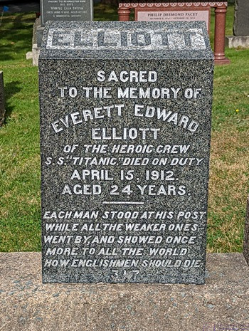
Monument for a known victim of the Titanic disaster; a crew member who stood his post and went down with the ship.


I got up at  0630 this morning, took care of my cat chores, started my laptop computer, and then cleaned our coffee cups.  I had a cup of half-caff as today was a sightseeing day for us, with a possible early departure, checked e-mail, and worked on the blog post for yesterday.  Breakfast was avocado toast with fresh blueberries and banana on the side, and a small can of V-8 juice.


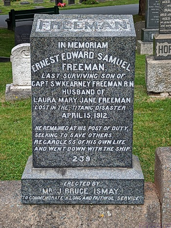
Another monument to a lost crew member of the Titanic who stood his post and went down with the ship.  The inscription captured the English sense of duty.


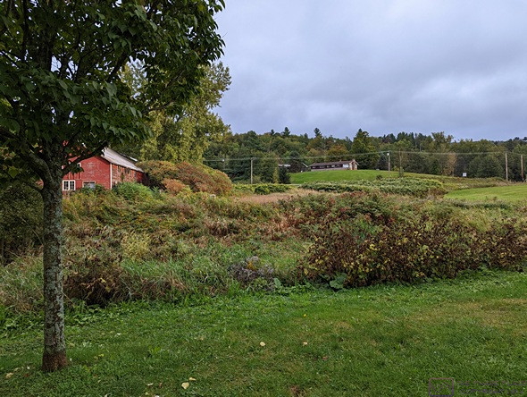
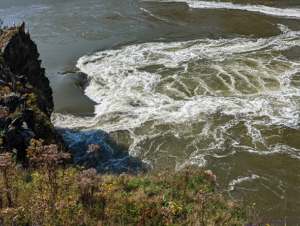
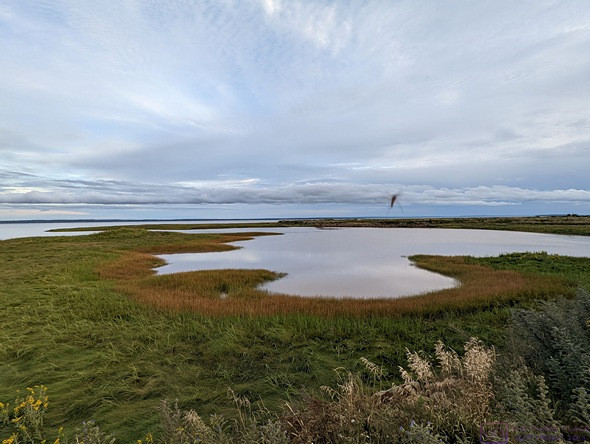
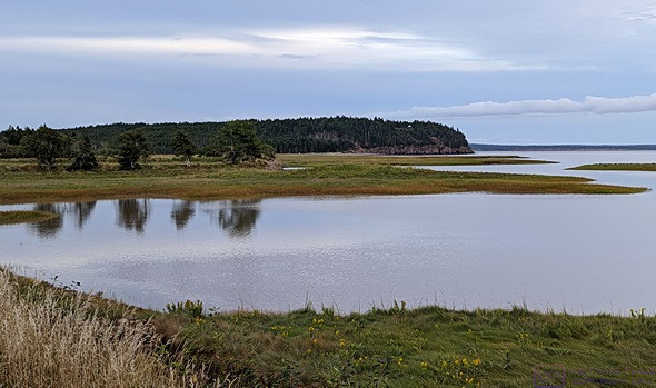
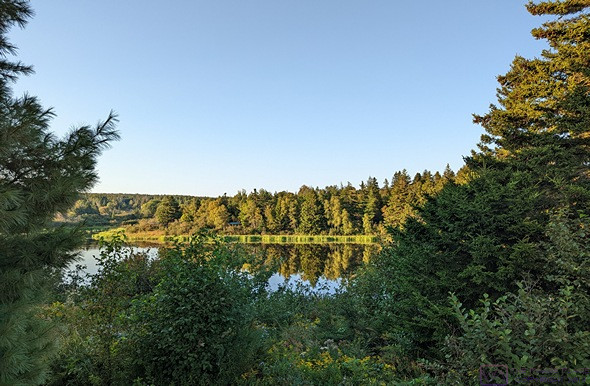
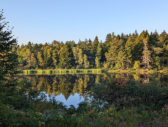
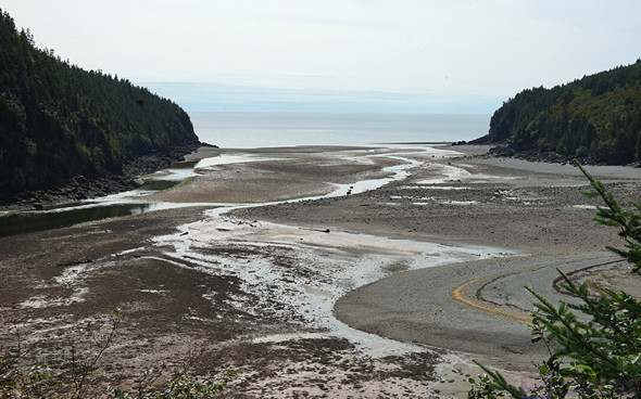
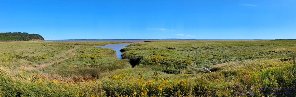
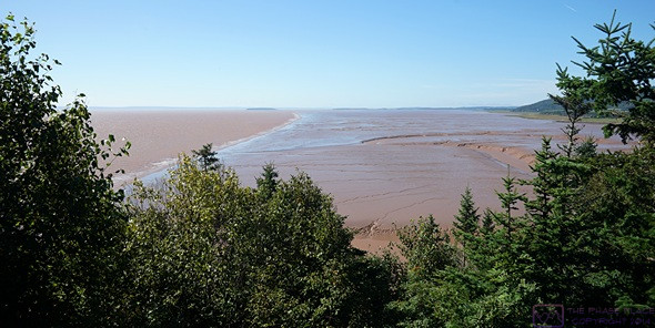
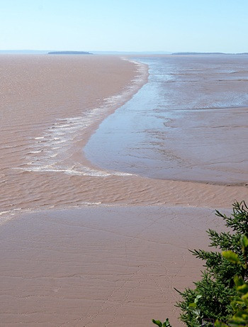
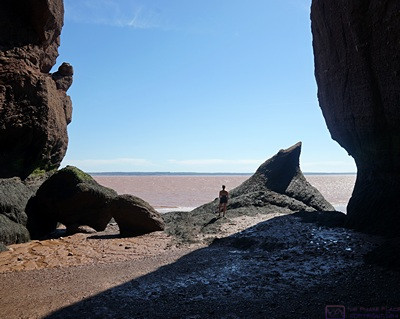
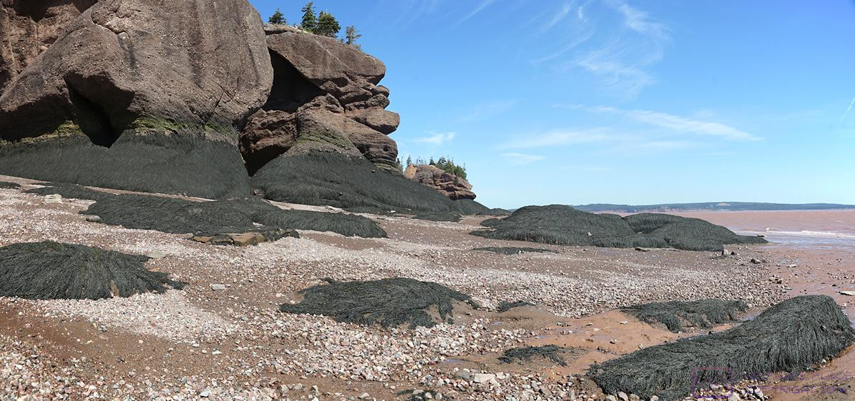
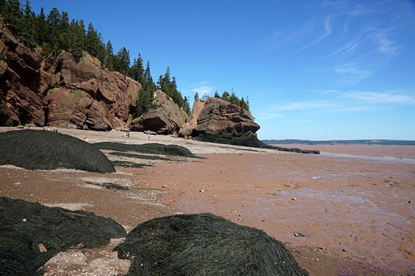
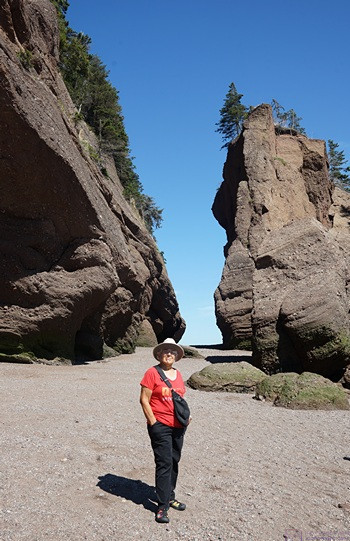
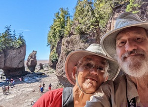
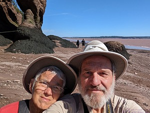
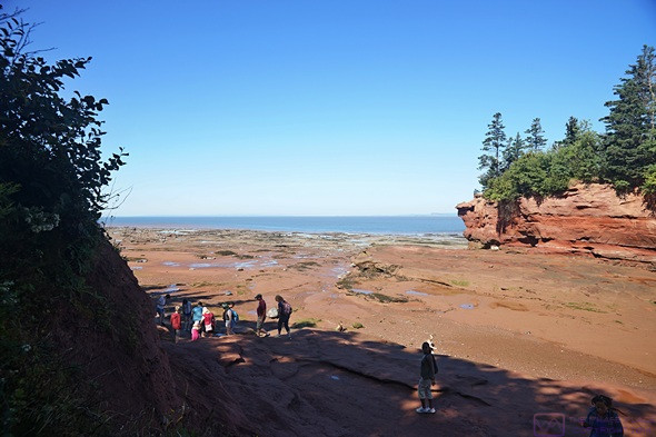
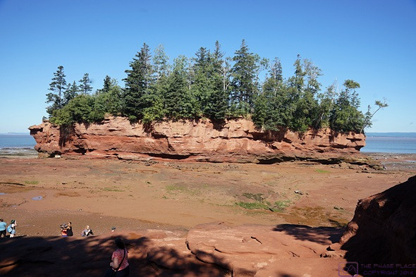
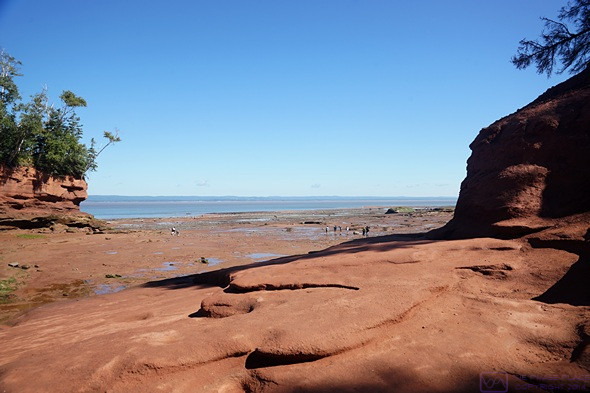
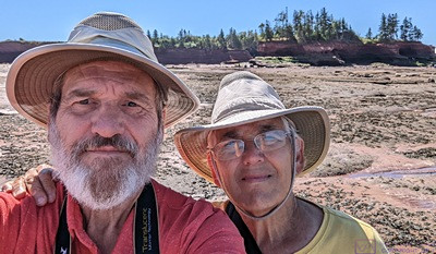
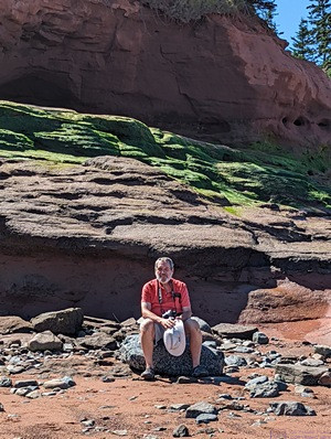
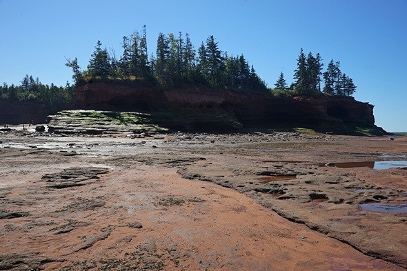
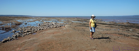
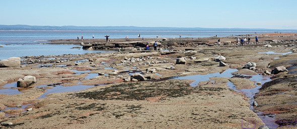
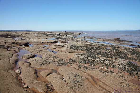
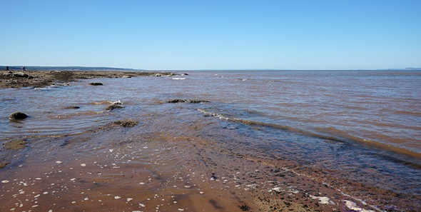
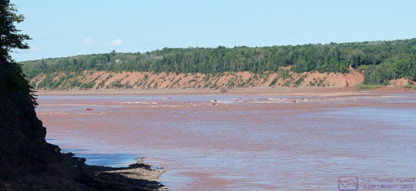
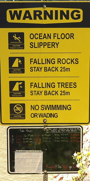
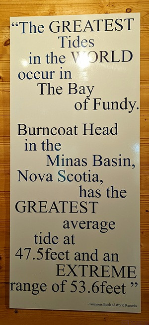
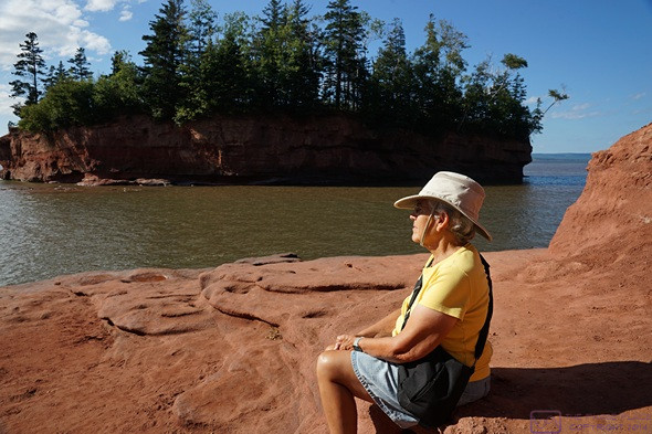
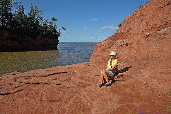
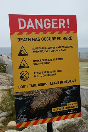
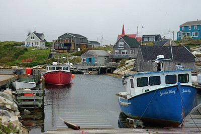
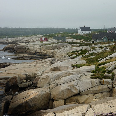
For this last day of August, 2022, and our second full day at the Halifax West KOA, we planned to do some more exploring of area.  We wanted to get to Burntcoat Head Park—on the western end of the Cobequid Bay end of the Minas Basin portion of the Bay of Fundy—to see the low and the high tide.  (We learned about this place yesterday from the staff person at the Peggy’s Cove Visitor Information Center.)

The low tide at that location today was at 10:25 AM, with dry, sunny weather.  The high tide was forecasted to be 45.6 ft (~14 m) around 4:25 PM, but it looked like rain would start around 3 PM.  The weather forecast for Halifax, on the other hand, called for partly cloudy to cloudy skies, with an elevated chance of rain starting around 5 PM.  We like to keep the weather in our favor as much as possible, and decided to head into Halifax today.

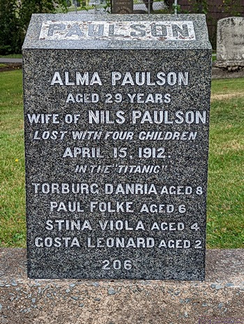
This marker really underscored for us the loss of entire families in the sinking of the Titanic.


We were getting close to a laundry day, and Linda wanted to get it done sooner rather than later.  She searched online and found a laundromat in Lower Sackville.  She suggested that we stop there on the way back from Halifax, so we gathered up all of our soiled items and loaded them in the car, along with our iPads.  We entered the address for Fairview Cemetery, and pulled out of our site shortly after 10 AM.


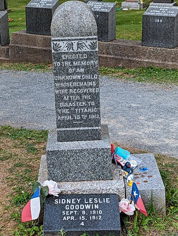
This marker was at the “bow” of the gravestones.  The odds of survival for most of the passenger was low, but especially so for children.


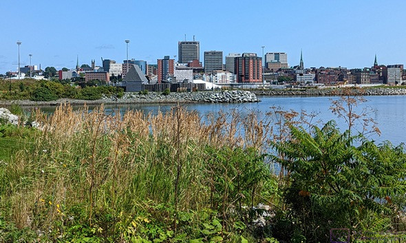
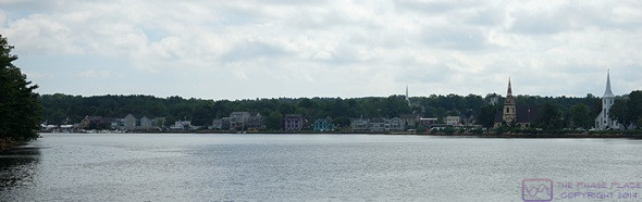
Like many of the Canadian cities we have visited on this trip, Halifax has a crazy road system.  We are probably spoiled by having lived for so long in the Detroit Metropolitan Area of Michigan, where the road system is largely based on a N-S and E-W grid.  But Eastern Canada is hilly, at best, and downright mountainous in many places, and the roads just go where they have to go, including up and down steep grades.


Halifax is also the largest city in Atlantic Canada, at ~250,000 residents; not large by big city standards, but the largest metro area we’ve been in since we left the Quebec City area on June 30th.  We quickly discovered that folks here drive a bit crazy after we saw three vehicles ahead of us run red lights.  Duly noted; defensive driving required here.

The view of the Titanic Graves from the “bow” of the ship.

People die in all sorts of ways, some horrible or tragic, but these markers, for victims who were recovered by never identified, evoked a particularly lonely sadness.

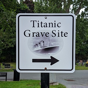
We got the sense that the Titanic Graves get a lot of visitors.  Tasteful, understated signs made them easy to find.


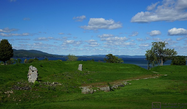
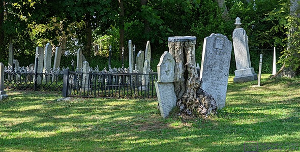
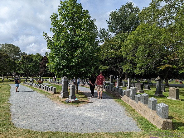
Our reason for visiting Fairview Cemetery was that 121 victims of the Titanic disaster are buried there.  The cemetery was not huge and signs directed us to the Titanic Graves.  We were not the only visitors; other cars were already parked along the edge of the road.


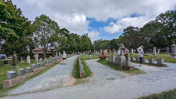
A view of the Titanic Graves portion of Fairview Cemetery from the “stern” end of the ship-like arrangement.  The camera is level.

The grave markers were arranged in four columns.  Two of the columns curved to meet at a point like the bow of a ship.  A short, third column was inside those two.  The marker at that “bow” was for a 19-month-old toddler whose identity was unknown at the time, but has since been determined using modern methods.  Indeed, quite a few of the markers were for unidentified victims.  While a few have been identified, most remain unknown.  The 4th column ran alongside the others.

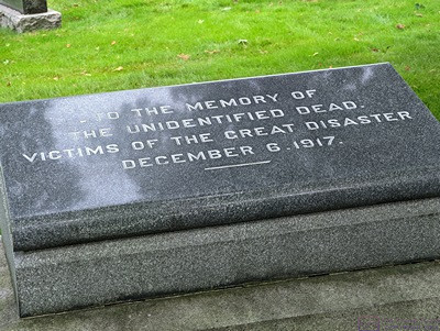
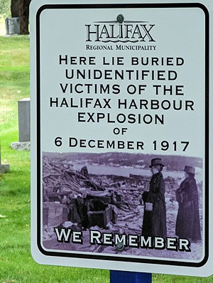
Grave sites at Fairview Cemetery of some of the unidentified victims of the 1917 munitions explosion in Halifax Harbor.

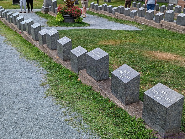
Most of the Titanic grave markers were small and identical.  These were provided by the White Star Lines, who owned the Titanic.  Each bears a number corresponding the order in which they were pulled from the sea.  Many victims were never recovered, and some were buried at sea.

There was also something moving about the fact that every marker had the exact same date of death, April 15, 1912.  A few of the small markers had been replaced with larger ones.  We presumed they had been provided by the victims’ relatives.  There were two other smaller Titanic Grave sites in Halifax, but we did not visit them.

The Halifax Explosion of 1917.


The sinking of the Titanic was not the only disaster, however, whose victims were buried here.  Just five years later, during WW I, a munitions ship in the harbor exploded, killing 2,000 people and injuring 9,000 more.  A small area at Fairview was the final resting place for a few of them who were never identified.


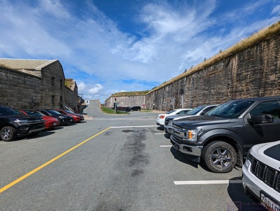
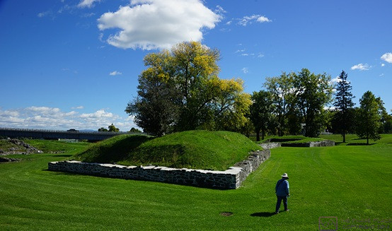
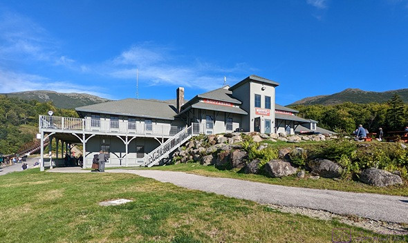
Our parking spot INSIDE The Halifax Citadel.  A good deal for 3.50$.  Right away we got a sense of the massive nature of its construction.

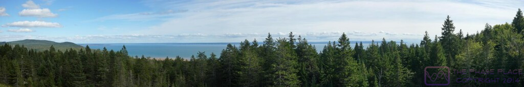
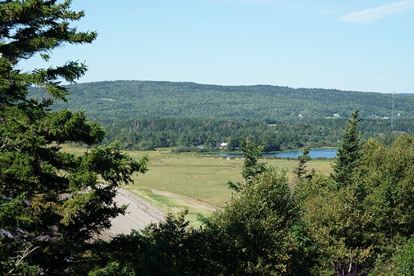
Our next stop was the Halifax Citadel.  By definition, it was a fortress that sits on top of a very large hill and usually has its own defenses.  In this case, the hill was very strategically located, overlooking the harbor with a view all the way out to ocean.  (The view is not so clear now, due to a lot of high-rise buildings, but we were still able to see off to the horizon in many directions.)

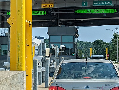
An entrance road wound around the hill and up to the top.  There was free parking at pull-offs along the way, but they were all full.  We got to an entrance booth with a big “P” sign and an arrow pointing into the actual fortified area.  We waited in line behind several other vehicles to find out what the deal was.

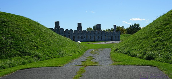
The deal was that our Parks Canada Discovery Pass covered our admission to the site (of course), but not to this particular parking area.  However, for 3.50$ we could park inside the fort.  Yes, please.  A steep entry ramp went down into an outer courtyard where Parks Canada had made a parking lot.  We found an open spot, backed the truck in, and walked through an arch in a stone wall into the Information Center.  We got a map, walked out into the innermost part of the compound, and waited about 5 minutes for a gun crew (of park employees), in uniforms, prepared to fire a large artillery rifle.  Boom.  The noise display concluded, we walked the upper ramparts, which still had many guns and rifles on display, and then went back down to the main level to look in some of the rooms.

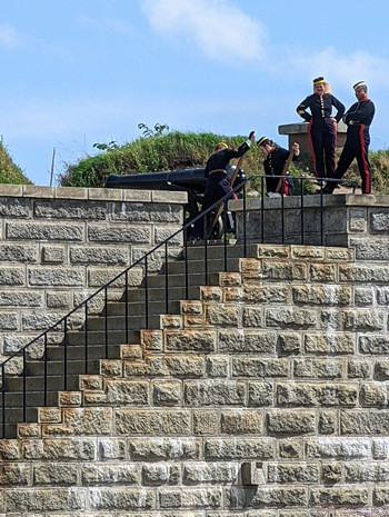
The gun crew moves the artillery rifle into position for firing (blanks, of course).


An opening with stairs going down took us to the lower area between the upper/inner walls and the lower/outer walls.  Parks Canada had used this space to recreate a view of the WW II Invasion of Normandy.  Although built out of plywood, the various props were convincingly painted to look like steel, iron, and concrete.


Starting from a simple mock-up of the bow of an LTA (landing craft) we looked out the bow across a beach to the land and houses beyond.  In-between were large log devices designed to tip the landing craft over, followed by iron structures that resembled “jumping jacks” designed to stop boats that got past the logs.  Beyond that was the minefield, and beyond that the “pill box” for the machine gun.

A park staffer said the recreation was supposedly close to life size.  Movies are one thing (Saving Private Ryan), but this allowed us to actually “walk up the beach.”  (As an aside, my father was in the invasion of Normandy shortly after his 19th birthday.  His unit landed at Omaha Beach, Red Dog Sector, and had a 90% casualty rate.  I’ve tried over the years to understand what that must have been like, but I cannot, even after seeing this recreation of the setting.  It must have been truly unimaginably horrible and terrifying.)

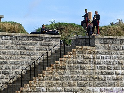
The gun crew “lights off” the large rifled artillery piece.  It made a big “boom” sound, but not as loud as the smaller canon at the Signal Hill NHS in St. John’s, NFLB.


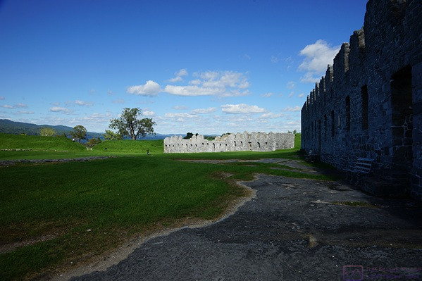
The Citadel is one of five military National Historic Sites in Halifax.  Two are on islands.  The other two were farther south, and we did not visit them.  The Citadel is massive in its construction, made almost entirely of stone surrounded on the outside by earth.


It’s actually the 4th Citadel that Great Britain built on this site.  Starting in 1828, it took 28 years to build and was completed in 1856.  This was a British fort until 1906, when the garrison left and it was handed over to the Canadian militia.  And It was a bit strange to stand here and think about the fact that one of the “enemies” it was built to defend against was us, as in the USA.  But the threats to Great Britain in the 18th and 19th centuries also came from France, Spain, and Germany.  Although the Citadel never fired a shot in anger (self-defense), it played important roles in both WW I and WW II.

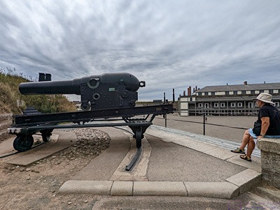
One of the large canons on the ramparts with the barracks building in the background.

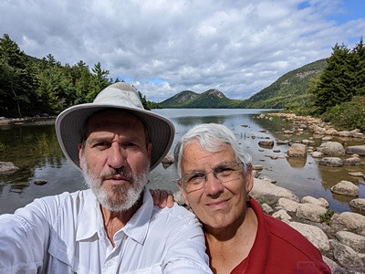
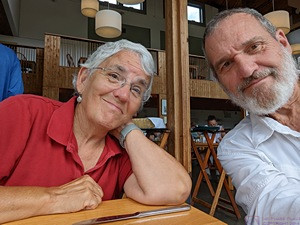
Linda had researched vegan dining options in Halifax and located a Copper Branch on the waterfront, about a mile from the Citadel.  We left the truck in the parking lot inside the fort and walked to the restaurant for lunch, arriving at 2 PM.  Linda had a breakfast bagel sandwich and I had the Aztec bowl with smoked tofu.


We discovered this chain in Ottawa, Ontario, and found another one in Rimouski, Quebec.  The menu is 100% vegan, and the food has been excellent every time.  Halifax is built on the west side of a large, deep bay on ground that rises sharply from the water, so it felt like our walk to lunch was about 1/2 mile horizontal and 1/2 mile vertical.  That’s an exaggeration, of course, but that’s how it felt, especially on the way back.


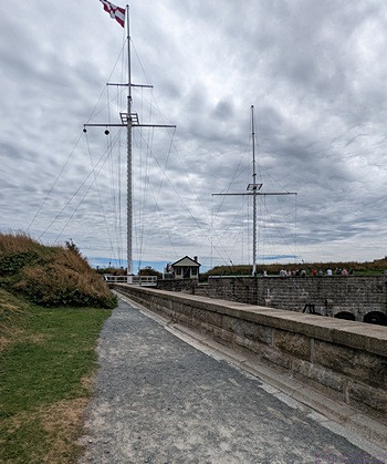
The Halifax Citadel dates from a time when flags were still the main way information was communicated between shore installations and ships.  The signal flags were stored in this small building and hoisted up onto the two masts as needed.  The mast on the left had twelve peripheral ropes/pegs and six inner ropes/pegs.  I appeared to be designed to hoist multiple smaller flags in two vertical columns.  By comparison, the mast on the right only had two sets of two ropes/pegs each.  It appeared to be designed to hoist two very large flags, one on each side of the mast.


Back at the Halifax Citadel, we finished our exploration of the fort with the Canadian Army Museum on the second floor of the former barracks building in the center of the interior ground.  It was a relatively small but very nice museum; well-curated, with artifacts well-displayed and well-described.  I am not a military history buff, but I found it fascinating just the same.


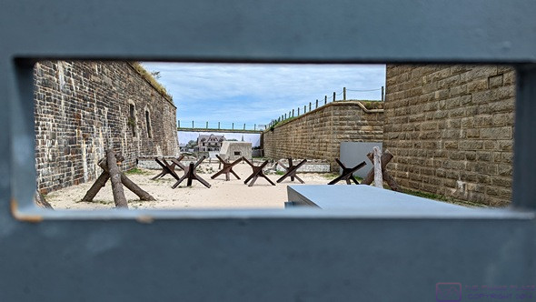
A recreation of a small piece of Normandy Beach, France on D-Day, 1944.  This view is from inside the mockup of an LCA (Landing Craft, Assault) which carried the infantry troops ashore.  The Germans knew an attack was coming but did not know where it would occur.  The log structures were designed to tip over the LCAs.  The iron “jumping jacks” were designed to stop the LCAs if the made it past the logs.  If troops managed to make it ashore (many did not), they had to cross a mine field, beyond which were “pill boxes” housing machine guns.

Linda had also researched laundromats, and found one in Lower Sackville.  On checking further, she discovered that it had really poor reviews.  She located another one only 5 minutes from the Citadel, so we drove there instead.  Downton Halifax is a dense urban area, so we expected parking to be a problem, and it was.  This was a small, neighborhood laundromat in a somewhat bohemian neighborhood, in which we suspected some of the residents did not have washers and dryers, either in their apartment or even their building.  There was one open parking spot across the street (naturally), but I was unable to get turned around owing to the myriad of one-way streets in this part of town, and intersections where left turns were not permitted between 3 and 6 PM.  It was already after 4 PM, of course.

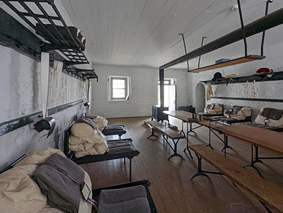
A view of one the rooms in the barracks building at The Halifax Citadel.  11 men “lived” in this room.  They slept and took their meals here, and tended to their daily chores or whatever activities occupied their time when off-duty.  Note the bed which fold in half lengthwise when not in use.  This made room to use the tables in the center.

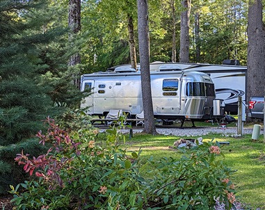
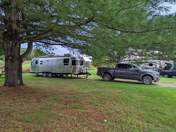
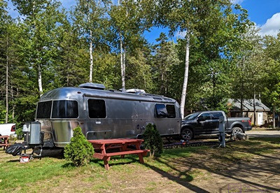
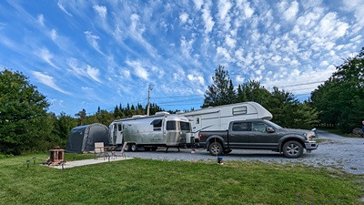
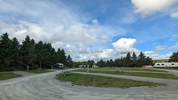
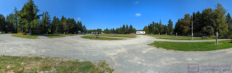
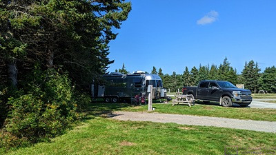
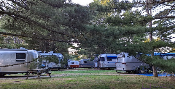
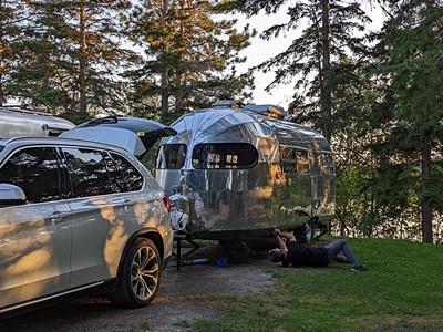
We decided to bail out on this option, head back to the RV Park, and see if the laundry room was available.  The laundry room is near the office at the entrance to the park, so I dropped Linda there with the intent of heading back out to the Irving fuel station on Hwy-1 at the egress to Hwy-101.  Several RVs had pulled in to register, however, including an older Airstream Classic Limited (3-axle) that we passed on the highway.  None of them pulled to the right, so the entrance lane was completely blocked.


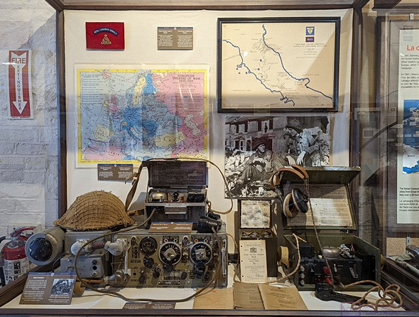
World War II radio equipment display.  The technology that was developed and used in this war was amazing.  It was the first “modern, industrial” war but, unfortunately, not the last.

The Airstream pulled up, perhaps thinking he was helping the situation, but made it worse.  The last building on the right on the way out is a “park model” unit.  The car parked in front of it was not as far enough off to the right as it needed to be, and the space between it and the rear end of the Airstream was too small for me to get through.  So, I sat and waited.

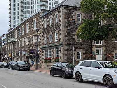
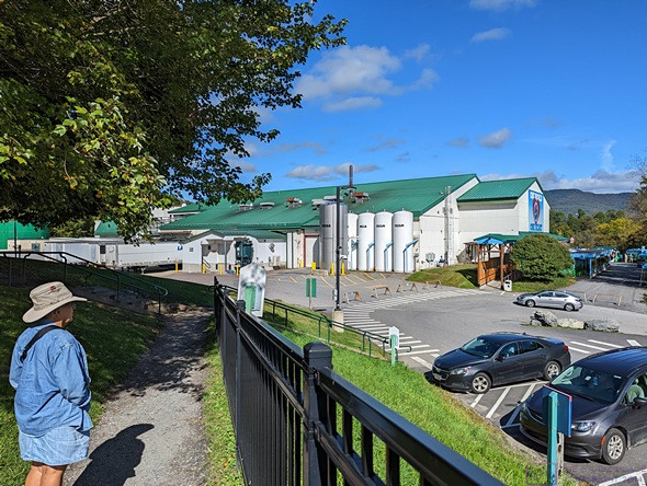
The Alexander Keith Brewery in Halifax, Nova Scotia.  Established in 1820, and in continuous operation since then, it lays claim to being the oldest continuously operating brewery in North America.

One-by-one, people got registered and moved their RVs, making room for the RVs behind them to pull up and continue to block the entrance lanes.  There are two of them by the office, and RVs are supposed to pull to the right while they register.  But the Airstream finally pulled up far enough that I could get by.

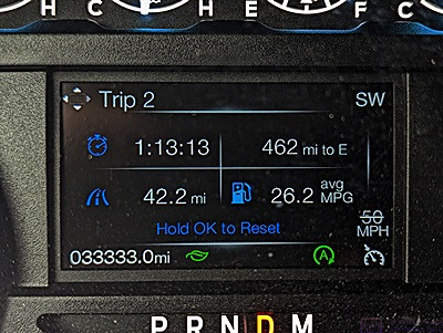
The Irving station was only 1.2 miles back up Hwy-1.  Traffic was light in my direction, but heavy coming the other way, including at least three RVs in a row that I presumed were headed to the KOA.  In spite of heavy traffic exiting Hwy-101, the station was not that busy and I pulled right through to a pump.  Credit card accepted, gasoline pumped, F-150 mileage computer reset, and I was on my way back to camp.

In my brief absence, the flagger for the construction project just beyond the entrance to the KOA, had stopped traffic.  When I became the last vehicle in line, there were about 8 vehicles between me and the KOA entrance.  But the flagger did not let traffic go, and the line behind me grew until it was out of my sight.  (I imagined it might have backed up all the way to the highway egress.)

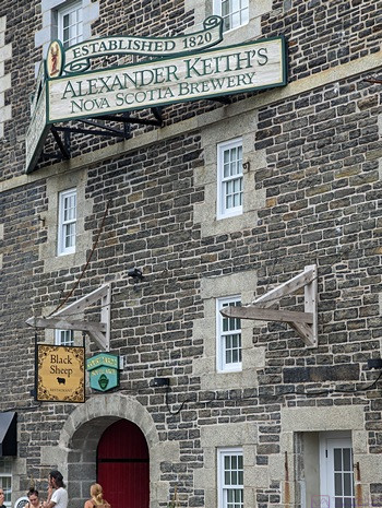
A closer view of the sign for Alexander Keith Brewery.  Tours were available, but we did not have time to take one.

A pickup truck from somewhere behind me pulled out and passed me on the left and then cut through the stalled traffic into the KOA.  I decided I could do the same thing, and a car a few ahead of me actually beat me to the punch.  But at least I was finally back in the RV park and not sitting in traffic.  I checked in with Linda.  The laundry was empty when she got there, so she had snagged both washing machines and had use of both dryers.  She said it would be another hour or so before the laundry was done.

Back at our trailer, I started my computer, gave Juniper-the-cat her afternoon kibble, and settled in to check my e-mail, copy photos from my phone to the computer, and start working on the blog post for today.  I still had work to do on the post for yesterday, but wanted to capture today’s events before the details got lost.

Linda texted me at 5:43 PM and I drove down to pick her up.  It had started raining, off and on, by then, but not hard and we got the clean laundry inside without it getting wet.  We both spent a little while putting our clean clothes away.  Linda made her bed, and I left mine for later, as there is only room in the aisle to make one bed at a time.

I cleaned out our coffee cups from this morning and we each had another cuppa; decaf for Linda and half-caff for me.  Linda finished up the dishes from this morning and we settled in for the evening.  We skipped dinner as we were not hungry, but had some popcorn around 8:30 PM.

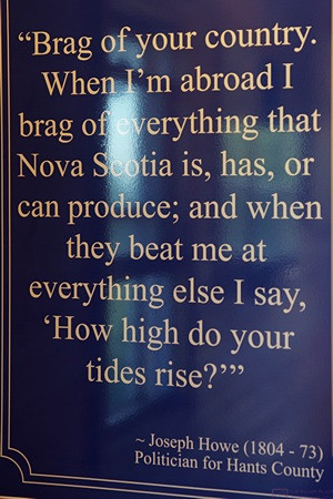
The weather forecast for tomorrow looked good, so we planned to go see the tides at Burntcoat Head on the Bay of Fundy.

20220830 – Peggy’s Cove and the Lighthouse Road to Lunenburg, Nova Scotia

TUESDAY 30 August

(Note:  There are 17 photos in this post, spread throughout the text.)

The ATVers we met at Channel-Port-aux-Basque, Newfoundland, were from Halifax and warned us about the “Black Rocks” at Peggy’s Cove.  We arrived to find lots of signs warning of this specific danger.  I can’t imagine coming to such a beautiful place and dying as result of my own stupidity, but it apparently happens several times every year.

Today was the penultimate day of this August, and we were eager to start exploring this part of Nova Scotia.  Since heading south from Truro towards Halifax yesterday, everything we saw was new to us.  As we have found throughout Eastern Canada, the Provinces are subdivided into named regions.  These regions are not governmental but rather for tourism, and Peggy’s Cove is the starting point for exploring “The South Shore” region of Nova Scotia.


The day started out heavily overcast but with no threat of rain.  We spent some more time studying our maps and Atlantic Canada guide book and then settled on a plan for the day.  After our usual morning chores, coffee, and a light breakfast, we got ready to go sightseeing.


Finnish-born artist William deGarthe’s 30-meter (~98 ft) carving depicting the fisherman, families, and lives of Peggy’s Cove.  This was carved into an exposed granite rock adjacent to his studio.  He started the carving in his 70’s, and it took him 8 years to finish.

William deGarthe’s studio / art gallery.  It was not open during our visit.  He is known for his nautically themed oil paintings which, according to our guide book, “grace galleries the world over.”  We did not see any images during our visit to Peggy’s Cove.

Our route took us back down Hwy-101 to Hwy-102 towards Halifax and along its western edge to Hwy-103, which headed southwest along the South Shore (but not right by the water).  We eventually left Hwy-103 for Hwy-3, “The Lighthouse Road.”  As we had seen in Newfoundland and Cape Breton Island, scenic routes have names.  Provinces also have mottos, and Nova Scotia’s is “So Much to Sea.”


Hwy-3 was slower and curvier, as it hugged the coast and went through the small villages that dot the shoreline along the south shore of the Atlantic Ocean.  Indeed, the bays along this coast extended deep into the land, often with small fingers at their furthest ends that provided safe harbors.

The lighthouse at Peggy’s Cove is still a functioning aid-to-navigation.

Another reminder that (careless) people have died here.

Peggy’s Cove is a small, working fishing village that is famous for its Lighthouse and surrounding rocks.  The lighthouse is Atlantic Canada’s most photographed site.  It appeared to also be Atlantic Canada’s most visited site.


The Visitor Information Center parking lot had 105 spaces, most of which were occupied, but we managed to find an open one, and it was big enough for the truck to fit comfortably.  Vehicles were also parked on the street anyplace they could do so legally.  There had to be at least 150 personal vehicles (and a few RVs) in town.  Even at a modest average of 2 people/vehicle, that was over 300 people.  The tour buses were parked in their own area behind The Sou’wester restaurant and gift shop up by the Lighthouse.  We counted nine buses, with a combined capacity for over 500 people.  My rough estimate was 700 – 1,000 tourists in town, but there was room to spread to (except in the gift shop), so we did not feel (too) crowded.  The weather was also still overcast , so I was not going to get any “post card” photos here today.

Peggy’s Cove is a working fishing village and the small harbor looked like it was all business.


There was a restroom building at the VIC, which was much appreciated.  In the VIC, we were studying a map on the wall and one of the staff came over to offer assistance.  She was great.  By the time we left we had maps and brochures and lots of suggestions based on local knowledge.


Linda at the Peggy’s Cove lighthouse, proof that we were there.

The Lighthouse was nice, but not unusually unique or impressive.  The setting, however, was spectacular (a word I probably use too often, but the other choices are “amazing” and “awesome,” so …) and probably the reason it’s the most photographed site in Atlantic Canada.


We did not quite feel that vibe, but perhaps we would have on a nicer weather day with blue skies and puffy clouds, or during a sunrise or sunset (the guidebook says to visit before 9 AM or after 5 PM to avoid the crowds), or during a storm with angry clouds and waves crashing against the shore.  The site certainly had the potential for all of that.

This guy strolled onto the rocks in full regalia carrying a wooden case.  I guessed, correctly, that it contained a bagpipe.  He put out a tip jar, and played for the crowd.  We saw this a few times in Nova Scotia, and never tired of it.


We were, of course, still in “New Scotland,” so we were not surprised when a distinguished looking gentleman walked out onto the rocks, got out his bagpipes, and started playing for anyone who cared to listen.  Not like it was a choice; when bagpipes are playing, you are going to hear them.  But that was not a problem for us.  We love hearing bagpipes, and we love that the players, at least in this part of Canada,     always wear appropriate/correct Scottish Highlander clothing when doing so.


Part of the reason Peggy’s Cove is so beautiful, and so dangerous.


Part of the beauty of Peggy’s Cove Lighthouse is that the rocky headland on which sits is completely open down to the ocean.  There are no fences, ropes, or barricades to prevent slips and falls.  Other than an observation platform by the Sou’wester restaurant, and a short concrete path onto the rocks, the site is potentially dangerous for the inattentive and foolish.


Post cards, of course, always show places like this with deep blue skies or stunning sunsets, but the reality is that this place faces the North Atlantic Ocean, and experiences many types of weather.  Overcast is just one of those types, and it always sets its own mood, which is what I tried to capture.

A view across Mahone Bay as we approached the village, with the three church spires clearly visible.

Mahone Bay is known for its three churches.  This is St. James Anglican.

Moving on from Peggy’s Cove, we continued to follow the edge of St. Margaret’s Bay as far as it’s northwest corner.  A peninsula separates St. Margret’s Bay from Mahone Bay to its west, but we skipped the drive along its coastline on Hwy-329.  As the Bay came into view from its northeast corner, we saw the three church steeples, and pulled off into a small look-off parking area for a photograph.  When we reached Chester, at the north end of Mahone Bay, we parked and walked around a bit.


Chester is known for its three churches, two of which are on/near the harbor, and the parking lot we used is across the street from them.  We had seen some very nice housing all along our drive, and Chester appeared to be a somewhat more upscale community.  The Bay certainly had plenty of sailboats at anchor, more than we had seen anywhere else the entire trip.

We continued on Hwy-3 along the coast of Mahone Bay and finally arrived in Lunenburg.  Lunenburg is, apparently, a big deal on The South Shore, and judging by the number of cars and pedestrians, lots of people think so.

St. John’s Lutheran Church, Mahone Bay, Nova Scotia.

To its credit, Old Town Lunenburg is a UNESCO World Heritage Site.  It’s built on a peninsula with a high ridge running down the center lengthwise.  A series of streets march up the southwest slope, parallel to the shore of Lunenburg Harbor, with steep streets cutting across every so often.  The streets were lined with historic buildings, most of which had been repurposed (of course) as shops or restaurants. It was very walkable, albeit with serious verticality, and lots of people were doing so.


Linda had  found a place for us to eat (Salt & Bait) in Lunenburg with a few vegan options, but their website said it closed at 3 PM and reopened at 4 PM.  We got to Lunenburg just after 3 PM, so we explored the town first.  But first we had to find a place to park.  Part of the charm of the place was negated by the vehicles parked almost bumper to bumper along both sides of the roads.  And all of the spots had parking meters.  There was a public parking lot at the northwest end of the waterfront street.  It had an entry gate, but no information was displayed about the cost or how to pay.  Free street parking was, however, outside the historic district.  Not tourist friendly, IMHO, but perhaps that’s the price of success that comes with the UNESCO World Heritage Site designation .  A bit away from the Historic Old Town, we found a spot on the street that was free.  As a bonus, it was near the start of the Harbor Path that took us on a short walk past an old Cemetery and into the historic district.

We walked past this old cemetery on the way into Lunenburg, Nova Scotia.  One of the things I like about old cemeteries is the less orderly placement of the graves and headstones.

The Theresa E. Conner is a 2-masted schooner in the style of the Bluenose and Bluenose 2

We strolled along the waterfront and eventually came to the Maritime Museum and the Theresa E Conner schooner.  The Bluenose II, a recreation of the original/famous Bluenose, was not in the harbor this day.  At the far end of the Harbor, we saw the Picton Castle, a 3-masted, square-rigged sailing vessel which is part of the Nova Scotia Sea School based in Lunenburg.

Like many seaside villages, many of the buildings in Lunenburg were painted in vibrant colors.  (Pastels are not used here like they are in the Caribbean.)  I never found a viewpoint that I liked for a photo, due to the cars and wires.  There were a lot of restaurants and shops here, and it felt more touristy than charming.

At 4 PM we made our way to our restaurant of choice, only to find that it was closed today.  Arrrgh.  There could be lots of reasons for that, of course, but we did not appreciate that the website said it was open, and there was no further explanation as to why it was closed.  Plan B was “J3 Pizza” which we had passed on our walk into town.

Besides pizza, they had a full Lebanese menu, so we knew we could get something to eat there.  We ended up getting a 12” thin crust gourmet veggie pizza, no cheese, and cold tea.  It was an OK meal.

The old red building by the Picton Castle was the home of the Nova Scotia Sea School as well as a place to shop for antiques.

Lunch concluded, we were done with Lunenburg, at least for this visit.  We programmed the navigation system in the F-150 for the “shortest” route which, once again, tried to do some peculiar things.  But it’s just an algorithm that is trying to find the absolute shortest mileage between the two specified points, and that often seems to lead to some otherwise peculiar routing decisions.  From Lunenberg we got on Hwy-103 as directly as possible.  Hwy-103 is the fast route through The South Shore, running parallel to the coastline and farther inland than Hwy-3, and skipping most the peninsulas and most of the towns and villages.


We took Hwy-103 all the way to Exit 5 for Hwy-213 to Lower Sackville.  This wasn’t designed to save us time but, rather, to avoid having to take Hwy-102 along-side Halifax to Hwy-101.  In a stroke of positive karma, there was a shopping plaza at the exit with a Sobeys Extra supermarket!  Even though we did not have list, we stopped and picked up a “few” things.

The Picton Castle is a square-rigged, 3-masted schooner used for training and based in Lunenburg.  When sailing, it has a professional crew of 12 and up to 40 trainees.  It has been around the world many times.  It was possibly still in active use, but looked like it had seen better days.

We were back on Hwy-213 by 5:30 PM.  It did not intersect Hwy-101 but went under it and ended at Hwy-1.  Perfect; the Halifax West KOA was on Hwy-1.  In spite of rush-hour traffic, we were back at camp before 6 PM.


Still full from our late lunch, we passed on dinner, but finished off the Black Tower Rivaner wine and had “So Delicious” vegan ice cream bars.  That was a treat, as we have not had non-dairy ice cream on this trip nearly as often as we might have it at home (which isn’t all that often) .  We spent the rest of the evening, as we often do, reading, working puzzles, editing photos, writing, and talking about our plans for the next day.  It had been a long day, and we were both a bit tired, so bedtime came a bit earlier than normal.