Category Archives: Airstream FC27FBT

20231201-02_Returning-Home

Note:  This post contains two (2) photos near the end.  Both were taken by me (Bruce) with a Google Pixel 6 Pro.


FRIDAY 01 December 2023 — Another travel day

Our trip last month from home to Luxury RV Resort in Gulf Shores, Alabama in October was around 1,400 miles and took 15 days because of our transit of the Natchez Trace National Parkway (NTNP).  The trip in the other direction was estimated at around 1,050 miles and a little over 14-hours driving time.  A shorter distance, for sure, as it would be more direct and we were not planning our route to include any special sites along the way.  Still, that would be an average daily driving distance of about 265 miles for each of the four travel days we planned for the trip, with a total driving time of 21 hours for an average 5 hours per day.  Our trip yesterday, however, was only 223 miles, so we still had 827 miles to travel over three days, or about 275 miles per day.  That was still within the 150 – 300 miles per day target that seems to work well for us.  In spite of cold temperatures, which would require us to quickly winterize the travel trailer once we got home, we were nonetheless eager to get there.

Our next overnight stop was the Grand Ole RV Resort in Goodlettsville, Tennessee, a place we have stayed several times, including at the beginning of our drive down the NTNP.  We like this RV park, and find it convenient when RVing up and down I-65 through Kentucky and Tennessee.  Our mapping/routing apps indicated a 256-mile drive which we estimated to be about 5 hours driving time at our estimated average speed of 50 MPH.

Check-in at RV parks is generally sometime after noon, but can be as late as 3 PM.  A call to the resort confirmed that we could arrive and check-in sooner than that.  I suspect, but I do not recall, that we broke camp and were on our way between 9 and 9:30 AM and arrived between 2 and 2:30 PM.  As best I recall (ABIR), the weather was nice when we arrived, which gave us plenty of time to leisurely “make camp,” and then go for a walk around the RV park.  We then detached the truck from the travel trailer and went in search of food and fuel.  I do not recall what the weather was like during the evening and over-night hours, but if we had storms (which can be fierce in this area) they must not have been too bad as we were not awakened and our truck/trailer did not have any damage.


SATURDAY 02 December 2023 — A minor technical issue, and home at last

As mentioned above, when we left Luxury RV Resort in Gulf Shores, Alabama on 30 November, we intended to take four days to make the trip home, stopping for three nights along the way, and arriving home on Sunday, December 3rd.  Indeed, Linda had made a reservation for each of the three nights.  ABIR these many months later, our last and final stop was booked at the Lebanon / Cincinnati NE KOA northeast of Cincinnati, Ohio and east of I-75, another KOA where we have stopped in the past.  The distance for this leg was approximately 300 miles, with a time estimate a little over 4 hours, which we figured would be closer to 6 hours.  (We use KOAs because when they are convenient to our route as it is easy to book online and easy to cancel with little or no penalty.)

One of the issues for us, when towing the travel trailer, is that the fuel economy of the F-150 / trailer combination usually averages around 12 MPG.  This is about 60% – 50% of the 20 – 24 MPG we can get from the truck during extended highway travel without the trailer.  We have a 36-gallon fuel tank so, hypothetically we can travel 432 miles before running out of gasoline, but we do not like the run the tank below the 1/4 mark if possible.  As a practical cutoff, as we approach the 300-mile mark of a leg we start to incur additional travel time because we have to stop for fuel before reaching our destination.  That also means trying to find a filling station that we can get into, position the rig for good access to a pump, and exit without getting stuck or damaging the trailer.  Yeah, we worry about things like that.  (Our preferred routine is to get to our campsite, set up camp, and then disconnect the truck and go find fuel.)  Fuel economy combines with other factors to determine a realistic ETA such as:  a) the time required to exit an RV park and make our way on surface streets to the highway we plan to travel, and b) the fact that we tend to drive at 62 MPH on highways posted at 65 or 70 MPH.  Basing our ETAs on that average speed has worked remarkably well for us.

Our only technical mishap of the entire trip (with the trailer) happened this morning.  Everything was going according to our usual routine for breaking camp and packing up.  When I tried to unplug the “50A RV” shorepower cord from the socket end of the Hughes Power Watchdog EPO surge/transient protector device, however, the ground pin on the cord broke off and remained lodged in the Power Watchdog.  The ground pin turned out to be potted metal surrounded by brass, and was much weaker by design that I would have expected.  Also, the plug was molded so, given these two facts, there was no chance of being able to do a field repair on this expensive piece of junk.

We did not have a spare “50 A” cord with us, as they are just too bulky and heavy to carry a second one.  (We always had a spare in the converted motorcoach, but we have the space and load capacity for that.)  We also did not want to try and buy a new one as they are expensive, the RV park store was unlikely to have (a good) one much less at a bargain price, and we did not want to take the time to go find one somewhere else.  We did have a “15 A” cord that was sufficient to run the lights (LED) and control circuits for the refrigerator, hot water heater, and furnace, which would allow us to use propane as the heat source, but because we were moving into an area with much colder temperatures, we were not comfortable with that option.

While our planned drive today was 300 miles, we were still almost 600 miles from our house.  That distance represented a 12-hour drive, including one or two fuel stops.  We pondered the situation for a while, but fairly quickly decided to cancel our overnight stop for this evening at the Lebanon / Cincinnati NE KOA, and just go home.  I probably drove faster that 62 MPH, but we still arrived home in the dark just ahead of a looming drop in temperatures.


The dining room portion of our open floor plan with the entry vestibule and kitchen.  Rather than try to keep the trailer warm, which would use a lot propane, we unloaded most of the food and other cold-sensitive items from the interior of the trailer.  Some of them are spread out on the table and others are on the floor in the vestibule by the stairs to the lower level.


Since we did not have a chance to winterize the travel trailer before getting home, I plugged it in to shorepower (which I had to turn on inside the house), turned on the propane furnace, and set it to about 45 degrees F.  Winterizing the trailer in the next few days would be a high a priority.


More of the stuff from the trailer on the counters in the kitchen.  Stuff tends to get loaded into the trailer gradually but unloaded quickly, so the unloading process tends to reveal just how much stuff we have onboard.


Much to our delight, and something of a surprise, Cabella (the cat who is not our cat but is basically becoming our cat) quickly appeared and did not hesitate coming into the house.  I worried about her the whole time we were away, even though our neighbor (Mike) was checking on her automatic feeder every week and restocking it as needed.  I was relieved that Cabella had clearly been getting enough to eat and looked well.


20231121-29_LuxRVR_GS-AL_3-3

Note:  There are 19 photos in this post.  Photos by me (Bruce) were taken with a Google Pixel 6 Pro or SONY alpha 6400, unless otherwise indicated.  (Photos by Linda taken with a Google Pixel 6.)


TUE 21 – WED 29 November 2023 — Luxury RV Resort — 3/3


This post covers our last nine full days at Luxury RV Resort in Gulf Shores, Alabama.  Our reservation was through the night of the 30th with departure on December 1st but we left on 30 November, one day early, to try and get ahead of a weather system that was moving our way.  Up to that point, however, the weather had generally been very nice.  Gulf Shores is a lovely place, climate-wise, in the late fall and winter.

At the Sunliner Diner in Gulf Shores, Alabama.  Counter-clockwise (L-2-R) around the table:  Evan, Anne, Paul, Robert (obscured, at his request), Linda (behind Nancy’s arm) and Nancy.

We continued to visit with Paul, Nancy, and Robert and occasionally also Kate and Charlie from the nearby Escapees RV Club Rainbow Plantation RV Park.  This small group of people are very much kindred spirits; each of them very much of the same mind as us when it comes to religion and politics and food (by and large), which makes for a comfortable and enjoyable time together.

This antique car is inside the Sunline Diner.  The doors on the passenger side have been removed to make a dining booth.


Paul makes a final inspection of the layout of our Thanksgiving dinner food in the Luxury RV Clubhouse in Gulf Shores, Alabama.

Paul and Nancy’s son, Evan, and his wife, Anne, drove down from Ann Arbor, Michigan and joined us for the Thanksgiving holiday.  Nancy arranged for the use of the Luxury RV Resort clubhouse on Thanksgiving Day, which allowed us to share a meal in comfort with plenty of space to lay out the food, arrange seating at tables, and not be concerned about the weather.  Everyone attended, including Kate and Charlie, and shared the work of putting together a nice meal.


The first of two tables for Thanksgiving dinner.  L-2-R, counter-clockwise around the table:  Robert (obscured), Nancy, Anne, and Evan.


The other table for Thanksgiving dinner.  L-2-R, counter-clockwise around the table:  Charlie, Paul, me (Bruce), Linda, and Kate.


Me (Bruce) sitting on the sofa in our Airstream travel trailer and using my iPad Pro.  Since Bella is also on the sofa, we were probably dog-sitting while Paula and Nancy were doing something that precluded taking their dog along.

We made a couple of visits to the Sunliner Diner during this time, and visited Historic Fort Morgan at the tip of the peninsula that extends west from Gulf Shores into Mobile Bay, stopping for lunch at a bayside restaurant.  Nice weather and dramatic sunsets continued during these nine days, with the later eventually portending of approaching weather.


A view of Fort Morgan, Fort Morgan State Historic Site, Alabama.


One of the entrances to the interior of Fort Morgan SHS.  The rectangular block centered above the opening says “Fort Morgan 1830.”  The two parallel lines on the pavement are embedded railroad ties.  My presumption was that these made it possible to use trollies with railcar wheels to move heavy loads in/out of the Fort.


The previous photo, this photo, and the next two (2) photos were taken at the Fort Morgan State Historic Site.


From Wikipedia:  Fort Morgan is a historic masonry pentagonal bastion fort at the mouth of Mobile Bay, Alabama, United States. Named for American Revolutionary War hero Daniel Morgan, it was built on the site of the earlier Fort Bowyer, an earthen and stockade-type fortification involved in the final land battles of the War of 1812. Construction was completed in 1834, and it received its first garrison in March of the same year.  …  Fort Morgan is at the tip of Mobile Point at the western terminus of State Route 180 (Alabama). It and Dauphin Island, on which Fort Gaines is situated, enclose Mobile Bay. The Alabama Historical Commission maintains the site.


An interior view of part of Fort Morgan, clearly showing the masonry construction.


Another entrance tunnel into Fort Morgan.  I thought the way the bricks were arranged to create the arch was architecturally interesting, although I presumed that they were set this way for fundamentally structural reasons.


Back at the Sunliner Diner for breakfast before Robert checks out of Luxury RV Resort and heads for points West.  From L-2-R, counter-clockwise around the table:  me (Bruce) taking a selfie of the group, Robert (obscured). Nancy, Paul, and Linda.


Robert’s class B motorhome and Jeep in front of the office at Luxury RV Resort while he connects them together in final preparation for his departure from the resort.  The foreground is a sitting area with a firepit.  To the left are some holiday decorations that are featured in the next two photos.


Linda provides a sense of scale for the Christmas holiday decorations at Luxury RV Resort; a travel trailer pulled by two Flamingoes.  Two lawn chairs and a Christmas tree with wrapped presents are also visible.  [Note that the door of the trailer is on the “driver” side, which is incorrect.  The main entrance doors of all commercial RVs are on the passenger/curb side, with the utility connections (hookups) on the driver/street side, and RV parks and campgrounds are built around this conventional arrangement.]

This photo of the other side of the trailer decoration shows more clearly that the trailer is a large/round straw/hay bale and that the trailer has tires.  A doll (or small mannequin) that is approximately half normal human-size, is holding one end of the brown sewer hose which runs down into the “dump” connection.


We were treated to a nice sunset on our final evening at Luxury RV Resort.  This view is looking southeast, so I could catch the sunset reflecting off of the windows in our travel trailer along with the general soft pink illumination of the aluminum siding and the effect of the color on the clouds to the southeast.


The play of light on the clouds seems to say “look at this trailer,” so I did.


A composite of four images creates a panoramic view of our final Gulf Shores sunset as it provides a wonderful backdrop for our travel trailer.


A composite of three images produces a panoramic photo of an amazing sunset behind some of the tall buildings in the downtown/beach area of Gulf Shores, Alabama, as seen from our travel trailer at Luxury RV Resort.


One of the three images used for the previous composite photo highlighting the letters A I R S T R E A M across the rear of our travel trailer, just above the awing over the large/opening window.

20231111-20_LuxRVR_GS-AL_2-3

Note:  There are 13 photos in this post.  Photos by me (Bruce) were taken with a Google Pixel 6 Pro or SONY alpha 6400, unless otherwise indicated.  (Photos by Linda taken with a Google Pixel 6.)


SAT 11 – MON 20 November 2023 — Luxury RV Resort — 2/3


Magnetic Minnie Mouse name placards for Madeline and Sadie’s stateroom door on the Disney Dream.

During our second 10 days in Gulf Shores, Alabama, we did a variety of things.  Linda brought accounting work for the bakery, of course, and spent some time on that.  She also walked almost every day, and we went on a few hikes together.  Linda also spent time planning and preparing meals with Nancy and Robert, and the five of us (the three just mentioned plus Paul and myself) dined together almost every night.  We also continued to make plans, and purchase odds and ends, for the Disney cruise Linda booked for late February next year.  The two younger grand-daughters did not find out about this until Christmas, but I wasn’t posting in real-time anyway (obviously).


Our walks along the marsh and over to Gulf State Park afforded a variety of views.  I am always on the lookout for nature images that have an element of abstraction and this caught my eye.


As seen from this vantage point, the marsh surrounding Luxury RV Resort extends well to the north and east to Gulf State Park


We ate well during our time at Luxury RV Resort, which is to say, healthy, delicious, and attractive.  The dishes shown here are an amazing salad and a pear upside down cake.  Yummy.

The sunrises and sunsets in Gulf Shores can be spectacular, and we had several of each during these 10 days.  Our trailer was parked with the rear end pointing slightly east of south, so the large wrap-around rear windows provided good views of both the sunrise and the sunset; good enough at least to see that something was happening and get outside with the phone and/or camera if called for.


Our travel trailer and truck against a beautiful sunset, but this turned out to just be the warmup for what was to follow.

I suspect that most photographers take sunrise and sunset photos (and flower photos, etc.), always hoping to capture something stunning and unique.  They can be a bit of clique; I lay no claim to unique, and stunning is rare.  But one of the first photos I ever took that I thought was worth printing and looking at was a sunset I saw while stopped for the night in Breezewood, Pennsylvania.  I was on my way from my parents’ house in St. Louis, Missouri to Red Fox Music Camp, in southwest Massachusetts.  It was the summer between my junior and senior year in high school, and I was making the drive by myself, so that probably had something to do with why I liked the photo.  I still have the print, matted and framed, and on display in our rec room.  I have been interested in sunset (and sunrise) photos ever since then.


Ooh, that’s nice!  But wait, there’s more!


And here it is!  Sometimes you have to go wide, and sometimes you have to zoom in.  The photographic capabilities of the Google Pixel 6 Pro smartphone really are impressive.  And, most importantly, I always have it with me, which cannot be said for my SONY cameras, as much as I enjoy using them and like the results.


Robert (out-of-frame to the left, Nancy (right) and me (center) making pasta for dinner.  (Robert does not like his image displayed in social media, so I have tried to respect that in my posts without ignoring his important presence in our group.)


I thought this more subtle, pastel sunset was worth capturing and sharing.  Pretty isn’t always dramatic.


Again, zooming in and isolating the most important features of the scene resulted in a stronger photo, IMHO.  But hey, it’s my photo and I get to make that decision.


Linda was out for a morning walk and captured this image of work being done to restore the beach in central Gulf Shores, Alabama.  These large pipes were serving a dual purpose, being used here to drag and smooth the sand.  (Photo by Linda)


Another photo from the same vantage point as the previous one.  A bulldozer is moving larger quantities of sand.  (Photo by Linda)


The other use of these large pipes was pumping sand onto the beach from the dredging barges used to collect it just offshore, up and down the beach for quite some distance.  This stretch of the shore at the northern extent of the Gulf of Mexico is subject to serious weather during hurricane season and the attendant beach erosion.  Nice white-sand beaches, in pristine condition, are central to the economies of the many towns that dot this coastline, and to the region in general.  As such, considerable effort and resources are put into their maintenance.  (Photo by Linda).

20231101-10_LuxRVR_GS-AL_1-3

Note:  There are 13 photos in this post.  Photos by me (Bruce), unless otherwise indicated, were taken with a Google Pixel 6 Pro or SONY alpha 6400.  (Photos by Linda taken with a Google Pixel 6.)


WED 01 – FRI 10 November 2023 — Luxury RV Resort, Gulf Shores, Alabama (1/3)

This is the first of three (3) posts that cover our time in Gulf Shores, Alabama during the month of November, 2023.

We arrived at Luxury RV Resort in Gulf Shores, Alabama on November 1st per our reservation, which was for the entire month (we got a better rate that way).  We had stayed here before at the suggestion of our friends, Paul and Nancy, who now keep a 5th wheel trailer here during the winter, with their Goldendoodle, Bella.   Robert, our new friend from this past summer, and his dog Buddy (an English Retriever), were also there for the month.  Our friends, Kate and Charlie, were at their place at the Escapees Rainbow Plantation RV park in Summerdale, so not too far away.  Having explored the area on our previous visit, we were looking forward to just having some time to relax and enjoy the pleasant weather in the company of these friends, including walks to the nearby seashore nearby (~1/2 mile), along with occasional visits to a few of the many things to see and do in the area, such as Fairhope, Alabama.


Our first sunrise in Gulf Shores, Alabama (for this visit) as seen from the rear windows of our 2020 Airstream Flying Cloud 27 FBT travel trailer at Luxury RV Resort.  The weather was generally good during our visit; not too much rain with mild temperatures and some nice sunrises and sunsets.


The passenger/curb side of our travel trailer parked in our site for the month at Luxury RV Resort.  Spacious enough site with a concrete pad/patio with a picnic table and good utility hookups.


A view of the beach and Gulf of Mexico looking east from the central beach plaza where Hwy 59 ends between E Beach and W Beach roads.


A view to the west from the same vantage point as the previous photo.


Gulf Shores is a somewhat quirky beachside town that trades on its location.  It’s a well-maintained and attractive place, with beautiful white sand beaches, restaurants (with fish and seafood on offer, of course), night life, surf shops, t-shirt shops, and quintessential “tourist” shops, as well as a very nice state park and lots of nature and history in the surrounding area.  It is a pedestrian and bicycle friendly place as well.  The central beach area was approximately a 1/2 mile walk from the RV park.  The photos that follow highlight a few of these things.


Souvenir City on the west side of Hwy 59 in downtown Gulf Shores, Alabama.  Linda is standing in the mouth of the giant shark “sculpture,” which is where the entrance to the store is located.  This place is definitely a “beach town” souvenir shop, and we spent an obligatory amount of time exploring all that it had to offer, which was impressive for its sheer quantity and diversity.


The “kitsch” at Souvenir City didn’t end with the entrance shark.  This fiberglass model of the head end of a hammerhead shark was setup for photo ops, and we used it in accordance with the mandatory rules of  tourist etiquette.


We only got the entire group together a few times during the month, but Nancy arranged for the use of the RV park clubhouse on Thanksgiving Day so we could share a meal with plenty of space to lay out the food, arrange seating at tables, and not be concerned about the weather.  Everyone attended and shared the work of putting together a nice meal, but a bit more on that in post 3 of this set.


What would a tourist/beach town be without a diner?  Hungry, I suppose.  Not a problem here.  The Sunliner Diner might not be authentic, in the sense of having been around for a long time, but it definitely had the look and feel, with some nicely preserved/restored old cars thrown in.


Just south of Luxury RV Resort, a major marsh extends east from Hwy 59 all the way to Gulf State Park.  This boardwalk provided walking access to the Wade Ward Nature Park part of it.  Linda walked almost every day while we were camped in Gulf Shores, Alabama, and I sometimes went too, along with Paul and Nancy.


The marsh mentioned in the previous photo caption clearly had some open water as well.  We were always on the lookout for wildlife, especially alligators, of course.  We saw birds and waterfowl and small animals, but never spotted any “gators.”  The Luxury RV Resort office building and a few RVs are visible, center right in the photo.


Our travel trailer, center-frame, with the bathhouse to center-right.  It was close enough to be really convenient.  Also, the clubhouse was just across the street, and it also had bathrooms with showers.


This photo was taken some four (4) hours after the previous one.  I think Linda is looking out over Mobile Bay as enlarging the photo faintly shows tall buildings on the distant horizon (in the direction of Mobile, Alabama).  But don’t hold me to this.


The Gulf of Mexico from the beach west of the Gulf Shores, Alabama.  Even when the weather was not all sunshine and unicorns, it was interesting and sometimes dramatic.  A couple of oil platforms are just barely visible on the horizon, center and left in the frame.


Another photo from the same place on the beach.  From left-to-right:  Buddy, Robert, Linda, Nancy, Paul, and Bella.  There was a small parking area out-of-frame to the left, with public access to the beach.

20231031_NTNP_14-14_End-of-the-Trace

Note:  This post contains 17 photos with captions, and some minor narrative.  Photos by me (Bruce) taken with a SONY alpha 6400 or Google Pixel 6 Pro unless otherwise indicated.  (Photos by Linda taken with a Google Pixel 6.)


TUESDAY 31 October 2023 — NTNP 14 of 14 — End of the Trace:  Emerald Mound (again) and the Town of Rocky Springs, near Natchez, MS


The only remaining wall of the Elizabeth Female Academy in Washington (West Natchez), Mississippi.  (See the next photo and caption.)


ELIZABETH FEMALE ACADEMY information sign.  Paraphrased from Wikipedia:  The Elizabeth Female Academy, founded in 1818 in the town of Washington (West Natchez), was the first female educational institution in Mississippi. It was named after Mrs. Elizabeth Roach (later Greenfield), who donated the land on which the school was located. The school closed in 1845, due in part to the relocation of the state capital from Natchez to Jackson, the general shift in the center of population, and several epidemics of yellow fever in the area. The site was reduced to ruins by a fire in the late 1870s. Part of a brick wall is all that now remains of the Academy buildings.

Learn more at:  Elizabeth Female Academy – Wikipedia


The small sign post at the lower left of the photo says Old Trace with an arrow pointing to the right.  This section of the old (original) trail starts at the opening on the left. 


We walked on identified sections of the original (old) Trace when we could.  We enjoyed the short hikes and admired the natural beauty of these places but also thought about the arduous journeys that so many people made along this trail so many years ago and the history that surrounds it.


Over time and thousands upon thousands of footsteps, the path of the Trace gradually wore down below the surface level of the surrounding landscape.  As shown here , the depth at this point is over twice Linda’s height.


EMERALD MOUND NATIONAL HISTORIC LANDMARK plaque.  We returned to Emerald Mound today as we only had a brief visit yesterday, mostly the find it.


The trail leading to the top of Emerald Mound was paved but steep.  This photo gives a sense of the height of the mound from the parking lot.


Linda on top of Emerald Mound heads towards a smaller mound and information sign.


This information sign and graphic provided a visualization of how archeologists think the structures atop Emerald Mound were arranged, appeared, and used.


Another section of the Old Natchez Trace.  Sections like this are sometimes labeled “Sunken Trace,” but if that was the case here, I did not document it.


A picture of me for scale (and just because) at a point where the Natchez Trace splits into two paths.  We rarely saw splits like this, and have no idea how common or rare this was on the original trail.


LOESS BLUFF information sign.  The loess bluff is the shear area behind the sign,  From MS Edge (Co-Pilot):  A loess bluff is a fascinating geological feature formed by the accumulation of windblown sediment known as loess.  Loess (pronounced LOW-ess) is a type of fine-grained, silty soil composed of particles deposited by the wind. It’s typically light yellow or tan in color.  During the Ice Age, glaciers covered the northern half of the United States. As these glaciers receded, they left behind vast expanses of bare land.  Continuous dust storms swept in from the western plains, carrying fine particles of dust and soil. These winds deposited the loess layer over the landscape.  The result?  Bluffs—steep, elevated landforms—made up of this windblown topsoil. Loess bluffs can be found in various regions around the world.  …  Mississippi also boasts its own loess bluffs, where nearly continuous dust storms during the Ice Age created a layer of sandy soil 30 to 90 feet deep.


THE TOWN OF ROCKY SPRINGS information sign.  The town was first settled in the 1790’s.  In 1860 it had a population of 2,616 people spread over a 25 square mile area.  Over 2,000 of those people were slaves who tended the fields of cotton, the main crop that made this town possible.


The historic Methodist church in Rocky Springs, Mississippi is the only remaining structure of Rocky Springs and continued to hold Sunday services until 2010.  The site and church are now maintained by the National Park Service.


MAGNUM SITE and GRINDSTONE FORD information sign.  The Magnum Site is a prehistoric mound and the Grindstone Ford was the threshold between civilization and wilderness on the Old Natchez Trace.


MAGNUM MOUND information sign.  Archeological excavation of this mound revealed much evidence about the prehistoric Plaquemine culture that was the precursor of the modern tribes of Louisiana and Mississippi.


A view of Magnum Mound from near the information sign.


GRINDSTONE FORD information sign.  The FORD marked the end of the old Natchez Trace District and the beginning of the (wilderness of the) Choctaw Nation.  But it was only “wilderness” in the eyes of the Europeans who were moving into and “settling” the area.


And that is the end of my 14th and last post on our trip down the Natchez Trace National Parkway.  It was a trip we had long talked about doing, and even planned for, and we were pleased to have finally done it.  Up next, our month in Gulf Shores, Alabama hanging out with friends.

20231030_NTNP_13-14_Emerald-Mound_GVNI_Natchez-MS

Note:  This post contains four (4) photos.  Photos by me (Bruce) taken with a SONY alpha 6400 or Google Pixel 6 Pro unless otherwise indicated.  (Photos by Linda taken with a Google Pixel 6.)


MONDAY 30 October 2023 — NTNP 13 of 14 — Emerald Mound and the Grand Village of the Natchez Indian, Natchez, MS


When we planned our trip, the itinerary included a 1-night stop for 31 October 2023 at The Great Mississippi Tea Company, another Harvest Host location, near Brookhaven, Mississippi.  We had stayed there once before and thoroughly enjoyed it.


EMERALD MOUND information sign.  Built on top of a hill, this flat-topped 8-acre mound was in use from 1300 to 1600 AD by the Mississippian Indians, predecessors of the Natchez Indians.  It supported temples, ceremonial structures, and burials for the civic and religious leaders of a complex society.  It is second in size only to Monks Mound in Cahokia, Illinois.


Besides being a nice place to camp for the night (strictly boondocking), the hosts/owners of The Great Mississippi Tea Company were delightful and very welcoming.  We were given a tour of the place—including the tea plants in the fields and the processing facility—and bought some things in their gift shop (of course).  But they also brought us a tea service in the morning of our departure.  That was a nice touch, very nice.


Another view of Emerald Mound from the parking lot and entrance to the trail that leads to the top.


We were very much looking forward to returning to The Great Mississippi Tea Company, but canceled the stop based on the weather forecast, which called for temperatures near freezing the night we would be there.  In previous posts, I have mentioned the various reasons we can’t really boondock in our Airstream travel trailer, but I didn’t mention one of the most important; it’s really not that well insulated, and that is especially a problem in cold weather.


In another part of Natchez, MS we visited the site of the Grand Village of the Natchez Indians.  The smaller mounds found at sites like this could be easily overlooked if care was not being taken to preserve them and tell their story to any/all who visit.  To learn more, visit the Wikipedia entry at this link:  Grand Village of the Natchez – Wikipedia


Before canceling our HH stay, however, we checked with the office at the River View RV Park & Resort to make sure we could extend our stay, as we could not check in at Luxury RV Resort in Gulf Shores, Alabama until Wednesday 01 December.  The park was not full and there was no difficulty extending our stay for an additional night (3 total).


A banner sign on the museum wall at the Grand Village of the Natchez Indians.


With that change in plans, we now had two full days to explore the southern end of the NTNP and the area around Natchez, Mississippi.


20231029_NTNP_12-14_Natchez-MS_Vidalia_LA

Note:  This post contains nine (9) photos.  Photos by me (Bruce) taken with a SONY alpha 6400 or Google Pixel 6 Pro unless otherwise indicated.  (Photos by Linda taken with a Google Pixel 6.)


SUNDAY 29 October 2023 — NTNP 12 of 14 — Natchez MS and Vidalia LA


Our truck and trailer backed into our wooded Boondockers Welcome parking spot at The HatchPad Off The Trace in the Farmhaven area of Mississippi.  No epic views, but a lovely, quiet spot in the woods that suited us just fine.  Our hosts’ house is farther back in the woods at the end of the driveway.  While not really visible in this photo, there is a shed to the right of their house with a washing machine and a dryer.  We were invited to use, and took advantage of the opportunity.  (Most commercial RV parks have laundry rooms, so we made use of those when available when needed.)


Today we completed our north to south transit of the Natchez Trace National Parkway at the south terminus in Natchez, Mississippi and then on across the Mississippi River to the River View RV Park & Resort in Vidalia, Louisiana, immediately across from Natchez.  In total, we drove all but about 10 miles of the 444-mile-long road, and that was only because a 10-mile stretch in/near Tupelo, MS was closed for construction/repairs.


Another view of our truck and trailer in our BW parking spot.  Barely visible near the center of the right edge of the frame is the electrical box where we were allowed to hook up to shorepower.


While not an “epic” trip, in comparison to some of the national scenic roads we have driven, it was a wonderful journey at a leisurely pace with light traffic and a nice mixture of scenery, culture, and history.  I mean, we took nine (9) days to pull our trailer from one end to the other a distance that we could easily have covered in two (2 days,) even with the trailer, or one (1) day without it.  But not on the NTNP, of course, which has a maximum speed limit of 50 MPH, with lower limits in some places.  No, this trip was an intentionally “slow roll” and was a kind of “bucket list” item that we had been trying to do for a while.


Natchez, Mississippi as viewed from Vidalia, Louisiana across the Mississippi River.  Most of the “downtown” area is to the left of the bridge.  The River level was very low.  The sand bar in the foreground is usually underwater and not visible.


As much as we would like to have the ability to dry-camp, our rig is only capable of doing that comfortably for a very short time in a very narrow temperature range.  We have two solar panels on the roof, but we do not travel with a generator, and our battery system is insufficient to run big loads.  We have propane for cooking, refrigeration, hot water heating, and forced-air space heating, but the last three appliances use DC power to run their control circuits, and the fan in the forced-air furnace is a real energy hog, precluding it’s use in cold weather precisely when we need i.  At the other extreme, we have two heat pumps which function as air-conditioners for cooling or can heat the rig efficiently in cool weather as long as it’s not too cold.  But they are 120VAC devices, and they still use a lot of power/energy.  Making the rig truly off-grid capable is something we discuss, but have not reached a conclusion on whether we will undertake the necessary modifications and upgrades.


There was a very nice walkway that went along the River by our RV park.  It extended up to and beyond the bridge, so we went for early evening stroll.


A closer view of the bridge with part of Natchez, MS visible on the horizon.


A barge being pushed (upstream, from right to left) by a tugboat (which seems backwards) passes under the bridge, being careful to stay in the center of the River in order to have sufficient underwater keel clearance.


Just beyond the bridge (on the north side) was the Vidalia Convention Center, a very nice-looking facility.


A selfie by the Vidalia Convention Center with Natchez, MS in the background.  I think the reason I never smile in selfies is that I am concentrating on framing the shot and also trying to remember to look at the lens, something both of us seem to have difficulty doing consistently.


Our site at River View RV Park & Resort on the western shore of the Mississippi River in Vidalia, Louisiana across the River from Natchez, MS.  And no, the name of the town has nothing to do with the onions, which get their name from Vidalia, Georgia.


While we were done traveling the NTNP with our travel trailer in tow, we were not quite done exploring the Trace, which I will cover in the post for tomorrow and the next day.

20231028_NTNP_11-14_West-Florida-Boundary_and_Vicksburg-MS

Note:  This post contains 11 photos with captions and a little narrative.  Photos by me (Bruce) taken with a SONY alpha 6400 or Google Pixel 6 Pro unless otherwise indicated.  (Photos by Linda taken with a Google Pixel 6.)


SATURDAY 28 October 2023 — NTNP 11 of 14 — West Florida Boundary and Vicksburg Civil War sites


Heading south on the Natchez Trace NP from our Boondockers Welcome site, our first stop was the West Florida Boundary parking area.  It was also a trailhead for a section of the Natchez Trace.  This photo provides a sense of scale to the trail and surrounding forest.


WEST FLORIDA BOUNDARY sign.  This image file is 1200×675 pixels and can be viewed a full-resolution on a suitable device.  The sign on the right with the map shows the territory known as “West Florida.”  The lower lower/narrow strip along the sea was the extent of the territory as of the end of the French and Indian War in 1763, at which time Great Britain gained control of the lands west to the Mississippi River.  The northern boundary of this area was set at 31 deg N latitude.  The region was quickly considered too restricted for settlement, and a year later (1764) the British (unilaterally) moved the northern boundary to 32 deg 28 min N latitude into the lands of the Choctaws and Creeks, approximately tripling its size.


This photo was taken at the Reservoir Overlook for the Ross R. Barnett Reservoir just on the NTNP near Ridgeland, Mississippi.  Our BW location was a bit northeast of here, closer to Canton, Mississippi.  The reservoir is on the Pearl River.  The photo is a composite of five images taken with the SONY alpha 6400.  It is 1200×327 pixels and can be viewed at full-resolution on a suitable device by clicking on the photo.


Another composite image from the Reservoir Overlook, this one taken with a Google Pixel 6.  (Photo by Linda)


The RESERVOIR OVERLOOK information sign.  The Ross R. Barnett Reservoir is formed by a large earthen dame and covers 50 square miles.  It is administered by the Pearl River Valley Water Supply District, an agency of the State of Mississippi.


Although our focus for this trip was the Natchez Trace National Parkway, we realized that we were close enough to Vicksburg, Mississippi that we decided to detour over there and have a look.  One of the major tourist destinations in the Vicksburg area is the Vicksburg National Military Park and the Vicksburg National Battlefield.  Once we were there, we discovered the USS Cairo Gunboat and Museum site within the NMP, and checked it out.  The museum was not open when we visited the site, but we found the ship, as shown in the following four photographs, fascinating.


USS Cairo Gunboat, Vicksburg National Military Park (NMP), Vicksburg, MS.


USS Cairo Gunboat, Vicksburg NMP.


Paraphrased from Wikipedia:  The USS Cairo was the lead ship of the City-class casemate ironclads built at the beginning of the American Civil War to serve as river gunboats for the Union.  Cairo is named for Cairo, Illinois. In June 1862, she captured the Confederate garrison of Fort Pillow on the Mississippi, enabling Union forces to occupy Memphis.  As part of the Yazoo Pass Expedition, she was sunk in the Yazoo River (a spur of the Mississippi River) on 12 December 1862 (near Vicksburg), while clearing mines for the attack on Haines Bluff.  Cairo was the first ship ever to be sunk by a mine remotely detonated by hand.  The remains of the Cairo can be viewed at Vicksburg National Military Park with a museum of its weapons and naval stores.


USS Cairo Gunboat, Vicksburg NMP.


USS Cairo Gunboat, Vicksburg NMP.


The remains of the ship were discovered in 1956 and salvaged in 1964-65.  It was listed in the National Register of Historic Places on 3 September 1971.  By 1980 Congress had authorized the National Park Service to accept the boat, move it to the Vicksburg NMP, and put in on display in conjunction with a museum to house the recovered artifacts and tell the story of the boat and its role in the Civil War.


One of the bunkers at the Vicksburg National Battlefield site.


This photo has nothing to do with the Civil War.  I’ve outlined the fuel economy readout on our F-150 instrumentation cluster.  Folks, you can’t make this stuff up; it really does say 29.1 (miles per gallon).  We had recently filled up the fuel tank and only traveled 39.3 miles, as shown in the lower left, so this was obviously light travel and slightly downhill.  Although this MPG is not sustainable under normal driving conditions, the number in the upper right indicates that we could travel another 747 miles before running out of fuel if we could maintain this MPG.


20231027_NTNP_10-14_BW_Canton-MS

Note:  There are no photos for this post.


FRIDAY 27 October 2023 — NTNP 10 of 14 — A Boondockers Welcome stop

We relocated to our next stopping spot today, a Boondockers Welcome (BW) host location named “The HatchPad Off The Trace” in the Farmhaven/Canton area of Monroe County, Mississippi.  We have been an active BW host site for some years now (whenever we are home), but have rarely used the program as a Guest.  In the search for places to stay along the NTNP, this one looked good, both for location and for the site itself.  And, indeed, it was.

The address was on a road that intersects the NTNP, and the site was not very far down the road.  It was wooded (see photos from Sunday 29 October), and the hosts were very nice.  In fact, we were vaguely acquainted, as it turned out, having both worked the Escapees RV Club Escapade (rally) in Essex Junction, Vermont in the summer of 2016.  They were part of the parking crew, while Linda worked in the office and I (Bruce) was the head photographer and put together the evening slide shows.  With fellow RVers, sometimes very experienced and sometimes brand new, there is always a lot to talk about.

Indeed, most BW hosts are (or were) active RVers, and all guests in this program must have a self-contained RV.  Self-contained means they can “boondock,” as indicated by the name of the program.  And this means they can carry, and arrive with, enough freshwater for their needs during their stay and have built-in tanks for capturing gray- (sinks, shower) and black- (toilet) waste water, with enough unused capacity to see them through their stay.  It also means they can camp without an electrical shorepower connection, either by using house batteries (with or without solar panels) and/or running a genset.  The reality, however, is that most BW hosts offer some level of electricity (which might entail a very modest donation if used) and many also have fresh water available, as well as Wi-Fi for connecting to the Internet.  A sewer connection or dump station, however, is relatively rare.

The Boondockers Welcome program shares a website and common ownership with the Harvest Hosts (HH) program.  HH and BW are similar in many ways, but different in a few important aspects.  BW host locations are almost exclusively private/residential properties (not condominium or apartment complexes).  Hosts configure their BW host profile on the website in terms of number of nights allowed (1 – 5 max), how far in advance a stay request can be made (ours is set to 60 days max), and how far in advance a request must be made, from same day to a week or more (ours is set to one day).  Each host also has a host calendar, and hosts can block out any dates for which they do not want to receive stay requests.  For instance, we do not accept stay requests unless we are home, but some BW hosts do.  Hosts also provide details about their site(s) (length, access, etc.), available amenities (if any) and donation amount (if asked for) to use electricity.

A “stay request” system is used as opposed to a “reservation” system.  The difference is that a BW guest submits a stay request to a specific host for a starting date and number of nights.  The host receives/reviews the request and then accepts or declines it.  If there are questions, communication is handled through a very good messaging feature of the website/app, but the host does not have to give a reason or explanation for not approving a stay request.  The host’s address, phone number, and other details are hidden from the guest until the request is approved.

The original idea behind the BW program was to allow RVers with a home base and some space, to provide a place for other RVers traveling through or visiting an area for a short time.  Basically, to get off the road without having to pay for a commercial or government campground, and meet some interesting RVers in the process.  The program has been a great success, and we continue to enjoy being a host when we are home.

Harvests Hosts locations, by comparison, are mostly business properties, but with the same basic idea of having someplace interesting to get off the road and “camp” for free for a night.  The thinking was that a lot of businesses have parking space large enough for one or more RVs, which would be available after business hours.  It is not unusual with HH that guests are asked to not arrive before a certain time, and to leave by a certain time the next morning so as not to interfere with normal business operations.  Originally, the program only allowed a one-night stay and lacked a system for making a stay request or reservation.  Under the new/second owners, a reservation system was added, and I think HH hosts can now allow a stay of more than one night.

Another difference from BW is that some of the host locations have things to sell; think wineries, breweries, distilleries, bakeries, orchards, museums, animal rescue facilities, etc.  Indeed, most of the original host locations were wineries and some vineyards (which are lovely places to spend a quiet night) followed by breweries and distilleries, but the program has expanded quite a bit as it is also very successful.  It even offers an add-on package for golf courses.  Because the hosts are businesses, there was always an “expectation” that guests would patronize the establishment.  Indeed, we have stayed at several HH locations that were wineries.  They were all wonderful, but proved to be the most expensive “free” camping we’ve ever done.  <<smile>>   But then, we got lots of bottles of really nice, interesting, local wines and met interesting people.

Not to put too fine a point on it, but while the terms “boondocking” and “dry-camping” are often used interchangeably, some folks insist that there is an important distinction, and the difference has to do with where you are camped.  In both cases your RV does not have any hookups (utilities like electric, water, and sewer, phone, cable, etc.) but when boondocking, i.e., camping in the “boonies”, if you run out of anything (water, propane, food, etc.) or need to dump your waste tanks, it might be a very long trip to get to someplace where you can take care of those things (appropriately and legally).  This is also sometimes referred to as “wild camping” (especially in Europe).

While BW can be, and HH usually is, dry-camping, this is sometimes also referred to as “driveway surfing,” a term that derives from “couch-surfing,” which is finding short-term overnight accommodations on someone’s sofa.  Indeed, the CouchSurfing.com platform is the “Air B&B” of couch surfers.  That’s not to say that a BW or HH host location might not be remote—they can be—but they are generally close to civilization with relatively easy access to products and services.  We have, for instance, had BW guests choose our location because of its relatively convenient access to medical facilities, shopping, and/or family/friends.

20231026_NTNP_9-14_Choctaw-Boundary

Note:  This post contains 8 photos.  Photos by me (Bruce) taken with a SONY alpha 6400 or Google Pixel 6 Pro unless otherwise indicated.  (Photos by Linda taken with a Google Pixel 6.)


THURSDAY 26 October 2023 — NTNP 9 of 14 — Choctaw Boundary


The JEFF BUSBY PARK information sign told us that Thomas Jefferson Busby, U.S. Congressman from Mississippi, introduced a bill on February 15, 1939 authorizing a survey of the Old Natchez Trace.  This was a direct result of the research and persistent lobbying of the Daughters of the American Revolution (DAR) to create the Natchez Trace National Parkway and resulted, four years later, in the historic road being designated a unit of the National Park System.  This park commemorates his role in the Parkway’s establishment.


Our explorations today of the Natchez Trace National Parkway (NTNP) included some of the section between Tupelo and Jackson, Mississippi, within reasonable driving distance of the campground, which is near Ackerman, MS.


These are Swamp Tupelo trees.  There might also be Bald Cypress trees in this swamp, at least we recall seeing both at one point along the NTNP.  The name Tupelo is of native origin.  From the National Forest Foundation website:  “The name “tupelo,” a common name used for several varieties of Nyssa trees, literally means “swamp tree” in the language of the Muscogee (Creek) Nation (ito ‘tree’ + opilwa ‘swamp’).”


CHOCTAW BOUNDARY  The map on this information sign shows the territory ceded to the USA when “…tribal leaders in central Mississippi signed the Treaty of Doak’s Stand, ceding rich cotton lands in the delta region east of the Mississippi River for approximately thirteen million acres in the Canadian, Kiamichi, Arkansas, and Red River watersheds in southeastern Oklahoma.  The history of the Choctaw Nation in Oklahoma began with the signing of this treaty on October 8, 1820 and ratified in Congress January 8, 1821.  To a much greater extent than we realized when planning this trip, the history of the Natchez Trace includes the history of the native people who occupied this land for a very long time prior to the arrival of Europeans in what became known as North America.


A trip down the NTNP is a trip through more than just American and native history.  Before the British and the eventual founding of the USA, the French and Spanish were here, as the following photo explains:


PEARL RIVER  This information sign tells that Pierre Le Moyne (Sieur) d’Iberville (a French soldier, explorer, colonial administrator, and trader) sailed into the mouth of this river in 1698 and discovered pearls, thus the origin of the name.  A hundred years later, the Natchez Trace avoided marshy lowlands by following a route between the Pearl and the Big Black Rivers for about 150 miles.  Since 1812, the last 75 miles of the river have served as the boundary between Mississippi and Louisiana.  D’Iberville is noted for founding the colony of Louisiana in New France.


Here’s the information sign explaining the TUPELO-BALDCYPRESS SWAMP.  These trees take root in summer when the swamp is mostly dry, but the seedlings have the somewhat unique ability to survive and thrive in water that that is deep enough to kill other plants.


CHOCTAW BOUNDARY (complete sign).  This image is 1200×742 pixels, and can be viewed full size on devices with suitable screen resolution.  In addition to the map shown in the third photo in this post, it includes the two wing signs, labeled INDIAN TREAT and DOAKS STAND.  The sign on the left indicates that a line of trees crossing the (now) Parkway just to the left marks part of the boundary that was agreed to in the aforementioned Treaty.


This FRENCH CAMP information sign tells yet another story of how a place got its name.  Around 1812, Louis Leflore first traded with the Choctaw Indians in the area northeast of the Trace.  Because he was of French nationality, the area was referred to as French Camp.  The name stuck and is still used today.  Interestingly, he married a Choctaw woman and their son, who changed his name to Greenwood Leflore, became a Choctaw Chief and a Mississippi State Senator.  The City of Greenwood and the County of Leflore are named for him.


This panorama shows another view of the Choctaw Lake Campground while Linda and I are out for an early evening stroll following our day exploring another section of the NTNP.


20231025_NTNP_8-14_Choctaw-Lake-CG

Note:  This post contains 7 photos.  Photos by me (Bruce) taken with a SONY alpha 6400 or Google Pixel 6 Pro unless otherwise indicated.  Photos by Linda taken with a Google Pixel 6.


WEDNESDAY 25 October 2023 — NTNP 8 of 14 — Choctaw Lake Campground, Choctaw Lake Recreation Area, Tombigbee National Forest, US Forest Service (USFS)


Our very generous campsite backed up to a spur of Choctaw Lake in the Choctaw Lake Recreation Area.  Our trailer rear bumper was still quite a way from the water and the site was elevated well above the Lake level.

If you look carefully, you will see a “walking stick” on the trunk of this tree, mid-frame.  I did not have a convenient way to show the scale of this insect, but I estimated it to be 6” – 8” long.  I have always been fascinated by these creatures.


Many years ago, when we were much younger, we were tent campers.  On a few occasions we camped in national forest campgrounds.  Some of these “campgrounds” were remote and very rustic.  While that is no longer “how we roll,” the campgrounds in some of the national forest recreation areas are a bit more developed.  Our basic requirements are: 1) a relatively level, and sufficiently large, site (but not necessarily paved); 2) Electricity at the site, and 3) a dump station.  A bathhouse is appreciated, but an outhouse (pit toilet) in place of a dump station is a “no go.”


Choctaw Lake CG more than met our basic requirements.  As with all of our camping spots, we stayed here for two nights, and used the full day to continue exploring the NTNP.


Another view of our site at Choctaw Lake CG.  Both the USACoE and USFS campsites included substantial concrete picnic tables.  This site also had something we had not seen before.  Note the black, upside down, “J-hook” at the left of the image.  Every site had one of these.  There were for hanging a camp lantern.  We didn’t have a camp lantern to hang (or didn’t want to dig ours out), but we thought this was a nice amenity that all campsites should adopt.


And another photo of our site at Choctaw Lake CG, taken by Linda and featuring yours truly.  (Photo by Linda)


And yet another shot of Choctaw Lake while strolling the USFS campground near the shore.


We have no idea what this was, and the staff at the Choctaw Lake CG didn’t either.  It was clearly some kind of living organism, and the staff indicated that biologists have been here to study it, but also didn’t know.  I am not one for swimming in lakes, rivers, or oceans, but if I was, I would have given this lake a pass.  Even so, I thought it was visually very interesting.


This gravel path extended along the lake shore for quite some distance.  The developed area actually wraps around Choctaw Lake far to the right, out of the frame.


20231024_NTNP_7-14_Brices-X-road-NBF

Note:  This post contains 8 photos.  Photos by me (Bruce) taken with a SONY alpha 6400 or Google Pixel 6 Pro unless otherwise indicated.  (Photos by Linda taken with a Google Pixel 6.)


TUESDAY 24 October 2023 — NTNP 7 of 14 — Brices Cross Roads National Battlefield


Brices Cross Roads National Battlefield sign.

The Natchez Trace National Parkway (NTNP) passes through a part of the “deep South” that was heavily impacted by the Civil War.  From Wikipedia (paraphrased):  Brices Cross Roads National Battlefield site memorializes the Battle of Brices Cross Roads in which a U.S. Army force was defeated by a smaller Confederate force commanded by Major-General Nathan Bedford Forrest on June 10, 1864, but nevertheless secured Union supply lines between Nashville and Chattanooga, Tennessee.  The 1-acre site is a grassy park with a flagpole, a memorial monument, two cannons, and some information signs.  The monument and site are very similar to that at Tupelo National Battlefield.  Brices Cross Roads, however, is the only component of the National Park System designated a “battlefield site.”  I felt that last point was interesting in and of itself.


WITCH DANCE information sign.  The site of local lore, also part of the history of the Natchez Trace.


LINE CREEK information sign.  A long time ago a nearby creek that flows through this valley was accepted as the boundary between the Chickasaw and Choctaw nations, and remained so until both tribes moved to Oklahoma in the 1830’s.  The course of the creek has changed over the years, but the name has stuck.


OLD TRACE information sign.  A 200+ year old section of the “Old Trace” is preserved here, and we walked it.  The sign describes the difficulty of creating and maintaining a nearly 500-mile-long path through the wilderness and how readily nature seeks to reclaim the ground, as shown in the next photograph this section of the trail/road.


Maintaining this 10-foot-wide section of the Old Trace involves constant work.  Without continuous human intervention, nature would, it its own time, completely reclaim this path.


Elements of Exchange.  Although the type is too small to read in this photo, the map highlights the territories of the Eastern Woodland nations and discusses the materials that served as “currency” for trading purposes.


These are obviously mounds, and the photo was taken about 4 minutes after the previous one, so I know they were in the same general area, but we failed to photograph a sign telling me about their significance.


OLD TOWN CREEK information sign.  This gist of the historical factoid reported here is that in the early 1800’s ordinary Americans could not be bothered to learn the Chickasaw names for their villages and other landmarks and features.  Thus, a nearby village was dubbed “Old Town” and the name eventually became attached to the creek that runs through the valley.


20231023_NTNP_6-14_Piney-Grove-Rec-Area_TTW_USACoE

Note:  This post contains 6 photos.  Photos by me (Bruce) taken with a SONY alpha 6400 or Google Pixel 6 Pro unless otherwise indicated.  (Photos by Linda taken with a Google Pixel 6.)


MONDAY 23 October 2023 — NTNP 6 of 14 — Piney Grove Recreation Area, Tennessee -Tombigbee Waterway, U.S. Army Corps of Engineers

One of the many responsibilities of the U.S. Army Corps of Engineers (USACoE) is the construction, maintenance, and operation of infrastructure on domestic inland waterways for purposes of transportation, power generation, and recreation.  The Tennessee–Tombigbee Waterway (aka the “Tenn-Tom” abv herein as “TTW”) is an example of this mission in action.  The Tenn-Tom is a 234-mile (377 km) artificial U.S. waterway built in the 20th century from the Tennessee River to the junction of the Black Warrior-Tombigbee River system near Demopolis, Alabama.


The Freedom Hills pullout along the NTNP.  (Photo by Linda)


The recreational use is a byproduct of the first two and primary concerns, but they are very popular with the public, such as boaters, hunters, fishermen (and women), and campers, including RVers.  We had been aware of the USACoE campgrounds for many years, but this was the first time we stayed at one.


Our trailer tucked into our site a Piney Grove CG, Piney Grove Recreation Area, USACoE.  (Photo by Linda)


The Piney Grove Campground met our expectations based on prior experience with state and federal camping and recreation facilities.  It was wooded, with spacious paved sites and interior roads and well-maintained trails.  It had beaches and boat launches, and functioning/clean restrooms, some of which is illustrated in the following photographs.  Not luxurious, of course, but the somewhat rustic appearance/nature of such a place is part of its charm, at least for us.


This sign indicates that we are 177 miles from the North Terminus (southwest of Nashville, TN) and 267 miles from the South Terminus (in Natchez, MS) of the Natchez Trace National Parkway.  That makes the NTNP 444 miles long, although I usually report it as 440 miles.


The sign at the entrance to USACoE Piney Grove Recreation Area heading in to the campground and boat launch (I think).


Another view of our truck and trailer in our campsite at the Piney Grove Recreation Area campground, USACoE.  If deforested commercial RV parks are not your thing, perhaps USACoE (and US Forest Service) campgrounds might be appealing (along with National Park Service campgrounds, of course).


A panoramic photo of a finger of the Tenn-Tom as seen from the Piney Grove Recreation Area campground, USACoE.


20231022_NTNP_5-14_TN-AL-MS-state-lines

Note:  This post contains 13 photos.  Photos by me (Bruce) taken with a SONY alpha 6400 or Google Pixel 6 Pro unless otherwise indicated.  (Photos by Linda taken with a Google Pixel 6.)


SUNDAY 22 October 2023 — NTNP 5 of 14 — Tennessee-Alabama-Mississippi State Lines

Today was our full day at Fall Hallow CG/RVpark/B&B.  The weather was nice, and we took advantage of it to further explore the section of the NTNP from here south a way, having explored from here north yesterday.  Fall Hallow CG is in Hohenwald, Tennessee, but traveling south from here, the Trace cuts across the northwest corner of Alabama.  The first photo below is for Pharr Mounds in Mississippi.  Subsequent photos show the signs for the Mississippi and Alabama sides of their common border along the Trace.


PHARR MOUNDS information sign describing the largest and most important native American archeological site in northern Mississippi.  The pre-European tribes in this area where part of the much larger and more extensive Mississippian mound culture, whose center was in Cahokia, Illinois.


Ancient mounds co-exist with present day agricultural use of the land.


Part of the dashboard in our F-150.  Yup, it shows an average fuel economy of 28.4 MPG.  The F-150 is capable of this when not towing the trailer, the fuel tank has just been topped off, good driving, light traffic, and flat roads with no stops.  (Photo by Linda)


Crossing into Mississippi from Alabama on the NTNP.


I walked to the other side of the road to photograph the matching sign entering Alabama from Mississippi on the NTNP.


The terrain in this area was not all flat, and afforded views like this on occasion.


Information sign for ROCK SPRING TRAIL which crosses Colbert Creek and meanders through woodlands to get to Rock Spring.  The sign indicates that since 1977 numerous beaver dams have been built here and subsequently destroyed by high water.


This panorama of Rock Spring is a composite of four images made with Microsoft Image Composer.  The resolution if 1200×360 pixels, and can be displayed at full resolution on a device with a suitable monitor.


This is a bicycle repair station at one of the rest areas in this section of the NTNP.  It has a “rack” for hanging the bike, all of tools one might need (suitably tethered to the post), and an air pump with integrated air pressure gauge.  Although not yet mentioned in this series of blog posts, bicyclists were much in evidence all along the NTNP and this was not the only such repair stand that we saw.  Most of the cyclists were self-contained.  Some of them camped in the NTNP campgrounds while others stayed in motels just off the Trace.


A all-purpose, 3-way water/drinking fountain at the same rest stop as the bicycle repair stand; Left portion for filling water bottles, center for drinking, and bottom right for “Fido.”


2

STATE LINE information signs.  This set of signs describes the boundary between Tennessee (right, north) and Alabama (left, south).  The image is 1200×675 pixels, and can be displayed at full size on a device with appropriate resolution.


McGLAMERY STAND information sign.  It says that “a stand was an inn or trading post—sometimes both—established along a well traveled route.”  The one here was established in 1849.  It did not outlast the Civil War, but the nearby village still retains the name.


Linda picks her way carefully across a stone portion of trail where it crosses a very wet area.

20231021_NTNP_4-14_N-end_and_Meriwether-Lewis

Note:  This post contains 7 photos.  Photos by me (Bruce) taken with a SONY alpha 6400 or Google Pixel 6 Pro unless otherwise indicated.  Photos by Linda taken with a Google Pixel 6.


SATURDAY 21 October 2023 — NTNP 4 of 14 — North end NTNP and Meriwether Lewis

Today was a relocation day in which we moved the travel trailer from the Grand Ole RV Resort in Goodlettsville, Tennessee to Fall Hollow Campground, RV Park, and B&B in Hohenwald, Tennessee.  Again, we camped here for two nights.  As RV parks go, this was not a great place and we did not have a great site.  But we had a FHU site, and the campground was located the desired distance from our previous RV park, so it served its purpose of moving us on down the road and using the full day (tomorrow) to explore the next section of the Trace within reasonable driving distance of the RV park.


The Meriwether Lewis Memorial.


A reproduction of the Grinder House (I think) where Meriwether Lewis met his demise.

The Natchez Trace National Parkway is not just a pretty drive on a nice paved road; it is that, but it is much more.  Although 440 miles long between it’s northern and southern termini, it is sometimes narrow enough that you could throw a ball across it.  In the wider sections, it is still rarely even a mile wide.  It is also a trail (Trace is French for trail) through history, and that history includes the indigenous people that lived in this part of what became North American long before Europeans arrived on the continent, and were still very much here as the USA expanded westward in the many decades following the War of Independence.


A plaque marking the site of the actual Grinder House where Meriwether Lewis died.

We quickly discovered, but were not surprised, that the National Park Service had done their usual exemplary job of making an overarching view of this history available to those travelers who were willing to take the time to read information placards, walk the trails, and ponder the few remaining remnants of a past era.

And, as history is want to do, there were intersections with other aspects of USA history that we did not know about or expect.  One of those intersections had to do with Meriwether Lewis, of the Lewis and Clark Expedition, and the Louisiana Purchase.  Lewis, who was President Thomas Jefferson’s private secretary, ended up in this area of the Trace, very much in debt as a result of the expedition.  Despondent about the inability of the Government (congress) to reimburse him for expenses, he took his own life on October 11, 1809.  Perhaps we learned this in our high school American History class but if so, I did not recall it.  We did not learn why he came he, so that is a question left for the reader.

The following photos highlight a few additional aspects of this portion of the NTNP.


Information sign for the STEELE’S IRON WORKS site.  Dating from 1820, a charcoal burning furnace located here was used to make pig iron.  Metal Ford crosses the Buffalo River just beyond this sign.


Metal Ford was a natural rock ledge that made it possible to cross (ford) the River at this place by the Steele’s Iron Works.  Crossing creeks, streams, and rivers was one of the many challenges of transiting the Trace.


Linda captures a picture of me positioning myself to get a photo of Metal Ford at the Steele’s Iron Works site, NTNP.  (Photo by Linda.)


And here’s the photo I took of Metal Ford at the Steele’s Iron Works site, NTNP.


20231020_NTNP_3-14_North-end-of-the-Trace

Note:  This post contains 13 photos.  Photos by me (Bruce) taken with a SONY alpha 6400 or Google Pixel 6 Pro unless otherwise indicated.  Photos by Linda taken with a Google Pixel 6.


FRIDAY 20 October 2023 — NTNP 3 of 14 — Natchez Trace National Parkway (NTNP), North Terminus


Yesterday afternoon, we arrived at the Grand Ole RV Resort in Goodlettsville, Tennessee with a 2-night reservation.  We have stayed here before, and really like the park.  Prevost’s “Nashville” service center is actually in Goodlettsville, just a mile or so from the RV park, and that is what originally brought us here.  It’s about 12 miles to downtown Nashville, so on previous visits we used the RV park as a base to explore the city, something we did not feel we needed to repeat this time, even though it is a vibrant and interesting town.  Our focus on this visit was on the Natchez Trace National Parkway.


The NTNP has quite a few bridges and overpasses, either for the parkway itself or for highways that cross it.  This one was located by the north entrance sign and was a wonderful piece of civil engineering.


Timberland Park and the Natchez Trace Trail.  The NTNP is a long, slender unit of the National Park Service with a paved road running its entire length.  Within the boundaries of the NTNP, however, are historic sites as well as hiking and equestrian trails.  A few sections of the original Natchez Trace (French for trail) still remain and can be hiked.

In planning this trip we discovered that transiting the NTNP while camping in a larger RV, and/or not being able/willing to boondock (dry camp), would be a challenge.

There are National Park campgrounds within the boundaries of the Parkway, but they are:  1) designed for small vehicles; 2) only available on a first-come/first-served basis (no reservations); and 3) only setup for boondocking (no hookups at any of the sites).  Years ago (over a half century), when we were newly married, these are the kinds of campgrounds we sought out, but we were tent campers back then, and places like this allowed us to avoid motorhomes and trailers and have a more rustic experience.  Not anymore.


Entrance sign at the north terminus of the NTNP.

The combination of our 2020 Airstream Flying Cloud 27 FBT (front bed twin) travel trailer with our 2019 Ford F-150 XLT short-bed FX4, is 49 feet long.  (Our bus/car combo was about 60 feet long and the bus/truck combo would be about 66 feet long if we ever decide to use it that way.)  At this point in our lives’, that’s just too much vehicle to not have a guaranteed place to park it each night where we know it will fit.  We are also not really set up for boondocking in the TT, except in very moderate weather, so we like to at least have electricity available.


The NTNP winds through hills and across flat lands over its length.  The northern end, in particular, was hilly and often afforded views such as this.

As for our exploration of the NTNP, we were unsure about whether we would find pull-outs and parking lots that could accommodate the length of our rig.  With that in mind, we decided we would use our planned overnight “stopping spots,” not all of which were campgrounds, as bases from which to explore the NTNP in detail using just the F-150.  And that is what we did with our first full day at the Grand Ole RV Resort.  Following are a few photos of things we saw on the northern end of the NTNP.


The information sign for THE GORDON HOUSE, one of the few relatively intact historic structures remaining along the NTNP.  This is the style of sign used within the NTNP to explain a site of historical interest.


A view of the Gordon House from a slight distance.


OLD TRACE WALK information sign.  A few sections of the original trail remain.  Pull-offs and parking lots were located to park and walk these sections if desired.  We did so at most opportunities, unless they were wet/muddy.


Linda stops for a photo on a section of the Old Trace.  The trace was originally a foot path from Natchez, Mississippi to the Ohio River near Cincinnati, Ohio.  As such, it was not very wide.  Log rafts were constructed near Louisville, KY and Cincinnati, OH to float cargo down the Ohio and Mississippi Rivers to Natchez.  In Natchez, the cargo was sold along with the rafts, and the traders walked back to do it again.  It was eventually widened and improved for military and commercial use, but remained a rustic trail through the wilderness.


TOBACCO FARM – OLD TRACE  As the area through which the Trace passed became more settled by Europeans, farms and business, such as inns, mills, etc. grew up along its length.  Being in the south, tobacco was a major crop.  This sign marks the site of tobacco farm.  To the right of the sign is a tobacco barn (shed) with tobacco drying in it which allowed a glimpse into the past.


I believe this is a replica of the original tobacco shed that was here.


The title of this information sign is “Cherokee Removal Routes.”  The area through which the Trace passed was occupied by native Americans, and had been for a very long time.  A big part of the history of the Trace has to do with these people; their histories, cultures, and ultimate treatment at the hands of European settlers and the US Government.  In its usual fashion, the National Park Service (NPS) tells this story as part of the NTNP experience.


There were a lot of small creeks, drainages, and streams in the Parkway.  Footbridges like this one were placed on trails where needed, making for a nice hiking experience for modern day visitors.  Linda stops while I take a photo.


Turnabout is fair play.  I pose on a footbridge while Linda takes my picture.  (Photo by Linda)


20231004-17_At-Home_Btwn-Trips_B-Day

NOTE:  This post has eight (8) photographs with captions and some narrative.  Photos by me (Bruce) taken with SONY alpha 6400 (A) and Google Pixel 6 Pro (B).  Photos by Linda taken with a Google Pixel 6 (L).


WEDNESDAY 04 October to TUESDAY 17 October, 2023 — At home between trips (again), and a birthday

Upon our return home from our outing to Frankenmuth Jellystone Family RV Resort, we spent the first half of October 2023 finalizing our plans for driving the Natchez Trace National Parkway with our Airstream Flying Cloud 27 FBT travel trailer.  This included decisions about where to make overnight reservations, find fuel, and what we might see and do while traveling the full length of the Trace from North to South.  We ended up booking a combination of commercial RV parks, US Army Corps of Engineers and National Forest Service campgrounds, Harvest Host sites, and a Boondockers Welcome site.

In the two (2) weeks available to us before departure, we had to prepare the trailer, F-150 tow vehicle, house, barn, property, and ourselves to be away for about six (6) weeks.  Grand-daughter Sadie’s 5th birthday/party was the highlight of this period.  When possible, we delay leaving for the winter until after her birthday.  Following are a few photos covering these two weeks.  The auto-feeder for the cat was working well, and we arranged again for our neighbor, Mike, to keep an eye on the house and check on the feeder while we were away.


Cabela resting on her “princess pillow” on the sofa in the living room.  She might not be our cat, but we have clearly become her caretakers, and we enjoy having her in our lives.  We are trying to figure out how best to make this work long term.  Even if we could get her to be an inside only cat, we doubt that we would be able to acclimate her to RV travel, and we would still be left with how to provide for her care while we are away on a cruise.


Cabela is not the only outside cat in our neighborhood, but she is the only one we are prepared to care for.  This beautiful cat showed up one day.  I was only a few feet away when I took this photo, so clearly not a feral cat.


Sadie opens one of her gifts at a family gathering on her birthday.  (A friends’ party was held on a more convenient time on the weekend.)


Sadie shows off her Love Pop birthday card from Nancy and Paul.


It wouldn’t be a birthday party with a birthday cake.  Sadie seems pleased at the sight of this flaming treat.


If you can see her face clearly enough, this is the look of a young lady determined to blow out all of the candles on the cake.


One of the small improvements I made to our camping situation was to purchase and install a Mopeka tank level sensor system for the two propane tanks on our Airstream travel trailer.  Shown here is the remote indicator that I mounted in the bedroom at the front of the trailer.  (The propane tanks are just on the other side of this front wall.)


The day before our departure for our trip down the Natchez Trace National Parkway we finished loading the F-150.  I always photograph the bed of the truck so I can make sure everything fits back in.  And yes, it is actually in the garage!

20230927-1003_Jellystone-FRVR

NOTE:  This post has 22 photographs with captions and some narrative.  Photos were taken by me (Bruce) using a SONY alpha 6400 or Google Pixel 6 Pro unless otherwise indicated.  (Photos by Linda taken with a Google Pixel 6.)


WEDNESDAY 27 September to  TUESDAY 03 October, 2023 — Jellystone Family RV Resort, Frankenmuth, MI

Our dear friends, and fellow “bus nuts,” Bill and Karen from Ontario, Canada have been visiting the Jellystone Family RV Resort (JFRVR) in Frankenmuth, Michigan for many years during the mid-September to mid-October timeframe.  There are a number of reasons they do this.  They have other “bus nut” friends in the area (besides us), and they like the town.  The downtown area is quaint, has shopping and dining options, and is a walkable distance from the RV park, if one so desires.

They also like the RV park, in part because of the indoor swimming pool, which the owners maintain at a pleasant temperature.  They both like to swim, and the first half of the morning is reserved for adults.  They have gotten to know the owners quite well over the years, and always book the same site, in the first row right across from the entrance to the indoor pool, before they leave each year.  (I think the owners hold this site for them.)

But this time of year, the Park does something special; a hay-wagon ride and Trick-or-Treating every weekend (on Saturday), starting with the last weekend in September or the first weekend in October, and leading up to Halloween.  The park is well known for this, and these weekends must be reserved well in advance as there won’t be any vacancies.  Bill and Karen enjoy supplying treats for the kids (and some of the adults) and in recent years have taken to giving out juice boxes rather than candy.

Last year (2022), we booked a spot spanning the last weekend in September to early October while Bill and Karen were there.  We took the Airstream travel trailer and had our son bring his daughters up on Friday after school to stay with us for a couple of nights, with us returning them home on Sunday.  They enjoyed the park and the pre-Halloween activities, so before leaving the park we booked a spot again for the same time in 2023, near Bill and Karen’s site.  We drove up on Wednesday 27 September, and the grand-daughters got delivered to us on Friday 29 September after school and work.  They stayed with us in the Airstream travel trailer until we took them home on Sunday afternoon October 1st.  Bill and Karen enjoyed spending time with the girls, but we booked our stay for a Tuesday 03 October departure so we had some additional adult only time before and after the girls were there.

Anyway, that’s the context for the photos which follow:


Sadie, who just turned 5 years old, is a very energetic young lady, seen here exiting the bounce house.  (Photo by Linda)


Sadie moves across the bounce pad with speed and determination.  (Photo by Linda)


Madeline enjoys a conversation with Karen.


Sadie decorates a pumpkin.


Sadie poses for a photo with Yogi Bear.


Madeline and Sadie on the Royal Chair by one of the shops in downtown Frankenmuth, Michigan.


The hay wagon ride at Jellystone Family RV Resort.  Linda, Sadie, and Madeline are on the ride with their backs to the camera.  Linda has a yellow ellipse around her.


Our Airstream travel trailer at JFRVR.


Bill and Karen’s 1960’s GMC TDH-5301 “New Look” (aka “Fishbowl”) bus conversion.  This bus was in service with Toronto Transit Co.  Bill bought it, in open auction, when it was retired from service and converted it into a motorhome.  He drove this exact bus briefly during is 30-year career with TTC.


Linda escorts Madeline and Sadie during trick-or-treat at JFRVR.


Bill and Karen with their juice boxes set out by their bus for the trick-or-treaters to pick up.


Sadie makes a scary (?) Halloween face.


Sadie proudly displays her Apa (me) sporting her “Super Sadie” cape.


I use Linda’s phone to capture Sadie proudly displaying her Ama (Linda) sporting the “Super Sadie” cape.


Bill and Karen’s juice boxes notwithstanding, the girls collected a fair number of sweet treats.  Far less than they could have, however, had been allowed to.  The RV park as approximately 215 RV sites and 16 rental cabins and every one was occupied and every one was giving out treats.


Madeline’s trick-or-treat makeup.


The earlier photo of their “sweets haul” did not tell the whole story.


Madeline models a chef’s Hat on our visit to N’orlins Café in the Frankenmuth River Place Shops complex on the south end of downtown Frankenmuth, Michigan.  A stop here has become a tradition for us.  They are known for their beignets and chicory coffee.  From MS Edge Co-pilot regarding beignets:  These delightful French fritter-style donuts, known as “ben-yays,” are a specialty at N’orlins. They’re made fresh to order, served hot, and generously dusted with powdered sugar (and they are available with several different dipping sauces).


Madeline expresses her fondness for N’orlins beignets by mirroring the shape of one of them.


Sadie was as fond of her beignet as the rest of us.


The munchkins have been returned to the parents and I (Bruce) catch the moon rising over the RV park.  Some of the other campers were still in the park and had not yet taken down their decorations.  The extent to which some families decorated for the weekend was impressive.


The girls collected enough sweet treats to get enough Snickers Miniatures to spell it out.  (We did not realize this was even a thing until now.)

20230916-26_At-Home_Btwn-Trips

NOTE:  This post has three (3) photographs with captions and some narrative.  Photos by Linda taken with a Google Pixel 6.


SATURDAY 16 September to TUESDAY 26 September, 2023 — At home between trips

Life returned to “normal” for a few weeks following our Alaska—Hawaii cruise.  That meant walks in the park for Linda as well as accounting work for the bakery, and chores around the house for both of us.  One of those chores was getting our Airstream Flying Cloud 27 Front-Bed Twin travel trailer ready for some Fall travel.

We were no sooner home from our Alaska-Hawaii cruise on the NCL SPIRIT, however, when Linda got the idea that it might be nice to get the whole family to take a cruise together.  That sounded good to me and the obvious choice was, of course, Disney Cruise Line.  The obvious time would be university spring break 2024, both for the two university professors (our son and his wife), as well as our son-in-law, who manages a restaurant in Ann Arbor, Michigan (where things slow down a bit during spring break).  The two youngest grand-daughters would miss a little school, but they are both excellent students and would not miss anything that could not be made up quickly and easily.  Linda’s sister is essentially retired with a fairly flexible schedule, but eldest grand-daughter (Katie) would have to take a few days off of work.  Presuming everyone wanted to go, and could make it, there would be 10 of us!

By September 27, Linda had gotten a commitment from everyone for a 5-night cruise on the Disney DREAM, departing Port Everglades in Hollywood (Fort Lauderdale), Florida on February 23, 2024 and returning there on Wednesday, February 28.  She booked four (4) adjacent staterooms which could be connected in pairs and would allow all four (4) balconies to be opened to make one large gathering space.  Of the ten of us, only myself, Linda, and her sister had cruised before, so this would be a totally new experience for everyone else.  We were very excited about this, but did not reveal it to the two youngest grand-daughters until Christmas Day, at which point they were 5 and 11 years old.


Linda tries to walk at least once a week with her friend, Diane.  Weather permitting, they usually walk at Kensington Metro Park as it is located between their respective homes, but otherwise at 12 Oaks Mall in NOVI.  They often see Sandhill Cranes and other wildlife, like the Great Blue Heron shown here.   (Interesting factoid:  the city of NOVI (“know – vie”) was named for the NO VI (number six) stop on the stagecoach trail from Detroit Michigan to Lansing Michigan (the State Capital).


Me (Bruce) on the roof of our Airstream travel trailer.  Unlike the bus, I very rarely get up on the trailer roof; there isn’t much room to walk around and I have to be careful to only put pressure on the ribs of the structure.


Fall was definitely here by the 25th of the month.  Our Crimson King Norway Maple tree has a lot of leaves, which it generously shares with our rear deck each year starting around this time.

20221011-17 – Post Trip Tasks (It’s Not Over ‘til It’s Over)

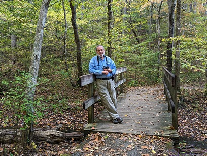
[ Note:  This is a long post without any photographs.  There will be a separate update post, with photos and captions, about the accessory building (barn) project. ]


TUESDAY 11 October

The driving portion of our grand tour of Eastern/Atlantic Canada and New England ended yesterday, but the trip itself wasn’t really over until all of the post-trip tasks had been completed.  This post covers the seven (7) days following our arrival back home.  A big part of returning home, of course, was the accessory building (barn) we were having built in our absence, but I will cover things related to that in separate, ongoing posts.

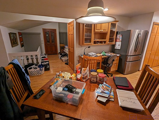
Top of the list was emptying out the trailer and moving back into the house, much of which we did as soon as we got home, and some of which I described in the post for October 10.  But there was a great deal more to do than I described there, and today we continued with the “things that must be done.”

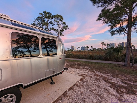
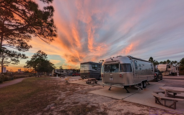
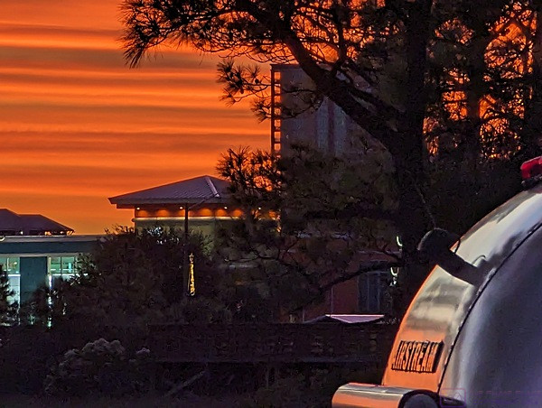
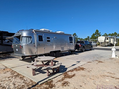
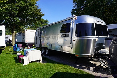
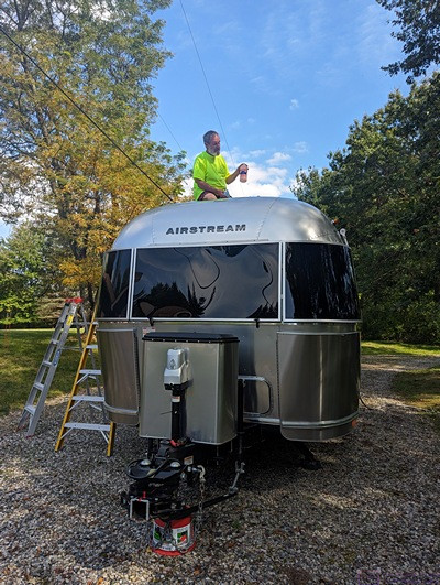
Foremost for us was washing and Walbernizing the Airstream, as the weather forecast was for a dry, partly sunny day with an afternoon high temperature in the 70s (F).  But it wasn’t the only thing on the list; high on my list was laundry.  After coffee and bagels for breakfast, I sorted the soiled laundry into the requisite categories (white-hot, white-cold, dark-warm, dark-cold, bedding/linens-warm, and blankets/bedspreads-cold), and put the white-hot load in the washing machine.

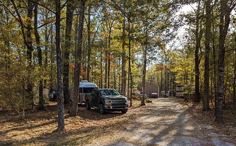
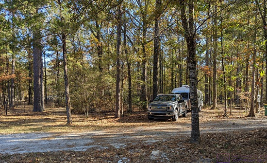
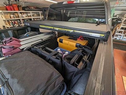
Washing the Airstream wasn’t a matter of simply turning on the outside water.  I had to get the tall (8’) step ladder out of the shed, along with the 100’ hose/reel and one of the wheelbarrows (to use for moving stuff between the trailer and the garage).  We have a 2-tank water deionizing system, so I had to get that out of the library.  Other items included:  McGuire’s Automotive soap; the spray nozzle for the hose; the long-handle brush; the bucket for soap; and the medium (6’) step ladder, all of which had to be moved from the garage to the wash area in the driveway in front of the house (where the water faucet is located, and the gravel drains well).  And, I still needed to empty the three outside storage bays in the trailer, and empty out the back of the F-150.  Linda helped with many of these tasks, of course.

On top of all that, our barn builder (Chuck) was due to come by today to meet with his insulation sub-contractor (Mike), and then meet with us.  He texted me mid-morning to let me know that he and Mike would be here at 11:30 AM.   Tuesday was also grass mowing day, so our lawn care guy (Keith) would be showing up sometime around noon.  We have not seen him since the Tuesday just before we left in June, so we knew there would be some catching-up conversation.  Besides maintaining the yard, Keith had sent occasional photos of the progress on the barn.  At a minimum, he had already mowed more times than we prepaid, so we owed him payment for services rendered.

But I digress.  We wrapped up our conversation with Chuck, as described in the separate post on the barn project, and he went on to his next appointment.  By then, it was lunch time, so we had grilled cheese sandwiches.  Very tasty.  I transferred the laundry from the washing machine to the clothes dryer, and then we turned our full attention to washing the trailer.

While not as big as the bus, it was still a lot of work.  I started with the roof (of course), which required me to work from the 8’ ladder.  Even then, it was sometimes an uncomfortable reach to get to some of the areas, and almost impossible to reach others.  For as streamlined as the Airstream trailer is, the roof is littered with stuff that is not very aerodynamic, and is hard to clean.  Too make matters more difficult, walking on the roof is ill-advised, and you have to be very careful where you step.

Linda stayed on the ground (she doesn’t like ladders) and managed the soap bucket, brush, and hose.  The procedure was as follows:  climb the ladder, get the hose from Linda, spray an area, give the hose back to her, get the soapy brush from her, scrub the rinsed area, give the brush back to her, get the hose from her, rinse the area I just washed, and give the hose back to her.  Climb down the ladder, move it to the next location, and repeat; at least a dozen times, probably more.

(Once we have the bus and the trailer in the barn, I will be buying a taller step-ladder, probably 14 feet, and some sort of adjustable platform that can go between two ladders to provide a stable work surface.  Alternatively, I might but some scaffolding with wheels.)

Once the roof and the end caps were done, I could reach the rest of the body from the ground.  Working from the top down, I did the upper half and then the lower half.  (This is not true for the bus, as the upper half still requires a ladder or work platform.)

We were busy enough all day that I wasn’t keeping a close watch on the time.  I think we actually started washing the trailer around 1 PM and finished sometime around 5 PM, but that included an extended time-out to chat with Keith.  It was probably 5:30 PM or later by the time we had cleaned up our equipment and put everything away.  But the trailer was clean and ready for the Walbernize One-Step Cleaner & Sealer.

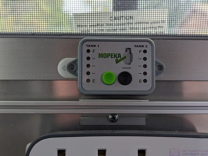
AMAZON was having their 2-day pre-something-or-other event today and tomorrow, so Linda put some things in our cart.  Among them was a new 2-slice toaster with openings wide enough to toast bagels.  It also had a bagel setting, so it would only toast on one side, essential for proper bagel toasting.  She also ordered a new frying pan, some baking sheets, and a pair of adjustable carbon-fiber walking/trekking poles.  I had been keeping an eye on a propane tank level monitoring kit.  It was still available, and still on sale for the same price I had seen previously, so I investigated a bit further into how it actually worked.  It turned out to use sonar, and was made by a company that makes various products using this technology for industrial applications, so I put it in the cart as well.

As I did not finish the post for this day until a week later, I no longer recall what we had for dinner, but whatever it was, I’m sure it was delicious, as always.  Being Tuesday, after dinner we watched the FBI shows on CBS.


WEDNESDAY 12 October

The forecast for today was for intermittent rain with cooler temperatures and overcast skies.  We had planned to treat the exterior aluminum on the trailer today with the Walbernize One-Step RV Cleaner & Sealer, but the weather was not conducive, either to the task or to our mood for doing it.  We were both a bit tired after the last two days, and decided to take it easier today.  Besides, I still had laundry to do, and wanted to work at my desk for a while to wrap up my blog post for Monday (October 10th).

I needed to get the F-150 in for service, specifically to have the brakes checked/repaired, so I called Brighton Ford and made that appointment for Monday 24 October.  We also needed to pick up Linda’s car, and our mail, from our daughter’s house, and drop off some gifts we had picked up in our travels.  Linda contacted her to check on timing and the reply was “any time after noon.”  It’s a nice, 45-minute, drive in the country to get to her house, so we timed our departure to arrive around 12:30 PM.

Before we left, however, I noticed a blue car in the driveway by the barn, so I walked down to see who was there.  There was at least one other vehicle there, and it was the lead carpenter and his two assistants.  I introduced myself and we chatted for a few minutes and then I left them to their work, which I will describe in separate posts about the barn project.

We visited with our daughter for a bit, but did not overstay our welcome as she was in the middle of a project.  She is redoing floors (wood and tile) and bathrooms (vanities, fixtures, wallpaper, etc.) and has already redone most of the lighting and installed smart switches and dimmers throughout the house.  She also put in remote controlled window shades, and has done a lot of painting.  She’s incredibly handy, has excellent taste and color sense, and is meticulous in her work.

On the way home, I ran some errands while Linda did some grocery shopping.  I topped up the fuel in the F-150 ($4.49 for regular / 87 octane) and then got the truck washed.  I used the same drive-through car wash I have used for a long time, but this time the final overhead brush in the drying area bent my antenna in two places.  That had never happened before, so something had obviously changed with their equipment.  But it won’t happen again, at least not there.  I did not even bring it to their attention (there would have been no point) and instead drove directly to Brighton Ford to see if I needed to add this to my service list for the 24th.  It turned out to be an easy, user-serviceable, job to replace the antenna, so I went to the parts department to get one.  They were on back-order (of course), so I ordered (and paid for) one.  I picked up a pair of replacement windshield wiper blades while I was there, and replaced them as soon as I got home.

Back at my desk, I finally managed to get on the DTE website and located the information I needed on the process/procedure for getting electrical power to the barn.  I printed off the instructions and called one of the indicated numbers, but it was already after hours, so this had to wait until tomorrow.  I will cover the details of this in my accessory building project update post, as all of this has to do with the barn project.

I did contact our friend, and fellow bus owner, Chuck (not-the-builder) to arrange a dinner get-together so we could catch up with him and Barb.  Saturday, 5 PM was agreed upon at the La Marsa in Brighton.  I also contacted our friend, and my former co-worker, Kate about getting together.  Tuesday the 18th was agreed to, with the place TBD.  Part of being gone for so long is that we were eager to reconnect with friends and family in person and (hopefully) they with us.

For dinner, we had breaded chicken cutlets, brown rice, and corn, with turkey gravy.  All vegan, of course, and all very tasty and satisfying.

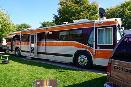
After dinner, we had a ZOOM call with Paul and Nancy.  They had finally taken delivery of their 2022 Alliance Paradigm 370FB 5th wheel trailer (RV) and had it delivered to the RV park in Gulf Shores, Alabama, where they plan to keep it, and will have it moved in/out of storage seasonally for their use.  They had been busy getting the things they needed for it, and getting it set up to live in.  It was great to chat again, and get a real-time video tour of the interior.  It was very nice, of course.

Wednesday is not one of our regular TV nights, but this past Sunday we missed the 3rd/final episode of Van Der Valk (for the season), so we streamed that.  It was followed by an episode of NOVA on Computers and Crime, so we watched that as well, and then went to bed.


THURSDAY 13 October

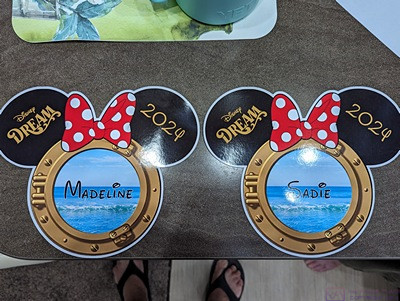
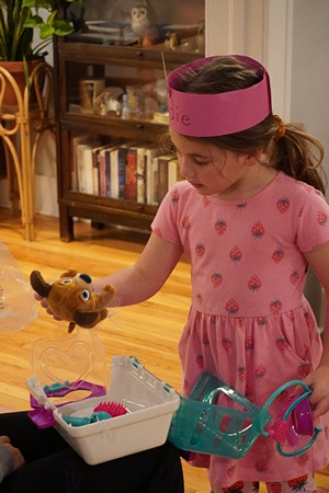
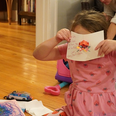
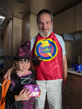
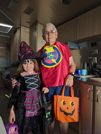
Today was someone’s 4th birthday; Happy birthday, Sadie Rose!  She was in pre-school all day, of course, so a happy birthday Facetime call had to wait until after dinner.

The weather forecast still had a possibility of rain today, so we deferred the Walbernizing of the trailer for another day.  Our main focus instead became finishing the job of completely emptying the inside of the Airstream and then thoroughly cleaning the inside as well as everything that had been stored in it, especially items that had to do with food (storage, preparation, consumption, cleaning, etc.).  That also included laundry, of course, which I continued to work on.  Before that happened, however, I was able to chat with Erich, the Service Manager at Woodland Airstream, about our upcoming appointment and list of issues, most notably the furnace and the transverse hump/bulge/ridge in the kitchen floor.

Breakfast was waffles with some of the Maple Butter we got at Domaine Acer in the Gaspé Peninsula.  It was just as delicious as we remembered, and brought us back briefly to the wonderful discovery of that place and its products.

After breakfast, I called the DTE phone number in the instructions.  Actually, there were two phone numbers, one for commercial and one for residential.  I called the commercial number first.  The voice menu made it fairly obvious that it was for builders, and that I needed to call the residential number, which I did.  I will cover the details of the conversation, and follow-up actions in my accessory building update post, as all of this had to do with the barn project.

As long as we were on a roll, we both logged in to our MyChart app on our iPads and set up our Annual Medicare Wellness Visits with the HFHS Columbus Medical Center Internal Medicine Department in Novi.  Our primary care physician retired in July, so we will both be seeing new, and different, doctors now.  I then used the CVS app on my iPad Pro to schedule both of us for our seasonal flu shots and the newest bi-valent CoVID-19 booster next week.

We also did a partial winterization of the fresh water system and the drain traps in the Airstream, which went something like this:  Drained the fresh water tank;  Opened the hot and cold low point drain valves;  Removed the drain plug from the water heater;  Used an air-compressor to blow out the fresh water lines and water heater as best we could;  Drained the little bit of water in the gray tank (onto the ground);  Filled the two sink traps and the shower trap with enough potable antifreeze to make sure some of it ended up in the gray tank;  Added potable antifreeze to the toilet flushed it into the black tank, and left some on top of the valve to keep the seal moist.  (The reason for the antifreeze in the waste tanks was to keep the knife valves from freezing if there was any residual water left in the tanks.)

Lunch was leftovers (chicken cutlet with gravy, rice, and corn).  Yum.

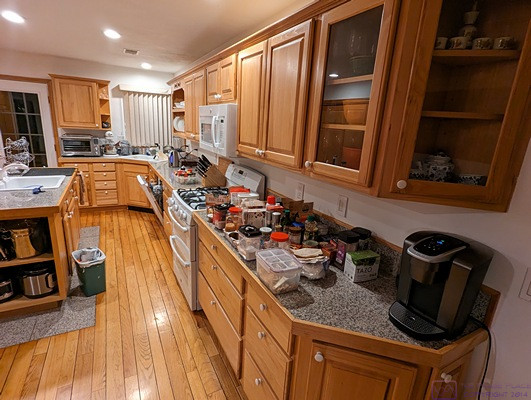
We were done working on the trailer by 5 PM, and ready to quite for the day.  We continued to be amazed by how much stuff we had brought into the house and garage as a result of emptying out the trailer and truck.  Linda continued to sort and separate stuff, setting aside things she does not intend to put back on board, and ran several loads through the dishwasher.  We wanted everything to be clean before we packed/stored it until the next time we use the tailer.  And at this point, we do not yet know when that will be, exactly or even approximately.

I was still working on this post the following week, and no longer recall what we had for dinner.  Whatever it was, it was undoubtedly good, after which we Facetimed with her Sadie, and sang happy birthday to her.

We didn’t have any Thursday evening TV programs we were watching at this point, so we streamed Masters of the Universe – Dr. Strange: The Multiverse of Madness.


FRIDAY 14 October

Around breakfast time, I got a call back from Sharon in the DTE Northwest Planning office, regarding the service request I had initiated yesterday.  More details about this call will be in the separate update post about the accessory building project.

Late morning, we finally got around to putting the Walbernize One-Step RV Cleaner & Sealer on the exterior of the Airstream.  It was cooler than we would have liked, and a bit breezy, which wasn’t great.  But it was also cloudy, which was good, as the product is not supposed to be applied in direct sunlight.  I worked on the upper half of the body, using a ladder, while Linda worked on the lower half from the ground.  It was an easy enough product to use:  wipe on, let dry to a haze (doesn’t take very long), and wipe off, always working with the grain of the aluminum.  The results are always very nice, and the body is slick to the touch afterwards, it’s just a lot of surface area and takes a while.

I was still working this post on Tuesday, the 18th, so I no longer recalled details of what we had to eat today, or other such minor considerations.  I do recall that after dinner we watched an episode of Star Wars: ANDOR and The Lord of the Rings: The Rings of Power and then the latest episode of The Great British Baking Show.  Our tastes in TV and movies are, if nothing else, eclectic.


SATURDAY 15 October

We were finally getting back into our normal “at-home” routine, starting the morning with coffee and our iPads.  Saturday mornings are also the weekly breakfast gatherings of members of the South Lyon Area Amateur Radio Club (SLAARC).  We did not go today, but I am looking forward to resuming our attendance at these gatherings.

Breakfast was scrambled eggs (Just Egg) with bacon, two slices of toast (expertly toasted in our new toaster), and an orange, split equally between us.  There might have been orange juice involved as well, but I don’t recall at this point.

We had enough recyclables to warrant a trip to Recycle Livingston.  Our membership had expired last month, so Linda made out a check for the renewal before we left.

My existing site plan for the barn project did not include a few pieces of information that DTE needed.  I spent part of the day modifying my QCAD drawing to include those features and e-mailed it to the DTE planning consultant (John).  Further details about this will be in the accessory building project update post.

The final task in cleaning the Airstream was to apply 303 Aerospace Protectant for the window and door seals, and adjust one of the window latches.  It was chilly outside, so this was a less-than-completely-comfortable task, but I got it done.  Except for the seals for the three bay doors; I forgot to do those, and just let it pass for now.  The window seals tend to stick, but the bay seals do not, so it was merely for preventative maintenance and could wait until spring.

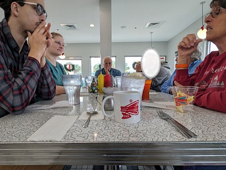
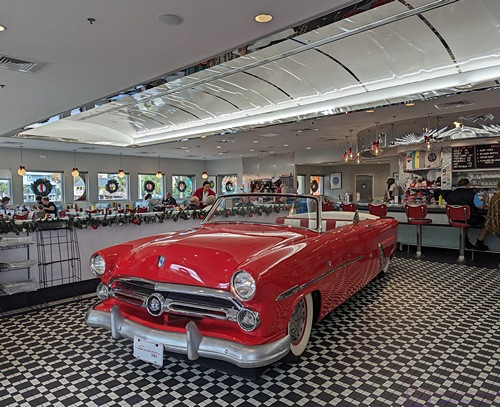
We both got showers and left around 4:40PM  to join our friends, Chuck and Barb, for dinner at La Marsa.  It was great to see them again.  We were glad we could all fit in dinner as quickly as we did, as they have an early November departure planned for their winter RV resort in Naples, Florida.  They plan to be back, however, from Thanksgiving to New Year’s, so we should have another opportunity to get together with them yet this year.  The meal (food), however, was a disappointment.

We both had Koshary, a dish we have had many times at this, and other La Marsa locations, and it was not as good as normal.  The caramelized onions they put on top had been burnt to a crisp and were not tasty.  The dish has always included some amount of capellini (angel hair or fine pasta) but this time seemed to be made with spaghetti, which was too thick, and there was too much of it.  Linda also thought it had too much tomato paste, so both the taste and texture were “off.”  We didn’t complain, but I doubt that we will order it again any time soon.  They have other things on the menu that we can eat, and like, so we have not given up on the restaurant.  We were reminded, however, of how quickly a restaurant can lose their regular customers if someone is not paying attention to the consistency and quality of the dishes, especially ones (like Koshary) that are both signature items for this chain, and a dish we have never seen on a menu anywhere else.

Back home we watched Father Brown and Midsummer Murders on PBS.  Death in Paradise had been moved ahead of Father Brown and Broadchurch, which we had already seen, was put in the 10 PM time slot.  It was fabulous (another great Nicola Walker role), but we had no desire to see it a second time.  We might have streamed something else instead, but I no longer recall what we did.


SUNDAY 16 October

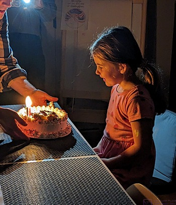
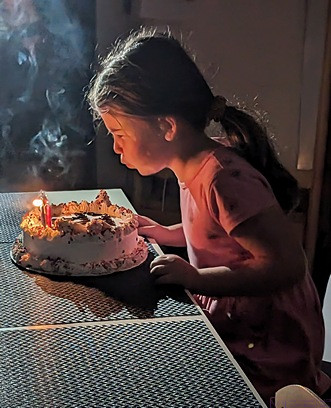
Today was our grand-daughter Sadie’s family birthday party and brunch.  She turned 4-years-old this past Thursday, and it was the first time we were able to see her, and big sister Madeline, (and son, Brendan and daughter-in-law Shawna) in person since we got home.  Our daughter (Meghan) and son-in-law (Chris) were there, along with Shawna’s brother, Rob, and his family (Becky, Jack, and Juniper).  It was nice to see everyone, the food was wonderful, and the kids made sure it was an energy-filled gathering.

On the drive home (Linda was driving) I texted Phil at Precision Grading, to let him know we were home.  Phil has done all of our driveway and septic tank work since we bought the house, and installed a French Drain in the west portion of our property that works really well.  But he is also the sub-contractor for the excavating, grading, and driveway work on the accessory building.  We are on his future project list to replace the drain in the valley behind the house with a proper French Drain, so I needed to check on that as much as anything else.

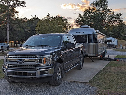
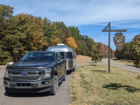
At home, I went ahead and put the stinger for the Propride 3P Hitch into the receiver of the F-150 and lined it up with the hitch on the Airstream.  Linda then came out and assisted with the actual hitching up process, following the procedure we had now used for almost four months.  With the trailer secured to the truck, we removed and stowed the chocks and the tongue jack stand, and the combo was ready to go in the morning.  I was going to finally need to use the Lot Bar, which we bought at the same time as the hitch in October 2019, so I made sure I had the necessary tools in the truck to install it once I got to the Airstream dealer tomorrow.

For dinner, Linda prepared home-made Raman from scratch (except for the noodles, of course).  It was amazing (naturally), and I suggested it be added to some regular menu rotation for the coming winter months.

Sunday evening is one of our two PBS nights, featuring Masterpiece Theater.  Tonight, was the first episode of the new season of Miss Scarlet and the Duke, followed by the premier of the Magpie Murders and then the US premier of Annika, staring Nicola Walker, whose work we have come to really enjoy and respect.

Tomorrow would be an early/busy day for both of us, so I set an alarm on my phone for 7 AM before turning in for the night.


MONDAY 17 October

I took today as the final day of our post trip tasks, as well as the resumption of some of our “at home” routines.  My me that meant taking the travel trailer to Woodland Airstream in Grand Rapids, Michigan for the scheduled appointment to take care of our list of service items before the factory warranty expired on November 8, 2022.  For Linda, that meant the first trip (of probably many) to Ann Arbor to provide child care for one or both of the younger grand-daughters while their parents worked.  Today, that meant watching (playing with) Sadie, as her Montessori pre-school was closed today.  She also had to hang around long enough to also spend time with Madeline after she got home from school while dad took Sadie to her ballet class.

I was scheduled to arrive at Woodland Airstream between 10 and 11 AM, and Erich (the service manager) had me on his calendar for around 10:30 AM to go over the repair list.  I pulled out of the driveway at 8:15 AM for the approximately 1-hour and 45-minute drive to the northeast side of Grand Rapids, Michigan.  There was a light mist as I pulled out, and I drove in and out of rain of varying intensity for the entire trip.  I missed the morning rush hour traffic in and around the Lansing, Michigan area, and the trip went smoothly even with occasional construction zones.

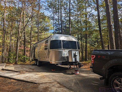
I arrived right around 10 AM to a very light-to-intermittent rain, and parked the truck-trailer combo in a convenient spot that was not blocking traffic or parked vehicles.  I checked in with Joyce, the service writer, and then checked in with Erich to see if they had chocks and blocks I could use to secure the trailer while I unhooked it.  (I did not want to leave my personal chocks or jack stand, if possible.)

It was probably 10:30, or a bit later, by the time I had the truck unhooked and the Lot Bar installed.  The Lot Bar is an accessory for the Propride 3P Hitch that allows the trailer to be moved around (at low speed) by a tow vehicle with a conventional trailer ball, such as on an RV dealer’s parking lot (thus the name of the device).  Woodland Airstream has several of these devices, but they now charge $50 to install and uninstall them.  Which is fair, as it involves some amount of time of their labor to do this if the customer doesn’t take care of it themselves.  I didn’t mind doing it, even in the very light rain, as I have had this accessory since we bought the hitch, and had yet to use it.  I knew exactly how it had to be installed, but had never actually done it.  It was very easy.  We never leave home without.  In the event that we had to have unexpected repairs attended to while traveling, it is highly unlikely that most RV service facilities would have one.

Erich met with me around 10:45 AM and I walked him through a few of the items on our list that I thought would make more sense if I could just have him look at something while I pointed to the problem area.  He was very attentive and, in spite of always being very busy, took the time and gave me his undivided attention.  I then met with Joyce to go over the paperwork, sign it, and give her the keys.  The estimated time to turn the trailer around was 3 to 4 weeks, but I told her we had no plans to use it again until spring, and it was fine with me if they took the time they needed to address everything correctly.  Most of the items were already identified as warranty, but I anticipate there will be things we have to pay for, beyond the winterization.  At a minimum, I want to get a couple of spare “sail switches” for the propane furnace and a spare fresh-water pump to carry as spare parts.

I had hoped to chat with Steve, our salesman, but he was tied up with a customer.  I was standing near the front door, waiting to see if Steve was going to have a break, but perhaps looking a bit lost, when a gentleman standing there asked if he could help me in any way.  Long story short, it was John, the CEO of Woodland Airstream, and the GM of the Grand Rapids location.  We had a really nice chat, but since he asked, I shared my concerns about the bulge in the floor.  He was confident they would be able to take care of it.  I made sure he knew how pleased we were with all of the employees we have interacted with, starting with our very first contact with Steve in August 2019.

Woodland Airstream recently opened a location in Indianapolis, Indiana and John said it was doing very well.  I also learned that they are about to break ground on a location in Clarkston, Michigan (much closer to our house) that will allow them to conveniently serve the whole southeast Michigan market, and possibly take in northwest Ohio.

While I am not completely happy with Airstream at the moment, as I think there are way too many items on our list for a 3-year-old trailer with no more than 10,000 miles on it, Woodland Airstream has been an absolutely top-notch, first-class group of people to deal with.  Woodland Airstream is an Airstream exclusive dealership, as a result of which they have a great relationship with Airstream and their customers ultimately benefit from that.

It was 11:45 AM by the time I was done at the dealership.  I texted Linda that I was about to head for home, but then decided to drive the short distance in the opposite direction on Plainfield Avenue NE to Anna’s House.  So, I texted my change in plans.  Anna’s House is local chain of restaurants that is well known for their breakfast offerings, including vegan ones.  I was in the mood for lunch, however, and ordered their vegan hamburger with French fries.  I should have ordered breakfast, as the burger was very disappointing.  I texted Linda again when I was ready to leave the restaurant, and again when I got home around 3 PM.  It’s been a long-standing practice of ours, ever since we finally had cell phones with text messaging, to let each other know when we are on the road and have reached our destinations.

Back at the house, there were trucks and a trailer down by the barn, so I figured the insulation crew was there, and walked down there to check on things.  There will be more details on that in the separate accessory building project update post.

Phil (Precision Grading) called me around dinner time and we had a nice, long chat.  We don’t talk too often, as Phil is very busy and works long hours, but we always have a great conversation when the opportunity presents itself.

For dinner, Linda made sandwiches of vegan deli slices and cheese with lettuce and vegan mayo on toast.  We had a few Fritos and orange slices on the side.

Monday is one of our two CBS nights, so we watched our usual programs and then went to bed.