Category Archives: Vidalia

20231031_NTNP_14-14_End-of-the-Trace

Note:  This post contains 17 photos with captions, and some minor narrative.  Photos by me (Bruce) taken with a SONY alpha 6400 or Google Pixel 6 Pro unless otherwise indicated.  (Photos by Linda taken with a Google Pixel 6.)


TUESDAY 31 October 2023 — NTNP 14 of 14 — End of the Trace:  Emerald Mound (again) and the Town of Rocky Springs, near Natchez, MS
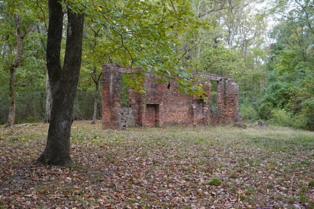
 

The only remaining wall of the Elizabeth Female Academy in Washington (West Natchez), Mississippi.  (See the next photo and caption.)
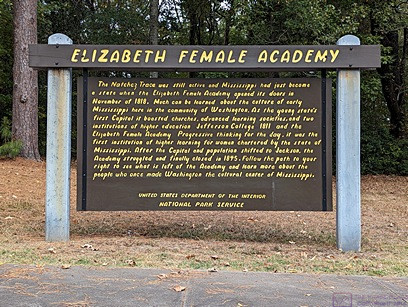
 

ELIZABETH FEMALE ACADEMY information sign.  Paraphrased from Wikipedia:  The Elizabeth Female Academy, founded in 1818 in the town of Washington (West Natchez), was the first female educational institution in Mississippi. It was named after Mrs. Elizabeth Roach (later Greenfield), who donated the land on which the school was located. The school closed in 1845, due in part to the relocation of the state capital from Natchez to Jackson, the general shift in the center of population, and several epidemics of yellow fever in the area. The site was reduced to ruins by a fire in the late 1870s. Part of a brick wall is all that now remains of the Academy buildings.

Learn more at:  Elizabeth Female Academy – Wikipedia
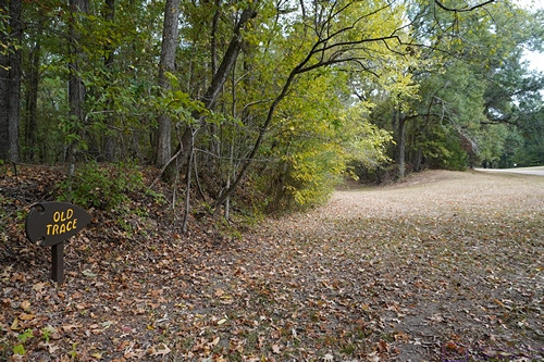
 

The small sign post at the lower left of the photo says Old Trace with an arrow pointing to the right.  This section of the old (original) trail starts at the opening on the left. 


We walked on identified sections of the original (old) Trace when we could.  We enjoyed the short hikes and admired the natural beauty of these places but also thought about the arduous journeys that so many people made along this trail so many years ago and the history that surrounds it.
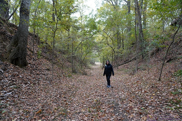
 

Over time and thousands upon thousands of footsteps, the path of the Trace gradually wore down below the surface level of the surrounding landscape.  As shown here , the depth at this point is over twice Linda’s height.
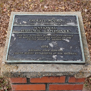
 

EMERALD MOUND NATIONAL HISTORIC LANDMARK plaque.  We returned to Emerald Mound today as we only had a brief visit yesterday, mostly the find it.
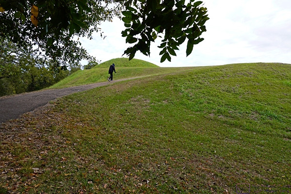


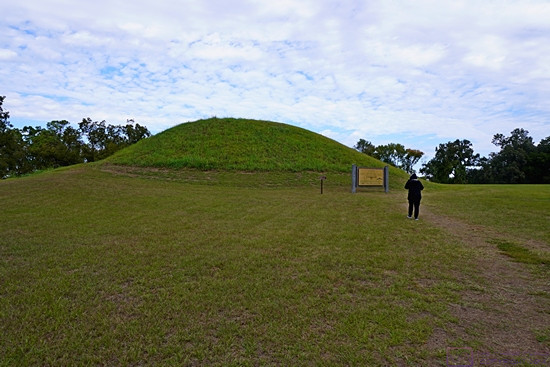
The trail leading to the top of Emerald Mound was paved but steep.  This photo gives a sense of the height of the mound from the parking lot.
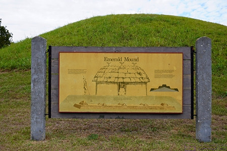
 

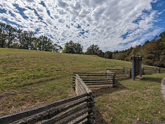
Linda on top of Emerald Mound heads towards a smaller mound and information sign.


This information sign and graphic provided a visualization of how archeologists think the structures atop Emerald Mound were arranged, appeared, and used.
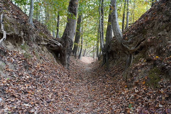
 

Another section of the Old Natchez Trace.  Sections like this are sometimes labeled “Sunken Trace,” but if that was the case here, I did not document it.
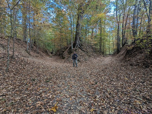
 

A picture of me for scale (and just because) at a point where the Natchez Trace splits into two paths.  We rarely saw splits like this, and have no idea how common or rare this was on the original trail.
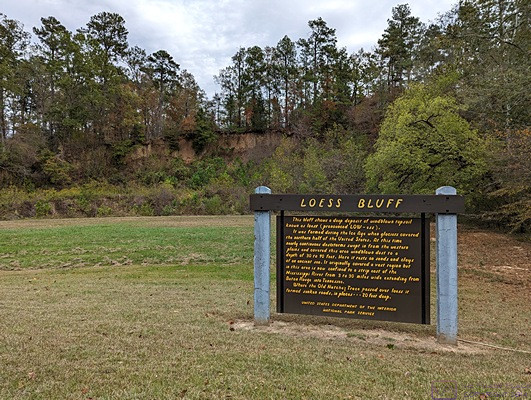
 

LOESS BLUFF information sign.  The loess bluff is the shear area behind the sign,  From MS Edge (Co-Pilot):  A loess bluff is a fascinating geological feature formed by the accumulation of windblown sediment known as loess.  Loess (pronounced LOW-ess) is a type of fine-grained, silty soil composed of particles deposited by the wind. It’s typically light yellow or tan in color.  During the Ice Age, glaciers covered the northern half of the United States. As these glaciers receded, they left behind vast expanses of bare land.  Continuous dust storms swept in from the western plains, carrying fine particles of dust and soil. These winds deposited the loess layer over the landscape.  The result?  Bluffs—steep, elevated landforms—made up of this windblown topsoil. Loess bluffs can be found in various regions around the world.  …  Mississippi also boasts its own loess bluffs, where nearly continuous dust storms during the Ice Age created a layer of sandy soil 30 to 90 feet deep.
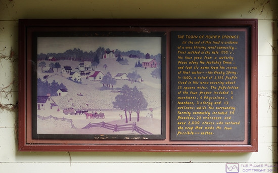
 

THE TOWN OF ROCKY SPRINGS information sign.  The town was first settled in the 1790’s.  In 1860 it had a population of 2,616 people spread over a 25 square mile area.  Over 2,000 of those people were slaves who tended the fields of cotton, the main crop that made this town possible.
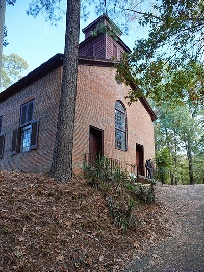
 

The historic Methodist church in Rocky Springs, Mississippi is the only remaining structure of Rocky Springs and continued to hold Sunday services until 2010.  The site and church are now maintained by the National Park Service.
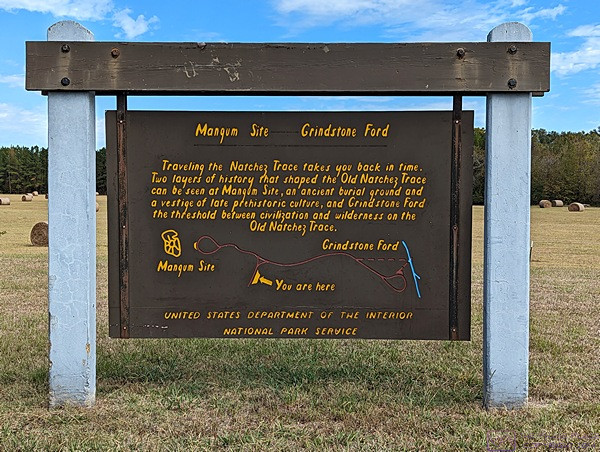
 

MAGNUM SITE and GRINDSTONE FORD information sign.  The Magnum Site is a prehistoric mound and the Grindstone Ford was the threshold between civilization and wilderness on the Old Natchez Trace.
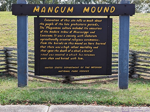
 

MAGNUM MOUND information sign.  Archeological excavation of this mound revealed much evidence about the prehistoric Plaquemine culture that was the precursor of the modern tribes of Louisiana and Mississippi.
 

A view of Magnum Mound from near the information sign.


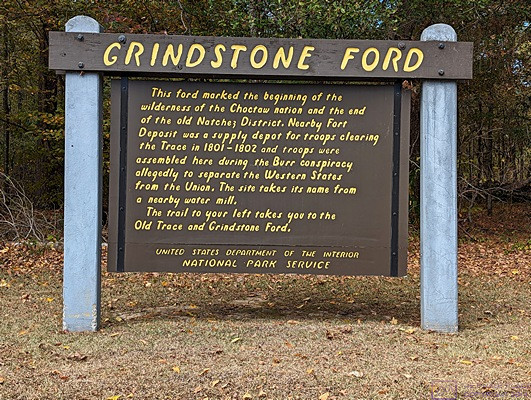
GRINDSTONE FORD information sign.  The FORD marked the end of the old Natchez Trace District and the beginning of the (wilderness of the) Choctaw Nation.  But it was only “wilderness” in the eyes of the Europeans who were moving into and “settling” the area.


And that is the end of my 14th and last post on our trip down the Natchez Trace National Parkway.  It was a trip we had long talked about doing, and even planned for, and we were pleased to have finally done it.  Up next, our month in Gulf Shores, Alabama hanging out with friends.

20231030_NTNP_13-14_Emerald-Mound_GVNI_Natchez-MS

Note:  This post contains four (4) photos.  Photos by me (Bruce) taken with a SONY alpha 6400 or Google Pixel 6 Pro unless otherwise indicated.  (Photos by Linda taken with a Google Pixel 6.)


MONDAY 30 October 2023 — NTNP 13 of 14 — Emerald Mound and the Grand Village of the Natchez Indian, Natchez, MS


When we planned our trip, the itinerary included a 1-night stop for 31 October 2023 at The Great Mississippi Tea Company, another Harvest Host location, near Brookhaven, Mississippi.  We had stayed there once before and thoroughly enjoyed it.


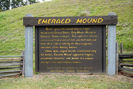
EMERALD MOUND information sign.  Built on top of a hill, this flat-topped 8-acre mound was in use from 1300 to 1600 AD by the Mississippian Indians, predecessors of the Natchez Indians.  It supported temples, ceremonial structures, and burials for the civic and religious leaders of a complex society.  It is second in size only to Monks Mound in Cahokia, Illinois.


Besides being a nice place to camp for the night (strictly boondocking), the hosts/owners of The Great Mississippi Tea Company were delightful and very welcoming.  We were given a tour of the place—including the tea plants in the fields and the processing facility—and bought some things in their gift shop (of course).  But they also brought us a tea service in the morning of our departure.  That was a nice touch, very nice.


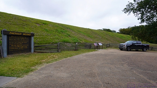
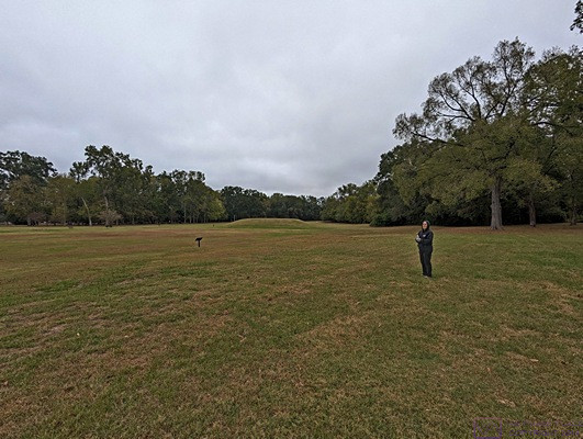
Another view of Emerald Mound from the parking lot and entrance to the trail that leads to the top.


We were very much looking forward to returning to The Great Mississippi Tea Company, but canceled the stop based on the weather forecast, which called for temperatures near freezing the night we would be there.  In previous posts, I have mentioned the various reasons we can’t really boondock in our Airstream travel trailer, but I didn’t mention one of the most important; it’s really not that well insulated, and that is especially a problem in cold weather.


In another part of Natchez, MS we visited the site of the Grand Village of the Natchez Indians.  The smaller mounds found at sites like this could be easily overlooked if care was not being taken to preserve them and tell their story to any/all who visit.  To learn more, visit the Wikipedia entry at this link:  Grand Village of the Natchez – Wikipedia


Before canceling our HH stay, however, we checked with the office at the River View RV Park & Resort to make sure we could extend our stay, as we could not check in at Luxury RV Resort in Gulf Shores, Alabama until Wednesday 01 December.  The park was not full and there was no difficulty extending our stay for an additional night (3 total).


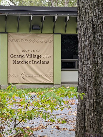
A banner sign on the museum wall at the Grand Village of the Natchez Indians.


With that change in plans, we now had two full days to explore the southern end of the NTNP and the area around Natchez, Mississippi.


20231029_NTNP_12-14_Natchez-MS_Vidalia_LA

Note:  This post contains nine (9) photos.  Photos by me (Bruce) taken with a SONY alpha 6400 or Google Pixel 6 Pro unless otherwise indicated.  (Photos by Linda taken with a Google Pixel 6.)


SUNDAY 29 October 2023 — NTNP 12 of 14 — Natchez MS and Vidalia LA


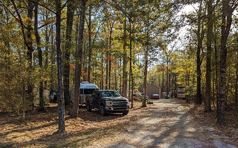
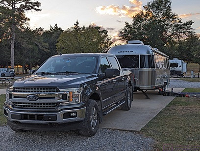
Our truck and trailer backed into our wooded Boondockers Welcome parking spot at The HatchPad Off The Trace in the Farmhaven area of Mississippi.  No epic views, but a lovely, quiet spot in the woods that suited us just fine.  Our hosts’ house is farther back in the woods at the end of the driveway.  While not really visible in this photo, there is a shed to the right of their house with a washing machine and a dryer.  We were invited to use, and took advantage of the opportunity.  (Most commercial RV parks have laundry rooms, so we made use of those when available when needed.)


Today we completed our north to south transit of the Natchez Trace National Parkway at the south terminus in Natchez, Mississippi and then on across the Mississippi River to the River View RV Park & Resort in Vidalia, Louisiana, immediately across from Natchez.  In total, we drove all but about 10 miles of the 444-mile-long road, and that was only because a 10-mile stretch in/near Tupelo, MS was closed for construction/repairs.


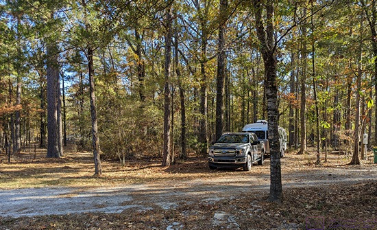
Another view of our truck and trailer in our BW parking spot.  Barely visible near the center of the right edge of the frame is the electrical box where we were allowed to hook up to shorepower.


While not an “epic” trip, in comparison to some of the national scenic roads we have driven, it was a wonderful journey at a leisurely pace with light traffic and a nice mixture of scenery, culture, and history.  I mean, we took nine (9) days to pull our trailer from one end to the other a distance that we could easily have covered in two (2 days,) even with the trailer, or one (1) day without it.  But not on the NTNP, of course, which has a maximum speed limit of 50 MPH, with lower limits in some places.  No, this trip was an intentionally “slow roll” and was a kind of “bucket list” item that we had been trying to do for a while.


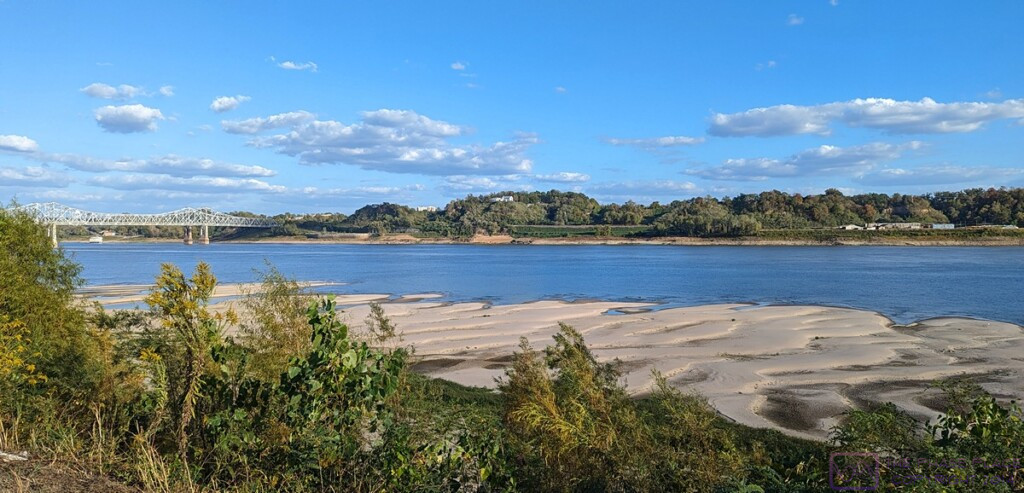
Natchez, Mississippi as viewed from Vidalia, Louisiana across the Mississippi River.  Most of the “downtown” area is to the left of the bridge.  The River level was very low.  The sand bar in the foreground is usually underwater and not visible.


As much as we would like to have the ability to dry-camp, our rig is only capable of doing that comfortably for a very short time in a very narrow temperature range.  We have two solar panels on the roof, but we do not travel with a generator, and our battery system is insufficient to run big loads.  We have propane for cooking, refrigeration, hot water heating, and forced-air space heating, but the last three appliances use DC power to run their control circuits, and the fan in the forced-air furnace is a real energy hog, precluding it’s use in cold weather precisely when we need i.  At the other extreme, we have two heat pumps which function as air-conditioners for cooling or can heat the rig efficiently in cool weather as long as it’s not too cold.  But they are 120VAC devices, and they still use a lot of power/energy.  Making the rig truly off-grid capable is something we discuss, but have not reached a conclusion on whether we will undertake the necessary modifications and upgrades.


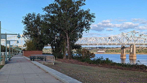
There was a very nice walkway that went along the River by our RV park.  It extended up to and beyond the bridge, so we went for early evening stroll.


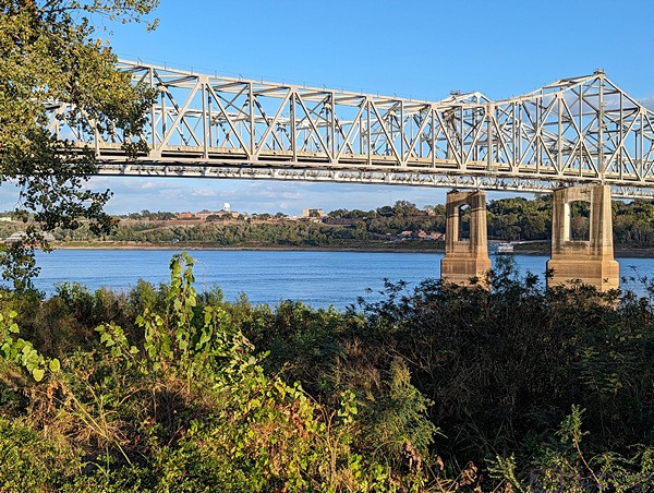
A closer view of the bridge with part of Natchez, MS visible on the horizon.


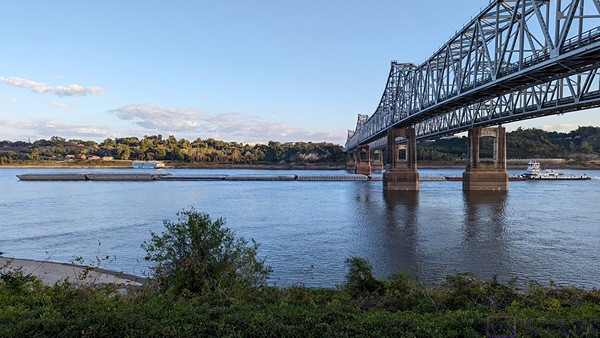
A barge being pushed (upstream, from right to left) by a tugboat (which seems backwards) passes under the bridge, being careful to stay in the center of the River in order to have sufficient underwater keel clearance.


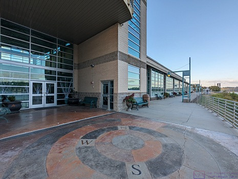
Just beyond the bridge (on the north side) was the Vidalia Convention Center, a very nice-looking facility.


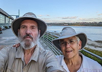
A selfie by the Vidalia Convention Center with Natchez, MS in the background.  I think the reason I never smile in selfies is that I am concentrating on framing the shot and also trying to remember to look at the lens, something both of us seem to have difficulty doing consistently.


Our site at River View RV Park & Resort on the western shore of the Mississippi River in Vidalia, Louisiana across the River from Natchez, MS.  And no, the name of the town has nothing to do with the onions, which get their name from Vidalia, Georgia.


While we were done traveling the NTNP with our travel trailer in tow, we were not quite done exploring the Trace, which I will cover in the post for tomorrow and the next day.