THURSDAY 18 August – The Easternmost Point in North America
It rained most of the overnight, with occasionally strong and gusty winds, but it let up by the time I got out of bed this morning. I got the blog post for yesterday assembled and published before breakfast. Breakfast was avocado toast on hot dog buns as our sliced bread had gone moldy before we could us all of it. In spite of an overcast and rainy forecast, it appeared that we might have little to no rain between 10 AM and 2 PM. That was more than enough time to visit Cape Spear National Historic Site, and we made that our plan for the day.
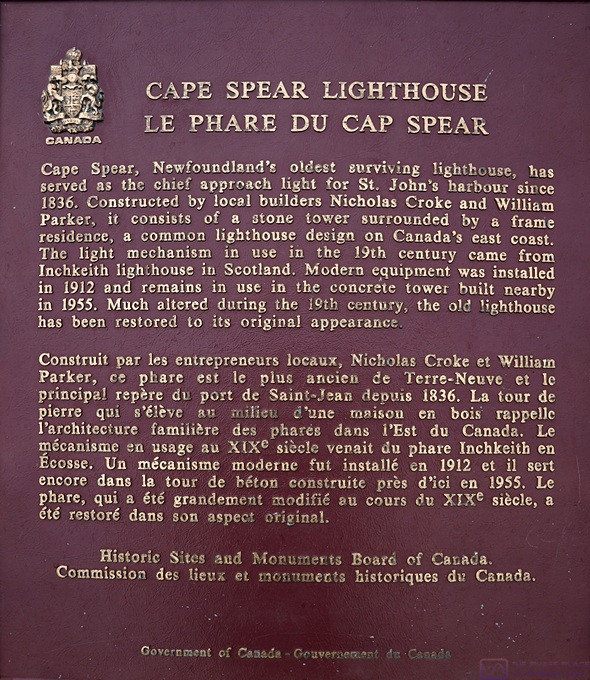
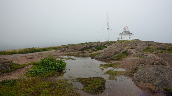
Cape Spear is known for its lighthouses, one historic and one operational, but is probably most famous for being the easternmost point of land in North America. From the tip of this Cape, any direction of travel from north through east to south is the North Atlantic Ocean. The nearest land is to the north, through the Labrador Sea to Greenland. Perhaps less well know is its military history, especially with respect to WWII and the Battle of the Atlantic. I’ve split our visit up into three posts: 1) the site and modern lighthouse; 2) the Historic 1836 lighthouse, and; 3) the military use. This is post #1.
Although only about 19 km (~12 mi) from our campground, Google Maps said it would take about 30 minutes to get there. The first part of the route was through residential areas and the downtown harbor district of St. John’s, so low speed limits with lots of stop signs/lights and traffic. Even after we left the dense urban area, the speed limit was often 50 km/hr (~31 mph) and sometimes only 30 km/hr (~19 mph). There was one stretch that was posted at 80 km/hr (~50 mph), but the road was curvy and had to get over a high ridge to get to the Cape, so lots of up and down, and some slowing down on downhill curves. On the higher elevation portions of the route, we had clouds drifting across the road. It was pretty neat, actually.
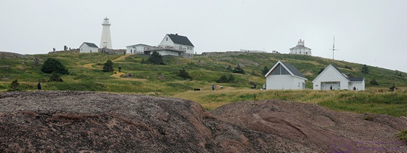
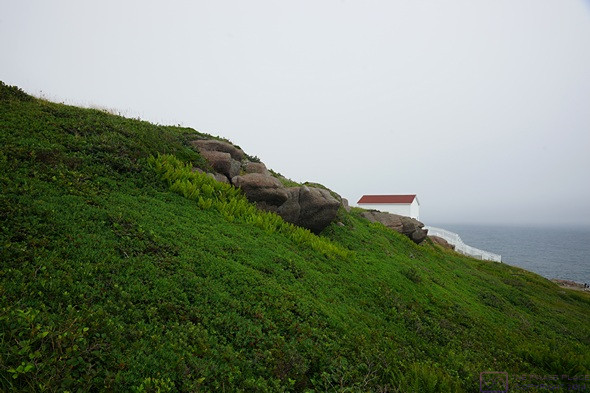
This is a view of all (most) of the buildings taken from near the parking lot.
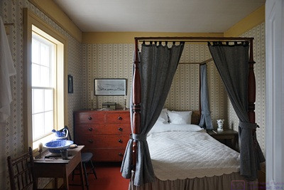
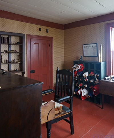
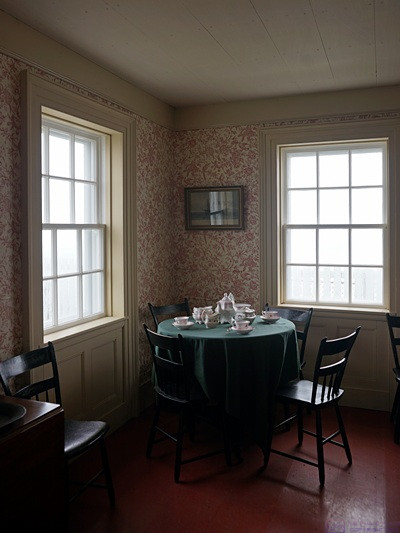
When we arrived at the Site, the parking lot was not full, but there were already a lot of vehicles. As with Signal Hill NHS yesterday, it was nice to see lots of visitors at this site on a cool, overcast, Thursday. The site is quite large, so we were rarely in close proximity to other visitors. Like every other Parks Canada site we have visited, it was well conceived and maintained. Our annual Discovery Family Pass got us in for free, of course, including our “ticket” to tour the historic 1836 lighthouse. But that is the subject of the 2nd of these three posts.
Most of this post is photos (17) with captions. There is some additional text at the end.
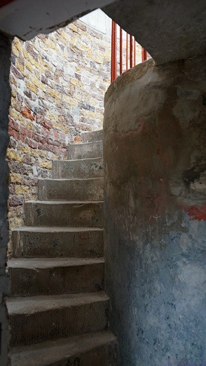
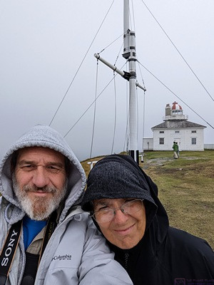
Starting at the Information Center at the end of the parking lot, Linda showed them the photo on her phone of our Discovery Pass we got our “ticket” to tour the Historic 1836 Lighthouse. We then headed up these stairs to the current Lighthouse. There was also an art gallery run by the Canadian Coast Guard Alumni Association and a building that looked like it was a café, but was closed for renovations. The site is not level, and we did a fair amount of walking today.
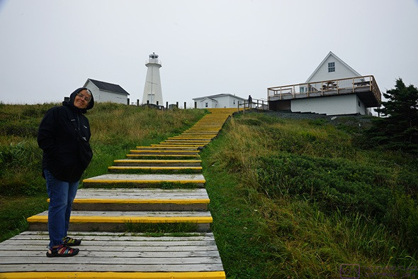
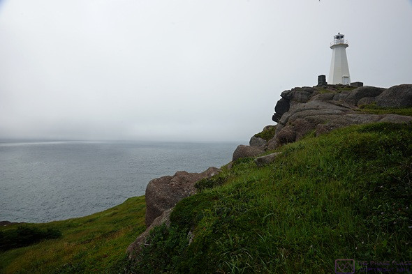
Another view of the modern lighthouse, art gallery, and café buildings as seen from higher up the hill at the historic 1836 lighthouse.
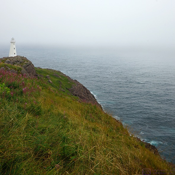
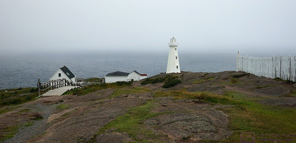
Most of the lighthouses along the eastern seaboard of Canada are not very tall. This photo shows why. Like elsewhere in Newfoundland, we found this to be a dramatic yet subtle landscape.

The clouds were flowing through the site from right-to-left in this photo. We were standing near the historic lighthouse, which is the high point of the site, and these clouds where just below our eye level.
We were headed towards the easternmost point and away from the modern lighthouse and looked back to see this.
Here we are moving towards the easternmost point on a trail that drops down off the higher ground and follows the shore as closely as it safely can. There were frequent warning signs cautioning visitors that the cliffs and rocks were dangerous and to stay on marked trails. The site is also covered in low vegetation that is both hardy (with respect to climate), and delicate (with respect to being stepped on).
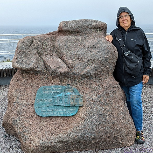
Linda standing by the “official” rock and plaque that mark the easternmost point in North America
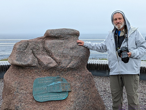
Bruce standing by the same “official” marker rock (photo by Linda).
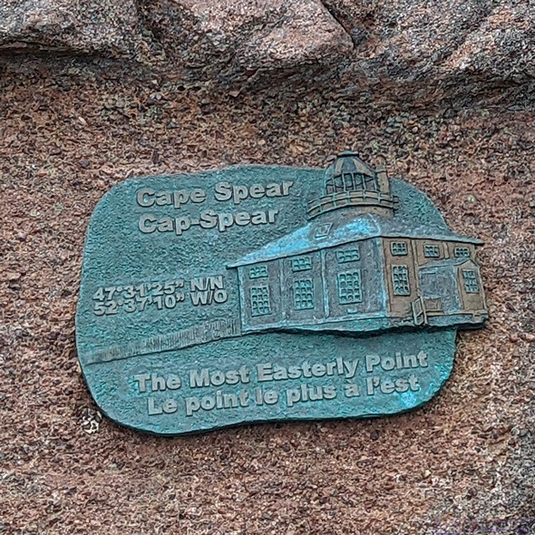
A close up of the plaque on the marker rock. It reads: 47o31’25” N and 52o 37’ 10” W. There was no additional information as to exactly what location these coordinates refer to, i.e., was this the location of the “marker” rock, or the location of the actual easternmost point. This rock is in the middle of a platform with a railing, and there is land around it in all directions, so it is clearly not, literally, the easternmost point. This latitude and longitude convert to 47.523611o LAT and –52.619444o LON in decimal degrees. This accuracy, to six decimal places, is sufficient to locate a point on the earth’s surface with a 10’ x 10’ square using the What 3 Words app on my smartphone. I intended to verify our location using the app, but I forgot.
Based on the layout of the site and the marker rock, it’s possible that the easternmost point is the rock that appears to be just off shore but possibly connected to the shore at low tide. Not that it really matters; the entire coast around Cape Spear is rugged and dangerous, and was being pounded by an ocean that wasn’t even that agitated. If the easternmost point is “out there” no one in their right mind would try to go stand there. In any event, the marker rock was close enough for us. Even if we couldn’t stand there, we know we saw it and were very close to it.
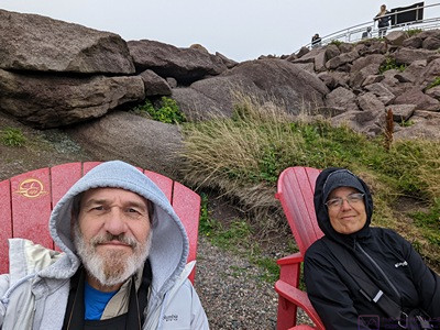
Every Parks Canada location we have visited has had at least one pair of big red chairs. Here there located in a flat area below the platform with the marker rock, easily accessed by a short trail.
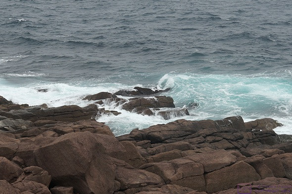
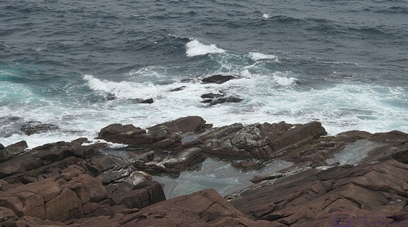
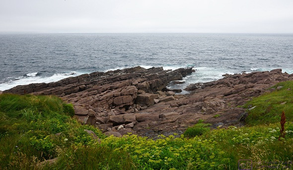
Another view of the rugged coast being pounded by the ocean.
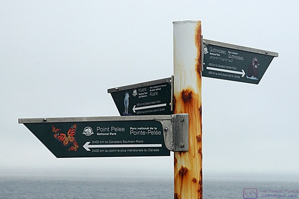
This sign post was near the marker rock. It shows the direction and distance to the other four “corners” of Canada, all of which are in National Parks managed by Parks Canada. The southernmost point in Canada is at Point Pelee, Ontario, 2,400 km from the signpost (and relatively close to our home in Michigan). From Wikipedia: “The first national park established for conservation, Point Pelee is the southernmost point of the Canadian mainland, and also includes the southernmost point overall on Middle Island.” The western most point in Canada is in Kluane National Park and Reserve, 5,500 km from the signpost. From Wikipedia: “The border between Alaska and the Yukon runs in a mostly straight line along the 141st meridian, making it difficult to pinpoint exactly one spot to be the westernmost in the country, but for one that is particularly scenic, head to Kluane National Park and Reserve.” The northernmost point (in Canada) is in Quttinirpaaq National Park, 4,000 km from the signpost. From Wikipedia: “Quttinirpaaq National Park is located on the northeastern corner of Ellesmere Island (Cape Columbia) in the Qikiqtaaluk Region of Nunavut, Canada. It is the second most northerly park on Earth after Northeast Greenland National Park. In Inuktitut, Quttinirpaaq means “top of the world”. It was established as Ellesmere Island National Park Reserve in 1988, and the name was changed to Quttinirpaaq in 1999, when Nunavut was created, and became a national park in 2000. The reserve covers 37,775 km², making it the second largest park in Canada, after Wood Buffalo National Park.” Canada is a BIG place, but Parks Canada has it covered.
Another view of the coastline around to the NNW of the site.
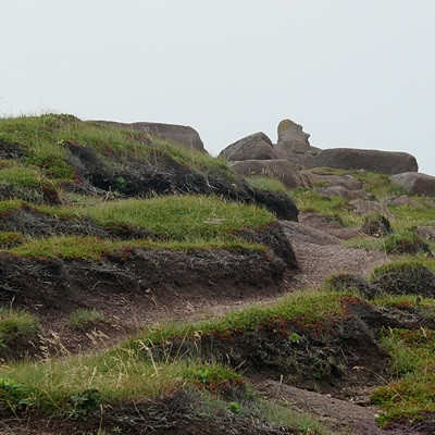
As we were headed back to the parking lot on a trail, I spotted what appeared to be Moai head, upper right corner, like the ones on Easter Island. I turned out to just be a flat rock, and only had this appearance when viewed from this angle.
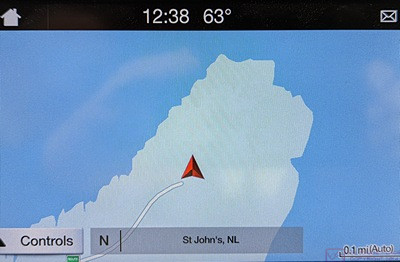
This is the navigation screen in our F-150. The red triangle is our truck in the parking lot of the Cape Spear National Historic Site.
While we were at the Cape, I got a call from Cabot Ford Lincoln. The receptionist, who had been off work the last couple of days, had just gotten the message that I had called on Tuesday and was responding to it. Even though I had already booked an appointment for Friday morning, it was nice to have my call returned.
We have had the truck for over three years now, and have not updated the navigation system in that time, so I have been trying to figure out how to update it. My Ford Pass app on my phone says I am eligible for a free map upgrade. It’s 15 GB, but doesn’t tell me how to actually do the upgrade. It turns out I have to first update the SYNC 3 feature, and then update the map, which I can apparently do by Wi-Fi or USB or have the dealer do it. I like the last option, and will ask about that when I take the truck in tomorrow morning for the oil change.
Before returning to camp, we stopped at the Sobeys supermarket on Topsail Road. That took us through a whole other part of the St. John’s area. On the way back to Pippy Park we drove through the Memorial University main campus on Prince Philip Drive, so Linda finally got to see it.
We got back to our trailer around 2:15 PM. After putting away the few perishable grocery items, we had a light lunch of cheese on crackers and split an apple and a pear. I took a lot of photos today, so I settled in to select the ones for the blog and process them. I spent most of the rest of the afternoon and evening editing photos and writing.
For dinner, Linda made a green salad (spring mix) with fresh blueberries and strawberries and a raspberry vinegarette dressing. Yum. The main course was mushroom risotto. Yum, yum. We had a Rheinhessen 2020 Classic Riesling (Qualitätswein) with the meal. Smile.
…