MONDAY 06 March – 51 miles between oceans on a ship
[ NOTE: Most of this post consists of 36 photos with captions. This is being posted more than 3 months after the fact – some of the details might be inaccurate and some of the photos might be out of sequence. ]
Going through (transiting) the Panama Canal was the main reason for going on this cruise, and the experience did not disappoint. The American Society of Civil Engineers considers it one of the seven wonders of the modern world. (We have no seen all of the wonders of the world, ancient or modern, so we will take their word for it.)
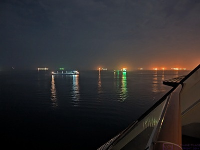
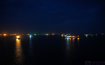
The ocean in the vicinity of Panama City and the entrance to the Panama Canal was crowded with ships waiting to make the transit. Ships can book a date/time to start the transit, but it is much more expensive than just waiting in line. Ships with non-perishable cargo and less critical delivery timelines choose to wait their turn and get the lower price. The fee for the NCL Joy to transit the Canal was approximately $750,000 USD. The pricing structure for the Canal is very complicated. (Photo by Linda)
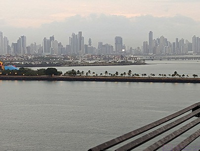
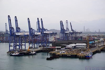
The NCL Joy left the dock at 5 AM to be in position for the 8 AM scheduled start of our transit. It was dawn by the time we were moving towards the entrance of the Canal and were opposite our starting point. Part of the Panama City skyline forms the background of this photo, taken by Linda.
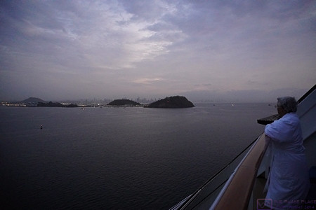
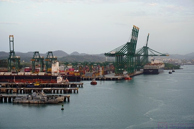
Starting into the marked channel that leads to the Panama Canal. Our ship was docked in the harbor on the other side of the small hills to starboard (right).
The Norwegian Joy left the dock in Panama City at 5 AM and we were up to see it off. We spent the entire transit in our front-facing 18th deck stateroom; usually on the balcony. We even took our meals in our room, one of the few times we took advantage of this perquisite.
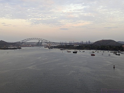
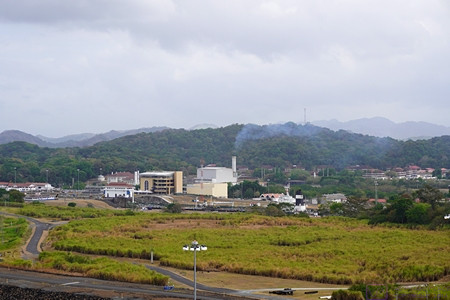
The Puente de las Americas (Bridge of the Americas) ahead. Channel markers to the left and right of the ship are visible. The hill on the right had the radio towers/antennas used to communicate with the ships using the Panama Canal.
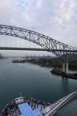
Approaching the Puente de las Americas (Bridge of the Americas). This bridge is considered the (unofficial?) southern terminus of the Panama Canal. Note the crowd of guests gathered on the foredeck of our ship. This area is normally only open to crew, whose quarters are located foreship near this level.
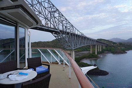
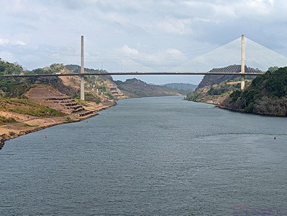
The Bridge of the Americas to port (left) of the ship just after our balcony passed under it. We are now (officially?) in the Panama Canal, but still some way from the first set of locks.
Ships transiting the Canal are queued up in the ocean and then proceed along a well-marked channel when cleared in. The Bridge of the Americas is considered the southern terminus of the Canal and the Puente Atlántico (Atlantic Bridge) at Colon is considered the northern terminus. Passing under either of these bridges is a cause for celebration on cruise ships. And so, it was for us too; we finally opened our bottle of “welcome on board” champagne and toasted the moment.
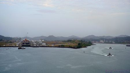
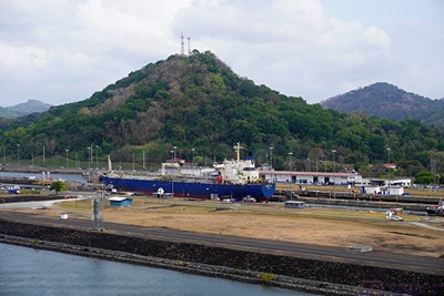
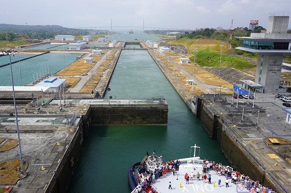
The original 2-flight Miraflores Locks are to starboard (right). The newer (2016) 3-flight Panamax class Miraflores West (Cocoli) Locks are to port (left). We used the newer locks as the NCL Joy is too large for the original ones. Both sets of locks are still referred to as the Miraflores Locks.
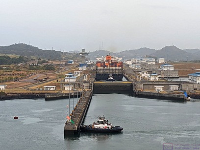
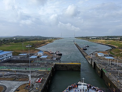
The NCL Joy lined up to enter the Miraflores West (Cocoli) Locks. The tug boat is positioned to block the Joy from going in yet, and to render maneuvering assistance if/when needed. (Photo by Linda)
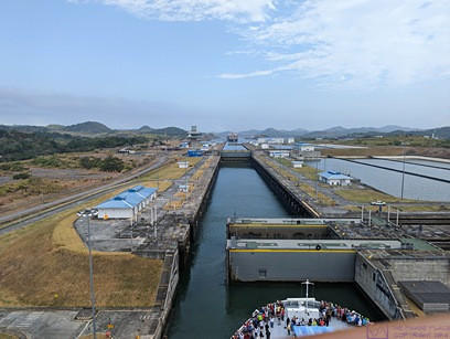
The double lock gates are sliding open so our ship can move from the first to the second/middle basin. The NCL Joy is just over 1,000 feet long; too big for the older/original locks at either end of the Canal, but much smaller than the maximum 1,400-foot length the new locks can accommodate. A third phase of lock building is in the planning stages with locks that will accommodate even bigger ships. (Photo by Linda)
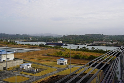
As our ship entered the Miraflores West (Cocoli) Locks, we could see other ships to starboard (right) using the original Miraflores Locks.
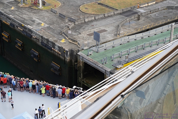
The structure center-right in the photo is the sliding lock gate that will close behind the ship once it is fully in the lock basin. The green surface on top is a road that allows Canal staff to get from one side to the other (when the gate is closed, obviously). All of the new locks use these massive sliding gates. The original locks using swinging gates.
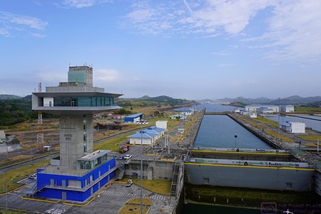
The “Cocoli control tower” for the Miraflores West Locks. We had one more basin after the one we are currently in. Each of the basins is an “elevator) that works like a bathtub. When filled with water any boat(s) in the basin are raised in elevation. When the water is drained, they are lowered. When the water level is the same on both sides of a gate, it can be opened or closed, allowing ships to enter or leave the basin.
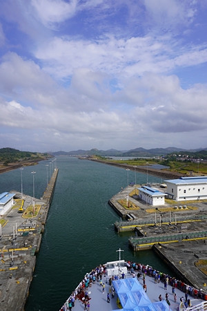
Exiting the last basin of the Miraflores West (Cocoli) Locks northbound. Miraflores Lake can be seen ahead to starboard (right). Because of the geology of this part of the Canal Zone, the original southern lock system consists of two flights in the Miraflores Locks and then a single flight in the Pedro Miguel Lock. The body of water in-between is named Lake Miraflores. The new West (Cocoli) Locks achieve the change in elevation in a 3-flight (staircase) lock system. The two channels reunite just north of the Pedro Miguel Lock.
There is a lot of information available online and in books about the Panama Canal. It’s a long, complicated story, and not a happy one in most regards. I was glad I had taken the time to read about this before being here (Panama Fever, by Matthew Parker). The engineering is amazing, and the location is beautiful, but it has a context and only became a reality at enormous cost in money, lives, and political relations with the countries of Central and South America.
Regardless of which way you go through the Canal, the trip begins and ends with locks, three at each end, with Gatun Lake in-between. The average sea level of the Pacific Ocean end of the Canal is only 20 cm higher than the average sea level on the Atlantic Ocean (Caribbean Sea) end. Because this difference is so small, the original “vision” for the Canal was a sea level transit with perhaps one lock. However, the tidal range on the Pacific Ocean end is 20 feet whereas on the Atlantic Ocean end it is 3 feet. Thus, locks were going to be needed at each end just to account for this difference. The fact that the Canal also had to cross the Continental Divide, ultimately meant that ships would have to change elevation by even more than the difference in sea levels, and the locks would have to accommodate this difference in elevation.
Gatun Lake is the largest man-made lake in the world, and was formed by damming the Rio Chagres. The Rio Chagres was a raging river that would rise 20 feet during floods. It had to be “tamed” (controlled) if the Panama Canal was ever to become a reality. There are three locks at each end to accomplish the 85 ft change in elevation from sea level to the level of Gatun Lake. New locks were built at each end, alongside the original ones, to accommodate larger ships and were opened in 2016. Just north of the southern locks (Miraflores / Lake Miraflores / Pedro Miguel are the old ones and Miraflores West (Cocoli) are the new ones. I think Lake Gatun “officially” begins at the northern end of the Miraflores Locks complex.
Heading north from the Miraflores Locks area we came to the Culebra Cut. Generally considered the most difficult part of building the Canal, it is a massively excavated passage through the Continental Divide. The Canal was taken up 85 feet and through this area as it offered the best chance of actually getting through the divide.
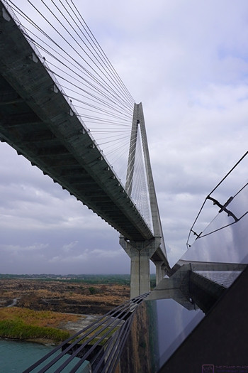
The official length of the Panama Canal is 51 miles, which doesn’t seem like much, but it took the NCL Joy about 9 hours to make the trip, including the locks at each end. As we sailed under the Atlantic Bridge we (officially) entered the Caribbean Sea (Atlantic Ocean) and continued on to our next port, sailing all night to get there by sunrise.
Following are the bulk of the photos from the transit:
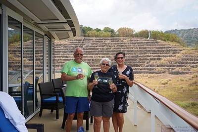
Paul, Linda, and Nancy with champagne glasses ready to toast our passage through the Culebra Cut. (Linda is holding my glass while I take this photo.) The “cut” was dug through the Continental Divide, and was the most difficult part of the Canal to create.
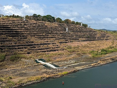
The sides of the “cut” are terraced to prevent erosion, which was a huge problem during the excavation of this passage through the Continental Divide. (Photo by Linda)
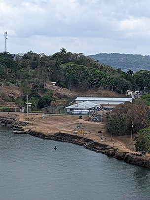
Panama is also a place with a long and troubled history. This compound to starboard (right) is where Manuel Noriega was held before being extradited to the USA for trial. (Photo by Linda)
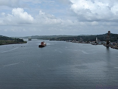
At this point, we are through the Culebra Cut and passing the town of Gatun on the right. This town within the Canal Zone is the base of operations for much of the Canal maintenance. Note the massive barge crane at the center-right edge of the photo. This crane, named Titan (nicknamed Herman the German), is able to lift the older swinging lock gates for repair and maintenance. A part of the history of the construction and operation of that Canal, Titan was built by Nazi for servicing U-Boats (submarines) during WW II. At maximum height, the top of the boom is 374 feet above the water. Like everything else connected with the Canal, it is massive. (Photo by Linda)
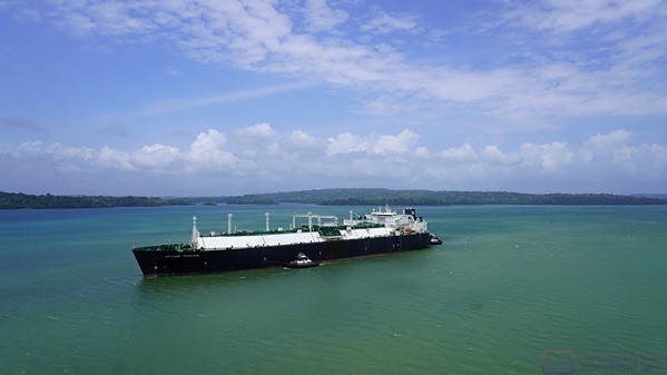
We are passing a southbound cargo ship (tanker?) on Lake Gatun. (Passing was always portside-to-portside.) Most of the Panama Canal consists of Lake Gatun. The lake was formed by a dam on the Rio Chagres near the northern end, and is still the largest man-made lake in the world.
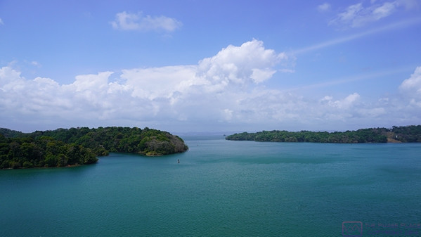
Another view of Lake Gatun. Channel markers are visible to port (left). It was a generally lovely day for the transit with a mix of blue skies and clouds. It was warm, but not uncomfortable on the deck (which always had a breeze from the movement of the ship) and we could go back into the stateroom if/when needed.
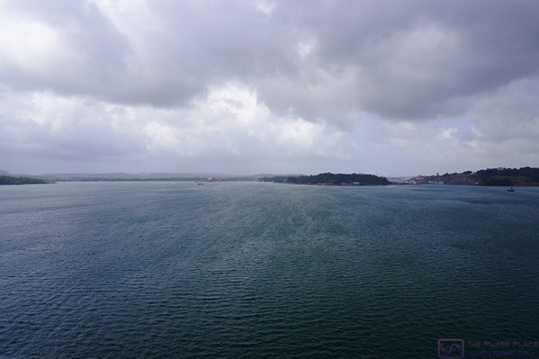
The clouds have filled in somewhat as we approach the northern end of the Canal and the end of the transit.
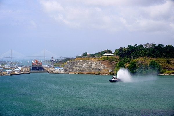
Approaching the new (2016 Panamax class) Gatun East Locks at the northern end of the Panama Canal. The cargo ship that entered the Canal ahead of us this morning is in the locks. The original Gatun Locks are off to the port (left) side out of the frame.
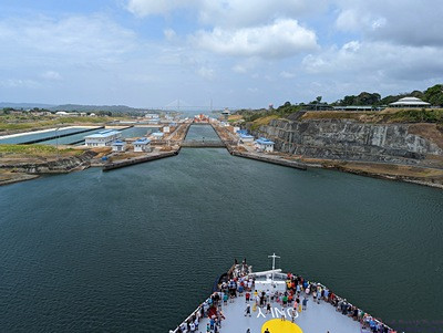
A small crowd of guests remains at the bow platform of the NCL Joy as we approached the Gatun East Locks and prepared to be lowered down to the level of the Caribbean Sea (Atlantic Ocean). (Photo by Linda)
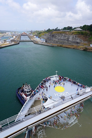
We are now close enough to the Gatun East Locks that a tug boat has taken up position on the port side of the bow to help guide the NCL Joy into the first basin. (In a Q&A with the Captain of the NCL Joy, he was quite blunt about not needing the assistance of tug boats when maneuvering the Joy at docks, or elsewhere, and found their presence more bothersome than helpful. I think he felt the same way about harbor pilots.)
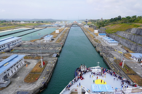
As we entered the first basin of the Gatun East Locks, the ponds used as part of the system for emptying and filling the lock basins were visible on the port (left) side of the ship. These ponds conserve some of the massive amount of water needed to operate the locks, where all of the water to fill the locks flows by gravity.
The water level in the first (Lake Gatun) basin has been lowered and the water lever in the second basin raised so that both basins are at the same water level, allowing the sliding gate to be opened so the NCL Joy can move to the second basin.
As the last lock gate opens, the NCL Joy has finally completed its journey from the Pacific Ocean, up and over (through) the continental divide, and back down to the Caribbean Sea (Atlantic Ocean). It was quite a trip and we certainly had “the best seats in the house.” (Photo by Linda)
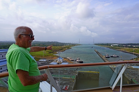
As the NCL Joy exits the last basin at the current level of the Caribbean Sea, Paul points out the Puente Atlántico (Atlantic Bridge) and the Caribbean Sea beyond.
It was around 5 PM local time as we passed under the Atlantic Bridge, marking our transit time at 9 hours. From here, the ship headed north (N) and then northeast (NE) for a short way before turning East East North (EEN) on a fairly direct course for Cartagena, Columbia where we were scheduled to enter the harbor around sunrise.
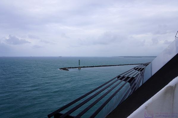
As we pass through the breakwater that protects the harbor at Canal terminus at Colon, Panama we sailed into the Caribbean Sea and points east.
…
