NOTE: This is a long post which includes nine (9) photo(s) with caption(s). Photos by me (Bruce) taken with a Google Pixel 6 Pro.
THURSDAY 16 – FRIDAY 31 May 2024 — The 2nd Half of May
In addition to normal household and property chores, the second half of May saw more garage cleaning, barn/workshop organizing, and property maintaining. It also saw a significant medical event (good), anniversaries, social time with neighbors, and an uptick in Boondockers Welcome (BdW) guests. Highlights for various days follow:
Thursday 16 …
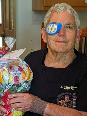
Linda sporting her eye guard on her right eye to protect it while it heals following cataract surgery. The guard frame is flexible rubber and is taped onto her face. The central shield is a harder plastic and is perforated, allowing for air to get to the eye and for some limited vision. She was immediately able to see with that eye. She’s holding an Edible Arrangements fruit bouquet sent by Nancy and Paul.
Linda had her first of two cataract surgeries today with Dr. Verkade at the Kellogg Eye Center (KEC) within the UofM Health (UofMH) Brighton Center for Specialty Care (BCSC). First up was her right eye. She has long been near-sighted in this eye and far-sighted in her left eye, so her brain is used to this difference. In consultation with Dr. V, they agreed that she would get a near-vision replacement lens. It took several hours between admission and discharge, but only about 10 – 15 minutes of that time was the actual surgery. Other than some initial time in the waiting room, the rest of the time was taken up by pre-op and post-op procedures and personnel.
The facilities and staff at BCSC-KEI were first-rate, and the entire experience was calm and relatively stress-free. Dr. V used eye drops rather than injections to do the final preparation for surgery. Linda reported no pain at any time, and only minor discomfort during the procedure. She had a perforated eye guard, but reported already being to see. She was advised to “take it easy” for a week, but her only specific restrictions for the next seven (7) days were: 1) Not bending over, and 2) not lifting anything heavier than a gallon of water (~8.6 lbs.). Both of those things can increase pressure in the eyes, which the doctor did not want. She was also told of symptoms that would prompt a phone call to the clinic. She had to keep the eye guard in place until her follow-up visit tomorrow, and wear it at night for the next week. Obviously, she did not engage in any property maintenance for a while. Her final follow-up visit would be approximately 30 days from today, after which she would have the same surgical procedure on her other/left (far-sighted) eye.
Friday 17 …
Linda had a (9:15 AM) follow-up visit with her ophthalmologist, Dr. V. at the KEI in the UofMH-BCSC. Her eye was healing well and her vision tested well-enough for her to be able to read without glasses. Needless to say, she was excited by this. While the main reason for the surgery was clearer vision, Linda also hoped that it would result in better vision to the extent that she would not have to wear glasses, something that has been a part of her daily life since she was 7 years old. Late in the afternoon Boondockers Welcome guest Connie G. arrived for a 4-night stay.
Saturday 18 …
Our daughter (Meghan) and her husband (Chris) celebrated their 11th wedding anniversary (2013). Both of our children (now in their 40’s) made good life-partner matches which is a source of comfort and joy to us.
Sunday 19 and Monday 20 …
Nothing of note, apparently.
Tuesday 21 …
Today was a double-header: Linda had brunch mid-morning with Diane and we had dinner with Kate at 6 PM. We always dine with Kate in the Ypsilanti / Ann Arbor area. Sometimes we meet her at the venue, but it’s become our standard practice to pick her up and return her home. Her partner, Brian, sometimes joins us, but not this time.
Wednesday 22 …
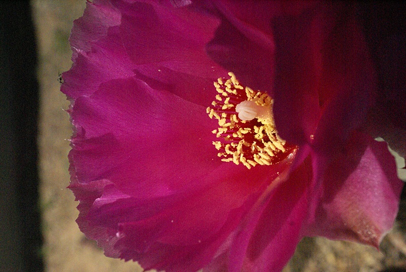
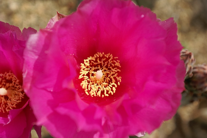
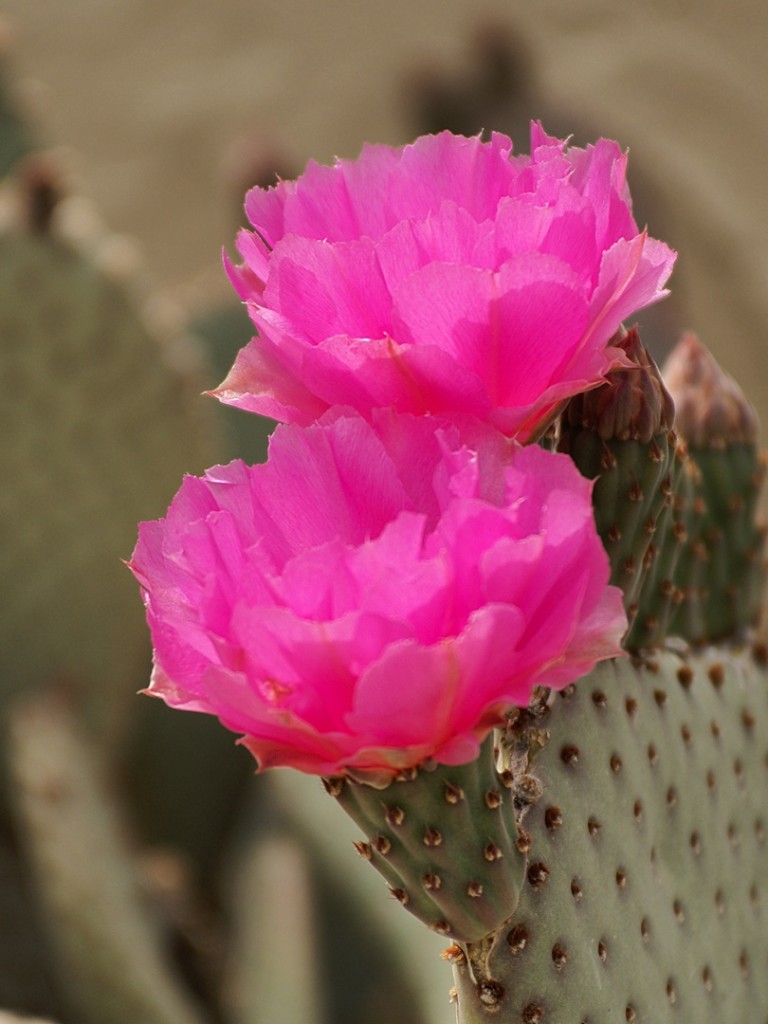
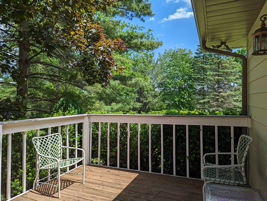
Today was another property maintenance day for me. Here are five (5) photos highlighting the work.

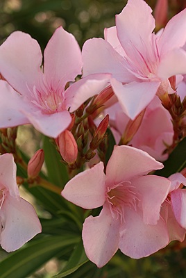
I just like this photo of our pink (&white) rhododendrons, framed buy nice conical evergreen tree and a stand of tall grass at the SW corner of the garage. The grass is blocking a view of our Kohler whole-house generator, and the rhododendrons conceal the exterior compressor/condenser unit for the air-conditioning portion of our library HVAC system.
I have cut our honeysuckle bush, on the right in front of the window by the chimney, down to a reasonable size. It was over six (6) feet tall and almost as wide, and completely blocked our view from this window, which is in our living room.
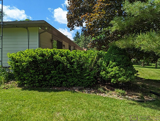
The evergreen bushes at the east end of our main deck on the rear of the house eventually grow up above the cap-rail and block our view in the direction. Every few years I cut them back down to the level of the cap-rail, and this was one of those years. I also got in behind them and cut them back away from the deck railing, and removed the lowest branches to open up the space below them and make it easy in the future to clean out the bed and the area under the deck.
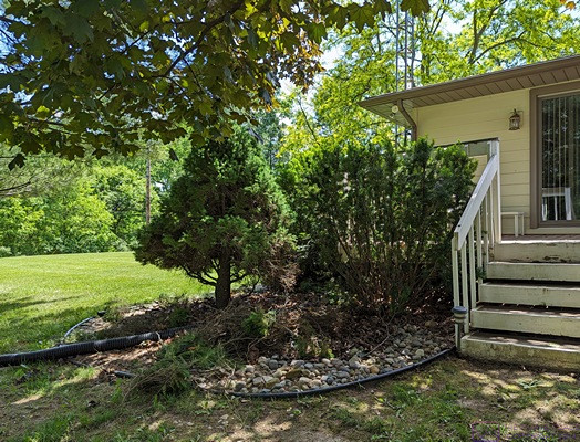
Another view of the evergreens around the east end of our main house deck. Also visible is a 4” corrugated drain line. Not visible is the 10-foot section of 1-1/4” plastic pipe the I attached to the discharge pipe for our sump pump and then slid the corrugated drain line over the end far enough to stay put during a discharge cycle. For most of the time we have lived in this house, the sump pump discharge has flowed through a 4” corrugated drain line underground down into the valley and along the (valley floor all the way to the march. This worked well for many years, but more recently we developed numerous puddles along the valley floor that never dried up, even after a period of no rain. (The gutters on the house also flow through underground drain lines to and along the valley floor.) It finally dawned on me that there was probably a problem with the sump drainage, and that re-routing it out into the yard, away from the valley, might result in the valley drying out. At that is exactly what happened.
The east end of our main deck, showing the evergreens trimmed down to the cap-rail height.
Thursday 23 …
Linda had her 1-week follow-up phone visit at 4 PM with Dr. V in the KEI at UofMH BCSC. Her eye continued to heal well and her brain was adjusting to the new lens.
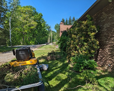
We have a variety of plants, bushes, and trees in front of the east façade of the front of the house. They were all there when we bought the house, and probably had been for quite a while. They were planted too close to the wall, and probably too close together, and had now reached a size where it was difficult to clean around their bases and impossible to get behind them. I worked my way along behind them, removing any dead branches, as well as some live ones, to create better access.
Friday 24 …
BdW guest PhotoGuy1057 arrived for a 5-night stay. He would be exhibiting/selling photographs at the juried arts fair being held at Kensington Metropark for the next few days.
Saturday 25 …
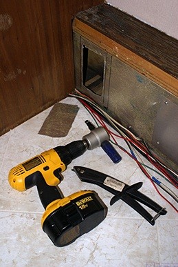
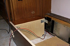
Our daughter and son-in-law recently closed on a house in a lakeside community—about half way between their current house—and ours and invited us over to see it. She found that it was already wired for a portable emergency/backup generator and wanted me to look at the setup. Here’s a photo of what is there:
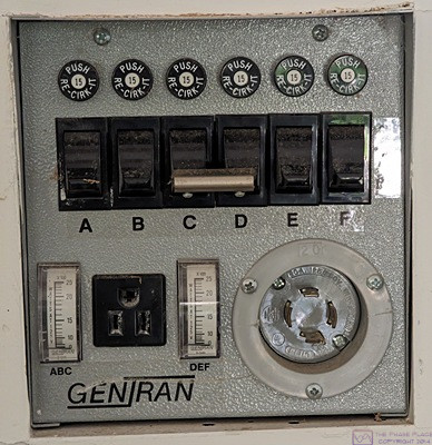
The lake house emergency/backup connection panel. I had never seen one like this. I still need to research this in more detail, but I did quickly find references to this exact GenTran manual transfer switch panel in a Google search.
The connection point for the portable generator is lower right in the photo. It is clearly a 4-pin twist-lock connector, so a 240/120 VAC single phase w/ ground setup (L1-L2-N-Gnd). As such, it can power both 120VAC loads (L1-N-G and L2-N-) and 240VAC loads (L1-L2-G). Because a 120VAC circuit requires a neutral (N) wire, it appears that each single switch also requires a neutral wire in order to return power to the generator, whereas a 240VAC load does not (but both hot wires have to routed through the GenTran box).
The labeling of the two power (Watt) meters at the lower left indicates that the three switches on the left (A, B, & C) are on one hot leg (say L1) and the three switches on the right (C, D, & E) are on the other hot leg (say L2). These six (6) switches are, in fact, individual transfer switches. With the switches in the DOWN position, as shown, incoming utility power is simply fed through the switch and back to the main panel and then on to the load. Circuit protection is provided by the circuit breaker in the main panel which feeds the power to the GenTran. With a switch in the UP position, however, the return wire to the main panel and load is connected to the portable generator. As the circuit breaker in the main panel is no longer in the circuit, a separate push-to-reset “pop-out” circuit breaker is located above each switch and takes over the circuit protection function. These circuit breakers are only active when the load is being powered by the portable generator. (Obviously, sic, the wire and circuit breaker sizes have to be appropriate for the current rating of the load.) Note also that the two middle switches (C & D) are tied together, so they are always in the same position. This means they are powering a 240VAC load, probably the well-pump. (There is a chart showing what each switch/breaker powers, but I did not photograph it.) Note that the portable generator connector is NEVER connected to the utility power coming into the main panel.
What I found fascinating about this device is that each load has to be individually switched to the generator, which also means it is possible to provide power to any one or more (or all) of them from the generator even with the house still running on utility power. Not that I think that would ever be a good idea, but the fundamental design of this box makes that possible. If it was desired to do this, at a minimum the load would have to be OFF before switching it to the generator.
Sunday 26 …
We attended the Kensington Metropark art fair today, or perhaps it was tomorrow, but I did not make a note of which day it was.
Monday 27 … Memorial Day
We did not do anything special today. It is not our family tradition to get-together on holidays such as this, or the 4th of July, or Labor Day. We do gather on Thanksgiving, Christmas and Christmas Eve, but not on New Year’s Eve, and the only “Hallmark Holidays” we celebrate are Mother’s Day and Father’s Day.
Tuesday 28 …
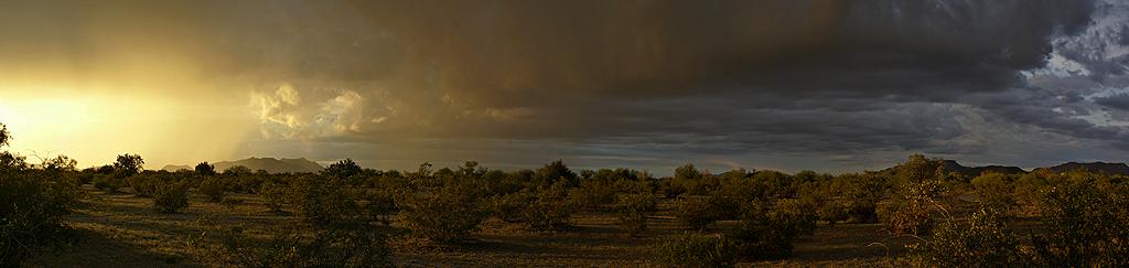
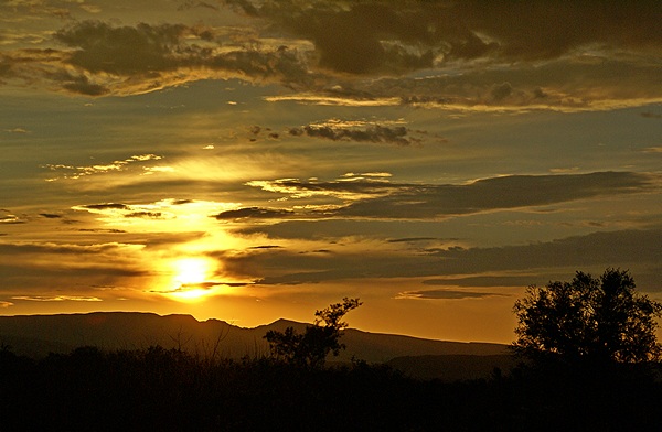
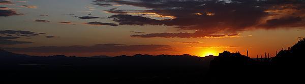
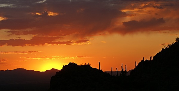
I do not have any notes about what we might have done today, but based on this photo, we apparently had some interesting weather.
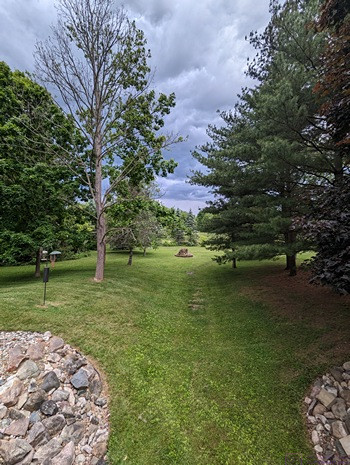
I like the clouds and the lighting in this photo of the valley in our backyard as seen from our main deck. Tuesday was also grass-mowing day, so the lawn looked it’s best.
Wednesday 29 …
Without much fanfare, we celebrated our 53rd wedding anniversary (1971) with dinner out at Ciao Amici’s in downtown Brighton. This was our first visit to this local Italian restaurant. We have generally heard good things about the place. We knew that it was not particularly vegan-friendly, but decide to go anyway. Linda selected something that was reasonably vegan-friendly, while I went a bit off-diet (vegetarian instead of vegan), but we both had meals that we rated as very good in a nice setting. We dated for four (4) years before we got married, and were acquainted for three (3) years before that. That means we have known each other for about 60 of our slightly more than 70 trips around the sun.
Thursday 30 …
Nothing of note today.
Friday 31 …
Linda met Diane at 9:30 AM for their weekly walk. Boondockers Welcome (BdW) guest Wade S. arrived around 1 PM. As always, I (Bruce) met him in the street and directed him into our guest site. Linda prepared some food items for a gathering later in the day. Just before 18:00, we walked down to Gary and Marta’s house for the get-together with our neighborhood friends (Gary & Marta, Mike & Gail, Rose & Jerry). We always enjoy the company of these people. We would welcome getting together more often but, even in retirement, we all continue to have busy lives.
…