[Photos for this post are in an image gallery at the end.]
2015/03/22 (N) A Day of Rest
After two days of bouncing around in the desert, getting in and out a truck and working hard to capture good images, we were all tired and needed/wanted an easy, relaxing day. Lou and I also wanted time to work on processing images on our computers. Being Sunday, and not being in a hurry to go anywhere, Linda made her yummy vegan blueberry pancakes for breakfast. After breakfast she walked up to the office and switched us to the weekly rate which would allow us to stay through Wednesday morning for just a few extra dollars. We then settled in to read (Linda) and work on RV club and photo tasks (me).
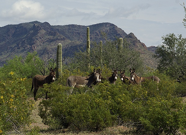
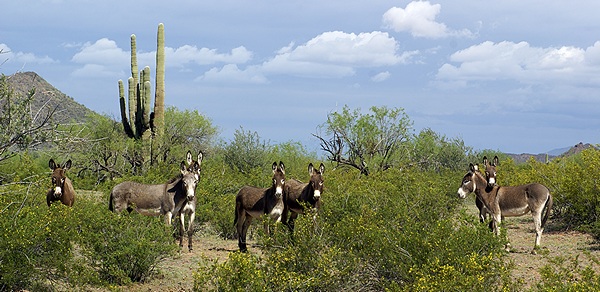
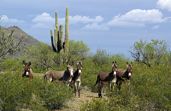
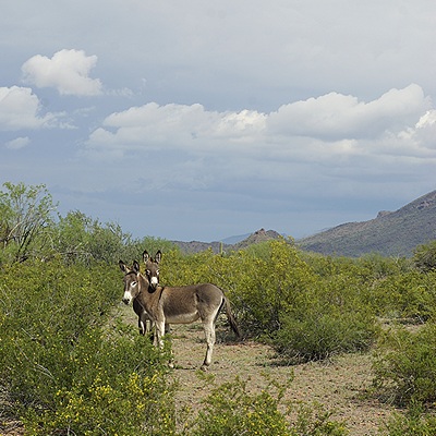
Early afternoon we cleaned out the back seat of our car and took Val with us to see the small city of Ajo and visit the mine museum there. Most businesses were closed but the museum was open and the people there were very knowledgeable. We then drove a scenic road that went west out of town and circled counterclockwise through some very interesting and rugged BLM land before ending at Darby Well Road and AZ-85. The road was good enough gravel most of the way that we were able to do it without difficulty in our front wheel drive Honda Element. The Element, however, has very good ground clearance.
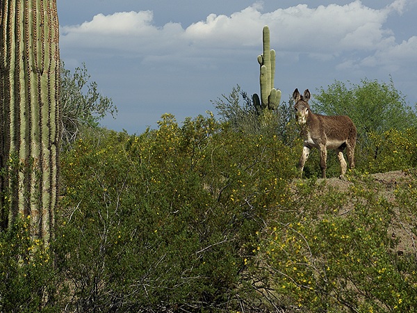
Based on our few days experience in this area I would not venture off of paved roads without a high ground clearance vehicle at minimum. A 4-wheel drive vehicle with tires that can withstand gravel/rocks and also perform well in soft, sandy soil would be preferred or necessary depending on exactly where you want to go. We have been thinking about eventually getting a Jeep Wrangler Unlimited to replace our Element but developed a serious case of Jeep Wrangler envy while we were in Quartzsite. Driving through Organ Pipe Cactus National Monument and the Florence to Kelvin Road has only served to solidify our desire to have a vehicle that is up to the challenge of being off-pavement.
As we drove the loop there were smaller two-track roads that led off through BLM land and into the Prieta Cabeza National Wildlife Refuge (PCNWR). They were not all closed but we knew from the Visitors Center that they would be before reaching the PCNWR. The PCNWR is the last place where Sonoran Pronghorn Antelope survive in the wild and their numbers are dangerously low. The breeding season is mid-March to mid-May and most of the NWR is closed during that time. Not that it is ever really open. The Visitor Center is on the north side of Ajo on AZ-85 and easily visited. The refuge, which lies to the west and south down to the Mexican Border, is the size of the state of Connecticut. It has no paved roads, a few very rough dirt roads, no human inhabitants, no services (including cell phone signals), and a climate with daily and seasonal extremes. This is why it one of the few truly wild places remaining in the lower 48 states. I would not consider traveling through the refuge without a functioning HF ham radio system; it would be the only way to call for help.
Every drive we have taken in this area starts with a large sign warning you of drug smuggling and illegal immigration activity and advising you of the risks and what to do if you encounter people in the desert. The only evidence we saw of such activity were the black plastic one gallon jugs, that are apparently the container of choice for carrying water, and the U. S. Customs & Border Patrol vehicles, agents, ATVs, and helicopters which are numerous and ever present in this area. One reason is that the main facility for the Customs & Border Patrol in this area is on AZ-86 just east of where it starts in Why and about a mile before the boundary of the Tohono O’Odham Indian reservation and Hickiwan Trails RV Park, filling station, and casino.
The helicopters seemed particularly interested in the mountains just east of our RV Park, day and night, the entire time we were there. Dave, the park manager, told us that the mountains contained many small caves that were used by “spotters” to elude detection and escape the desert climate while the washes were favored travel routes providing cover and easier travel. The helicopters would hover or travel very slowly below the ridge line, apparently checking each known cave and crevice where someone might be hiding. Dave said that on one occasion he witnessed heavily armed agents repel out of the helicopters.
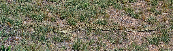
It’s a constant cat and mouse game, but it is serious business. Illegal immigrants risk their lives trying to enter the U. S. through this vast and inhospitable wilderness and some of them do not survive the journey. The drug smugglers are criminals and agents have been killed by them. The Visitor Center at OPCNM is named for one such agent who was murdered patrolling the Monument. He was in his late 20’s. And yet we felt perfectly safe the entire time we were in this area. Like rattlesnakes, cacti, and other aspects of this desert you simply have to be thoughtful about where you go and what you do and be aware of your surroundings. Vigilance is your best/only defense here.
2015/03/23 (M) Return to Ajo
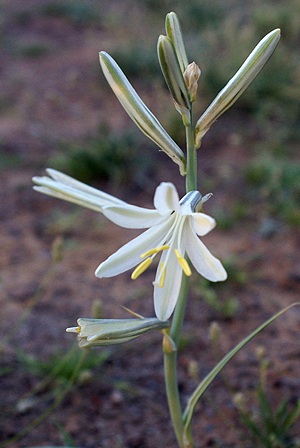
Ajo is Spanish for garlic. We found a few widely scattered Ajo Lilies blooming in the desert just south of our campground and tried photographing them on several different occasions. The Lilly is not a member of the garlic family, but got its name because the flowers have a faint smell of garlic, or so someone thought when they were named. Regardless of where the name came from they are lovely white trumpet bell shaped flowers that are 6 to 10 inches from the ground, and therein lies the photographic challenge.
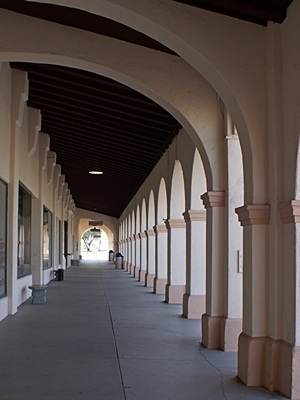
Mid-late morning all four of us headed back to Ajo. The central plaza is a three-side U-shaped arrangement of (faux?) adobe buildings that dates from 1917. The two sides of the U house a variety of stores including a cafe and coffee shop where Linda and I got some coffee. The bottom of the U is the old train depot and now houses the Ajo Chamber of Commerce. The buildings have full length covered sidewalks with arched supports. The parking is also U shaped, following the arrangement of the buildings, and the central area has grass, benches, and a bandstand. Ajo is something of an arts community and many of the store fronts were gallery spaces with local artwork for sale.
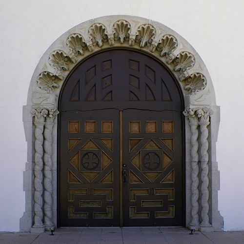
Just across the main street from the open end of the plaza were two white washed adobe churches, one Catholic and the other Federated, and beyond those the old high school that is now a conference center with 30 apartments that are rented by local artists. Kitty-corner to the left was the only restaurant in town that appeared to be open for business. Fortunately for us our friends at Technomadia had been there earlier in the season and assured their blog followers that it was an excellent little place to dine. Our waitress was charming and our food was good.
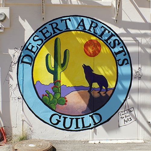
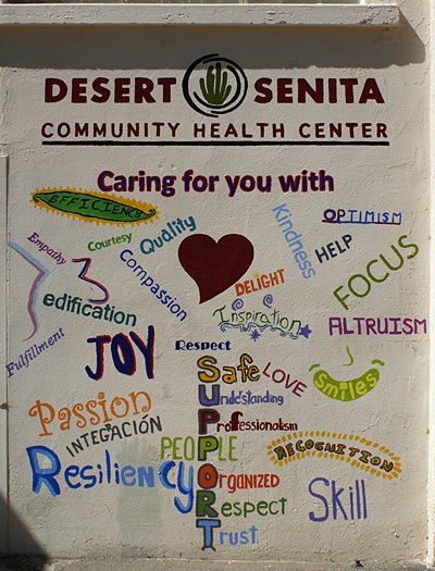
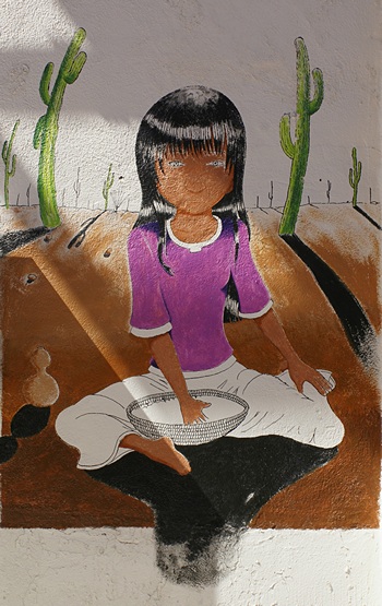
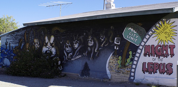
Being any artsy community there are lots of murals around town. Some of them were in an alley across the street from the restaurant so we started there. One in particular that we wanted to find was a tribute to the movie “Night of the Lepus” which was filmed in Ajo some years ago. It was a B- Sci-Fi/horror flick about mutant killer rabbits, but it is Ajo’s singular claim to movie fame, so it is remembered and celebrated. We found the mural on the north end of town.
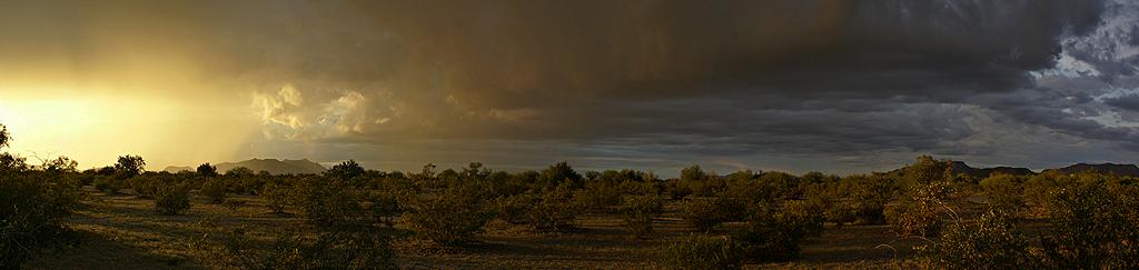
By the time we finished scouting murals and visiting the occasional shop it was 4:30 PM and we were all ready to return to camp. When we got back to our rigs we circled our chairs in the shade of Lou and Val’s 5th wheel, brought out an assortment of snacks, and enjoyed the cool early evening breeze while we talked about our visit to the area. We shot a few sunset photos and called it a day. Lou wanted to take one more stab at astro photography before we left so we checked websites and apps to determine where/when the Milky Way would be visible. The answer was low in the southeast sky from 3 to 5 AM. Given that my camera was not up to the task I decided to pass and get some rest, as we had decided we would leave late Tuesday morning and head back to Arizona City.
-

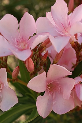
- Flowers by the Ajo Chamber of Commerce in the old train depot at the plaza.

-

- Flowers by the old train depot in Ajo, AZ.
-
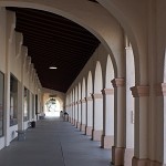
- The covered sidewalk along the southern building of the U-shaped plaza in Ajo, AZ.
-

- Another flower we spotted in Ajo, AZ.

-
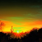
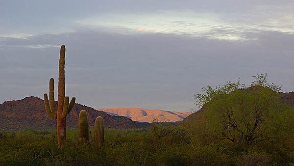
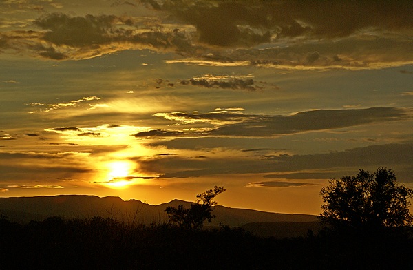
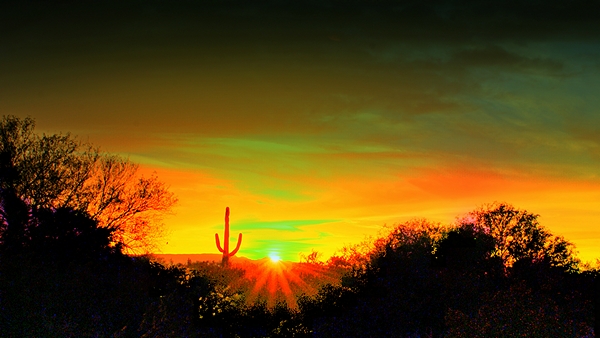
- Sunset as seen just south of the Hickiwan Trails RV Resort. This is an HDR image.
-

- One of the many murals in the alley across the street from the restaurant where we had lunch in Ajo, AZ.
-
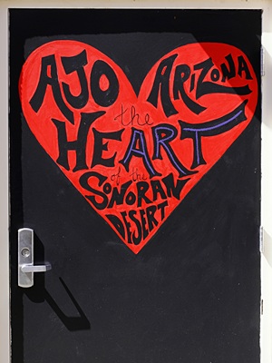
- Another mural in the alley. This one was on a door, which I liked.
-

- The use of words to create this mural intrigued me. Ako, AZ.
-

- I lie this Ajo mural and it was painted where it could be photographed nicely.
-
- I find that I am often attracted to doors as photo subjects. This one was the front entrance to the Catholic church across from the Ajo Plaza.
-
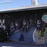
- We finally found the mural for the Sci-Fi move “Night of the Lepus on the north-facing wall of a building on AZ-85 on the north end of Ajo.
-

- This mural was also on a building on AZ-85 on the north end of Ajo, AZ. It is approximately 70 feet long.

…