Tag Archives: Hickiwan Trails RV Park

2015/03/24-25 (T-W) RVillage WHQ Redux

2015/03/24 (T) Return to Arizona City, AZ

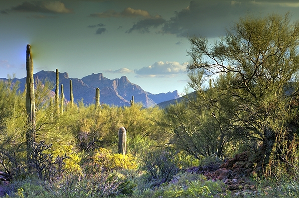
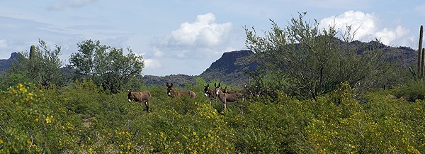
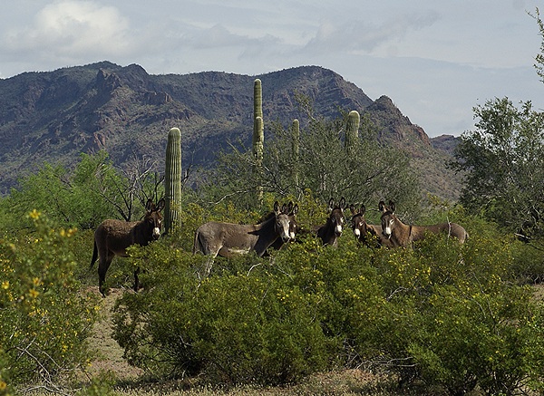
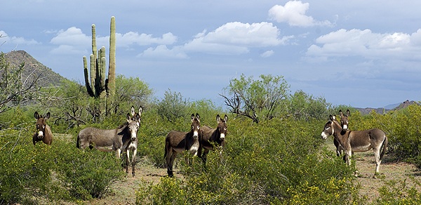
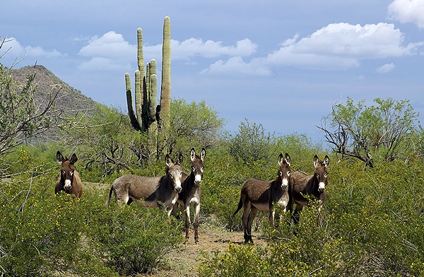
[Note:  There are no photographs for this post.]

We targeted a late morning departure from Hickiwan Trails RV Park.  The normal checkout time is 11:00 AM but that had nothing to do with our target as we were paid through Tuesday evening and the park was empty enough that the manager did not care when we left.  The timing mostly had to do with the necessity of having some agreed target time when traveling with other RVers, not wanting to feel like we had to get up at the crack of dawn and get on the road, and not wanting to drive into the morning sun but wanting arrive at our destination by mid-afternoon.  There is a lot that goes into something as simple as answering the question “what time are we going to leave?” which was preceded by answering the apparently equally simple question “what day are going to leave?”

We only had 120 miles to travel so an 11 AM departure met all of our requirements.  We pulled out of our site about 10:45 AM and hooked up our car.  I tried to adjust the driver’s side rearview mirror and could not position it where I wanted it.  The mirror had loosened and moved on the support arm and needed to be repositioned.  Lou got out his small step ladder and I found a star bit for my screwdriver.  It took a bit of back and forth but I got the mirror repositioned and tightened so that the correct view was near the center of the motorized travel that I can control from the driver’s seat.  By the time we put everything away and were ready to pull out it was 11:20 AM.  11 AM was a target, not a hard and fast requirement.

It was a warm day and Lou decided that he wanted to keep his speed at 50 MPH because he was unsure of the spare tire he had installed on their trailer on Thursday.  That is slower than optimal for our bus, especially when the speed limit is higher than that.  He suggested that we travel at whatever speed was comfortable for us and they would meet up with us sometime later at our destination.  Once we cleaned Ajo we had a good run up AZ-85 at 55 MPH.  The road is posted 65 MPH but it is a 2-lane highway with very little shoulder, so 55 felt just fine.  Once we got on I-8 headed east the speed limit was 75 MPH.  I set the cruise control at 63 MPH and let it roll.  The bus likes that speed which has the engine turning ~1,800 RPM in the top gear of the transmission.

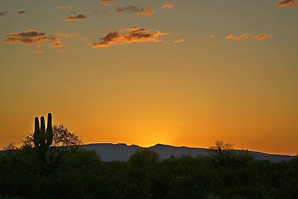
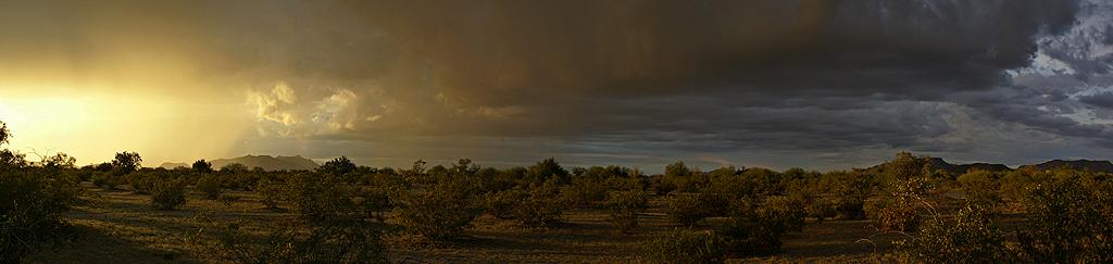
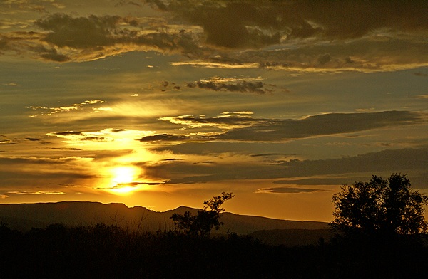
We did not need to stop for fuel or to rest so we rolled slowly through Arizona City to our destination and got ourselves parked at the RVillage headquarters.  Lou and Val stopped to eat lunch and take on fuel and finally arrived an hour or so behind us.  We circled our camp chairs, slumped into them, and said a collective “ahhhh.”  It was beautiful and peaceful here, as always, with warm sun and a cool breeze.  Linda captured a gorgeous sunset over the lake and mountains to the west on her cell phone.  It cooled off quickly after the sun set and soon enough we retreated to our rigs for the evening.

Curtis is a very gracious host and even though we are boondocking he lets us use his wireless Internet connection.  I wasted almost 4 GB of our 10 GB Verizon data plan last billing cycle trying to download a map update for our Rand McNally RVND 7710 GPS that failed after most of it had been downloaded.  The GPS is an excellent device but the download/update protocol is one of the most stupid I have ever encountered.  Why do I say that?  Read on.

Almost 1,000 files are involved in the update and even at that a few of them are gigantic.  The entire download of 4.4 GB has to succeed or everything is lost and you have to start over.  Even on a good Internet connection it takes one-to-two hours for the download so the chances of having it fail are definitely non-zero.  By 11 PM no one else was using the Internet and I was able to get everything downloaded in a little over an hour.  It took another 30 minutes to install the updates into the GPS, after which it indicated there were more updates available.  Thankfully those only took a few minutes to download and install and I managed to get to bed by 12:30 AM.

2015/03/25 (W) Chill’n at the Lake

In a switch from our normal routine Linda got up before me and made coffee while I slept in until 8 AM.  We have our customary ways of doing things, but they are not hard and fast rules.  We had toast and jam for breakfast with fresh grapefruit and coffee.  We opened up the windows and turned on the exhaust fans to keep the inside of the bus comfortable for the cats and then moved to the shaded table on the porch by the lake. I took my iPad and worked on drafts of posts for the last two weeks.

Linda made up a nice lunch platter for each of us and brought it to the table where Lou and Val eventually joined us with their mid-day meals.  Mid-afternoon Lou wanted to go find some tire stores and get prices for two new truck tires and two new trailer tires.  I was ready for a break so I went along.  That proved useful as I was able to use Google voice on my smartphone to research places and request navigation.  Linda uses this feature all the time, but I rarely do.  It’s pretty cool and I should probably use it more than I do.

Our first stop was the local SpeedCo truck tire and lube facility in Arizona City but they only sold 22″ and 24″ truck tires.  We stopped at the Love’s truck stop across the street where I found the 12 VDC cigarette lighter style plug I needed to wire up the TireTraker repeater we got from Darryl Lawrence at Escapade to try out.  We stopped at Discount Tire in Casa Grande next and that turned out to be the best quote Lou got.  We stopped at the Arizona City Post Office at 4:30 PM on our way back to camp so Lou could mail something.

The rest of the day and early evening was spent by the lake quietly using our technology.  Once the light faded and the temperature started to drop we returned to our rigs to have dinner.


2015/03/22-23 (N-M) Why Ajo

[Photos for this post are in an image gallery at the end.]

2015/03/22 (N) A Day of Rest

After two days of bouncing around in the desert, getting in and out a truck and working hard to capture good images, we were all tired and needed/wanted an easy, relaxing day.  Lou and I also wanted time to work on processing images on our computers.  Being Sunday, and not being in a hurry to go anywhere, Linda made her yummy vegan blueberry pancakes for breakfast.  After breakfast she walked up to the office and switched us to the weekly rate which would allow us to stay through Wednesday morning for just a few extra dollars.  We then settled in to read (Linda) and work on RV club and photo tasks (me).

Early afternoon we cleaned out the back seat of our car and took Val with us to see the small city of Ajo and visit the mine museum there.  Most businesses were closed but the museum was open and the people there were very knowledgeable.  We then drove a scenic road that went west out of town and circled counterclockwise through some very interesting and rugged BLM land before ending at Darby Well Road and AZ-85.  The road was good enough gravel most of the way that we were able to do it without difficulty in our front wheel drive Honda Element.  The Element, however, has very good ground clearance.

Based on our few days experience in this area I would not venture off of paved roads without a high ground clearance vehicle at minimum.  A 4-wheel drive vehicle with tires that can withstand gravel/rocks and also perform well in soft, sandy soil would be preferred or necessary depending on exactly where you want to go.  We have been thinking about eventually getting a Jeep Wrangler Unlimited to replace our Element but developed a serious case of Jeep Wrangler envy while we were in Quartzsite.  Driving through Organ Pipe Cactus National Monument and the Florence to Kelvin Road has only served to solidify our desire to have a vehicle that is up to the challenge of being off-pavement.

As we drove the loop there were smaller two-track roads that led off through BLM land and into the Prieta Cabeza National Wildlife Refuge (PCNWR).  They were not all closed but we knew from the Visitors Center that they would be before reaching the PCNWR.  The PCNWR is the last place where Sonoran Pronghorn Antelope survive in the wild and their numbers are dangerously low.  The breeding season is mid-March to mid-May and most of the NWR is closed during that time.  Not that it is ever really open.  The Visitor Center is on the north side of Ajo on AZ-85 and easily visited.  The refuge, which lies to the west and south down to the Mexican Border, is the size of the state of Connecticut.  It has no paved roads, a few very rough dirt roads, no human inhabitants, no services (including cell phone signals), and a climate with daily and seasonal extremes.  This is why it one of the few truly wild places remaining in the lower 48 states.  I would not consider traveling through the refuge without a functioning HF ham radio system; it would be the only way to call for help.

Every drive we have taken in this area starts with a large sign warning you of drug smuggling and illegal immigration activity and advising you of the risks and what to do if you encounter people in the desert.  The only evidence we saw of such activity were the black plastic one gallon jugs, that are apparently the container of choice for carrying water, and the U. S. Customs & Border Patrol vehicles, agents, ATVs, and helicopters which are numerous and ever present in this area.  One reason is that the main facility for the Customs & Border Patrol in this area is on AZ-86 just east of where it starts in Why and about a mile before the boundary of the Tohono O’Odham Indian reservation and Hickiwan Trails RV Park, filling station, and casino.

The helicopters seemed particularly interested in the mountains just east of our RV Park, day and night, the entire time we were there.  Dave, the park manager, told us that the mountains contained many small caves that were used by “spotters” to elude detection and escape the desert climate while the washes were favored travel routes providing cover and easier travel.  The helicopters would hover or travel very slowly below the ridge line, apparently checking each known cave and crevice where someone might be hiding.  Dave said that on one occasion he witnessed heavily armed agents repel out of the helicopters.

It’s a constant cat and mouse game, but it is serious business.  Illegal immigrants risk their lives trying to enter the U. S. through this vast and inhospitable wilderness and some of them do not survive the journey.  The drug smugglers are criminals and agents have been killed by them.  The Visitor Center at OPCNM is named for one such agent who was murdered patrolling the Monument.  He was in his late 20’s.  And yet we felt perfectly safe the entire time we were in this area.  Like rattlesnakes, cacti, and other aspects of this desert you simply have to be thoughtful about where you go and what you do and be aware of your surroundings.  Vigilance is your best/only defense here.

2015/03/23 (M) Return to Ajo

Ajo is Spanish for garlic.  We found a few widely scattered Ajo Lilies blooming in the desert just south of our campground and tried photographing them on several different occasions.  The Lilly is not a member of the garlic family, but got its name because the flowers have a faint smell of garlic, or so someone thought when they were named.  Regardless of where the name came from they are lovely white trumpet bell shaped flowers that are 6 to 10 inches from the ground, and therein lies the photographic challenge.

Mid-late morning all four of us headed back to Ajo.  The central plaza is a three-side U-shaped arrangement of (faux?) adobe buildings that dates from 1917.  The two sides of the U house a variety of stores including a cafe and coffee shop where Linda and I got some coffee.  The bottom of the U is the old train depot and now houses the Ajo Chamber of Commerce.  The buildings have full length covered sidewalks with arched supports.  The parking is also U shaped, following the arrangement of the buildings, and the central area has grass, benches, and a bandstand.  Ajo is something of an arts community and many of the store fronts were gallery spaces with local artwork for sale.

Just across the main street from the open end of the plaza were two white washed adobe  churches, one Catholic and the other Federated, and beyond those the old high school that is now a conference center with 30 apartments that are rented by local artists.  Kitty-corner to the left was the only restaurant in town that appeared to be open for business.  Fortunately for us our friends at Technomadia had been there earlier in the season and assured their blog followers that it was an excellent little place to dine.  Our waitress was charming and our food was good.

Being any artsy community there are lots of murals around town.  Some of them were in an alley across the street from the restaurant so we started there.  One in particular that we wanted to find was a tribute to the movie “Night of the Lepus” which was filmed in Ajo some years ago.  It was a B- Sci-Fi/horror flick about mutant killer rabbits, but it is Ajo’s singular claim to movie fame, so it is remembered and celebrated.  We found the mural on the north end of town.

By the time we finished scouting murals and visiting the occasional shop it was 4:30 PM and we were all ready to return to camp.  When we got back to our rigs we circled our chairs in the shade of Lou and Val’s 5th wheel, brought out an assortment of snacks, and enjoyed the cool early evening breeze while we talked about our visit to the area.  We shot a few sunset photos and called it a day.  Lou wanted to take one more stab at astro photography before we left so we checked websites and apps to determine where/when the Milky Way would be visible.  The answer was low in the southeast sky from 3 to 5 AM.  Given that my camera was not up to the task I decided to pass and get some rest, as we had decided we would leave late Tuesday morning and head back to Arizona City.

2015/03/20-21 (F-S) OPCNM

[Note:  Photos for this post appear at the end in an image gallery.]

Friday, March 20th, Organ Pipe Cactus National Monument (Day 1)

We finally made it to Organ Pipe Cactus National Monument (OPCNM) today.  The Sonoran Desert has a beauty all its own and the drive down was scenic.  Although OPCNM is a remote place that borders Mexico, and most of it is designated wilderness that is difficult-to-impossible to access, the volume of traffic on AZ-85 surprised us.

We have learned that anytime we are surprised by something it simply means there are aspects of a place/situation that we did not understand or anticipate in advance.  AZ-85 runs from I-10 west of Phoenix to Gila Bend, jogs to the west, and continues south through Ajo and Why and then through the center of the Monument to the border crossing at Lukeville.  Mexican Highway 2 runs along the border and is a major east-west route that is busy with truck traffic.  Puerto Penasco, on the Sea of Cortez, is only 62 miles farther south from the border.  Often referred to by “northerners” as Rocky Point Puerto Penasco is a haven for U. S. and Canadian snowbirds from the western states and provinces.  We saw at least a dozen businesses in Ajo selling Mexico Travel Insurance and billboards welcoming “Rocky Pointers” to town.  Now we know.

This was all of more than passing interest to us.  Fellow FMCA/SKP freethinkers Larry and Orene Brown will be serving as the wagonmasters for a SKP Chapter 8 (Mexico Connection) caravan of some 60 rigs to Puerto Penasco in February 2016 and we are actually considering going!  They plan to rendezvous at the OPCNM campground and then head into Mexico.  With that in the back of our minds we drove to the Visitor Center, which is much closer to the south end of the Monument than the north end, and is the access point to the campground.  We picked up a guide for the Ajo Mountains Loop Road and decided to drive that.  Linda and Val also bought general purpose field guides.

The Ajo Mountains Loop Road is a 21 mile gravel road that starts on the east side of AZ-85 across from the Visitor Center.  Most of the road is a one-way loop that does not require a 4-wheel drive vehicle but does require good ground clearance.  We were traveling in Lou and Val’s Chevy pickup truck, which is 4-wheel drive with significant ground clearance, so we did not have any trouble with the road.

The Monument Rangers and the printed guide said the road would take two hours to drive, an average of only 10 miles per hour.  There were places we could go faster than that (but why would we) but also places where we had to go much slower.  The two hour time estimate also did not account for the time needed to take photographs or go on even short hikes at some of the trailheads.  It took us 4.5 hours to drive the road but we stopped often and took a lot of photographs.  Lou continued to work with his small Sony camera and concentrate on photos of flowering plants and cacti.  I tried photographing those subjects as well, but I don’t seem to have a natural talent for taking pictures of flowers.  I did, however, get some nice landscape images, including both panoramas and HDRs.  I entered one of my HDR images in the RVillage spring photo contest, which was unusual for me as I do not enter my photos in contests as a rule.

When we got back to the Visitor Center it was still open so we did some more shopping.  Linda bought a T-shirt and some jellied (soft) Prickly Pear Cactus candy that turned out to be excellent.  The only other drive through the Monument is a 41 mile one-way loop on the west side of AZ-85.  It was too late in the day to start that drive and we had been bounced around enough for one day anyway.

We drove down to Lukeville to check it out.  We were told there was a restaurant there where we might want to eat dinner, but changed our minds after getting there.  Lukeville is a Port of Entry with a filling station, a restaurant behind it, and an RV park (of sorts) across the street.  We drove back to Hickiwan Trails RV Park, stopping along the way to take more photos in the warm early evening sunlight.

Long after dinner I tried taking some night sky photos but may Sony alpha-100, which is 8 years old, was not up to the task.  Lou, however, went out around 3 AM and got some excellent photos of the Milky Way in the southeast sky.

Saturday, March 21st, Organ Pipe Cactus National Monument (Day 2)

We had originally planned to only stay at Hickiwan Trails RV Park for Wednesday and Thursday nights.  With tire repair taking up Thursday we extended our stay by one night on Friday morning.  We were not able to see as much of Organ Pipe Cactus National Monument (OPCNM) yesterday as we wanted, so we extended our stay at the RV Park for another night.  The lady in the office said she would retroactively switch us from the $19 daily rate to the $85 weekly rate if we decided to stay longer.  The longer we have been at Hickiwan the more we like it.

Linda and Val packed picnic lunches, we loaded up the truck, and headed back to OPCNM.  We stopped at the Visitor Center again to get information about the 41 mile west loop road.  This road is more isolated and less traveled than the Ajo Mountains Loop Road we drove yesterday and a 4-wheel drive, high ground clearance vehicle is required.  The Ranger indicated on the map an area where we would probably find wild poppies in bloom and we knew there was a picnic area with a modern pit toilet about half way through the drive.

The ranger told us to allow at least four hours for this drive.  There were fewer places/reasons to stop but it still took us almost seven hours to get back to the Visitor Center.  And yes, we found and photographed the poppies.  As we were driving along the border with Mexico near the end of the loop we were looking for Senita cacti.  The Senita cactus is similar to the Organ Pipe cactus, but is a different plant.  We saw some at the Sonoran Desert Museum west of Tucson, but the southern part of OPCNM is the only place in the U. S. where they occur naturally.

OPCNM is a biosphere preserve and has a sister preserve on the Mexican side of the border.  The Senita Cactus is indigenous to the Mexican Sonoran Desert but a few plants are found just north of the border.  We had not seen one all day when we noted a spur road on the map that ran up to the Senita Basin.  Surely that must be where they are growing.  We still had plenty of daylight so we headed up.  We had gone about a mile when Val spotted one so we stopped to examine it and take pictures.  Having accomplished our objective, and having grown a bit weary of the long, bouncy ride, we returned to the main road and completed the loop, taking AZ-85 back to the Visitor Center.

As long as we were at the Visitor Center we took the opportunity to drive through the campground and check it out.  The campground is beautifully designed and landscaped.  They claim to have sites for RVs up to 40 feet in length but our assessment was that they had maybe two or three sites that we might be able to get in and out of without scratching our paint or damaging some aspect of the campground.  Unless/until we outfit our rig with a serious solar system we will not be staying here anyway because of the restricted generator hours.

We made the drive back to Hickiwan, passing through the northbound Border Patrol checkpoint at the northern boundary of the Monument.  After dinner I transferred my photos to my computer and started processing them.  Between yesterday’s visit and today’s visit I took a LOT of photographs so I had quite a bit of work in front of me.

.

2015/03/18-19 (W-R) Why, AZ

2015/03/18 (W) Hickiwan Trails

Why, indeed?  Or perhaps Why Not.  You can go there too.

Looking east from Hickiwan Trails RV Park at sunset.

Looking east from Hickiwan Trails RV Park at sunset.

Bonnie left yesterday headed for New York (eventually) and Curtis was planning to leave today for next week’s FMCA national rally in Pomona, California.  We were invited to remain at RVillage WHQ while Curtis was away, but we had our sights set on Organ Pipe Cactus National Monument (OPCNM).

An Ajo Lilly at Hickiwan Trails RV Park.

An Ajo Lilly at Hickiwan Trails RV Park.

Our original plan was to stay in the ‘modern’ campground at the Monument.  It is strictly boondocking (no hookups) which would have been fine except that the section where generators are allowed is limited to only four hours a day with two windows from 8-10 AM and 4-6 PM.  We could have managed on the four hour limitation for a few days, but the unequal spacing of the two windows would have drawn our batteries down more than we wanted during the 14 hours from 6 PM to 8 AM.

Linda searched for websites and found Hickiwan Trails RV Park in Why, Arizona.  It was 10 miles south of Ajo, the nearest/only town of any size, and would locate us about 20 miles north of the north entrance to OPCNM.  Linda called to make reservations, which were not necessary as it was past prime season and the park was mostly empty, and confirmed the availability of full hookups and 50 Amp power.  The price was $19/day or $85/week with bathrooms/showers and a laundry.  It was located just inside the Tohono O’Odham Indian Reservation behind their combination casino, filling station, and convenience store.

Wild burros on the trail leading east out of Hickiwan Trails RV Park.

Wild burros on the trail leading east out of Hickiwan Trails RV Park.

We left Arizona City around 1 PM and traveled back west on I-8 to Gila Bend where we headed south on AZ-85 through the Barry M. Goldwater Air Force Range, a beautiful drive through yet another part of the Sonoran Desert.  We wound our way slowly through Ajo (25 MPH speed limit) past an enormous open pit copper mine (shut down) and continued on to Why, AZ where we took AZ-86 (the left branch of the “Y”) for two miles.  We pulled in to the RV Park around 3:30 PM after missing the (poorly marked) entrance, finding a turn-around spot, and unhooking the car so we could turn around.  Linda got us registered while I parked the bus.  We drove through the campground and selected a 50 Amp back-in site facing east.  Lou and Val took the site just south of us.

A group of wild burros watching us watching them.

A group of wild burros watching us watching them.

Hickiwan Trails turned out to be a hidden gem.  The park was clean, the roads and sites generous in their size, the bathhouse and laundry clean and fully functional, and the view in all directions amazing.  We had barely finished making camp when we heard the braying of burros.  The park manager, Dave, and several of the campers confirmed that there were wild burros in the area east of the campground and all we had to do to see them was hike out a wide, clear trail about 3/4 mile to the wash where they like to hang out.  Or wait for them to come through the campground at night.  Linda hiked out and found them and took a few photos with her cell phone.

The wild burros were obviously used to the presence of people.

The wild burros were obviously used to the presence of people.

Somewhere before pulling into the RV Park the driver side rear tire on Lou and Val’s 5th wheel trailer went flat.  We got out our Dewalt air compressor and aired it up and the leak was immediately obvious, a 1/2 inch gash at the edge of the tread.  It was likely not repairable but the condition of the tire tread, which was badly worn in one spot, ruled that out anyway.  They had a spare that had never been used but was 10 years old.  Not ideal, but it’s what they had.  We discussed several options and Lou decided to sleep on it.

A nice family grouping of wild burros.

A nice family grouping of wild burros.

We took some sunset photos and let ourselves be awed by the dark night sky and plethora of stars before turning in for the night and using the park Wi-Fi which had initially been a bit fussy and not very fast.  I discovered, however, that the connection stability and performance increased the later it got.  By midnight I may have been the only user and was seeing a rock solid connection and almost 12 Mbps, which is outstanding for RV Park Wi-Fi.

It was a real treat to get such a good look at this wild animals.

It was a real treat to get such a good look at this wild animals.

2015/03/19 (R) First Things First

We came to this place to see and photograph nature; western landscapes, flora, fauna, and night skies.  But our homes on wheels always take precedence over everything else except our personal health.  Until the flat tire on Lou and Val’s 5th wheel trailer was fixed we were not going to be doing anything else.  After thinking about it overnight, Lou decided to call Coach-Net.  Yes, they could send someone out to take care of it.  The guy arrived an hour or so later and in less than an hour had the bad tire/wheel off and the spare tire/wheel on and inflated.

I know they are wild animals, but this is just too cute.

I know they are wild animals, but this is just too cute.

You just can not have too many pictures of wild burros.

You just can not have too many pictures of wild burros.

While the tire was being taken care of Linda and I hiked out the trail in search of the wild burros.  We found them about a mile out, a group of 12 and another group of 5.  As best we could count we saw and photographed between 17 and 20 wild burros in a beautiful, natural setting.  On the way back we left the trail as we neared the edge of the campground and headed through a sparsely vegetated area, watching the ground carefully for snakes.  We were strolling along when I heard a rattle and looked to my right to see a rather large snake coiled up and staring at me.  It was only about 7 feet away and Linda had passed by it on the other side by about the same distance.  It decided I was not a threat, uncoiled and slithered off under a large, nearby bush.  That was when I could positively identify it was a Western Diamondback Rattlesnake that I judged to be at least five feet long, which is close to the maximum size they attain.  It was so well camouflaged when coiled up that either of us could have easily stepped on it even though we were looking carefully where we were going.

They never took their eyes off of us.

They never took their eyes off of us.

Look carefully.  That is, indeed, a very large Western Diamondback Rattlesnake.

Look carefully. That is, indeed, a very large Western Diamondback Rattlesnake.

By the time the tire issue was resolved it was too late to head down to OPCNM so we decided to scout out a good place to photograph the sunset.  It turned out that there was a BLM 14-day STVA just south of Why on the west side of AZ-85.  It was a maze of makeshift dirt roads and washes but we kept working our way west trying to get beyond where most of the campers were located.  We were surprised at how far back some of them had gone and the size/type of rigs they had brought back there, including large tag axle motorhomes and a full-size tractor towing a huge 5th wheel trailer.  We could not have gotten our bus in here without scratching the paint and risking getting stuck.

Panorama of a desert thunderstorm at sunset near Why, AZ.

Panorama of a desert thunderstorm at sunset near Why, AZ.

We finally found a suitable spot and set up our cameras on tripods.  Rain had passed through the area and there was a thunderstorm in progress over the mountains to the northwest.  Lou concentrated on shooting HDR images with his small Sony camera which has excellent low light sensitivity and records colors very nicely.  I concentrated on shooting panoramas and got several nice ones with rain falling from the storm clouds.  We hung in as long as the color was good and then packed up our gear and found our way out while there was still just enough light to see.

Sunset as viewed from the BLM STVA just south of Why, AZ.

Sunset as viewed from the BLM STVA just south of Why, AZ.

.