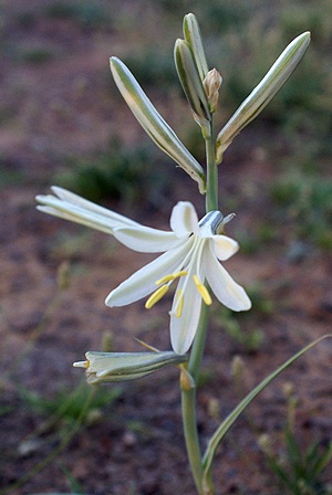
2014/12/09 (T) Elvis Is Not Dead
No, indeed, Elvis is alive and well and living in Alvarado, Texas with his owner, Donn and fellow dog Lucy. Sweet animals both, we enjoyed their presence while visiting with Donn.
We heard Donn pull out a few minutes before 5 AM, in an attempt to beat the worst of the morning rush hour traffic headed into Dallas, but we were not ready to get up. I think we finally piled out of bed around 7:30 AM to find that the fog was so thick we could not see the road at the end of Donn’s driveway. We had targeted 9 AM as a departure time that would have us miss most of the morning traffic, and actually pulled out of our parking spot at 9:11 AM. The fog was still thick but it was bright enough that we could usually see at least a quarter of a mile in our direction of travel.
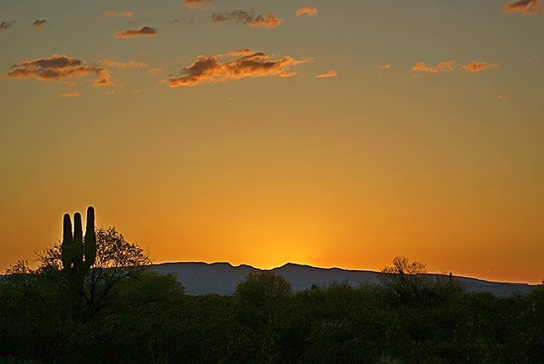
We worked our way back onto northbound I-35W towards Fort Worth and kept to the right in spite of entering traffic. We chose not to stop at the QT (Quick Trip) even though Diesel fuel was $3.08 per gallon, the least expensive we have seen in years. The transition to I-20 westbound was via one of the very high ramps that are used to connect intersecting freeways around the Dallas / Fort Worth metropolis, but it was not a problem. We continued to drive through fog for at least 90 minutes, so we could not tell you what Texas west of Fort Worth looks like if had to. We stayed on I-20 all the way to Midland, Texas only stopping to fuel up at the Flying J Truck Stop on the far side of Abilene, Texas by which point the fog had lifted and it was partly sunny with temperatures in the upper 60s. Eventually, however, the clouds closed back in, which made the last 90 minutes of the drive a bit less bright and easier on the eyes.
The bus ran well all day and I did better at getting on the accelerator in advance of climbing grades, spinning up the turbocharger and keeping the engine RPMs in the 1900-2000 range. The bus took 98.135 gallons of fuel at the truck stop and we had traveled 553.8 miles since the last fill-up for an average of 5.64 MPG. That included running our generator at the Wal-Mart in Texarkana, Texas on Friday. Our previous fill-up computed out at 5.45 MPG. In our previous use of the coach I figured we were getting 6.0 MPG, but we had not done as much dry-camping as we did on this trip. We have used the generator and the Aqua-Hot on this trip, both of which draw fuel from the main tank.
The only issue I had today was with the dual pyrometers, specifically the right one. Historically the right pyro has read 50 – 100 degrees F higher than the left one, which would often stick on “0” and then swing up if I tapped on the gauge. Both gauges have been tracking within 50 degrees since I rechecked the DDEC II connectors, but today the right gauge started lagging behind the left one, sometimes by a couple of hundred degrees. If that difference was real it would be a real problem, but everything else looked, felt, and sounded OK, so I think this is a continuing problem with the instrument, and/or sensors, and/or wiring and connectors, but I will have to keep an eye on it.
A half hour before the GPS said we would arrive Linda tried calling the Wal-Mart in Midland several times but never got an answer. We exited at Midland just before 3 PM and did not have any problem getting into the Wal-Mart parking lot which was very convenient to the freeway but relatively busy for that time of day on a Tuesday. Not surprising, though, as Midland is the epicenter of the current oil and wind boom in west Texas. The stretch of I-20 from Fort Worth to Midland is not desolate. Sweetwater is the wind power capital of the USA, and all along I-20 there are “RV Parks” on both sides of the freeway. Some of them were genuine, nice looking, RV Parks but most were makeshift looking places that appeared to have been created quickly to service (take advantage of?) a sudden need for places to park almost anything that might serve as shelter for energy workers.
As always, we checked with Customer Service to make sure it was OK to stay overnight. They said it was but twice told us to “be careful.” The warning had to do with leaving our vehicle for an extended period of time and risk having it towed. Apparently “extended” meant weeks, not hours, and I assured them we would be gone first thing in the morning. While we were in the store we picked up several bottles of PineSol and a couple of boxes of Calgon bath beads. We prefer the larger, cylindrical plastic containers of Calgon but rarely find them in retail stores and pharmacies. After we carried everything back to the coach I went for a walk to confirm our exit options for tomorrow morning. We looked at satellite images on Google Maps last night so I had a good understanding of the parking lot and access roads, but I wanted to verify that information while it was still daylight.
For dinner we had a nice salad, a fresh apple, and Tofurkey brand turkey and vegan cheese sandwiches. We were going to have the leftover chili from last night’s dinner, but the microwave and the Magnum charger are on the same leg, and the microwave acts like it is going to self-destruct if we try to use it while the charger is also drawing a large amount of current. I may try moving the circuit breaker for the microwave to a position in the sub-panel that puts it on Leg 2 and see if that helps, but I have to maintain a reasonable load balance between the two legs. It may be, however, that the microwave is more sensitive to a reduced voltage level than the other high power devices or things like lights or entertainment equipment, which just converts the AC to DC internally anyway.
I called Butch before dinner and they were still on the road in New Mexico. He called me back after our dinner to let me know they were in a rest stop on I-25 and had the place to themselves. By comparison, the Midland Wal-Mart was a busy place and most of the vehicles (drivers) seemed to find driving up and down the aisles to be a great inconvenience. Instead, they took straight line paths across the parking lot, driving between closely spaced parked vehicles (including buses) at surprisingly high speed and didn’t always stop to see if another vehicle might be driving in the lane (where it belongs). There was a Murphy USA filling station on the property, as well as a McDonalds, which contributed to the constant flow of traffic.
Butch had talked to Luke at U. S. Coach earlier today and got prices for the parts he presumes he needs to repair the main engine air-compressor (Bendix Tu-Flo 700 series) on their bus or replace it with a factory rebuilt one. Either way the work will wait until we get to Quartzsite, Arizona.
We had a good a Verizon 4G/LTE cellular signal so I sent TXT messages to Donn and Chuck letting them know where we were and ended up having brief TXT message exchanges with both of them. When we first arrived Linda sent TXT messages to both of our children updating them on our location. We received messages while we were driving that our older grand-daughter, Katie, had been accepted to Michigan State University. She applied to three state schools and Michigan Technological University was the first to accept her. She is waiting to hear about a scholarship from them but knows for sure that she will be going to college somewhere in the fall of 2015 and will have to make a choice as to where.
2014/12/10 (W) Dream Catcher
We went to bed early last night knowing we planned to drive over 400 miles today and wanted to get an early start. I was awake by 4 AM and finally got up at 5 AM. The parking lot had thinned out and quieted down overnight but even at that hour tractor-trailer rigs were coming and going. The house batteries were at 95% SOC when I turned the generator off at 8:45 PM last night and were at 70% SOC when I turned it back on when I got up.
Although I do not like to eat a big breakfast and drink coffee on days that I have to drive, I also do not like to travel too long on an empty stomach. I have also noticed that lack of liquids can lead to a headache or general feeling of unwellness. I was up early enough that I had a piece of raisin bread, a banana, and a small glass of grapefruit juice with time to digest it before we hit the road.
Linda got up at 5:30 AM and we started preparing the bus for travel at 5:45 AM. We pulled out at 6 AM, using the route I had scoped out last night to work our way around behind the Wal-Mart and onto the service drive for I-20 and get position for the freeway entrance. Once we were on the Interstate it was dark, of course, but it was also foggy. In spite of those conditions traffic was heavy until we were well past Odessa. Midland and Odessa are at the center of the current Texas energy (oil and wind) boom and between them are spread out along 30 miles of I-20. I was definitely not the most scenic part of our trip to date.
The fog stayed with us almost to where I-20 ends and merges with I-10. We drove through it for hours. The rest of the day was a mix of sun and clouds. The bus generally ran well but the turbocharger did not seem to be as responsive as it should be. I continued to do better at anticipating grades and getting the engine RPMs and turbo boost up ahead of time but noticed that the turbo boost was not peaking off the scale the way it used to.
The speed limit on I-20 yesterday between Fort Worth and Midland was 75 MPH. That continued through Midland and Odessa but once we were past Odessa it went up to 80 MPH. I usually travel 60 to 62 MPH when the speed limit allows it but for stretches of today’s trip I set the cruise control at 65 MPH and sometimes traveled at 70 MPH. Texas is a big place and west Texas is vast. The speed limits are this high because it is safe to drive that speed out here, and you just have to go faster if you want to get across west Texas in any reasonable amount of time.
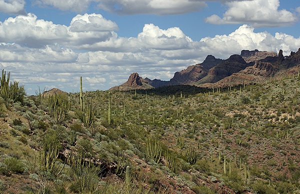
Towards the end of I-20 and once we were on I-10 the terrain became rolling and then slightly mountainous and was very pretty in a southwestern desert kind of way. At some point we notice very large mountains off to the southwest. Just before reaching El Paso we were very close to the Rio Grande River and realized that the mountains were now very close on the Mexican side of the river and were very large and very rugged. I-10 through El Paso, Texas was an experience unto itself as there was road construction along its entire length for what seemed like endless miles. On the other side of El Paso we had to stop at a Homeland Security check point where we went in with the trucks by mistake but got waived through. Whenever I am unsure about overhead clearances I stick with the big rigs.
We continued on I-10W into New Mexico where it was joined by I-25 in Las Cruces and completed our run to Deming. We pulled into the Escapees Dream Catcher RV Park at 11:50 MST, just shy of 7 hours after we pulled out of the Wal-Mart in Midland, Texas. We had traveled 407 miles at an average speed of 58 MPH which was faster than our usual 50 MPH average.
Butch and Fonda were already checked-in to the RV Park and we took one of the sites next to theirs’. They had developed an apparent chassis battery problem and Butch was trying to sort it out. I got the shorepower hooked up while Linda prepared lunch. She made open faced chili cheese dogs with some tofu hotdogs and the leftover chili from Monday night.
Butch needed a new battery for their Suburban so I rode with him to the local Wal-Mart. He had them install it (no extra charge) but had to teach the “technician” how to do it. He was also scoping out batteries for the bus but Wal-Mart did not have the Group 31’s he was looking for. We stopped at both O’Reilly’s and NAPA auto parts stores and got prices then went back to do some additional diagnosis. Butch suspects a shorted cell but has not confirmed that.
Linda suggested that I connect the sewer hose and fresh water line while it was still daylight with comfortable temperatures so that is what I did. I decided to check out the two pyrometer sensors. In the process I “discovered” a metal plate with an electrical harness plugged into it and a fitting for a hose but with only a small piece of hose attached to the fitting. Butch identified the plate as the turbocharger boost sensor. I found the loose end of the hose and followed it back to turbocharger outlet manifold. That explained why I was not able to get the turbo boost and engine power I expected from the engine. The hose was incredibly brittle and had to be replaced; not good. We discussed options and appeared to have two: 1) Attach a new hose to the sensor tube and then try to splice it into the old hose, or 2) get a new barbed fitting for the manifold and run a new hose from there to the sensor. We drove back to the NAPA store and got the parts we might need.
Butch removed the old fitting from the intake manifold and decided we could re-use it. It took some doing but he got it installed. We routed the new hose (fuel injector rated) to the sensor plate and connected it. I could not figure out how to mount the plate so I left it sitting behind the computer on top of the engine where I found it. I do not know if the old hose has been broken for a while or if it finally failed this afternoon when I grabbed it, but either way it was certainly leaking and was another potential disaster averted.
For dinner Linda made a nice green salad and pan-grilled tofu slices with Bar-B-Que sauce and caramelized onions. After dinner we took advantage of our full hookups to take showers and get additional water in our waste tanks. We watched an episode of Nova on the local PBS station and then went to bed. Both sides of the air mattress were very hard. When we checked the settings, my side was at 50 and Linda’s was at 85, both much higher than we usually set them.
The thought crossed my mind that the cats might have stepped on the controls, but that seemed unlikely as the buttons are slightly recessed and have to be pushed in to activate the system. Besides, the odds of them stepping on the controls for both sides of the bed were very small. Linda made an off-hand comment about altitude and I realized immediately that this was the effect of having climbed from 765 feet above sea level (ASL) in Alvarado, Texas to 2,862 ft. ASL in Midland, Texas, to 4,300 ft. ASL in Deming, New Mexico. I also realized in that moment why the tire pressures were higher than I expected when I checked the PressurePro TPMS this morning before we pulled out of Midland. Sometimes that which should be obvious is not. We reset the air mattress pressures and drifted comfortably off to sleep.
2014/12/11 (R) RoVer’s Roost SKP CO-OP
I was up at 6 AM after a good night’s sleep and Linda got up around 7 AM. The overnight low was 38 degrees Fahrenheit, and we did not have any of the heaters turned on, so the front of the coach got a bit chilly. We were parked facing east so the rising sun lit up the front of our coach and helped warm it up. I checked on the house battery SOC and then settled in to write for a while. We had a light breakfast of oatmeal and juice around 7:30 AM. At 7:45 AM I turned on the engine block heater and Aqua-Hot pre-heat pump. Linda gathered up the trash shortly thereafter and went for a walk.
I failed to mention in yesterday’s blog post that our grand-daughter Katie called Linda yesterday to let us know that she had received a full academic scholarship to Michigan Technological University in Marquette, Michigan. We were, of course, very excited to receive this news. Katie has been an excellent student throughout high school and we are confident she will do well at MTU if she decides to go there.
Fonda was out with their two dogs, Rascal and Daffy, around 7:30 AM but there was no sign of activity beyond that until 8 AM when Linda returned from her walk and said Butch was outside looking at their chassis battery situation. I put on the hooded sweatshirt I use when I have to work outdoors in cool weather and joined them.
Butch had left the 24 VDC battery charger on the chassis batteries overnight. Both batteries seemed to be holding an adequate voltage so he decided to swap them rather than replace the one that seemed to be a problem yesterday (lower 12 volts). After disconnecting the cables we pulled both batteries out. These are 8D lead acid (wet cell) batteries and weight ~160 pounds each. Butch topped off the fluid level in all of the cells. He then put the batteries back in place, reversing their position, and reconnected the cables. We re-checked voltages and everything looked OK so Butch decided they were ready to travel today rather than spend another night in Deming.
Yesterday we had discussed driving to the Escapees Saguaro Co-op RV Park in Benson, Arizona. Called them just before 5 PM and they said they had plenty of spaces available. Linda was checking the details of the park online and discovered that they have a 40,000 pound weight limit, but no one at the park could explain why. Further research revealed that the last 0.3 miles into the park might be a weight restricted road.
Benson would have been a short drive of just over 180 miles, leaving us a longer drive for Friday if we wanted to get all the way to Quartzsite. Looking at the map it appeared that Casa Grande, Arizona, 280 miles from Deming, might be a better stopping point. As it turned out, the Escapees (SKP) RoVer’s Roost CO-OP RV Park is located near Casa Grande and did not have weight restrictions. Linda called to make sure they had space for us, and after consulting with Butch and Fonda decided that was where we would head.
Linda checked online for fuel stops and prices. The best price was $3.15 at a Pilot/Flying J just 10 miles shy of Casa Grande, but I wasn’t sure we could comfortably make it that far with adequate reserves as we were already at 1/2 tank mark on the fuel gauge. I dumped our waste tanks, stowed the hoses, turned on the chassis batteries, opened the various air valves, disconnected the shorepower cord, and stored it. We secured all of the bays and then hooked up the car for towing. When Butch and Fonda were close to being ready we fired up the bus engine and checked the exterior lights.
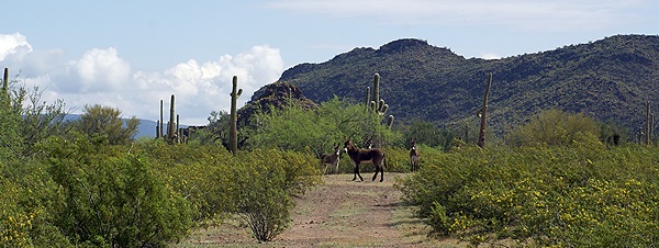
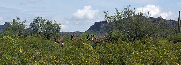
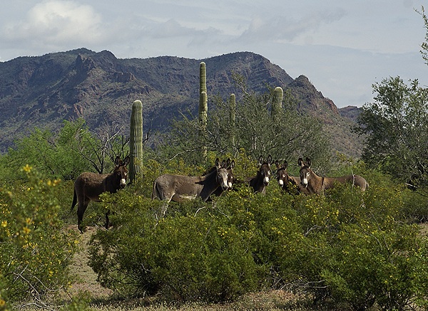
We pulled out of the SKP Dream Catchers RV Park at 10 AM with our first stop planned for a Flying J Truck Stop about 60 miles west of Deming. We had a good run on I-10 across the rest of New Mexico and into Arizona, exiting onto I-8 about 13 miles from the RoVer’s Roost RV Park. The bus ran like it had a new engine. The turbocharger was very responsive to the accelerator, producing more boost than I saw yesterday. The engine had noticeably more power climbing grades, with the pyrometers reaching 850 – 900 degrees F and the engine coolant temperature reaching 195 – 200 degrees F. Repairing the turbo boost sensor hose yesterday was clearly the right thing to do.
The scenery was beautiful and the largest city on our route was Tucson, which appeared to have a very nice downtown area. The city was spread out for 30 miles from east to west and was not nearly as hectic as the drive through El Paso, Texas yesterday. We arrived at RoVer’s Roost SKP CO-OP AT 3:15 PM MST with 3/4’s of a tank of fuel.
RoVer’s Roost is a very dense RV Park with closely spaced lots that are permanently assigned to co-op members and most of which were occupied. The lots were all perpendicular to the long, straight, narrow roads. All sites, including the boondocking area, were back-in which required us to unhook our cars. The sites were also limited to a 40 foot long RV maximum, but many of them were “developed” in such a way that they would not accommodate a rig that long. Registration took longer than it should have but eventually we were escorted to our site by a man in a golf cart who guided me as I backed into the site. He had obviously done this many times and knew how to get a 40 foot motorhome into a tight space with limited room to turn so we were glad to have his assistance.
Once we were in our spot he escorted Butch and Fonda to their site and helped back them in. Their bus developed an air problem after they pulled into the park, producing a squealing sound when Butch applied the parking breaks. Butch had to bleed the pressure down to 30 PSI to get the noise to stop. He re-pressurized the system and the noise did not reappear, so he put the Quadra Big Foot leveling jacks down.
I updated our recent locations in RVillage. The four of us then went for a walk around the park to check it out and scope out our exit path. We met a very nice lady resident who has painted a number of murals on storage sheds around the park and the ones we saw were very well done. We returned to our coach and had dinner. I had a TXT message from Chuck and called him after dinner to tell him about the turbo boost problem and solution. We turned in early and watched a football game for a while before turning out the lights and going to sleep.
2014/12/12 (F) RR to Q
Today was our 13th day on the road since leaving home on November 30th. We could easily have taken a month to do this repositioning, stopping along the way at more places for more nights and exploring each area, but we chose not to. In part this was because we were caravanning with friends, and in part because we both had bus issues along the way and we were all anxious to just “get there.”
Pulling in to 715 Lollipop Ln in Quartzsite, Arizona.
RoVer’s Roost has WiFi but we were not offered the use of it when we registered. We had an excellent Verizon 4G/LTE signal, however, so I checked RVillage last night and realized that I had not updated our location since Alvarado, Texas. In the span of just a few minutes I checked into Midland, Texas, the SKP Dream Catcher RV Park in Deming, New Mexico, and finally the RoVer’s Roost SKP CO-OP in Casa Grande, Arizona. I posted a comment about this and drew a comment about “…living in the fast lane” and several “likes.” RVillage is not only useful, it’s fun.
The park home page showed 11 check-ins, so I perused the list and discovered that Forrest and Mary Clark were apparently here. I say “apparently” because, like our situation, the information is only accurate if the person has kept it up to date. I sent Forrest a message and he replied that they were, indeed, at the park and provided their site number. I did not see the reply until this morning, however, so I messaged him back and said we would stop by before we pulled out. Like us, they are also headed to “Q” for the first time this winter.
I was up by 6:30 AM and made a half pot of coffee. We have not been making coffee in the morning and really miss it. We enjoyed our Teeko’s Cafe Europe Blend while watching a gorgeous sunrise, the first of many we expect to see. The temperature had dropped to 50 degrees F overnight from the high of 76 yesterday afternoon; warmer than normal for this time of year. RoVer’s Roost has recycling bins, so Linda gathered up the various packaging materials she has been saving and walked them over to the bins along with the trash. She likes to go for morning walks and has missed doing so while working on the software conversion project for the bakery since mid-September.
At 8 AM the house batteries were at 93% SOC. The last time they were at 100% was at the end of our stay in Alvarado, Texas where we sat for three night plugged-in to “50 Amp” shorepower. The Magnum ME-ARC remote was showing 116-120 VAC in, which more closely matched the main panel gauges than I have seen recently. I obviously have some investigating to do (voltage measurements) and need to revisit the manuals for the 4024 inverter/charger and its add-on modules. As with everything on this coach, there is no magic involved, just basic engineering principles. The problem comes when there is inadequate documentation on the construction of the systems, including their principles of operation and their specific interconnections. That’s when the detective work begins and I have to be particularly cautious about coming to premature conclusions regarding all of this. It is better to admit that I do not understand how something works than to assume that I do and turn out to be wrong (not that that has ever happened).
In my chat with Chuck last night he suggested that I might want to eventually replace the turbo boost (manifold) sensor hose with a silicon one. The two hottest places on the engine are the exhaust manifolds and the turbocharger and this hose connects to the latter. He planned to check the hose on his coach, which is the same type and age as ours, first thing this morning. His coach has more miles on it than ours (we think) so this hose is likely to be in bad shape on his coach too. At some point I would like to have the radiator re-cored and that would be the time to replace ALL of the coolant hoses, and anything else on the engine that is made of rubber, with new silicon parts if possible, or at least with new rubber.
Along those same lines we were discussing air-powered accessories last night. We do not use the bedroom pocket door and I will probably disconnect it or add a shutoff valve. The waste tank dump valves are also air-powered and I may do the same thing to them. That would leave the toilet and the shutters for the two front air-conditioner condensers as the only devices that needs air to work while we are parked. We like the air flush toilet—it is fairly water efficient—and we would keep it if we could eliminate air leaks to the point that the auxiliary air-compressor only runs a few times a day. The other downside to the toilet, however, are the difficulty and expense of getting spare parts. We are considering replacing it with a standard gravity flush “RV style” toilet when we redo the water tanks, hopefully next year. That would greatly reduce the need to run the auxiliary air-compressor while we are parked. It does, however, also help maintain the air pressure in the suspension system.
We walked down to Forrest and Mary’s site at 8:30 AM and they came out to greet us. Precision RV pulled up just as we got there. They are affiliated with AM Solar in Oregon and are installing a solar electric system on Forrest and Mary’s Foretravel motorhome. They wanted to see our bus so we all walked back to our site. Butch walked up and joined us and we had a long chat. Several folks walked by and were very friendly which help mitigate our first impressions of the place.
While we were standing there the man who parked us yesterday drove by in his golf cart and also stopped to chat. He and his wife have been coming to RoVer’s Roost since 2004 and help manage the park. With the co-op you obtain a leasehold on a specific lot which is then yours to use until you move to a different lot or sell your leasehold. The lots are not deeded; your leasehold buys you a fractional ownership of the co-op. Leaseholds are currently $8,500 with a $500 annual maintenance fee, and many leaseholders are full-timers; their RV is the only home they have. Under $10K for a place to live plus $500 in association fees and metered electric is not bad. In the last few years many of the original residents, who built the park, have given up their RV’s for assisted living or passed away. At the present time there are a few lots available and, for the first time in the park’s history, there is no waiting list. The hope is that a new generation of retirees will discover the Escapees RV Club and the Rainbow Parks and SKP co-ops.
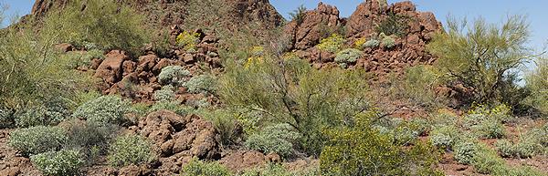
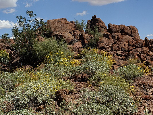
RoVer’s Roost is an odd place when you first see it, a kind of “RV oasis” in the dessert. It’s a compact, low-walled, compound surrounded by endless miles of nothing; no housing, no industry, not even agriculture. It turns out that such places are not uncommon in the southwest but it got me wondering why it was built here and why it was built this way. I presume the reason for the location had to do with climate, land costs, and the willingness of local, county, and state agencies to allow it.
We learned that some of the reasons RoVer’s Roost is built the way it is had to do with it being the first SKP CO-OP and when it was built. Construction began in 1981 and Escapees RV Club Founders Joe and Kay Peterson helped build it with their own hands and had a lot there for a while. RV’s over 35 feet long were rare in those days. Although 40 foot highway buses existed, such as the Eagle, and some were already being converted into motorhomes, many conversions were based on the 35 foot Flxible and GMC buses. Pull-behinds (trailers and 5th wheels) were rarely longer than 30 feet, although there were exceptions. The size of the lots, the width of the roads, and the tightness of the turns all reflect the RV realities of the time and provide a living example of how difficult it is to see into the future.
Another reason, I presume, had to do with the costs associated with building RoVer’s Roost. Even if the cost of the land was negligible, doubling the size of each lot would have at least doubled the cost of the infrastructure. Roads, electrical wire, fresh water pipes, sewer lines, and the perimeter wall would all have involved at least double the material and the associated cost. The visit to RoVer’s Roost reminded me that I need to carefully consider the historical context of something before I can hope to understand it.
We targeted 10 AM as our departure time, but there was no urgency to our leaving as we had less than 180 miles to get to our winter home in Quartzsite. Butch discovered the digital dashboard on the Rand-McNally RVND 7710 last night and called to let me know how to access it. I vaguely recalled that it was there, having been to several seminars on the unit, but I had not developed the habit of using it. I decided I would try it out on this last leg of our journey to “Q.” One of its features is the display of elevation. On the downside, it does not display the current posted speed limit, which is shown on the map view.
We prepared the coach for travel and I fired up the engine at 10 AM. Linda watched to make sure I did not hit anything as I pulled out. Once I was out of our site (#77) I drove to the end of the street and around the corner to a spot where we could hookup the car, which Linda drove down and positioned behind the bus. I shut off the engine while we hooked up as the park is posted as a “No Idle Zone.” Several residents stopped to chat and all of them were very nice, wished us a safe journey, and invited us back. After a less than 100% positive experience yesterday when we arrived and registered we were feeling very good about the park by the time we left. That, however, did not change the fact that the park design is only marginally usable by a 40 foot highway bus, and not really a good choice for an overnight stay as they do not have any pull-through sites.
Butch and Fonda pulled out of their spot about 15 minutes after us and by 10:30 AM had their car hooked up and were ready to roll. We pulled out in the lead and 1.5 miles later pulled back onto westbound I-8. We exited I-8 34 miles later near Gila Bend and got on a connecting road leading to AZ-85. We came to a split and were not sure where the GPS intended to take us as it told us to turn left which would have put us on AZ-85 southbound whereas the signs clearly showed that AZ-85 N to I-10 was a turn to the right. Linda was double checking on her phone what we needed to do. We went to the right and that turned out to be correct.
The 39 mile run up AZ-85 to I-10 was a 4-lane divided highway, although the road surface was a bit rough initially. When we left I-10 for I-8 at Casa Grande yesterday the signage indicated that I-8/AZ-85 was the designated bypass route to get around Phoenix. Once we rejoined I-10 westbound there was noticeably more traffic even though we were already 70 miles west of Phoenix. The traffic eventually spaced out and we finished the 180 mile trip easily while enjoying the other-worldly scenery of the deep Southwest U. S.
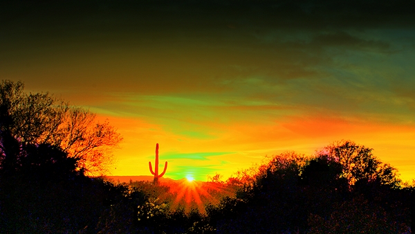
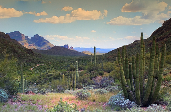
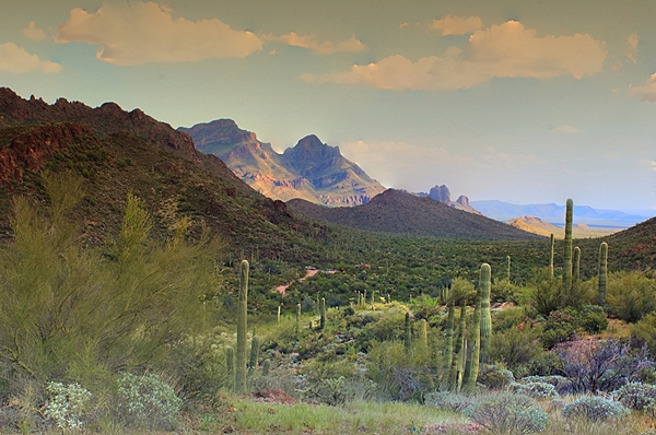
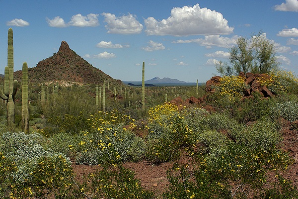
We climbed over several small mountain ranges and stopped briefly at a rest area. We climbed over one last mountain range, reaching an elevation of ~1,600 feet ASL (on the RVND 7710 dashboard display), and finally saw the valley where Quartzsite sits at the bottom nestled against the next mountain range to the west. We then dropped 700 plus feet over the next 12 miles on a gradual but constant grade. As we descended and neared Quartzsite we saw the first RV’s parked on the BLM land south of the highway, which was very exciting.
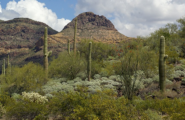
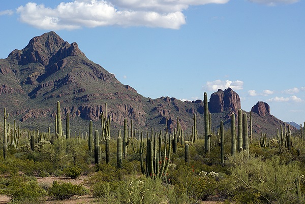
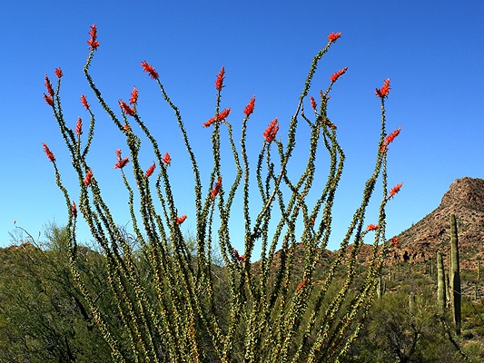
In spite of studying satellite images I did not have a good picture in my mind of what I was now seeing. I did not expect the mountains to the east and west of town and I did not expect vegetation. I thought this area would be a vast expanse of flat, barren, sun baked desert. What lay before us was much nicer than that and we could see immediately why RVers have come here for years and returned year after year.
There are two exits for Q, one at either end of Main Street (B-10) which parallels I-10 on the north side. We took the second (west most) exit as that is where the Pilot Truck Stop is located. We both topped up our tanks and then pulled out of the way to disconnect our cars. We had 5/8ths of a tank but I wanted to add biocide and top it off to eliminate as much air as possible. With changes in temperature moisture in the air (in the fuel tank) can condense out. Water in the fuel then contributes to the growth of algae. I wanted to prevent that since we will be sitting for almost three months. I will run our fuel polishing pump as well, but the biocide and full tank will really help prevent fuel problems.
Butch had already called Jim (Joe’s brother) and he drove over to escort us back to Joe and Connie’s property. We made a little caravan with two buses and two cars following him there. I really did not know what Quartzsite would be like. My first impression was that it was a combination of the world’s largest RV rally with the world’s largest flea market. There are RV’s everywhere, and stuff for sale everywhere else. It is not an “upscale” place, but it is not trashy and rundown either. It’s a little funky and a bit alternative, a kind of 1960s meets the old west vibe, and I think it will be a great home base for the winter.
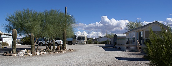
Joe and Connie’s property is on a small side street in the NNW part of the city. Butch pulled in first and I waited in the street while Jim got him backed into their spot facing due south. Jim then directed me into a spot parallel to the fence on the north property line facing east, which is how I had hoped we would be parked. It was much easier to get into than Butch and Fonda’s spot. Fonda and Linda pulled the cars in and parked them after I was out of the way. The property was smaller than I thought it would be from the satellite images, but large enough, and nicer looking than I expected as well. There was one motorhome here already, an older Country Coach, and it turns out that they will be the only other rig here. The owners had gone home for Christmas unexpectedly and will be back around January 1st.
We were pointing slightly up hill so I initially raised the rear end rather than drop the front. To get level, however, I still needed to drop the front and the Level Low system once again failed to respond. I checked the pneumatic solenoid valves in the bay under the driver’s seat but nothing seemed to be amiss. I switched the selector valve in the cockpit between its various positions and the front finally responded. I have replacement parts for one pneumatic solenoid valve but I am now wondering if the problem might be the selector switch? I have not checked the maintenance manual but I presume this is a strictly electrical switch that determines which pneumatic solenoid valve the “up/down” rocker switch controls. I presume the rocker switch is working correctly as it controls the left rear and right rear leveling valves and puts the suspension in driving mode without difficulty.
The easiest/cheapest fix is the pneumatic solenoid valve, unless that turns out not to be the problem. The next easiest fix is probably replacing one or both Norgren valves in the bay because they are somewhat accessible. I know the cost of those valves, so it is both a more expensive and more involved repair, especially if it turns out to be unnecessary. I have no idea what the selector switch costs and it appears to be in a difficult location to service, but if that is the problem then that is what has to be repaired. There are several possibilities besides the pneumatic solenoid valve. It’s possible that the selector switch connections for controlling the front height control valve have become marginal and intermittent. It’s also possible that the switch itself is failing and needs to be replaced. Another possibility is the electrical connections at the solenoid. Whatever it turns out to be it won’t be the first marginal/intermittent thing we have found on the bus.
I eventually got it leveled, and having the rear end raised and the front end lowered is not a bad thing as it makes it easier to get in/out of the front door and provides more clearance under the utility bay for the dump hose. We will be in this spot for the next 12 months, except possibly for a few days in February to attend an informal gathering of a few members of our FMCA Freethinkers Chapter at the Peg Leg Monument near Anza-Borrego State Park in Southern California. We will leave Quartzsite in early March for the Escapade rally in Tucson, Arizona.
Once I had the coach leveled I shut off the engine and went through my arrival routine. When I went to connect the shorepower cord I discovered that we only had a “30 Amp” RV service. A “30 Amp” service is just that; a single 120 VAC connection (line, neutral, ground) protected by a single pole 30 Amp circuit breaker (on the line). A “50 Amp” RV service, by comparison, is two 120 VAC lines (180 degrees out of phase) with a shared neutral and a ground. The two lines are protected by a 50 Amp double pole circuit breaker and are actually a 240 VAC, 50 Amp service. However, in most RV’s each line (leg) is used as a 120 VAC, 50 Amp service in conjunction with the neutral, so a “50 Amp” RV connection is actually used as a 120 VAC, 100 Amp service. That’s over three times the power of a “30 Amp” RV service.
We can manage on a 30 Amp service—we have before—especially if we do not have to run the air-conditioners. Our air conditioners are not working at present anyway, but we do not expect to need them while we are here, so that will help. We cannot use the Gaggenau cooktop, as it is a 240 VAC device, but that’s OK too. Linda prefers to use the portable induction cooker anyway; it is more efficient and doesn’t heat up the coach. Still, operating our coach on a 30 Amp service requires much more conscious management of our electrical usage and is thus a tad inconvenient. On the other hand, our electricity is metered so we pay for what we use. Having a 30 Amp service inherently limits how much electricity we can use.
Many (most) circuit breakers will only carry 80% of their rating on a continuous basis so we effectively have 24 Amps available to run things. That’s not a lot of power for a large, “all electric” coach. I adjusted the “AC Input” setting on the Magnum 4024 inverter/charger to 25 Amps before turning the power on. The unit limits the amount of current it uses to charge the house batteries to a percentage of that setting. Setting it to 25 Amps instead of 30 Amps gave us a bit more cushion to run other devices while the batteries were charging. Once they are fully charged I will dial this back up to 30 Amps.
I joined Linda, Butch, Fonda, and Jim and introduced myself to Connie. Joe and Connie own this place but Joe was not here today. He ended up in the hospital being treated for a scorpion sting and is now recovering in a care facility for a week. By his own admission he was careless; he took a pair of shoes out of a closet he had not worn in a year and put them on without checking to see if something had taken up residence therein. Not being from the desert southwest this would not even have occurred to us. We know there are snakes, scorpions, and other “things” here, but this scorpion was in their park model trailer living in a shoe in their closet just 60 feet from our bus. That certainly served as a heads up for us.
After chatting for a while I finished hooking up the water softener to the water supply and the coach. We had about 1/2 tank when we arrived and I brought the level up to 2/3rds. Butch had some test strips so we used one to check the hardness of the water. It showed 25 grains per gallon (gpg), the highest mineral content it could indicate. Our portable water softener has a capacity in grains which determines how much water it can soften before it needs to be recharged. A “1,000 grain” water softener will only treat 40 gallons of 25 grain hardness water (1,000 / 25 = 40) whereas it will treat 100 gallons of 10 grain hardness water (1,000 / 10 = 100).
Butch and Fonda have a 10,000 grain portable water softener but the information we got with ours did not include the grain capacity. Our softener is similar in size to theirs so I can probably safely assume that it has at least a 7,500 grain capacity. Given the hardness of the water here that means it can treat about 300 to 400 gallons before needing to be recharged. Our fresh water tank holds approximately 125 gallons. If we use most of the water before refilling it we will need to recharge the water softener after every third filling.
Recharging (regenerating) the water softener is simple and inexpensive but takes a little time. The filter is removed from the housing and the housing filled with crushed salt. Water is allowed to flow very slowly through the salt and then through the softener and onto the ground. When the salt is gone the unit is recharged. If this seems wasteful of water it is, in fact, how almost all water softeners work. The advantages of softened water are worth the little bit of added water use, especially since we have an Aqua-Hot hydronic heating system that specifies the use of softened water for optimum performance and reduced maintenance.
Rain had been in the forecast all day and we finally started to get an occasional drop so I closed up the bay doors and went inside. Once we were settled in Linda sent a TXT message to our children letting them know we had arrived. She attached a photo she took on her camera of our coach in situ. I took a few photos on mine and TXT’d one to Chuck to let him know we were finally here. I then laid down on the sofa and took a nap. I eventually woke up to the sounds and smells of dinner being prepared. Linda made a very yummy crushed lentil curry and opened a bottle of Barefoot Pinot Noir. It was a bit dry for my taste but she enjoyed it. It’s a good life.
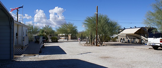
The view to west (towards Lollipop Ln) from the east end of our “camp.” Our coach is to the right with the awning out.
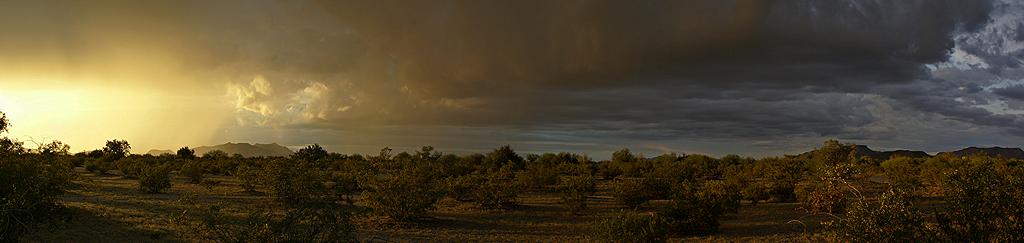
Storm clouds gathered and shrouded the mountains to the west but all we got was light rain; nothing like the weather that swept through the Pacific coast from Los Angeles up into Oregon. Not that far north of us Las Vegas, Nevada, got rain, ice, and snow.
After dinner Linda signed-in to RVillage and updated our location. She indicated that we were not in an RV park as we are on private, non-commercial property that is not, and should not, be in the RVillage (AllStays) database. I will check tomorrow to see if the website shows us other Villagers in and around the Q.
I checked the house batteries at 9:45 PM. They were at 25.6 VDC drawing 0 Amps and showed “Full Charge” even though the BMK showed the SOC at 95%. Like our stay in Alvarado I suspect the SOC will be back up to 100% in a couple of days. I made note of the readings and headed to bed. It was good to finally be here and we are looking forward to an interesting, pleasant, productive, and enjoyable winter.