Note: This post contains 8 photos. Photos by me (Bruce) taken with a SONY alpha 6400 or Google Pixel 6 Pro unless otherwise indicated. (Photos by Linda taken with a Google Pixel 6.)
THURSDAY 26 October 2023 — NTNP 9 of 14 — Choctaw Boundary
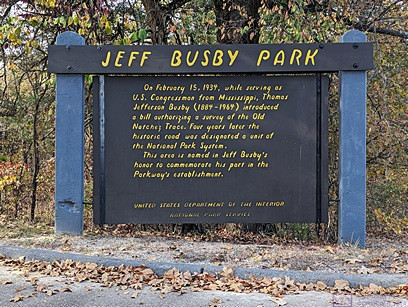
The JEFF BUSBY PARK information sign told us that Thomas Jefferson Busby, U.S. Congressman from Mississippi, introduced a bill on February 15, 1939 authorizing a survey of the Old Natchez Trace. This was a direct result of the research and persistent lobbying of the Daughters of the American Revolution (DAR) to create the Natchez Trace National Parkway and resulted, four years later, in the historic road being designated a unit of the National Park System. This park commemorates his role in the Parkway’s establishment.
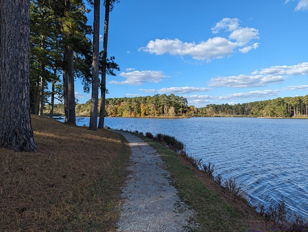
Our explorations today of the Natchez Trace National Parkway (NTNP) included some of the section between Tupelo and Jackson, Mississippi, within reasonable driving distance of the campground, which is near Ackerman, MS.
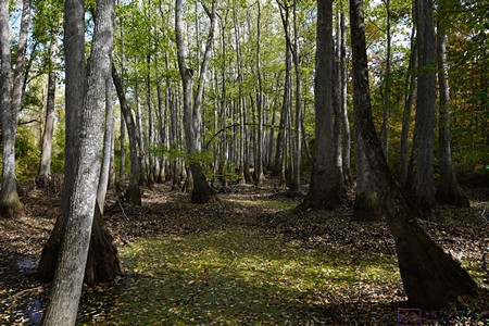
These are Swamp Tupelo trees. There might also be Bald Cypress trees in this swamp, at least we recall seeing both at one point along the NTNP. The name Tupelo is of native origin. From the National Forest Foundation website: “The name “tupelo,” a common name used for several varieties of Nyssa trees, literally means “swamp tree” in the language of the Muscogee (Creek) Nation (ito ‘tree’ + opilwa ‘swamp’).”
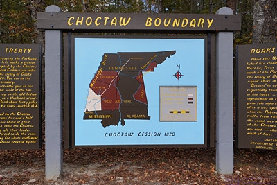
CHOCTAW BOUNDARY The map on this information sign shows the territory ceded to the USA when “…tribal leaders in central Mississippi signed the Treaty of Doak’s Stand, ceding rich cotton lands in the delta region east of the Mississippi River for approximately thirteen million acres in the Canadian, Kiamichi, Arkansas, and Red River watersheds in southeastern Oklahoma. The history of the Choctaw Nation in Oklahoma began with the signing of this treaty on October 8, 1820 and ratified in Congress January 8, 1821. To a much greater extent than we realized when planning this trip, the history of the Natchez Trace includes the history of the native people who occupied this land for a very long time prior to the arrival of Europeans in what became known as North America.
A trip down the NTNP is a trip through more than just American and native history. Before the British and the eventual founding of the USA, the French and Spanish were here, as the following photo explains:
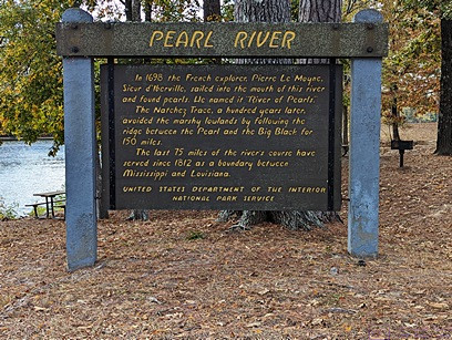
PEARL RIVER This information sign tells that Pierre Le Moyne (Sieur) d’Iberville (a French soldier, explorer, colonial administrator, and trader) sailed into the mouth of this river in 1698 and discovered pearls, thus the origin of the name. A hundred years later, the Natchez Trace avoided marshy lowlands by following a route between the Pearl and the Big Black Rivers for about 150 miles. Since 1812, the last 75 miles of the river have served as the boundary between Mississippi and Louisiana. D’Iberville is noted for founding the colony of Louisiana in New France.
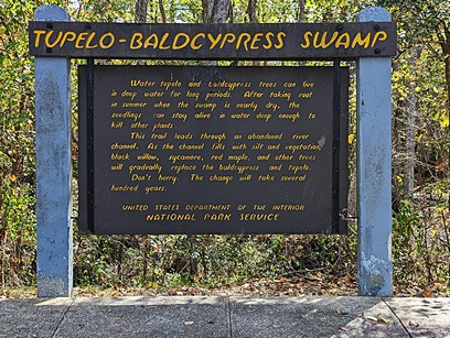
Here’s the information sign explaining the TUPELO-BALDCYPRESS SWAMP. These trees take root in summer when the swamp is mostly dry, but the seedlings have the somewhat unique ability to survive and thrive in water that that is deep enough to kill other plants.
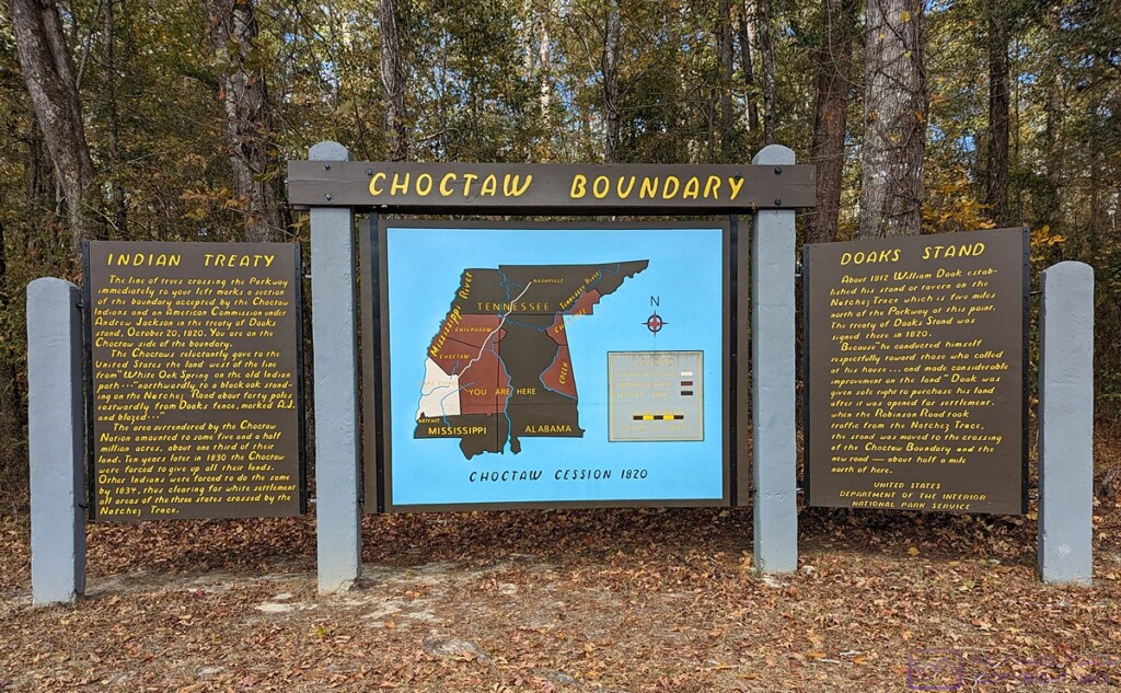
CHOCTAW BOUNDARY (complete sign). This image is 1200×742 pixels, and can be viewed full size on devices with suitable screen resolution. In addition to the map shown in the third photo in this post, it includes the two wing signs, labeled INDIAN TREAT and DOAKS STAND. The sign on the left indicates that a line of trees crossing the (now) Parkway just to the left marks part of the boundary that was agreed to in the aforementioned Treaty.
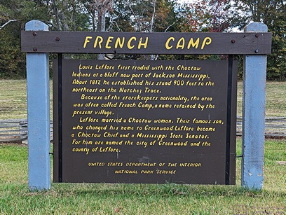
This FRENCH CAMP information sign tells yet another story of how a place got its name. Around 1812, Louis Leflore first traded with the Choctaw Indians in the area northeast of the Trace. Because he was of French nationality, the area was referred to as French Camp. The name stuck and is still used today. Interestingly, he married a Choctaw woman and their son, who changed his name to Greenwood Leflore, became a Choctaw Chief and a Mississippi State Senator. The City of Greenwood and the County of Leflore are named for him.
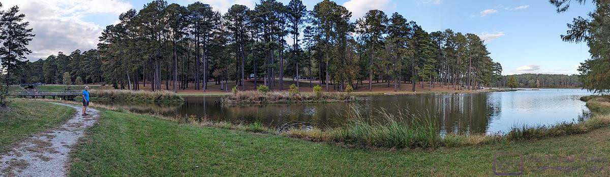
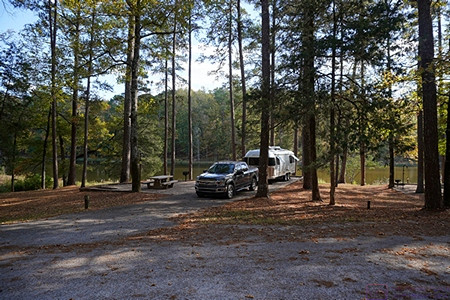
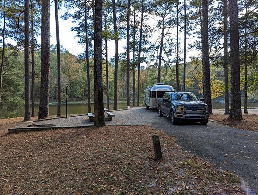
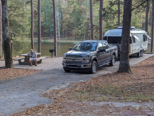
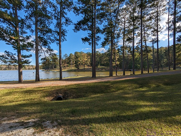
This panorama shows another view of the Choctaw Lake Campground while Linda and I are out for an early evening stroll following our day exploring another section of the NTNP.
…