Note: This is the 15th of 16 posts about our 21-day trip that included a 17-day (16-night) cruise on the Norwegian Cruise Line (NCL) ship SPIRIT from Vancouver, British Columbia to Honolulu, Oahu. This post has 20 photographs with captions and some narrative. Photos taken by me (Bruce) with a SONY alpha 6400 or Google Pixel 6 Pro unless otherwise indicated. (Photos by Linda taken with a Google Pixel 6.)
THURSDAY 14 September 2023 — (T19,C16) Hilo, Hawai’i, Hawaii and Mona Kea
This was the 19th day of our trip, and the 16th day of our cruise and saw us arrive in the cruise port at Hilo, Hawai’i (the Big Island), Hawaii (the State of). Our main activity was a shore excursion that stopped at Rainbow Falls Lookout before taking us to the observatories atop Mona Kea (also spelled “Muanakea”).
At 13,803 feet (4,207.3 m) AMSL, which is also its “wet prominence,” the summit of Mona Kea (Muanakea) is the highest point of land in the Hawaiian Islands, and the second highest island mountain summit on earth. From Wikipedia: “Because the Hawaiian Islands slope deep into the ocean, Mauna Kea has a dry prominence of 9,330 m (30,610 ft) (it’s height if the ocean was “drained” of water. This dry prominence is taller than Mount Everest’s height above sea level of 8,848.86 m (29,032 ft), so Everest would have to include whole continents in its foothills to exceed Mauna Kea’s dry prominence. …” The highest summit on an island is Puncak Jaya in New Guinea, Indonesia, which stands at an impressive elevation of 4,884 meters (16,024 feet) above mean sea level.
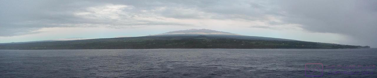
Our first view of Hawai’i (the Big Island) and Mona Kea. This panoramic photo is a composite of five (5) images. Mona Loa is just visible at the left edge of the frame.
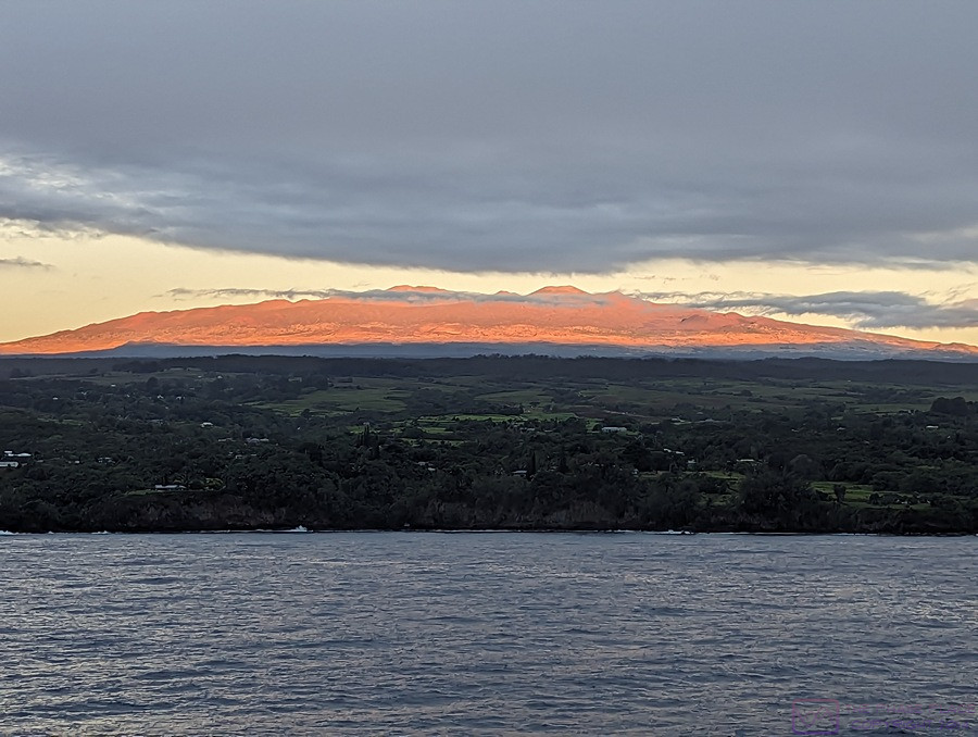
Sunrise lights up Mona Kea as the NCL SPIRIT slowly motors towards the cruise port in Hilo, Hawai’i, Hawaii. The photo is 900×678 pixels and can be viewed at full-resolution on compatible devices. (Photo by Linda)
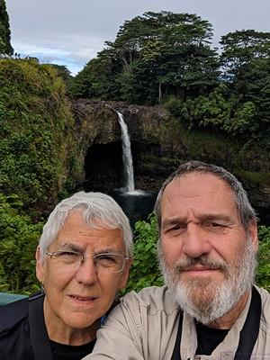
A selfie at Rainbow Falls Overlook in Hilo, Hawai’i, HI.
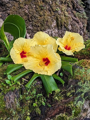
A flower along the trail at Rainbow Falls Overlook. (Photo by Linda)
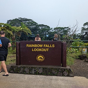
We always try to take a photo of signs to identify where we are. If we can get a photo with a clock in it, so much the better as it helps me time sync photos to local time. (Photo by Linda)
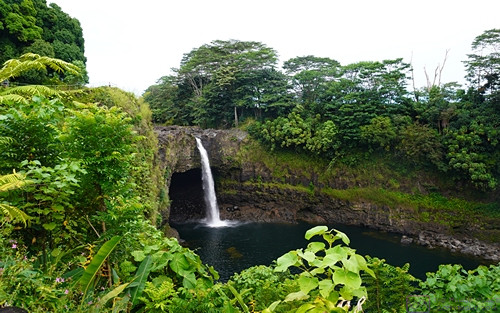
Rainbow Fall in Hilo, Hawai’i, HI.
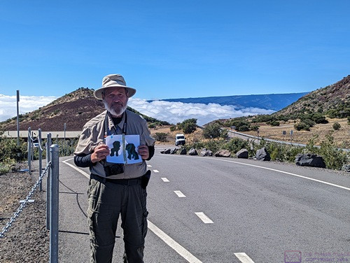
I’m holding grand-daughter Sadie’s “Apa and Ama” artwork to mark our location at the Mona Kea ranger station / store (the building behind me). We are already at/above the level of the clouds.
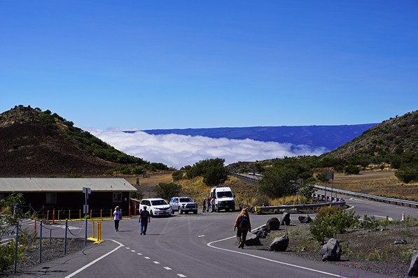
The Mona Kea ranger station/store/museum with our tour van in the front parking lot. From a web search: “The Onizuka Center for International Astronomy Visitor Information Station (VIS) on Maunakea is open every day of the year from 9am to 9pm. Located at the 9,200 foot (2,804 meter) level, they provide health, safety, and other information about Maunakea along with access control. The road up the mountain is open to any/all visitors up this building. Beyond this point, permission is needed and a 4-wheel drive vehicle is required. Our tour van met both of those criteria.
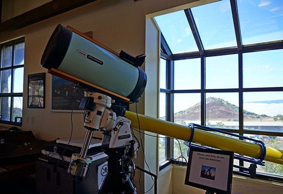
The VIS has a store with various Mona Kea and astronomy related merchandise. It is also a small museum focused on telescopes and other things astronomical.
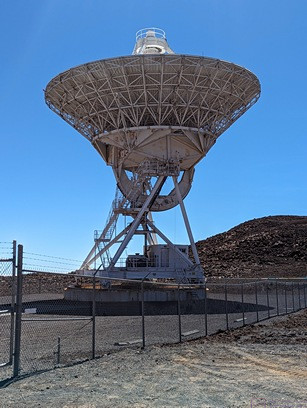
One of the radio telescopes on top of Mona Kea. (Photo by Linda)
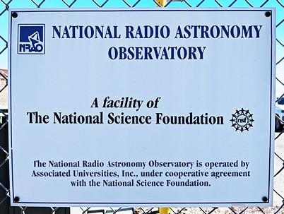
The National Radio Astronomy Observatory is a joint operation of several universities under the auspices of the National Science Foundation.
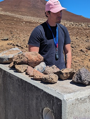
Our tour guide presents information on the various rocks that make up Mona Kea. (Photo by Linda)
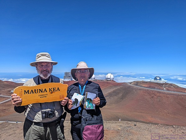
Our tour guide had a Mauna Kea (Mona Kea) sign for photo ops for his customers. Linda is holding grand-daughter Sadie’s “Apa and Ama” artwork. (Photo taken with Linda’s phone, but obviously taken by someone else, probably our tour guide.)
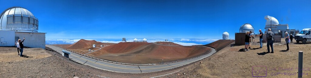
A panoramic view of several telescopes made using the panorama feature of the Pixel 6 Pro. This photo file is 1080×271 pixels and can be viewed at full-resolution on compatible devices.
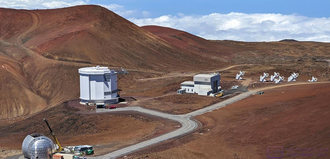
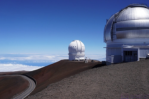
This is a composite of two (2) images, showing several different types of telescopes on Mona Kea, how they are situated, and the road(s) that are used to access them. Not all of the telescopes have a 360-degree clear view of the horizon. They are situated based on available real estate and what part of the sky they need to be able to see.
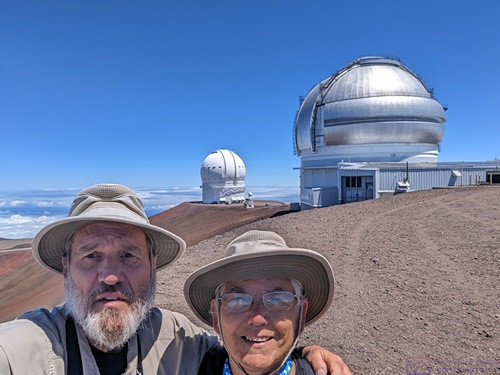
By now it should be obvious that we were there, but here’s another selfie, just to prove the point.
The same two observatories as the previous photo without us in the frame.
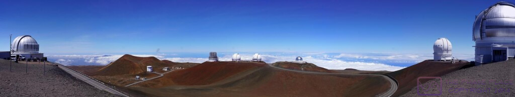
This panorama is a composite of eight (8) images. The photo file is 1920×363 pixels, so there is a lot of detail that can be seen on a device with appropriate screen resolution. There are at least 15 telescopes of various kinds visible in the image, along with a portion of the amazing road system that winds up to and around the observatories and support buildings.
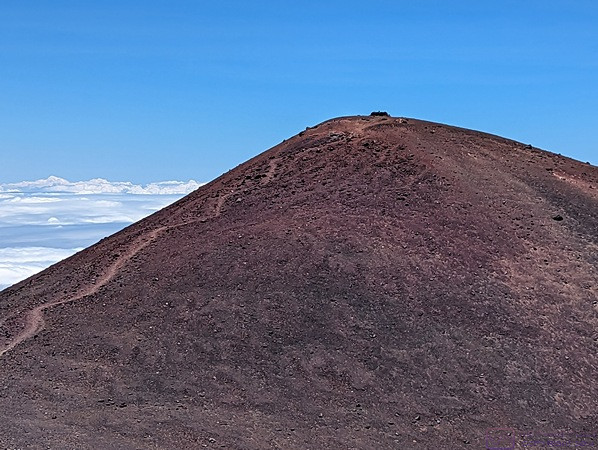
Last, but not least, a photo of the actual summit of Mona Kea, several hundred feet above where we are standing, and higher than the highest observatory on the mountain. Why? Because the summit is a sacred site to indigenous Hawaiians that is used for special ceremonies throughout the year. As such, it is not open to the public at any time.
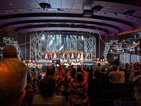
We are back on the ship in the theater at the conclusion of the evening’s entertainment at ~10:15 PM. If was the final ensemble performance of the cruise and featured most of the performers who had entertained us throughout the last couple of weeks. The performances were of a high enough caliber that we were always entertained. This final performance was over, so cameras where very evident as passengers tried to capture the celebratory moment. I took this photo to provide some context for the look of the theater.
…