Monthly Archives: June 2023

20230311-12 – Miami, FL (USA) and home

SATURDAY 11 March – Arrival in Miami and Disembarkation

This post consists of some narrative and 18 photos with captions.  ]

As our cruise was slowly drawing to a close, it would be an understatement to say that we had a great time.  We were grateful that Nancy and Paul invited us along on this adventure, as it was not even on our event horizon.  Had we decided at some point in the future to do this on our own, it would still have been a great trip, but getting to do it with close friends in one of the two “owner’s suites” of the NCL Joy HAVEN, was a unique (and probably once-in-a lifetime) experience for us.  And it was a very special experience, indeed.  Now where’s that lottery ticket?

We were up early to get ready to disembark and watch the ship come into the Port-of-Miami.  The Haven staff had laid out a breakfast buffet in the Haven’s Horizon Lounge, so we made use of that first.  The Lounge was mostly devoid of guests at this early hour, so following are photos of areas of the HAVEN that I have not previously posted.
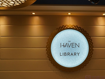
 

The sign for the HAVEN Library, in the hall just outside the main entrance doors.  (We actually had a “back way” into the library as the emergency exit opened into the hallway right at the entrance door to our suite.)  The Library is on the middle (18th) of the three HAVEN decks.
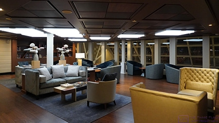
A partial view of the HAVEN Library from near the main entrance doors, looking forward to port.  Our suite is just on the other side of the wall/bookcase at the left of the photo.
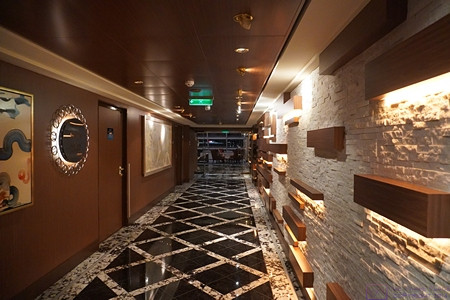
The hallway leading to the HAVEN Horizon Lounge.  The Lounge is all the way forward on the lower (17th) of the three HAVEN decks.  The center portion of the Lounge, however, has its ceiling at the top of deck 18.  All of the staterooms are on decks 17 and 18.  The Horizon Lounge, concierge desk, pool, and bar are on deck 17.  Deck 18 includes the Library and the Restaurant.  Deck 19 is indoor/outdoor lounging space.
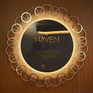
The entire NCL Joy is an attractive and well-maintained ship, but even the signage in the HAVEN had a special, understated elegance.  (This photo also contains a selfie image of the photographer.)
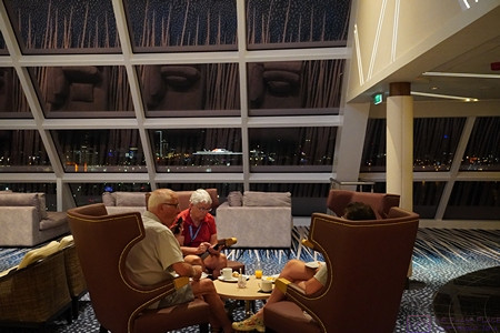
The other members of our little “gang” having a bite of breakfast in the HAVEN Horizon Lounge while I roam around taking photographs.
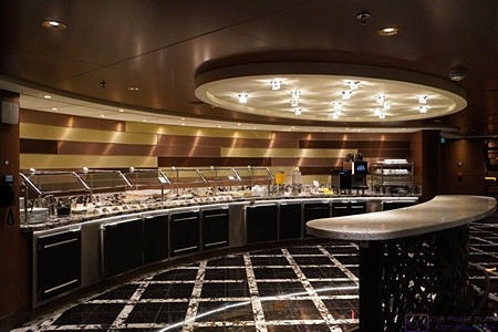
The buffet area of the HAVEN Horizon Lounge.  We were there quite early (this photo was date/time stamped at 7:03 AM.)
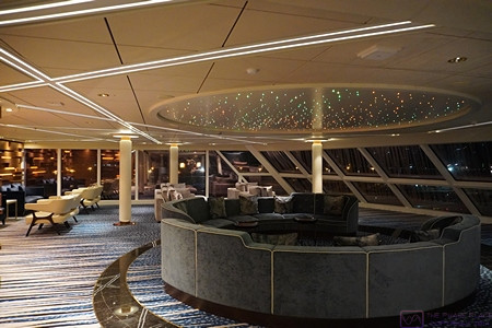
The port side of the HAVEN Horizon Lounge.  The front portion of our suite, including the balcony, is above this ceiling but we never heard any noise from below when we were there.
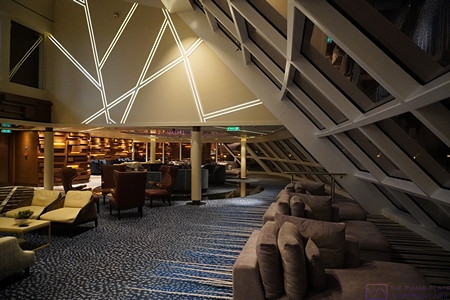
A wider view of the HAVEN Horizon Lounge from mid-ship front looking to port.  The forward port corner of the library is visible in the upper left.  The front portion of our suite, including the balcony, is behind the upper wall with the slanted lighting.  To the right in the photo are the large forward-facing windows in the center of the Lounge which span both decks (17 and 18).
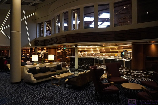
A view of the HAVEN Horizon Lounge and Library looking aft/starboard from slightly to port.  The forward wall of the Library is also all windows, so from there you can see all the way forward through the large center Lounge windows.  The wall with the lighting running at various angles is the other owner’s suite.
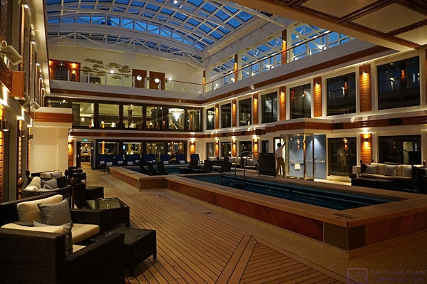
The HAVEN swimming pool and hot tub area.  The area is open all the way to the ceiling of deck 19.  The ceiling is retractable, but we never saw it opened during our cruise.  The opening on deck 19 has lounge chairs all the way around.  There is also access to the outside portion of deck 19 that is part of the HAVEN.


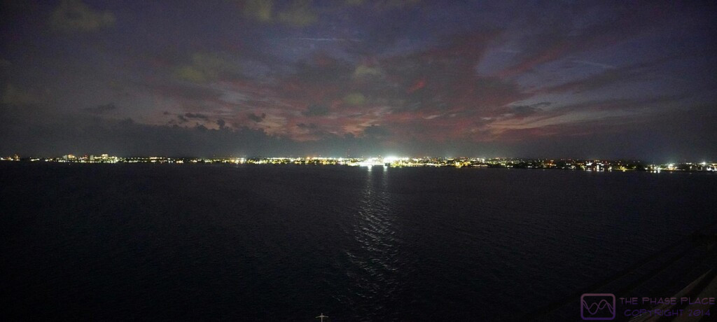
We arrived at the Port of Miami around 7 AM.  Our departure from Los Angeles was in late afternoon light under heavy mist and rain, so we didn’t really see any of the California coast.  With our approach to Miami, however, it was still dark and the sky was clear.  From our first sighting of lights along the shore, it took several hours to actually get to the cruise ship terminal.  While we might prefer national parks as places to visit and explore, there was no denying that the Miami skyline, lit up in the dark, is an impressive, urban sight.
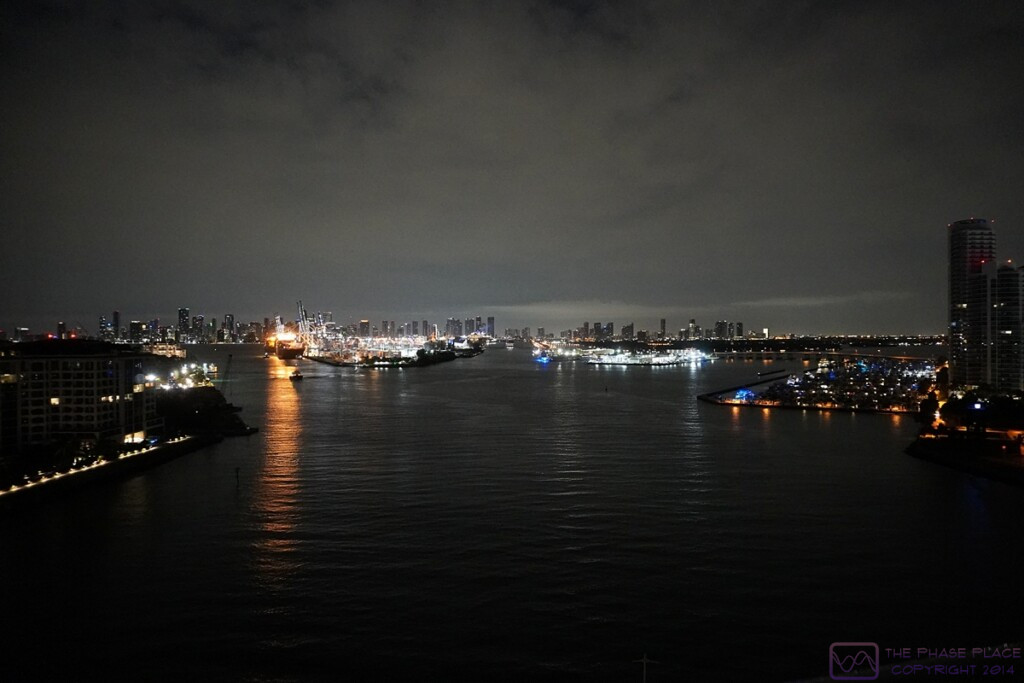


Coming into the Port-of-Miami under the cover of darkness.  The cruise ship terminals are straight ahead.  (Click for a higher resolution image on appropriate devices.)
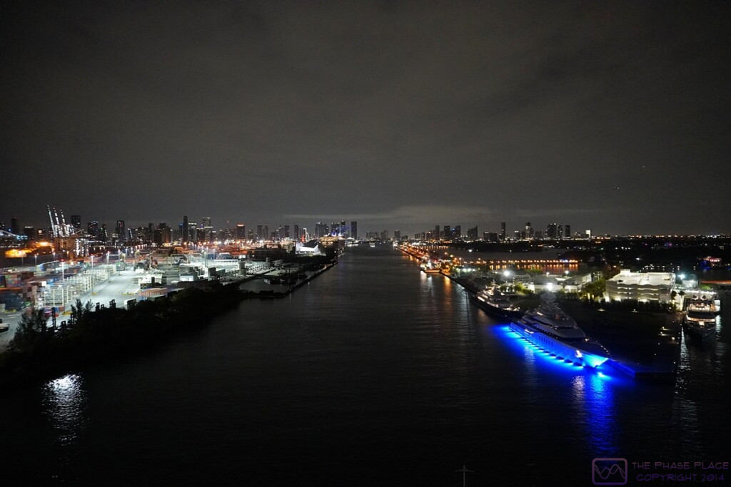
Heading towards the cruise ship terminals with the Miami skyline in the background; container dockyard on the left, superyachts docked on the right.  (Click for a higher resolution image on appropriate devices.)
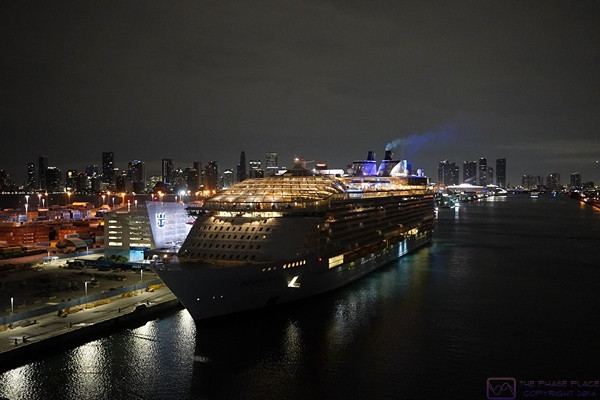
The Royal Caribbean Harmony of the Seas at its Miami terminal on the left.  The Harmony of the Seas is even bigger than the NCL Joy.
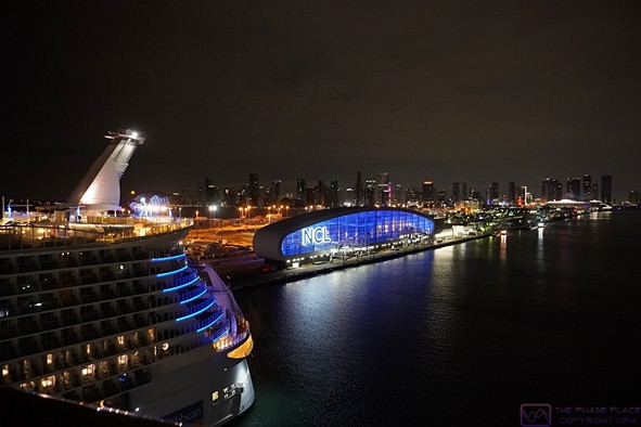
As we come alongside the RC Harmony of the Seas, the NCL cruise ship terminal comes into view on the left.
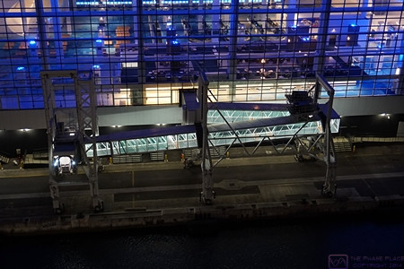
The NCL terminal is very modern.  This photo shows one of the two enclosed gang planks.  They are similar to the jetways used at airports.  The whole structure moves parallel to the edge of the dock on rails and the opening for the ship can be adjusted (up and down) to match the boarding deck.

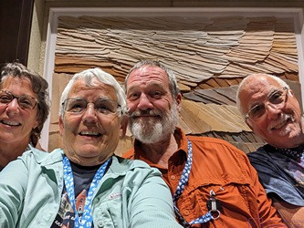
A final selfie of the “fab 4” by the maître de station of the HAVEN Restaurant.


As soon as we began disembarkation things got busy and we did not take any more photos until we reached the Orlando area.  The Norwegian Cruise Line terminal is a large, modern facility designed to make embarkation and disembarkation smooth and relatively easy.  We elected to take our own luggage with us and had priority disembarkation as a result.  (We each had an individual carry-on size rolling suitcase and each couple had a larger rolling suitcase that we checked when flying.)  We cleared in through US Customs quickly and found our way to the taxi / ride-share area where we booked a larger Uber to get the four of us and our six suitcases to the car rental area at Miami International Airport where we had reserved a car with Enterprise Car Rental for the next leg of our journey.

The rental car area was a new/large terminal in itself, and picking up our rental car was a relatively smooth, painless process.  We upgraded the size of vehicle at the counter for a small extra charge.  We also verified that we could use the toll roads.  The toll road system uses “toll-by-plate” and the tolls would be billed to Enterprise and passed along to us.  We were on our way by 9 AM and headed north on the Florida’s Turnpike towards Orland.  Our first destination was the boarding facility near Walt Disney World to retrieve Nancy and Paul’s mini-Goldendoodle, Bella, who was boarded there for the duration of the cruise.  (It was an amazingly nice boarding facility with a great staff, so Bella was in good hands while her servants were away on holiday.  She even had her own private “suite” with access to an outside area.  Sometimes “a dog’s life” is a pretty good life.  )


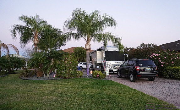
Nancy and Paul’s lot/pad at Mount Olive Shores North (MOSN) with their American Eagle motorhome.


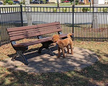
Bella, Paul and Nancy’s mini-Goldendoodle, at the MOSN dog park.

With Bella in hand, we headed southwest on I-4 towards Lakeland, a route with which we were all too familiar.  Traffic on I-4 was as bad as usual, but eventually loosened up.  Soon enough, we were exiting for Polk City.  We arrived at Mount Olive Shores North (MOSN), where Paul and Nancy have a lot with a pad for their Class A American Eagle motorhome, a short time later.


Even through I wasn’t feeling well, we decided to go to Ford’s Garage in Lakeland for dinner.  Bella was with us, so needed their outside seating as dogs are allowed there.  We abandoned that idea shortly we arrived as the wait was going to be at least an hour.  We considered other dinner options, but ultimately decided to return to MOSN and pickup some pizzas in Polk City on the way.   We had a flight booked for the next morning from Tampa International Airport to Detroit Metropolitan Airport (DTW), and spent the night in Paul and Nancy’s motorhome.


SUNDAY 12 March – Closing the Loop

We were up early in order to be ready to go and skipped breakfast.  We said our “farewells until next time,” and “thanks yous,” “and left MOSN around 8 AM for the approximately 1-hour drive to Tampa International Airport.  This early on a Sunday morning the traffic wasn’t too bad, and returning the rental care was quick and easy.  Our flight home on DELTA Airlines was schedule to depart at noon, so we found some seats near our gate, got some coffee and bagels/muffins, and doodled on our iPads will we waited.

Our incoming flight was delayed so we waited a bit longer, but it was no big deal for us.  A couple sitting nearby was a bit anxious, however, and we struck up a conversation.  They were headed to Amsterdam (Netherlands) via a connecting flight out of Detroit Metro Airport.  Their window to get off of our flight onto their next one was already uncomfortably small, but I think we made it out of Tampa International Airport in time for them to make the connection in Detroit.

Our daughter was tracking our flight, and drove to DTW to pick us up and take us back to her house, where we left our F-150 while we were gone.  Back at her house, we transferred all of our luggage into our truck, ready to return to our house.  The truck started just fine, but displayed a warning message about the charging system, and the battery light stayed on.  Linda Googled the message and found that it was likely that our battery was not charging and our range might be limited a 20- to 30-minute drive.  Knowing that, we thought we might make it home, and started on our way.  We didn’t get very far, however, before deciding that this was not a good idea, especially later on a Sunday afternoon, whereupon we turned around and returned to our daughter’s house.  She was happy to let us borrow her car to get home and we promised to return it in a day or so.  It was not the conclusion to our epic adventure that we envisioned, and the problem was resolved over the next few days, but that’s another story for another post.

20230309-12 – Georgetown, Cayman Islands & a sea day

THURSDAY 09 March – Georgetown, Cayman Islands

This post consists of some narrative and 12 photos with captions.  ]

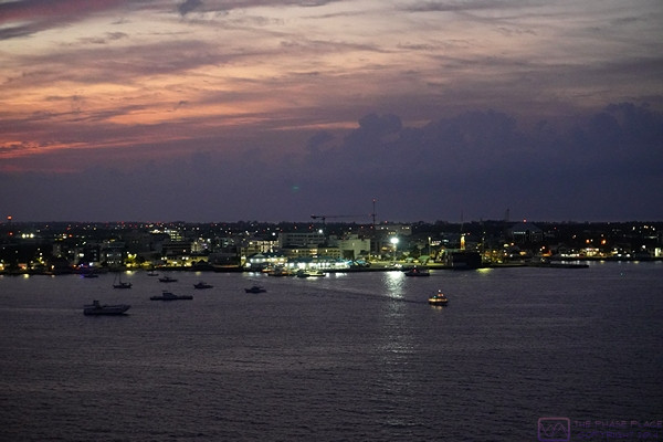
Our approach to Georgetown, Cayman Islands at first light.  (This image is 1920×862 pixels.  Clicking on the image might allow it to be viewed at full resolution on a device with sufficient resolution.)

Center frame; the tender dock and Port of Entry station at the heart of Georgetown, Cayman Islands as sunrise approaches.


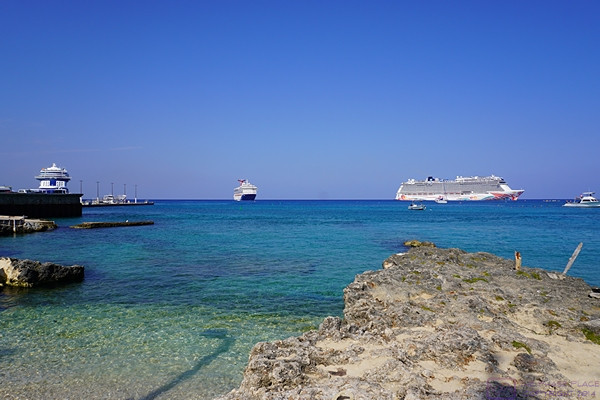
Our penultimate port of call was Georgetown, Cayman Islands.  The port lacks a deep-water marina, so cruise ships “anchor out” and the guests “tender in.”  There are quite a few things to do on the island, and there were numerous shore excursions from which to choose.  This was not our first visit to Georgetown, however, and we were content to just go ashore and stroll around for a bit.  As port towns go it’s not very interesting.  Most of the things to see and do are elsewhere on the island(s).


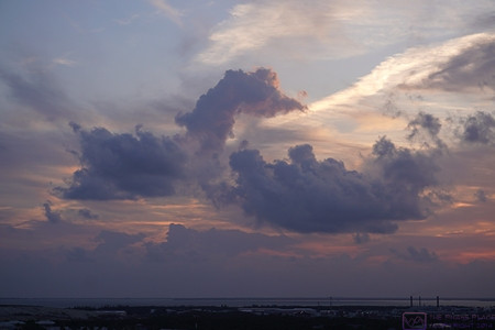
Cloud figures; a horse plays with a hippopotamus on its back.

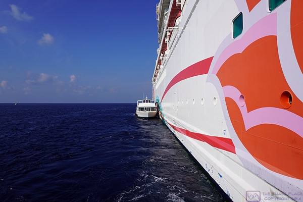
One of the tenders (shuttle boats) tied up alongside the NCL Joy.  Cruise ships are BIG; tender boats are small.

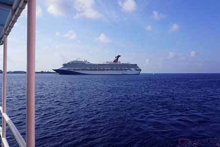
The NCL Joy is joined by the Carnival Glory cruise ship in the harbor.

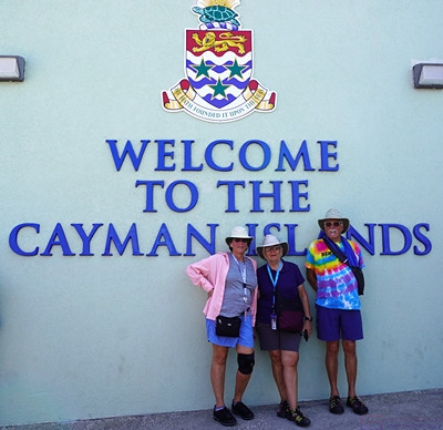
Welcome to the Cayman Islands:  Nancy, Linda, and Paul.

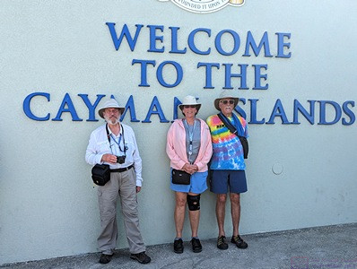
Welcome to the Cayman Islands; Bruce, Nancy, and Paul.


The Cayman Islands in general, and Georgetown in particular, is known for its (offshore) banking industry.  We were here as part of our 2nd Holistic Holiday at Sea cruise in 2013, so we knew the town itself is relatively small, without too much high-rise architecture, and is very walkable, but without very much to see and do.  It seemed unchanged to us since our last visit.  The two most novel things about our time here were:  1) an actual police officer directing traffic, and;  2) the number of cruise ships in the harbor; four at one time (as best I recall).  The Joy departed at 5 PM for the final leg of our journey.


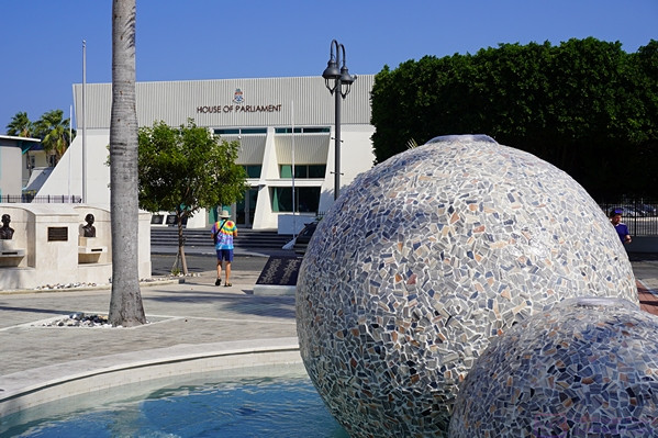
The Cayman Islands Parliament building and part of the plaza that it faces.  A lot of the buildings in Georgetown are white or light colored, so Paul is wearing his favorite tie-die shirt to add a splash of color.

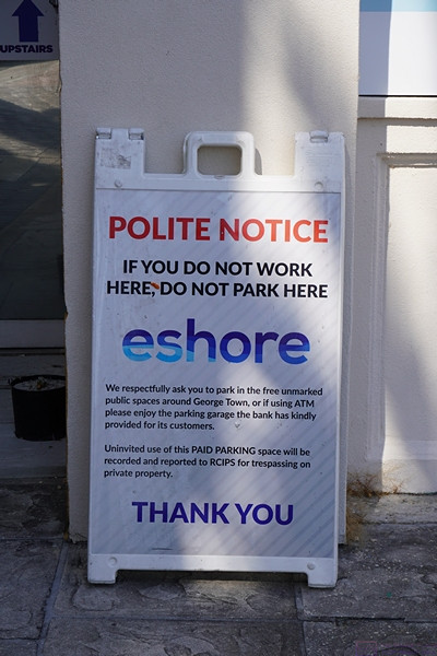
When in Georgetown there isn’t any doubt as to its history and affiliation with England.  Even they way they post “NO PARKING” signs is very polite.

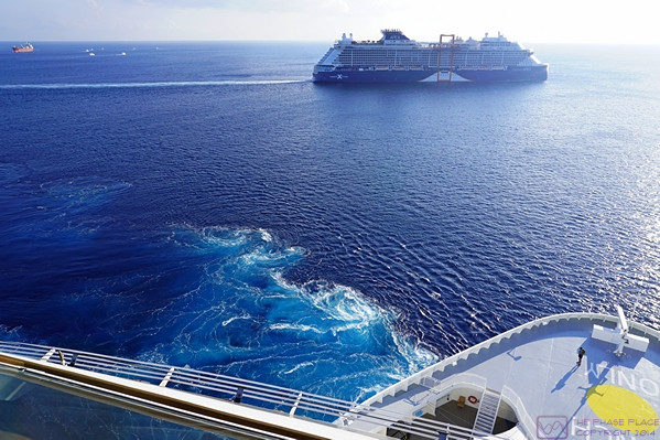
The Celebrity APEX cruise ship (left) has joined the NCL Joy (right) and Carnival Glory (center) in the Georgetown anchorage.  There’s a 4th cruise ship anchored here as well, but not visible in this photo.


In larger ports that can handle multiple cruise ships simultaneously, it’s a bit mind-boggling how many people they can disgorge into a waiting community.  Equally amazing, are the number of businesses (and people) that are in place at each port to service, and indeed depend on, these large number of visitors.  Cruise ships have their purpose, however, and we had thoroughly enjoyed our time on the NCL Joy and the places it stopped.  Perhaps someday we will return to some of these locations on our own, as well as others that our cruise skipped, and stay long enough to get a better sense of what they are really like.  But if not, at least we have experienced them, however briefly, and been keenly aware that we were in places that were very different from where we have spent most of our lives.


The NCL Joy puts its port side bow thruster to work to spin the ship 180 degrees around its mid-point.  Not shown (not visible from our port-side suite baloney) is that the starboard side stern thruster is also being used.

The Celebrity APEX has already completed it’s 180 degree turn and is headed out to sea as our ship completes its turn to do the same.


FRIDAY 10 March – At Sea

We sailed all evening on the 9th, all day on the 10th, and into the early morning of the 11th.  We had our last dinner meal aboard in the Haven restaurant on the 10th.  After dinner, we gave gratuities to the key crew who had made our trip extra special, namely:  Isidro (our Butler), Harold (our Stateroom Attendant), Patrick (the head Haven concierge), and Melody (the Assistant Concierge in charge of the Haven restaurant).  These gratuities were in addition to the ones that all guests pre-pay and are (presumably) divided up (in some equitable way) between the entire crew (except for the butlers and the Haven concierges, as we understood it).  These four people, however, had made our time onboard memorable in the best possible way.

Over the course of the day, I developed an irritated throat that got worse with time and eventually moved to my sinuses.  Not the way I wanted to end the cruise, but there wasn’t anything I could do about it except for symptomatic treatments, until we got ashore in Miami, Florida and back to Paul and Nancy’s place at MOSN in Polk City, Florida.

20230307-08 – Cartagena, Columbia & a sea day

TUESDAY 07 March – Cartagena, Columbia

This post has some narrative along with 22 photos with captions.  ]

After finishing our daytime transit of the Panama Canal on March 6th, we were at sea for the rest of the evening and overnight into March 7th, arriving at the cruise ship dock in the harbor at Cartagena, Columbia around 10 AM.

Our first full view of the harbor area of Cartagena, Columbia in the early morning haze.  We are already past the entrance in the breakwater into the outer harbor but have some ways to go before enter the inner harbor and get to the port/dock.

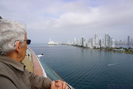
Linda takes in the upscale water-front area of Cartagena as the NCL Joy prepares to enter the inner  harbor.

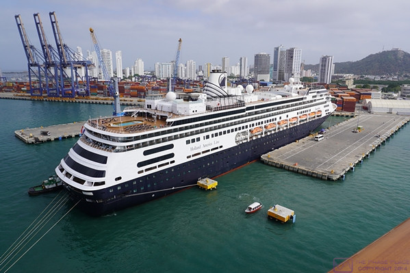
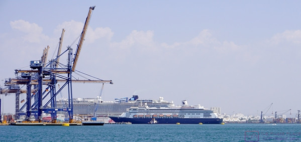
The Holland America Zandam at the cruise ship dock.  We are pulling on the other side of the dock.  The Zandam is a big ship, but is dwarfed by the Joy.

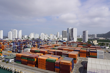
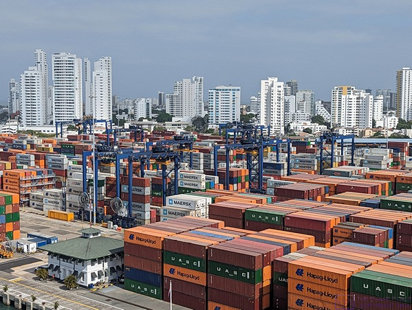
Cartagena is a major shipping port.  This container facility is just one of many that we passed on the way into the dock.


The Zandam, a Holland America cruise ship, was already there when we arrived.  Cartagena is Columbia’s main Caribbean port.  It is mostly commercial, but the Columbian Navy has a base here, and there are marinas for pleasure craft and sightseeing boats.  We were amazed, however, at the number of containers stacked up in the shipyard and the number of gantry cranes that were in use moving them around.  Outside of the commercial and cruise ship docks, however, the city around the harbor is very modern and (we were told) has become a safe, inviting place for tourists.


This photo provides another view of the container shipyard adjacent to the cruise dock/port area, very close to a lot of commercial and residential buildings.  We counted at least 21 of the blue gantry cranes in this shipyard, and it seemed at times that most of them were busy moving containers around.  There was also a constant flow of tractors coming in to drop off or pick up containers.  (Photo by Linda.)

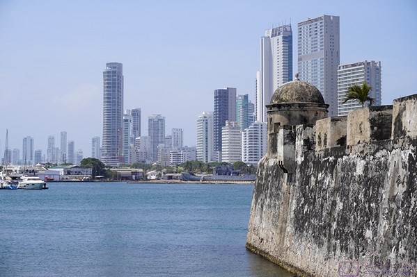
On our bus ride to the Old City, we saw lots of juxtapositions of old and new.  The old stone work in the foreground is 16th century.  The high-rise buildings in the background are late 20th to earl 21st century.

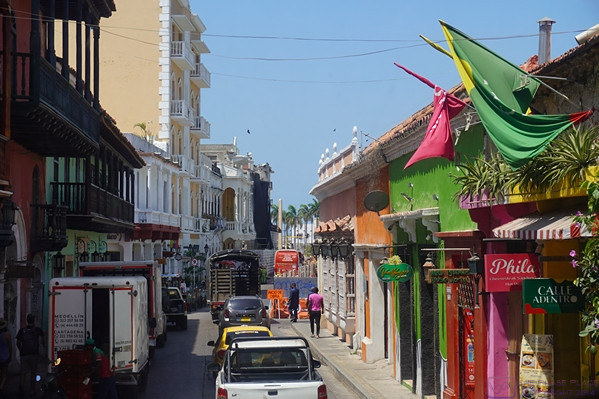
This photo was typical of the Cartagena streets that our excursion bus took to get to the Old City.  While the look and feel of the place was different from what have experienced for most of our lives, it was also fascinating.


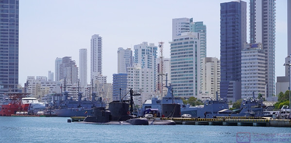
Like Antiqua, Guatemala the Spanish presence in Cartagena dates back to the very beginning of the 16th century.  The Walled Old Town by the sea is still intact, and is another UNESCO World Heritage Site.  The four of us booked a shore excursion that involved a bus ride from the dock to the Old City, a walking tour of the Old City, and then a 1-hour boat ride around the harbor.  As part of the harbor cruise, we got a close-up look at the Caribbean fleet of the Columbian Navy base, which includes two small submarines and a 3-masted sailing vessel named Gloria (presumably for training cadets).  While on our cruise, we watched the Holland America Zandam back out from the dock, turn around and head for the ocean.


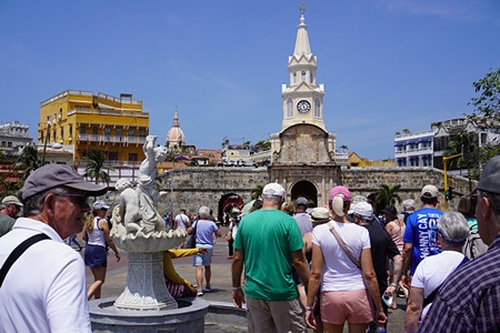
The entrance to the Old (walled) City.  This photo only provides a glimpse into the tourist crowd that awaited us inside the walls.

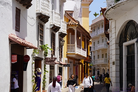
Many of the streets in the Old City were like the one pictured here, running straight for short distances before turning in a different direction.

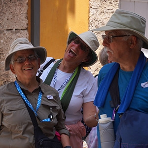
Linda and Nancy enjoying a funny moment.  (They do this a lot.)  Paul is focused on something else.

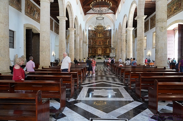
The inside of the Cathedral in the Old City with its massive, carved altar.

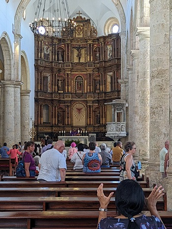
A closer view of the altar with someone praying in the foreground.

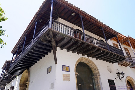
There was a lot of variety in the architecture of the buildings in the Old City so it’s not really possible to say what was “typical.”  This style, however, was in the mix.

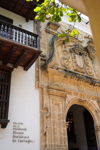
Cartagena was the seat of the Spanish Inquisition in the Americas, and it was administered from this building, now a museum dedicated to this part of Columbia’s history.

The Caribbean fleet of the Columbian Navy is based Cartagena, and moored in plain sight.

The Holland America Zandam backing out of its berth at the cruise terminal.  The NCL Joy is behind it, and difference in size is obvious.

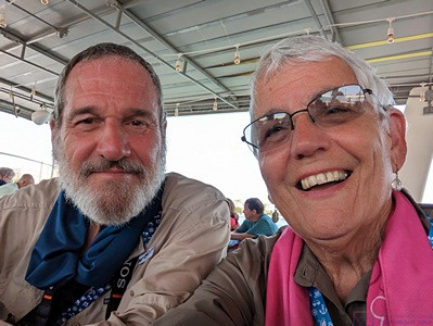
A selfie on the little harbor cruise ship.  It appears that we were satisfied with the experience.  (Photo by Linda.)

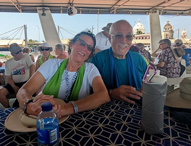
It appears that Nancy and Paul also enjoyed the harbor cruise.  (Photo by Linda.)

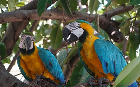
A pair of Macaws at the zoo/shops that make up the entrance the cruise terminal.

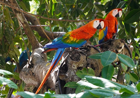
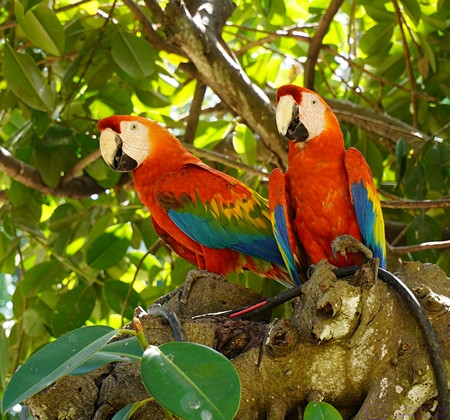
Another pair of Macaws at the zoo/shops terminal entrance area.

The same pair of Macaws as the previous photo.  Such beautiful birds.


Following our harbor cruise, we were bused back to the cruise terminal, which we entered by walking through a small outdoor zoo and then past some gift shops.  Although farther north than Panama City, the climate, even at this time of year, was more tropical – warm and humid – and the birds reflected that.  We were always aware that we were getting a superficial “tourist eye’s view” of Cartagena, but nonetheless enjoyed our brief time in Cartagena, Columbia and felt like this was another port-of-call where an overnight stop might have allowed a closer, more relaxed acquaintance with the place and its people and culture.

The Norwegian Joy left Cartagena at 6 PM and headed for our next port, sailing all evening, all the following day, and overnight into March 9th.


WEDNESDAY 08 March – At Sea

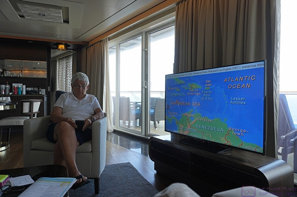
We spent the entire day sailing NNW in the western Caribbean Sea, out of sight of land.  The weather was pleasant with blue skies and water and white, puffy clouds.  The only photo I’ve included shows the monitor in our suite.  Our present location is approximately half way to our destination of Georgetown, Cayman Islands.  The right end of the upper information banner shows that we have sailed 3,767.1 NM (nautical miles) from our starting point at the Port of Los Angeles.  We sailed overnight before finally sighting land around sunrise.


The monitor in our suite showing our current location, heading, and speed, along with other information, including our total distance sailed since departing the dock at the Port of Los Angeles.


While we enjoy seeing land from the ship, and getting off the ship at ports to explore, we also enjoyed our days at sea.  Far from being boring, sea days provided a chance to relax and explore/enjoy the many amenities the ship had to offer.  While cruise ships can take you to amazing places there is no doubt that the ships themselves (and especially the staff) are part of the experience.

20230306 PCC 9of12 – Transiting the Panama Canal

MONDAY 06 March – 51 miles between oceans on a ship

[  NOTE:  Most of this post consists of 36 photos with captions.  This is being posted more than 3 months after the fact – some of the details might be inaccurate and some of the photos might be out of sequence.  ]

Going through (transiting) the Panama Canal was the main reason for going on this cruise, and the experience did not disappoint.  The American Society of Civil Engineers considers it one of the seven wonders of the modern world.  (We have no seen all of the wonders of the world, ancient or modern, so we will take their word for it.)


The NCL Joy moving into the queue for entrance to the southern end of the Panama Canal.

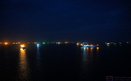
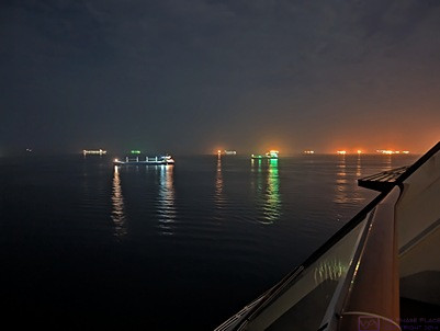
The ocean in the vicinity of Panama City and the entrance to the Panama Canal was crowded with ships waiting to make the transit.  Ships can book a date/time to start the transit, but it is much more expensive than just waiting in line.  Ships with non-perishable cargo and less critical delivery timelines choose to wait their turn and get the lower price.  The fee for the NCL Joy to transit the Canal was approximately $750,000 USD.  The pricing structure for the Canal is very complicated.  (Photo by Linda)

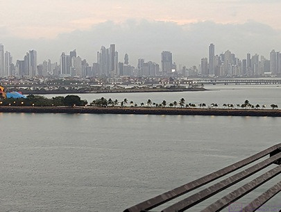
The NCL Joy left the dock at 5 AM to be in position for the 8 AM scheduled start of our transit.  It was dawn by the time we were moving towards the entrance of the Canal and were opposite our starting point.  Part of the Panama City skyline forms the background of this photo, taken by Linda.

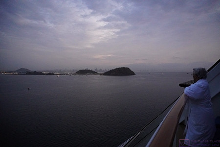
Starting into the marked channel that leads to the Panama Canal.  Our ship was docked in the harbor on the other side of the small hills to starboard (right).

The Norwegian Joy left the dock in Panama City at 5 AM and we were up to see it off.  We spent the entire transit in our front-facing 18th deck stateroom; usually on the balcony.  We even took our meals in our room, one of the few times we took advantage of this perquisite.

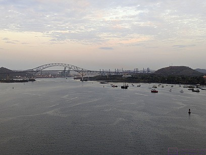
The Puente de las Americas (Bridge of the Americas) ahead.  Channel markers to the left and right of the ship are visible.  The hill on the right had the radio towers/antennas used to communicate with the ships using the Panama Canal.

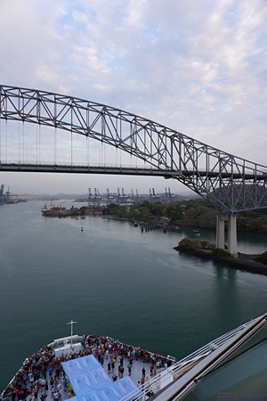
Approaching the Puente de las Americas (Bridge of the Americas).  This bridge is considered the (unofficial?) southern terminus of the Panama Canal.  Note the crowd of guests gathered on the foredeck of our ship.  This area is normally only open to crew, whose quarters are located foreship near this level.

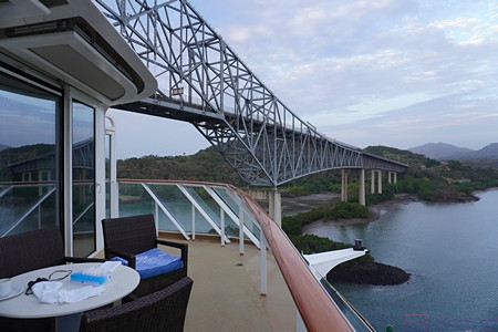
The Bridge of the Americas to port (left) of the ship just after our balcony passed under it.  We are now (officially?) in the Panama Canal, but still some way from the first set of locks.

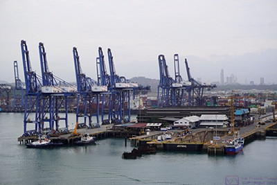
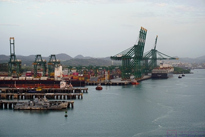
Large commercial/cargo docks to starboard (right).

More commercial/cargo docks to port (left).


Ships transiting the Canal are queued up in the ocean and then proceed along a well-marked channel when cleared in.  The Bridge of the Americas is considered the southern terminus of the Canal and the Puente Atlántico (Atlantic Bridge) at Colon is considered the northern terminus.  Passing under either of these bridges is a cause for celebration on cruise ships.  And so, it was for us too; we finally opened our bottle of “welcome on board” champagne and toasted the moment.

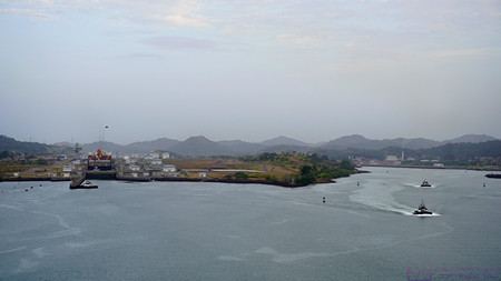
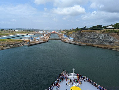
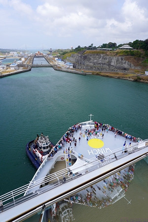
The original 2-flight Miraflores Locks are to starboard (right).  The newer (2016) 3-flight Panamax class Miraflores West (Cocoli) Locks are to port (left).  We used the newer locks as the NCL Joy is too large for the original ones.  Both sets of locks are still referred to as the Miraflores Locks.

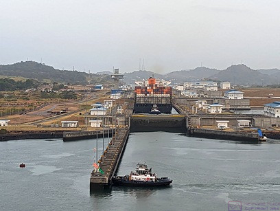
The NCL Joy lined up to enter the Miraflores West (Cocoli) Locks.  The tug boat is positioned to block the Joy from going in yet, and to render maneuvering assistance if/when needed.  (Photo by Linda)

The double lock gates are sliding open so our ship can move from the first to the second/middle basin.  The NCL Joy is just over 1,000 feet long; too big for the older/original locks at either end of the Canal, but much smaller than the maximum 1,400-foot length the new locks can accommodate.  A third phase of lock building is in the planning stages with locks that will accommodate even bigger ships.  (Photo by Linda)

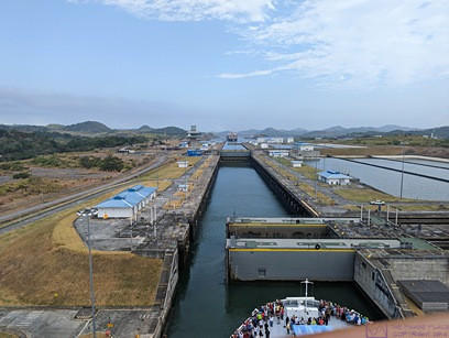
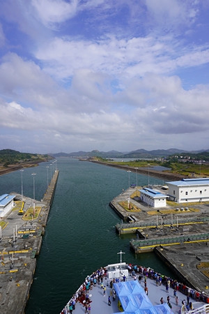
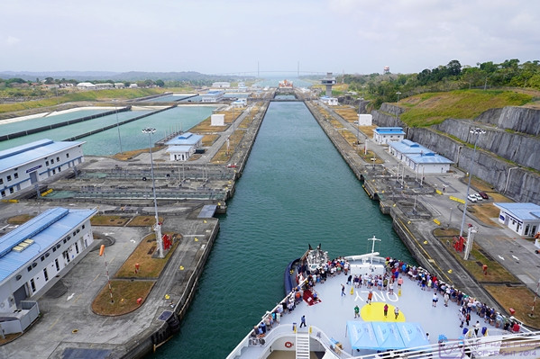
As our ship entered the Miraflores West (Cocoli) Locks, we could see other ships to starboard (right) using the original Miraflores Locks.

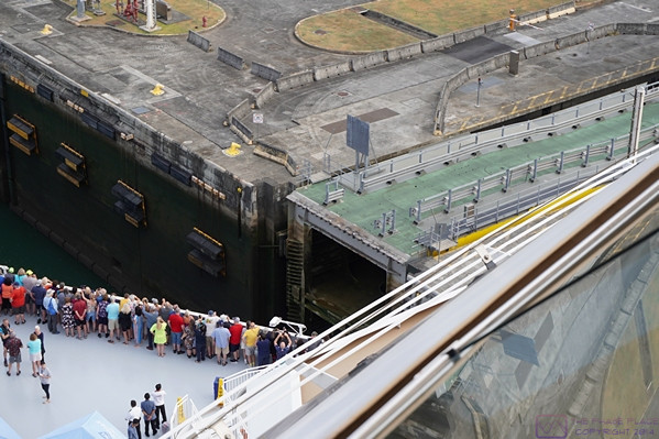
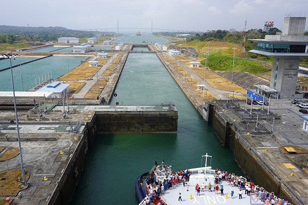
The structure center-right in the photo is the sliding lock gate that will close behind the ship once it is fully in the lock basin.  The green surface on top is a road that allows Canal staff to get from one side to the other (when the gate is closed, obviously).  All of the new locks use these massive sliding gates.  The original locks using swinging gates.

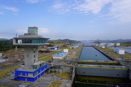
The “Cocoli control tower” for the Miraflores West Locks.  We had one more basin after the one we are currently in.  Each of the basins is an “elevator) that works like a bathtub.  When filled with water any boat(s) in the basin are raised in elevation.  When the water is drained, they are lowered.  When the water level is the same on both sides of a gate, it can be opened or closed, allowing ships to enter or leave the basin.

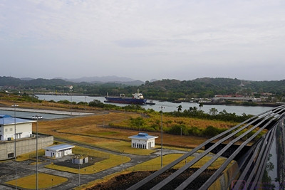
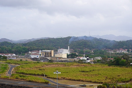
Exiting the last basin of the Miraflores West (Cocoli) Locks northbound.  Miraflores Lake can be seen ahead to starboard (right).  Because of the geology of this part of the Canal Zone, the original southern lock system consists of two flights in the Miraflores Locks and then a single flight in the Pedro Miguel Lock.  The body of water in-between is named Lake Miraflores.  The new West (Cocoli) Locks achieve the change in elevation in a 3-flight (staircase) lock system.  The two channels reunite just north of the Pedro Miguel Lock.


There is a lot of information available online and in books about the Panama Canal.  It’s a long, complicated story, and not a happy one in most regards.  I was glad I had taken the time to read about this before being here (Panama Fever, by Matthew Parker).  The engineering is amazing, and the location is beautiful, but it has a context and only became a reality at enormous cost in money, lives, and political relations with the countries of Central and South America.


The Miraflores Locks Visitor Center and Control Room just left of center in the photo.

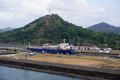
A smaller ship exiting the Miraflores Locks.


Regardless of which way you go through the Canal, the trip begins and ends with locks, three at each end, with Gatun Lake in-between.  The average sea level of the Pacific Ocean end of the Canal is only 20 cm higher than the average sea level on the Atlantic Ocean (Caribbean Sea) end.  Because this difference is so small, the original “vision” for the Canal was a sea level transit with perhaps one lock.  However, the tidal range on the Pacific Ocean end is 20 feet whereas on the Atlantic Ocean end it is 3 feet.  Thus, locks were going to be needed at each end just to account for this difference.  The fact that the Canal also had to cross the Continental Divide, ultimately meant that ships would have to change elevation by even more than the difference in sea levels, and the locks would have to accommodate this difference in elevation.

Gatun Lake is the largest man-made lake in the world, and was formed by damming the Rio Chagres.  The Rio Chagres was a raging river that would rise 20 feet during floods.  It had to be “tamed” (controlled) if the Panama Canal was ever to become a reality.  There are three locks at each end to accomplish the 85 ft change in elevation from sea level to the level of Gatun Lake.  New locks were built at each end, alongside the original ones, to accommodate larger ships and were opened in 2016.  Just north of the southern locks (Miraflores /  Lake Miraflores / Pedro Miguel are the old ones and Miraflores West (Cocoli) are the new ones.  I think Lake Gatun “officially” begins at the northern end of the Miraflores Locks complex.

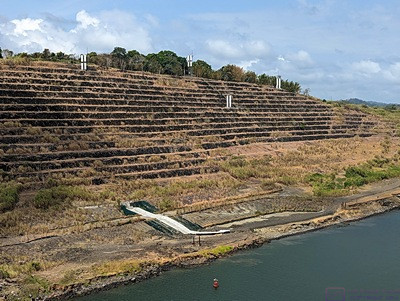
Heading north from the Miraflores Locks area we came to the Culebra Cut.  Generally considered the most difficult part of building the Canal, it is a massively excavated passage through the Continental Divide.  The Canal was taken up 85 feet and through this area as it offered the best chance of actually getting through the divide.

The official length of the Panama Canal is 51 miles, which doesn’t seem like much, but it took the NCL Joy about 9 hours to make the trip, including the locks at each end.  As we sailed under the Atlantic Bridge we (officially) entered the Caribbean Sea (Atlantic Ocean) and continued on to our next port, sailing all night to get there by sunrise.

Following are the bulk of the photos from the transit:


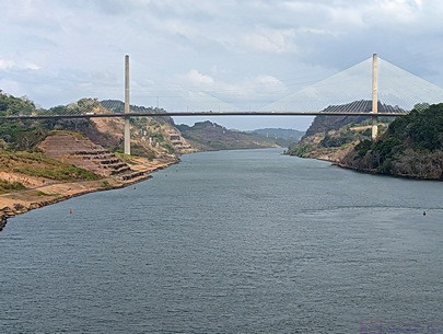
The Centennial Bridge at the Culebra Cut.  (Photo by Linda)

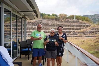
Paul, Linda, and Nancy with champagne glasses ready to toast our passage through the Culebra Cut.  (Linda is holding my glass while I take this photo.)  The “cut” was dug through the Continental Divide, and was the most difficult part of the Canal to create.

The sides of the “cut” are terraced to prevent erosion, which was a huge problem during the excavation of this passage through the Continental Divide.  (Photo by Linda)

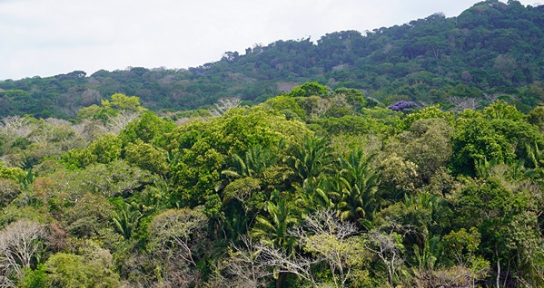
Panama is a beautiful place with lush flora.

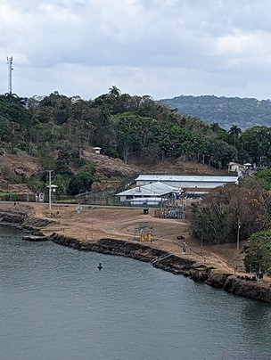
Panama is also a place with a long and troubled history.  This compound to starboard (right) is where Manuel Noriega was held before being extradited to the USA for trial.  (Photo by Linda)

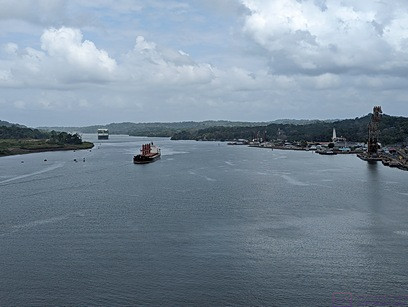
At this point, we are through the Culebra Cut and passing the town of Gatun on the right.  This town within the Canal Zone is the base of operations for much of the Canal maintenance.  Note the massive barge crane at the center-right edge of the photo.  This crane, named Titan (nicknamed Herman the German), is able to lift the older swinging lock gates for repair and maintenance.  A part of the history of the construction and operation of that Canal, Titan was built by Nazi for servicing U-Boats (submarines) during WW II.  At maximum height, the top of the boom is 374 feet above the water.  Like everything else connected with the Canal, it is massive.  (Photo by Linda)

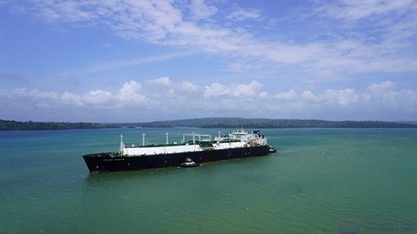
We are passing a southbound cargo ship (tanker?) on Lake Gatun.  (Passing was always portside-to-portside.)  Most of the Panama Canal consists of Lake Gatun.  The lake was formed by a dam on the Rio Chagres near the northern end, and is still the largest man-made lake in the world.

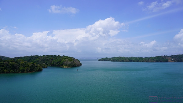
Another view of Lake Gatun.  Channel markers are visible to port (left).  It was a generally lovely day for the transit with a mix of blue skies and clouds.  It was warm, but not uncomfortable on the deck (which always had a breeze from the movement of the ship) and we could go back into the stateroom if/when needed.

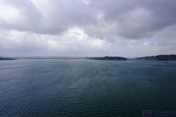
The clouds have filled in somewhat as we approach the northern end of the Canal and the end of the transit.

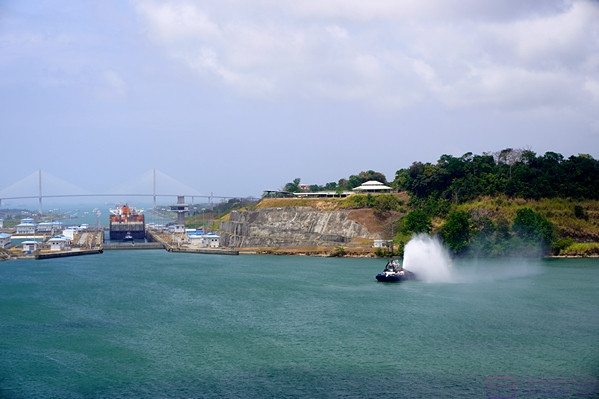
Approaching the new (2016 Panamax class) Gatun East Locks at the northern end of the Panama Canal.  The cargo ship that entered the Canal ahead of us this morning is in the locks.   The original Gatun Locks are off to the port (left) side out of the frame.

A small crowd of guests remains at the bow platform of the NCL Joy as we approached the Gatun East Locks and prepared to be lowered down to the level of the Caribbean Sea (Atlantic Ocean).  (Photo by Linda)

We are now close enough to the Gatun East Locks that a tug boat has taken up position on the port side of the bow to help guide the NCL Joy into the first basin.  (In a Q&A with the Captain of the NCL Joy, he was quite blunt about not needing the assistance of tug boats when maneuvering the Joy at docks, or elsewhere, and found their presence more bothersome than helpful.  I think he felt the same way about harbor pilots.)

As we entered the first basin of the Gatun East Locks, the ponds used as part of the system for emptying and filling the lock basins were visible on the port (left) side of the ship.  These ponds conserve some of the massive amount of water needed to operate the locks, where all of the water to fill the locks flows by gravity.

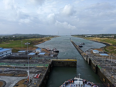
The water level in the first (Lake Gatun) basin has been lowered and the water lever in the second basin raised so that both basins are at the same water level, allowing the sliding gate to be opened so the NCL Joy can move to the second basin.

As the last lock gate opens, the NCL Joy has finally completed its journey from the Pacific Ocean, up and over (through) the continental divide, and back down to the Caribbean Sea (Atlantic Ocean).  It was quite a trip and we certainly had “the best seats in the house.”  (Photo by Linda)

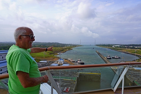
As the NCL Joy exits the last basin at the current level of the Caribbean Sea, Paul points out the Puente Atlántico (Atlantic Bridge) and the Caribbean Sea beyond.

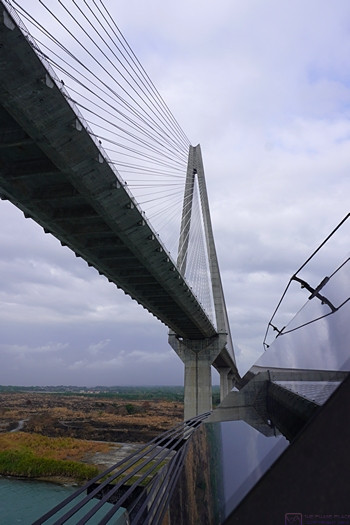
Passing under the Puerto Atlantic (Atlantic Bridge) and into the Caribbean Sea (Atlantic Ocean).


It was around 5 PM local time as we passed under the Atlantic Bridge, marking our transit time at 9 hours.  From here, the ship headed north (N) and then northeast (NE) for a short way  before turning East East North (EEN) on a fairly direct course for Cartagena, Columbia where we were scheduled to enter the harbor around sunrise.


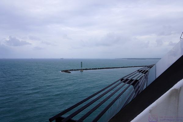
As we pass through the breakwater that protects the harbor at Canal terminus at Colon, Panama we sailed into the Caribbean Sea and points east.