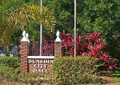
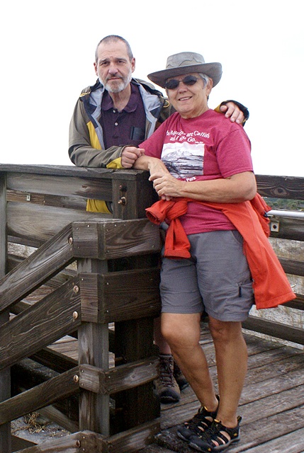
2016/01/11 (M) Jack and Paula
Linda was up at 7:30 AM and read quietly. I got up at 8:15 AM and made coffee. We had granola for breakfast with fresh strawberries which finished the current batch of cereal. Linda got another batch out of the freezer to thaw. We have five batches remaining.
Linda was checking e-mail and noticed that we had been billed yesterday for almost $500 by iPage for web-hosting services. I originally signed up with iPage in January 2013 for three years. I transferred everything over to QTH in August 2013 but did not cancel the iPage account. I did not realize that the account was set up for automatic renewal. I logged in to see if I could close the account and cancel the transaction or initiate a refund but the website just gave me a number to call. I did and finally got to talk to Scott in billing. He was obviously a native English speaker and was able to take care of everything quickly and efficiently and provide a confirmation number. If iPage’s technical/customer support had been that good I might never have switched to a different web-hosting service. I am, none-the-less, very glad that three of the four websites I work with are on QTH.com‘s web-servers and wish that all four of them were. The technical and customer support there is second-to-none.
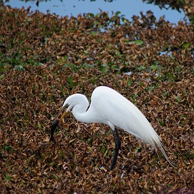
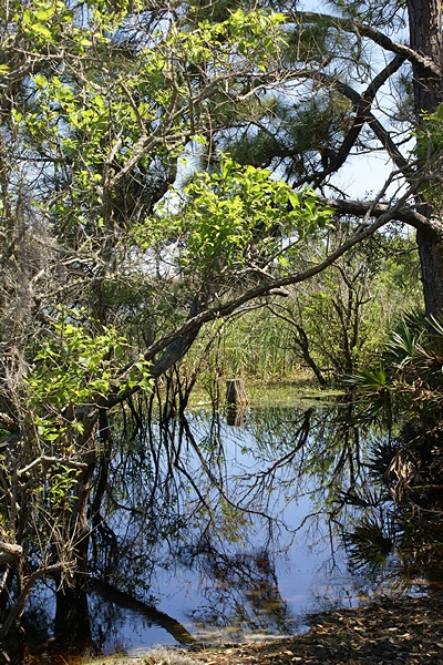
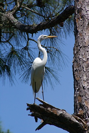
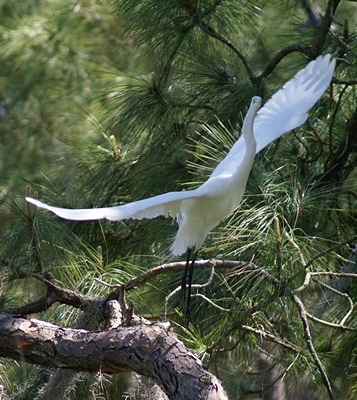
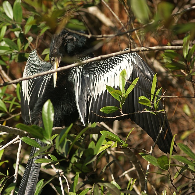
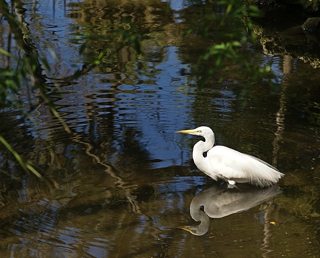
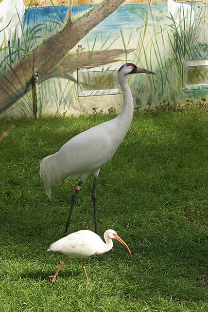
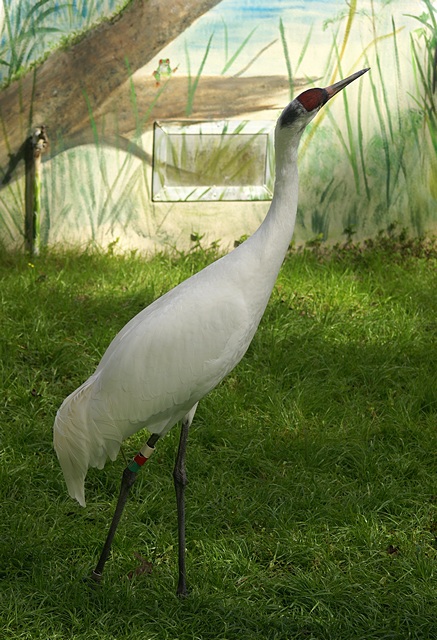
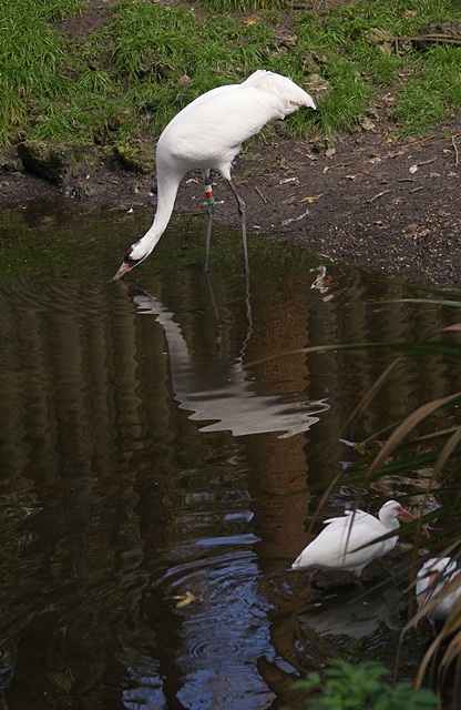
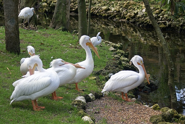
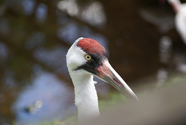
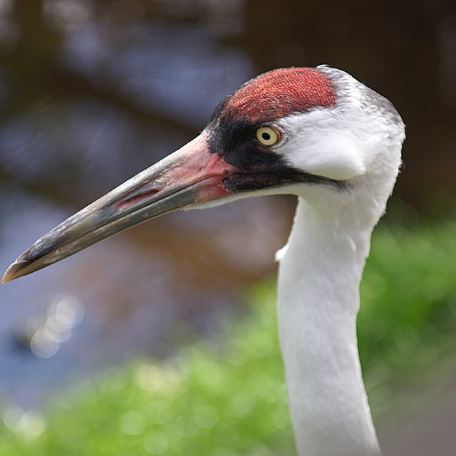
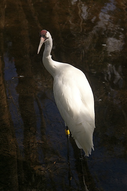
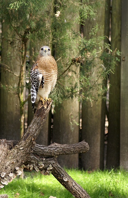
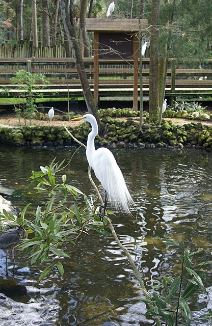
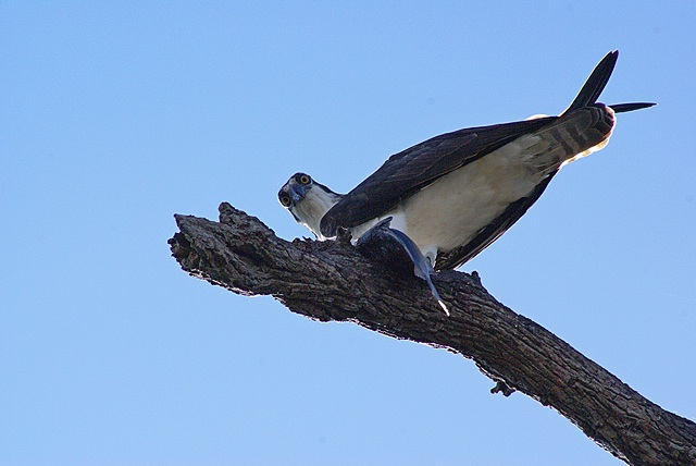
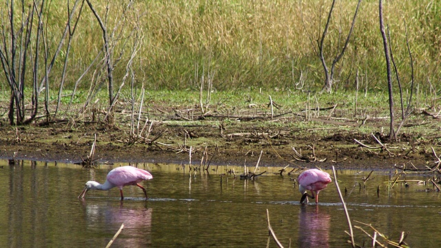
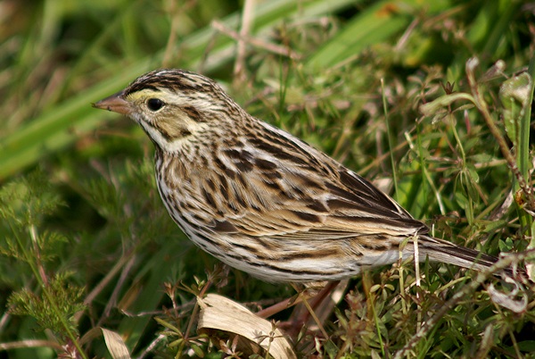
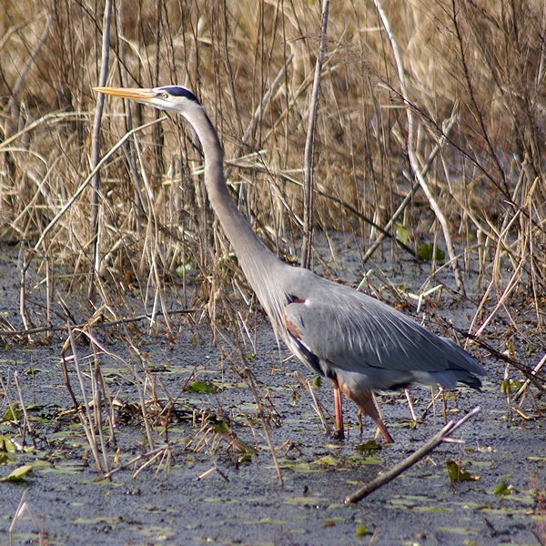
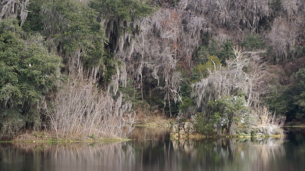
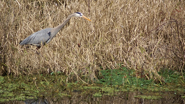
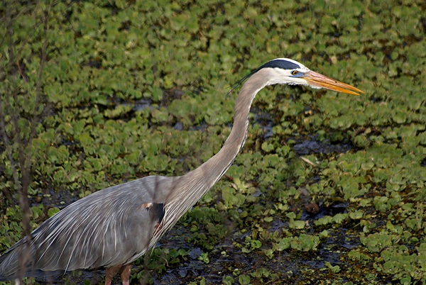
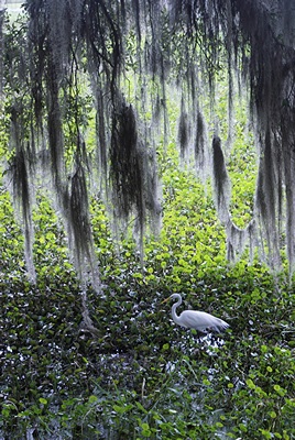
Linda wanted to send another postcard to grand-daughter Madeline so I downloaded the photos I took yesterday and selected one of a heron to use. I post-processed it at several different sizes and copied it to the NAS. She needed it on her iPad, however, so I e-mailed it to her. Even though our iPads (and phones) can connect to our secure Wi-Fi network they are not able to access the network resources such as the NAS and printer. I really should take the time to figure out if there is a way to do that.
On the drive home last night the Honda Element started displaying a message to “Check Gas Cap.” I pulled off the road and checked but it was on tight. The message, however, did not clear. When we got home Linda Googled the message and found several sites that indicated it was a periodic system check and would clear the next time around, assuming the cap was not, in fact, loose. That could take days, however, depending on how much we drove the car. The answer for most of this week will be “not much.”
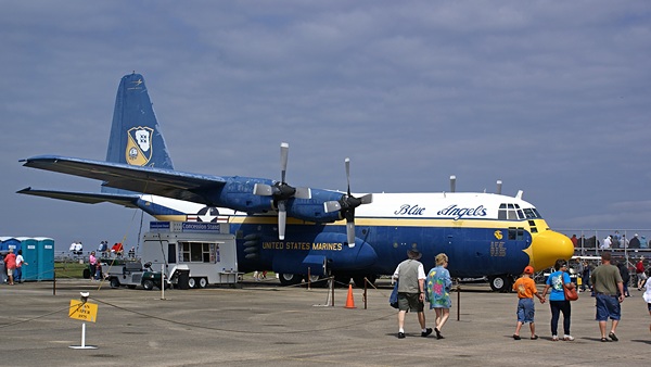
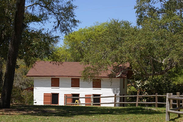
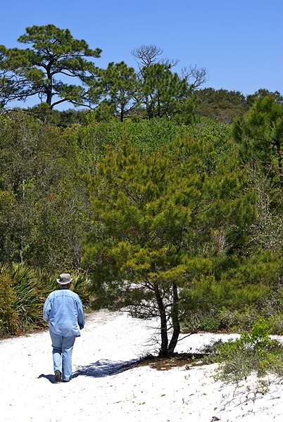
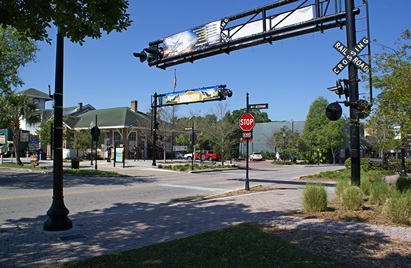
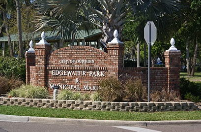
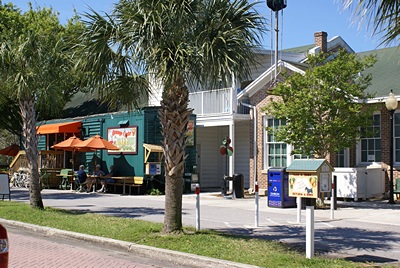
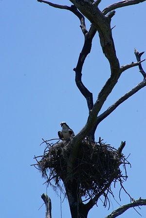
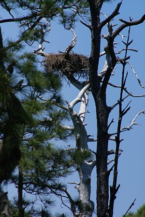
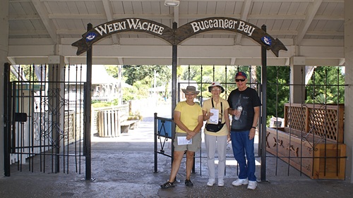
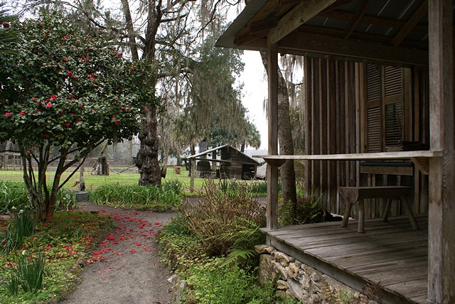
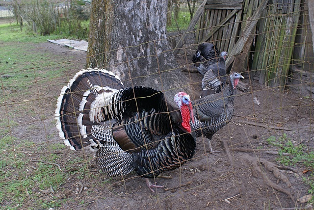
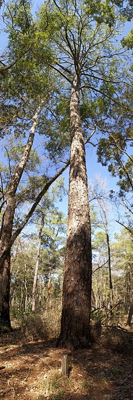
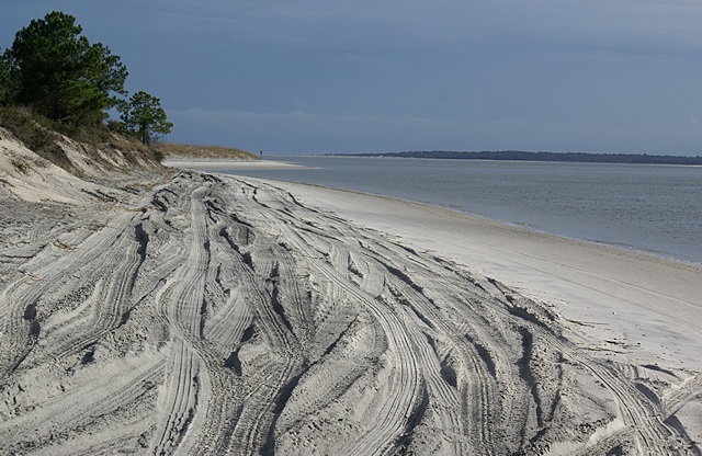
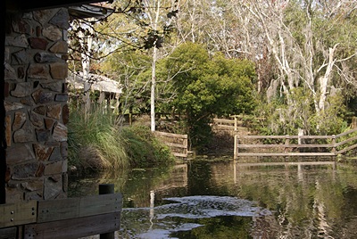
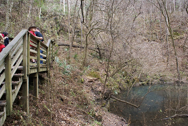
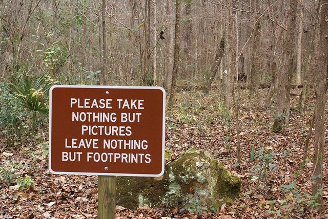
Linda went for a late morning walk. The Element needed fuel so I drove to the Shell station on FL-70 to fill up the tank. Linda had walked to Winn-Dixie and was just returning as I was pulling out so she rode along to the filling station. She ran into Claudine Elbisser at the produce market and found out that she and Paul were still at Jack and Paula Conrad’s place south of town. Jack and Paula started the Arcadia Bussin Rally and ran it for the first 10 years before turning it over to Bill and Brenda Phelan.
Back at the coach Linda heated some Amy’s vegan chili for lunch. She opened a new (sealed) pack of saltine crackers as we like to crumble them in our chili and have a few on the side with vegan butter spread. They did not taste quite right but we were not sure just why. They were not spoiled but it seemed as if they were slightly stale (not crisp) and the flavor was also “off.” They were Publix branded and all of the grocery items we have ever gotten from there have been good quality but we decided to throw the crackers away.
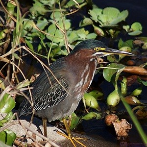
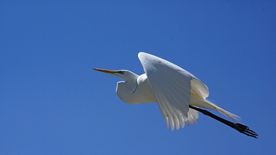
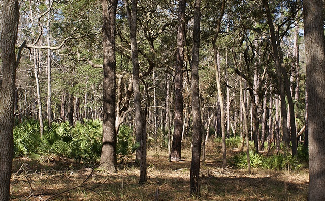
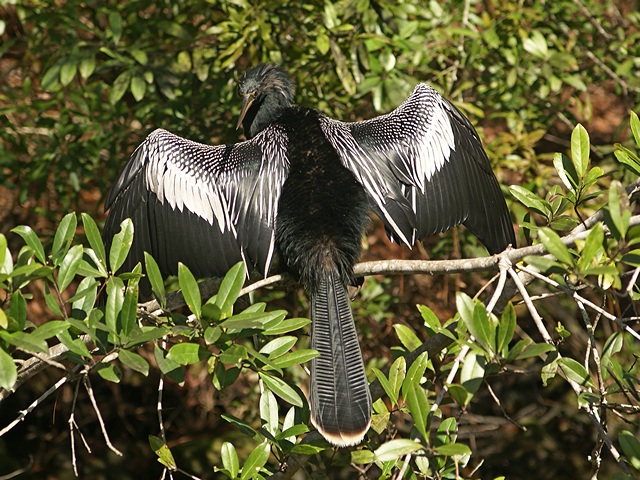
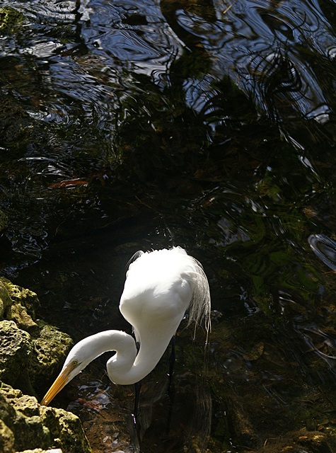
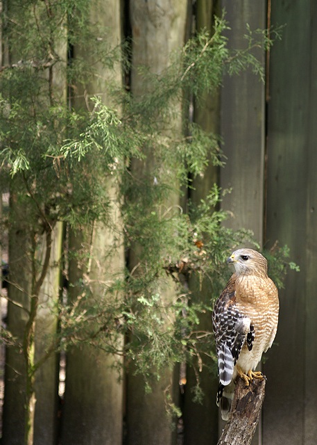
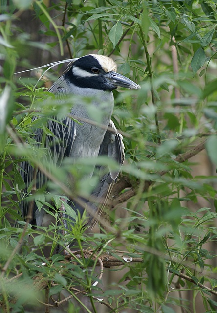
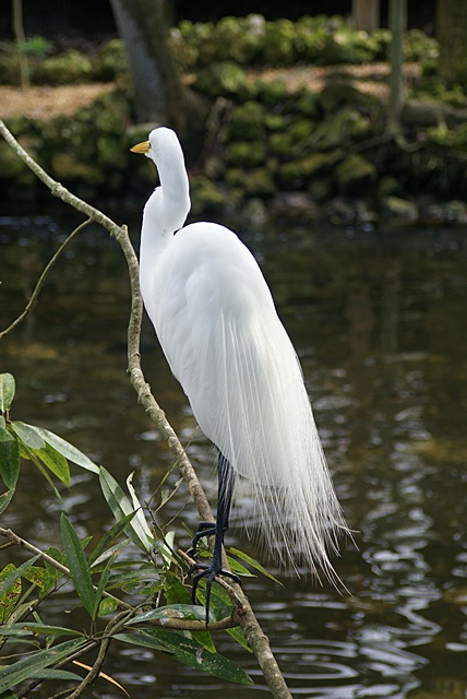
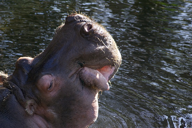
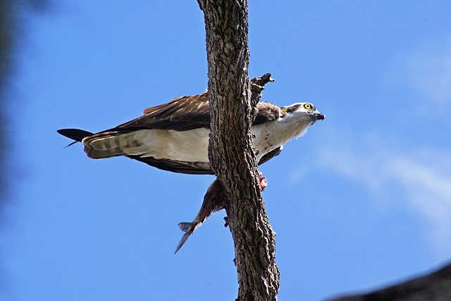
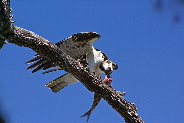
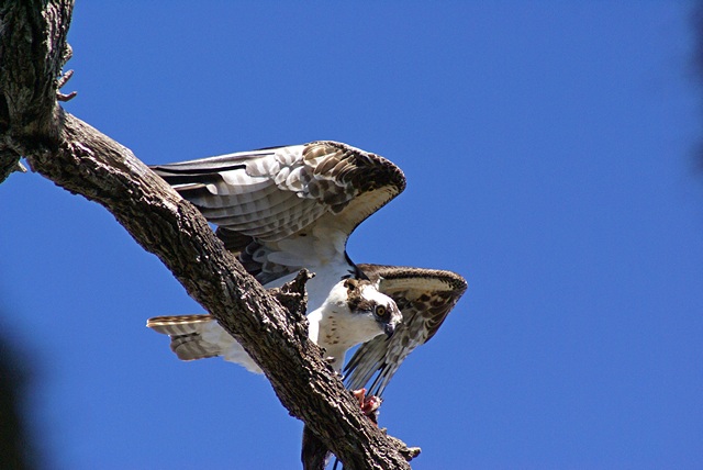
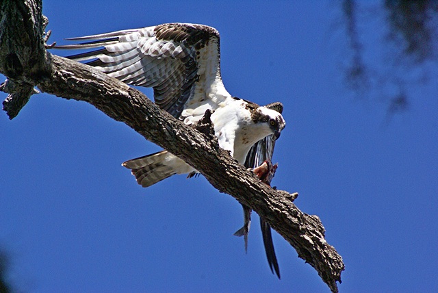
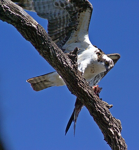
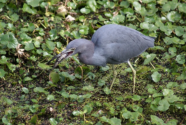
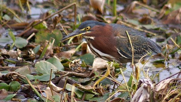
A Green Heron at Myakka State Park, FL.
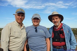
We went for a walk after lunch during which Linda got a call from her sister-in-law, Mary. They agreed that we might do something together tomorrow if Spence and Nancy had not made other plans for them. It was a beautiful, sunny afternoon but cool with highs in the upper 60’s. Rather than sit around the coach I called Jack to see if we could stop by for a visit. He and Paula did not have anything specific going on so we drove to their place about 10 miles south of Arcadia.
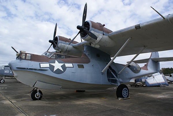
When we arrived we were greeted by Jack and Paula but found out that Paul and Claudine had pulled out this morning, so we did not get to visit with them. We then realized that when Claudine told Linda she had to run “because Paul was waiting for her at Walmart” he was waiting in the bus. John and Lois Vickrey were there, however, and the six of us had a nice visit. There were two other converted buses at the Conrad’s but the owners were not around. We did not recognize their names but both coaches were at the Arcadia Rally 2016 and we would probably have recognized them on sight.
By 4:45 PM the sun was low in the sky and the temperature had dropped into the low 60’s. We were getting cold so we excused ourselves and left. We stopped at Walmart on the way back to our RV resort for a box of angel hair pasta and a box of Nabisco saltine crackers. Back at our coach I closed the two roof vents and we closed all of the windows. I checked e-mail and Linda started working on dinner.
She started with a nice salad of baby kale, scallions, olives, and pumpkin seeds dressed with balsamic vinaigrette. The main course was angel hair pasta with a vegan mushroom cream sauce. She used the Miatake mushrooms we bought yesterday at the Farmers Market in Punta Gorda. It was outstanding and we really liked the taste and texture of the mushrooms, which were a new culinary experience for us.
We went for our usual after-dinner stroll around the resort and stopped by the activity building where lots of residents were playing bingo and smaller groups were playing cards and games. In another building a dozen men were playing pool. It was a beautiful clear night with the constellation Orion rising in the eastern sky. Although the air temperature was crisp folks were out walking, just like us.
Back at our coach we settled in to watch our usual Monday night TV programs (CBS). They were all re-runs, which we thought was odd, but we watched them anyway. We were off to bed at 11 PM and straight away to sleep. I turned on the electric heater pad and set it on 3. Toasty.
2016/01/12 (T) Myakka River State Park (FL)
The overnight low temperature was 47 degrees F; not cold enough to warrant turning the heat on in the coach but cold enough to cool off the interior by morning. We pulled up the blankets when we went to bed and I turned on the electric heater pad on my side of the bed; a more efficient use of energy than heating the whole coach. As a bonus, the cooler the coach the less the refrigerator runs, although the new one is much more efficient than the old one. When it gets cool enough in the coach Juniper (the cat) gets under the covers between us and puts her head between our pillows. She is such a princess.
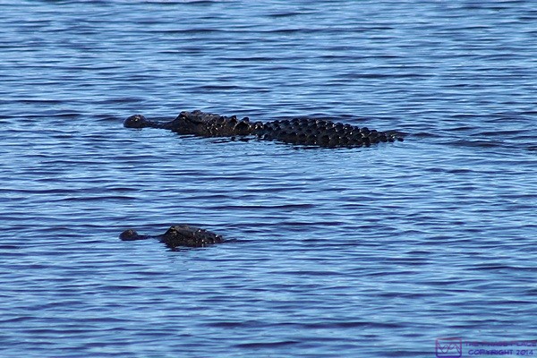
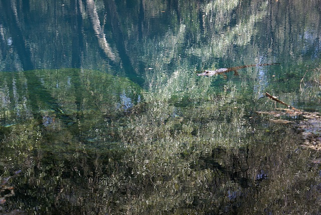
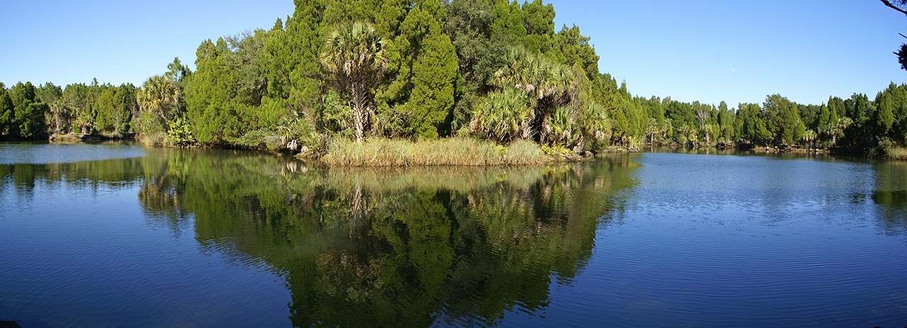
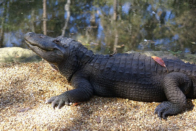
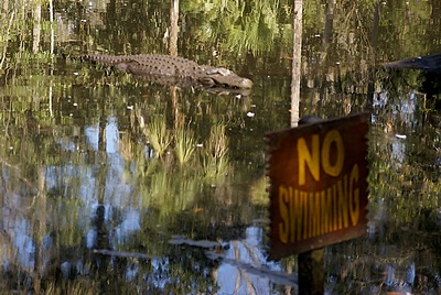
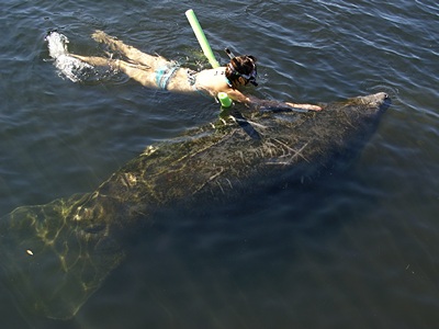
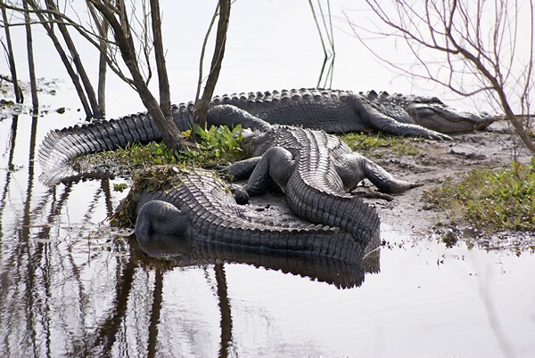
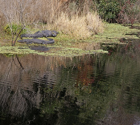
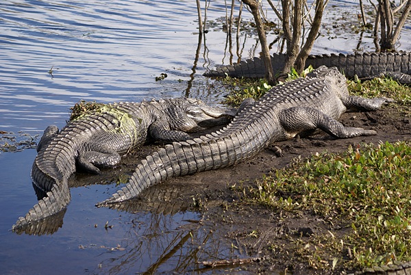
A pair of alligators in the Myakka River, Myakka SP, FL.
We finally got out of bed at 8:15 AM and slipped into out sweats. I made coffee while Linda talked to Kathi at the bakery back in Michigan. We doodled on our iPads while we drank our coffee and let the coach warm up. By 9:30 it was 72 inside. I turned off the heaters and we sat down to a breakfast of homemade granola with blueberries and bananas and a small glass of orange juice. We doodled for another half hour after breakfast and then got dressed. In preparation for meeting Linda’s brother, Ron, and his wife, Mary, at Myakka State Park at 11 AM Linda made a picnic lunch and I got the camera gear ready to go.
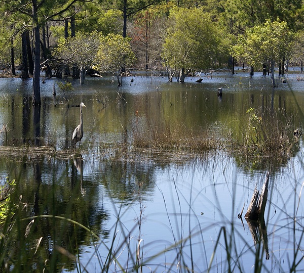
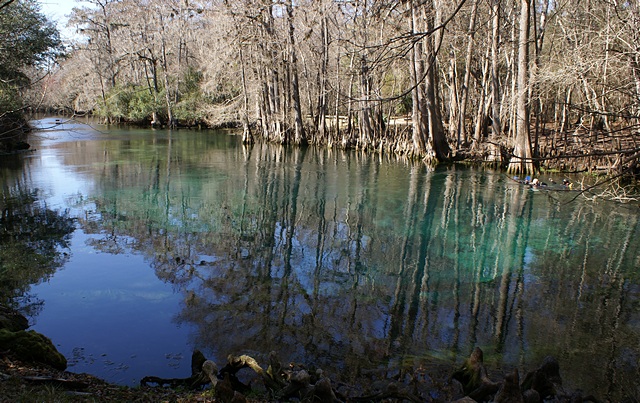
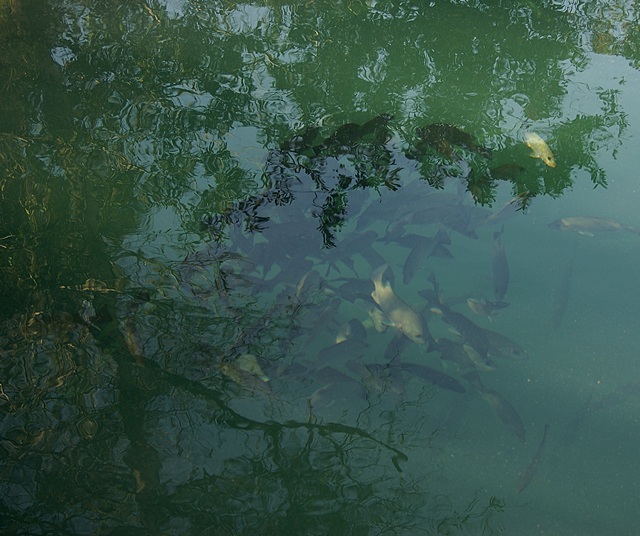
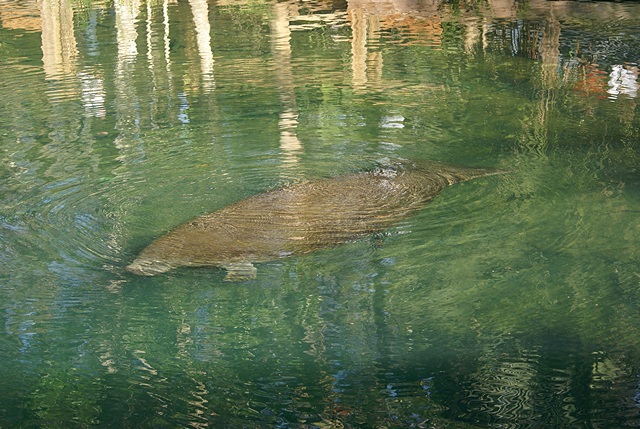
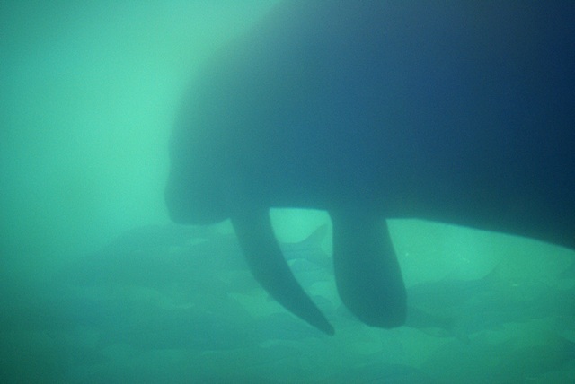
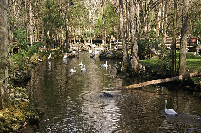
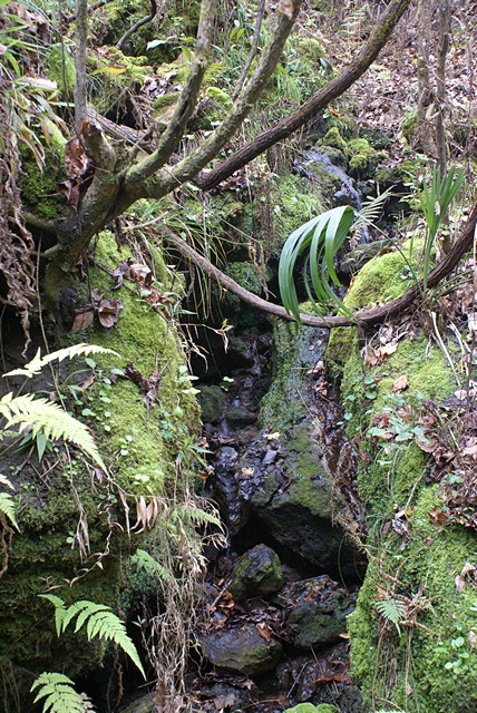
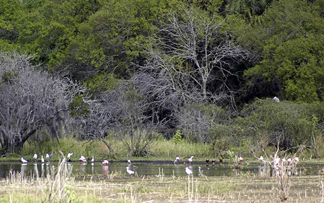
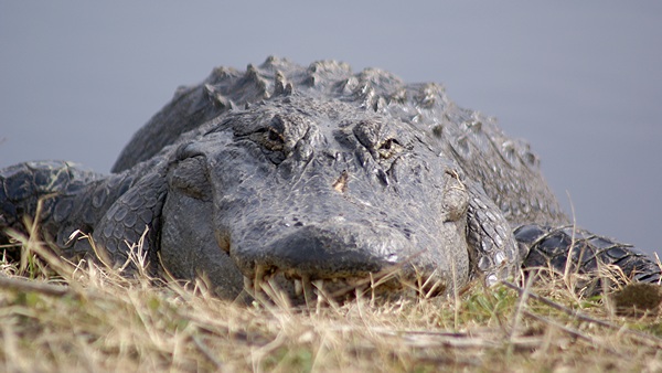
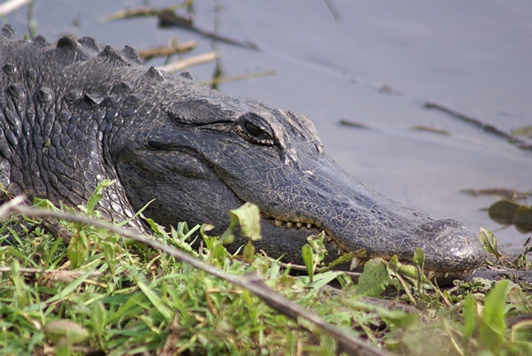
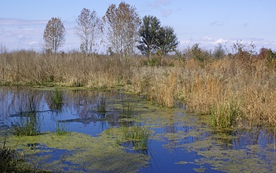
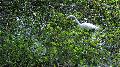
We had planned to be on the road by 10:30 AM but actually left at 10:39. The 29 miles to the park entrance was not all 60 MPH, so we did not get to the visitor center until 11:20 AM. Ron and Mary were already there waiting for us. We looked at maps and discussed what we wanted to do. Ron and Mary wanted to see alligators in the wild, so they had come to the right place. The main park road crosses the Myakka River about a mile into the park from the entrance / visitor center with parking at both ends of the bridge. We knew from our visit two years ago that this was an excellent place to see alligators, as well as a variety of birds and so it was again today. After spending some time on the bridge we walked along the south/east bank of the river and found two more alligators sunning themselves on the opposite bank.
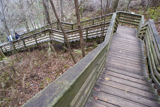
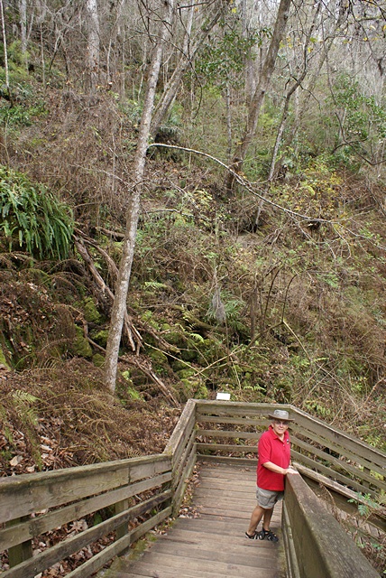
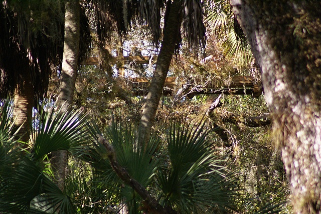
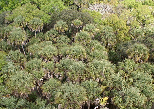
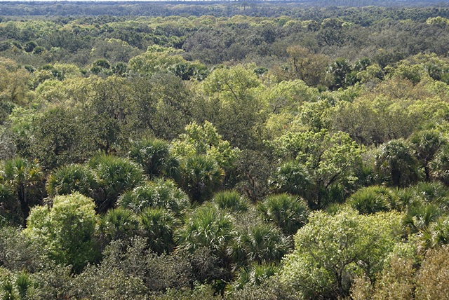
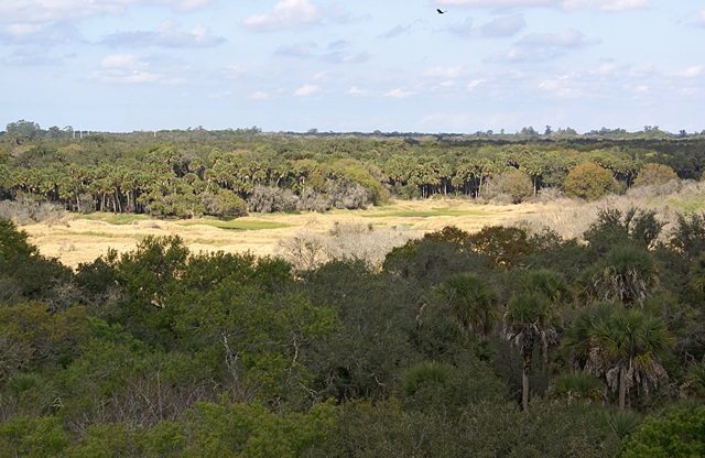
A little farther down the road was the parking area for the Canopy Walk and Nature Trail. We climbed the tower, walked across the suspension bridge, and then climbed to observation deck at the top of the second tower. The suspension bridge goes through the forest canopy about 35 feet in the air and affords a view of the forest that most of us rarely see. At 76.1 feet AGL the observation level put us well above the top of the trees with a commanding 360 degree view of the park and beyond. I shot a nine frame panorama from west through north to east.
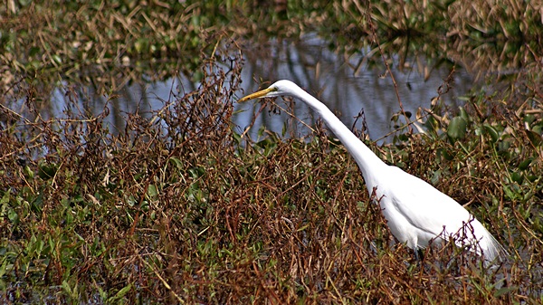
By the time we got back to our cars we were all ready for lunch so we drove to the developed area on the south shore of Upper Myakka Lake. This area has one of the two campgrounds, a boat ramp, air boat tour concession, restaurant, restrooms, picnic tables, and a trail that leads out to a platform where the lake flows out and becomes the river. We found a picnic table in the sun near the shore and had our PB&J sandwiches, oranges, pretzels, and water. After lunch we walked out to the platform and were rewarded with more views of wildlife.
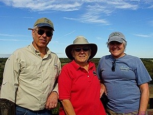
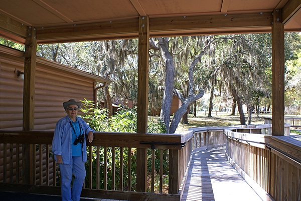
Ron, Linda, & Mary atop the 76.1 foot observation tower, Myakka SP, FL.
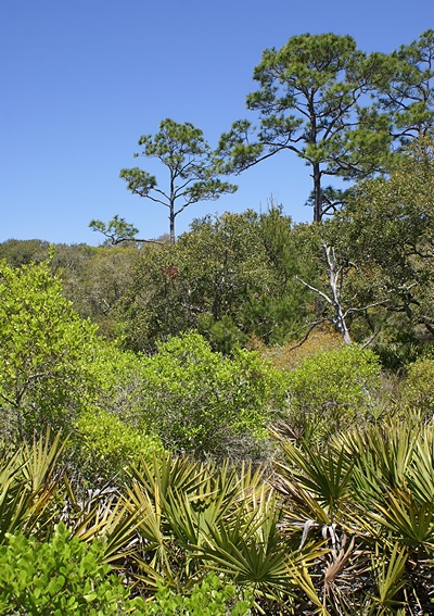
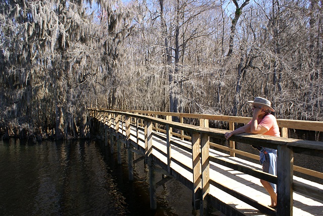
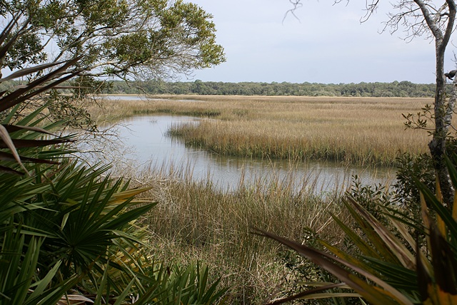
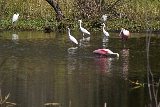
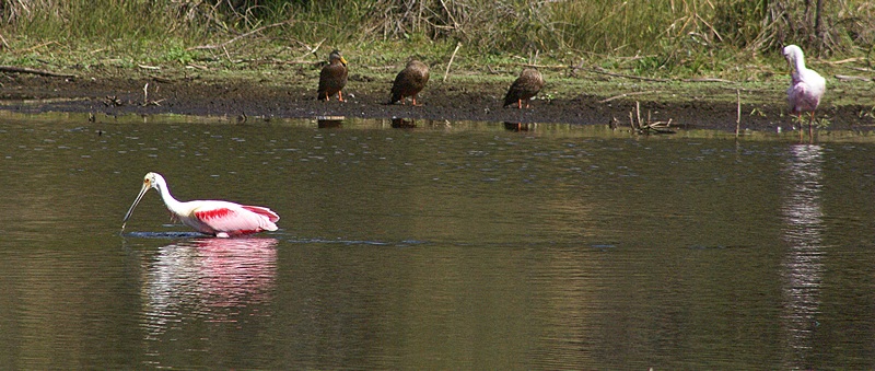
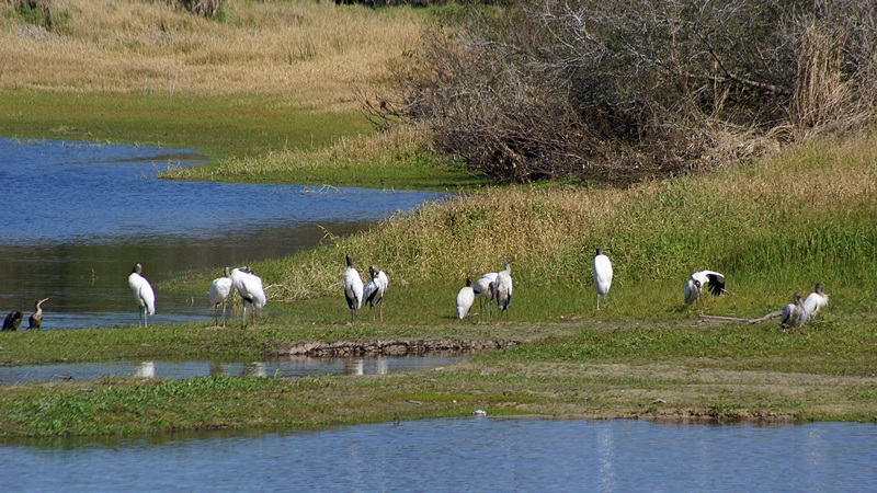
Our next stop was the “Birdwalk,” an elevated boardwalk near the northeast corner of the lake that goes out into an open harsh and gets people close to the shore. There was lots of wildlife out there but most of it was some distance away. A sign indicated that the donation box was to raise money to build an observation tower at end of the boardwalk above the existing viewing platform.
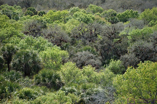
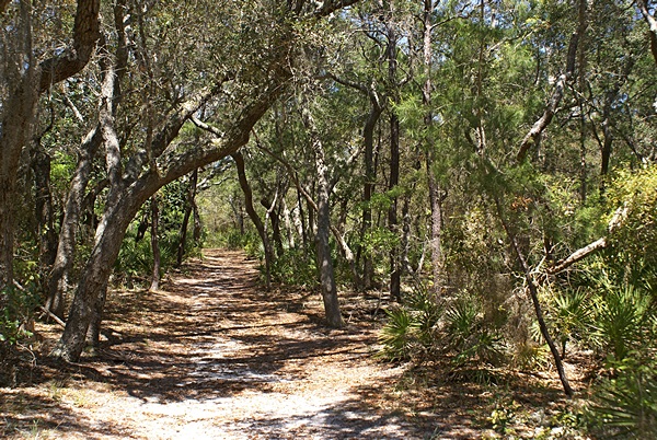
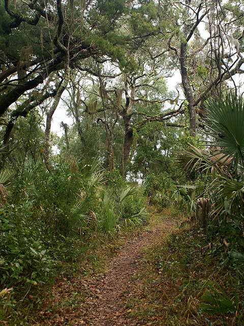
Our final stop for the day was the parking area for a trailhead in the northeast corner of the park. The main trail led to primitive campsites as much as 10 miles away. We did a loop of about 2.5 miles (by my estimate). Although the entire trail (park) was level terrain the footing was rough or soggy in places. Portions of our hike were through the forest and the rest was through prairie. It was our most vigorous hike of the day and I did not take any photos even though I carried the camera along.
By the time we got back to our cars it was 4:45 PM. The sun was low in the sky and the temperature had dropped. We discussed our plans for Thursday and then headed our separate ways. We had just left the park entrance and headed east on FL-72 when I spotted a group of 6 to 8 feral hogs on the north side of the road by a stream about 100 feet from the road. Linda did not spot them in time so I turned around and went back. As I slowed down they took off but Linda got to see them. I turned around again and headed towards Arcadia. Less than a mile down the road I saw four more in the ditch just off the north side of road. They were very large adult animals.
We were back at our coach by 6 PM and had left over Asian salad for dinner. It had been a slightly more physical day than normal so after dinner we settled in to watch our Tuesday evening TV programs on CBS.
2016/01/13 (W) Coffee Clutch
Today was our second Wednesday at Big Tree RV Resort. The only significance to that factoid is that Wednesday morning is the weekly resort coffee. As new arrivals in the resort we received a coupon for free coffee but forgot to go last week so we made a point of getting up and going this morning. The coffee starts at 8 AM but we had been “advised” by folks to arrive early if we wanted a seat. We got there around 7:50 AM and the place was packed. We got in line to get our coffee and found out that today’s gathering was sponsored by an insurance agency and was free of charge. We found seats and made the acquaintance of the people sitting near us.
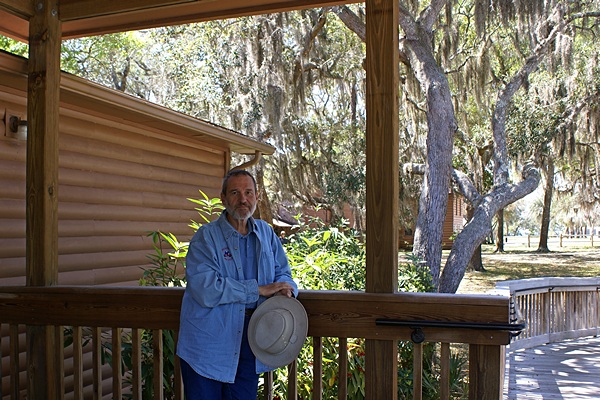
Ron, Mary and Me atop the 76.1 foot observation tower, Myakka SP, FL. (Photo by Linda)
This was not a coffee clutch where folks stand around, mingle, and chat. There are somewhere between 700 and 800 people in this park and I estimated that at least 400 of them were present at the coffee. Everyone was seated on both sides of long tables for the entire duration of the coffee, which lasted until 9:15 AM. It was very organized and consisted of introductions, lots of announcements, lots of door prizes, and a 50/50 drawing. For the seasonal and permanent residents the information is probably useful, but it was not that interesting or useful to us. We might go one more time just to take advantage of our free coffee coupon but the nature of the gathering won’t afford us any opportunity to meet people and talk to them over coffee so we probably won’t make a priority of going.
Today was laundry day for us. Linda needed a few things from Winn-Dixie, including a few Powerball lottery tickets, and walked down to get them. I gathered up the laundry, sorted it by color and temperature into three batches, and drove over to the laundry room in the activity building. The washing machines only took about 25 minutes so I stuck around until they were done. After getting those loads into dryers I went back and got the bedding, returned to the laundry room, and put it in a washing machine. I took my iPad with me but ended up in a conversation with a few folks. By the time I was done with the laundry and back at our coach it was 2 PM.
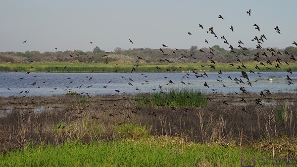
A flock of birds takes flight at the north end of Upper Myakka Lake, Myakka SP, FL.
I took a long a long nap during which Linda went for a long walk, prepared ingredients for tomorrow’s lunch, and worked on her counted cross-stitch project. I finally got up just in time for dinner. After dinner we watched a fascinating documentary titled “Autism in Love” as a result of which we did not watch Nature. We did, however, watch NOVA. It was also a fascinating program exploring new discoveries and understandings about the role and relationship of minerals in the origin and evolution of life on earth.
I watched some of the evening news on channel 11-1 and also checked the weather on channel 11-2. A strong low pressure system was moving east from New Orleans across the Florida panhandle with strong storms coming ashore in that area. A long, comma-shaped cold front extended from the low far down into the Gulf and was advancing on the peninsula. It was forecast to come ashore starting north of Cedar Key after midnight and then progressively affect all of the shore communities south to Marco Island with strong thunderstorms along the front and a low possibility that some of them might become severe. Rain, possibly heavy, was due in Arcadia starting around 4 AM and getting heavy by 5 AM. Knowing this obviously doesn’t change whatever is going to happen, but knowing what is expected allows us configure the coach properly and to be prepared and react appropriately to events as they unfold if needed.
2016/02/14 (R) Ron and Mary
We were up by 7:30 AM this morning, had showers, got dressed, and had breakfast. Linda finished food preparations for lunch today and then straightened up the inside of the coach while I dumped the holding tanks and filled the fresh water tank.
I was outside a little later in the morning and learned from a neighbor that the sewer line that services row K (where we are parked) had developed a blockage and sewage had “backed up into a couple of rigs.” No one, however, was able/willing to be more specific than that. A plumber was called and I chatted with him briefly when he arrived. He confirmed that the sewer line ran from our end of row K south towards the front of the park by Hwy 70. He determined quickly that there was indeed a blockage and I learned from him later that it extended along a considerable length of the sewer pipe. This was not the first time he was called to deal with this and was able to get the drain line opened up.
Piecing together the available information I figured it was entirely possible that the sewage that backed up was from our tanks but that the blockage was not something we caused. Linda, however, was of the opinion that the plumber had been summoned before I dumped. Regardless, I’m sure it was unpleasant for those who were affected and I hope we do not have a repeat of this situation while we are here. While in no way our fault, we would hate to have contributed to the situation in any way, however inadvertently.
My reasoning was that we are the second rig from the far end of the drain line and the tops of our waste tanks are almost 4 to 5 feet above ground level. The tanks are large and if they were near full would release a considerable volume of effluent with a significant head pressure. If the drain line was mostly constricted (reducing its available volume), and the blockage was not very far down stream (also reducing its available volume), the weight of the contents of our waste tanks could cause the drain line to quickly fill and then force the effluent up through any available path, such as another rig’s dump hose. This would continue until the levels reached equilibrium.
In a trailer with its floor not that far off the ground sewage could, hypothetically, back up into waste tank(s) and then into the toilet and/or sinks. None of that would happen, of course, unless the dump valves on the other RV(s) had been left open. We have always been told that leaving the dump valves open on an RV is a very bad idea but the reason is that getting a good, thorough, dump requires a nearly full tank. Today’s events have given us additional reason to keep the valves closed except to dump.
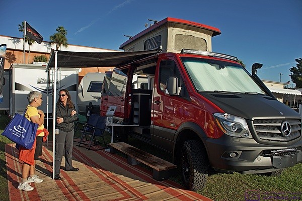
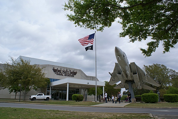
Now that’s what I’m talking about! We have got to get one of these. A 4-wheel drive, Sprinter-based Class B conversion from Sportsmobile as seen at the Tampa RV Supershow, Tampa State Fairgrounds, Tampa, FL.
Ron and Mary arrived a little after 11 AM. We gave them a tour of the interior remodeling work we have done and then sat and visited. Eventually we were hungry and spread the tablecloth on the outside picnic table and had lunch out there.
After lunch Ron drove us to Joshua Citrus a couple of miles south of our resort where we bought a variety of citrus fruit. We then drove to downtown, parked, and walked around poking our heads into some of the antique shops. Mary was looking for a pair of clear glass lamp chimneys with a 2″ diameter base. The closest she came was a pair with a 2-1/4″ base. Apparently 3” diameter bases are common, 2” diameter bases, not so much.
We returned to the coach for a while and then took two cars and went to El Pirata for dinner. It was our first time there although friends had told us it was OK and it was the #4 rated restaurant in Arcadia. Linda did not care for her margarita and also did not care for the veggie fajitas or any of the sides that came with the dish. I had Dos Equis Amber in a bottle, so it was fine. I thought the food was OK; not outstanding but not disagreeable, so perhaps she just wasn’t in the mood for Mexican food tonight.
The restaurant wasn’t full so we lingered and chatted for quite a while but eventually it was time to leave. We were only a few minutes from home but Ron and Mary had an hour’s drive to get back to Spence and Nancy’s place. Back at our coach we settled in to watch our usual Thursday evening CBS TV programs and then headed off to bed as we planned an early departure tomorrow morning to get to the Tampa RV Supershow.
2016/01/15 (F) Tampa RV Supershow
As forecast, the rain started around 4 AM and by 5 AM was fairly heavy. I was not, however, aware of any lightning, thunder, or strong winds. We got up at 7:30 AM, got dressed, and had some of the Honeybelle tangelos we bought yesterday. Honeybelles are only available for about a month starting this time of year and are highly touted so we bought a quarter-Bushnell bag. We were, however, quite disappointed in their taste and texture. We will eat them anyway, of course, but they will not be the treat we were counting on.
We planned to leave at 8:30 AM to drive to the Florida State Fairgrounds for the Tampa RV Supershow. It was still raining and was forecast to continue through the morning. I took the vertical grip off of the Sony SLT-a99v to lighten it and make it easier to carry in the Cotton Carrier camera harness/holster. I packed a couple of extra batteries, we took our raincoats, and headed out.
We encountered very heavy rain between Arcadia and Tampa, especially along FL-70 between Arcadia and I-75. We arrived at the fairgrounds around 10:15 AM, got our tickets, and made it into the Expo hall just as another heavy band of rain moved through.
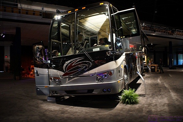
A Prevost H3-45 VIP conversion shell on display at the Tampa RV Supershow. The driver side of the coach is elevated on ramps and mirrors on the floor allow show attendees to see the underside of the bus.
Just inside the door to the right was the major display of Prevost bus conversions and to the left was a major display of Airstream trailers and Class B motorhomes. We crossed paths with Steve Zigler, Prevost Sales Manager for conversion shells and chatted briefly. We met Giesle from the home office in St. Claire, Quebec and also met Melanie from Millennium Coach. We found out from Melanie that Millennium is now the primary corporate support for the Royale Coach Club. Apparently Liberty Coach took over sponsorship when Royale Coach folded around 2005 and Millennium took over from Liberty some time more recently. We were members at one time but have not paid dues in several years.
The Prevost coaches were one of the main things we came to see and meeting people from the company was a bonus. Our other objective was to check out all of the parts and accessories vendors, of which there were many, and RV Parks and Resorts, of which there where an equal number. We mostly picked up literature until we found Bill and Brenda Phelan’s booth. One of their products is tire covers made from heavy nylon mesh material. It blocks most of the sunlight while allowing moisture to escape. We have meant to get tire covers for years but never have so we ordered six in a dark brown material. They are a significant purchase, but not compared to the tires they are designed to protect. They will make the covers based on our tire size and ship them to us. They also make nylon mesh windshield wiper covers but I need to measure the length of our lower wiper blades and send Brenda the measurement. Another product of theirs are windshield and side window covers. These, however, are custom made on site.
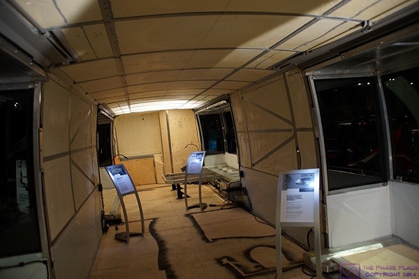
The interior of the Prevost H3-45 VIP motorcoach conversion shell. This coach was actually in the process of being converted by Millennium for a customer. Note the interior layout marked out on the floor.
In the other vendor building we stopped at the booth for Williston Crossings and Belle Parc RV Resorts. Alan, who is the managing partner for both properties, was staffing the booth so we chatted with him briefly. We also stopped at the booth for Florida Grande Motorcoach Resort in Webster, Florida. This was the other RV Resort that our friend, Ed Roelle, suggested we check out two years ago. Unlike Williston Crossings, where we ended up, the lots in Florida Grande are all for sale as deeded properties with a fractional ownership in the common grounds and structures. At least that was our understanding.
The sites at Florida Grande sell for about $48K and a coach house can be added for about $31K. HOA fees currently run about $550 per quarter but we did not inquire about how the level is set or what limits might exist on them being raised. Lots can be placed in a rental pool when unused but we did not ask if owners can arrange their own sublets. We heard from someone later than only about half the lots are sold. That means lots are still available for purchase, but also makes such a purchase potentially risky. It means plenty of unsold lots are available to rent and if the rest of the lots do not eventually sell in a reasonable amount of time the future of the whole development would be in doubt.
We are not planning on purchasing a lot anytime soon, in Florida or elsewhere, but it is an idea that interests us longer-term. We might drive up in the car to check it out or, more likely, stop there for a few days in the bus when we finally leave Big Tree RV Resort in March.
We eventually found our friend, Al Hesselbart, manning his Antique RV booth at the far end of the fairgrounds. He was asked by the RV Show organizers to put together an antique RV display but relegated him to a remote corner of the show. He had commitments from the owners of eight antique RVs, plus his own 1978 Newell, but four of them backed out at the last minute and the other four simply did not show up. Whatever their reasons it was disappointing and inconsiderate. Al had a large TV monitor with a slide show of about 500 images running automatically in a loop. He had them in a shelter to protect them, and him, from the worst of the rain.
It was almost 5 PM by the time we got back to our car. We discussed calling Ed and Betty Burns, who live near Bradenton, to see if they were up for a visit but we were at least an hour away and decided it was too short a notice, too late in the day, and we were too tired. We fought our way through Friday rush hour traffic across US-301 to I-75 and headed south to exit 217, which is FL-70 to Bradenton (west) and Arcadia (east). We stopped at the Speedway for gasoline and bought two coffees to scare away the cobwebs. It had been a long day.
As we continued east on FL-70 Linda got a call from her sister, Marilyn, to finalize plans for tomorrow. We got back to our coach around 6:45 PM and had a light dinner of garbanzo bean salad sandwiches and a small glass of wine. We then watched a program about Agatha Christy on PBS/Create followed by two episodes of Miss Marple. Linda headed off to bed before the second episode was over while I remained up to continue working on my blog posts from today and the previous two days.
I stayed up to watch the WINK evening news (channel 11-1). They reported that the storms this morning included a confirmed EF-1 tornado in south Fort Meyers and wind damaged property in Lehigh Acres. The meteorologists made it clear that the January tornados from today and last weekend would normally be quite rare for this time of year but were not unusual in an El Niño year like this one. We are headed to Fort Meyers tomorrow for the first time to visit with Marilyn and the weather forecast looks fine if a bit cool. Another round of strong storms is forecast for Sunday morning in connection with the passage of yet another cold front trailing from a strong low pressure center moving east across the Florida panhandle. We plan to stay home Sunday but Marilyn is flying back to St. Louis, Missouri, weather permitting.