Category Archives: New Brunswick

20221000 – Miscellaneous Photos Taken by Linda

Special Blog Post

At the end of September 2022, I was going through our photos (Sony SLT and two smartphones) to make sure they were backed up to our Western Digital Passport portable disc drive, as well as backing up the Word documents and processed photos for each blog post.  I try to keep up with this task on a daily basis, but sometimes I get behind.  In backing up the photos from Linda’s phone I came across some that I really liked but had not used in a blog post at the time they were taken.  We take a lot of photos, and only a small percentage of them end up in the blog.  Here are six previously unseen photos, all taken by Linda on her Google Pixel 6 smartphone.

Our Boondockers Welcome host, Rob (The Lake House) baked a loaf of bread (walnut & date) and some cookies for us.  He knew from our Facebook interactions that we were both vegan, so the break and cookies were too.

When we were trying to set up our travel trailer in site #24 at Hadley’s Point Campground in Bar-Harbor, Maine, a fellow Airstream  owner stopped and gave Bruce a small, pink flamingo.  Linda put it on the end of the cabinet by the door, just above our keys.

While we were camped in the Bar Harbor, Maine area we played a round of miniature golf at Pirate’s Cove Adventure Golf.  This is Bruce lining up a shot.

While driving through Gorham, New Hampshire on US-2, we spotted this house.  We were camped in the area for four nights, so the next time we went past it headed east, Linda got this photo.  As the saying goes “our kids and (some of) our money went to U of M.”  (It was money well spent.)  It’s not our Alma Mater, but it was still neat to see this so prominently displayed so far from the center of the(ir) collegiate universe.

We had read reviews about the “camp store” at Brookwood RV Resort in Ticonderoga, New York.  Since we were camped at this RV park for two nights, we checked it out.  It was more like a general store than a camp store.  Linda made me try on the moose hat for this photo, but wouldn’t let me buy it.

I did a whole post on our visit to the Star Trek Experience – Original Series attraction in Ticonderoga, New York but did not include a photo of this partial mock-up of the NCC-1701/7 Shuttle.


20220911 – Farewell Canada, Hello USA

SUNDAY 11 September

Today was a travel day, taking us from Rockwood Park Campground in Saint John, New Brunswick, Canada to Hadley’s Point Campground in Bar Harbor, Maine, USA.  Our planned driving distance was 177 miles, with an estimated time of 3-1/2 hours, not including the time to get through the Port-of-Entry (PoE) at Calais, Maine.

ABIR, we got up at 7 AM, and had one cup of coffee each (mine was half-caff).  We finished the fresh blueberries and bananas for breakfast, as we could not take them across the border.  I finished off the coffee creamer as well.  We disposed of some grapes, greens and an apple.

Earliest check-in time at Hadley’s Point CG was 1 PM EASTERN time.  We were starting our drive in the ATLANTIC time zone, so we would “gain” an hour when we crossed into Maine.  Paul and Nancy used this border crossing on August 27, and reported that they were boarding every RV.  Not knowing how busy this POE would be on a Sunday, we estimated it could take 30 minutes at the border.  We targeted a 10 AM departure, aiming to arrive at Hadley’s Point CG around 1 PM local time.

As we were preparing our rig for departure, a group of three RVers walked by with their dogs and we ended up chatting with them for about 15 minutes.  They had just arrived from the U.S.  They were headed to PEI and beyond and were curious about our visit there.  One of them was from the Finger Lakes region of New York, so we were curious about what to do there.  Wine was the answer.  By the time we were ready to leave it was going on 10:30 AM.  We made our way slowly out of the campground and in less than a mile we were on NB Hwy-1 West.

It did not take long to move beyond the limits of Saint John, and the maximum speed bumped up to 110 km/hr (~68 mph) at that point.  NB Hwy-1 was a 4-lane, divided, limited access road and was in fabulous condition all the way to the border.  I set the cruise control at 64 or 65; fast enough to get the transmission to shift up into 9th gear.  We cruised along easily and comfortably at this speed for most of our last 72 miles in Atlantic Canada.

The Port-of-Entry at Calais, Maine.  Six lanes for personal vehicles.  Lane 6 (far right, not in photo) was the only one for RVs and trailers. Commercial/truck lanes were separate and far to the right
(Photo by Linda.)

The Port-of-Entry in Calais is not huge, with six lanes for passenger vehicles and RVs, and a couple of separate lanes for commercial trucks.  There were two cars ahead of us (in the RV lane) and it took 5-10 minutes before we could pull up to the booth.

The young female officer was pleasant and chatty, and was joined by a young male officer who was equally friendly.  She boarded the RV with Linda and had a quick look around, including the refrigerator and freezer.  We declared the 2,625 ml of wine we had on board, which was 625 ml over the duty-free limit, but she let it pass as inconsequential.  We were on our way after about 10 minutes, so a 20-minute total time to get through the PoE.

Our route in Maine was US-1 to ME-9 to ME-179.  ME-9 was a good, 2-lane road that rolled and curved through the heavily wooded countryside.  ME-179 was also a really good road surface that looked like it was recently paved, but was narrow with no shoulders, and was really hilly and curvy as it ran along the top of ridge.  The sights along the way were a slice of rural Maine.

Waiting our turn in Lane 6 at the Calais, Maine Port-of-Entry into the U.S.  (Photo by Linda.)

We pulled into Hadley’s Point Campground around 1:30 PM EDT, and that is when what had been a lovely day started to fall apart.  It started with our assigned site (#24), which was right on the entrance road where RVs lined up to register, and was a back-in water/electric.  We knew all of that before we got there, but what we didn’t know was how unlevel the site was going to be.


I tried to pick the best placement for the trailer, but couldn’t get backed in.  The longer this took the less well we were communicating, and the more frustrated and, frankly, deeply annoyed we got with the whole situation.  We had leveled side-to-side and were getting ready to unhitch, when I finally determined that we would not be able to get the trailer even close to level, front-to-rear.  (I would have had to raise the trailer tongue 14.5”, which was beyond the capability of our equipment.)  IMO, this was not a usable RV site and the campground had no business trying to sell it as one.

Linda finally went to the office and explained our situation.  Even though they were “fully booked” (Linda had called while we were driving) they had a site they were not planning on using and the older gentleman, who had tried to help us get into the site, drove me down to look at it.  It wasn’t great either, but it looked manageable and I said we would take it.  (We really did not have any other options as all of the other RV parks in the area had no sites available to book.)  Since we had not yet unhitched the truck from the trailer, or hooked up any services, we did not have as much work to do to move to the new site, but it was still extra work to get the trailer ready to move again.

I had a rough idea of where I wanted to place the trailer on the new site (21 & 22) but had a really difficult time getting the trailer positioned where I wanted it.  (W3W=”trial.increments.drizzly”)  But I finally did (sort of) and we got it level, side-to-side within 1/2”, and level front-to-rear, which was good enough for the refrigerator and for our comfort.  By the time we had the rig ready to use, including 30A electric power, it was 4 PM, so 2-1/2 hours to “make camp” versus our usual one (1) hour.  It was very warm, and we were both sweaty by then.

We still needed to register and pay for our four nights here, and go buy some groceries, especially fresh fruits and vegetables.  We stopped at the office on our way out to take care of the first item.  Linda had a nice chat with the woman in the office, and let her know (politely) about the issue with site 24.  We then headed to the Edwards Brothers Supermarket in Trenton, about 5 miles back up Hwy-3.  The Market was small, but had a decent selection of the things we needed most.  We also bought a bottle of Pear wine.  Now that we are back in the States, we no longer had to be concerned about buying and traveling with wine, other than our limited storage space.

When we got back to the trailer, I hooked up our shore water equipment, which was my last setup task (we do not have a sewer connection at this site).  While I was working outside, I heard what sounded like our TV.  Linda had turned it on and found at least one usable station!  It had been a long time since we could tune in a TV station, especially in English, but I haven’t really missed it.  I finished my water task at 6 PM, 4-1/2 hours after we arrived here.  We were both beat and, frankly, more than a bit annoyed with the campground and with each other.  It happens sometimes.  We ended up having peanut butter and jelly sandwiches and Fritos for dinner, which was fine; it was quick, easy, and tasty.

The day ended on a good note, however, as we were able to get our Verizon Jetpack Mi-Fi online and use it to Facetime with Brendan, Shawna, Madeline, and Sadie.  Once we signed off, we each had a glass of the Pear wine we had just bought at the supermarket.

The rest of the evening followed its usual routine; Linda read and played word games for a while, and I caught up on some of the blogs I follow.  She managed to stay up until 10 PM, which actually felt like 11 PM, and then went to bed.  Juniper-the-cat followed her, as she does every night.  I set up my computer, connected it to our Mi-Fi, and uploaded, assembled, and published three blog posts covering the last two days.  I backed those up, and then started working on this one before finally going to bed.


20220910 – Saint John, New Brunswick Highlights

SATURDAY 10 September

Today was our last full day of our grand tour of Atlantic Canada, and our last night camping here (at least for now; we’ll be back).  Our objective for today was to visit downtown Saint John, New Brunswick, with six specific things we wanted to see or do:  1) Visit the Saint John City Market, which was established in 1876 and is Canada’s oldest Farmer’s Market building;  2) Do the Harbor Walk;  3) Visit the Stone Sculpture Exhibition;  4)  Visit the “Reversing Falls;”  5) Dine at VEGolution, and;  6) Refuel the truck for tomorrow’s drive to Bar Harbor, Maine.

But first, the usual morning stuff; cat, coffee, breakfast.  For breakfast, we toasted some of the cranberry walnut bread Rob had baked for us on Thursday.  He said it was good toasted, and he was right.  We counted and noted the amount of Canadian money we had left and decided we would try to spend it today rather than take it back to the U.S. and then try to change it back into U.S. currency.

As we were getting ready to leave for the day,  we noticed that the older Airstream travel trailer parked kitty-corner from us, was hooking up.  Chatted with the husband long enough to establish that they were from Vermont, were headed to Prince Edward Island, and their trailer was a 1965.  If properly maintained, and repaired if/when needed, Airstreams can/will last a long time in regular use, not just stored somewhere.

The City Market in Saint John, New Brunswick.  It was historic, and interesting to visit, but we probably would not go out of our way to shop there.

Although smaller than St. John’s, Newfoundland, and much smaller than Halifax, Nova Scotia, Saint John is still a port city built on hills with a crazy road system, and some traffic to match.  (It has the highest tides of any port on the Bay of Fundy, at 23 feet on average.)  Linda had checked online and determined that paid parking, both street and public lots, was only active from 6 AM to 6 PM, Monday through Friday.  In spite of Google Maps, we drove around through the part of town where the City Market was supposed to be located looking for someplace to park, but I had a hard time identifying lots we could actually park in.  We finally picked one on Smythe St. (???), adjacent to the Harbor Walk.  A young man parked a few spots away with his wo daughters and we asked him if we were OK to park here.  He thought so, so we went with that.  Not being familiar with the City, I used What 3 Words to mark the location of the truck.

The 1810 Loyalist House is the oldest surviving example of the type of houses built by the some of the wealthier Loyalists who fled to the Saint John, New Brunswick area after the American War of Independence.  Some 150,000 people left the new United States in the years following the end of the war and formation of the republic.  It is a National Historic Site managed by Parks Canada.


We were a bit of walk from the Market, which Linda located on her phone.  We walked to where we thought it was supposed to be, but were obviously in the wrong place.  It seemed that this part of downtown had a lot of “Market Squares,” which were not the City Market.  We were in a nice place, however, as we had stumbled upon the restaurant district.


A young woman saw us looking at our phones and stopped to see if we needed assistance.  As it turned out, we were close to the City Market.  We she led us back to the next intersection, where she gave us the final directions (up that hill to the light and then left).  She was carrying a small, boxed wedding cake, so it was especially nice of her to take the time to help us out.

The City Market is still in its original building, which was old and kind of cool, but the market itself was a bit underwhelming.  There was only one vendor selling fresh produce, several butcher shops, a few fast-food stalls (which looked interesting), and some artisan booths (although much of what was on offer did not look handmade, and likely came from places far away).  But our perception of the place was, no doubt, colored by the fact that we went there not intending, or even able, to buy anything.  We were not collecting things to bring home at this point, and we had to eat or throw away any fresh fruits and vegetables still in our refrigerator before we re-entered the U.S. tomorrow.  (Meat (all kinds), eggs, and dairy would also be a problem at the U.S. border, but we don’t have any of that.)

We arrived way too late to see the Reversing Falls actually change direction, but it was still interesting to be there and see what was happening.  Our understanding is that the change in height of the falls/cascade is less than the average tidal swing, so as the tide comes in, it backs up the water and makes it flow in the opposite direction.  For the entire time we were there (half hour before to a half hour after high tide) the river both above and below the Falls, was flowing upstream.

High tide in the Saint John Harbor was at 12:25 PM today.  It was 11 AM so we decided to go see the Reversing Falls.  We walked back to where the truck was parked and picked up the Harbor Walk, rather than move the truck.  It was ~2.2 miles (~3.5 km) to the Falls, plus the 1.3 miles we walked to get back to the truck.  The Harbor Walk is a very nice, paved path that is colored faded red, but we were hoofing it to get to the falls, and arrived at noon.

Actually, the Harbor Walk was very nice right up until it ended, which was 0.9 km (~0.56 mi) from the Falls.  The rest of the walk was on a sidewalk along a very busy street with high-speed traffic.  Part of that final walk was on Ocean Steel property.  Saint John is a working port and commercial/industrial town.

Once we reached the Falls, we realized that we had mis-calculated when we need to be there to see the water flow uphill, which was starting 3-1/2 hours before high tide, or 9 AM today.  We stayed at the viewing platform for an hour, expecting to at least see the flow reverse and start flowing back downstream, but when we left the current was still strongly upstream, at least in the center of the River.  We did see several seals, however, fishing in the River below the Falls.  The only information we could find indicated they were probably Harbor Seals, but they looked bigger than that to me.  I also had a long chat with a woman from Ottawa who was headed to PEI and the Nova Scotia and Newfoundland with her family.  It was a delightful interaction.

The interaction of water trying to flow in opposite directions created waves, and whirlpools, and sometimes gave the appearance of boiling.

We took a more leisurely pace on the walk back and stopped to view the sculptures that are installed along the path, some of which were from previous New Brunswick International Sculpture Symposiums. The Sculpture Exhibition which was, conveniently enough, in a specially fenced area adjacent to the path and very close to where the truck was parked.  The sculptures were all contemporary/abstract and carved out of granite, and will be the latest additions to the International Sculpture Trail, which runs along SE New Brunswick and Maine from Calais to Deer Island.

The New Brunswick International Sculpture Symposium started in 2012, and has been held every other year except for 2020.  The Schoodic Woods International Sculpture Symposiums were held seven (7) times from 2007 to 2014.  Of the eight sculptors whose work was on display today, only one was Canadian, and none were from  the U.S.  The Trail runs for over 300 miles and currently has 64 sculptures on public display.  The 8 sculptures we saw today will bring that up to 72.  Sculpture Saint John is the organization behind the New Brunswick Symposiums, and all of the sculptures at done from granite.

A view of downtown Saint John, New Brunswick, from across the Harbor while walking along the Harbor Walk Trail on our way back from viewing the Reversing Falls.

From the Sculpture Exhibition, we walked back to VEGolution, two doors up the hill (everything here was up a hill) from the City Market.  With perfect hindsight, we should have done the Reversing Falls first, then the Sculpture Exhibition, then the City Market and finally the restaurant.  But it was all OK.  It was nice day, weatherwise, if a bit warm, and we got in a lot of steps.

We wanted to eat out one more time before we left Canada, and Linda had found VEGolution on a Google search.  The fact that it appeared to be the only vegan restaurant in town, made it the obvious choice.  We got there around 2:30 PM.  It was not an upscale place (very few vegan restaurants are) but it was nice enough.  Their breakfast menu was still available until 3 PM, and the French toast was very tempting, but we both ended up ordering the Vegan Donair with a Caesar side salad.  Both were excellent.  We paid the bill with the last of our bills and “twonies,” leaving us with under 4$ in Canadian dimes and nickels.

The front entrance to the City Market building.  This was taken mid-afternoon when we walked back to this part of town to have linner at VEGolution, which was a few doors to the left of this frame.

We walked back to the truck and did a Google search for Irving fuel stations.  There was one less than a mile away and on our route back to Rockwood Park, so I drove there and topped up the tank.  In a day of “final things,” this was the last gasoline we would buy in Canada, and the last fuel we would buy measured in Liters, at least for the foreseeable future.

Back at camp, Linda reported that she ad 14,462 steps on her FitBit.  That’s roughly 7 miles based on her normal walking stride.  It had been a good day, but a lot of walking in bright sun and temperatures in the mid-70s (F), and we were a bit tired.  We just relaxed for a bit and eventually took naps for about 60 minutes.  We had a couple of the vegan chocolate chip cookies we from Rob.  As the sun set and it cooled off, we had some hot tea (orange pekoe decaf).  We eventually finished the bottle of Bodacious Smooth Red wine, another thing out of the refrigerator that we won’t have to deal with at the U.S. border.

Our trip tomorrow will take us the 116km (~72 mi) to the west terminus of Hwy-1 and the U.S. Customs and Border Protection Port-of-Entry at Calais, Maine.  From there, it will be another 105 miles to Hadley’s Point Campground, near Bar Harbor, Maine for a total of = 177 miles.  Google Maps estimates 3 hours and 20 minutes for the trip, but it will likely be closer to 4 hours, not including whatever time it takes to get through the Port-of-Entry.  We “gain” an hour at the border as we leave Atlantic Time Zone and enter the Eastern Time Zone.  We planned to pull out of Rockwood Park Campground at 10 AM local time (9 AM Eastern), which should have us in Hadley’s Point by 2 PM.  Earliest check-in time is 1 PM, so that should work well.  There was no threat of rain during the morning, so we deferred all of our departure preparations to tomorrow morning.

20220908 – A travel day and a Boondockers Welcome stay.

THURSDAY 08 September

(I forgot to mention in yesterday’s post that, in addition to the 21 airstreams in the Maritimes Caravan, which included the one parked two sites down from us, at least 10 other RVs had pulled into or section of the Ponderosa Pines Campground.  So, what looked like the end of their season yesterday morning, looked much different by dinner time.)

We were awake just before sunrise and actually watched the sun appear above the high land on the other side of Chignecto Bay to our east (obviously).   The sky was clear and crisp as the overnight low temperature was 52 (F).  We had the zone 2 heat-pump set to heat mode, with the thermostat set to 62 (F), so it came on a few times during the night.  I bumped the temperature up to 65 (F) when I got up.  When it cycled off, I switched it to furnace mode, which uses propane, to heat up the belly pan around the tanks and floor.  Once the trailer was warm enough we turned the furnace off.

Today was a travel day for us, so we each had a cup of half-caffe coffee and doodled on our iPads for a bit.  Breakfast was homemade oatmeal with bananas, blueberries, and oat milk.  We targeted a noonish arrival at our next destination, and planned to pull out of the campground by 10 AM.  I was outside by 9 AM, taking care of my departure tasks, when a couple walking their dog (smallish chocolate brown standard poodle) eyed the Airstream and stopped to chat.  They were part of the Airstream Maritimes caravan, and it turned out that our neighbors (two sites down) were too.  All of the people in the caravan were members of the Airstream Club International (ACI) / formerly known as the Wally Byam Caravan Club International (WBCCI).  We are too, and I enjoyed chatting with them for about 20 minutes.  Linda came out and joined the conversation for the last 5 minutes, but I think her real intent was to get me back on task.

Even with the interruption, we were ready to go by 10 AM, and actually pulled out of the campground at 10:11 AM.  Our destination was The Lake House, a Boondockers Welcome host site near St. John, New Brunswick.  It was a relatively short drive of ~180 km (~112 mi) that took about 2-1/4 hours.  Our route was Hwy-114 through Fundy National Park (Parks Canada) to Hwy-1 towards Saint John, New Brunswick, and then down Hwy-111 towards the airport, followed by a few miles of smaller, residential roads.  All told, we were only on six different named roads, which made for easy navigation.

Hwy-114 was the now familiar winding/undulating 2-lane road through the countryside.  It was never posted higher than 80 km/hr (~50 mph) and was slower through villages and construction zones.  The initial portion within Fundy NP was posted 50 km/hr (~31 mph), but eventually went back up to 80 km/hr.  The northwest portion the Park/road was new for us, and there were some long, steep grades.  It was a mostly-to-very-good road surface, and traffic in our direction was light to non-existent, so it and was fun and relaxing to drive.

Hwy-1 was a 4-lane, divided, limited-access freeway posted at 110 km/hr (~68 mph).  It was in very good condition, and we made up some time with the cruise control set at 65 mph (~105 km/hr).  It wound through a valley of sorts, with wide curves, less steep grades, broad shoulders, and a right-of-way that was wider and more cleared than we had seen in months.  Although the surrounding terrain was still hilly and tree covered, it looked and felt more like a U.S. Interstate Highway.  We were still 48 km (~30 mi) from Saint John, when we started to see larger businesses (including agricultural), followed by small communities, and eventually residential neighborhoods.

Our travel trailer in the guest site next to our hosts’ 5th wheel trailer.

We found our destination and parked along the side of the road.  Rob (our host) was mowing the grass and stopped to welcome us and help us back the trailer into the guest parking site.  I will have to describe this as I will not be posting any photos.  Also, I cannot share our What 3 Words descriptor.  That would tell your EXACTLY where this host is located, which is not allowed as a matter of policy, but also just plain common sense.

The guest site was next to their 5th wheel trailer and perpendicular to the entrance/driveway, not that far off the edge of the road .  The driveway entrance was on the left, with the RV sites to the right, so he had me go to the cul-de-sac at the end of the road, turn around, and approach from the other direction.  I did the “swoop” to set the trailer up to for backing in.

With a lot of directing from Rob, and spotting from Linda, I managed to back the trailer around to the passenger/right side into the driveway, and then around to the driver/left side, just past the front/right corner of their 5th wheel, and into the spot.  The trailer wasn’t quite straight in the site, and the truck wasn’t lined up with the trailer, so I pulled forward and the right (ABIR) to get the truck and trailer aligned, and then backed straight in.  I left the rear bumper of the trailer about 5 to 6 feet short of the farthest back it could go until we had determined what we needed to do to get level.

Our LevelMatePro+ indicated we were ~1.25” low on the left/driver side and ~4.50” low in front.  I noticed that the left side trailer wheels were in a little low spot, but the rear wheel was going to start going up if I backed up a bit more.  We placed one of the Andersen rocker levelers behind the left/front tire and I backed up until the LevelMatePro+ indicated we were level side-to-side.

The guest patio, lawn furniture, and firebox, as seen from our rig.  The lake is beyond the trees and down the hill.

We were only going to be here for one night, and had no plans to go anywhere while we were here, so we did not disconnect the F-150 from the trailer.  We always use our Andersen tongue jack stand unless the trailer is on a forward upslope and we have to lower the tongue to get level after disconnecting the truck.  Nine times out of 10, it’s the opposite, and we need the jack stand for the added height and stability.  I was able to lower the jack stand extension tube to the 3rd hole, which allowed me to raise the trailer tongue without excessive extension of the main tube.  We chocked the tires and put down the stabilizer jacks on the trailer, but did not install the X-Chocks.

I took care of the utility hookups while Linda straightened up the interior and got lunch ready.  Rob had a 15A electric power connection available, so I dug out the necessary adapter cable.  The water was from their house plumbing, so I skipped hooking up our filter and water softener and connected to it directly.  No waste dump here, of course, as that is a very rare amenity at Boondockers Welcome locations.  We will take the waster water with us to our next campground, tomorrow.

When we were done setting up, Rob came over with a “welcome package.”  It had a manila folder with information and flyers about services and things to do in the area.  He also had a package of 13 homemade chocolate chip cookies and a beautiful loaf of cranberry walnut bread.  Both of them were vegan, and he had baked them himself.  The bread was still warm.  Shelia also follows a vegan diet, but Rob knew ahead of time that we were as well, and had adapted his usual recipes for us.  Linda and I would like to think that we are good BDW hosts, and that our guests have enjoyed their stays on our property, but we do not bake fresh bread for our guests.

While the day was unseasonably warm at 74 (F), it was not warm enough to require air-conditioning.  Good thing, too, as we were on a 120V/15A service.  Besides, this is Atlantic Canada and there is always a breeze.  We opened the windows and turned on the ceiling exhaust fan.

The view to the northwest from the guest site in the early evening.

Lunch was salami and cheese sandwiches with greens, along with a peach and some veggie straws.  It was a beautiful day, so we sat outside on the guest patio and lawn chairs, and connected our phones and iPads to the guest Wi-Fi.

I poured us a couple of glasses of Bodacious Red wine and cut a couple of slices of the cranberry walnut bread.  Rob finished mowing the yard and then chatted with us for a while.  Sheila was at work but we got to meet her and chat for a bit when she got home.

Besides being convenient to our route through the Saint John area, we had booked a stay here because we had never really used our guest privileges, which we earned by being an active host.  But mostly, I wanted the meet Rob.  We were both active in the Boondockers Welcome Facebook group, and his comments/replies, along with a handful of other hosts, comments resonated with our hosting experiences and viewpoint.

Another weather feature of Atlantic Canada is that the air temperature goes down with the sun, and that was true here as well.  We thought Rob and Sheila were going to come back out and visit or a bit—we sat out long enough to watch the sun sink in the western sky—but they didn’t.  And that was fine; socializing is not an obligation of either hosts or guests.  We finally retreated to the trailer to escape the advancing chill, shut most of the windows and the door, and turned on the propane burner on the water heater.

We ate dinner at 7:30 PM.  We had the last two smoked sausages and buns, with grilled onions and mustard.  We split the leftover ear of corn, had a few bread & butter pickles, and split a can of orange Bubbly water.  After dinner, Linda had a call from Diane.  They caught up on each other’s family happenings and compared notes about what they had been reading.  The rest of the evening was quiet. It was very dark here, and very quiet towards the end of this dead-end road.  I copied the photos from my phone to my computer and processed them.  This post was done before 11 PM, so I went ahead and published it.

20220907 – Camp Day, and End-of-Season (?) at Ponderosa Pines CG, New Brunswick.

WEDNESDAY 07 September

(This post has 11 photos from the last three days, including today.  They were all taken with my Google Pixel 6 Pro smartphone.  They are distributed throughout the text, with captions, in chronological order.)

I was in bed last night just after 11 PM, so I was up this morning at 6:45 AM.  I arose to clear skies and lots of pre-sunrise light.  The hills on the east side of Chignecto Bay were shrouded in fog but our side, and the Bay itself, were clear except for a little fog over the small private pond to our north.  We planned to stay in camp today and take care of small tasks and just relax.  Beautiful weather was on tap for today, but that would make for a nice “camp day” too.  The next four days will be a bit less relaxed as we move the trailer on Thursday, again on Friday, and again on Sunday.  The Sunday move will also involve re-entering the U.S. via the Calais, Maine Port-of-Entry.

The southern-most road in Ponderosa Pines Campground winds around to the south and then west, where there is a sign for the Strawberry Trail.  The trail runs out a long way on top of an earthen dike that separates the salt marsh from fresh water ponds and agricultural land.  We went part way out with Laurel after dinner, but did not stay long due to the mosquitoes.  I managed a couple of photos on my phone.  This is the view looking east, with the tide well in, but not yet at the high mark.  The smudge, center-right, is a mosquito.

The outside air temperature was 49 (F), and the sun was just about to rise, so I went out and checked/adjusted the tire pressures on the truck.  The front/steer tires were both at 40.5 psi and I lowered them to 39.0.  39 psi is the specified pressure for maximum load on all four tires, but it’s not completely clear why the front and rear tires have the same specification, as the GAWR of the drive axle is quite a higher than the steer axle, suggesting that the front tires are at a higher pressure than needed.  And, I know that when the trailer is connected to the truck, a little bit of weight comes off of the steer axle, even after the weight-distribution bars are set.  My best guess is that Ford Motor Company made a marketing decision to just specify all four pressures the same, and at a high enough level, to minimize underinflated tires.

The view is looking north from the dike south of Ponderosa Pines Campground.  The forested headland and cliffs in the distance are Hopewell Rocks Park.  High tide was still an hour or two away.

The Wi-Fi/Internet connection was wonderful, of course, because there was almost no one here to use it.  We updated apps on our phones and iPads and then played a few games and worked a few puzzles while we had our coffee.  Being a camp day, Linda made scrambled eggs (Just Egg), ‘bacon’, and toast for breakfast.  I like camp days.

After breakfast, we set up our computers and got them ready to use.  Anytime we have a camp day, Linda works on entering credit card receipts into Quicken and reconciling them with our bank activity.  I deal with e-mail, and work on blog-related stuff (photos, writing, and sometimes online research) or take care of other special tasks.

Our section of Ponderosa Pines Campground yesterday around check-out time was almost empty.  (Looking west from the east end of the section.)  The rest of the campground was similarly empty, and the few rigs by the entrance appeared to be seasonal sites with no one around.

My special task was researching, and possibly contacting DTE Energy (our electricity utility at home), so start the process of finding out what the process is (might be) for getting power to the new barn.  I got as far as looking stuff up on the DTE website, but that was it for today.

Another shot from the east end of our section looking west, this time a panorama.  There are three RVs visible in this photo.  A fourth one is out of the frame behind the camera to the left.

Our truck and trailer in site 306 at Ponderosa Pines Campground, Hopewell Cape, New Brunswick.  The site faced NE and the tree line behind the site provided shade from the sun, now following a lower arc across the sky.

One of our tasks for today was haircuts, and we wanted to get that done while it was still cool outside, and hopefully avoid the mosquitoes.  Linda decided that the longest guard for our clipper was too short at 1”, so I was the only one who got a haircut.

Linda used the 5/8” guard, and did my beard as well.  The salon treatment done, I finished the trimming and shaved before taking a shower and getting dressed to face the rest of the day.

Linda followed in turn, and then cleaned the shower and floor.  The cat really makes a mess of the floor by getting her paws wet and then using her litter tray.  We have some mats out, but they don’t catch everything.  It bugs Linda, so she sweeps the floor multiple times a day, and mops it about once a day.  Fortunately, it appears to clean up fairly easily.

We went for a walk after dinner today (Wed 30 September) and saw the private pond north of the campground nicely lit by the setting sun.  The water was flat-calm, the first time we have seen water that produced a clear reflection in a very long time.  Most of our time in Atlantic Canada the wind has kept the surface of bodies of water disturbed.

Even though the official end-of-season here at Ponderosa Pines Campground is October 14, it looked like it had already arrived.  There were only four RVs in our section this morning.  Another one pulled in while I was taking the trash to the collection cans and walking our section of the campground to get a few pictures of how empty it was.

Just before noon, we heard a strange, scraping sound.  A quick look around and we spotted the tractor dragging the gravel road leading into our section with a “box blade.”  With campground basically empty, it was an obvious time to cut grass, grade roads, and do other such maintenance.

Another view of the north pond in a slightly different direction.

We had grapes and pretzels for a snack around 1:30 PM and then went for a walk around the campground.  The bath house was locked, which we thought was odd, so we walked all the way to the office to inquire about this.  It turned out that they had taken advantage of the park being empty to give them a very thorough cleaning and planned to reopen them at 2 PM.  While we were there, an Airstream travel trailer pulled in.  It was a solo female traveler from Texas.  Throughout our trip, and especially after moving from Ontario into Quebec, we had not seen very many U.S. license plates, except when we crossed paths with Fantasy RV Tours and Adventure Caravans.

Throughout the afternoon, more RVs arrived, including this Airstream International that parked two sites down from us.  The International is a different/higher model line, but it appeared to be a front-bed floor plan of approximately the same length as our trailer.  The were towing it with a Hyundai SUV.

We are moving the trailer tomorrow to a Boondockers Welcome host site near St. John, New Brunswick.  I had already confirmed via the BW messaging system that we would be there, but wanted to touch base with the host, Rob, by phone in advance of our arrival.  We chatted briefly, verified that we had the correct directions, and confirmed an arrival time of “noonish.”  We have hosted quite a few BW guests at our home, but this will only be the second time we have stayed somewhere as a guest.

“Holy cow, Batman, that’s a lot of Airstreams.”  As we walked through a sea of Airstreams, we saw the woman who had checked in at 2 PM and chatted with her.  We had stumbled upon an Airstream caravan touring the Maritime Provinces.  She said there were 21 RVs in the group, including one motorhome. The motorhome was quite rare as it was one of the conventional fiberglass body models that Airstream only made for a couple of years.

True vintage, sort of.  Wally Byam himself (founder of Airstream) is said to have actually helped build this 1946 Curtiss-Wright Airstream travel trailer.  The current owners restored the exterior, but installed a modern interior, so it was not a collector’s item, but beautiful, just the same.

I had started processing photos last night from our visit to Fundy National Park yesterday, but was too tired to do them justice.  I had also started working on the text for the blog post, but ended up sort of outlining the highlights of our visit.  I work better when I’m not tired, and was much productive this afternoon than I was last night.  The same was true for Linda, who worked on receipts and banking for a while.  Her special task was the compiling a list of everything we have purchased in Canada that we are bringing back to the U.S.A. on Sunday and printing it out so we can hand it to the CBP officer, if needed.  My goal was to get the post for yesterday finished before dinner and at least make good progress on the one for today.  I almost made it, but had to put my computer aside while we had dinner.

Linda had hoped to grill our impossible burgers for dinner this evening but, once again, the mosquitoes dictated that we cook and eat indoors.  To go along with the cheeseburgers, we had corn-on-the-cob, and finished the cole slaw from yesterday.  Fresh strawberries provided a nice finish to the meal.

We went for a walk after dinner, and as we approached the bath house we saw another Airstream travel trailer.  “How unusual,” we remarked “to have four Airstream units in a somewhat out-of-the-way-and-mostly-empty RV park.”  And then we saw another one, and another one, and it finally became clear that a group of Airstreams had occupied the entire section of the campground on the south side of the bath house.  That didn’t happen by chance, so we routed our walk through that section and eventually met the woman we had seen checking in when we walked to the office in the early afternoon.  She verified that this was an organized caravan of members of the Airstream Club International (ACI) (which we also belong too), also known as the Wally Byam Caravan Club International (WBCCI).  It did not, however, appear to be an official ACI caravan.

A panoramic view looking east at part of the Airstream Maritimes Caravan.

After our walk, we settled in for the evening and closed up the trailer as the evening chill had set in.  We both had a glass of Black Tower Rivaner white wine, which finished off that bottle.  I finished proofreading and correcting the blog post for yesterday and was finally able to upload, assemble and publish it.  Linda was reading it on her iPad later and found an error, so I logged back in and fixed it right away.

Because tomorrow will be a travel day, I put the finishing touches on this blog post and uploaded, assembled, and published it at 11:15 PM local time before I went to bed.

20220906 – Moncton & Fundy National Park (Parks Canada), New Brunswick

TUESDAY 06 September

(There are 12 photos in this post, spread throughout the text.)

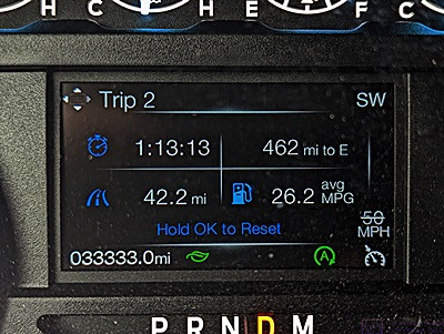
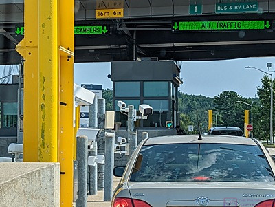
This is the information display in the center of the F-150 dashboard (just above the steering column).  The number in the lower left corner of the display, 033333.0 is the total mileage on the vehicle.  It’s a palindrome (I ignore the decimal point).  Such numbers only occur every 11,111 miles, up to 099999.0, and then every 111,111.1 miles up to the limit of the odometer at 999999.9 miles.  Also of note is the number, mid-right, of 26.2 ave mpg.  I can get these numbers under the right conditions of speed and terrain, and I actually had this number up past 27 and almost to 28, but the slightest hill reduces it right away.  It was somewhere between 23 and 24 by the time we got back to camp.

Our day was a bit unusual in that it consisted of several distinct segments.  Our normal morning routine was shortened to one cup of coffee and no breakfast as we had to drive into Moncton early to do the grocery shopping that we were unable to do yesterday due to the Labor Day holiday.  I was cleaning out e-mails on my iPad while having that cup of coffee, and noticed one from last Monday (August 29) indicating that our Kohler whole house generator had shut down due to a fault, was “Not in Auto,” and would not restart automatically.  The fault was identified as “Low Generator Voltage AB.”  Not being in auto-start was bad, and that was a fault message I had never seen before.  Yikes.  We rely on the genset to make sure our sump-pump and well-pump have power year-round, and that the furnace has power in the winter.

Our first stop in Fundy National Park, after the Visitor Center, was the Butterfly Garden.  It contained an extensive assortment of plants designed to attract and sustain butterflies, including the Monarch Butterfly

While that was not a good situation, we were fairly sure we had not lost power as:  1) the Kohler OnCue Plus system would have notified us of the loss of utility power (or loss of connectivity), 2) our DTE (electric utility) app would have alerted us to the loss of power (I think), and;  3)  We might have heard from our neighbor that the power was out.  Still, it was bad on several levels:  1) That it happened over a week ago, and the genset had been unavailable since that time;  2) that neither of us paid careful enough attention to the notification when it arrived at the time of the fault;  3) We knew there were bad storms last week in our home county, and;  4) our battery-powered backup sump pump was not yet installed, so if the power did go out we would not have a functional sump pump.  Not good.

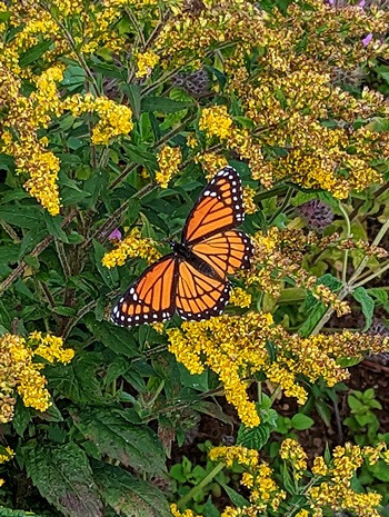
Linda managed to capture this photo of an actual Monarch butterfly in the Butterfly Garden at Fundy National Park.

I texted our neighbor, Mike, who has been checking on the house for us occasionally, and asked him to stop by the house to check the sump-pump closet and put the genset back in auto.  I then texted Shawn, at GenPro LLC (our local servicing Kohler dealer), and asked if he would stop by the house and check that the unit was actually functioning properly.

I heard back from both of them within an hour in the affirmative.  Mike indicated that he had reset the fault, run the genset, shut if off, and put in back in Auto.  The display said the next exercise cycle was set for next Monday (September 5).  (We could also check the status using the Kohler OnCue+ app on our phones, iPads, or laptop computers.)  Shawn indicated that he would be there sometime today.

Another series of notifications appeared around 13:20 (our local time).  I presumed they were the result of Shawn working with the genset, but I did not get a text or phone message confirmation to that effect.  We did, however, get his electronic invoice that evening with a short explanation of what he found and what he did.  All of the wiring connections were tight but he found the gas line shutoff valve partially closed.  He opened it fully and ran the genset,.  He said it ran perfectly.  I trust his diagnostic and repair skills, but we probably won’t for sure that this was the problem until next Monday (September 12) when the next scheduled exercise occurs.

But I’ve jumped ahead in terms of the order of events today.  Some of that communication took place before we left to drive to the Vaughn-Hadley Sobeys in Moncton for groceries, some of it took place after we got there, and some of it took place later in the evening.

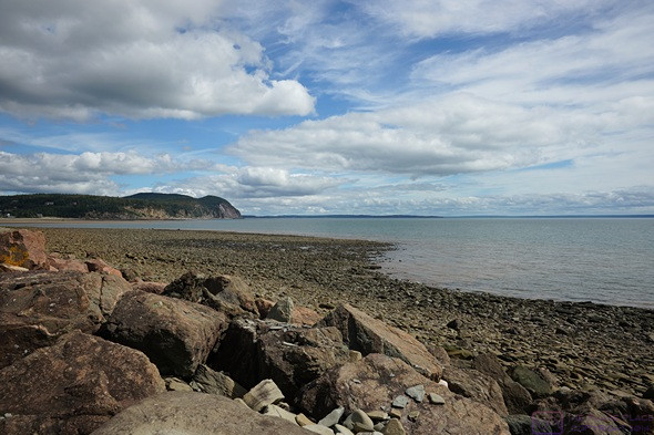
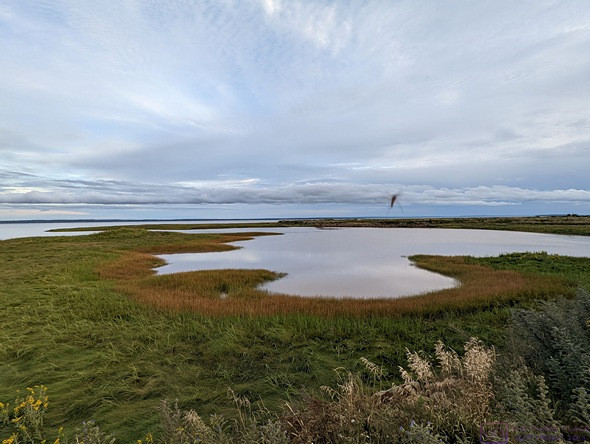
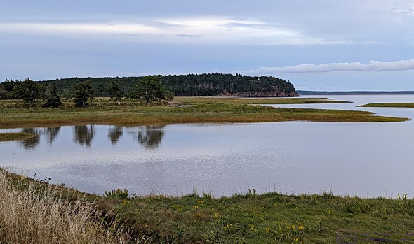
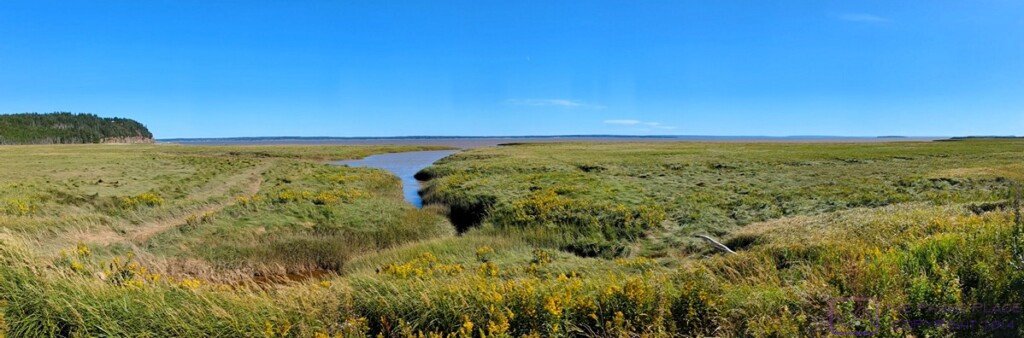
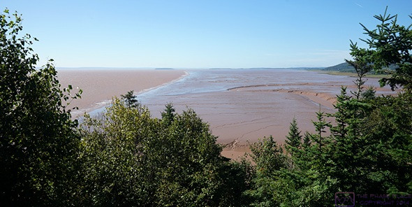
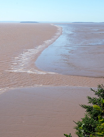
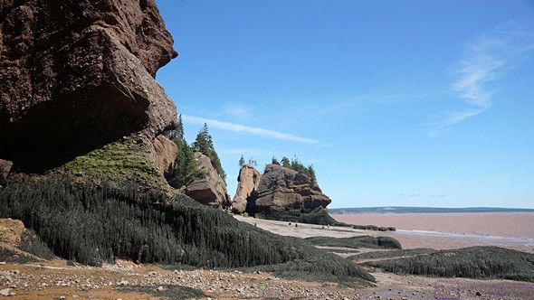
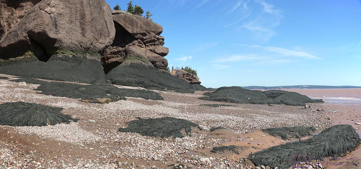
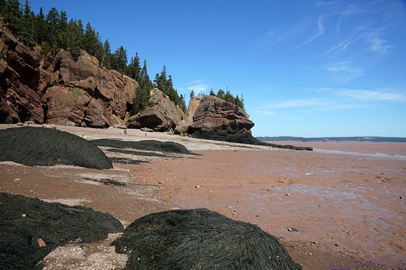
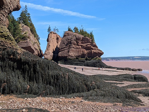
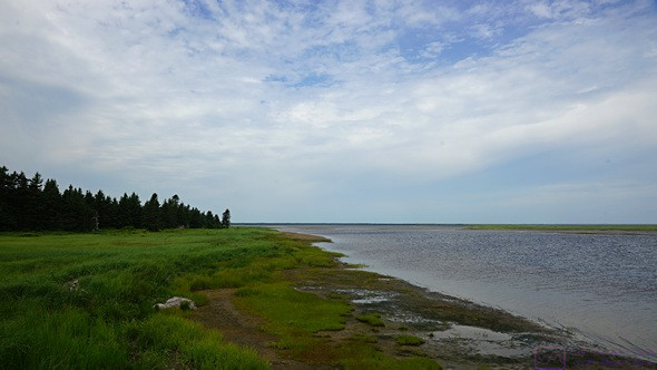
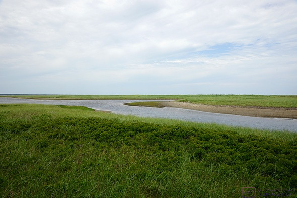
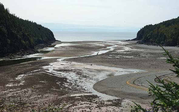
The view of Alma Beach looking north from Cannontown Beach in Fundy National Park.  The amount of exposed ocean floor at low tide is extensive.  There were people at the water’s edge, but probably to small to see in this photo.

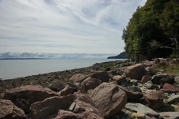
This is the view looking south from Cannontown Beach in Fundy National Park.  The North Atlantic Ocean is off to the right, but still a long way away.  The Bay of Fundy is over 400 km (~250 mi) long, and 100 km (~61 mi) wide at its mouth on the Gulf of Maine

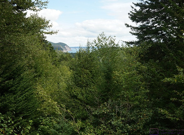
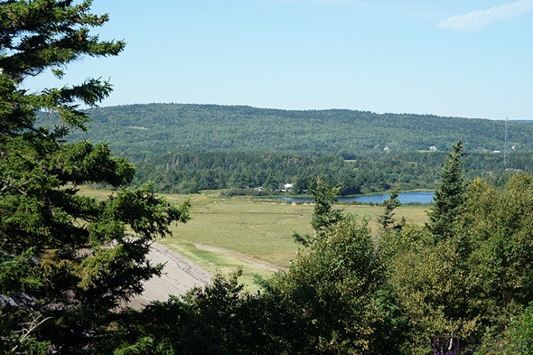
A view looking north from the Dickson Falls Trail of the headland and cliffs by the village of Alma.

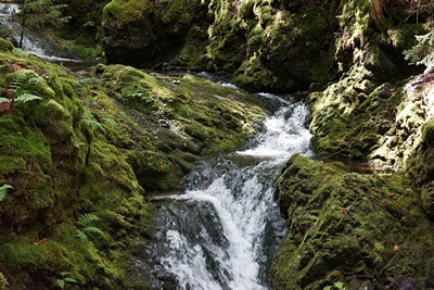
The Dickson Falls Trail had two routes.  The upper route was partially closed for construction, but we wanted the lower route anyway as it descended 65 feet into the gorge downstream of the actual waterfall.  Before getting to the actual waterfall, the trail crossed and then worked its way up alongside a long cascade.

We encountered several construction zones on the drive into Moncton, but collectively they only cost us about 20 minutes driving time.  Each way.  We bought just enough fresh food to get us through the next three days and stocked up on a variety of non-perishable items.

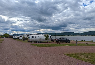
On the way back to our campground we stopped at the Petro Canada on Hwy-114 and topped up the fuel tank.  We encountered the same construction zones on the way back to camp, of course.  We also saw a school bus (on the road, not parked), and noticed a lot of RVs headed towards Moncton. School is back in session, and the Labor Day weekend probably marked          the end of summer vacations, just as it does in the States.  We recognized several of the RVs as having been in our section of the campground when we left this morning.  When we got back to our site, there were only three other RVs left in our section.

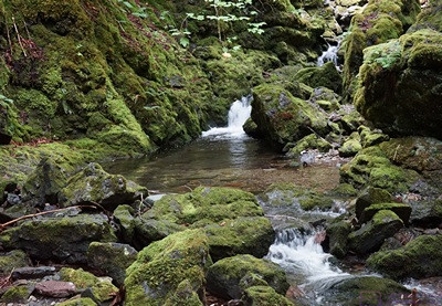
Mid-way up the Dickson Falls cascade.  The eco-system of this gorge is different than the rest of the parkland that surrounds it, and there was a protected lichen here that is able to survive underwater.

Back in camp, Linda rearranged the refrigerator to make everything fit, and put the non-perishable items in their usual cabinets.  We loaded what we needed for the next part of our day, which was hats, jackets, the SONY SLT a99v camera bag, and the carrier harness.

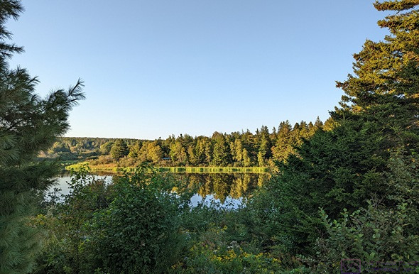
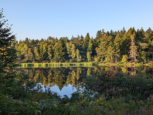
It was ~42 km (~26 mi) south on NB Hwy-114 to the S/E entrance to Fundy National Park (Parks Canada).  It took us an hour to drive there, as the maximum posted speed limit was 80 km/hr, slower through small villages, and much slower through several construction zones.  Two of them had flaggers controlling traffic and the longest one, where asphalt pavement was being placed, had an escort vehicle as well.  We also encountered a couple of places with automated temporary traffic signals, but it was still a good drive through rolling wooded countryside and small villages with views of the Bay of Fundy, salt marshes, and some agricultural fields.  It was also a good preview, as NB Hwy-114 South through the park will be our route to get to the St. John, New Brunswick area on Thursday.

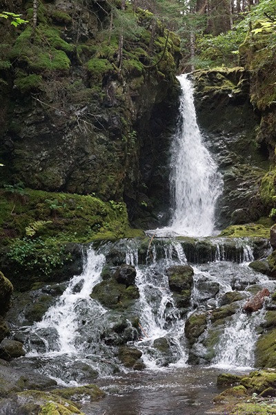
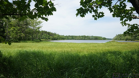
Dickson Falls.  The source of the water is a pond some distance into the park.  The pond, and the stream that flows out of it all the way to Chignecto Bay, are completely contained within Fundy National Park, and are very pristine.

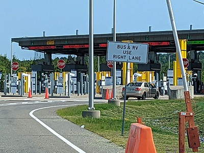
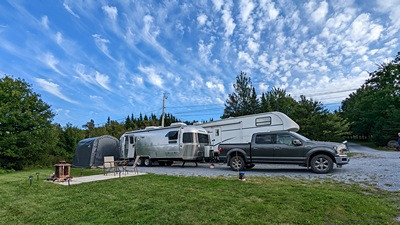
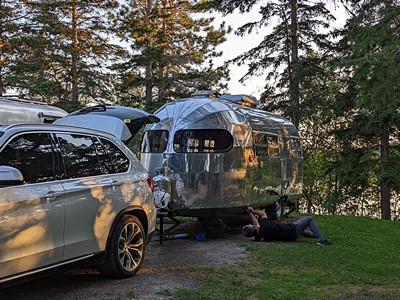
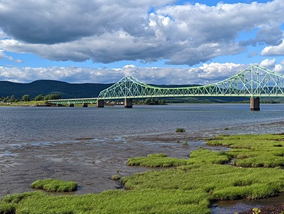
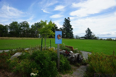
Not long before reaching the park, I noticed that the odometer on the truck (total mileage) was about to create a palindrome (symmetrical number or word ).  I have always enjoyed the patterns formed by the odometer readings in our vehicles, such as 012345.6, but I especially like palindromes.  I had a car behind me, but managed to pull off the road just in time to capture the first image in this post.

We passed through the quaint little town of Alma just before entering the Park.  Fundy National Park encompasses 206 square kilometers, including a section of coastline on the Chignecto Bay portion of the Bay of Fundy.  It is also a UNESCO Biosphere Reserve, which protects and preserves an Acadian Coastal Forest comprised of 32 different species of trees, and other flora and fauna that depend on that forest for survival.   It is, however, a small portion of the much larger Bay of Fundy Biosphere Reserve.

From the Parks Canada website:

There are 37 national parks and 10 national park reserves in Canada that represent 31 of Canada’s 39 terrestrial natural regions and protect approximately 336,343 square kilometers of Canada’s lands.  …  A national park reserve is an area that is managed like a national park but is subject to one or more Indigenous land claims. These land claims are being negotiated between the federal and Indigenous governments. Indigenous peoples continue to use the land for traditional hunting, fishing, and trapping. The Canada National Park Act applies to the national park reserve and provides the same protections to those of national parks. The resolution of the land claims finalizes the boundaries and establishment conditions, and the national park reserve can be brought under the Canada National Parks Act as a national park.

The largest park, Wood Buffalo NP, is ~45,000 square kilometers (~17,360 square miles) and is both a UNESCO WHS and Biosphere Reserve.  The smallest park, Georgian Bay Islands, is just 14 square kilometers (~5 square miles) and is a UNESCO Biosphere Reserve.  Parks Canada also manages National Historic Sites, which are places of great historic and/or cultural importance.

We started our visit to Fundy National Park at the Visitor Center and Gift Shop, where we got a couple of maps and some advice about trails, and learned that the Park offered an interesting assortment of activities.  The Bay of Fundy (of course), with access to the ocean floor at several “beaches” including Alma Beach.  Hiking (of course, and lots of it), along with canoeing, kayaking, and bicycling.  A swimming pool at Cannontown Beach (closed for the season);  Accommodations (motel & cottages).  Four campgrounds (at least one closed for the season as of yesterday) as well as lots of backcountry camping.  And a golf course (that looked to be 9 holes).

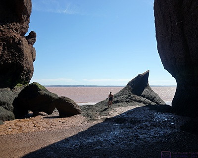
Most of the hiking is long and difficult, so we confined our visit to the area along the shore from the Visitor Center to Point Wolfe Campground at the end of Point Wolfe Road and the in/out Herring Cove Road.

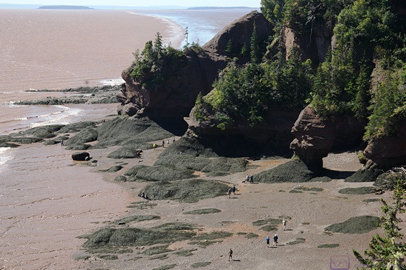
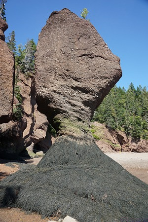
From the Pointe Wolfe Campground area at the end of Point Wolfe Road, we hiked out on the Shiphaven Trail towards the covered bridge.  The Point Wolfe River flows down to this inlet from deep in the park, seen here near low tide.  This bay was once bustling with commerce, specifically logging and lumber milling, and eventually shipbuilding.  All of that is gone now, and the forest is recovering from the effects of that activity.

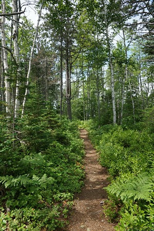
Our big hike was to Dickson Falls.  It was mix of dirt (with tree roots), gravel sections, and wooden stairs, bridges, and boardwalks.  It was considered moderate with a 65 ft elevation change.  I did not count all of the stairs, but I was quite certain it was more than we had to deal with at Hopewell Rocks Park this past Sunday.  But we handled it OK, and it was a cool hike, figuratively and literally; it was noticeably cooler down in the gorge below the waterfall than in the surrounding forest.  The water for the falls originates in the park, finally flowing to the Bay of Fundy.  It was incredibly clean, as it is entirely within the management jurisdiction of the park.

We did a smaller return hike on the Shiphaven Trail from the Point Wolfe Beach area to the covered bridge and back.  Still a lot of stairs, but usually only a few at a time.

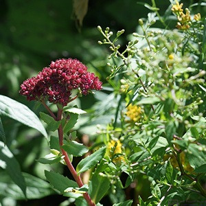
After driving Herring Cove Road to its endpoint, we started down the trail to Herring Cove Beach.  We could see that the water was still a long way below us, and the first set of stairs looked to be 100 steps in a straight line with no landing.  We decided that was not for us today, and turned back.  On the way back up I saw this flower and, not wanting to come away empty-handed, took its picture.

On the way pack up Pointe Wolfe Road we turned off onto Herring Cove Road.  It was a long way down from the trailhead at the parking lot to the ocean.  We might have done this as our first trail, but had already done the Dickson Falls Trail and the Shiphaven Trail.  With the afternoon wearing on, and our bodies telling us we had done enough hiking for the day, we took a pass on this one.  Again, we came away with the new understanding that staying in one of the campgrounds here for a week would allow us to do more trails like this, at the rate of one a day, or perhaps one harder one in the morning and an easier one after lunch.

Our second-to-last stop was the Butland Lookout scenic pullout part way up Hwy-114 into the park.  We had a commanding view of part of the east side of the park and the Bay, and I was able to create this composite image:


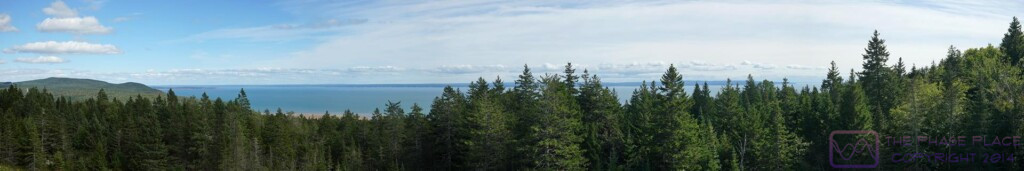
This is a composite of 10 photos created with MS Image Composite Editor.  The photos were taken at the Butland Lookout with the camera set to Manual mode so that all of the photos had the same exposure.  The photos were taken from left to right with the left 1/3rd of each photo overlapping the right 1/3rd of the previous one.  The zoom lens was set at 50 mm, to minimize distortion across the photos and provide a “natural” perspective that composites well.Our final stop was back at the Gift Shop where we picked up a T-shirt (for Linda) and two FNP logoed “moose mugs”.

The drive back to camp was pleasant, even with the road construction delays.  We got back to camp in the late afternoon, and Linda set about making dinner right away.  She wanted to grill a couple of our smoked vegan sausages, but the mosquitoes were just too thick and persistent.  She made a bowl of cole slaw, heated up a can of Bush’s Maple & Brown Sugar beans, sauteed some onions, and pan-grilled the sausages inside the trailer.  We had some of the AHA Pineapple & Passion Fruit sparkling water with our meal.

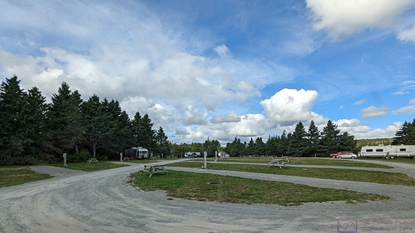
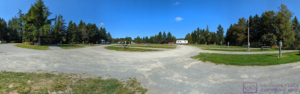
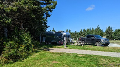
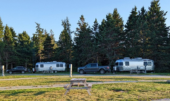
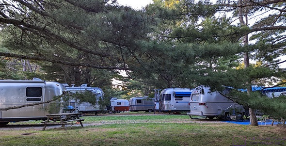
We went for a walk after dinner, which is really something we should do at home, weather permitting.  We kept moving in order to keep the mosquitoes at bay.  The Ponderosa Pines Campground is a nicely laid out and maintained place, in a beautiful location with convenient access to things we wanted to see.  The mosquitoes were just part of the nature where we were.

Back at our trailer, we had small glasses of the Black Tower Rivaner wine.  I think Golden Oreos made an appearance for dessert.  The rest of the evening Linda read and I tried to work on the photos from the park and start writing the blog post.  I was a bit tired, and had trouble making photo selections and then adjusting them to my satisfaction.  We planned to stay in camp tomorrow, so I put those tasks aside.

20220905 – It’s Labor Day here, too!

MONDAY 05 September

(There are no photos for this post.)

We both slept in this morning and finally got up at 7:45 AM.  Even the cat settled down when she realized neither us was getting up at 6, or even 7 AM today.  We got up to a cloud layer but bright morning sun.  The clouds eventually opened up to reveal the blue sky above, and the forecast was for a wonderful weather day, with a high temperature of 67 (F) and winds out of the NNE at under 10 mph.

While we had our morning coffee, Linda checked in on the world and I continued working on the blog post for yesterday.  I had already selected and processed photos from the SONY SLT a99v camera, but still needed to get a few from each of our phones.  I selected and processed those, and then finalized the post.  I write the posts in Microsoft Word, and include the placement and captions for the photos.  This allows me to minimize the time I spend actually logged in to our WordPress site, especially when I am on an erratic Internet connection.

We had planned our time in the Hopewell Cape area, 5 nights and 4 full days, around doing our chores and errands today, the mid-point of our visit.  We were going to drive into Moncton to buy groceries and top up the fuel tank in the F-150, and then do a couple of loads of laundry back at the campground.  We also talked about returning to Hopewell Rocks Park as our park admission was good for two consecutive days.  What we did not realize until this morning, was that today was also Labor Day here in Canada.

Linda called a couple of different Sobeys supermarkets in Moncton to make sure they were open, but got no answer.  She checked the website, and they were closed today.  Well, we did not see that coming.  In the States, many stores are open on holidays, but might have reduced hours.  But this is not the States, and we have enjoyed traveling in a “foreign” country where things do not always work the way we are used to.

We decided to make it a “camp day” anyway, but thought we might walk over to Hopewell Rocks Provincial Park during the afternoon and possibly grab a bite to eat at the restaurant.  The trail from the campground is about 1.7 km (~ 1 mi) through the woods, so long pants and shirt sleeves would be required, along with our bug nets for our heads, which we had not yet used.

We had bagels and grapefruit for breakfast and watched other campers slowly break camp and pull out.  We reasoned that the laundry facility might not be in use, so we gathered up the soiled laundry and carried it to the building.  Three of the five washing machines and at least two of the five dryers were in use, but we only needed two washing machines to get started.  Linda stayed with the laundry but brought her iPad along so she could read.

I returned to our trailer, did the dishes, and started writing today’s post.  With many of the campers gone, the Wi-Fi/Internet connection was strong, solid, and fast.  I took a break from that task around 12:25 PM and hooked up the sewer hose and black tank flush hose; might as well do it while the weather is nice.  As long as I was up, I walked the trash to the receptable.  The mosquitos were out in force.  Annoying as they are, they are part of the natural world.

Given that Nova Scotia is “New Scotland,” the question had been on my mind as to what “New” Brunswick” was a new version of, so I searched online and found the following from Wikipedia under the heading New Brunswick:

“ … After the founding in 1784, the colony was named New Brunswick in honour of George III, King of Great Britain, King of Ireland, and prince-elector of Brunswick-Lüneburg in what is now Germany.

Indigenous peoples have been in the area since about 7000 BC. At the time of European contact, inhabitants were the Mi’kmaq, the Maliseet, and the Passamaquoddy.  (The Mi’kmaq people and culture are still very much present.)

Prior to European arrival, Indigenous tribes did not leave a written record, but their language is present in many placenames, such as Aroostook, Bouctouche, Memramcook, Petitcodiac, Quispamsis, Richibucto and Shediac.

New Brunswick (FrenchNouveau-Brunswick, pronounced [nuvo bʁœnswik], locally [nuvo bʁɔnzwɪk]) is one of the ten provinces (and three territories) of Canada. It is one of the three Maritime provinces and one of the four Atlantic provinces. It is the only province with both English and French as its official languages.

In 1969, New Brunswick passed the Official Languages Act which began recognizing French as an official language, along with English.  New Brunswickers have the right to receive provincial government services in the official language of their choice.  About 23 of the population are anglophone and 13 are francophone. New Brunswick is home to most of the cultural region of Acadia and most Acadians. New Brunswick’s variety of French is called Acadian French and 7 regional accents can be found.  …”

So, now I know.

Linda got back to the trailer with the laundry at 1:30 PM, which had to be hung up or folded and put away.  It was obvious to both us that we were not going to walk, or even drive, over to Hopewell Rocks Park today, either for lunch or to look at the Rocks again.  Instead, we snacked on pistachios and hummus with Fritos and Veggie Straws.

While doing laundry, Linda crossed paths with Laurel, a solo traveler from Alberta, Canada that she met while doing laundry at the North Sydney / Cabot Trail KOA back in late July.  That has happened a few times, and it’s always a fun surprise when it does.

The remainder of the afternoon was pretty low-key.  Linda mostly read and played a few word games on her iPad.  I split my time between my computer (blog and file management) and my iPad (games and puzzles).  I’d been getting notifications on my phone from Google for a while letting me know that my 15 GB of free storage was almost full, and warning me about the dire consequences that would befall me were I to actually run out of storage.  This Google account is used by my phone and iPad for Google Photos, Google Drive, and Gmail, and all of these would stop working.

The was a “manage storage” link in the notification, of course, but I decided to log into my account from the Chrome browser on my laptop.  My storage pool was 93% full, and most of that was Google Photos.  It’s been a while since Google stopped providing free/unlimited storage for Google Photos, with the free storage now capped at 15 GB.  I knew that additional storage was available for a monthly subscription, and the cost was competitive with Dropbox and other similar services.  What I did not expect, and did not appreciate, was how aggressive they were in “promoting” this solution.  I just wanted to delete things (after verifying I had them on my camera and backed up) but every time I tried to do something, the website wanted to know how much additional storage I wanted to sign up for.  None, thank you very much.  I did manage to free up about 8 GB of storage, but I was a bit annoyed with Google by the time I was done.

Since I still had a solid Internet connection, I searched online for information about what we had to declare when crossing back into the USA.  I was interested, in particular, on the rules regarding wine, and ended up at the official Customs and Border Patrol website.

Since we have been out of the country for over 48 hours, our “personal exemption limit” appears to be $800 each.  The stuff we are bring back only cost a small fraction of that amount, so no worries there.  There is no stated limit on the amount of wine we could bring back for personal use, but only the first bottle (1 L) would be included in the personal exemption.  After that there could be a small duty and tax.  Bringing a large quantity, however, might raise the suspicions of the CBP officer as to possible commercial use or resale.  Large quantity, however, was undefined.  We will only have four bottles, so we should be OK.

The report we got from Nancy, however, indicated that they only thing they seemed to care about when crossing at Calais, Maine, were fresh fruits and vegetables.  When they came through that Port of Entry, the CBP Agents were checking every RV, especially the refrigerators.  We could not find anything online, however, listing what is not allowed.  Our presumption will be no fresh fruits and vegetables, and no meat, eggs, or dairy.  No problem for us on the last three, and easy enough to make sure we don’t have any of the first two.

By 6:30 PM we were both ready for something to eat.  Dinner was a green salad and Daiya Deluxe Cheezy Mac Alfredo Style.  Quick and easy and tasty.  We were just finishing dinner at 7 PM when Laurel knocked on our door.  She had discovered the Strawberry Trail, which leads south out of the campground along the top of a long earthen dike.  She was very excited to have us hike out there with her to see the salt marsh and mud-flats and the rocks of Hopewell Rocks Park off to the north.  We said we would join her as soon as we were done eating and she went on ahead.

We caught up with her part way along the dike where she was sitting.  She did not take the trail as far out as it goes because the mosquitoes were swarming.  High tide would be around 8 PM, and she really wanted to see the water come in but realized she needed to be out here about 3 hours before high tide.  We talked on the walk back, and she plans to return tomorrow around 6 PM, as high tide will be around 9 PM.  We will be away from camp most of the day tomorrow, but if we have time go back out, we will definitely wear our mosquito netting.  The view was certainly worth the short, easy hike.

When we got back, I backed up all of my camera photos and videos from my phone to our WD MyPassport drive, and then organized them for better access.  I then did the same for all of the camera photos and movies from my iPad Pro.  Most of the files copied just fine, but a few of the iPad movies (.MOV files), and a couple of other files, either copied as 0 KB in size, or wouldn’t copy at all.

Linda and the kitty headed off to bed at 10 PM and I put the finishing touches on this post.  Our plan for tomorrow is to drive back to Moncton in the morning to fuel up the truck and do our grocery shopping at one of the Sobeys supermarkets (there are five of them).  After the groceries are put away, we will continue south on Hwy-114 to Fundy National Park.  I uploaded this post just before midnight, local time, and headed off to bed.

20220904 – Hopewell Rocks (Provincial Park), Hopewell Cape, New Brunswick

SUNDAY 04 September

(This post has 16 photos.)

A panoramic view of the salt marsh at the east end of Ponderosa Pines Campground.  Mud-flats are beyond the marsh and extensive.  The water is Chignecto Bay (Bay of Fundy); North Atlantic Ocean far to the right; Petitcodiac River and Moncton, NB  “upstream” to the left.  The headland to the far left is Hopewell Rocks Provincial Park.  If you know where to look , the two south-facing overlooks and the picnic pavilion are just visible.  (This photo is 1198×396 pixels.  Click to view full-resolution.)

.

We could see the headland at the southern end of Hopewell Rocks Park from our campground.  It stood to reason that we could also see the campground from these vantage points.

I got to bed late again last night (naps tend to do that to me) but did not get up until 7:45 this morning.  The temperature dropped to 53 (F) overnight, but I was much more comfortable sleeping compared to the night before.  Linda had suggested I put the small throw pillow from my bed between my head/shoulders and the wall, so perhaps that helped.  She was awake and up shortly after me.  We both got a good night’s sleep, which we needed.

our first experience with the Hopewell Cape area was yesterday when we walked to the east end of the campground after we finished setting up camp and had linner.  From there we had a sweeping view of an extensive marsh, which had not yet been inundated by the incoming tide, and some muddy ravines that obviously filled with water when the tide was in.  Our first two viewpoints today were looking south over the same salt marsh and the extensive Daniel Mud-Flats.  Neither of these features were present at Burntcoat Head / Park, so Hopewell Rocks Park was clearly going to be a different experience.

.

A closer look at the Daniel Mud-Flats, with Grindstone Island on the horizon, upper left.

I switched zone 2 from the heat-pump to the furnace for a few minutes to heat the belly of the trailer and take the chill out of the floor, and put the zone 1 (bedroom) heat-pump in fan mode to circulate some air.  Once the furnace cycled off, I shut off zone 2, put the zone 1 heat-pump in heat mode, and set the thermostat up high enough for it to run.  When it was finally warm enough in the living room, I shut off zone 1 as well.

We had a nice weather day on tap, which started with a bright morning sun bathing our trailer in light and warmth.  Even with the outside air temperature still below 60 (F), we opened the door.  Juniper-the-cat likes to sit there where she can see, hear, smell the outside world.  She probably dreams of going out and exploring, but has never tried to “escape” from the trailer.

.

Formations that end up surrounded by water at high tide, but protrude above it, are called “flower pots.”  (This is what the staff person at Burntcoat call the island, but these were not a prominent feature of that site.)  At Hopewell Rocks Park, they are one of the main attractions, along with shear rock cliffs.  We were also impressed by the abundance of “dead man’s fingers” seaweed, which covered almost every rock surface up to the high tide mark.  It had the appearance of a long, tangled head of hair on something that might have been in the Pirates of the Caribbean films.  Note how small the people on the ocean floor appear.  The rock cliffs and formations are huge.

A flower pot with a seaweed encrusted base.  In spite of the obvious and ongoing erosion, a display board indicated that the Park should continue to look much as it does today for at least another 100,000 years.  That meant we could plan a return visit and it would still be here.


We planned to visit Hopewell Rocks Provincial Park today.  Linda checked the tide chart, and low tide would occur at 1:06 PM, so planned to be there around 11 AM.  The Park is adjacent to the north side of our campground and only a one mile drive to the entrance.  There’s also a 1.7 km (~1 mi) trail from the east end of the campground to the Provincial Park parking lot, but we drove over.


The park is open from 8 AM to 6 PM, irrespective of what the tide is doing, so we would not get to experience a high tide there today.  But we could see Chignecto Bay from our campground, so we could walk to the east end of the campground around 7:15 PM to catch the high tide at 7:19 PM if we were so inclined.


.

Big rocks and thick seaweed.  The entire shoreline of Hopewell Rocks Provincial Park looks like this.  The formations are huge.

A young woman is standing with her back to the camera just to the left of the “small” pointed rock in the middle of the photo.  She provides the sense of scale needed to understand the size of these rock formations.

We had egg sandwiches and fresh fruit for breakfast at 9 AM.  Showers were the order of the day following breakfast.  We tidied up the trailer, got the camera, left for the park just before 11 AM, and pulled in a few minutes later.

The entrance sign said it’s a New Brunswick Provincial Park, but it’s not.  It’s run by the Provincial Parks, but is considered an “Attraction.”  The large parking lot already had quite a few vehicles, but was far from full.  We paid for our admission at the entrance booths, good for today and tomorrow.  The staffer at the entrance booth said they are trying to gain Provincial Park status.  It was a short walk from there to the main building, which housed a gift shop, information center, restaurant, and the all-important restrooms.

The first two viewpoints were not far from the main building and faced south overlooking the extensive Daniel Mud-Flats and salt marsh on the west bank of the Bay.  From there, it was an 800 m (~1/2 mile) walk on a wide gravel path through the woods to the “99 steps” that go down to the ocean floor.  There was one short, but steep, side path to a third viewpoint.

This is a composite image of three photos.  It’s 1198×562 pixels, and should be viewable at full-resolution by clicking on it.  The dark green stuff covering many of the low rocks is “dead man’s fingers” seaweed.

.

It was past low tide and we were headed back to the staircase when I took this photo.  The ocean floor here has a very gentle slope as it first emerges from the water at low tide, and then has a steeper slope as it rises to meet the base of the cliffs.  As soon as the tide switches and starts coming in, the water moves horizontally towards the cliffs very quickly at first.

.

Linda on the ocean floor at Hopewell Rocks Park.  She is closer to the camera than she is to the rocks, and the lens is set to 28 mm, so the perspective is distorted and she appears taller relative to the rocks than is actually the case.

The main staircase was impressive in its own right.  It was a solidly built and anchored steel structure, with landings between flights of stairs.  It had two “sides,” one labeled “Down Only” and one labeled “Up Only.”  (We were immediately reminded of the movie “Up The Down Staircase.”)


When we finally got a view of the ocean floor, we understood why this structure existed; there were hundreds of people down there, and almost all of them had to go down these stairs and come back up them eventually.  (There was also handicapable access to the ocean floor at the north end of the Park, which as its own parking lot.)  But the park has a long shoreline, and people were spread out, so it did not look or feel crowded.


.

Us the ocean floor at Hopewell Rocks Provincial Park in New Brunswick.  (Camera pointing south with the sun behind us.)

The Bay of Fundy and Ocean Floor experience here was different from Burntcoat Head / Park.  The Rocks here were more numerous, higher and dramatic, and there was plenty of drier places to walk in the upper half of the tidal range, but we had less access to the water.  There was also an absence of visible life in the tide pools, and no warnings to avoid them.  But we did not venture down to the water’s edge as we did not want to get our sandals muddy this time.  The only real warning was to stay out of the mud-flats and not slip and slide on the mud in the areas where you could walk.  There were also a lot of small coves that were roped off with warning signs about the danger of rock falls.  There was plenty of evidence of rocks cleaving off from the cliffs, and some of them where many times larger than a pickup truck.

Us again, this time with the camera pointing north, so we are facing the sun.  Same faces, different rocks.

We ate lunch at the on-site counter-service restaurant around 2 PM.  They had a nice salad on the menu, but it was sold out it (there must have been other vegans there ahead of us.).  We split a veggie wrap and an order of onion rings instead.  We sat outside at a shaded table because it was such a nice day, and because a young child inside was very unhappy about something and making sure everyone (except the parents, apparently) knew about it.

After lunch, we spent time in the information center.  The displays were very informative and we read all of them.  From there we visited the gift shop and picked up a couple of post cards and a couple of other little things.  When we returned to our truck around 3:30 PM, the parking lot was much fuller than when we had arrived, but still not at capacity.  Based on the park map, there was space for over 300 vehicles, including a dozen or more buses.  My WAG was 800 to 1,000 people in the park by the time we left.

Bruce standing next to a large flower pot formation.  (Photo by Linda.)

Back at camp, we made coffee (we didn’t have our second cups this morning) and sat outside to use our iPads.  I had a good enough Wi-Fi/Internet connection that to use Feedly, so I caught up on reading the latest posts from the blogs I follow.  When it was finally too cool to sit outside without a jacket, we retreated to the trailer, where I started up my computer, transferred photos from the camera, and started looking through them.

We had dinner around 6:45 PM, a bit later than usual owing to our slightly later lunch at the park.  Linda improvised a sauteed vegetable dish with potatoes, carrots, onions, garlic, green beans, shitake mushrooms, black pepper, and red chili pepper flakes.  It was very tasty, and had a bit of “heat.”

.

Seaweed and large rock formations were the defining features of the shore at low tide.  Hopewell Rocks Provincial Park, New Brunswick.  (Photo by Linda.)

.

Bruce poses with the Moose in the Hopewell Rocks Park Visitor Information Center.  (Photo by Linda.)

After dinner we went for a stroll in the campground to “get our blood circulating” and to check out the laundry room.  We had three more days at this campground to explore the area and two main things we want/need to do.  One was visit Funday National Park (Parks Canada) just south of here, and the other was take care of a few essential chores, including laundry and a trip into Moncton for groceries and fuel.

The current forecast showed good weather for all three days.  Rather than leave errands until the last minute, we decided we would take care of those tomorrow and visit the National Park on Tuesday.  That would leave Wednesday for a return visit, or a chance to just relax (and work on blog posts).

We read and worked puzzles for a while after our walk.  By 10 PM it was very cool, so we closed down most of the windows and turned down our beds.  Linda climbed in, followed by the cat, as that is her usual bedtime, while I returned to processing photos from today and started writing this post.  It rained briefly, and there was a low chance of rain during the overnight hours.  The low temperature was forecasted to be 58 degrees (F).  I set the zone 2 heat-pump to 60 (F), but did not expect it run much, if at all.

20220903 – Good bye (again) Nova Scotia, Hello (again) New Brunswick

SATURDAY 03 September

Technically, I covered the beginning of this day at the end of yesterday’s post, as I was up after midnight publishing the most recent blog posts.  By the time I actually got in bed it was approaching 0100 hours, and it was chilly in the trailer, in spite of having the zone 2 heat-pump in heating mode and set to 62 degrees (F).  I was able to sleep (stay in bed) until 7 AM, but I was uncomfortably cool most of the night.  Linda got up shortly after me.

The outside air temperature dipped into the upper 40’s (F), but with the heat-pump on, why would that matter?  Well, it’s because the insulation in the trailer is marginal (IMHO) and, as a result, the inner aluminum skin gets cold to the touch with low outside air temperature.  So, even thought the air temperature in the trailer is 62 (F), I was sleeping next to a cold surface which drew heat away from me.  The same was true for Linda, but she tends to be too warm at night while I tend to be too cool.  I’ve read about solutions to the heat draw problem in the AirForums, and will have to give it some thought once we get home.  (On 50 A electrical service my best bet is probably an electric blanket or pad, like we use at home.  On 30 A electrical service, which we often have, that might be a problem.)

I fed the cat, made a cup of coffee for each of us, and started my computer.  Check-out time (latest) at the Halifax West KOA was 11 AM and check-in time (earliest) at the Ponderosa Pines Campground in Hopewell Cape, New Brunswick was 2 PM.  That’s pretty typical, and is only a problem for short distance/time re-positionings.  We estimated a 3-1/2 hour drive to cover the 306 km (~190 mi) and targeted a 10:30 AM departure.  That gave me time to finish the blog post for our visit to Burntcoat Head / Park on Thursday (September 1).  Wi-Fi access to the Internet was solid and fast, and I was able to upload and publish it by 9 AM.  Breakfast was a bagel and orange juice; quick, easy, and tasty, with very little clean up.  We then got busy preparing the truck, trailer, and us (and the cat) for travel.

The couple across from us was also getting ready to leave, and needed to use the front part of our site to pull their enormous fifth wheel trailer out.  He (husband/driver) needed to pull it out going the “wrong” way (to his left) because he could not make the turn at the end of our section if he went out the “right” way.  No problem.  I moved our truck to give him the room he needed.  And then I moved it again, because he needed even more room.  He then proceeded to make the very sharp turn to go behind our trailer, rather than take the much easier path through the other half of our section (E) past the dump station.  He appreciated that I moved our truck, but wasn’t interested in anything else I had to suggest, so I disengaged.  The wife, however (following in their car), stopped to thank Linda for us being willing to make it easier (possible) for them to get out.  Guys and gals, I guess.

All of that added about 15 minutes to our departure preparations, which went smoothly enough otherwise, and it wasn’t a big deal for us.  Why wouldn’t we do what we could to help fellow RVers?  As Red Green says “we’re all in this together.”  We put the address of our destination into the F-150 navigation system, and were on our way at 10:45 AM.

We had been back-tracking since returning to North Sydney, Nova Scotia from Newfoundland, and had to do more back-tracking today.  The nature of the landscape in Atlantic Canada is that there is often only one way to get somewhere, and that same route is the only way to get back.

We got back on NS Hwy-101 heading south towards Halifax, took the now familiar left at Exit-1(G&H), but stayed with 1H to swing around onto NS Hwy-102, towards the Halifax Airport and Truro, where we would pick up NS Hwy-104 (the Trans-Canada Highway) going west.  Much of this route was posted 110 km/hr (~68 mph), so I set the cruise control at 65 mph (~105 km/hr), which allowed the transmission to shift up into 9th gear and drop the engine rpm to ~1,700.  Normally that would drop the sound level in the cab slightly (it isn’t that loud to begin with) but we were traveling with the windows open a bit and the air-conditioner turned off.  It really was that nice of a day.

Quite a few miles before our turn onto the T-CH, we encountered the worst traffic jam of our entire time in Canada (so far).  Hwy-102 was down to one lane just a mile before our exit AND there was an entrance ramp just after the merger for the lane closure.  Traffic was some where between a dead stop and very slow creep.  We remembered seeing traffic backed up for miles at this point when we drove this route the other way on Monday, but had no practical way to get around it.  The delay added 30 minutes to our ETA.

At Masstown, we decided to stay on the T-CH, which becomes the Cobequid Pass Toll Highway for 45 km (~28 mi) with a toll plaza near the mid-point.  It was posted 110 km/hr, which allowed us to move right along, and the toll for our truck/trailer combination was 5.25$.  This was a new road for us, as we had taken the Trunk 4 route when heading into Masstown from the north back in July.  It was in excellent condition.

Not long after the toll section ended, we crossed into New Brunswick and continued northwest towards Moncton.  The north end of the Bay of Fundy splits and goes around part of Nova Scotia.  To the right/east is the Minas Basin and Cobequid Bay, where we had been earlier in the week.  To the left is Chignecto Bay, with New Brunswick on its left.  Chignecto Bay splits again, with the Cumberland Basin to the right/NE (ending at Sackville, NB) and Shepody Bay to the left/N.  Shepody Bay is fed from the NW by the Petitcodiac River, which runs through Moncton.  The point of all this is that to get to southwest New Brunswick, we had to go around the north end of the Bay of Fundy, which is Moncton.

The T-CH flowed through a high-speed rotary in the center of Moncton and I made a mistake there, exiting before I should have.  I was NOT pleased with this unexpected route change, but had no one to blame except myself.  I could see clearly on the nav screen how the rotary worked, but it did not make it clear what lane I should be in, and I ended up in an exit lane I should not have been in.

We got re-routed through downtown and ended up on Main street, which was narrow, dense with buildings and people, and choked with traffic; definitely not a place to be with the trailer.  The navigation system tried to route us under a 3 m overpass (it doesn’t know we are towing a travel trailer), but I made a left turn in time to avoid that.  (3 m is ~10 ft.  The trailer is at least 10-1/2 feet high.)  Once we were off of Main Street, we were able to work our way back to the road we should have been on in the first place, which was NB Hwy-106.  Expressions that applied here included:  “all’s well that ends well” and “no harm, no foul” (or “no blood, no foul” if the context is ice hockey).

At Gunningsville Blvd., we turned left, crossed the river, and turned left again onto NB Hwy-114.  Hwy-114 ran southeast along the Petitcodiac River to Hopewell Cape and then southwest along Shepody Bay past Hopewell Rocks Provincial Park to the entrance to our destination.  It was not a good road surface.  We had planned to be here at 2 PM, our navigation system originally gave an ETA of 14:22, and we actually arrived at 14:45.  While Linda checked us in, I turned on the LevelMatePro+ in the trailer and paired it with the app on my phone.  (All times are Atlantic Time Zone.  We cross back into the Eastern Time Zone when re-enter the USA at Calais, Maine.)

We were assigned site 306 (W3W=”chestnut.savings.subsystem”), a back-in with full hookups (including 50A electrical service).  It was angled to the road, so easier to back in.  I am getting better at doing this, but it took me quite a bit of back and forth to the get the trailer positioned close to where I wanted it AND get the truck well enough aligned that we could put the tongue jack down.  On the plus side, we were level side-to-side (again!) and only 0.75 inches low in the front while still hooked up to the truck.

Ponderosa Pines Campground is on Shepody Bay, adjacent to the south side of Hopewell Rocks Provincial Park, which was our main reason for booking a site here.  Our site faced northeast, towards the Provincial Park, and we could see the Bay from the front of our campsite.  At the rear of the site was a long row of tall trees, which provided shade from the afternoon sun, and will from mid-morning on. The two sites on either side of us, and some of the pull-through sites across from us, were empty, which surprised us for the first Saturday in September.

It took us an hour to make camp, so our main meal of the day was linner.  We had salami and cheese sandwiches with lettuce, a few Fritos, and black grapes.  After linner, we went for a walk across the low earthen dam that forms a pond on the west side and separates it from the marsh to the east, which goes all the way to the Bay.  The bugs were pretty bad, both mosquitos and small black things. We’ve had our mosquito netting with us since before Newfoundland, and this was the first place where we might actually need them.  Our park info indicated that moose can sometimes be seen here, with the best chances at dawn and dusk.

Linda set up her computer and got online to take care of our banking.  I tried to work a puzzle, but my less-than-ideal night’s sleep finally caught up with me, and I took a nap from 5 to 6 PM.  We had a light supper around 7 PM of kimchi ramen, crackers with butter, and more grapes, with a few cookies later for dessert.

After supper I started my computer, proof read and corrected my draft of the post for yesterday, and then logged in to our WordPress site to post it.  The Park Wi-Fi signal was strong but Internet access was spotty.  Our cellular signal, however, was very strong, so I hot-spotted my phone long enough to publish the post, reply to a comment, and delete a couple of spam comments before logging off.  I then turned my attention to writing the post for today.

Looking around before it got dark, I got the sense that we might have a fairly dark sky here tonight, with good star visibility under clear weather conditions.  I went out at 23:30 to check, and I was right; it felt like it was one of the two best nights we have had on this trip.  If I had waited for 20 minutes in the dark for my eyes to adjust, it might have been spectacular.  But for the want of a tripod, I might have gotten a really good Milky photo.  But I needed to get to bed, and hoped these conditions would occur again during our stay here.

2022902 – Stary Night & Quiet Day at Halifax West KOA, Nova Scotia

FRIDAY 02 September

I was up late last night and did not get to bed until 12:30 this morning, so it was nice to be able to sleep in until 7:30 AM.  I had spent the evening writing and editing photos but, as dusk turned to night, had noted that cool temperatures and clear skies were on tap for the evening.  While not a dark sky area, the sky above our RV park was starting to reveal a fair number of stars, including some fainter ones.  The Big Dipper was prominent, as always, in the NNW sky.

Around midnight I went out to have another look.  After letting my eyes adjust, I was able to just make out the Milky Way, running from horizon to horizon, ENE to WSW.  I decided to try and get a photo of a portion of it, just to see if I could.  I set the SONY SLT a99v on manual mode, 25600 ISO, 24mm focal length, f/2.8, and tried various shutter speeds (exposure times).

I didn’t bring a tripod on this trip, so I tried setting the camera on the picnic table pointing skyward, but I couldn’t get the camera shutter to trigger.  I did not bring my remote release cable on this trip either, so that option was not available.  (In fact, I left most of my camera gear at home.  The available storage space in the trailer and truck require decision about what to bring.)  That meant long, hand-held exposures, guaranteeing less than perfect, and probably unusable, results.

Astro-photography is its own little niche which, like all photo-niches, exists at the intersection of photography with some other interest.  I was fascinated with astronomy as a pre-teen and young teenager.  My involvement with photography as a hobby began when I was 16, by which time my interest in astronomy had faded.  Perhaps I thought it was cool to stay up late at night when I was 10 -13 years old but, for whatever reason, I never pursued Astro-photography.

I did recall, however, our time in Arizona in the spring of 2015 when we were camped with Val and Lou Petkus (silent key) just north of Organ Pipe Cactus National Monument.  Lou had acquired a SONY mirrorless camera that had excellent low-light sensitivity and was eager to try it out.  We were in a dark sky area, and he knew the Milky Way would be visible as an arc across the southern sky above the low mountains to our south.  I remembered that he used a high ISO setting of at least 12,800 and used exposure times from 8 to 20 seconds.  He had the camera on a tripod, of course, with the lens at its widest aperture and focused at infinity.  The photos he got were amazing, and revealed details that were unavailable to the naked eye.

I tried to emulate what Lou had done, as best I could without a tripod.  I tried exposure times from 1 to 20 seconds.  While the shorter exposure times resulted in less camera movement, they did not collect enough light.  One shot, however, looked like it might work.  It was a 20 second exposure that I made while lying on my back on the picnic table bench and bracing the camera.  It looked completely overexposed, and had slight movement, but the exposure histogram showed the image values fairly well centered, and substantial.  I was able to process this image in the morning to produce this result:

PHOTO – 1200x800_Milky-Way_02 …  The Milky Way as seen from the Halifax West KOA in Nova Scotia a 0025 (ATZ).  Handheld, ISO 25600, 24mm, f/2.8, 20 seconds.  Post processed with Faststone Image Viewer.  (This image is 1200 x 800 pixels, so can probably be viewed at that size on a device with a large enough screen.)

The Milky Way as seen from the Halifax West KOA in Nova Scotia a 0025 (ATZ).  Handheld, ISO 25600, 24mm, f/2.8, 20 seconds.  Post processed with Faststone Image Viewer.  (This image is 1200 x 800 pixels, so can probably be viewed at that size on a device with a large enough screen.)

A gorgeous day was on tap, with blue skies, no rain, and a high temperature in the upper 60’s.  Our original plan for today was to drive into the Annapolis Valley, north and west of the KOA, as far Annapolis Royal.  The Annapolis Valley is essentially agricultural, however, which did not command our enthusiasm.  This would, however, have taken us through Windsor, Glooscap (Mi’kmaq First Nation), Wolfville, and Kentville, which is wine country.

While we hated to “waste” such a day, we were both a bit tired and not really looking forward to a 5-hour round-trip sight-seeing drive in the truck, especially with a travel day coming up tomorrow.  And, as much as we love wineries and vineyards, we would be re-entering the USA in 9 days, and did not want to buy any more wine than we could drink between now and then.  We briefly considered other options, such as a return to Peggy’s Cove or a drive up the first part of the Eastern Shore, but both sounded like too much driving.  In the end, we opted to step back from tourist mode and just stay in camp.  Since we were not going anywhere this morning, Linda made pancakes for breakfast, one of the perks of “camp days.”

Linda decided that she wanted to get a haircut and searched online for someplace not too far away.  She found a salon nearby in Mt. Uniacke, and called when they opened at 10 AM.  “Walk-in only, no appointments, and probably tied up until 2:30 PM.”  Her plan was to drive up around 2 PM.

She was glad to have a day in camp, and spent 30 minutes cleaning the floor before going outside to read.  I was also glad to have a day in camp, as I still had to process the photos from our trip to Burntcoat Head / Park yesterday, and finish writing the blog posts for August 30 and 31, and September 1, which included deciding where to place photos and writing the captions.  I also needed to upload, assemble, and publish them, but wasn’t sure if the RV Park Wi-Fi would be adequate for that during the day.

Around 1:30 PM we had a light lunch of Fritos and spicy roasted red pepper hummus along with a nectarine.  As 2 o’clock rolled around, Linda decided that she did not feel like going out to get a haircut after all, and resumed her reading.  We went out briefly around 3:30 to top up the fuel in the truck and pick up a package of hamburger buns.  (Our bakery buns from Sobeys had spoiled and had to be thrown out last night.)

Linda decided to grill hamburgers and Brussel’s sprouts for dinner, so we got the grill out and set it up.  After dinner, we went for a long stroll through every part of the campground.  By the time we finished our walk, the sun was dropping behind the trees and the temperature was dropping along with it.  The overnight low tonight was forecast to be 48 degrees (F).  She cleaned the grill and we loaded it back in the truck along with our camp chairs.  We had the last two So Delicious non-dairy ice cream bars for dessert.

We are just under 3 weeks from the autumnal equinox, and the hours of daylight have definitely diminished compared to the beginning of our trip and or our much more northern locations.  We are now very near the 45th parallel, which runs through the northern tip of Michigan’s Old Mission Peninsula (in the lower peninsula), but still north of the latitude of our home.  While there will be daily variances, the average high and low temperatures are definitely dropping with each passing day, and the chill in the evening air is a prelude to fall.

The Wi-Fi at this KOA has not been great, but it has not been terrible either.  When we can connect to it, it often works reasonably well.  But when all of our devices need multiple things updated, it’s a challenge to get it done.  As has been the case with most of our RV parks on this trip, early morning and late at night have been the workable times.  My Google Pixel 6 Pro smartphone, informed me that I was 1 to 2 days late installing a system update which was 1.2 GB in size.  I get 500 MB (0.5 GB) of data per day.  It needs to be done, of course, and we tend to be meticulous when it comes to installing updates in a timely manner but really, Verizon, how did you think I was going to accomplish this?  We had a lot of updates for our iPad apps too, so I suspected an iPadOS update was also coming soon.

Linda headed off to bed at 10 PM and I turned down my bedding so it would be ready later.  She set the zone 2 heat-pump to heating mode and the thermostat to 62 degrees (F).  The temperature sensor was already indicating 64 degrees (F), so it would definitely run during the overnight.

At 23:45 I logged in to our WordPress site and started uploading and assembling the blog post from our Tuesday visit to Peggy’s Cove and Lunenburg.  I finished the process right at midnight and published it.  I was on a roll, so I proceeded with the post for Wednesday’s visit to Halifax.  I clicked the “publish” button at 12:24 AM.  It started the process, but then indicated it had lost connection with the Internet and was backing up the post in the browser until the connection was restored.  At 12:25 the connection re-established itself and the process finished successfully.  I deleted the 42 spam comments that had come in since the last time I logged in, and then logged out.  Getting these two posts published was a big deal for me; they were both long and had a lot of photos.  I will probably have to deal with the posts for Thursday and Friday (this one) once we get settled at our next RV park. I headed to bed at 12:31 AM.  Not ideal the night before a travel day, but we did not have to leave early which would allow me to get enough sleep.

20220713 – Irving Eco-Centre & Kouchibouguac NP, NB

WEDNESDAY 13 July (edited on 17 July)

Today was the beginning of our 5th week on the road and our last night at Bouctouche Baie Chalets & Camping in Saint-Edouard-de-Kent, New Brunswick.  The campground is mostly occupied by “seasonal” campers whose RVs never leave, but has been a fine base of operations for exploring the area.  The cellular service here has been marginal, but the Wi-Fi has been quite usable.

The Irving Eco-Centre buildings and initial stretch of the Le Dune de Bouctouche boardwalk.

Before heading back to Kouchibouguac National Park (with Nancy and Paul this time) we headed south on Route 475 to the “Irving Eco-Centre, La Dune de Bouctouche.”  We have seen Irving gas stations throughout our Canadian travels, but were unfamiliar with the company previously.  From the web “Irving Oil operates Canada’s largest refinery and Ireland’s only refinery, along with more than 900 gas stations and a network of distribution terminals spanning Eastern Canada and New England.”  Based on our visit to the Eco-Centre, they are a company that has put some money back into the communities they serve.

The bay (baie) side of the Dune. The seascapes are a palette of greens.

ABIR, the Eco-Centre was established in the late 1990’s to protect the 12km long Bouctouche Dune while providing access and education.  The dune and beach are accessed via an 800m long elevated boardwalk going south from the main center complex.  As a special bonus, we were able to see wind turbines on the horizon located on Prince Edward Island on the other side of the Northumberland Strait.

A display in the information center of the modern oyster farming gear (two floats on a wire cage).

From the Eco-Centre we continued south on Route 475.  Paul and Nancy had driven this stretch previously, and wanted us to the see the extensive oyster farming operations.  The furthest extent of our travels was the town of Bouctouche.  From what we saw driving through the town, this was a larger town that is doing well with nice public park spaces.  We picked up NB-134 and headed north through the countryside to Kouchibouguac National Park.  (BTW:  the park name is pronounced “koo-she-boo-qwak” with no separation between the syllables and only a slight emphasis on the last one.  It comes from the Mi’gmaq language, native to this area, and means “river of the long tides.”  The main body of water in the park is the Kouchibouguacis.)

We had selected several shorter/loop hikes and started with the Mi’gmaq Cedar trail.  It was mostly in a cedar swamp, but emerged near fresh water.  It was warmer than yesterday, with more direct sun and less wind, and we found the mosquitoes to be a bit much, even with insect repellent.  We decided to forego the other woodland hikes and headed to Kellys Beach.  After a brief stop for a bite to eat, we all headed out the boardwalk to the Northumberland Strait (Gulf of St. Lawrence).  To complete our visit to this wonderful park, we drove to the end of the road, stopping at the South Kouchibouguac campground area (we didn’t drive into the actual campground) and the La Source picnic area.

By this point in the day, we were all ready to return to camp.  Having taken the slower trip on NB-134 several times now, we opted for a quicker return via Hwy-11.  Tomorrow would be another repositioning, so Linda gathered up our laundry and took it to Paul and Nancy’s rig while I went ahead and positioned the truck for easy hook-up to the trailer in the morning.

While I was fiddling with the truck, one of the other campers stopped to chat.  He was out walking his Golden Retriever / Yellow Lab mix and our Airstream had caught his eye.  He was one of the seasonal “residents” and had already been here for 8 weeks, even though they only live 30 minutes away.  But 30 minutes to west is very much “inland” whereas here they are “at the coast” which, no doubt, has some influence on weather as well as well as things to do.  And there’s a swimming pool.  I enjoyed this interaction as seasonal campers, here as most everywhere, form a community, and transient visitors are not part of it.  If wave as we walk the park roads folks usually wave back, but they are not interested in talking to us.  We did get a lot of folks walking past the rear end of the trailer and stopping to stare at it.  We weren’t sure if it was the first time they had ever seen an Airstream travel trailer (unlikely) or were surprised to see a Michigan license plate.  Either way, it was fun to watch them.

For dinner, Nancy made two salads—macaroni and bulgur—both served chilled, with slices of a baguette and a little butter (vegan).  We opened a bottle of Bodacious (brand) Smooth Red wine and enjoyed a nice, cool meal on a warm evening.

While Linda was finishing our Laundry and Nancy was finishing the dinner preparations, I looked at the motor brake switch for their bedroom slide-out.  The brake switch is located behind a small panel on the foot end of their bed platform, retained by four screws.  It is currently in the disengaged position and needs to be put in the engaged position.  Paul had documentation on the location of the switch and release lever that was supposed to allow the main switch to change position.  I could see the mechanism, although reaching it was awkward (of course, it’s an RV).  He had not been able to find the release, however, and neither was I.  Hopefully another call to their factory contact will yield the needed additional information to allow us to take care of this.

Back at our rig, I transferred photos from my camera to my laptop computer, went through them, and selected/edited a few for this post, all from the Irving Eco-Centre.  Tomorrow, we head to Prince Edward Island.

20220712 – A Walk in the Woods

TUESDAY 12 July

(dans le respect de Bill Bryson)

National Parks, whether in the U.S.A., Canada, or elsewhere in the world, are special places that have been set aside to protect and preserve areas and things that are unique and important.  Some offer places of historic and cultural significance, while others offer grand views, sweeping vistas, or put the power of nature on display in the form of mountains, raging rivers, waterfalls, volcanoes, lakes and oceans.  Some protect habitat for rare or endangered flora and fauna, while others protect more subtle places, such as prairies, tundra, and quiet woodlands.  And most of them balance their protection and preservation mission with maintaining access for people to experience, enjoy, and learn from them.

Kouchibouguac NP Visiter Center. New Brunswick appears to have a thing about really big red chairs.

Today we visited our second Parks Canada location of the trip, Kouchibouguac National Park (and got to use our Parks Canada annual pass).  We went without Paul and Nancy as they had to attend to some other business.  The forecast high temperature was 80 deg F, with constant winds out of the west of 20 mph.  We could not leave the windows open in the Airstream so we set the main heat pump to cool before we left.

We are camped on the northeast coast of the New Brunswick, towards the southern end of the Acadian cultural region of the province.  Since we took Highways 11 and 8 yesterday to get here, we decide to take smaller coastal roads to the park.  This kept us in sight of water, on bridges over numerous rivers, and through the villages of Rexton, Richibucto, and Saint-Louis-de-Kent (birthplace of the Acadian flag).

The Osprey Trail near Black Point in Kouchibouguac NP.

The national park occupies the area on either side of the Kouchibouguacis River, the First Nation meaning of which is “long tidal river.”  It’s an apt name, but the park also has a long coastline on the Gulf of St. Lawrence.  It has extensive hiking, biking, and multi-use trails, as well as a beach area, and several campgrounds.  It was also an obviously excellent place to use a canoe or kayak.


A view from the Osprey Trail.

We went there to see it, of course, but especially to hike.  After stopping at the Visitor Center, our main hike for the day was the Osprey Trail and spur to Black Point, far up the road on the northeast side of the river.  Changes in elevation were relatively minor, which made for an easy, but great, hike over the 5.3 Km distance.  It was essentially a quiet walk in the woods, although water was often in sight through the trees, and the trail occasionally went close to the shore.

A porcupine that hangs around the snack bar deck at Kelly’s Beach.

PHOTO – 300x300_porcupine-(L)

By the end of the hike, we were a bit thirsty and hungry.  The only food available in the park was at the Kelly Beach area at the far end of the road the runs up the southeast side of the river and begins at the aforementioned visitor center.  It was a nice drive to get there, and we made note of the turn-offs and parking areas for several shorter hikes we want to do with Paul and Nancy tomorrow.


The porcupine climbed a tree and went to sleep.

We got a couple of beverages and an order of French fries at the snack bar and while we were enjoying those, a porcupine made an appearance.


A view of the lagoon from the Kelly’s Beach boardwalk.

We then walked out the boardwalk to the Gulf, stopping to admire the scenery, feel the wind (steady at over 20 mph), and try to capture images of some of it.

Signs in three languages. We were used to English and French, but the signs here also include the local First Nation language.

We returned to camp via NB-134, part of which we had driven on the way to the park.  It’s a slower, curvier, bumpier road that Hwy 11, but more scenic.

A view of the salt marsh from the Kelly’s Beach boardwalk.

Back at camp, the trailer was warm inside, but not uncomfortable.  We tried opening some windows but the winds were still too strong so we left the air-conditioning running.  I started off-loading and processing photos from the park while Linda began preparing sweet and sour tofu with brown rice for dinner.

Paul and Nancy came down around 6 PM and brought wine.  The “Bodacious White” (Niagara, ON) was to our liking, a “smooth, fruit-forward …” style (according to the label).  Basically, a touch of sweet and low acidity that seemed to pair well with the main dish.  After dinner, we sat outside and talked for a bit before they returned to their rig as it was much too windy to have a campfire.

We were getting ready to retire for the evening when we realized we had no shorewater.  Whatever the issue, it was quickly resolved.  Our fresh water tank was still at 38% (about 15 gallons), enough to meet our most basic needs for the next 36 hours.  Still, the brief outage served as a reminder that we need to keep our on-board water supply at or above 50% of the tank capacity at all times.  100% would be even better, except for the added weight when traveling.

The moon was full tonight, but I did not bring a tripod on this trip and so I was unable to photograph it.

20220711 – Campbellton, NB to Saint-Edouard-de-Kent, NB

MONDAY 11 July

Today was a repositioning day, taking us from Campbellton RV Camping in Campbellton, New Brunswick to Bouctouche Baie Chalets & Camping in Saint-Edouard-de-Kent, New Brunswick.  I was up early enough to post the blog entries for the 9th and 10th.  We had coffee and toast and then set about our departure preparations at a relaxed pace.  There was a possibility of rain but it did not materialize.  We pulled out at 9:30 AM ADT.

Our route was Hwy-11 to Hwy-8 and back to Hwy-11, exiting at Saint-Anne-de-Kent onto NB-475 to Chockpish and then through Saint-Edouard-de-Kent to our destination.  Hwy-8 essentially bypasses the Acadian peninsula in the northeast corner of New Brunswick, whereas staying on Hwy-11 would have taken us along the entire coast.  We would have loved to do this drive along the Gulf of St. Lawrence and through lots of small villages, but it would have doubled our driving time, which was already estimated at 3-1/2 hours.

The roads were mostly good—some of the best we have been on in Canada—with a few bumpy spots and two constructions areas.  Highways 11 and 8 were similar to U.S. Interstate Highways with limited access and bypassing the cities and towns along the way.  The maximum speed limit was usually 100 Km/h.  The short leg on NB-475, a smaller 2-lane road, required two turns of ~135 degrees.  With no oncoming traffic, I was able to use as much of the road as I needed and made the turns without any difficulty.  We pulled in to the campground at 12:45 PM

Linda got us registered and got our site assignment, park maps, and list of amenities and rules.  The sites were grass, and only five feet longer than our combined rig length, but wide enough to provide adequate separation from other campers to the sides.  We got into our site (W3W=hike.turnout.flake) easily enough.  Although it looked fairly level, we had to raise the left side 1.5” and the front ~4.5”  From check-in to completely set up took a little over an hour.  It was warm, about 80 degrees F, so we ran one of the heat pumps in cooling mode.  The power in the park proved to be very good, with voltage around 121 VAC that barely dropped under heavy loads.  We were still leveling the trailer when Paul and Nancy pulled in.  They left ahead of us this morning, but stopped for fuel along the way.

For dinner, Linda fixed a nice “Asian” salad and served it with fresh cherries and slices of a baguette.  Paul and Nancy walked down from their site and brought a bottle of Rose’.  For dessert we had Passion-fruit Lemonade Sorbetto (vegan).  It was a lovely, light meal.

We are about 200 meters from the Gulf of Saint Lawrence, but a somewhat longer walk to get to a public beach, which we did after dinner.  When we returned to or site we chatted for a while, but did not have a campfire.  The winds had been strong all day and were forecast to continue around the clock for the foreseeable future.  The persistent wind has been the most unexpected aspect of the trip (so far).

20220710 – Campbellton RV Camping and the Restigouche Esplanade

SUNDAY 10 July

Because of our location and time zone, sunrise here was not until 5:30 AM and we managed to sleep in until 6:30 AM.  The only thing on our agenda for todays was chores and errands, so we had a leisurely morning to enjoy our coffee.  When we got around to it, breakfast was vegan sausage and eggs, with orange-cranberry bread and orange juice.

The salmon fountain in Campbellton, NB. The waterfront along the Restigouche River east of the bridge is beautifully developed with this fountain as the centerpiece. Salmon are integral part of the culture here.

We took our laundry over to Paul and Nancy’s rig and Linda started the first load.  We then went for a walk on the path that ends at the west end of the RV park and heads east towards the bridge.  This path, the Restigouche Esplanade, runs along the Campbellton waterfront for a long way, to the river side of a divided boulevard.  We walked perhaps a half mile (???) from Camp and then back, but it went much farther.  We came across a fountain featuring a large metal salmon.  The adjacent road was closed and had activities drawn on it.  Several artists were painting the salmon fountain.  There was a bandstand, but no band, and couple of really large red chairs.


A city worker was emptying trash containers and took time to chat with us about the city and the surrounding area.  He confirmed that there are a LOT of Moose in this part of New Brunswick, from here all the way to Moncton (and the Celebration Bridge Prince Edward Island).  The challenge won’t be seeing them, it will be not hitting them with a vehicle.

One of two “big red chairs” near the salmon fountain, with Linda for scale.


Linda and Nancy made a run to the local IGA and scoped out our departure route for tomorrow.  I had spent much of the day working on the blog, but while they were shopping, I decided to tape up the plastic u-channel trim in the front left bay of the trailer.  This trim covers the edges of the opening (for the bay) where two pieces of body panel meet.  The panels are riveted together, as is almost everything on the trailer.  Two of the rivets (upper left corner) had failed and the panels had pulled apart.  The gap at the corner was about 3/8”.  The trim was designed to surround the edge when the panels were clamped together with no gap and would not fit this area.  I was going to tape the trim to the ceiling temporarily, but decided to just fix the panels instead.

I had a small drill (it’s a tight space to work in), a rivet installation tool, an assortment of aluminum rivets, and the proper drill bits to go with the rivets.  It turned out to be a relatively simple matter to drill out the old rivets, squeeze the panels together with the pliers on my Leatherman tool, and install two rivets.  (This would have been a bit easier if I had used my channel-lock pliers, but they were in the tool box in the bed of the truck and I did not feel like digging them out.) As long as I was at it, I drilled a new, larger hole and installed an additional, and much larger, rivet in the corner.  I then worked the u-channel trim piece back on, called it good, and put everything away.

When Linda returned, we had a quick lunch that finished off the last two vegan hotdogs and an apple.  Quick, easy, tasty, and got stuff out of the refrigerator.

We used half a tank of gasoline on the drive yesterday and I like to start out on travel days with a full tank to avoid having to pull into a fueling station with the travel trailer.  The nearest filling station was an Ultramar.  We had seen these throughout Quebec but had not used one yet.  It was pay-at-the-pump, VISA accepted, menus in English.  The three grades of gasoline were 87, 89 and 91 octanes for 1.99$/L, 2.02$/L, and 2.06$/L respectively, but the 87 and 89 were 10% ethanol while the 91 did not contain ethanol.  I thought the engine had been idling just a bit rougher than normal, so I topped up with the 91-octane product.  If nothing else, it was the same price we had been paying (or less) throughout Quebec.

We spent some time considering our route for tomorrow and decided to forego coastal scenery in favor a more direct and faster route:  Hwy 11 as far as Bathurst, Hwy 8 to Miramichi, and Hwy 11 to Saint-Edouard-de-Kent, our next destination.  This meant we would miss the section of Hwy 11 that runs along the edge of the Acadian peninsula, but would add several hours to the trip.

Sunset over the Restigouche River from the RV park.


For dinner, Nancy made vegan Brazilian stroganoff using mushrooms and pickles.  Yummy.  We had maple sap wine from Domaine Acer with dinner and then small glasses of Inniskillin Ice Wine by the campfire while the sun set over the Restigouche River and the mountains beyond.


20220709 – Perce, QC to Campbellton, NB

SATURDAY 09 July

Au revoir, Quebec — Hello, New Brunswick.

Today was a travel day, taking us from Chalets Camping Nature Ocean in Perce, Quebec to Campbellton RV Camping in Campbellton, New Brunswick.  Our route was the now familiar QC-132, which followed the coast for most of the distance, occasionally heading inland to go over or around a headland or other shoreline obstruction.  The road was mostly OK, often smooth but occasionally rough and/or bumpy.  Traffic was light and there were no construction delays.

The weather was lovely; blue skies with scattered clouds and temperatures in the upper 60’s and to low 70’s.  We passed through many small villages and few slightly larger towns, all of which simply line either side of the highway.  The posted maximum speed on QC-132 is 90 Km/H, but was slowed to 80, 70, or even 50 Km/H through the towns and villages, or on sharp turns.   The larger the town, the longer the stretch of developed road, but the slowed allowed for more relaxed travel and better sight-seeing.  There were a few grades steep in the 7% to 9% range, enough to be marked but no big deal given what we had already driven through to get this far.

With few exceptions, the houses were charming and well-kept.  White was a favorite color with a contrasting roof and/or trim, often red.  As with our entire journey through the Gaspésie region, the churches have silver-colored steeples, and sometimes roofs as well.  There’s a history to this practice, which involved the requirement in the Roman Catholic Church for ecumenical things to be made of precious metal.  Gold being too expensive, silver was the metal of choice in “new France” and this somehow got carried over to the color of church steeples and even roofs.  We suspected that most of the steeps were painted, but in a couple of larger towns they appeared to be polished metal.  We presumed that none of them were actual silver.

This part of Quebec, and the coastal part of New Brunswick we are headed into, are still part of the Appalachian Mountain chain, so our view was of water and mountains for the entire trip.  We were reminded of our trip (many years ag) up the Washington State coast north of Seattle, when we discovered that we really liked being near large water (Anacortes) and seeing mountains (North Cascades).  Water is ever-changing and always interesting, while marinas and ocean-side towns have a unique charm.  Mountains are dramatic, with surprises around every corner and grand views, but we find them a bit confining.

The J. C. Van Horne Interprovincal Bridge from Quebec to New Brunswick over the Restigouche River from Campbellton RV Camping.  Yet another tidal salmon river.

The boundary between the two provinces at Campbellton is the middle of the (Riviere) Restigouche River.  The J. C. Van Horne Interprovincial Bridge connects the two sides.   (At night, the lights on the Quebec side were yellow-orange while the lights on the New Brunswick side were white.)  As an aside, when we entered New Brunswick, we also entered the Atlantic Time Zone, currently on Daylight Savings Time (ADT).  Even though we were well west of where we started (and now ~ due north of the easternmost point of Maine), we lost an hour when we crossed the bridge.  Knowing the earliest arrival time, we had planned our departure with the time zone change in mind.

Campbellton RV Camping is a municipal park located on the edge of the river just west of the bridge, so it was easy to find and enter.  Being owned and operated by the city, it is a very nice facility, what you might expect from a community with the resources, willingness, and sense of pride to build something nice for locals and guests alike, including excellent/free Wi-Fi.  We made extensive use of the Wi-Fi to get online and update apps (on six devices), check e-mail, and take care of any other deferred tasks.

Our rig/site at Campbellton RV Camping looking upstream over the Restigouche River. Hills in the background are in Quebec.

Our site (W3W=options.exhibit.provoking) was in the front row, facing the river, with small mountains on the Quebec side.  (Mont) Sugarloaf Mountain, a New Brunswick provincial park, was directly behind us.  The only problem with the campground was that all of the sites in the area where our site was located slope down towards the river.


The slope was “only” 2% – 3%, but that’s huge for an RV that needs to be level, side-to-side and front-to-back, both for comfort and, in our case, the proper functioning of our absorption refrigerator.  Every rig that was already here either had their front tires on tall sets of leveling blocks or had bult-in leveling jacks extended to get the tires completely off the ground.  Yikes!  That’s a major “no no” when leveling an RV.  The best placement on our site had us 1.5” low on the driver side and 7.5” low in the front.  We were able to deal with that, but were close to our limit front-to-back.  Other than puzzling out how to best us our leveling equipment, and dealing with the wind, the rest of our setup went smoothly.

Paul and Nancy’s rig with Linda for scale as to how off level the sites were.

We had the same persistent winds all day that we have had since we entered the Gaspe peninsula.  I was vaguely aware of them while driving, but the Propride 3P (pivot point projecting) hitch kept the Airstream lined up behind the F-150.  It is an amazing piece of technology, and with no possibility of sway (mechanically impossible), it made for a relatively relaxing drive.  By the time we reached Campbellton the winds were steady out of the west at 20 mph, adding a chill to the already cool air coming over the mountains and down the river valley.

Once we were settled in, we went for a walk around the campground, as is our practice, weather permitting.  The registration building was much too big for just that purpose, so we stopped in to investigate.  It turned out to also house a small gift shop, a tourist information table, a small museum devoted to the Restigouche River and salmon fishing, and a restaurant.  The menu included some vegan possibilities, so we arranged for the four of us to have dinner there later.

The Tourist Information lady was very nice and very helpful.  We walked away with a very comprehensive and well-designed guide to the province that included an excellent map.  New Brunswick is the largest of the three Maritime Provinces, but only has 750,000 people.  Canada is a BIG place, and most of it is sparsely populated.  The part of Eastern Canada that we have been in is also devoted to salmon and salmon fishing.  It’s not just a sport, it’s part of the culture.  Almost every river we crossed had two names, and the second one was always Riviere Saumon.  At one point we finally realized that this sign, always below the first sign, was a different color (darker brown) and was merely indicating that this was (yet another) designated salmon river.

We dined at the Krave Restaurant on site for dinner.  Our waitress was friendly and had personal knowledge of the extensive local Moose population.  The food was acceptable, nothing to rave about, but it met our need for someplace we could walk to from our rigs, and not have to cook and clean up at the end of long day.