Category Archives: Panama

20230306 PCC 9of12 – Transiting the Panama Canal

MONDAY 06 March – 51 miles between oceans on a ship

[  NOTE:  Most of this post consists of 36 photos with captions.  This is being posted more than 3 months after the fact – some of the details might be inaccurate and some of the photos might be out of sequence.  ]

Going through (transiting) the Panama Canal was the main reason for going on this cruise, and the experience did not disappoint.  The American Society of Civil Engineers considers it one of the seven wonders of the modern world.  (We have no seen all of the wonders of the world, ancient or modern, so we will take their word for it.)


The NCL Joy moving into the queue for entrance to the southern end of the Panama Canal.

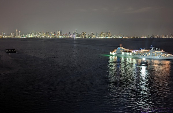
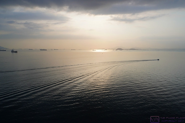
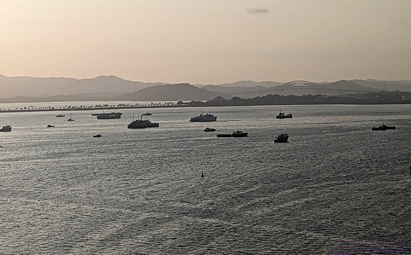
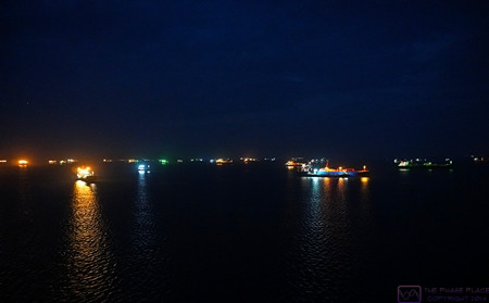
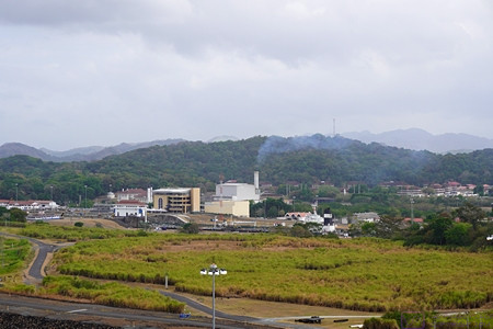
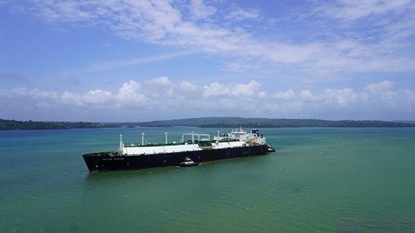
The ocean in the vicinity of Panama City and the entrance to the Panama Canal was crowded with ships waiting to make the transit.  Ships can book a date/time to start the transit, but it is much more expensive than just waiting in line.  Ships with non-perishable cargo and less critical delivery timelines choose to wait their turn and get the lower price.  The fee for the NCL Joy to transit the Canal was approximately $750,000 USD.  The pricing structure for the Canal is very complicated.  (Photo by Linda)

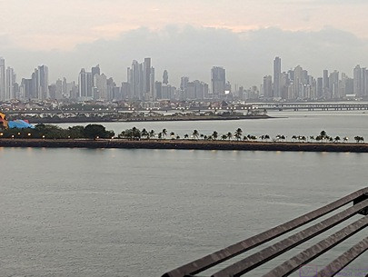
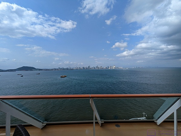
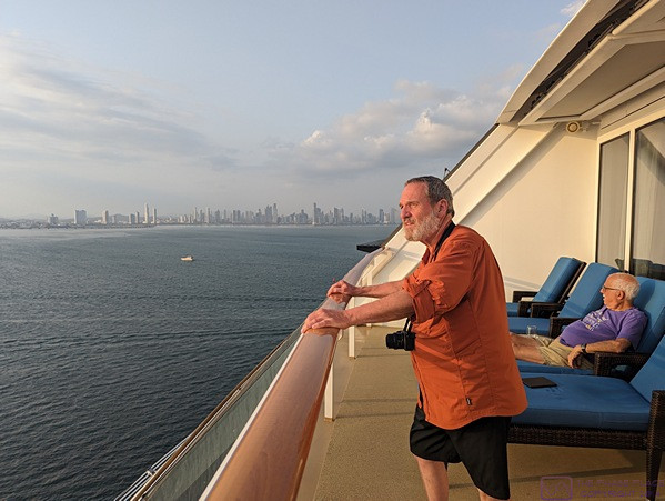
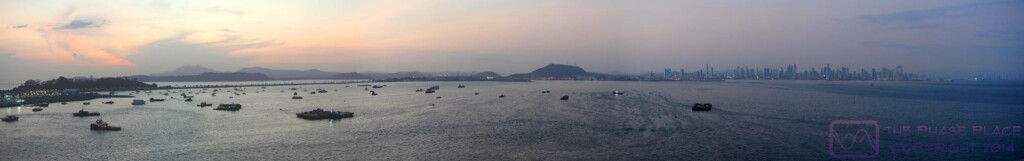
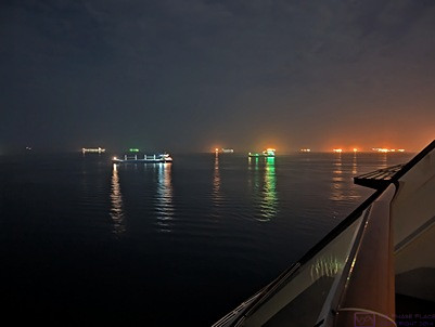
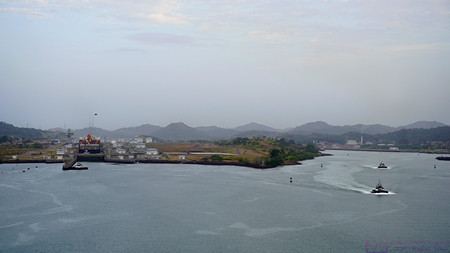
The NCL Joy left the dock at 5 AM to be in position for the 8 AM scheduled start of our transit.  It was dawn by the time we were moving towards the entrance of the Canal and were opposite our starting point.  Part of the Panama City skyline forms the background of this photo, taken by Linda.

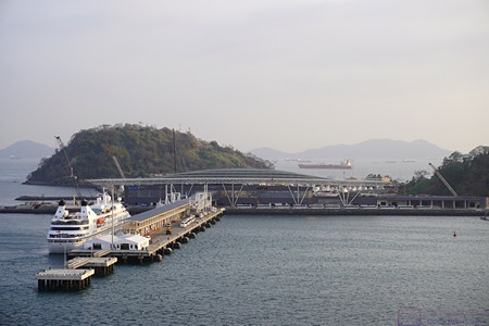
Starting into the marked channel that leads to the Panama Canal.  Our ship was docked in the harbor on the other side of the small hills to starboard (right).

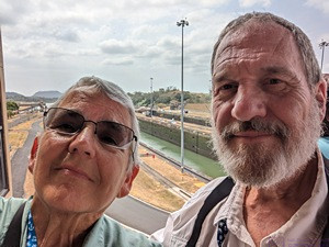
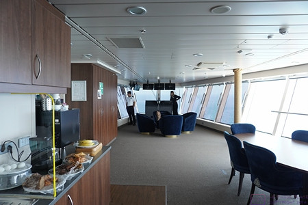
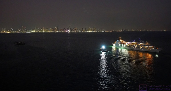
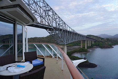
The Norwegian Joy left the dock in Panama City at 5 AM and we were up to see it off.  We spent the entire transit in our front-facing 18th deck stateroom; usually on the balcony.  We even took our meals in our room, one of the few times we took advantage of this perquisite.

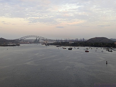
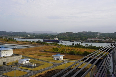
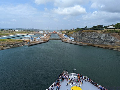
The Puente de las Americas (Bridge of the Americas) ahead.  Channel markers to the left and right of the ship are visible.  The hill on the right had the radio towers/antennas used to communicate with the ships using the Panama Canal.

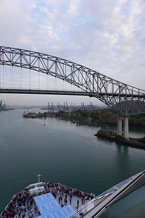
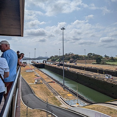
Approaching the Puente de las Americas (Bridge of the Americas).  This bridge is considered the (unofficial?) southern terminus of the Panama Canal.  Note the crowd of guests gathered on the foredeck of our ship.  This area is normally only open to crew, whose quarters are located foreship near this level.

The Bridge of the Americas to port (left) of the ship just after our balcony passed under it.  We are now (officially?) in the Panama Canal, but still some way from the first set of locks.

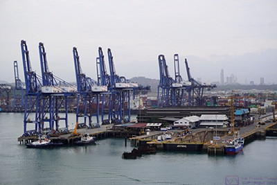
Large commercial/cargo docks to starboard (right).

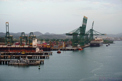
More commercial/cargo docks to port (left).


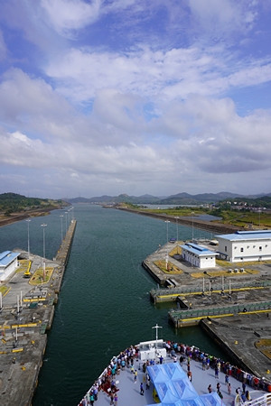
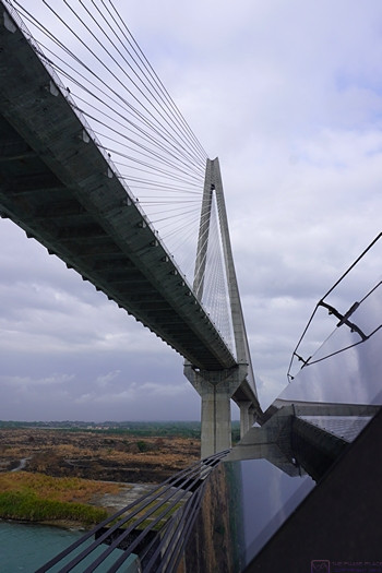
Ships transiting the Canal are queued up in the ocean and then proceed along a well-marked channel when cleared in.  The Bridge of the Americas is considered the southern terminus of the Canal and the Puente Atlántico (Atlantic Bridge) at Colon is considered the northern terminus.  Passing under either of these bridges is a cause for celebration on cruise ships.  And so, it was for us too; we finally opened our bottle of “welcome on board” champagne and toasted the moment.

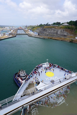
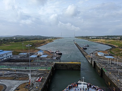
The original 2-flight Miraflores Locks are to starboard (right).  The newer (2016) 3-flight Panamax class Miraflores West (Cocoli) Locks are to port (left).  We used the newer locks as the NCL Joy is too large for the original ones.  Both sets of locks are still referred to as the Miraflores Locks.

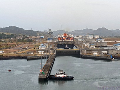
The NCL Joy lined up to enter the Miraflores West (Cocoli) Locks.  The tug boat is positioned to block the Joy from going in yet, and to render maneuvering assistance if/when needed.  (Photo by Linda)

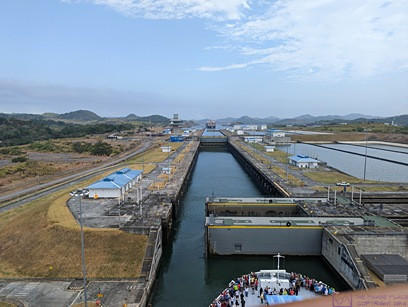
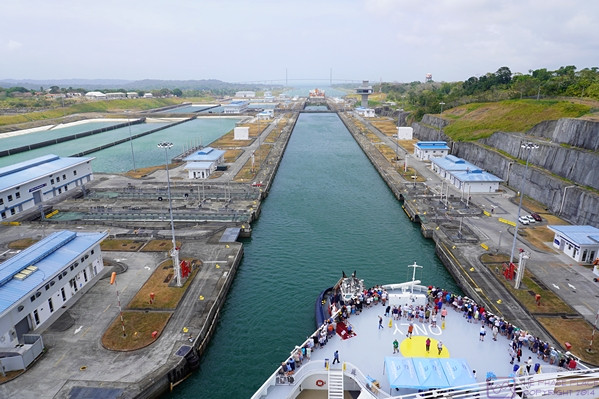
The double lock gates are sliding open so our ship can move from the first to the second/middle basin.  The NCL Joy is just over 1,000 feet long; too big for the older/original locks at either end of the Canal, but much smaller than the maximum 1,400-foot length the new locks can accommodate.  A third phase of lock building is in the planning stages with locks that will accommodate even bigger ships.  (Photo by Linda)

As our ship entered the Miraflores West (Cocoli) Locks, we could see other ships to starboard (right) using the original Miraflores Locks.

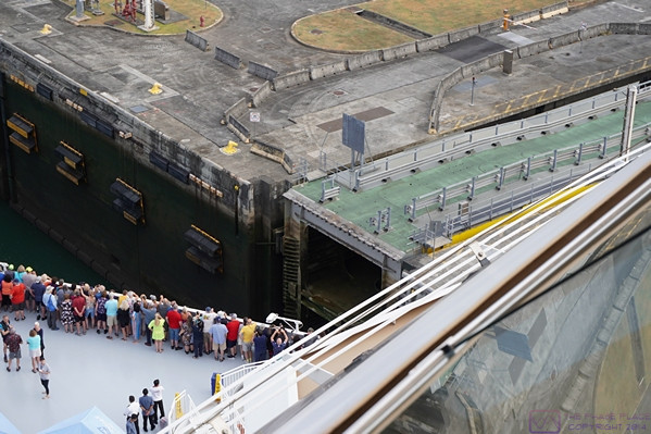
The structure center-right in the photo is the sliding lock gate that will close behind the ship once it is fully in the lock basin.  The green surface on top is a road that allows Canal staff to get from one side to the other (when the gate is closed, obviously).  All of the new locks use these massive sliding gates.  The original locks using swinging gates.

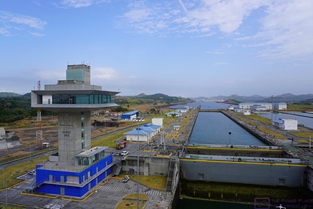
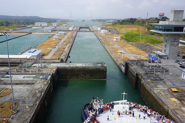
The “Cocoli control tower” for the Miraflores West Locks.  We had one more basin after the one we are currently in.  Each of the basins is an “elevator) that works like a bathtub.  When filled with water any boat(s) in the basin are raised in elevation.  When the water is drained, they are lowered.  When the water level is the same on both sides of a gate, it can be opened or closed, allowing ships to enter or leave the basin.

Exiting the last basin of the Miraflores West (Cocoli) Locks northbound.  Miraflores Lake can be seen ahead to starboard (right).  Because of the geology of this part of the Canal Zone, the original southern lock system consists of two flights in the Miraflores Locks and then a single flight in the Pedro Miguel Lock.  The body of water in-between is named Lake Miraflores.  The new West (Cocoli) Locks achieve the change in elevation in a 3-flight (staircase) lock system.  The two channels reunite just north of the Pedro Miguel Lock.


There is a lot of information available online and in books about the Panama Canal.  It’s a long, complicated story, and not a happy one in most regards.  I was glad I had taken the time to read about this before being here (Panama Fever, by Matthew Parker).  The engineering is amazing, and the location is beautiful, but it has a context and only became a reality at enormous cost in money, lives, and political relations with the countries of Central and South America.


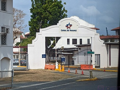
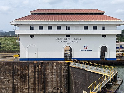
The Miraflores Locks Visitor Center and Control Room just left of center in the photo.

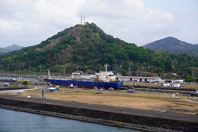
A smaller ship exiting the Miraflores Locks.


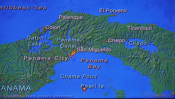
Regardless of which way you go through the Canal, the trip begins and ends with locks, three at each end, with Gatun Lake in-between.  The average sea level of the Pacific Ocean end of the Canal is only 20 cm higher than the average sea level on the Atlantic Ocean (Caribbean Sea) end.  Because this difference is so small, the original “vision” for the Canal was a sea level transit with perhaps one lock.  However, the tidal range on the Pacific Ocean end is 20 feet whereas on the Atlantic Ocean end it is 3 feet.  Thus, locks were going to be needed at each end just to account for this difference.  The fact that the Canal also had to cross the Continental Divide, ultimately meant that ships would have to change elevation by even more than the difference in sea levels, and the locks would have to accommodate this difference in elevation.

Gatun Lake is the largest man-made lake in the world, and was formed by damming the Rio Chagres.  The Rio Chagres was a raging river that would rise 20 feet during floods.  It had to be “tamed” (controlled) if the Panama Canal was ever to become a reality.  There are three locks at each end to accomplish the 85 ft change in elevation from sea level to the level of Gatun Lake.  New locks were built at each end, alongside the original ones, to accommodate larger ships and were opened in 2016.  Just north of the southern locks (Miraflores /  Lake Miraflores / Pedro Miguel are the old ones and Miraflores West (Cocoli) are the new ones.  I think Lake Gatun “officially” begins at the northern end of the Miraflores Locks complex.

Heading north from the Miraflores Locks area we came to the Culebra Cut.  Generally considered the most difficult part of building the Canal, it is a massively excavated passage through the Continental Divide.  The Canal was taken up 85 feet and through this area as it offered the best chance of actually getting through the divide.

The official length of the Panama Canal is 51 miles, which doesn’t seem like much, but it took the NCL Joy about 9 hours to make the trip, including the locks at each end.  As we sailed under the Atlantic Bridge we (officially) entered the Caribbean Sea (Atlantic Ocean) and continued on to our next port, sailing all night to get there by sunrise.

Following are the bulk of the photos from the transit:


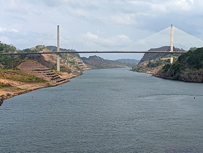
The Centennial Bridge at the Culebra Cut.  (Photo by Linda)

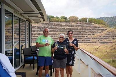
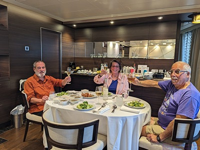
Paul, Linda, and Nancy with champagne glasses ready to toast our passage through the Culebra Cut.  (Linda is holding my glass while I take this photo.)  The “cut” was dug through the Continental Divide, and was the most difficult part of the Canal to create.

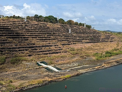
The sides of the “cut” are terraced to prevent erosion, which was a huge problem during the excavation of this passage through the Continental Divide.  (Photo by Linda)

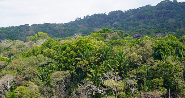
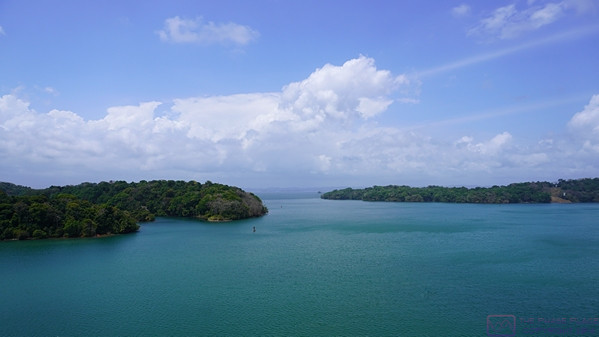
Panama is a beautiful place with lush flora.

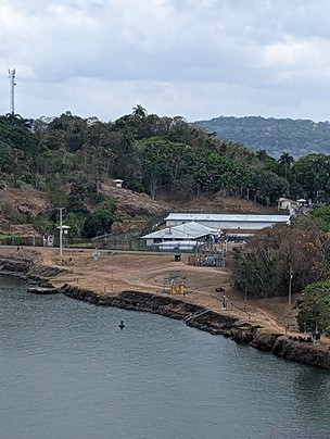
Panama is also a place with a long and troubled history.  This compound to starboard (right) is where Manuel Noriega was held before being extradited to the USA for trial.  (Photo by Linda)

At this point, we are through the Culebra Cut and passing the town of Gatun on the right.  This town within the Canal Zone is the base of operations for much of the Canal maintenance.  Note the massive barge crane at the center-right edge of the photo.  This crane, named Titan (nicknamed Herman the German), is able to lift the older swinging lock gates for repair and maintenance.  A part of the history of the construction and operation of that Canal, Titan was built by Nazi for servicing U-Boats (submarines) during WW II.  At maximum height, the top of the boom is 374 feet above the water.  Like everything else connected with the Canal, it is massive.  (Photo by Linda)

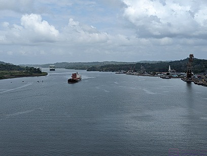
We are passing a southbound cargo ship (tanker?) on Lake Gatun.  (Passing was always portside-to-portside.)  Most of the Panama Canal consists of Lake Gatun.  The lake was formed by a dam on the Rio Chagres near the northern end, and is still the largest man-made lake in the world.

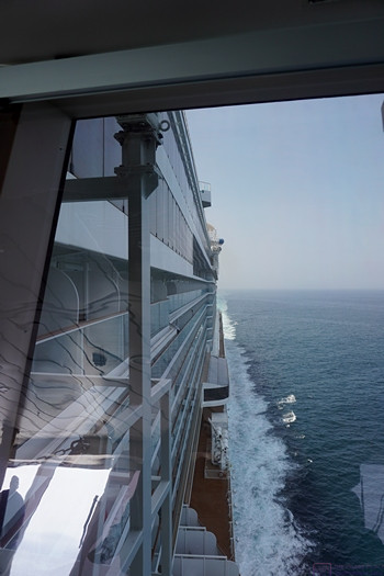
Another view of Lake Gatun.  Channel markers are visible to port (left).  It was a generally lovely day for the transit with a mix of blue skies and clouds.  It was warm, but not uncomfortable on the deck (which always had a breeze from the movement of the ship) and we could go back into the stateroom if/when needed.

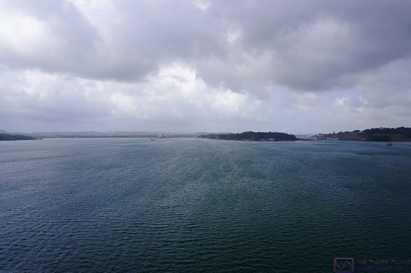
The clouds have filled in somewhat as we approach the northern end of the Canal and the end of the transit.

Approaching the new (2016 Panamax class) Gatun East Locks at the northern end of the Panama Canal.  The cargo ship that entered the Canal ahead of us this morning is in the locks.   The original Gatun Locks are off to the port (left) side out of the frame.

A small crowd of guests remains at the bow platform of the NCL Joy as we approached the Gatun East Locks and prepared to be lowered down to the level of the Caribbean Sea (Atlantic Ocean).  (Photo by Linda)

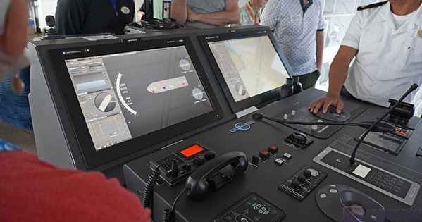
We are now close enough to the Gatun East Locks that a tug boat has taken up position on the port side of the bow to help guide the NCL Joy into the first basin.  (In a Q&A with the Captain of the NCL Joy, he was quite blunt about not needing the assistance of tug boats when maneuvering the Joy at docks, or elsewhere, and found their presence more bothersome than helpful.  I think he felt the same way about harbor pilots.)

As we entered the first basin of the Gatun East Locks, the ponds used as part of the system for emptying and filling the lock basins were visible on the port (left) side of the ship.  These ponds conserve some of the massive amount of water needed to operate the locks, where all of the water to fill the locks flows by gravity.

The water level in the first (Lake Gatun) basin has been lowered and the water lever in the second basin raised so that both basins are at the same water level, allowing the sliding gate to be opened so the NCL Joy can move to the second basin.

As the last lock gate opens, the NCL Joy has finally completed its journey from the Pacific Ocean, up and over (through) the continental divide, and back down to the Caribbean Sea (Atlantic Ocean).  It was quite a trip and we certainly had “the best seats in the house.”  (Photo by Linda)

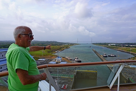
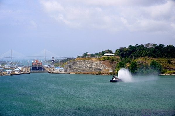
As the NCL Joy exits the last basin at the current level of the Caribbean Sea, Paul points out the Puente Atlántico (Atlantic Bridge) and the Caribbean Sea beyond.

Passing under the Puerto Atlantic (Atlantic Bridge) and into the Caribbean Sea (Atlantic Ocean).


It was around 5 PM local time as we passed under the Atlantic Bridge, marking our transit time at 9 hours.  From here, the ship headed north (N) and then northeast (NE) for a short way  before turning East East North (EEN) on a fairly direct course for Cartagena, Columbia where we were scheduled to enter the harbor around sunrise.


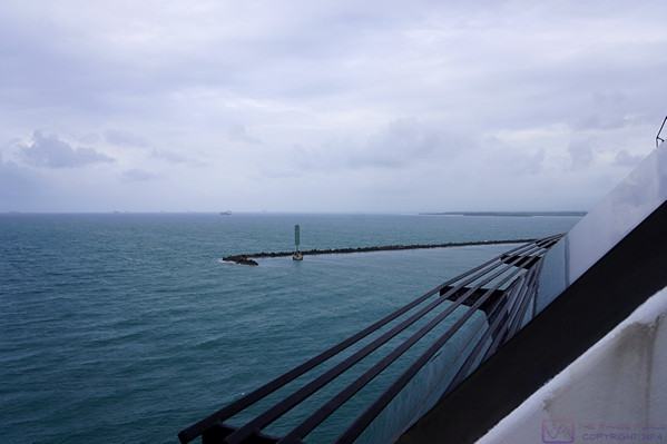
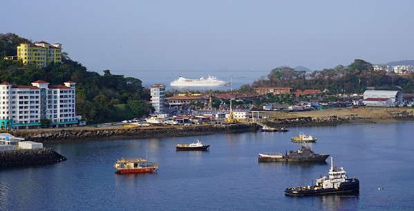
As we pass through the breakwater that protects the harbor at Canal terminus at Colon, Panama we sailed into the Caribbean Sea and points east.


20230305 PCC 8 of12 – Panama City, Panama; Gateway to South America

[ This post contains 12 photos with captions. ]

SUNDAY 05 March – Panama City, Balboa, and the Panama Canal Zone


A photo from last night of the other cruise ship next to the NCL Joy just after leaving the dock.  It will head around to the right (west) and position itself in the queue to enter the Panama Canal tomorrow morning.  (Photo by Linda.)

The other cruise ship heading towards the Pacific Ocean entrance to the Panama Canal just before 8 AM for the beginning of its scheduled transit of the Canal.  The ship left the dock next to us last evening to queue up in Panama Bay for its transit this morning.  A lot of ships move through the Canal every 24 hours, and it’s imperative that ships with reservations arrive at the first lock (at either end) exactly on time.

Panama City was the only port where we stayed overnight; in this case for two nights, before transiting the Panama Canal.  This meant that passengers had a chance to go ashore last night and take in the life of the city after sunset.  It also meant that passengers (and some crew) had a full day today to explore the area, either on a shore excursion or on their own without fear of not getting back to the ship on time.


The road leading out of the port/dock area and onto the causeway to the mainland.  (Photo by Linda.)

Paul and Nancy arranged a private tour of Panama City while we signed up for one of the shorter ship-arranged shore excursions.  Our excursion was aboard a motorcoach with an excellent tour guide and focused mostly on the southeastern end of the Canal Zone in Balboa, now a NW suburb of Panama City.  (The Panama Canal runs from Panama City northwest to Colón at the other end.)  We had read about the history and operation of the Canal in the book Panama Fever (by Matthew Parker) before arriving here, and the history/technology of the Canal was what interested us most about the area.  The following, however, is excerpted from the Wikipedia entry “Panama Canal Zone”:


The Panama Canal Zone … was an unincorporated territory of the United States, located in the Isthmus of Panama, that existed from 1903 to 1979. It was located within the territory of Panama, consisting of the Panama Canal and an area generally extending five miles (8 km) on each side of the centerline, but excluding Panama City and Colón.  Its capital was Balboa.

The Panama Canal Zone was created on November 18, 1903 from the territory of Panama; established with the signing of the Hay–Bunau-Varilla Treaty, which allowed for the construction of the Panama Canal within the territory by the United States. The zone existed until October 1, 1979, when it was incorporated back into Panama.

In 1904, the Isthmian Canal Convention was proclaimed. In it, the Republic of Panama granted to the United States in perpetuity the use, occupation, and control of a zone of land and land underwater for the construction, maintenance, operation, sanitation, and protection of the canal. From 1903 to 1979, the territory was controlled by the United States, which had purchased the land from its private and public owners, built the canal and financed its construction. The Canal Zone was abolished in 1979, as a term of the Torrijos–Carter Treaties two years earlier; the canal itself was later under joint U.S.–Panamanian control until it was fully turned over to Panama in 1999.


(Photo by Linda.)  The Biomuseo (Bio-Museum) building.  From the Wikipedia entry “Biomuseo”:  “The Biomuseo is a museum focused on the natural history of Panama, whose isthmus was formed very recently in geologic time, with major impact on the ecology of the Western Hemisphere.  Located on the Amador Causeway in Panama City, Panama, it was designed by renowned architect Frank Gehry. This is Gehry’s first design for Latin America. The design was conceived in 1999 and the museum opened on 2 October 2014.  The Biomuseo highlights Panama’s natural and cultural history, emphasizing the role of humans in the XXI century. Its galleries tell the story of how the rise of the isthmus of Panama changed the world.” …


Although no longer under direct US control or military protection, the “Canal Zone” still exists as a highly secured area.  This is one of many entrance gates.  The lettering on the arch reads “CANAL DE PANAMA”.  (Photo by Linda.)

While the long-term goal is to have the Canal operated and maintained by Panamanians, it remains the case today that many of the people operating the canal are US citizens who are also training Panamanians to take over those roles.


Much of our shore-excursion focused on the infrastructure that was built to house the administration, construction, and health care facilities as well as the housing needed by the canal employees, and U.S. military bases and personnel.  These facilities remain in use today, some still attached to canal operations while others are being converted into private or other public uses such as housing, schools, and health care facilities.

One of the many housing areas in Balboa original built to house the thousands of U.S. workers who oversaw the building and operation of the Canal.


The main administration building of the Panama Canal Company, still in use for its original purpose today by the Panama Canal Authority, part of the Government of Panama.  The operation of the Canal is a large, technically complex endeavor, and generates a significant portion of the revenues that flow into the Government of Panama.  (Photo by Linda.)

A view of the Miraflores Locks from the Visitor Center observation building, looking back towards the Pacific Ocean.  Between the road and the lock basin are the train tracks for the “mules” that control the movement of the ships through these locks.  The Miraflores locks are the original ones but are still in use for all but the newest/largest ships, which do not fit the length, width, or draft limitations.  The new locks, which accommodate much larger ships, are out of sight to right in this photo.  (Photo by Linda.)


One of the control buildings for the Miraflores Locks.  The gates are closed, separating the basin on the left at a low-water level, from the basin on the right at a high-water level.  Water flows in and out of these basins by gravity.  The gates are only swung open when the water level on both sides is exactly the same.  This is conceptually the same technology that was used hundreds of years ago in Great Britain to create the canal system there; although the scale is much larger here.  The newer locks (opened in 2016) do not use swinging gates.  They use sliding doors (like pocket doors) instead.  (Photo by Linda.)


We were there!  (Photo by Linda.  Not photoshopped, promise.)


The U.S. Embassy.  The Torrijos–Carter Treaties treaty that returned sovereignty of the Panama Canal Zone to Panama as well as primary responsibility for its defense, nevertheless also preserved that right of the USA to intervene militarily if the Canal and its neutral operation (open to ships of all nations) should be threatened at any time in the future.  (Photo by Linda.)


A view of Panama City from the balcony of our stateroom.  The Joy remained at the dock until early the next morning, when it departed to queue up for the transit.


20230304 PCC 7of 12 – At sea & Panama City, Panama (Day 1)

[ This post has 25 photos with captions. ]


SATURDAY 04 March – Enroute to, and arrival at, Panama City, Panama

Again, our original itinerary had us stopping in Puerto Caldera (Puntarenas), Costa Rica but the revised itinerary skipped this stop and went directly to Panama City, Panama.  We would have liked to stop in Costa Rica, but recalled that shortly before NCL changed the itinerary in early October 2022, the US State Department had issued a travel advisory against visiting the country.  We don’t know if this was the reason for the change, but it seemed to be more than coincidental.  Something similar might have been true for Nicaragua, but we did not recall any advisories regarding travel there.  It was possible that the other changes in the itinerary might have been a domino effect from the loss of the Costa Rica stop, but we were never informed of the reasons for the changes.  And  it’s worth noting that these kinds of changes are always part of the booking contract; the cruise lines do not guarantee their itineraries.


We were at sea for most of the day, however, and made good use of the time.  This was the only day that the NCL Joy was doing “behind the scenes” tours of the ship.  We knew ahead of time that this experience would be very limited, and signed up for the tour (they treat it as a “shore excursion”) as soon as possible after we got on the ship in the Port of Los Angeles.  It turned out that they only offered the tour on this day while we were at sea, and only offered two groups, both of which were limited in the number of participants.  Here are some images of parts of the ship where I was allowed to take photos or there was something interesting to see.

A view of the main kitchen under the Manhattan dining room at the aft of the ship.

The Linda/Nan culinary team enjoying their tour of the NCL Joy main kitchen facilities.


A view of the laundry facility.  The machines to the right are used to press certain clothing items, such as officers’ uniforms.

Another view of the pressing portion of the laundry facility.


Some of the washing machines in the laundry facility.


This machine irons napkins.  The napkins shown here (with the blue banding) are unique to the buffet dining area.  The laundry facility handles approximately 6,000 of these napkins every day.


This machine irons and folds bedding.  The operator hangs the sheet and then the arms spread apart and feed it into the rollers.


Folder sheets coming off of the machine in the previous photo.


Our behind-the-scenes tour of the NCL Joy included a visit to the bridge.  Shown here is the helm/navigation station in the center (side-to-side).  The bridge covers the entire width of the ship at the forward end of Deck 14, and extend beyond the sides of the ship on both the port and starboard sides.  All of the bridge officers have their living quarters immediately aft of the bridge.  We also got to visit the engine control room (but not the engine room, for safety reasons).  I found all aspects of the ships operation to be fascinating, but the control room and bridge caught my interest in particular.

A view towards the port side wing station of the bridge.


The port side wing station looking aft.  The ship can be driven from this location, which is used when docking using the port side of the ship.  The pilot has a clear view of the port side of the ship, for and aft, as well as down through a glass portion of the floor.

There are a lot of controls at the port side wing station, and yet it had a beautiful, clean layout.


The view looking aft from the port side wing station of the bridge.


We were never south of the equator on this cruise, so that experience is still somewhere in our future.  While I did not make note of our most southern latitude, it had to occur somewhere between the southern tip of Isla Jicaron (7.2 deg N) and the southern edge of the peninsula southwest of Panama City that forms the western edge of the Gulf of Panama (also 7.2 deg N).


Prior to this, our furthest south latitude was around 16 deg N when we visited Roatán, Honduras on our second Holistic Holiday at Sea cruise on the MSC Poetia in March 2013.


An example of the map that was constantly available as part of the ship/route information on the monitors in our stateroom.  The NCL Joy’s location is the yellow arrow with the red circle, center bottom of the screen, heading north into Panama Bay.  Panama City is the orange area ahead of (N) and slightly to the left (NNW) of the ship.  The Pacific Ocean terminus of the Panama Canal is at Panama City (Balboa) and runs NW to it’s Atlantic Ocean (Caribbean Sea) terminus at Colon.  Gatun Lake is a major portion of the Canal.

This larger view of the area shows the location of our ship relative to both North and South America.  The ship’s track is shown from (just before) Acapulco, Mexico to Puerto Quetzal, Guatemala, and then to Panama City, Panama.  Our next port of call after transiting the Panama Canal will be Cartagena, Columbia, so it’s clear that our farthest south latitude was achieved as we rounded the peninsula to the southwest of Panama City.

I included this photo to give a better sense of our location relative to the equatorial portion of South America as well as the relative closeness of Africa.

Linda contemplates our arrival in Panama City.  The coast of Panama is faintly visible on the horizon.

Panama City sits on the northeast side of the Pacific entrance to the Panama Canal.  It is the capital of Panama, and has a modern, impressive skyline facing the ocean.  It is sometimes compared to the Miami (USA) shoreline, and has become a jewel of, and gateway to, South America.  And yes, it is considered to be in South America, the official dividing line between North and South America being the Panama Canal (which runs from SE to NW when going from the Pacific Ocean to the Caribbean Sea).

As we came into Panama Bay and approached Panama City, we saw more and more ships “anchored out”.  The number was impressive.  We eventually learned to many (most?) of them were waiting to transit the Panama Canal.  Ships transiting the Canal are able to make a reservation or can anchor in the harbors on either end and wait for an opening.  The wait can be as much as three (3) weeks, but is less expensive than a reserved entry time.

Coming into the cruise ship dock and terminal area.  This area is at the end of a long, man-made causeway, so Panama City proper is not really accessible by foot and requires some form of transportation to get into town.  A major improvement project was underway while we were there, but was not an issue.  A smaller cruise ship was already at the dock.  The ship in the distance has just exited the Panama Canal.

Panama City had lots to offer, however, and was the only port where we stayed overnight; in this case for two nights.  We are not “night life” people, and did not leave the ship this evening, but other passengers went ashore to explore and take in the life of the city after sunset.


The next day, Paul and Nancy arranged a private tour of Panama City while we signed up for a ship-arranged shore excursion, which I cover in the next post.  In the meantime, here are a few more photos from today:

A view of the Panama City skyline as Paul and I observe the docking process from our stateroom balcony.  (Photo by Linda.)

We were scheduled to arrive at the dock in Panama City around dinner time, so we opted to have dinner in our stateroom, allowing us to conveniently watch the whole process.  Panama City is visible through the doorwalls and the location map is showing on the monitor


A better view of our meal.  Salud!  (Photo by Linda.)


A composite image of 10 photos of the Panama City harbor skyline and the causeway that leads out to the cruise ship terminal and dock.  The water on the other side of the causeway leads (to the right) to the beginning of the Panama Canal.

The Centennial Bridge, visible in this photo, is usually taken as the official Pacific Ocean terminus of the Panama Canal.  (Photo by Linda.)

The Panama City skyline at night, as the other cruise ship leaves the dock to position itself in the Bay for its scheduled transit of the Panama Canal.