[ This post has 25 photos with captions. ]
SATURDAY 04 March – Enroute to, and arrival at, Panama City, Panama
Again, our original itinerary had us stopping in Puerto Caldera (Puntarenas), Costa Rica but the revised itinerary skipped this stop and went directly to Panama City, Panama. We would have liked to stop in Costa Rica, but recalled that shortly before NCL changed the itinerary in early October 2022, the US State Department had issued a travel advisory against visiting the country. We don’t know if this was the reason for the change, but it seemed to be more than coincidental. Something similar might have been true for Nicaragua, but we did not recall any advisories regarding travel there. It was possible that the other changes in the itinerary might have been a domino effect from the loss of the Costa Rica stop, but we were never informed of the reasons for the changes. And it’s worth noting that these kinds of changes are always part of the booking contract; the cruise lines do not guarantee their itineraries.
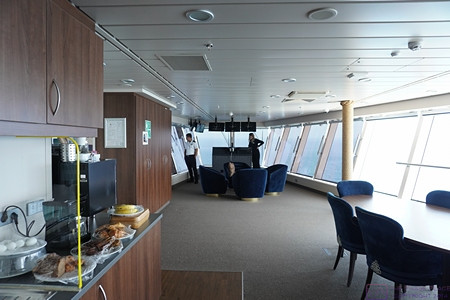
We were at sea for most of the day, however, and made good use of the time. This was the only day that the NCL Joy was doing “behind the scenes” tours of the ship. We knew ahead of time that this experience would be very limited, and signed up for the tour (they treat it as a “shore excursion”) as soon as possible after we got on the ship in the Port of Los Angeles. It turned out that they only offered the tour on this day while we were at sea, and only offered two groups, both of which were limited in the number of participants. Here are some images of parts of the ship where I was allowed to take photos or there was something interesting to see.
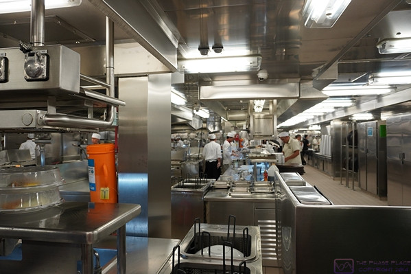
A view of the main kitchen under the Manhattan dining room at the aft of the ship.

The Linda/Nan culinary team enjoying their tour of the NCL Joy main kitchen facilities.
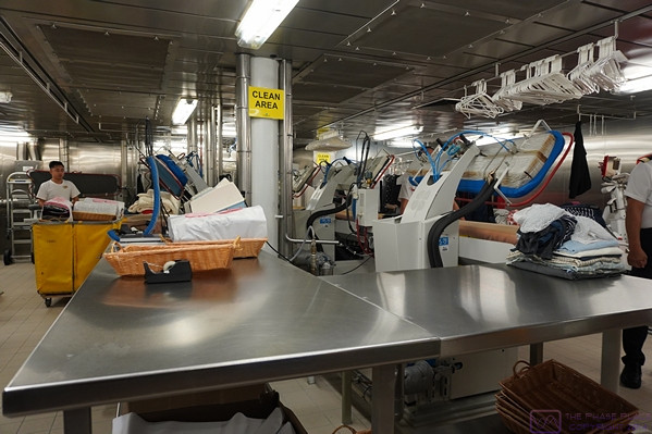
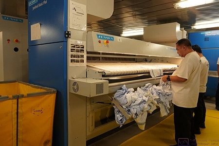
A view of the laundry facility. The machines to the right are used to press certain clothing items, such as officers’ uniforms.
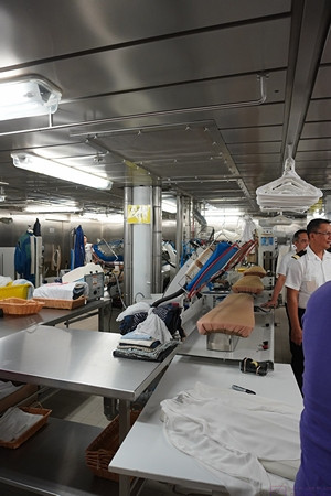
Another view of the pressing portion of the laundry facility.
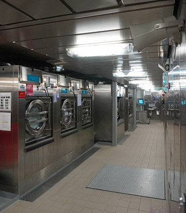
Some of the washing machines in the laundry facility.
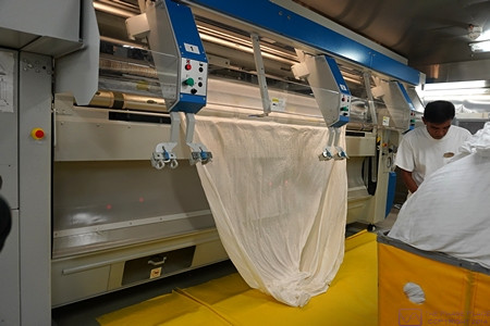
This machine irons napkins. The napkins shown here (with the blue banding) are unique to the buffet dining area. The laundry facility handles approximately 6,000 of these napkins every day.
This machine irons and folds bedding. The operator hangs the sheet and then the arms spread apart and feed it into the rollers.
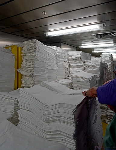
Folder sheets coming off of the machine in the previous photo.
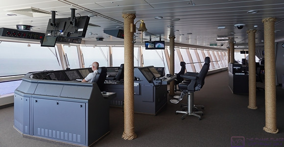
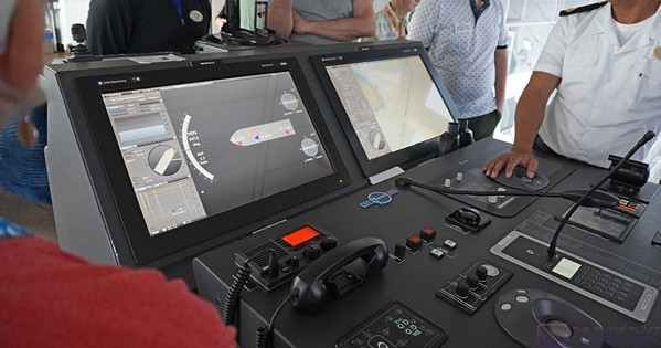
Our behind-the-scenes tour of the NCL Joy included a visit to the bridge. Shown here is the helm/navigation station in the center (side-to-side). The bridge covers the entire width of the ship at the forward end of Deck 14, and extend beyond the sides of the ship on both the port and starboard sides. All of the bridge officers have their living quarters immediately aft of the bridge. We also got to visit the engine control room (but not the engine room, for safety reasons). I found all aspects of the ships operation to be fascinating, but the control room and bridge caught my interest in particular.
A view towards the port side wing station of the bridge.
The port side wing station looking aft. The ship can be driven from this location, which is used when docking using the port side of the ship. The pilot has a clear view of the port side of the ship, for and aft, as well as down through a glass portion of the floor.
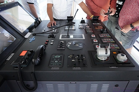
There are a lot of controls at the port side wing station, and yet it had a beautiful, clean layout.
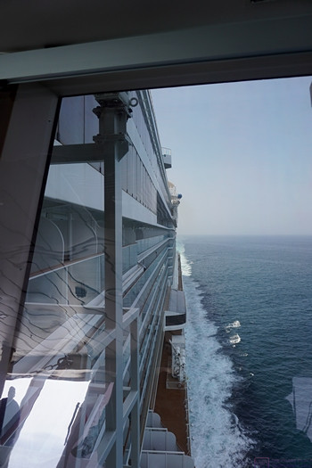
The view looking aft from the port side wing station of the bridge.
We were never south of the equator on this cruise, so that experience is still somewhere in our future. While I did not make note of our most southern latitude, it had to occur somewhere between the southern tip of Isla Jicaron (7.2 deg N) and the southern edge of the peninsula southwest of Panama City that forms the western edge of the Gulf of Panama (also 7.2 deg N).
Prior to this, our furthest south latitude was around 16 deg N when we visited Roatán, Honduras on our second Holistic Holiday at Sea cruise on the MSC Poetia in March 2013.
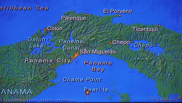
An example of the map that was constantly available as part of the ship/route information on the monitors in our stateroom. The NCL Joy’s location is the yellow arrow with the red circle, center bottom of the screen, heading north into Panama Bay. Panama City is the orange area ahead of (N) and slightly to the left (NNW) of the ship. The Pacific Ocean terminus of the Panama Canal is at Panama City (Balboa) and runs NW to it’s Atlantic Ocean (Caribbean Sea) terminus at Colon. Gatun Lake is a major portion of the Canal.
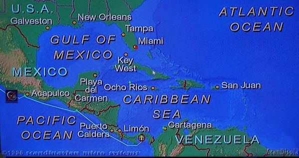
This larger view of the area shows the location of our ship relative to both North and South America. The ship’s track is shown from (just before) Acapulco, Mexico to Puerto Quetzal, Guatemala, and then to Panama City, Panama. Our next port of call after transiting the Panama Canal will be Cartagena, Columbia, so it’s clear that our farthest south latitude was achieved as we rounded the peninsula to the southwest of Panama City.
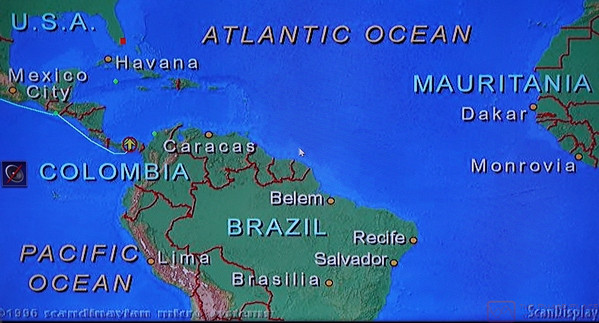
I included this photo to give a better sense of our location relative to the equatorial portion of South America as well as the relative closeness of Africa.
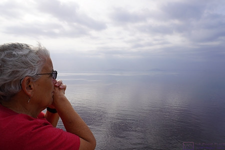
Linda contemplates our arrival in Panama City. The coast of Panama is faintly visible on the horizon.
Panama City sits on the northeast side of the Pacific entrance to the Panama Canal. It is the capital of Panama, and has a modern, impressive skyline facing the ocean. It is sometimes compared to the Miami (USA) shoreline, and has become a jewel of, and gateway to, South America. And yes, it is considered to be in South America, the official dividing line between North and South America being the Panama Canal (which runs from SE to NW when going from the Pacific Ocean to the Caribbean Sea).
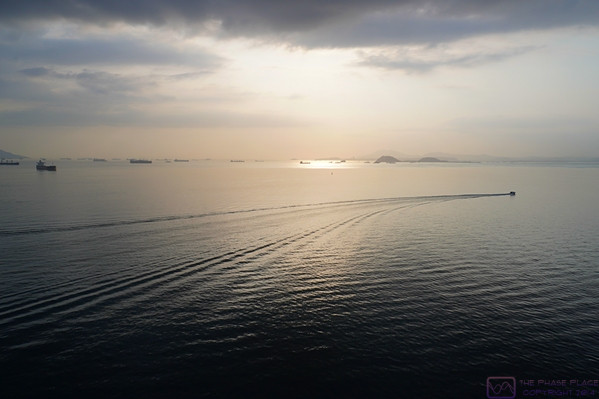
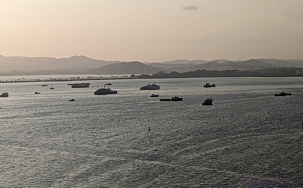
As we came into Panama Bay and approached Panama City, we saw more and more ships “anchored out”. The number was impressive. We eventually learned to many (most?) of them were waiting to transit the Panama Canal. Ships transiting the Canal are able to make a reservation or can anchor in the harbors on either end and wait for an opening. The wait can be as much as three (3) weeks, but is less expensive than a reserved entry time.
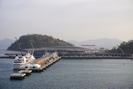
Coming into the cruise ship dock and terminal area. This area is at the end of a long, man-made causeway, so Panama City proper is not really accessible by foot and requires some form of transportation to get into town. A major improvement project was underway while we were there, but was not an issue. A smaller cruise ship was already at the dock. The ship in the distance has just exited the Panama Canal.
Panama City had lots to offer, however, and was the only port where we stayed overnight; in this case for two nights. We are not “night life” people, and did not leave the ship this evening, but other passengers went ashore to explore and take in the life of the city after sunset.
The next day, Paul and Nancy arranged a private tour of Panama City while we signed up for a ship-arranged shore excursion, which I cover in the next post. In the meantime, here are a few more photos from today:
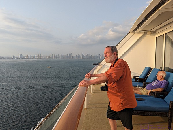
A view of the Panama City skyline as Paul and I observe the docking process from our stateroom balcony. (Photo by Linda.)
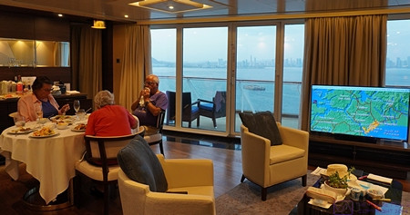
We were scheduled to arrive at the dock in Panama City around dinner time, so we opted to have dinner in our stateroom, allowing us to conveniently watch the whole process. Panama City is visible through the doorwalls and the location map is showing on the monitor
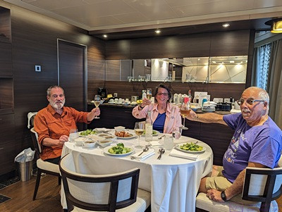
A better view of our meal. Salud! (Photo by Linda.)
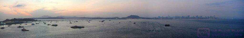
A composite image of 10 photos of the Panama City harbor skyline and the causeway that leads out to the cruise ship terminal and dock. The water on the other side of the causeway leads (to the right) to the beginning of the Panama Canal.
The Centennial Bridge, visible in this photo, is usually taken as the official Pacific Ocean terminus of the Panama Canal. (Photo by Linda.)
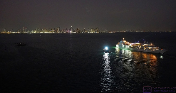
The Panama City skyline at night, as the other cruise ship leaves the dock to position itself in the Bay for its scheduled transit of the Panama Canal.
…