Category Archives: Historical Parks

20231031_NTNP_14-14_End-of-the-Trace

Note:  This post contains 17 photos with captions, and some minor narrative.  Photos by me (Bruce) taken with a SONY alpha 6400 or Google Pixel 6 Pro unless otherwise indicated.  (Photos by Linda taken with a Google Pixel 6.)


TUESDAY 31 October 2023 — NTNP 14 of 14 — End of the Trace:  Emerald Mound (again) and the Town of Rocky Springs, near Natchez, MS


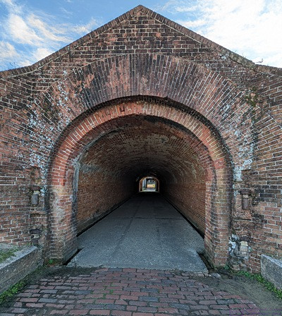
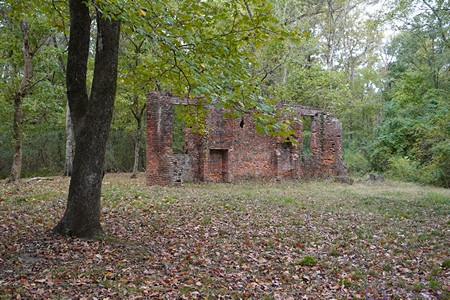
The only remaining wall of the Elizabeth Female Academy in Washington (West Natchez), Mississippi.  (See the next photo and caption.)


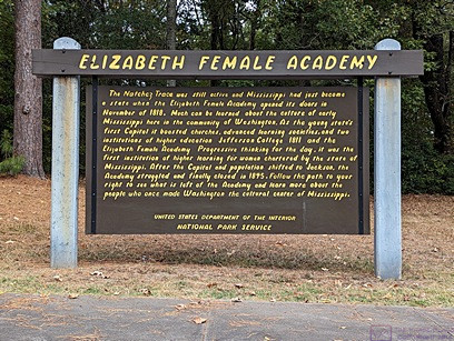
ELIZABETH FEMALE ACADEMY information sign.  Paraphrased from Wikipedia:  The Elizabeth Female Academy, founded in 1818 in the town of Washington (West Natchez), was the first female educational institution in Mississippi. It was named after Mrs. Elizabeth Roach (later Greenfield), who donated the land on which the school was located. The school closed in 1845, due in part to the relocation of the state capital from Natchez to Jackson, the general shift in the center of population, and several epidemics of yellow fever in the area. The site was reduced to ruins by a fire in the late 1870s. Part of a brick wall is all that now remains of the Academy buildings.

Learn more at:  Elizabeth Female Academy – Wikipedia


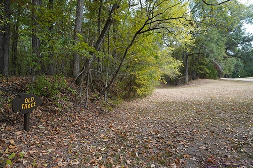
The small sign post at the lower left of the photo says Old Trace with an arrow pointing to the right.  This section of the old (original) trail starts at the opening on the left. 


We walked on identified sections of the original (old) Trace when we could.  We enjoyed the short hikes and admired the natural beauty of these places but also thought about the arduous journeys that so many people made along this trail so many years ago and the history that surrounds it.


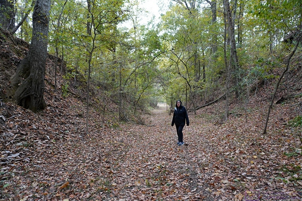
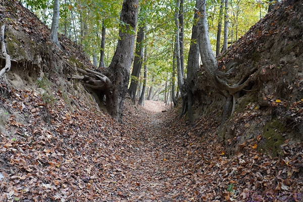
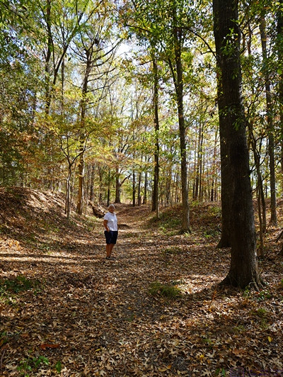
Over time and thousands upon thousands of footsteps, the path of the Trace gradually wore down below the surface level of the surrounding landscape.  As shown here , the depth at this point is over twice Linda’s height.


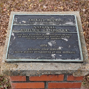
EMERALD MOUND NATIONAL HISTORIC LANDMARK plaque.  We returned to Emerald Mound today as we only had a brief visit yesterday, mostly the find it.


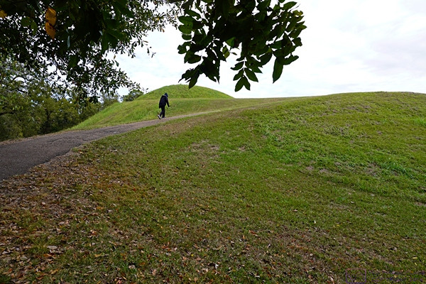
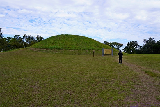
The trail leading to the top of Emerald Mound was paved but steep.  This photo gives a sense of the height of the mound from the parking lot.


Linda on top of Emerald Mound heads towards a smaller mound and information sign.


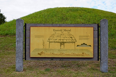
This information sign and graphic provided a visualization of how archeologists think the structures atop Emerald Mound were arranged, appeared, and used.


Another section of the Old Natchez Trace.  Sections like this are sometimes labeled “Sunken Trace,” but if that was the case here, I did not document it.


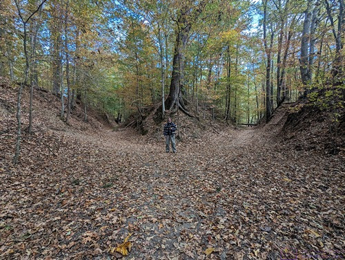
A picture of me for scale (and just because) at a point where the Natchez Trace splits into two paths.  We rarely saw splits like this, and have no idea how common or rare this was on the original trail.


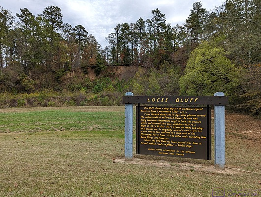
LOESS BLUFF information sign.  The loess bluff is the shear area behind the sign,  From MS Edge (Co-Pilot):  A loess bluff is a fascinating geological feature formed by the accumulation of windblown sediment known as loess.  Loess (pronounced LOW-ess) is a type of fine-grained, silty soil composed of particles deposited by the wind. It’s typically light yellow or tan in color.  During the Ice Age, glaciers covered the northern half of the United States. As these glaciers receded, they left behind vast expanses of bare land.  Continuous dust storms swept in from the western plains, carrying fine particles of dust and soil. These winds deposited the loess layer over the landscape.  The result?  Bluffs—steep, elevated landforms—made up of this windblown topsoil. Loess bluffs can be found in various regions around the world.  …  Mississippi also boasts its own loess bluffs, where nearly continuous dust storms during the Ice Age created a layer of sandy soil 30 to 90 feet deep.
 

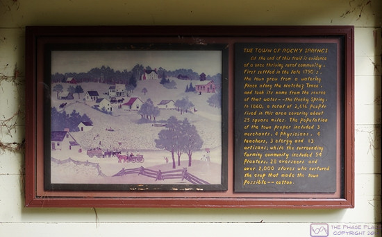
THE TOWN OF ROCKY SPRINGS information sign.  The town was first settled in the 1790’s.  In 1860 it had a population of 2,616 people spread over a 25 square mile area.  Over 2,000 of those people were slaves who tended the fields of cotton, the main crop that made this town possible.


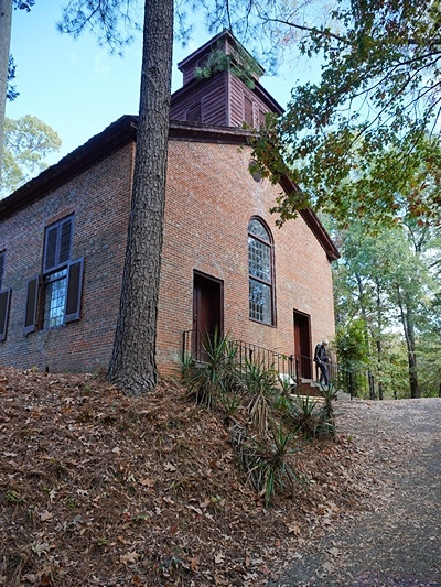
The historic Methodist church in Rocky Springs, Mississippi is the only remaining structure of Rocky Springs and continued to hold Sunday services until 2010.  The site and church are now maintained by the National Park Service.


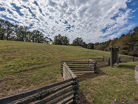
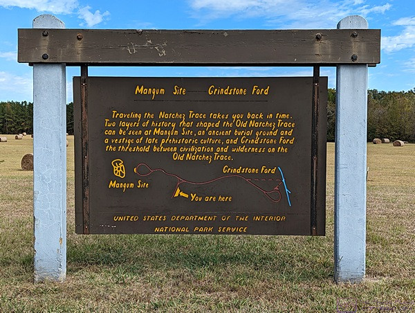
MAGNUM SITE and GRINDSTONE FORD information sign.  The Magnum Site is a prehistoric mound and the Grindstone Ford was the threshold between civilization and wilderness on the Old Natchez Trace.


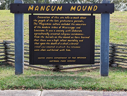
MAGNUM MOUND information sign.  Archeological excavation of this mound revealed much evidence about the prehistoric Plaquemine culture that was the precursor of the modern tribes of Louisiana and Mississippi.


A view of Magnum Mound from near the information sign.


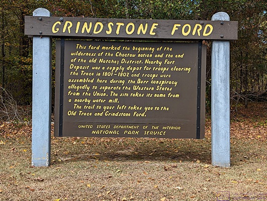
GRINDSTONE FORD information sign.  The FORD marked the end of the old Natchez Trace District and the beginning of the (wilderness of the) Choctaw Nation.  But it was only “wilderness” in the eyes of the Europeans who were moving into and “settling” the area.


And that is the end of my 14th and last post on our trip down the Natchez Trace National Parkway.  It was a trip we had long talked about doing, and even planned for, and we were pleased to have finally done it.  Up next, our month in Gulf Shores, Alabama hanging out with friends.

20231028_NTNP_11-14_West-Florida-Boundary_and_Vicksburg-MS

Note:  This post contains 11 photos with captions and a little narrative.  Photos by me (Bruce) taken with a SONY alpha 6400 or Google Pixel 6 Pro unless otherwise indicated.  (Photos by Linda taken with a Google Pixel 6.)


SATURDAY 28 October 2023 — NTNP 11 of 14 — West Florida Boundary and Vicksburg Civil War sites


Heading south on the Natchez Trace NP from our Boondockers Welcome site, our first stop was the West Florida Boundary parking area.  It was also a trailhead for a section of the Natchez Trace.  This photo provides a sense of scale to the trail and surrounding forest.


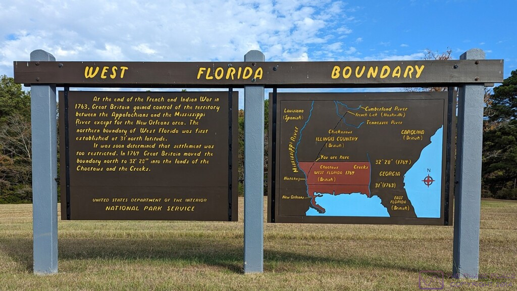
WEST FLORIDA BOUNDARY sign.  This image file is 1200×675 pixels and can be viewed a full-resolution on a suitable device.  The sign on the right with the map shows the territory known as “West Florida.”  The lower lower/narrow strip along the sea was the extent of the territory as of the end of the French and Indian War in 1763, at which time Great Britain gained control of the lands west to the Mississippi River.  The northern boundary of this area was set at 31 deg N latitude.  The region was quickly considered too restricted for settlement, and a year later (1764) the British (unilaterally) moved the northern boundary to 32 deg 28 min N latitude into the lands of the Choctaws and Creeks, approximately tripling its size.


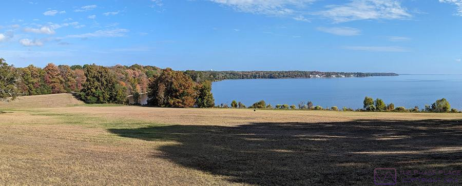
This photo was taken at the Reservoir Overlook for the Ross R. Barnett Reservoir just on the NTNP near Ridgeland, Mississippi.  Our BW location was a bit northeast of here, closer to Canton, Mississippi.  The reservoir is on the Pearl River.  The photo is a composite of five images taken with the SONY alpha 6400.  It is 1200×327 pixels and can be viewed at full-resolution on a suitable device by clicking on the photo.


Another composite image from the Reservoir Overlook, this one taken with a Google Pixel 6.  (Photo by Linda)


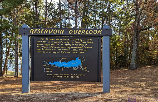
The RESERVOIR OVERLOOK information sign.  The Ross R. Barnett Reservoir is formed by a large earthen dame and covers 50 square miles.  It is administered by the Pearl River Valley Water Supply District, an agency of the State of Mississippi.


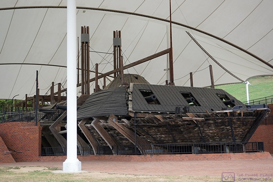
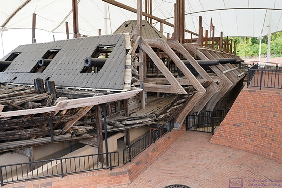
Although our focus for this trip was the Natchez Trace National Parkway, we realized that we were close enough to Vicksburg, Mississippi that we decided to detour over there and have a look.  One of the major tourist destinations in the Vicksburg area is the Vicksburg National Military Park and the Vicksburg National Battlefield.  Once we were there, we discovered the USS Cairo Gunboat and Museum site within the NMP, and checked it out.  The museum was not open when we visited the site, but we found the ship, as shown in the following four photographs, fascinating.


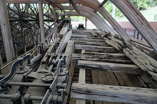
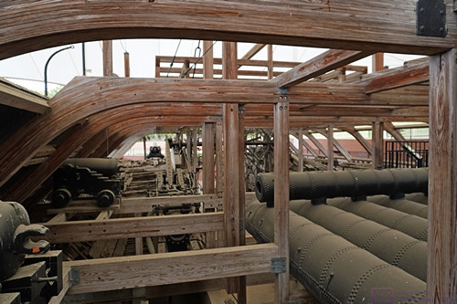
USS Cairo Gunboat, Vicksburg National Military Park (NMP), Vicksburg, MS.


USS Cairo Gunboat, Vicksburg NMP.


Paraphrased from Wikipedia:  The USS Cairo was the lead ship of the City-class casemate ironclads built at the beginning of the American Civil War to serve as river gunboats for the Union.  Cairo is named for Cairo, Illinois. In June 1862, she captured the Confederate garrison of Fort Pillow on the Mississippi, enabling Union forces to occupy Memphis.  As part of the Yazoo Pass Expedition, she was sunk in the Yazoo River (a spur of the Mississippi River) on 12 December 1862 (near Vicksburg), while clearing mines for the attack on Haines Bluff.  Cairo was the first ship ever to be sunk by a mine remotely detonated by hand.  The remains of the Cairo can be viewed at Vicksburg National Military Park with a museum of its weapons and naval stores.


USS Cairo Gunboat, Vicksburg NMP.


USS Cairo Gunboat, Vicksburg NMP.


The remains of the ship were discovered in 1956 and salvaged in 1964-65.  It was listed in the National Register of Historic Places on 3 September 1971.  By 1980 Congress had authorized the National Park Service to accept the boat, move it to the Vicksburg NMP, and put in on display in conjunction with a museum to house the recovered artifacts and tell the story of the boat and its role in the Civil War.


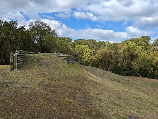
One of the bunkers at the Vicksburg National Battlefield site.


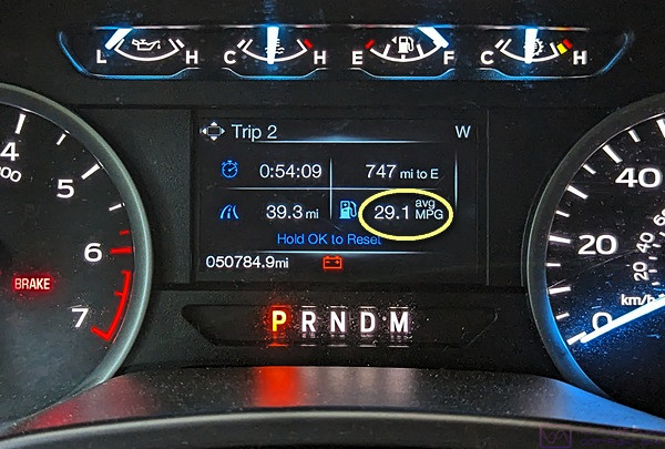
This photo has nothing to do with the Civil War.  I’ve outlined the fuel economy readout on our F-150 instrumentation cluster.  Folks, you can’t make this stuff up; it really does say 29.1 (miles per gallon).  We had recently filled up the fuel tank and only traveled 39.3 miles, as shown in the lower left, so this was obviously light travel and slightly downhill.  Although this MPG is not sustainable under normal driving conditions, the number in the upper right indicates that we could travel another 747 miles before running out of fuel if we could maintain this MPG.


20231024_NTNP_7-14_Brices-X-road-NBF

Note:  This post contains 8 photos.  Photos by me (Bruce) taken with a SONY alpha 6400 or Google Pixel 6 Pro unless otherwise indicated.  (Photos by Linda taken with a Google Pixel 6.)


TUESDAY 24 October 2023 — NTNP 7 of 14 — Brices Cross Roads National Battlefield


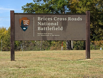
Brices Cross Roads National Battlefield sign.

The Natchez Trace National Parkway (NTNP) passes through a part of the “deep South” that was heavily impacted by the Civil War.  From Wikipedia (paraphrased):  Brices Cross Roads National Battlefield site memorializes the Battle of Brices Cross Roads in which a U.S. Army force was defeated by a smaller Confederate force commanded by Major-General Nathan Bedford Forrest on June 10, 1864, but nevertheless secured Union supply lines between Nashville and Chattanooga, Tennessee.  The 1-acre site is a grassy park with a flagpole, a memorial monument, two cannons, and some information signs.  The monument and site are very similar to that at Tupelo National Battlefield.  Brices Cross Roads, however, is the only component of the National Park System designated a “battlefield site.”  I felt that last point was interesting in and of itself.


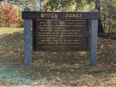
WITCH DANCE information sign.  The site of local lore, also part of the history of the Natchez Trace.


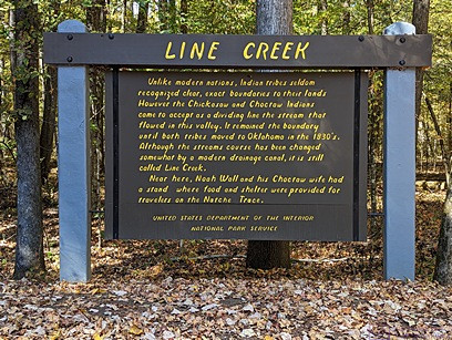
LINE CREEK information sign.  A long time ago a nearby creek that flows through this valley was accepted as the boundary between the Chickasaw and Choctaw nations, and remained so until both tribes moved to Oklahoma in the 1830’s.  The course of the creek has changed over the years, but the name has stuck.


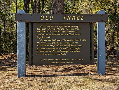
OLD TRACE information sign.  A 200+ year old section of the “Old Trace” is preserved here, and we walked it.  The sign describes the difficulty of creating and maintaining a nearly 500-mile-long path through the wilderness and how readily nature seeks to reclaim the ground, as shown in the next photograph this section of the trail/road.


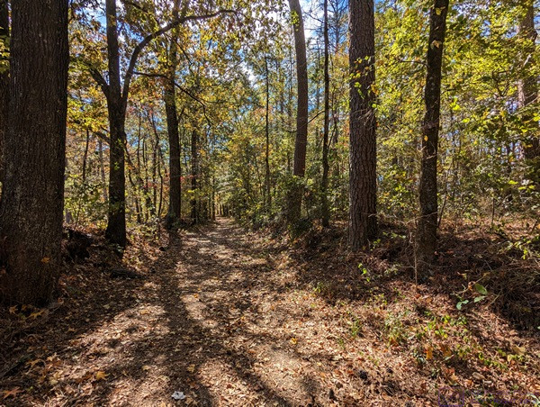
Maintaining this 10-foot-wide section of the Old Trace involves constant work.  Without continuous human intervention, nature would, it its own time, completely reclaim this path.


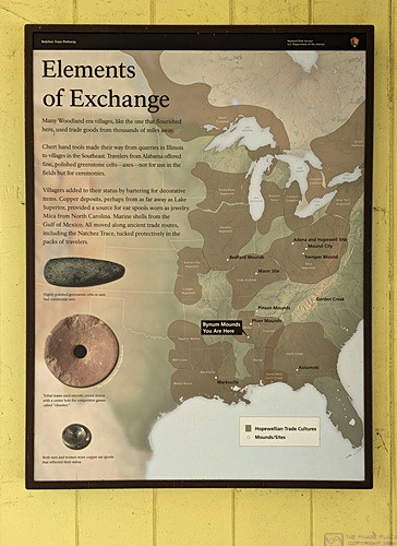
Elements of Exchange.  Although the type is too small to read in this photo, the map highlights the territories of the Eastern Woodland nations and discusses the materials that served as “currency” for trading purposes.


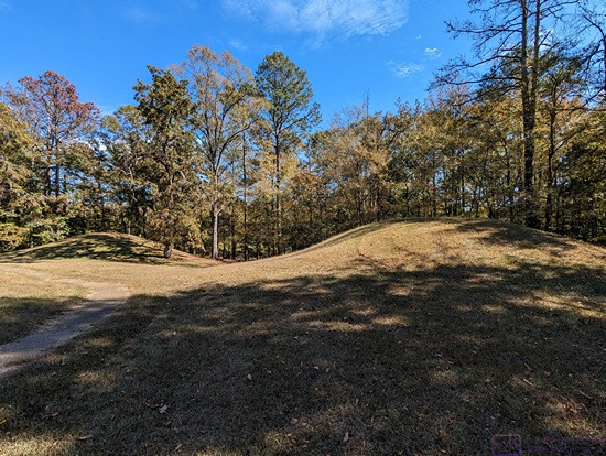
These are obviously mounds, and the photo was taken about 4 minutes after the previous one, so I know they were in the same general area, but we failed to photograph a sign telling me about their significance.


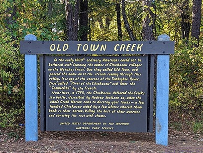
OLD TOWN CREEK information sign.  This gist of the historical factoid reported here is that in the early 1800’s ordinary Americans could not be bothered to learn the Chickasaw names for their villages and other landmarks and features.  Thus, a nearby village was dubbed “Old Town” and the name eventually became attached to the creek that runs through the valley.


20230915-16_T20-21_C17_Honolulu-Oahu-HI_Home

Note:  This is the 16th of 16 posts about our 21-day trip that included a 17-day (16-night) cruise on the Norwegian Cruise Line (NCL) ship SPIRIT from Vancouver, British Columbia north along the inside passage to Sitka, Alaska, and then across the North Pacific Ocean to the Hawaiian Islands, before ending in Honolulu, Oahu.  This post has 13 photographs with captions and some narrative.  Photos by me (Bruce) taken with SONY alpha 6400 or Google Pixel 6 Pro unless otherwise indicated.  (Photos by Linda taken with a Google Pixel 6.)


FRIDAY 15 September 2023 — (T20-21,C17) Honolulu, Oahu, Hawaii and home

This was the 20th day of our trip, and the 17th and final day of our cruise.  We arrived in the early morning hours at the cruise port in Honolulu, Oahu, our final port-of-call in the Hawaiian Islands.  (It was a 21-day trip in total, as we would not arrive back at our home in Michigan until the following day, but I cover a few highlights of that at the end of this post.)

On the last day of a cruise, passengers must disembark fairly early in the day so the crew can “turn the ship around” and get it ready for the next set of passengers, who will start their embarkation by late morning.  When leaving from and returning to ports in the continental USA, we can usually arrange flights back to Michigan that allow us plenty of time to get to the airport without having to wait too long to board our plane after getting there.  In the case of this cruise, however, the most “reasonable” flight we could book departed at around 5 PM local time.  That meant we had to figure out what to do during the day, which included what to do with our luggage, a not insignificant issue.

The easiest solution was to book a motorcoach shore excursion that included transportation to the Honolulu International Airport, with our luggage safely stored onboard the motorcoach until we were dropped off at our terminal.  Yes, pre- and post-cruise shore excursions are a “thing,” as are pre- and post-tour transportation options.  Actually, any service a cruise line can provide, or product they can sell, to extract a bit more money from their customers is a thing.  In this case, however, it was an excellent option for us.  Although we had been to Pearl Harbor on our last visit to Hawaii, it was the shore excursion that best met the needs of passengers, like us, with flights departing after 3 PM local time.  And so, we went to Pearl Harbor.

Although still very much an active military base, the Pearl Harbor National Memorial is an interesting, historically important, and somber place that draws some 2 Million visitors every year.  Perhaps we were just tired from the cruise, but it seemed like half of those people were there today, or perhaps just half of the people from our cruise ship.  They weren’t, of course, but the place did seem crowed.  Since we had already seen many of the major sites that make up the National Memorial, we were not motivated to spend more money beyond our entrance fee just to stand in lines and deal with crowds to try to see them again.  We decided to just stroll the grounds instead, read placards, take a few photos, and find something to eat.  Our biggest problem was finding someplace to sit (at all, never mind comfortable) and stay out of the sun.  As we’ve gotten older, however, I think we’ve gotten better at just quietly “passing the time” when we find ourselves in situations that require it, or at least benefit from adopting that attitude.

Here are a few photos from that day, followed by an epilogue to wrap up our 21-day trip.


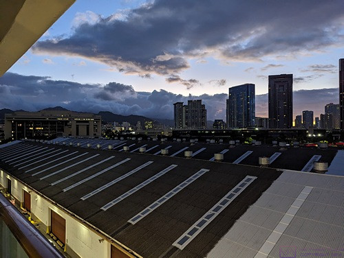
Our ship was already at the dock when I took this photo around 6 AM local time.


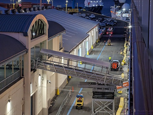
I am always interested in structures, machines, etc.  Shown here is a service ramp that has already been deployed from the terminal to the ship.


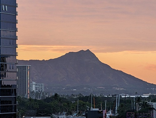
The famous Diamond Head (extinct volcano) at the far east end of Waikiki Beach, backlit by the sunrise around 6:30 AM.


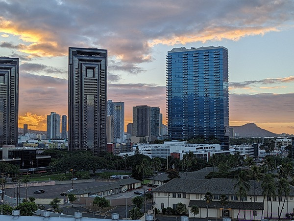
Another view looking towards Diamond Head, which is towards the right edge of the frame at the horizon, showing some of the skyscrapers in this part of Honolulu.  These could be hotels, apartment/condos, or office buildings.  (Photo by Linda)


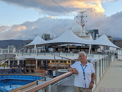
Since we had to disembark early, we were up and dressed early to get a bite to eat and have one last stroll around the ship.  At ~6:30 AM we had the walking track on Deck 13 (ABIR) to ourselves.  The pool has been covered with netting to keep people out, or catch anyone who might fall in.


A panorama composited from five (5) images of the harbor off the port side of the ship.


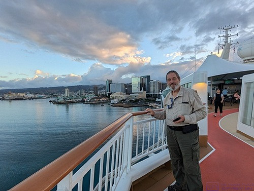
Another early morning photo from the starboard side walking track with the harbor behind Bruce.  (Photo by Linda)


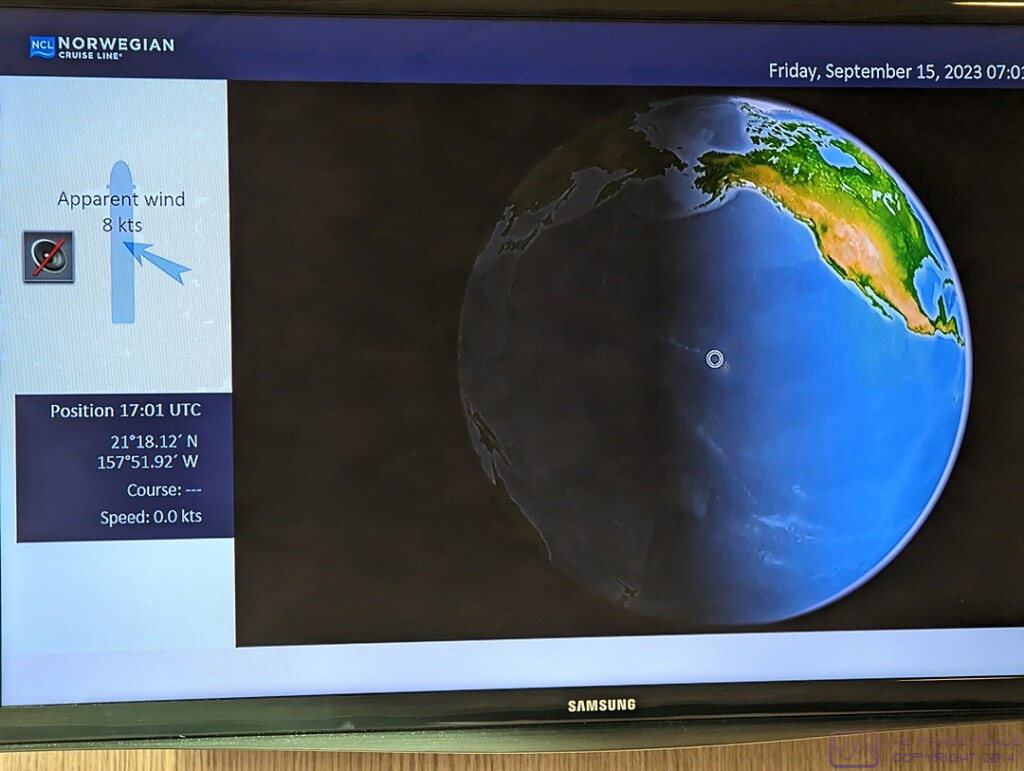
Yes, this is a photo of the TV screen in our stateroom.

Regarding the above photo, the left side of the screen clearly shows the time to be 17:01 UTC and the upper right corner shows the time to be 07:01 (local) establishing the 10-hour time difference between Honolulu and Greenwich, England (where Greenwich Mean Time (GMT) and UTC are usually the same).

UTC (Universal Time Coordinated) is a time standard that never changes (no daylight savings time nonsense), while GMT is a time zone, in which Greenwich, England is located.  We live in the Eastern Time zone (EST or EDT, depending on the time of year), which is UTC minus 5 this time of year (Daylight savings time was still in effect in the USA).  By the time we arrived back in Michigan, our plane (and us) had been in six (6) time zones over ~ 9-1/2 hours in the air.

The screen also shows our position at 21 degrees 18.12 minutes North Latitude and 157 degrees 51.92 minutes West Longitude.  Linda captured an image (not shown here) of the lower left corner of the screen indicating that our total distance traveled (in the ship) was 4,502 nautical miles (5,180.8 statute miles).  The flight distance from DTW (Detroit) to YVR (Vancouver) is ~1,959 miles, and the flight distance from HNL (Honolulu) to DTW (Detroit) is ~ 4,475 miles.  Thus, the total distance traveled on this trip, not including excursions, was ~ 11,614 statute miles, or ~553 miles per day on average.


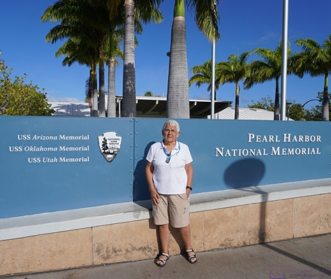
Welcome to the Pearl Harbor National Memorial, which includes Memorials for the USS Arizona, USS Oklahoma, and USS Utah, all lost on the December 7, 1941 attack on Pearl Harbor.


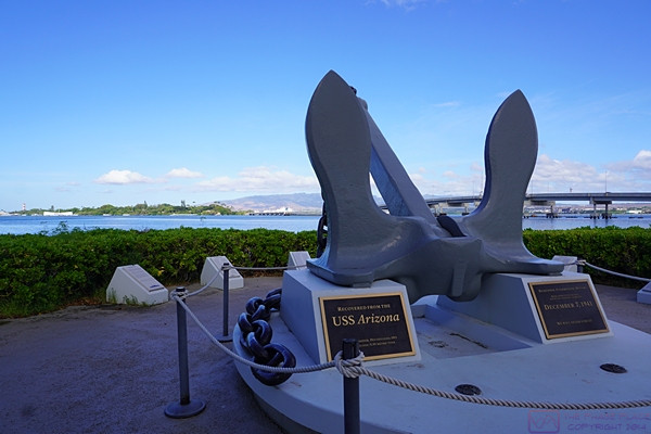
An anchor that was salvaged from the USS Arizona.


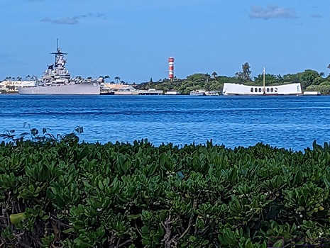
The low white building with the curved roof is the USS Arizona Memorial.  It straddles the ship in its final resting place and has a glass floor, allowing visitors to view the remains of part of the ship.  We visited this Memorial on our previous visit.  (Photo by Linda)


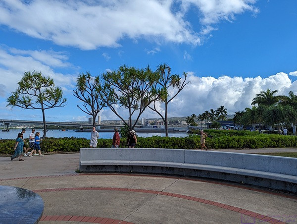
A circular courtyard that surrounds a relief map of Pearl Harbor, and has plaques with the names of the lost, provided some place to sit and contemplate the events of the day that pulled the USA into World Ward II.  (Photo by Linda)


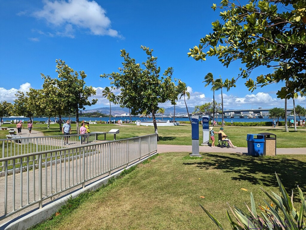
A broader view of the grounds at the Pearl Harbor National Memorial.  The USS Arizona Memorial is visible at the left edge of the frame.  The site is beautifully maintained, as you would expect, and is accessible for those visitors with mobility issues.  I think the exception is the submarine tour, as it involves climbing stairs and, ABIR, ladders.  We toured the submarine on our previous visit to the National Memorial.

…..


Epilogue (T20-21) — Friday evening 15 September & Saturday 16 September

With our drop-off at the Honolulu International Airport around 3 PM, our NCL SPIRIT cruise was officially concluded.  We were no longer “cruisers,” just ordinary travelers waiting to fly home.  The drop-off point was a “back” entrance to the terminal and it was a bit confusing at first figuring out where to go once we were inside.  But we figured it out in short enough order, and began the process of checking our two larger suitcases, clearing through the TSA checkpoint, finding our gate, and waiting to be called to board the airplane.  The airport was busy;  the Hawaiian Islands are a popular tourist destination, and Honolulu International Airport is the major way most people arrive and depart.

Time zones are fascinating, and while travel across them can be interesting, it can also be challenging, especially as regards sleeping.  (As noted in several posts, I’ve also had an issue merging photos from three different devices in correct chronological sequence.  This has been due to different devices using different time references when naming and tagging image files.)  ABIR, our Delta Airlines flight was scheduled to depart at around 5 PM Honolulu time.  At 5 PM in Honolulu, it was already 10 PM in Detroit, Michigan, and within a couple of hours of taking off, it was Saturday, 16 September at home.

We had an approximately 4,500-mile trip ahead of us at an average (air) speed of ~500 mph, so roughly a 9-hour flight plus a 30-minute allowance for ground operations (takeoff and landing combined).  The actual time, gate-to-gate, could have been more or less depending on prevailing wind speeds and directions at flight altitude (which tend to be from west to east, so a favorable tailwind), or the need to detour around severe weather.  That put our estimated time of arrival at Detroit Metropolitan Airport (DTW) at 6:30 AM local time.  Realistically, that meant we should be off the plane, luggage collected, and ready for pickup by around 7:30 AM, but I no longer recall exactly what time we reached the gate.  Early, in any event, but not hugely inconvenient for our son, who lives about 30 minutes from the airport, and had agreed to fetch us upon our arrival.

As with past cruises, we had one of our children take us to the airport and pick us up upon our return.  That has usually been our daughter, but for this trip it was our son.  We drove our F-150 to his house on departure day and he chauffeured us from/to there.  Part of the reason for this, was that he and his wife wanted to get the truck “detailed” while we were away.  They had borrowed it during the summer, along with the Airstream travel trailer, to use for a family vacation and wanted to get it cleaned up as a “thank you” for letting them use it.  We did not expect them to do this, of course, but we were not going to say “no” either.  They also live closer to the airport than our daughter does.

Back at his house the rest of the family was awake, so we got to see our two youngest grand-daughters and tell everyone a little bit about our trip.  We eventually left for home and arrived to find Cabella (the cat who is not our cat, or so we say) waiting for us, even though she had lived outside for the entire duration of our trip.  (She is an outside cat who has become an outside/inside cat while we are trying to figure out how to take care of her in a way that works for her and us.)  Our neighbor, Mike, had kept an eye on the house (and the cat) while we were away, making sure she had water and refilling her automatic food feeder as needed.

I always like to launder all of the clothes we have had with us on any trip (short or long), but that was a task that would wait until tomorrow and get spread over a couple of days so as not to overload the septic system (or me).  What could not wait, was putting the water treatment system back in full operation.  I shut it off whenever we are gone for more than few days so the tanks do not regenerate, which puts a lot of water into the sump.  I recall that we talked about stopping at a Panera to get something to eat, but I don’t recall what we actually did for lunch or dinner.  I suspect we found something to eat for dinner in our refrigerator and/or panty as Linda usually plans for that when we go on shorter trips.  We had, after all, eaten out every meal for the last 21 days.  For longer trips, we try to use up any fresh food before we leave.

20230905_T10-C7_Sitka-AK

Note:  This is the 10th of 16 posts about our 21-day trip that included a 17-day (16-night) cruise on the Norwegian Cruise Line (NCL) ship SPIRIT from Vancouver, British Columbia to Honolulu, Oahu.  This post has 21 photographs with captions and some narrative.  All photos were taken by me (Bruce) using a SONY alpha 6400 or Google Pixel 6 Pro unless otherwise indicated.  (Photos by Linda were taken using a Google Pixel 6.)

As I am writing these posts some five (5) months after our trip, I have struggled with getting the correct local time stamp for each photo and thus establishing the correct time sequence for images within a post.  The issue is the intermixing of photos from two Pixel smartphones with photos from a Sony a6400 ILC camera while shooting in different time zones far removed from home.  I think I have the photos in this post in the correct order, but have avoided making any reference in the captions to the time of day an image was captured.


TUESDAY 05 September 2023 — (T10,C7) Sitka, AK

This was day 10 or our trip, day 7 or our cruise, and our final stop in Alaska before crossing the North Pacific Ocean to the Hawaiian Islands.  We arrived in the Sitka harbor early this morning.  The weather was hazy upon arrival, but quickly gave way to blue skies with nice puffy clouds over the surrounding mountains.  It was just cool enough to require a light jacket, which made for wonderful conditions to walk around the town and go on a guided shore excursion with a very good local guide.

Sitka is a fascinating city with a history that placed it at the center of a crossroads of cultures.  The area around Sitka has been the traditional home of the Tlingit people for thousands of years, and they are still here.  The Russians arrived in 1804 and forcibly established a colony with Sitka (New Archangel) as its Capital.  It later became the Capital of American Alaska when the Russians sold the territory to the United States in 1867.

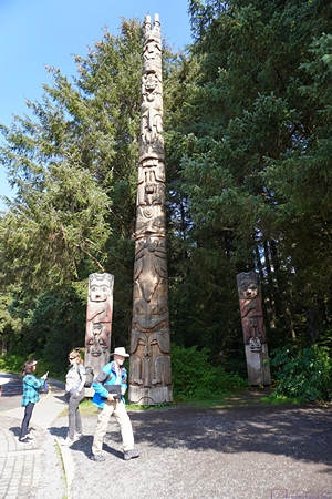
The Tlingit maintain a vibrant culture here with a performance center in the style of a traditional community clan house; offerings include song and dance.  Traditional art abounds in the Center and various art galleries, as well as the many intricately carved totem poles in the National Park peninsula.  Russian influence is evident in the onion domed Cathedral of St. Michael and the Russian Bishop’s House, as well as the Russian Cemetery and the names of places, buildings, and streets.  Russian dance is performed in town by the New Archangel dancers, while Summer music festivals celebrate Jazz as well as other musical traditions.

Paraphrased from Wikipedia:  Sitka is a unified city-borough in the southeast portion of the U.S. state of Alaska. It was under Russian rule from 1799 to 1867.  The city is situated on the west side of Baranof Island and the south half of Chichagof Island in the Alexander Archipelago of the Pacific Ocean.  As of the 2020 census, Sitka had a population of 8,458, making it the fifth-most populated city in the state.   Although the City of Sitka is located on a two small islands, the borough encompasses a vast area.  According to the United States Census Bureau, the city-borough is the largest incorporated municipality by area in the U.S., with a total area of 4,811 square miles (12,460.4 sq km ), of which 2,870 square miles (7,400 sq km ) is land and 1,941 square miles (5,030 sq km ), comprising 40.3%, is water.

We enjoyed our short time in Sitka, as we did in Ketchikan, Juneau, and Skagway, but we sensed that we would enjoy returning here for a longer visit and the opportunity to explore the area more thoroughly.


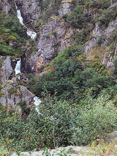
This photo is from the day before around 4 PM as the ship was departing from Skagway.  (Photo by Linda)


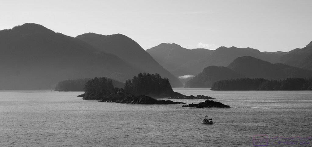
We had slightly hazy weather for our arrival in the Sitka area, and the best scenery was to the ESE, into the sun.


After playing around with this photo for a while in post -processing, I decided it looked best as a black & white image.  (I got my first camera when I was 16 and started out shooting with B&W film and learning how to develop it and make prints using a darkroom that belonged to my parent’s best friends.  It still appeals to me.)


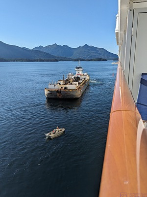
We were “anchored out” during our time in Sitka.  (It was never clear to me if this was due to a lack of adequate dockage for a ship our size, or a limited amount of such dockage that was already occupied by another ship or ships.)  A fuel ship prepares to come along side and refuel the SPIRIT in advance of our crossing the North Pacific Ocean.  (The fuel ship is not a barge as it is under its own power.)  (Photo by Linda)


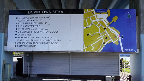
As the NCL SPIRIT was anchored out, we had to tender in to the Sitka marina.  Shortly after disembarking from the tender, we were greeted by this very helpful sign with highlights marked on a map of the main downtown area.


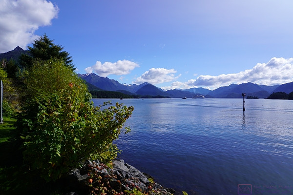
I never tire of views where mountains meet the water.  This was captured from near the Sitka marina looking out towards our ship, which is just visible center frame where the mountains and water meet.


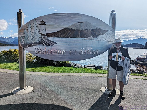
The “Welcome to Sitka” sign seemed like a good place to take a “Apa and Ama are here” photo for grand-daughter Sadie.  We tried to remember to take a photo in each place we visited and text them to her parents so she could follow our travels.  (Photo by Linda)


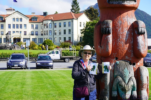
Linda holds the Apa and Ama artwork for another “we are here” photo.  This one is in Totem Square with the Sitka Pioneers Home in the background.  It might look like a hotel, but it’s actually an assisted living complex; one of the nicest we had ever seen (at least form the outside).


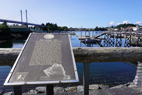
On June 14, 1879 the U.S.S. Jamestown (a sailing ship of war) arrived in the waters near Sitka to relieve the U.S.S. Alaska, and eventually moored near where this sign now stands.  From 1879 to 1881, she was the official seat of government for the Alaska District.  The Jamestown was relieved in August 1881 by the U.S.S Wachusett (a steam ship of war), which continued as the seat of government for the District of Alaska until the Civil Government was finally established by the Organic Act of 1884.


Our shore excursion today included a visit to the Sitka National Historical Park (aka Totem Park).


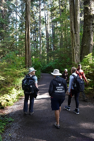
Our visit to Sitka NHP included a walk in the woods.  The tour guide (left) and Linda (right) are sporting their Tilley hats.  Linda’s lightweight hoodie says “Travel Park Connect.”  This was the motto of the RVillage social media platform.  I have one too.  It was a great idea and good platform for RVers that was very popular but did not survive.


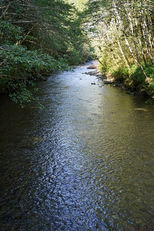
While walking through Totem Park, we got to stop at a small footbridge over the Indian River, an active Salmon run.  Although not really visible in this photo (I couldn’t get a good one) the stream was thick with salmon swimming against the current, presumably trying to reach their spawning grounds.  It was quite a sight.  As I mentioned in a previous post, when I think of Alaska I think of Grizzly Bears, Bald Eagles, and Salmon.  I would add to that Eskimos and other indigenous people, totem poles, Polar Bears, Moose, Elk, Caribou, Whales, Bush planes/pilots, and oil production.


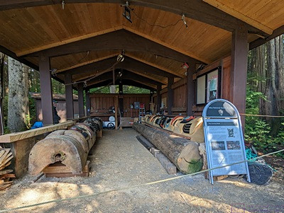
A shed at Sikta NHP / Totem Park where totem poles are repaired and restored.  (Photo by Linda)


This panorama of the Historic Campus of the Sika Fine Arts Camp is a composite of seven images.  The image is 1920 x 270 pixels; clicking on it will display it full size on a device with a suitable monitor.


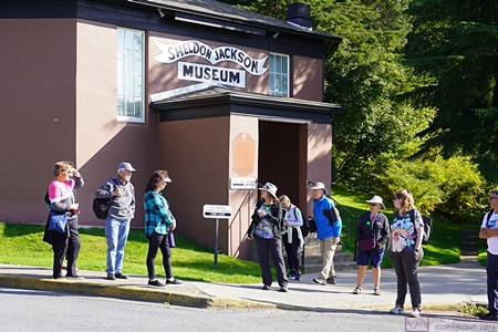
The Sheldon Jackson Museum, founded in 1888, houses an exceptional collection of Alaska Native ethnographic material gathered by Presbyterian missionary and General Agent of Education for Alaska, the Rev. Dr. Sheldon Jackson.  It was purchased by the State of Alaska in 1985.


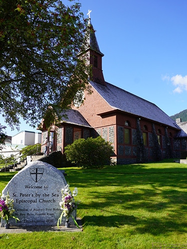
This charming and well-maintained building is St. Peter’s By The Sea Episcopal Church.  It was established on Thanksgiving Day in 1896, the same year the Klondike Gold Rush began.


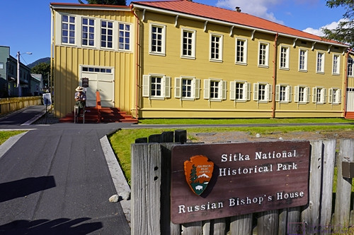
The Russian Bishop’s House is now part of Sitka National Historical Park.  Given that Alaska was Russian territory for 68 years before being sold to the USA, it was not surprising to see Russian influences everywhere, including in the names of islands, streets, buildings and, of course, churches.  Next photo please.


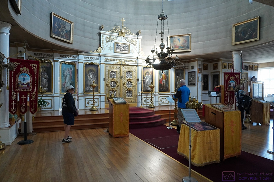
Paraphrased from Wikipedia:  St. Michael’s Cathedral, also known as the Cathedral of St. Michael the Archangel, is a cathedral of the Orthodox Church in America, Diocese of Alaska, in Sitka, Alaska. The earliest Orthodox cathedral in the New World, it was built in the nineteenth century, when Alaska was under the control of Russia.  After 1872, the cathedral came under the control of the Diocese of Alaska.  It had been a National Historic Landmark since 1962, notable as an important legacy of Russian influence in North America and Southeast Alaska in particular.  An accidental fire destroyed the cathedral during the night of January 2, 1966, but it was subsequently rebuilt.  The new building’s green domes and golden crosses are a prominent landmark in Sitka.  Some of the icons date to the mid-17th century; two icons are by Vladimir Borovikovsky.


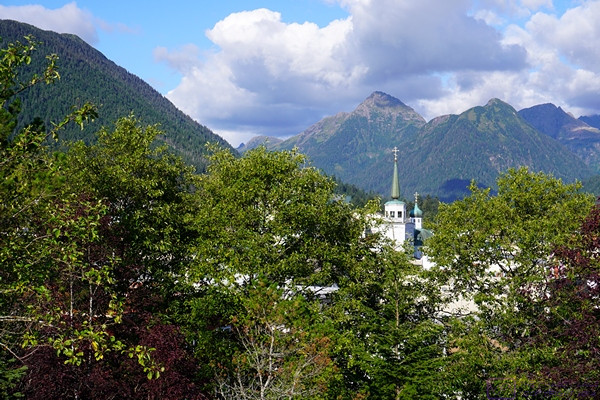
Our shore excursion guided walking tour ended atop Castle Hill.  Looking northeast, the green domes and golden crosses of the Orthodox Cathedral are visible  through the trees.


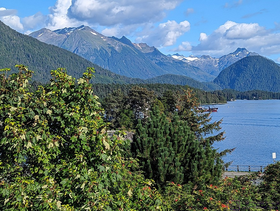
A view (probably from Castle Hill) of the mountains, and the east end of the harbor, south of Sitka, Alaska.  (Photo by Linda)


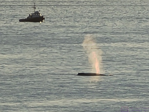
We departed Sitka Harbor in the late afternoon / early evening and were greeted by this spouting whale and fishing boat.  Fishing boats were numerous in the harbor and marina.  This was the last time we would see land until the morning of Monday 11 September when we arrived at the port in Nawiliwili, Kauai, Hawaii.

20230901_T6-C3_Ketchikan-AK

Note:  This is the 6th of 16 posts about our 21-day trip that included a 17-day (16-night) cruise on the Norwegian Cruise Line (NCL) ship SPIRIT from Vancouver, British Columbia Honolulu, Oahu.  This post has 14 photographs with captions and some narrative.  Photos taken by me (Bruce) with SONY alpha 6400 or Google Pixel 6 Pro unless otherwise indicated.  (Photo by Linda taken with Google Pixel 6.)


FRIDAY 01 September 2023 (T6,C3) Ketchikan, Alaska and Totem Bight State Historical Park


This was day 6 of our travels and day 3 of the cruise.  I’m not sure what time we arrived at Ketchikan, Alaska, but our first photos, taken from our balcony, appear to be from 6 AM local time.  If so, we were up early and dressed for the arrival.  The embarkation “sail away” is always a big deal, but we especially like arriving in a new port-of-call.  Cruise ships often arrive in ports very early in the morning to give their guests as much time as possible to go ashore (and spend money on shore excursions).  Departure is typically anywhere from mid-afternoon to early evening, depending on the distance/time to the next port.  These ships are able to set and course and speed and maintain it with considerable precision, so they have very accurate ETAs as a rule.   After a few photos, I presume we went in search of breakfast somewhere on the ship.


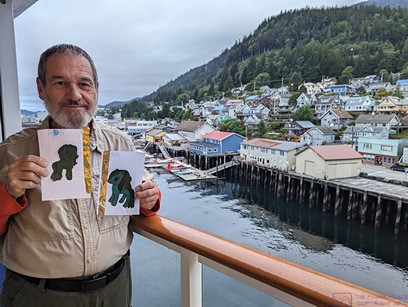
Proof of Arrival for grand-daughter Sadie.  The pony on the left (of the photo) is labeled “APA” (Grandpa Bruce) and the other one is labeled “AMA” (Grandma Linda).  (Photo by Linda)


We were docked starboard side in, so we had a view of most of Ketchikan from our stateroom balcony.  Most of the town is nestled between some small mountains and the water, and has an extensive waterfront.  This is a composite image of 4 photographs.


We booked a shore excursion to Totem Bight State Historical Park (TBSHP), which took up the late morning.  As we stepped ashore to gather by our tour bus, we were aware that this was the first time we had set foot on Alaskan soil.

One of things we noticed on the Coastal Alaska portion of this cruise was that many of the tour bus drivers/guides and venue guides were relatively young.  In conversation, we discovered that many of them were from Brigham Young University (Utah) and were here working seasonal jobs.  The reason is that BU has a semester schedule that makes it possible for students to take jobs in places like Alaska at times of the year when they are needed.  They also have a training program for tourist industry work, and many companies recruit from there as a result.  We were impressed that these relatively young folks had gotten their CDL-B (Commercial Driver’s License – Passenger Bus).


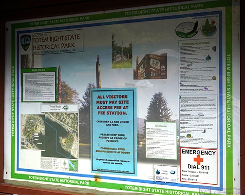
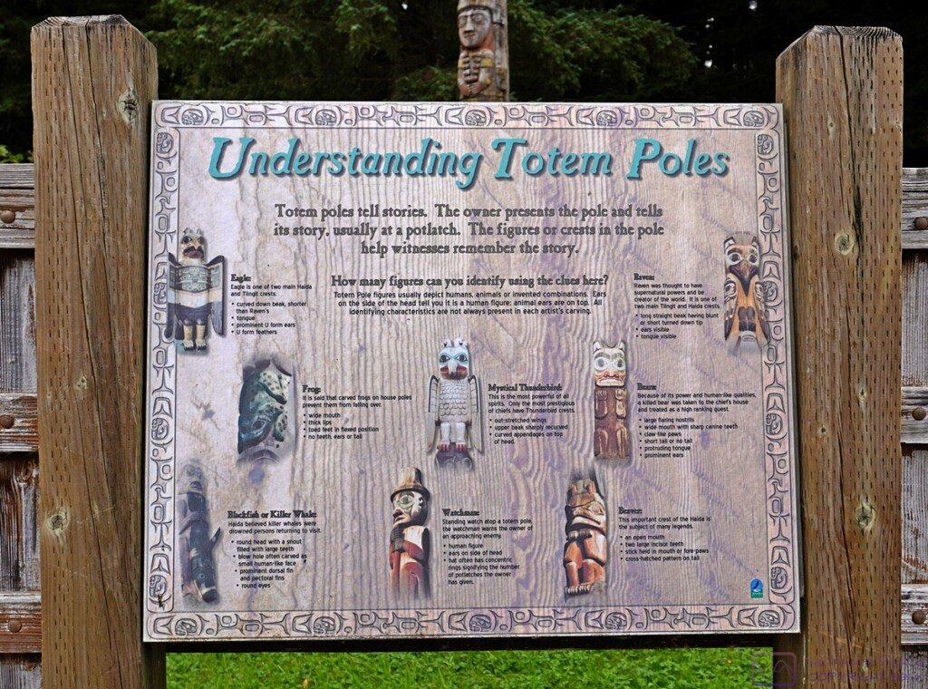
An information board on arrival at TBSHP.


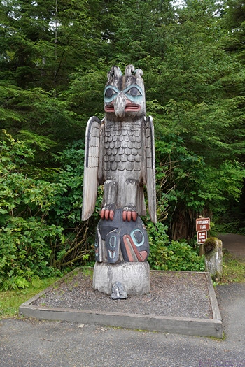
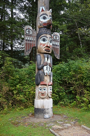
A totem pole at the entrance into TBSHP.


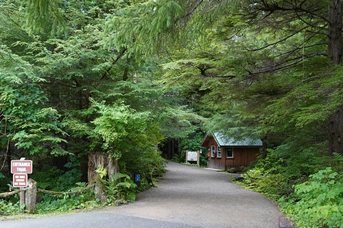
The lovely, wooded entrance path into TBSHP.


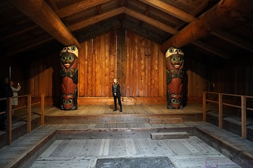
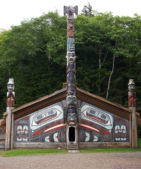
The Lodge House at TBSHP.  Our tour guide provides scale for the carved figures that support the massive beams that support the rafter beams for the roof.


The Lodge House at TBSHP viewed from the entrance end.


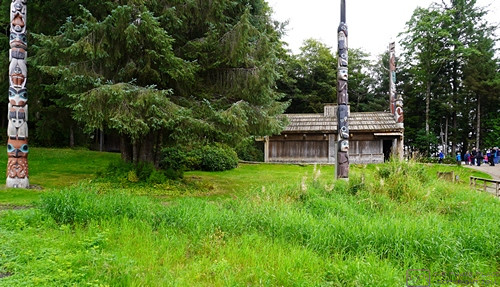
A view of the Lodge House at TBSHP from the side, with several totem poles visible.


20

A view of the Lodge House at TBSHP from the side, with several totem poles visible.


Another interesting totem pole as we were exiting the TBSHP.


Upon return to the cruise ship dock, we walked the town for a while before returning to our ship well ahead of “all on board” time.


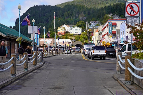
A view of one of the streets in Ketchikan.  Ketchikan was a neat little town, but busy with tourists and vehicles and difficult to photograph in an interesting or meaningful way.


This photo is from mid-afternoon, not long after leaving the dock in Ketchikan.  Seven images were composited to form this panoramic photograph.


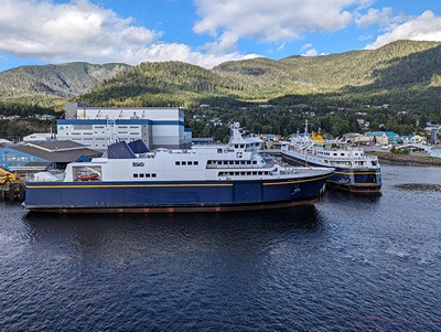
These ships are part of the Alaska Marine Highway System, which is headquartered in Ketchikan, Alaska.  There is a major dry dock facility just out of frame to the left with a ship in it for repairs.