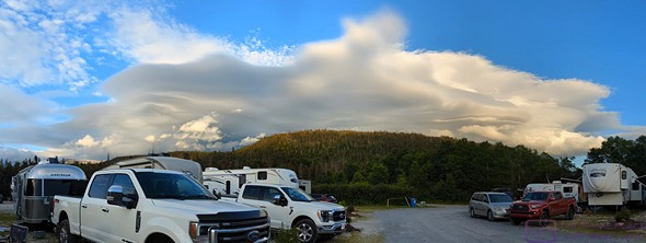
Category Archives: Gros-Morne-NP

20220802 – Boat Tour of (Étang) Western Brook Pond, Gros Morne NP, NL

TUESDAY 02 August

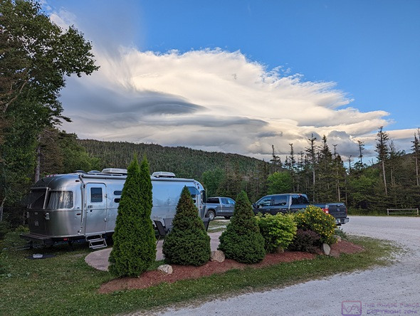
In case I failed to mention it in any of my last four posts, our What 3 Words location in Site 60 at the Gros Morne – Norris Point KOA is “brilliant.cooperation.goodbye”.

Because I was up late last night star gazing, and we were not in a rush this morning, I slept in a bit and did not get up until 7 AM to start my morning routine (turn on computer, feed cat, wash and refill her water bowl, put away dishes from last night, make coffee, work on uploading blog posts).  By not getting up at 6 AM (or earlier) I had taken a chance that the campground Wi-Fi might not be usable.  Fortunately, it was, and I was able to publish the posts for the last three days.  If felt good to be caught up.  Linda also slept in, and got up around 8 AM.  We were both tired from yesterday.

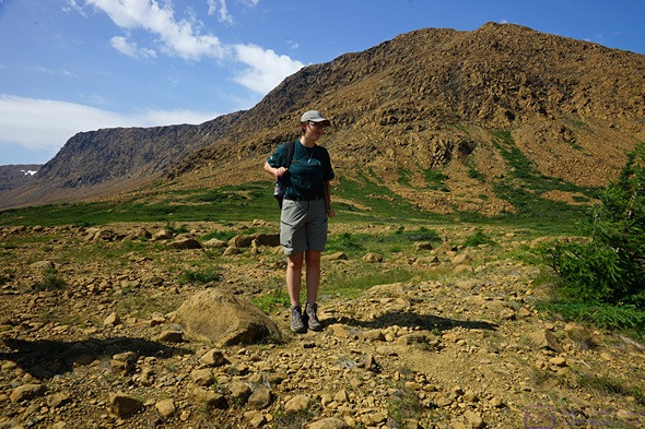
Our hikes yesterday were “easy,” but the Tablelands hike was in full sun with lots of wind.  And we are not in the prime of our youth anymore.  We are healthy enough, and fit enough for what we are doing, but sometimes we get tired.  Indeed, one of the things we have been very conscious about, since we started extended-time RVing in retirement, is not being in “vacation mode.”  We try not to cram each day full of activity, and we take days as needed to do the necessary chores (laundry, rig maintenance, house cleaning) and errands (shopping) required to sustain us in our MAHU (Mobile Auxiliary Housing Unit).  And that includes time to just hang out around camp, relax, and visit with other campers.  At the same time, we are acutely aware that visiting places like Gros Morne National Park might be once-in-a-lifetime experiences for us, and we want to experience them as completely as possible in the days we have available.

But first, breakfast.  Both of us have recently had a hankering for pancakes, and this morning Linda had time to make them.  They were very yummy.  They are, of course, a delivery vehicle for maple syrup and jam.  But they are also quite tasty on their own.

After breakfast I walked over to the campground shower house.  I don’t mind the shower in our trailer, but we store things in there and have to remove them to use it.  Also, it’s small and does not have a powerful water flow when connected to 40 psi shore water.  All of which is OK, but sometimes it’s nice to have a long, hot shower.  With light winds and no rain in the daytime forecast, we decided not to use the heat-pump to cool the rig.  We left the trailer windows open and deployed the awnings to shade as much of the trailer as possible.  I also turned on the ceiling exhaust fan to move air through the rig.  We are very conscious of making sure the interior environment of our trailer is suitable for Juniper-the-cat.

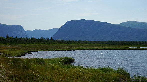
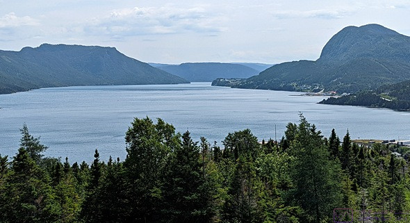
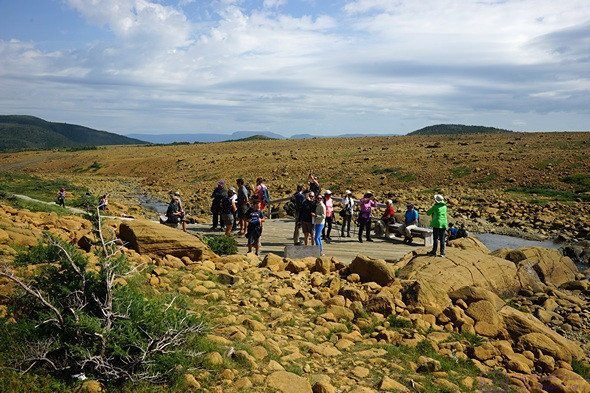
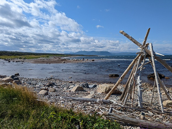
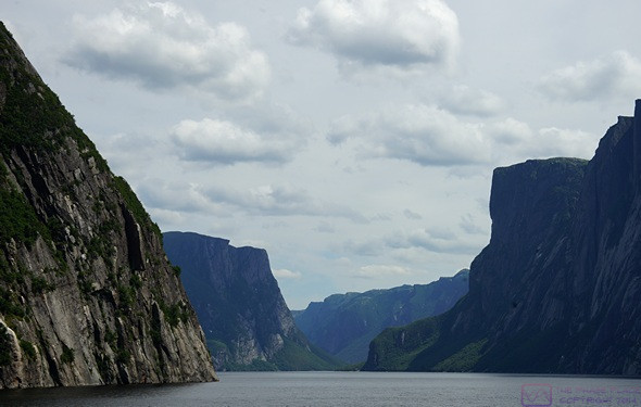
The opening on the west end of Western Brook Pond, as seen from the trail leading to the boat dock.

One of the other “must see” features of Gros Morne National Park is the (Étang) Western Brook Pond.  One of the first things we did when we arrived at the Gros Morne – Norris Point KOA was find out how to book the tour boat and take care of that.  The boat is operated by BonTours through a special arrangement with Parks Canada, and it was easy to make a reservation online for the 1:30 PM boat today.

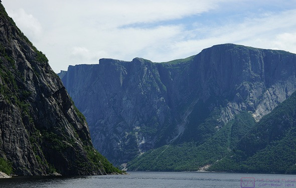
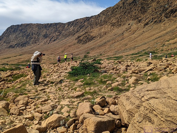
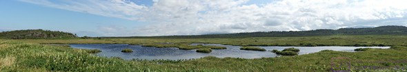
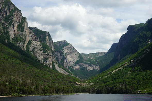
The dramatic nature of this valley was obvious as we entered it. GMNP, NL.

We knew before going that (Étang) Western Brook Pond is a long, narrow, east-west oriented freshwater lake with mountains on either side that plunge steeply into the water, suggestive of a Norwegian fjord.  It was formed by a glacier that once flowed all the way to the ocean but the deposits it left behind as it retreated eventually cut the valley off from the ocean and it filled with fresh water.  The iconic image of Gros Morne National Park is a view of this lake/gorge from above at the far east end, but the only way for most people to see it is by boat.  While Parks Canada has done an incredible job of providing vehicle access to trailhead parking lots, like most of this National Park, the pond is not directly accessible by vehicle, so walking was required.

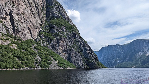
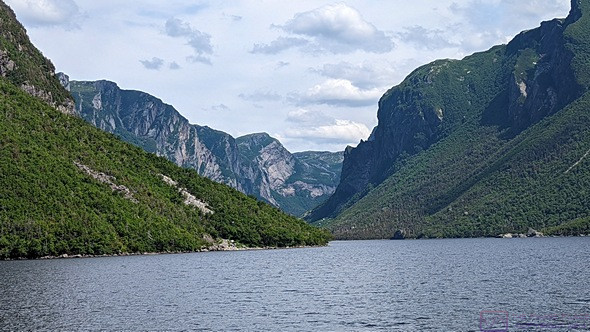
We start to wind our way into the valley on Western Brook Pond.  A serious back-country hiker could climb down to the shore from the plateau above via one of the crevices, but the only way to really see this valley is on a boat. (Photo by Linda.)

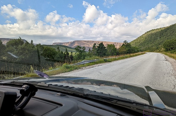
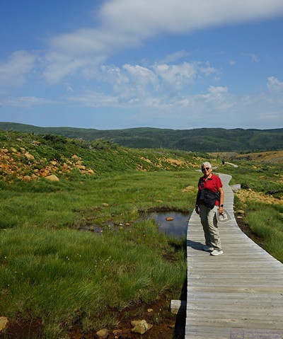
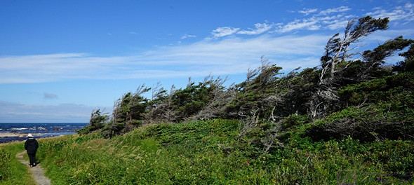
The tour boat dock was at the west end of the pond, not too far from Hwy-430 (The Viking Trail), but we had to take a trail from the parking lot (at the highway) to the dock.  The parking lot was a 30-minute drive from the RV park, and the trail was a 6 km return (3 km one way), which took another 40 minutes.  Just to be safe, we left camp around 11:30 AM.

The pond looks straight on the park map, but the water actually winds around sections of the steep walls.  GMNP, NL.

The trail was basically a gravel road and was rated “easy”, with only modest changes in elevation, but there was no cover from the sun.  There was a café and restrooms (always appreciated) at the lake end.  Equally important, there was a lavatory on the boat.  We checked in at the registration desk in the main building and got our boarding passes.  Our boat was scheduled to start boarding at 1:15 PM and leave the dock at 1:30 PM.  By one o’clock a line was already forming, so we got in it.  We were close enough to the front of the line to get two seats together on the upper/outside deck.

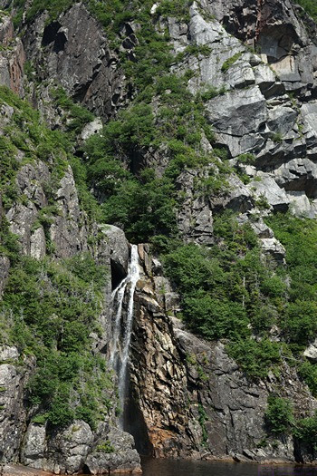
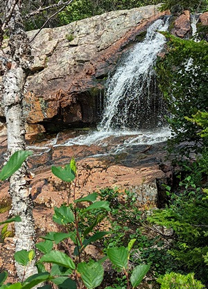
We saw at least a dozen of these cascading waterfalls, but there were probably many more out of sight in the deep crevices that cut into the walls of the valley.  GMNP, NL.

Our boat was the MV Westbrook I, and two of the crew members (KJ and Jessie) also served as tour guides, explaining the geology of how this place came to exist and pointing out specific features.  The weather was hazy, but we could see the pond and surrounding mountains.  The light, however, was not ideal for photography.  Given the orientation of the pond, a later afternoon tour would probably have afforded better light, but some of those times were already booked, and we can only do what we can do.  There were also a lot of people on the boat and everyone was free to move around and take pictures, which meant that very few people actually got good pictures.  Even so, was it spectacular?  Yes, it was!


Like clouds, rocks sometimes form recognizable shapes, at least from certain angles.  The tour guides referred to this “face” as “the tin man.”

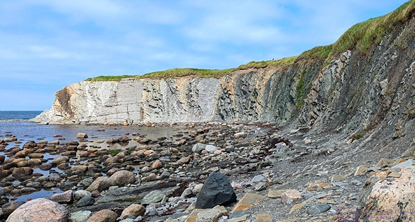
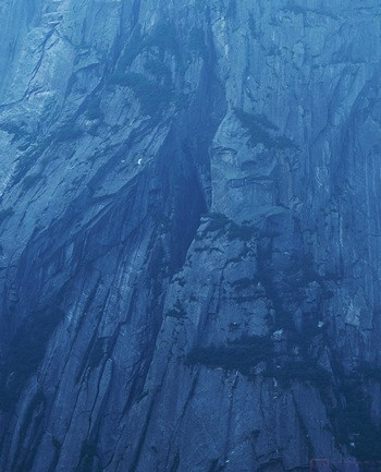
The Long Mountains, into which this valley is carved, are made of the oldest rock in the park at 1.25 billion years, and are mostly granitic gneiss.  While the valley has the classic U-shaped glacial cross-section, the upper 2/3rds of most of the valley walls are near vertical.  The walls rise 650 m (~ 2,015 ft.) or more above the surface of the pond.  The highest wall is ~ 700 m (~ 2,170 ft.).  For comparison, that’s 140 m (~ 434 ft.) taller than the CN Tower in Toronto, Canada.  The walls are also cut by numerous crevices that run deep into the mountains and up to the plateaus on top.


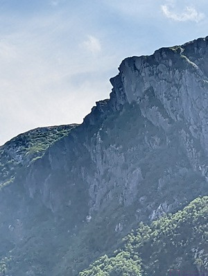
Here’s another rock formation that has a recognizable shape (photo by Linda).

The surface of the pond is ~ 30 m ( ~93 ft.) above sea level and is 165 m (~ 512 ft.) deep in the deepest place, so much of the water in it is below sea level, 60% in fact.  Water does flow out of the pond into the Gulf of St. Lawrence (Golfe du Saint-Laurent), but the flow is minor.  Water also flows into the pond as it falls and cascades from the plateaus of the Long Mountains, but just enough to make up for the outflow.  The pond gets 20 ft. of snow in the winter, but the plateaus get very little accumulation due to high winds.  We also learned that the water is so pure that it does not support much life.


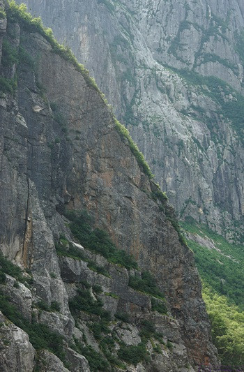
The rock walls in the Western Brook Pond valley are very steep.

The pond is 16 km (~9.9 miles) long.  The east end is closed in a cirque, but there is a dock there.  The longest hike available in the park starts at this dock and traverses 35 kilometers over the Long Mountains to the base of Gros Morne Mountain.  There are no trails for this hike, and it takes an experienced back-country hiker 3 to 5 days, with map and compass (GPS), to complete it.  A special permit is required to do this hike.  You must have the necessary skills and equipment to do it on your own, or hire a guide from BonTours.


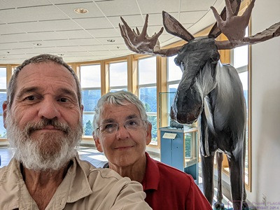
At the east end of the pond, the valley also ends in a cirque.An interesting side note was that the park has that ~ 3,400 moose and ~ 400 caribou reside within its boundaries.  They are free to move, of course, so the exact number varies.  The caribou are native to this area, but the moose are not.  The moose population is the densest in Newfoundland, averaging three (3) moose per square kilometer (~ 0.36 sq. mi.).  However, we have yet to see a moose.  Seeing a moose was high on our list, along with puffins and gannets.

Looking back at the east end of the pond as we start the return trip to the dock. (Photo by Linda.)

When the boat was about 20 minutes from the dock, a microphone stand appeared, followed by a microphone and some cords.  A few minutes later, KJ came up the aft stairs with a guitar and entertained us almost to the dock.  He was good, and Jessie accompanied him on the spoons.  They even got a few of the passengers to give the spoons a try.  The songs were upbeat and snappy and KJ was a good performer.  When he’s not crewing on a BonTours boat, KJ Hollahan runs Bobs Ya Uncle Entertainment ( bobsyauncleentertainment at gmail dot com ).  He had CDs for sale, and I bought one.  He’s also on Facebook and Instagram, of course.

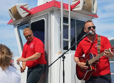
Crewmember Jessie (left, playing spoons) and KJ Hollahan (singing and playing guitar)  entertained us for the last 15 minutes of the boat ride.

Once we were off the boat, we had a leisurely walk back to the parking lot.  On the way back to camp we stopped at the Parkway Irving station in Rocky Harbor to top up the fuel tank.  We are leaving in the morning for St. Barbe and try to start each new leg of the trip with a full fuel tank.  It’s 234 km up the Viking Trail, mostly north of our current location, and should take about 2-1/2 hours to drive.  Since we have pretty much decided not to take the ferry over to Quebec and drive into Labrador, the farthest north we will be on this trip is the Viking Settlement at L’Anse aux Meadows, another 137 km northeast of St. Barbe, and close to the northernmost point in Newfoundland.

By the time we got back to the KOA it was 5 PM.  The rig was not as warm as yesterday, but we closed up and ran the heat-pump for a while to cool it down more.

We had made arrangements this past Sunday for a late departure from the Kinsman RV park in Corner Brook on August 26 in order to get us to the Marine Atlantic Terminal in Channel-Port-aux-Basques at a good time.  While there, I noticed a “boil water” order.  Linda looked into this and there was indeed such an order in place.  We had two nights booked there, and that did not sound like something we wanted to deal with.  It was also 224 km (~ 139 mi) and almost 2-1/2 hours from the ferry terminal.

We had become aware of the Grand Codroy RV/Tent Camping Park from a sign at our current KOA.  It’s the closest RV park to the Marine Atlantic Terminal in Channel-Port-aux-Basques, only 40 km (~ 24 mi) and 30 minutes away.  I called them and was able to get a site for two nights (Aug 24 and 25) with late departure on the 26th.  It will be at least water and electric, and 3-way service if a site is available.  If not, they have a dump station. This will mean a long drive on the 24th from Grand Falls Windsor of 441 km (~ 274 mi) and 4-1/2 to 5 hours.  But we will be very well positioned to get on the ferry back to North Sydney, Nova Scotia on the evening of the 26th.

By this point we were both hungry, so Linda made dinner earlier than usual.  We had potato salad, vegan hot dogs, and fresh strawberries.  Simple and easy, but satisfying.

After dinner, Linda checked the weather forecast.  It called for rain starting around 2 AM and continuing through the morning.  While a wet departure appeared to be unavoidable, we wanted to minimize our exposure to the rain by doing what we could tonight.  I stowed the awnings, filled the fresh water tank to 75% capacity (~ 30 gallons), and then disconnected the shore water system, which Linda helped stow for travel.  I dumped the black waste tank and flushed it twice with about 10 gallons of water each time.  Finally, I dumped the grey water waste tank and then stowed all of the associated waste water paraphernalia.  I checked the torque on the trailer wheel lug nuts (they were all OK) and then positioned the truck in front of the trailer to expedite hitching up tomorrow.  (I got it lined up on the 2nd try!)  That left the electrical service, stabilizer jacks and chocks, and hitching up the trailer for tomorrow, as well as getting the interior of the trailer ready to go and moving technology, the cat, and us to the truck.  We are targeting a 10:30 AM departure, so we will not be rushed in the morning.

As an aside, we have now completed seven (7) weeks on the road.  That’s 49 nights so far.  We estimated $50 (US) per night, but suspect that our average cost has probably been closer to $40 (US), so about $2,000 (US) for RV parks.  In that time, the engine has run for 108 hours and we have traveled 3,977 miles (~ 37 mph on average), with an average fuel economy of 14.6 mpg.  That works out to approximately 272 gallons (~ 1,024 L) of gasoline.  Our fuel cost has averaged right around 2$ (can) per L, so we have spent about $2,000 on fuel.  We knew the exact cost for the round-trip ferry between Nova Scotia and Newfoundland, and made an allowance for food (groceries and restaurants) and entrance fees and tour costs.  Linda knows the exact costs, of course, or can figure them out if needed.

20220801 – Tablelands Trail & South East Brook Falls Trail, Gros Morne NP, NL

MONDAY 01 August

As July turns to August, we are nearing the end of the 7th week of our Atlantic Canada trip.  And, with our arrival on the island of Newfoundland, Province of Newfoundland & Labrador, it was officially an “Atlantic Canada” trip and not just a “Eastern Canada” or “Maritime Provinces” trip.  We’ve been camped in the heart of the Gros Morne National Park (Parks Canada) since our arrival, and it’s been wonderful; the place, the people, and the weather.  But, like all National Parks, it exists for a variety of special reasons.  And one of the most special was the Tablelands area in the south of the park.  But more on that in a bit.

Because I was unable to create blog posts late last night, I got up at 6 AM this morning and got right to work (after my usual morning routine).  The KOA Wi-Fi connection was solid, the signal strength was good, and the data transfer was fast enough to be able to work efficiently.  I had managed to publish one post last night on “Leaving Nova Scotia(for now)”.  This morning I was able to publish two more—one on our experience with the Marine Atlantic Ferry, and the other on our arrival in Newfoundland—all before having breakfast getting ready to leave camp for the day.  Linda slept in a bit, but was ready to leave before I was, as is almost always the case.

There is a passenger ferry that sails between Rocky Harbor to Woody point in about 15 minutes, but it’s people only, no vehicles.  The drive between these two towns took us about 80 minutes, give or take.

The light / barren mountain ahead is the Tablelands area of Gros Morne NP (photo by Linda).

The Tablelands is a flat-topped mountain area in the south portion of Gros Morne National Park.  And it was here that a geologist started to piece together the evidence that eventually turned plate tectonics (continental drift) from a hotly contested scientific hypothesis into a solid and accepted scientific theory.  It is considered one of the most important scientific advances of the 20th century and led to a UNESCO World Heritage Site designation.  That designation led, in turn, to the creation of Gros Morne National Park.

The southern tip of the South Arm of Bonne Bay from the Tablelands Visitor Center. (The Tablelands is to the right , out of the frame).

So, what was the evidence?  The Tablelands, and a few other areas in the park, is one of the few places on earth where the earth’s mantle was pushed above the earth’s crust in the collision between continental plates, AND it is accessible enough that people can walk on it.  We had read about this prior to coming to Newfoundland, and it was our top “must do” item in the park.

We finally saw a Moose! This one is paper mache, at the GMNP Visitor Center.

The Woody Point Visitor Center was very nice, with an information desk, café, gift shop, and display area detailing the geology of the park and its significance.  There was also an area devoted to a major project to collect detailed local knowledge from the inhabitants of the area about the geology, hydrology, flora, and fauna, including the plants and animals of the lakes and ocean.  Another area was set aside for exhibits which change over time.  The current one featured photographs of Labrador created by seven photographers from Labrador.

Julie, our Tablelands Trail interpretive guide.

It would be pointless for me to say any more about the specifics of the geology but those details were important to us, which is why we wanted to go on the guided trail hike.  Our guide was Julie, and she was very good.

Bruce doing his photography thing along the Tablelands Trail, GMNP (photo by Linda).

Julie had obviously learned and internalized what she needed to know to lead this interpretive hike.  She spoke with clarity and enthusiasm from knowledge rather than a script.  Equally interesting to us, and unexpected before getting there, was that about half of what she talked about and showed us along the trail was biology rather than geology, and the important connection between them in this place.  We also learned that nearby Woody Point is the snowiest place in all of Canada.  Not in Newfoundland; in the entire country.

Our guided hike group was large, probably 40 people, but Julie did a great job. This is the platform at the end of the “developed” trail, but off-hiking is permitted here as long as you are careful not to disturb the flora.  (Linda is third from the right in the red shirt, sitting on the bench.)

The guided hike took about 90 minutes to reach the end of the defined trail and Julie stuck around for a while to answer questions.  Many of the hikers were as curious to know more about her as they were about the Tablelands.  A graduate student in political economics with an interest in the environment and ecology, this was her 4th summer working for Parks Canada.  She had previously been at Banff National Park but applied for the assignment as an “Interpreter” in Gros Morne NP.

Selfie at the end of the Tablelands Trail which provides of view of the cirque behind us.

The Tablelands is on the south side of an east-west, “U” shaped valley that was gorged out by glaciers.  It is strikingly barren and other-worldly, in sharp contrast to most of the National Park.  Indeed, the other side of the valley is a balsam fir boreal forest.


Linda on the Tablelands Trail boardwalk near the end. The green ridge behind her is balsam fir boreal forest. The geology there is very different from the Tablelands mantle rock.

We lingered at the end of the trail and had a long chat with several other hikers.  One couple was staying at the same KOA as us, and owned the third Airstream travel trailer we noticed the other night.  And the husband was an amateur radio operator (ham).  And their home base was just west of St. Louis, Missouri.  We grew up in a northern suburb of St. Louis.  We then had a slow walk back to the trailhead parking lot, taking photos along the way.

We returned to the Visitor Center to check out the offerings at the café, but there wasn’t anything for us. We returned to our truck and had trail mix bars and water.  Before returning on Hwy-431 to Hwy-430 we drove through Woody Point.  It was an interesting mix of an authentic “Newfy” fishing village with a purposefully quaint waterfront designed to please tourists and locals alike.  We thought about stopping, but parking was higgledy-piggledy, and the eating establishments all appeared to be busy.

Linda had studied the park map and located all of the “easy” hikes.  One of them was the South East Brook Falls Trail, and she spotted the sign for the parking lot on the drive down to Tablelands.  It was a short (less than 1/2 mile) return trail that led to a waterfall with a 40 m (~ 132 ft.) drop.  I missed the turn, but found a place not to far along and turned around.  And I was glad I did.

Near the top of South East Brook Falls from the South East Brook Falls Trail.

Trails are considered “easy” in this part of the world if they have an elevation change of less than 100 m (~ 330 ft.).  What I don’t know is how that is measured.  Is it the difference in elevation between the highest and lowest point on the trail, or is the total amount of “up grade” elevation gain, i.e., trail that begins at sea level and then goes up to 10 m and back down to sea level 10 times.  Not that it matters.  What matters is the easy does not mean, flat/level, or that the surface/footing is easy to walk on our navigate.  The Tablelands Trail was designated easy, but had quite a bit of elevation gain, almost entire up from the parking lot to the end point.  Most of the trail was gravel, which was brought in and supported flora that the actual Tablelands rock did not.  But we often went off-trail, and where the footing was loose rock, and a bit trickier.

A selfie at the mid-trail stairs. Trail improvements like this allow a trail to be designated “easy.” We really enjoyed our walk on this short trail.

The South East Brook Falls Trail left the parking lot and immediately went downhill.  Literally, it went down the side of hill and into a forest.  And it continued to drop all the way to the waterfall.  There was a staircase mid-trail and another one at the end that led up to the top of the falls.  Stairs are also a feature of “easy” trails, apparently.  Presumably on a moderate trail we would have had to just scramble down these slopes and on a “hard” or “difficult” trail we would have to climb over boulders and fjord streams.  I supposed “advanced” or “expert” would mean technical climbing.

We didn’t bother with the top view as we could already see the water spilling over an ancient/hard granite ledge (~ 1.1 billion years old, IIRC).  Most of the waterfall was below our level.  We could not see it from our vantage point, and there wasn’t any way to get to the bottom and look up.  Not that we would have anyway; 132 ft. is a lot of elevation change.

These tree roots along the South East Brook Trail had a fairy tale quality,. so of course I had to take a picture.

If that sounds like we didn’t enjoy this trail, that was not the case.  It was a lovely dirt trail through a short, but nice stretch of forest.  There was light getting through the trees, but we were sheltered from the heat of the direct sunlight we had on the Tablelands Trail.  There were ferns everywhere, and lots of other plant life.  There were trip hazards in the form of rocks and roots, but the roots provided their own interest and beauty.

We enjoyed the drive to Tablelands and back.  Hwy-430 (The Viking Trail) through the park is an amazing stretch of highway engineering and construction that has gotten us into and through an even more amazing natural landscape.

It had been an interesting, informative, and active day and we finally felt the tiredness once we were back at camp.  Tired or not, we had things to do.  I deployed the patio awning to shield the rig from the sun. We closed up the rig and turned on one of the heat-pumps in cooling mode.  I then started transferring photos to my laptop computer. Meanwhile, Linda gathered up a load of laundry and took it to the RV park laundry room.  She then made potato salad and put it in the refrigerator for tomorrow night.

Based on recent conversations with a couple of different people, and some additional research on the South Labrador Ferry that sails between St. Barbe, Newfoundland and Blanc-Sablon, Quebec, we were coming to the conclusion that we would NOT do this day-trip in the truck.  In that case, we would not need to be at the RV park in St. Barbe for the four nights we currently had booked.

After visiting the northwest peninsula, we planned to return to the Gros Morne – Norris Point KOA on Sunday for one night before resuming our eastward travel on the Trans-Canada Highway.  We checked with the office, and they were able to add Saturday night to our existing Sunday night reservation for a 3-way/30A pull-thru site.  Our plan now is to stay in St. Barbe for three nights (instead of 4), which will give us a choice of Thursday or Friday to visit the L’anse aux Meadows Viking Settlement and St. Anthony’s, based on the weather.  It’s a long drive from St. Barbe to St. Anthony’s and the Viking Settlement, and we won’t have to pull the trailer those extra kilometers.

Just before dinner we got a text message from our son with a few photos attached, confirming that they had begun their trip to Banff National Park and made it to their first stop in Sault Ste. Marie with happy, smiling faces.

Dinner was sandwiches and fresh strawberries, after which I folded my clean laundry and put it away. The sun had dropped below the mountain ridge to the west, so we turned off the heat-pump, opened the windows, and I stowed the patio awing.  Linda went to bed early and I continued to work at my computer with the goal of catching up on blog posts and publishing them.  When I tried to log into WordPress, the response times were very long.  Rather than fight with slow Wi-Fi Internet, I decided to defer this the next morning.  When I went to close the door to the trailer for the night, I noticed that the sky was clear and dark and the stars were bright, so I took some time to just sit in one of the patio chairs and look at them.  Seeing the stars in a truly dark sky is high on my list of things I hope to experience on this trip.  There was still some light pollution from the RV park, but I let my eyes adjust and could see the Milky Way.


20220730 – Green Point Trail & Geologic Site, Gros Morne National Park (Parks Canada), NL

SATURDAY 30 July

Our drive yesterday from Channel-Port-aux-Basques to the Gros Morne – Norris Point KOA (near Rocky Harbor) took us along and through spectacular scenery.  The towns of Norris Point and Rocky Harbor sit on the northeast shore of Bonnie Bay, which runs deep into the south end of Gros Morne National Park.  The mountains that make up most of this park are the northernmost extent of the Appalachian Mountain chain.  The highest peaks are in the 800 – 900 m (2,500 – 2,800 ft.) range.  That does not sound that high, but the whole park is dotted with lakes, and the terrain plunges steeply wherever land meets water, including the ocean.  It’s another amazing place managed by Parks Canada.  Its nickname is “Canada’s Norway,” and it is the reason we booked 5 nights at this particular KOA. – Green Point Trail & Geologic Site, Gros Morne National Park (Parks Canada), NL.

Around 7:30 AM, we were sitting outside enjoying our morning coffee.  A red pickup truck parked in one of the spaces across from us and guy got out of the driver’s seat.  He walked over, introduced himself, and pulled up a chair.  He was friendly enough and just wanted to chat.  Fine by us.  He was here with his family, on their way to a family reunion in Twillingate.  Nothing unusual about that.  But it there was something unique about him in our experience thus far.  He had come over from Labrador on the South Labrador Ferry from Blanc-Sablon, Quebec to St. Barbe, Newfoundland.  And, he had been born in Labrador, grew up there, and still lived and worked there as a carpenter.  To the best of our knowledge, he was the first “native” Labradorian we had ever met (not native in the sense of a First Nation person).

Following coffee and breakfast, we were eager to start exploring the park, to the extent our physical abilities would allow.  Our research had indicated several “must do” experiences.  One was the Tablelands hike, where the earth’s mantle is exposed and you can walk on it.  Another was a boat tour of Etang Western Brook Pond.  But those were both things we needed to find out more about, and wanted to do on days when the weather would be nice.  We also wanted to rest a bit from our exciting but tiring experience getting from Nova Scotia to Newfoundland on the ferry.

A temporary Parks Canada Visitor Center was located in Rocky Harbor, so we drove there.  But first we stopped at the Pharmacy for incontinence pads.  No, it’s not what you think.  Juniper-the-cat has occasionally been peeing outside her litter tray onto the special mat we have for collecting litter off of her paws when she exits.

The Coastal Trail to Green Point along the Baker River.

There was a festival taking place in town with a main, fenced area set up behind the Visitor Center.  Parking was a bit crowded, but the Visitor Center was not.  One of the park staff talked us through the park map, map recommendations, and gave us a guide book.  An important piece of information was a listing of the guided tours/hikes the park offers.   Our best option for today was the Green Point Trail and Green Point Geological Site.  The trailhead was only a 10-minute drive up the road and we headed there.

Someone built the frame of a teepee (wigwam) on the beach where the Baker River flows into the ocean (photo by Linda).

The trailhead was located right off of Hwy 430 on the north side of Bakers Brook.  It was rated as an easy trail, and that proved to be the case.  It followed the edge of the brook out to the ocean and then followed the seashore north.  It was a 6 km “return” trail, which we now understood to mean it was an “out-and-back” trail and the total hiking distance was 6 km.

PHOTO – stitch

ONe of the many ponds in the marshlands along the Coastal Trail.

The trail followed the coastline to the north, usually along a low bluff set back slightly from the water’s edge and perhaps 15 feet above the level of the water.  It was mostly exposed, with large areas of grass and marsh, dotted with ponds and small streams.  There were also groves of Duck Amuck trees, small windswept, and entangled to form a sheltering canopy.  Some groves had openings that allowed you to go inside.  It was different and struck me as a suitable place for hobbits.

The Green Point Geologic Site at the north end of the Coastal Trail. This rock cliff has international significance to stratigraphy.

The wind was constant and strong, coming in over the ocean from the west. The trail was level, but offered quite a variety of surfaces, some which required careful and constant attention to foot placement. Towards the far end of the trail, it veered away from the coast and wound its way through balsam fir forest.  The trail was supposed to end at a PC campground, but headed back before reaching it.  The trail was busy, but not crowded.  We often stopped and stepped aside to let other hikers get past us.

The keepers house and light at Lobster Cove Head, now part of Gros Morne NP (photo by Linda).

When we were almost back to the parking lot, we met a couple just starting the trail and walking their rather large, 11-month-old white Goldendoodle named Toby.  They were from Pasadena, Newfoundland, just north of Corner Brook.  We thought it was an unusual name for Newfoundland.  It was founded, not that many years ago, by folks from Pasadena, California USA.  They confirmed what we had noticed on maps, that almost everything in Newfoundland (and Labrador), whether trail or road, was a “return” route.  Toby was very friendly and enjoyed all the attention we could give him.  When we finally wrapped up our chat and started for the trailhead barked rather sharply and startled us.  The husband apologized for not warning us that Toby does that when he wants to play and someone walks away.  No harm, no foul; it was just unexpected.

The Lobster Cove Head light seen from the cliffs below.

On the way back to camp, we stopped at the Lobster Cove Head Lighthouse.  It was still operational, but no longer manned, and was park of the National Park.  The keeper’s cottage was now a museum with a park staff person on site to answer questions.  The museum was mostly about life along the shores of Bonnie Bay and the ocean in times past.  Like all things National Park, it was well done.


Lobster Cove Head trail. LInda holds her hat on (the wind was strong).

From the lighthouse it was just a short drive into Rocky Harbor.  We drove along main street to the far end of town, just to have a look, and then back-tracked to Pond Road and took that up to W Link to stop at the pharmacy for some itch medication.  (Something got Linda’s foot while we were hiking.)


The Lobster Cove Head Light and House.

Back in camp, Linda made our reservations for the BonTour boat tour of Étang Western Brook Pond for Tuesday at 1:30 PM.  It’s a 1-hour drive north on Hwy-430 to a trailhead and then a 45-minute easy hike to the boat dock, so we will have to leave camp well ahead of that departure time.

I was working inside and Linda was reading out on the patio when I heard her talking to someone.  It was the couple, “Don” and “Sun”, we had met at the North Sydney / Cabot Trail KOA.  They also have a recent model year Airstream Flying Cloud 25 RBT.  Airstreamers, it seems, just naturally seek each other out.  The iconic trailers are also magnets for the curious.  We agreed to walk over to their site after dinner for wine and conversation, and perhaps a campfire.  At least that’s what WE thought we had agreed to.

After dinner we were getting ready to walk over to Don and Sun’s site, when I noticed interesting cloud formations developing over the mountain ridge to our east.  Naturally, I had to take photos of this phenomenon.

Unusual clouds form over/beyond the mountain ridge just to the east of the KOA.

We walked over to their site with two of our wine glasses and our bottle of Lavender Mead from the Honey Bee Meadery on PEI (I went back for our two camp chairs).  That was when we discovered that they had prepared dinner.  They did not know, of course, that we were vegan, but Sun quickly made a vegetable stir fry with oyster sauce while Don cooked their assortment of fish and seafood, purchased fresh that afternoon in Rocky Harbor.  The stir-fry was delicious.  They were not familiar with mead, but Sun seemed to like it.  Don started a campfire in their mid-sized SOLO stove/firepit.  After watching how efficiently it burned, we decided we should perhaps get the small version for camping, if we can figure out where to store it.  The Lavender mead was excellent, by the way, better than our memory of it from the tasting at the meadery.

The same clouds from a different location in the campground. They were steadily changing.

Originally from South Korea, they were long time residents of the Vancouver, British Columbia area.  Now retired and RVing, they had previously spent many years doing international hikes in almost 70 countries.  They did one month at a time, several times each year, and it took them decades.  Don took photos and Sun took notes as they traveled.  Don owned/operated a Korean language newspaper in British Columbia, so the notes and photos became stories in the paper.  We talked late into the evening (for us) and finally returned to our trailer at 11 PM.  We passed several groups sitting around campfires and just enjoying the evening and each other’s company, but the campground was already very quiet.