TUESDAY 02 August
In case I failed to mention it in any of my last four posts, our What 3 Words location in Site 60 at the Gros Morne – Norris Point KOA is “brilliant.cooperation.goodbye”.
Because I was up late last night star gazing, and we were not in a rush this morning, I slept in a bit and did not get up until 7 AM to start my morning routine (turn on computer, feed cat, wash and refill her water bowl, put away dishes from last night, make coffee, work on uploading blog posts). By not getting up at 6 AM (or earlier) I had taken a chance that the campground Wi-Fi might not be usable. Fortunately, it was, and I was able to publish the posts for the last three days. If felt good to be caught up. Linda also slept in, and got up around 8 AM. We were both tired from yesterday.
Our hikes yesterday were “easy,” but the Tablelands hike was in full sun with lots of wind. And we are not in the prime of our youth anymore. We are healthy enough, and fit enough for what we are doing, but sometimes we get tired. Indeed, one of the things we have been very conscious about, since we started extended-time RVing in retirement, is not being in “vacation mode.” We try not to cram each day full of activity, and we take days as needed to do the necessary chores (laundry, rig maintenance, house cleaning) and errands (shopping) required to sustain us in our MAHU (Mobile Auxiliary Housing Unit). And that includes time to just hang out around camp, relax, and visit with other campers. At the same time, we are acutely aware that visiting places like Gros Morne National Park might be once-in-a-lifetime experiences for us, and we want to experience them as completely as possible in the days we have available.
But first, breakfast. Both of us have recently had a hankering for pancakes, and this morning Linda had time to make them. They were very yummy. They are, of course, a delivery vehicle for maple syrup and jam. But they are also quite tasty on their own.
After breakfast I walked over to the campground shower house. I don’t mind the shower in our trailer, but we store things in there and have to remove them to use it. Also, it’s small and does not have a powerful water flow when connected to 40 psi shore water. All of which is OK, but sometimes it’s nice to have a long, hot shower. With light winds and no rain in the daytime forecast, we decided not to use the heat-pump to cool the rig. We left the trailer windows open and deployed the awnings to shade as much of the trailer as possible. I also turned on the ceiling exhaust fan to move air through the rig. We are very conscious of making sure the interior environment of our trailer is suitable for Juniper-the-cat.
One of the other “must see” features of Gros Morne National Park is the (Étang) Western Brook Pond. One of the first things we did when we arrived at the Gros Morne – Norris Point KOA was find out how to book the tour boat and take care of that. The boat is operated by BonTours through a special arrangement with Parks Canada, and it was easy to make a reservation online for the 1:30 PM boat today.
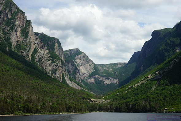
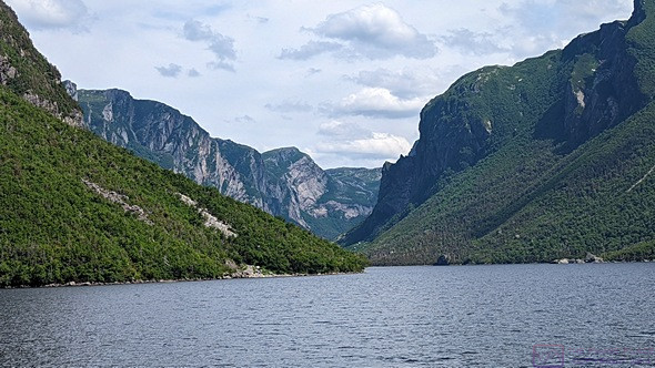
We knew before going that (Étang) Western Brook Pond is a long, narrow, east-west oriented freshwater lake with mountains on either side that plunge steeply into the water, suggestive of a Norwegian fjord. It was formed by a glacier that once flowed all the way to the ocean but the deposits it left behind as it retreated eventually cut the valley off from the ocean and it filled with fresh water. The iconic image of Gros Morne National Park is a view of this lake/gorge from above at the far east end, but the only way for most people to see it is by boat. While Parks Canada has done an incredible job of providing vehicle access to trailhead parking lots, like most of this National Park, the pond is not directly accessible by vehicle, so walking was required.
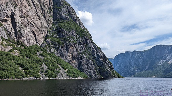
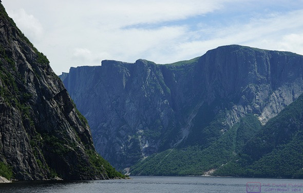
We start to wind our way into the valley on Western Brook Pond. A serious back-country hiker could climb down to the shore from the plateau above via one of the crevices, but the only way to really see this valley is on a boat. (Photo by Linda.)
The tour boat dock was at the west end of the pond, not too far from Hwy-430 (The Viking Trail), but we had to take a trail from the parking lot (at the highway) to the dock. The parking lot was a 30-minute drive from the RV park, and the trail was a 6 km return (3 km one way), which took another 40 minutes. Just to be safe, we left camp around 11:30 AM.
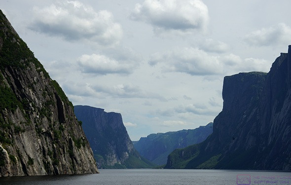
The pond looks straight on the park map, but the water actually winds around sections of the steep walls. GMNP, NL.
The trail was basically a gravel road and was rated “easy”, with only modest changes in elevation, but there was no cover from the sun. There was a café and restrooms (always appreciated) at the lake end. Equally important, there was a lavatory on the boat. We checked in at the registration desk in the main building and got our boarding passes. Our boat was scheduled to start boarding at 1:15 PM and leave the dock at 1:30 PM. By one o’clock a line was already forming, so we got in it. We were close enough to the front of the line to get two seats together on the upper/outside deck.
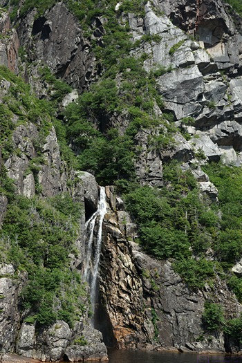
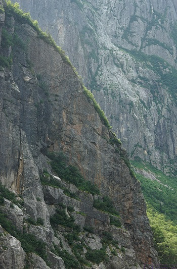
We saw at least a dozen of these cascading waterfalls, but there were probably many more out of sight in the deep crevices that cut into the walls of the valley. GMNP, NL.
Our boat was the MV Westbrook I, and two of the crew members (KJ and Jessie) also served as tour guides, explaining the geology of how this place came to exist and pointing out specific features. The weather was hazy, but we could see the pond and surrounding mountains. The light, however, was not ideal for photography. Given the orientation of the pond, a later afternoon tour would probably have afforded better light, but some of those times were already booked, and we can only do what we can do. There were also a lot of people on the boat and everyone was free to move around and take pictures, which meant that very few people actually got good pictures. Even so, was it spectacular? Yes, it was!
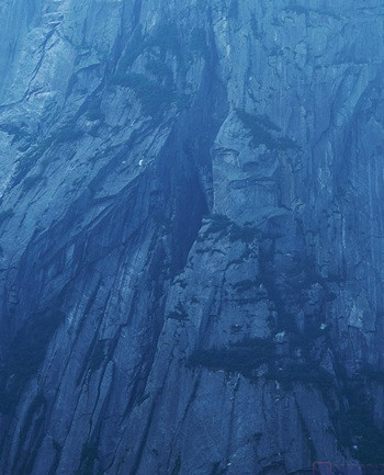
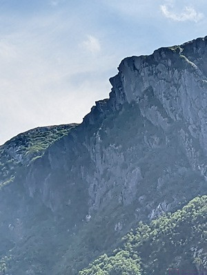
Like clouds, rocks sometimes form recognizable shapes, at least from certain angles. The tour guides referred to this “face” as “the tin man.”
The Long Mountains, into which this valley is carved, are made of the oldest rock in the park at 1.25 billion years, and are mostly granitic gneiss. While the valley has the classic U-shaped glacial cross-section, the upper 2/3rds of most of the valley walls are near vertical. The walls rise 650 m (~ 2,015 ft.) or more above the surface of the pond. The highest wall is ~ 700 m (~ 2,170 ft.). For comparison, that’s 140 m (~ 434 ft.) taller than the CN Tower in Toronto, Canada. The walls are also cut by numerous crevices that run deep into the mountains and up to the plateaus on top.
The surface of the pond is ~ 30 m ( ~93 ft.) above sea level and is 165 m (~ 512 ft.) deep in the deepest place, so much of the water in it is below sea level, 60% in fact. Water does flow out of the pond into the Gulf of St. Lawrence (Golfe du Saint-Laurent), but the flow is minor. Water also flows into the pond as it falls and cascades from the plateaus of the Long Mountains, but just enough to make up for the outflow. The pond gets 20 ft. of snow in the winter, but the plateaus get very little accumulation due to high winds. We also learned that the water is so pure that it does not support much life.
The pond is 16 km (~9.9 miles) long. The east end is closed in a cirque, but there is a dock there. The longest hike available in the park starts at this dock and traverses 35 kilometers over the Long Mountains to the base of Gros Morne Mountain. There are no trails for this hike, and it takes an experienced back-country hiker 3 to 5 days, with map and compass (GPS), to complete it. A special permit is required to do this hike. You must have the necessary skills and equipment to do it on your own, or hire a guide from BonTours.
At the east end of the pond, the valley also ends in a cirque.An interesting side note was that the park has that ~ 3,400 moose and ~ 400 caribou reside within its boundaries. They are free to move, of course, so the exact number varies. The caribou are native to this area, but the moose are not. The moose population is the densest in Newfoundland, averaging three (3) moose per square kilometer (~ 0.36 sq. mi.). However, we have yet to see a moose. Seeing a moose was high on our list, along with puffins and gannets.
When the boat was about 20 minutes from the dock, a microphone stand appeared, followed by a microphone and some cords. A few minutes later, KJ came up the aft stairs with a guitar and entertained us almost to the dock. He was good, and Jessie accompanied him on the spoons. They even got a few of the passengers to give the spoons a try. The songs were upbeat and snappy and KJ was a good performer. When he’s not crewing on a BonTours boat, KJ Hollahan runs Bobs Ya Uncle Entertainment ( bobsyauncleentertainment at gmail dot com ). He had CDs for sale, and I bought one. He’s also on Facebook and Instagram, of course.
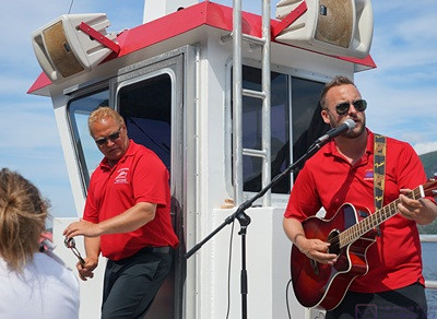
Crewmember Jessie (left, playing spoons) and KJ Hollahan (singing and playing guitar) entertained us for the last 15 minutes of the boat ride.
Once we were off the boat, we had a leisurely walk back to the parking lot. On the way back to camp we stopped at the Parkway Irving station in Rocky Harbor to top up the fuel tank. We are leaving in the morning for St. Barbe and try to start each new leg of the trip with a full fuel tank. It’s 234 km up the Viking Trail, mostly north of our current location, and should take about 2-1/2 hours to drive. Since we have pretty much decided not to take the ferry over to Quebec and drive into Labrador, the farthest north we will be on this trip is the Viking Settlement at L’Anse aux Meadows, another 137 km northeast of St. Barbe, and close to the northernmost point in Newfoundland.
By the time we got back to the KOA it was 5 PM. The rig was not as warm as yesterday, but we closed up and ran the heat-pump for a while to cool it down more.
We had made arrangements this past Sunday for a late departure from the Kinsman RV park in Corner Brook on August 26 in order to get us to the Marine Atlantic Terminal in Channel-Port-aux-Basques at a good time. While there, I noticed a “boil water” order. Linda looked into this and there was indeed such an order in place. We had two nights booked there, and that did not sound like something we wanted to deal with. It was also 224 km (~ 139 mi) and almost 2-1/2 hours from the ferry terminal.
We had become aware of the Grand Codroy RV/Tent Camping Park from a sign at our current KOA. It’s the closest RV park to the Marine Atlantic Terminal in Channel-Port-aux-Basques, only 40 km (~ 24 mi) and 30 minutes away. I called them and was able to get a site for two nights (Aug 24 and 25) with late departure on the 26th. It will be at least water and electric, and 3-way service if a site is available. If not, they have a dump station. This will mean a long drive on the 24th from Grand Falls Windsor of 441 km (~ 274 mi) and 4-1/2 to 5 hours. But we will be very well positioned to get on the ferry back to North Sydney, Nova Scotia on the evening of the 26th.
By this point we were both hungry, so Linda made dinner earlier than usual. We had potato salad, vegan hot dogs, and fresh strawberries. Simple and easy, but satisfying.
After dinner, Linda checked the weather forecast. It called for rain starting around 2 AM and continuing through the morning. While a wet departure appeared to be unavoidable, we wanted to minimize our exposure to the rain by doing what we could tonight. I stowed the awnings, filled the fresh water tank to 75% capacity (~ 30 gallons), and then disconnected the shore water system, which Linda helped stow for travel. I dumped the black waste tank and flushed it twice with about 10 gallons of water each time. Finally, I dumped the grey water waste tank and then stowed all of the associated waste water paraphernalia. I checked the torque on the trailer wheel lug nuts (they were all OK) and then positioned the truck in front of the trailer to expedite hitching up tomorrow. (I got it lined up on the 2nd try!) That left the electrical service, stabilizer jacks and chocks, and hitching up the trailer for tomorrow, as well as getting the interior of the trailer ready to go and moving technology, the cat, and us to the truck. We are targeting a 10:30 AM departure, so we will not be rushed in the morning.
As an aside, we have now completed seven (7) weeks on the road. That’s 49 nights so far. We estimated $50 (US) per night, but suspect that our average cost has probably been closer to $40 (US), so about $2,000 (US) for RV parks. In that time, the engine has run for 108 hours and we have traveled 3,977 miles (~ 37 mph on average), with an average fuel economy of 14.6 mpg. That works out to approximately 272 gallons (~ 1,024 L) of gasoline. Our fuel cost has averaged right around 2$ (can) per L, so we have spent about $2,000 on fuel. We knew the exact cost for the round-trip ferry between Nova Scotia and Newfoundland, and made an allowance for food (groceries and restaurants) and entrance fees and tour costs. Linda knows the exact costs, of course, or can figure them out if needed.
…
