Category Archives: Alaska

20230905_T10-C7_Sitka-AK

Note:  This is the 10th of 16 posts about our 21-day trip that included a 17-day (16-night) cruise on the Norwegian Cruise Line (NCL) ship SPIRIT from Vancouver, British Columbia to Honolulu, Oahu.  This post has 21 photographs with captions and some narrative.  All photos were taken by me (Bruce) using a SONY alpha 6400 or Google Pixel 6 Pro unless otherwise indicated.  (Photos by Linda were taken using a Google Pixel 6.)

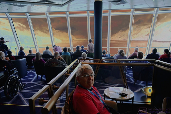
As I am writing these posts some five (5) months after our trip, I have struggled with getting the correct local time stamp for each photo and thus establishing the correct time sequence for images within a post.  The issue is the intermixing of photos from two Pixel smartphones with photos from a Sony a6400 ILC camera while shooting in different time zones far removed from home.  I think I have the photos in this post in the correct order, but have avoided making any reference in the captions to the time of day an image was captured.


TUESDAY 05 September 2023 — (T10,C7) Sitka, AK

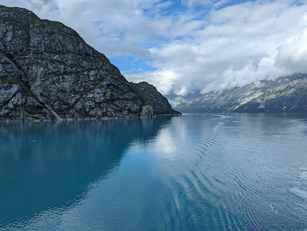
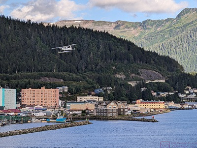
This was day 10 or our trip, day 7 or our cruise, and our final stop in Alaska before crossing the North Pacific Ocean to the Hawaiian Islands.  We arrived in the Sitka harbor early this morning.  The weather was hazy upon arrival, but quickly gave way to blue skies with nice puffy clouds over the surrounding mountains.  It was just cool enough to require a light jacket, which made for wonderful conditions to walk around the town and go on a guided shore excursion with a very good local guide.

Sitka is a fascinating city with a history that placed it at the center of a crossroads of cultures.  The area around Sitka has been the traditional home of the Tlingit people for thousands of years, and they are still here.  The Russians arrived in 1804 and forcibly established a colony with Sitka (New Archangel) as its Capital.  It later became the Capital of American Alaska when the Russians sold the territory to the United States in 1867.

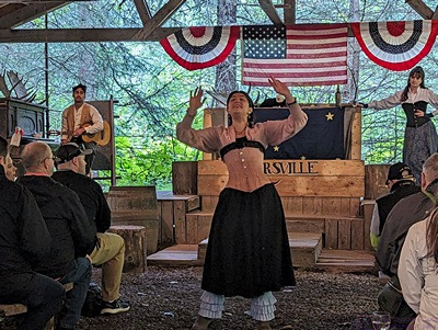
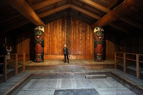
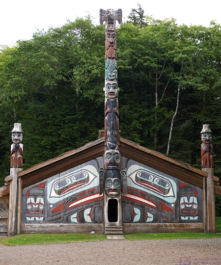
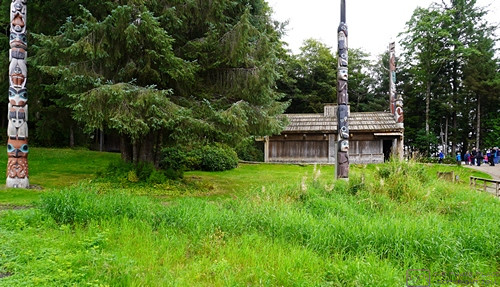
The Tlingit maintain a vibrant culture here with a performance center in the style of a traditional community clan house; offerings include song and dance.  Traditional art abounds in the Center and various art galleries, as well as the many intricately carved totem poles in the National Park peninsula.  Russian influence is evident in the onion domed Cathedral of St. Michael and the Russian Bishop’s House, as well as the Russian Cemetery and the names of places, buildings, and streets.  Russian dance is performed in town by the New Archangel dancers, while Summer music festivals celebrate Jazz as well as other musical traditions.

Paraphrased from Wikipedia:  Sitka is a unified city-borough in the southeast portion of the U.S. state of Alaska. It was under Russian rule from 1799 to 1867.  The city is situated on the west side of Baranof Island and the south half of Chichagof Island in the Alexander Archipelago of the Pacific Ocean.  As of the 2020 census, Sitka had a population of 8,458, making it the fifth-most populated city in the state.   Although the City of Sitka is located on a two small islands, the borough encompasses a vast area.  According to the United States Census Bureau, the city-borough is the largest incorporated municipality by area in the U.S., with a total area of 4,811 square miles (12,460.4 sq km ), of which 2,870 square miles (7,400 sq km ) is land and 1,941 square miles (5,030 sq km ), comprising 40.3%, is water.

We enjoyed our short time in Sitka, as we did in Ketchikan, Juneau, and Skagway, but we sensed that we would enjoy returning here for a longer visit and the opportunity to explore the area more thoroughly.


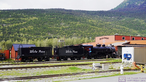
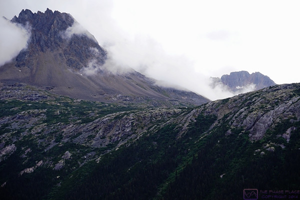
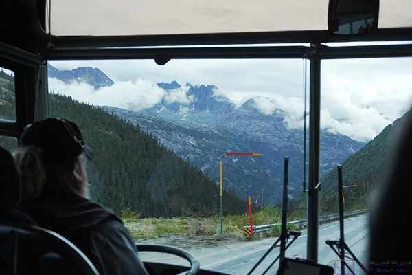
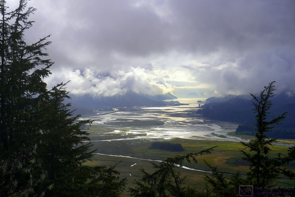
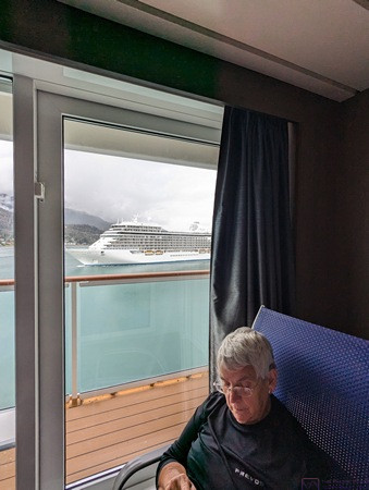
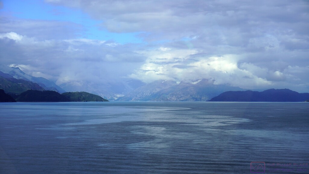
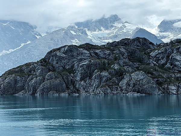
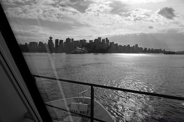
This photo is from the day before around 4 PM as the ship was departing from Skagway.  (Photo by Linda)


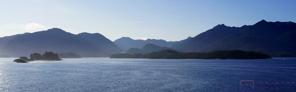
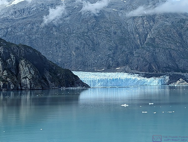
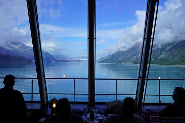
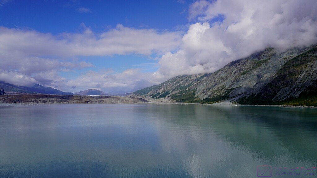
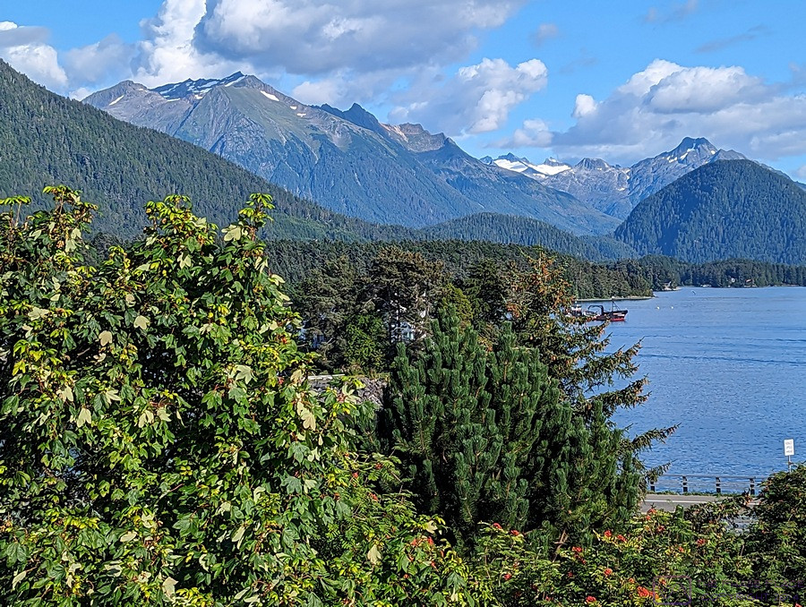
We had slightly hazy weather for our arrival in the Sitka area, and the best scenery was to the ESE, into the sun.


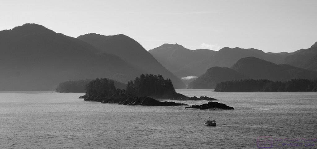
After playing around with this photo for a while in post -processing, I decided it looked best as a black & white image.  (I got my first camera when I was 16 and started out shooting with B&W film and learning how to develop it and make prints using a darkroom that belonged to my parent’s best friends.  It still appeals to me.)


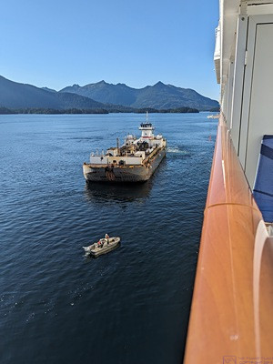
We were “anchored out” during our time in Sitka.  (It was never clear to me if this was due to a lack of adequate dockage for a ship our size, or a limited amount of such dockage that was already occupied by another ship or ships.)  A fuel ship prepares to come along side and refuel the SPIRIT in advance of our crossing the North Pacific Ocean.  (The fuel ship is not a barge as it is under its own power.)  (Photo by Linda)


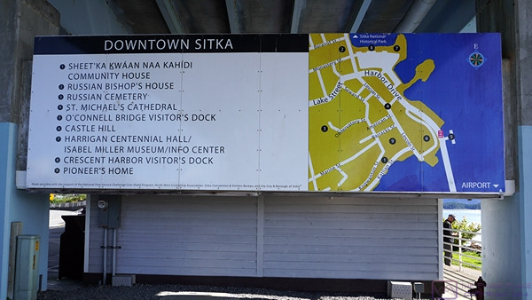
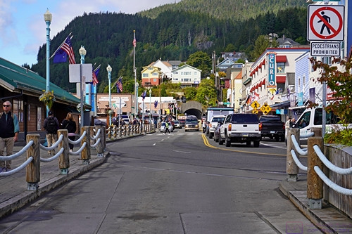
As the NCL SPIRIT was anchored out, we had to tender in to the Sitka marina.  Shortly after disembarking from the tender, we were greeted by this very helpful sign with highlights marked on a map of the main downtown area.


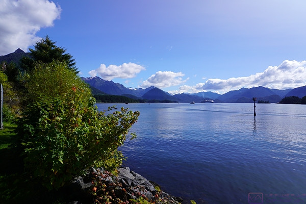
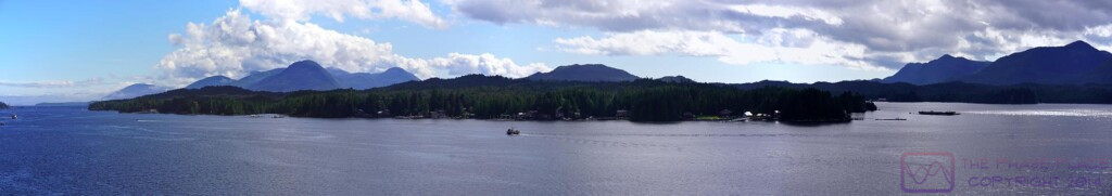
I never tire of views where mountains meet the water.  This was captured from near the Sitka marina looking out towards our ship, which is just visible center frame where the mountains and water meet.


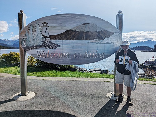
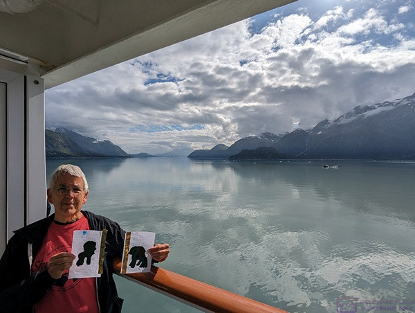
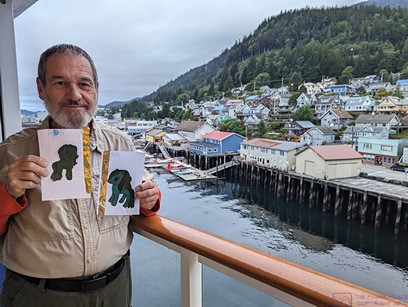
The “Welcome to Sitka” sign seemed like a good place to take a “Apa and Ama are here” photo for grand-daughter Sadie.  We tried to remember to take a photo in each place we visited and text them to her parents so she could follow our travels.  (Photo by Linda)


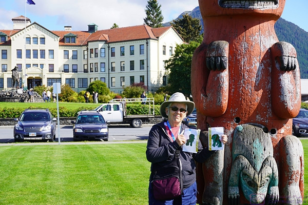
Linda holds the Apa and Ama artwork for another “we are here” photo.  This one is in Totem Square with the Sitka Pioneers Home in the background.  It might look like a hotel, but it’s actually an assisted living complex; one of the nicest we had ever seen (at least form the outside).


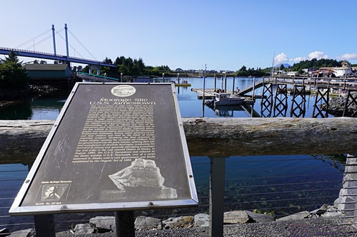
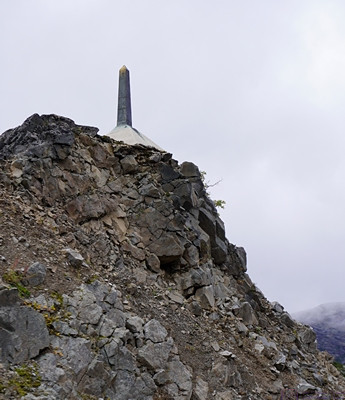
On June 14, 1879 the U.S.S. Jamestown (a sailing ship of war) arrived in the waters near Sitka to relieve the U.S.S. Alaska, and eventually moored near where this sign now stands.  From 1879 to 1881, she was the official seat of government for the Alaska District.  The Jamestown was relieved in August 1881 by the U.S.S Wachusett (a steam ship of war), which continued as the seat of government for the District of Alaska until the Civil Government was finally established by the Organic Act of 1884.


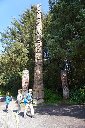
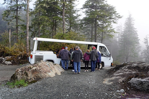
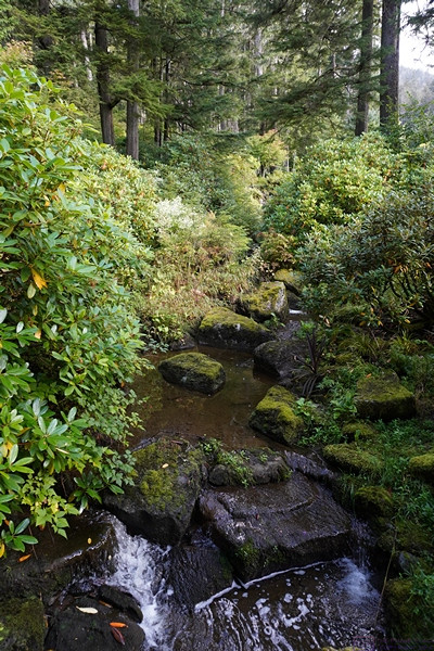
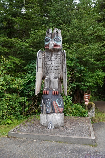
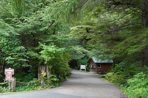
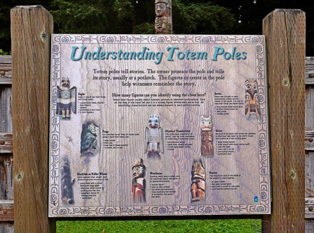
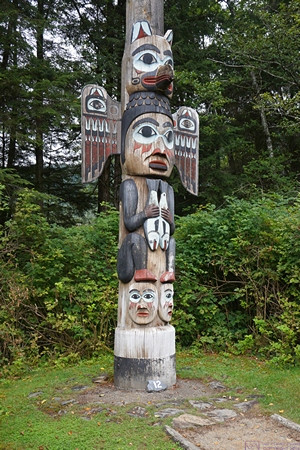
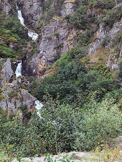
Our shore excursion today included a visit to the Sitka National Historical Park (aka Totem Park).


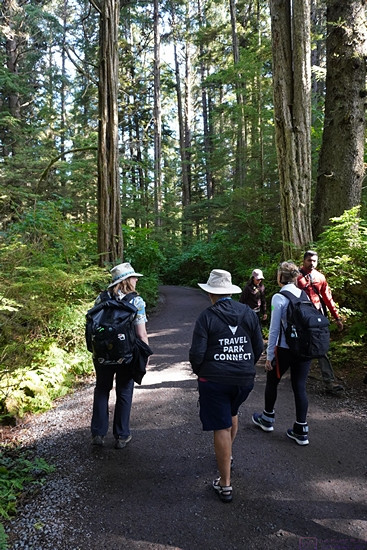
Our visit to Sitka NHP included a walk in the woods.  The tour guide (left) and Linda (right) are sporting their Tilley hats.  Linda’s lightweight hoodie says “Travel Park Connect.”  This was the motto of the RVillage social media platform.  I have one too.  It was a great idea and good platform for RVers that was very popular but did not survive.


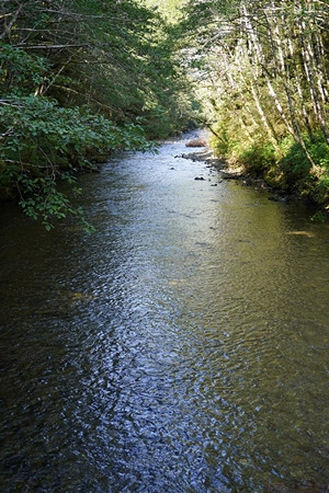
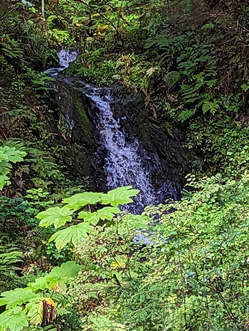
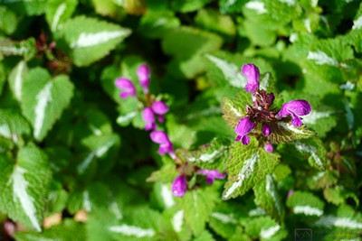
While walking through Totem Park, we got to stop at a small footbridge over the Indian River, an active Salmon run.  Although not really visible in this photo (I couldn’t get a good one) the stream was thick with salmon swimming against the current, presumably trying to reach their spawning grounds.  It was quite a sight.  As I mentioned in a previous post, when I think of Alaska I think of Grizzly Bears, Bald Eagles, and Salmon.  I would add to that Eskimos and other indigenous people, totem poles, Polar Bears, Moose, Elk, Caribou, Whales, Bush planes/pilots, and oil production.


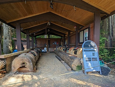
A shed at Sikta NHP / Totem Park where totem poles are repaired and restored.  (Photo by Linda)


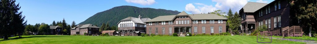
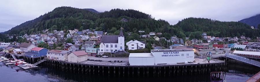
This panorama of the Historic Campus of the Sika Fine Arts Camp is a composite of seven images.  The image is 1920 x 270 pixels; clicking on it will display it full size on a device with a suitable monitor.


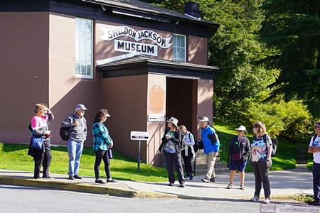
The Sheldon Jackson Museum, founded in 1888, houses an exceptional collection of Alaska Native ethnographic material gathered by Presbyterian missionary and General Agent of Education for Alaska, the Rev. Dr. Sheldon Jackson.  It was purchased by the State of Alaska in 1985.


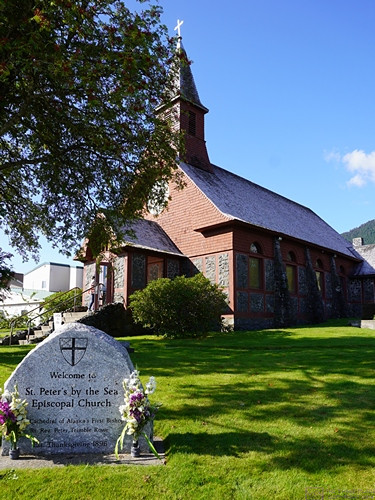
This charming and well-maintained building is St. Peter’s By The Sea Episcopal Church.  It was established on Thanksgiving Day in 1896, the same year the Klondike Gold Rush began.


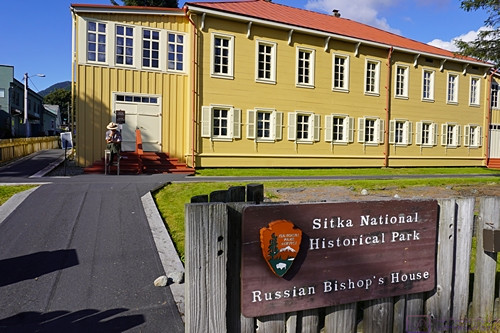
The Russian Bishop’s House is now part of Sitka National Historical Park.  Given that Alaska was Russian territory for 68 years before being sold to the USA, it was not surprising to see Russian influences everywhere, including in the names of islands, streets, buildings and, of course, churches.  Next photo please.


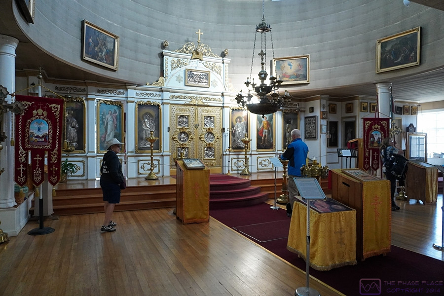
Paraphrased from Wikipedia:  St. Michael’s Cathedral, also known as the Cathedral of St. Michael the Archangel, is a cathedral of the Orthodox Church in America, Diocese of Alaska, in Sitka, Alaska. The earliest Orthodox cathedral in the New World, it was built in the nineteenth century, when Alaska was under the control of Russia.  After 1872, the cathedral came under the control of the Diocese of Alaska.  It had been a National Historic Landmark since 1962, notable as an important legacy of Russian influence in North America and Southeast Alaska in particular.  An accidental fire destroyed the cathedral during the night of January 2, 1966, but it was subsequently rebuilt.  The new building’s green domes and golden crosses are a prominent landmark in Sitka.  Some of the icons date to the mid-17th century; two icons are by Vladimir Borovikovsky.


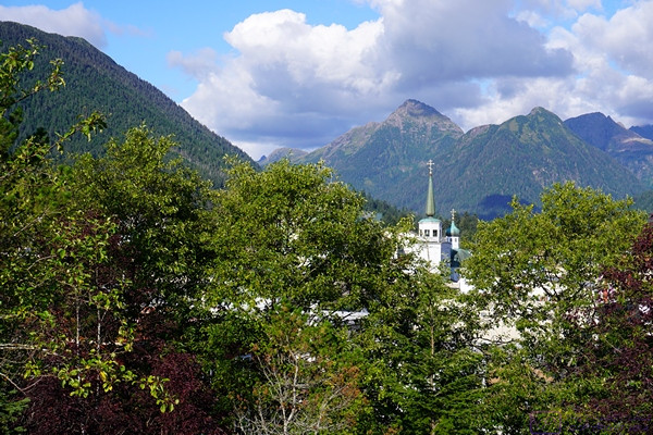
Our shore excursion guided walking tour ended atop Castle Hill.  Looking northeast, the green domes and golden crosses of the Orthodox Cathedral are visible  through the trees.


A view (probably from Castle Hill) of the mountains, and the east end of the harbor, south of Sitka, Alaska.  (Photo by Linda)


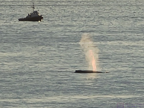
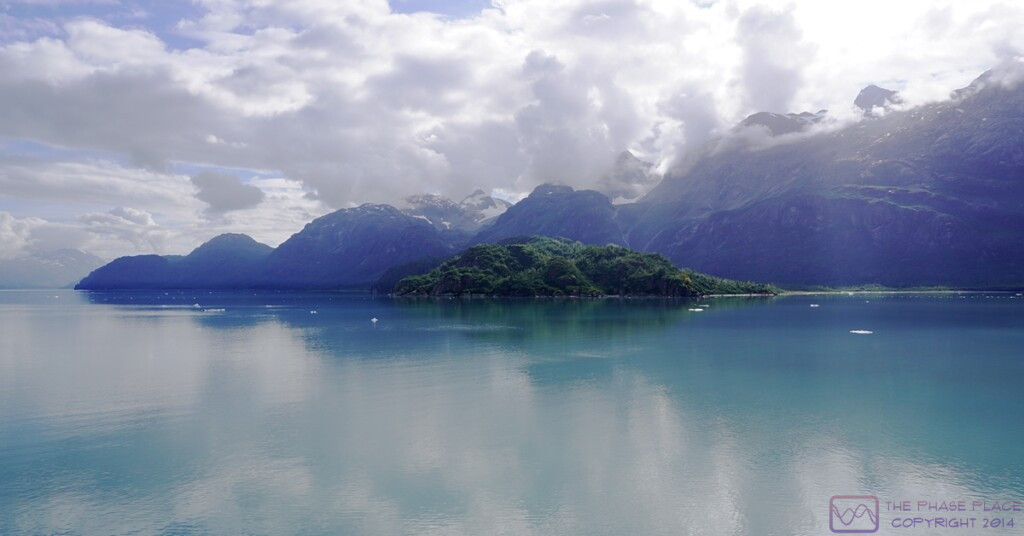
We departed Sitka Harbor in the late afternoon / early evening and were greeted by this spouting whale and fishing boat.  Fishing boats were numerous in the harbor and marina.  This was the last time we would see land until the morning of Monday 11 September when we arrived at the port in Nawiliwili, Kauai, Hawaii.

20230904_T9-C6_Skagway-AK

Note:  This is the 9th of 16 posts about our 21-day trip that included a 17-day (16-night) cruise on the Norwegian Cruise Line (NCL) ship SPIRIT from Vancouver, British Columbia to Honolulu, Oahu.  This post has 27 photographs with captions and some narrative.  All photos taken by me (Bruce) using a SONY alpha 6400 or Google Pixel 6 Pro unless otherwise indicated.  (Photos by Linda taken with a Google Pixel 6.)


MONDAY 04 September 2023 — (T9,C6) Skagway, AK — Miners Camp, Bar & Brothel, White Pass & Yukon Railroad

This was day 9 or our trip and day 6 of our cruise.  We had three shore experiences, but they were booked as one shore excursion that provided transportation between venues and ensured we met the starting times for each one, including getting back to the ship on time.

The excursion(s) started with a bus ride to the Liarsville Gold Rush Trail Camp & Salmon Bake, a private reproduction gold mining camp.  It was nicely done, but only provided a sanitized glimpse at what life must have been like during the Klondike gold rush period, which started in 1896.  The “camp” we experienced was certainly much cleaner than the reality of a by-gone era of fortune-seeking in the Alaskan wilderness.  Our visit to the camp included panning for gold (we didn’t get any), a show in the Hippodrome (which was very good), and a buffet lunch (with LOTS of salmon on offer along with lots of side dishes).

Back in town, we toured the Red Onion Saloon and Brothel.  It was a brothel in its day, but is now a museum (of course), although the saloon is still a functioning bar.  Again, a somewhat “sanitized” glimpse, but a glimpse nonetheless, into another aspect of frontier life in the Klondike Gold Rush era.

Our third experience, and one of the highlights of our entire trip, was a ride on the White Pass and Yukon Railway from Skagway, AK through White Pass Summit (mm 20.4) and ending in Fraser, British Columbia (mm 27.7). The return trip to Skagway was by motorcoach, which is much faster than the return trip by train, but also gave us different views.

Paraphrased from Wikipedia (and other sources):  The White Pass and Yukon Railway was completed in 1900.  The 3-foot “narrow gauge” railway extended from Skagway, Alaska to Whitehorse in the Yukon Territory of Canada, a distance of 177 km (~ 110 miles).  It was built in two sections; the first from Skagway, AK north to Carcross, BC (67.5 mi) and the other from Whitehorse, YT south to Carcross (42.9 mi).

When first built, the railway transported would-be miners, equipment, and supplies to the gold fields in the Yukon Territory, as well as points along the route.  It continued to service mines all along the route until metal prices collapsed and the railway closed on October 7, 1982.  The route reopened from Skagway to White Pass Summit in 1988 (20.4 mi) for tourist traffic only, to Fraser, BC in 1989 (an additional 7.3 mi for a total of 27.7 mi) and then to Bennett, BC in 1992 (another 12.9 mi for a total of 40.6 mi).  The reopening from Skagway north was at the urging, and with the active support, of the cruise line industry, which was already calling on Skagway and saw the potential for a unique onshore experience.  (The parent company of Carnival Cruise Lines is a major stakeholder in the current railroad operations.)

The hope has always existed that the entire route would reopen someday.  A train from Skagway, AK reached Carcross Station, YT in 1997 for the “Ton of Gold Centennial Celebration,” a distance of 67.5 miles (~110 km), and this is the currently active portion of the original line.  On October 10, 1997 a special passenger train (invitation only) ran from Carcross Station to Whitehorse, affirming that the rails were still intact and usable.

Here are some highlights of our day in photos and captions:


The entrance to Liarsville Gold Rush Trail Camp.  The “camp” is mostly based on tents displaying various aspects of camp life in the Klondike Gold Rush era.  “Rustic” permanent buildings on-site house a store, restrooms, and the Hippodrome entertainment venue.


Our Liarsville location photo for grand-daughter Sadie with her Apa and Ama artworks.  (Photo by Linda)


Signs to the most important places in the Liarsville camp (top-to-bottom): General Store, Brothel, and Restrooms.  (Photo by Linda)


The Liarsville Hippodrome; a covered entertainment venue (that would not have been part of an 1897 Gold Rush camp).  (Photo by Linda)


The young (to us) entertainers were very good.  (Photo by Linda)


Linda pans for gold.  (She didn’t find any.)


The Liarsville experience included a salmon bake luncheon.  Shown here is the Cookhouse.  It was here for tourists and employees and would not have been part of an authentic tent camp.


A view of the “back-room bar” at the Red Onion Saloon and Brothel.  The “madam” serves drinks to our tour group and “explains” the operation of the establishment.  The “rooms” are upstairs and we got to tour that area as well.


A massive snowblower used to clear the White Pass & Yukon Railway tracks.  My research indicated that it still works, and is still used, and is quite a sight to see in operation.  (Photo by Linda)


A rare selfie of the two of us.  We are in our Pullman-style train car as the train starts its journey up to White Pass Summit and Fraser, BC.  (Photo by Linda)


A view from of the left side of the train from in-between two of the passenger cars.  The views were constantly changing, and always amazing, but not always easy to capture from a moving platform with limited choices of shooting angle (and lots of other passengers also trying to take photos).  (Photo by Linda)


This a composite of two images that Linda shot with her phone.  The Coastal Range are some serious mountains.  (Photo by Linda)


The train approaches one of several trestle bridges that span deep gorges.  The construction of this rail line was quite a feat of engineering and labor.  (Photo by Linda)


In the area around White Pass Summit, the highest surrounding peaks are in the 6000 to 7000 ft AMSL category.  The highest peak anywhere near Skagway is Mt. Fairweather.  Located 89 miles to the SW of town, near the ocean coast, it rises to 15,325 ft AMSL.  It is part of a range with numerous peaks in the 10K, 11K, and 12K foot ASL categories, and must be quite a sight to see from the ocean.  (Photo by Linda)


Mountains, mountains everywhere, with snow still present in the highest elevations.  (Photo by Linda)


The WP&YR uses several different types of diesel-electric locomotives, and still operates a couple of steam engine locomotives.  Our locomotives were black with a red horizontal stripe, but I have been unable to identify the exact model.


If this photo is of the maintenance yard, it is out of order.  The sequence number (assigned by the camera), however, indicates that it is in the correct order, so I’m not sure what is being shown here, but I have included it anyway.


A view of our passenger car from the rear as Linda (closest person to the camera on the right) enjoys the scenery.


Somewhere along the White Pass & Yukon Route (the image has been manipulated, obviously).


Well, this is obviously a view from Rocky Point, which is mm 6.9, so we still had most of the trip ahead of us.  The day was obviously cloudy, but the views were spectacular nonetheless.


A jagged peak towers into the clouds.  Like I said earlier, the Coastal Ranges are serious mountains.


Our train crosses a gorge and disappears into a tunnel.  There are only two tunnels on the WP&YR route, Tunnel Mountain at mm 16.0 and a newer one (1969) at mm 18.8.  I was unable to determine which one this was after the fact.


The end of our train as it is about to cross a trestle bridge over a gorge and follow the rest of the train into a tunnel.


Distant views.


White Pass Summit and the monument marking the boarder between Alaska (USA) and British Columbia (Canada).  The Summit at White Pass is 2,864 ft AMSL.  The train starts in Skagway a few feet above sea level and climbs ~ 140 feet per mile traveled, on average.  That’s a 2.65% grade, on average.


The (old) North West Mounted Police (NWMP) station.  I think this was right after crossing into British Columbia, but I’m not sure of the exact location.


Our train ride ended in Fraser, British Columbia, where we cleared Canadian Customs before boarding a motorcoach for the return trip to Skagway via the Klondike Highway.


20230903_T8-C5_Juneau-AK

Note:  This is the 8th of 16 posts about our 21-day trip that included a 17-day (16-night) cruise on the Norwegian Cruise Line (NCL) ship SPIRIT from Vancouver, British Columbia to Honolulu, Oahu.  This post has 23 photographs with captions and some narrative.  All photos taken by me (Bruce) with a SONY alpha 6400 or Google Pixel 6 Pro unless otherwise indicated.  (Photos by Linda taken with a Google Pixel 6.)


SUNDAY 03 September 2023 — (T8,C5) Juneau (AK); Glaciers, Gardens, and Hatcheries

This was day 8 of our travels and day 5 of the cruise.  We signed up for a shore excursion to that included the Mendenhall Glacier, Glacier Gardens Rainforest Adventure (GGRA) (a private botanical garden and Yard Doctor Nursery), and the Macauley Salmon Hatchery.  The shore excursion started early and took most of the morning.

The Mendenhall Glacier is located in the Tongass National Forest.  Access is controlled and limited and, for whatever reason, our tour bus did have access today, so we only got to see the glacier from a distance.  Disappointing, certainly, but not the end of the world as we had just seen Glacier Bay National Park and Preserve yesterday.  We returned to the dock by noon and then walked around downtown Juneau, which is Alaska’s state capital.


Our tour bus stopped at a parking area that allowed us to walk north along a trail on the west side of the Mendenhall River, where I spotted this flower.


A stretch of the Mendenhall River, flowing strongly.  The Mendenhall Glacier is visible center frame just above the trees.  (Photo by Linda)


Glacier Gardens (GGRA) is known for their “upside down” trees.  Steve and Cindy Bowhay created this place, with the Rainforest Adventure opening in 1998.  Located within the Tongass National Forest, GGRA is a temperate rainforest environment.  The upside-down trees are just that; the lower portion of large trees and their root ball, inverted and stuck in the ground.  The top of the root ball is then used as a planter.  They are unique and delightful, with a wonderful variety of flowers and shrubs.


The GGRA Adventure involved climbing a small mountain through a dense forest in open-sided vehicles (shown later).  The road is constructed of logs in many places, with no shoulder and steep drop-offs in places.  There is a log curb, however, as shown in this photo, and our driver seemed to take safety seriously.  (Photo by Linda)


Another view of the road as seen from below.  The GGRA gardens were beautiful, and the views from the summit outstanding, but the road was an attraction in its own right, at least for those who are curious about such things (like me).  (Photo by Linda)


A view to the west (I think) from the summit of GGRA.  (Photo by Linda)


The extended wheelbase “vans” used to transport guests on the road to/from the summit of GGRA.


A small waterfall/feature at GGRA.  (Photo by Linda)


This planting bed at GGR caught our eyes.


A closer view of an interesting plant at GGRA.


Proof that I was here at GGRA.  (Photo by Linda)


Proof that Linda was also here at GGRA.  (Photo by Bruce using Linda’s Pixel 6.)


The landscaping at GGRA really was something.  This cascading stream looked very natural.  Glacier Gardens is not just a tourist attraction; is also a nursery and landscaping service for the greater Juneau area.


Our shore excursion concluded with a stop at the Macauley Salmon Hatchery (MSH), located northwest of Juneau on the Gastineau Channel.  Fishing in general, and salmon in particular, is a big industry in Alaska, of course, and there are many hatcheries and processing plants in the state.  The MSH is a working facility that is also open to the public for tours.  It was a great way to end our shore excursion.


The salmon run at MSH looking northwest.  The Gastineau Channel is to the left.  The tide was out and the water level was very low.


There were quite a variety of fish and crustaceans in the tanks at MSH.  I selected this photo because I thought it was an interesting composition.


The official (?) “Welcome to Juneau” sign.  We had, in fact, felt very welcomed everywhere we had been on this trip thus far.  (Photo by Linda)


We were not looking for it, but managed to stumble across the City Hall building for the “City and Borough” of Juneau.  The distinction must be important or the sign would not have mentioned it.  I wonder if the locals divide up into “townies” and “boroughies”?  And I wonder if “boroughies” is even a word?  (MS Word spell check doesn’t think so.)


I don’t recall what the significance of this building was, if indeed it had any special significance.  I photographed it because I liked its design and materials, and it had a cool totem pole.


This statue was in the plaza that is part of the State Capital complex, which included the Capitol, of course.  When I think of Alaska I think of many things, but especially Bald Eagles, Grizzly Bears, and Salmon.  This statue had two of those three, so …


We took this to be the main food/shopping street in Juneau, or at least typical of the retail sector in town.  Some of the shops and eateries might have been a bit more upscale, but not all of them, and the look/feel of the place was still very much coastal Alaska.  (Note:  The timestamp on this photo matches the time on the clock in the photo.  I love it when that happens.)


Like all of the coastal cites we visited, Juneau occupies land between the water and steep, high terrain.  Much of the city is built on the lower, flatter areas, when possible, but the land rises quickly and steeply as you move away from the water, and we saw plenty of structures up on the slopes that appeared to be mostly residences.  This staircase is very steep and long, and leads up to a building at the top that might be visible in this photograph.  (Photo by Linda)


Linda relaxes in our stateroom after spending the better part of 5+ hours ashore.  The ship in the background is the Seven Seas Explorer from the Regent Seven Seas Cruise Line.  It is one of their two new Explorer Class ships, the other being the Seven Seas Splendor.  ALL staterooms on ALL Regent Seven Seas ships are “suites” and come with butler service.  Regent Seven Seas offers a luxury cruise experience and tends to be more inclusive than most other lines, but with a fare to match.  In spite of being upscale, it is our understanding that these ships are quite relaxed, with freestyle dining, for instance.  They also tend to be mostly adult oriented, lacking some of the “entertainment” attractions on more family and “younger cruiser”-oriented lines.  I think we would enjoy this (or a similar) cruise line, if not for the cost.  (Winning a big lottery might chance that equation.)

20230902_T7-C4_Glacier-Bay-NPP-AK

Note:  This is the 7th of 16 posts about our 20-day trip that included a 16-night cruise on the Norwegian Cruise Line (NCL) ship SPIRIT from Vancouver, British Columbia north along the inside passage to Sitka, Alaska, and then across the North Pacific Ocean to the Hawaiian Islands, before ending in Honolulu, Oahu.  This post has 10 photographs with captions and some narrative.  Photos by me (Bruce) taken with SONY alpha 6400 or Google Pixel 6 Pro unless otherwise indicated.  (Photos by Linda taken with Google Pixel 6.)


SATURDAY 02 September 2023 — (T7,C4) Cruising Glacier Bay National Park & Preserve, Alaska

This was day 7 of our travels and day 4 of the cruise.  Our destination for today was Glacier Bay National Park and Preserve (GBNP&P).  We had an early departure from the port at Ketchikan yesterday, as it was a long sail from there to the Bay and our itinerary was planned to give us as much sailing time in the Bay as possible.  We anticipated that this would be one of the scenic highlights of our entire trip, and it was, in spite of less-than-ideal weather conditions.  The weather also made photography a bit more challenging, but I think we did okay.

Glacier Bay is a National Park & Preserve, so ships (cruise and otherwise) cannot just sail in as they please.  Access is controlled and cruise ships, in particular, have to book entrance for their itineraries well in advance.  They also have to stop near the entrance of the Bay and pick up a National Park Service Ranger/Historian, who remains on-board until the ship leaves the boundaries of the park/preserve.  The Park employee does double duty, both explaining on the P.A. system what the passengers are seeing, as well as (I suspect) “advising” the Captain about conditions in the Park so no harm comes to the ship or the Park.  Not a harbor pilot, of course, but an official Park presence for sure.  The Park employee is returned to their base as the ship exits the Park.


Our first large glacier appears on the port (left) side of the ship as it works its way north into Glacier Bay.  (Photo by Linda.)


Our APA and AMA “proof we were here photo for GBNP&P.  (Photo by Bruce using Linda’s phone.)


There were great views in every direction all of the time.  This photo is looking forward from the forward lounge.  The large glass windows distort the exposure and color.  I’ve corrected it as best I can.  (This image is 1200×675 pixels.  Clicking on it will display it full-resolution on a device with a sufficient screen resolution.)


The exposure on this photo was so bad I could not correct it.  I wanted to use it as it’s a nice shot of Linda and shows the forward observation lounge.  I adjusted it to make it “artsy.”


This is the same basic view as the previous two photos with an attempt at natural color corrections.  Some of the forward observation lounge windows are visible along with a few passengers for scale.


Winding our way around headlands as we sailed deeper into the Bay was exciting as we (literally) never knew what was around the next corner (even though we had a map of GBNP&P).  (Photo by Linda.)


Linda caught an especially nice photo of this headland with higher mountains behind.  I think this photo captures just how rugged GBNP&P is.  (Photo by Linda.)


The end of the Bay, ABIR.  The day started out overcast and grey, with weak light.  By later in the afternoon, the clouds had opened up a bit to let in light and reveal blue skies.  (This image is 1080×608 pixels, and can be displayed at full-resolution on an appropriate device by clicking on the image.)


Linda on the pool deck (13, ABIR) with mountains looming in the background, relatively close to the ship.  The experience of seeing the Park from a cruise ship was grand.


The land comes down to meet the sea as we sail south out of GBNP&P.  I liked the way this green island stood out against the somewhat monochromatic mountains and clouds.  (This image is 1200×628 pixels.  You know what to do.)

20230901_T6-C3_Ketchikan-AK

Note:  This is the 6th of 16 posts about our 21-day trip that included a 17-day (16-night) cruise on the Norwegian Cruise Line (NCL) ship SPIRIT from Vancouver, British Columbia Honolulu, Oahu.  This post has 14 photographs with captions and some narrative.  Photos taken by me (Bruce) with SONY alpha 6400 or Google Pixel 6 Pro unless otherwise indicated.  (Photo by Linda taken with Google Pixel 6.)


FRIDAY 01 September 2023 (T6,C3) Ketchikan, Alaska and Totem Bight State Historical Park


This was day 6 of our travels and day 3 of the cruise.  I’m not sure what time we arrived at Ketchikan, Alaska, but our first photos, taken from our balcony, appear to be from 6 AM local time.  If so, we were up early and dressed for the arrival.  The embarkation “sail away” is always a big deal, but we especially like arriving in a new port-of-call.  Cruise ships often arrive in ports very early in the morning to give their guests as much time as possible to go ashore (and spend money on shore excursions).  Departure is typically anywhere from mid-afternoon to early evening, depending on the distance/time to the next port.  These ships are able to set and course and speed and maintain it with considerable precision, so they have very accurate ETAs as a rule.   After a few photos, I presume we went in search of breakfast somewhere on the ship.


Proof of Arrival for grand-daughter Sadie.  The pony on the left (of the photo) is labeled “APA” (Grandpa Bruce) and the other one is labeled “AMA” (Grandma Linda).  (Photo by Linda)


We were docked starboard side in, so we had a view of most of Ketchikan from our stateroom balcony.  Most of the town is nestled between some small mountains and the water, and has an extensive waterfront.  This is a composite image of 4 photographs.


We booked a shore excursion to Totem Bight State Historical Park (TBSHP), which took up the late morning.  As we stepped ashore to gather by our tour bus, we were aware that this was the first time we had set foot on Alaskan soil.

One of things we noticed on the Coastal Alaska portion of this cruise was that many of the tour bus drivers/guides and venue guides were relatively young.  In conversation, we discovered that many of them were from Brigham Young University (Utah) and were here working seasonal jobs.  The reason is that BU has a semester schedule that makes it possible for students to take jobs in places like Alaska at times of the year when they are needed.  They also have a training program for tourist industry work, and many companies recruit from there as a result.  We were impressed that these relatively young folks had gotten their CDL-B (Commercial Driver’s License – Passenger Bus).


An information board on arrival at TBSHP.


A totem pole at the entrance into TBSHP.


The lovely, wooded entrance path into TBSHP.


The Lodge House at TBSHP.  Our tour guide provides scale for the carved figures that support the massive beams that support the rafter beams for the roof.


The Lodge House at TBSHP viewed from the entrance end.


A view of the Lodge House at TBSHP from the side, with several totem poles visible.


20

A view of the Lodge House at TBSHP from the side, with several totem poles visible.


Another interesting totem pole as we were exiting the TBSHP.


Upon return to the cruise ship dock, we walked the town for a while before returning to our ship well ahead of “all on board” time.


A view of one of the streets in Ketchikan.  Ketchikan was a neat little town, but busy with tourists and vehicles and difficult to photograph in an interesting or meaningful way.


This photo is from mid-afternoon, not long after leaving the dock in Ketchikan.  Seven images were composited to form this panoramic photograph.


These ships are part of the Alaska Marine Highway System, which is headquartered in Ketchikan, Alaska.  There is a major dry dock facility just out of frame to the left with a ship in it for repairs.

20230831_T5-C2_At-Sea on the Inside-Passage

Note:  This is the 5th of 16 posts about our 21-day trip that included a 17-day (16-night) cruise on the Norwegian Cruise Line (NCL) ship SPIRIT from Vancouver, British Columbia to Honolulu, Oahu.  This post does not have any photographs.

THURSDAY 31 August 2023 — (T5,C2) At Sea in the southern Inside Passage

This was the fifth day of our trip, and the second day of our cruise.  We left the cruise terminal in Vancouver, BC yesterday at approximately 3 PM local time and were scheduled to arrive in Ketchikan, Alaska early on the morning of September 1st.  That meant today was a “sea day.“  We had sailed overnight last night and would sail through the overnight hours again tonight—approximately 37 hours in total—before reaching Ketchikan, Alaska.  We tend to sleep well on cruise ships, perhaps surprisingly, as we are in an unfamiliar space with unfamiliar noises and sleeping on a mattress and pillows that are not our own.  Linda attributes this to the gentle movement of the ship (in nice weather) and perhaps the faint sound of water flowing as the ship glides through the ocean.

This cruise was going to have more sea days than most 2-week cruises as we would be crossing the North Pacific Ocean (NPO) from Sitka, Alaska to Nawiliwili, Kauai (Hawaiian Islands), a 5-night journey that would take five full days and parts of two others.  But this sea day was in the southern end of the famous “inside passage,” a route up the coast of British Columbia and Alaska that winds its way between the mainland to the east and the plethora of islands to the west.  As a route, it is more protected and (presumably) more scenic than the “outside passage” but, I presume, also trickier to navigate.  It’s not really optional, however, as the major cities here are mostly located on the mainland coast.  Going from outside to inside and back would add many, many nautical miles and hours to the journey and therefore $$$ to the cost of such cruises.  I presume it is also more scenic, with something to see on both sides of the ship most of the time.  An Alaskan coastal cruise is not just about epic scenery, however; it also about history, culture, and adventure, so the ships have to go to the cities if guests want to visit them which, of course, they do.

The weather was overcast and hazy during our initial passage, so we did not have any good photo opportunities until our arrival in Ketchikan.  Which was fine.  Sea days are a wonderful time to explore the ship in greater depth as well as just relax and enjoy the motion of the ship and the world floating by, if only ephemeral glimpses of land through the mist.  I found a book on the Bauhaus in the ship’s library, and spent some relaxing time reading it over the duration of the cruise.

20230830_T4-C1_NCL-SPIRIT Embarkation and Sail-Away

Note:  This is the 4th of 16 posts about our 21-day trip that included a 17-dat (16-night) cruise on the Norwegian Cruise Line (NCL) ship SPIRIT from Vancouver, British Columbia to Honolulu, Oahu.  This post consists of 13 photos with captions and some narrative.  Photos taken by me (Bruce) with SONY alpha 6400 and Google Pixel 6 Pro unless otherwise indicated.  (Photos by Linda taken with Google Pixel 6.)


WEDNESDAY 30 August 2023 — (T4,C1)  NCL SPIRIT Embarkation & Sail-Away, Le Bistro French Restaurant

Today was the fourth day of our trip, and the first day of our “Ice & Fire” cruise on the NCL cruise ship SPIRIT.  Embarkation was at the cruise terminal at the Port of Vancouver, which we had visited during the last couple of days to make sure we knew where it was and how to get in as pedestrians.  Given that it was only ~0.5 miles from our hotel, which did not have a shuttle service, we walked to the cruise port with our roller bag suitcases rather than take a cab or Uber.  I’ve mentioned previously that central/downtown Vancouver is a very walkable city, at least in nice weather.

Embarkation was relatively easy.  We checked our larger bags, and took our smaller ones on-board with us rather than leave them for the porters to deliver.  We had to wait for a while to gain access to our stateroom but once we did, we dropped off our bags and explored the ship.  We would naturally do this anyway, as there isn’t much else to (other than drink or swim) while all of the guests are being embarked, but we have also discovered that this is one of the “tips” that is widely shared on Youtube cruising channels.

We made an assumption that the scenery going up the inside passage might be better on the starboard (mainland) side of the ship, so we booked a balcony cabin on that side (the right when facing forward towards the bow).  We chose a room on Deck 9 near the fore-aft center of the ship.  This deck was high enough to have a good view and a near optimal location to minimize the effect of the ship’s movement by being near the ships center of gravity.  This minimizes both roll (side-to-side, worse the higher up you are) and pitch (fore-to-aft, worse the closer you are to the bow or the stern).  (The most movement is felt high up at either end of a ship.)


I hold two “cards” that our 4-year-old grand-daughter made.  We tried to photograph them each place that we visited and share the photos with her.  This photo was taken around 10 AM local time near the bow as the ship was docked “bow in” such that the bow was close to shore and the buildings of central downtown Vancouver, BC.  (Photo by Linda)

After getting to our room, we explored the ship for a bit and then had some lunch in the café (buffet).


This photo was taken from the forward lounge (the bow of the ship is visible).  The “sails” to the right of the ship are on the roof the terminal, which also houses Canada Place.  The upper deck by the sails is publicly accessible and affords a great, close-up view of docked cruise ships.


This photo is a view of the rear of the ship with the small swimming pool surrounded by lounge chairs arranged on stadium tiers.  The land in the background is North Vancouver on the other side of the harbor.


A rare photo of me on an upper/rear deck above the rear swimming pool looking towards the exit from the harbor and the bridge to North Vancouver.  (Photo by Linda)


Departure was scheduled for mid-late afternoon local time, and the ship started to move away from the dock around 3 PM, ABIR (and as evidenced by my photos).  We had a lovely cruise out of the Vancouver harbor, with lots of seaplane activity, something we don’t see much at home.  We watched the scenery go by for quite a while, but eventually went to dinner.


The ship has left the dock, and is making a backing turn.  This and the next three (3) photos were taken from the upper forward lounge though large plate glass windows.  This resulted in reflections and a heavy blue cast to the images, which I tried to correct.  Notice how the cruise terminal juts out like the bow of a ship, which was the architectural intent.


Another view of the Port of Vancouver Cruise Terminal.  The ship-like appearance is even more apparent here, with the “sails” flying above the building.


The ship is bringing the bow around towards the harbor entrance with the Vancouver skyline visible to port (left).


From Wikipedia:  “The Lions Gate Bridge, opened in 1938 and officially known as the First Narrows Bridge, is a suspension bridge that crosses the first narrows Burrard Inlet and connects the City of Vancouver, British Columbia, to the North Shore municipalities of the District of North Vancouver, the City of North Vancouver, and West Vancouver.”


The entrance/exit from the harbor is underneath a bridge (center of the frame) that connects Vancouver (left) and to the North Shores municipalities (right).


The ship is about to pass under the Lion’s Gate Bridge that connects Vancouver (left) to the North Shores municipalities (right).  The bridge marks (symbolically) the boundary of Vancouver harbor with the larger Pacific ocean.


Once the ship was out of the harbor and underway we eventually went to dinner.  Dining on NCL ships is “freestyle,” which means we did not have an assigned dining room, time, or table.  This is not true with all cruise lines, but it’s something we like and will look for on future cruises, regardless of the cruise line.  On this occasion, however, we had booked a table at Le Bistro, the specialty French restaurant.  I think we got two specialty restaurant meals as part of our cruise fare, and Linda thought it would be nice to use one of for our embarkation dinner, and she was right (of course).  We booked a 7:45 PM seating.  The setting was lovely and the food was amazing.


Linda models our table at Le Bistro, with lots of glasses waiting to be filled.


Our salad.  I think it had artichokes, but whatever it was, it was amazing.


I pose with what I presume was the main course.  Whatever it was, it was also amazing, because our recollection is that everything about this meal was amazing.  (Photo by Linda)


The Le Bistro dinner menu for this evening.  The reality of cruise ship dining is that we have to become vegetarians (or pescatarians) as true vegan options are very limited to non-existent, unless we only eat salad from the café/buffet venue.  (Photo by Linda)


Sometime during the day, and certainly before we went to sleep for the night, we unpacked our suitcases and found a storage place for everything.  We appreciated that the empty suitcases fit neatly under the bed and did not take up valuable closet or floor space.  Had they been a few inches thicker, they might not have fit.  Something to keep in mind for future cruises.