Category Archives: NCL Joy Panama Canal

20230311-12 – Miami, FL (USA) and home

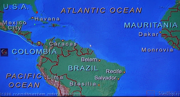
SATURDAY 11 March – Arrival in Miami and Disembarkation

This post consists of some narrative and 18 photos with captions.  ]

As our cruise was slowly drawing to a close, it would be an understatement to say that we had a great time.  We were grateful that Nancy and Paul invited us along on this adventure, as it was not even on our event horizon.  Had we decided at some point in the future to do this on our own, it would still have been a great trip, but getting to do it with close friends in one of the two “owner’s suites” of the NCL Joy HAVEN, was a unique (and probably once-in-a lifetime) experience for us.  And it was a very special experience, indeed.  Now where’s that lottery ticket?

We were up early to get ready to disembark and watch the ship come into the Port-of-Miami.  The Haven staff had laid out a breakfast buffet in the Haven’s Horizon Lounge, so we made use of that first.  The Lounge was mostly devoid of guests at this early hour, so following are photos of areas of the HAVEN that I have not previously posted.


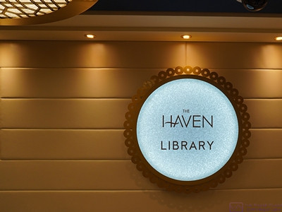
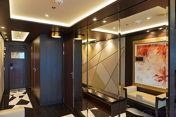
The sign for the HAVEN Library, in the hall just outside the main entrance doors.  (We actually had a “back way” into the library as the emergency exit opened into the hallway right at the entrance door to our suite.)  The Library is on the middle (18th) of the three HAVEN decks.

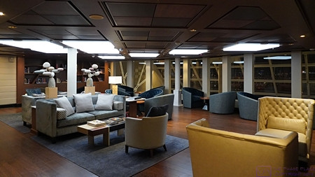
A partial view of the HAVEN Library from near the main entrance doors, looking forward to port.  Our suite is just on the other side of the wall/bookcase at the left of the photo.

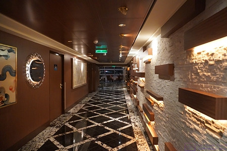
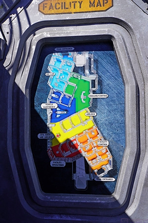
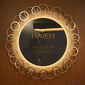
The hallway leading to the HAVEN Horizon Lounge.  The Lounge is all the way forward on the lower (17th) of the three HAVEN decks.  The center portion of the Lounge, however, has its ceiling at the top of deck 18.  All of the staterooms are on decks 17 and 18.  The Horizon Lounge, concierge desk, pool, and bar are on deck 17.  Deck 18 includes the Library and the Restaurant.  Deck 19 is indoor/outdoor lounging space.

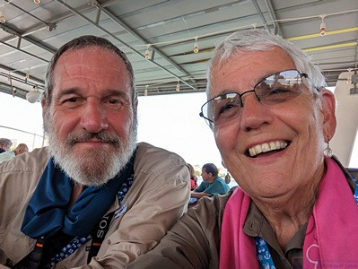
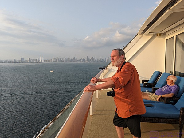
The entire NCL Joy is an attractive and well-maintained ship, but even the signage in the HAVEN had a special, understated elegance.  (This photo also contains a selfie image of the photographer.)

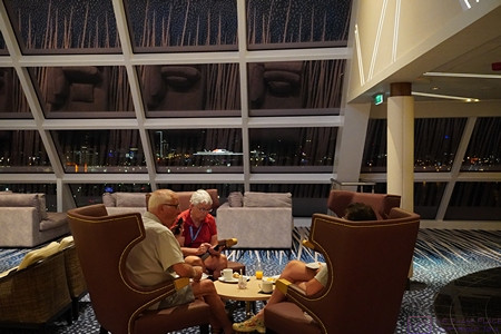
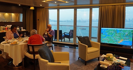
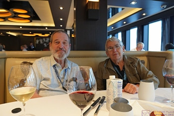
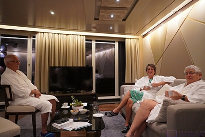
The other members of our little “gang” having a bite of breakfast in the HAVEN Horizon Lounge while I roam around taking photographs.

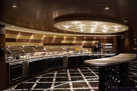
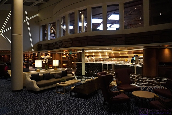
The buffet area of the HAVEN Horizon Lounge.  We were there quite early (this photo was date/time stamped at 7:03 AM.)

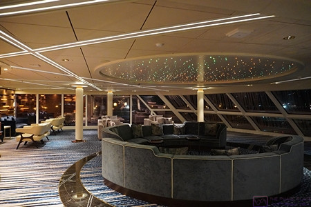
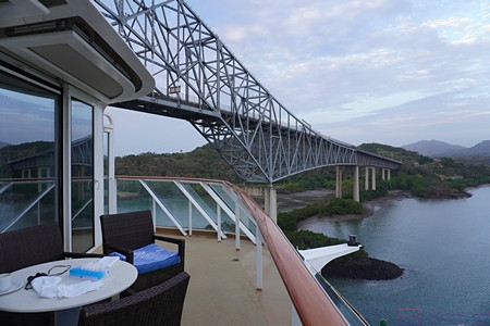
The port side of the HAVEN Horizon Lounge.  The front portion of our suite, including the balcony, is above this ceiling but we never heard any noise from below when we were there.

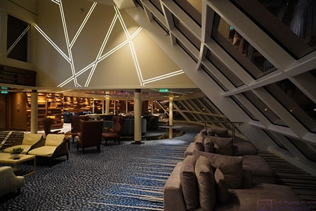
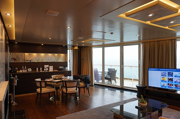
A wider view of the HAVEN Horizon Lounge from mid-ship front looking to port.  The forward port corner of the library is visible in the upper left.  The front portion of our suite, including the balcony, is behind the upper wall with the slanted lighting.  To the right in the photo are the large forward-facing windows in the center of the Lounge which span both decks (17 and 18).

A view of the HAVEN Horizon Lounge and Library looking aft/starboard from slightly to port.  The forward wall of the Library is also all windows, so from there you can see all the way forward through the large center Lounge windows.  The wall with the lighting running at various angles is the other owner’s suite.

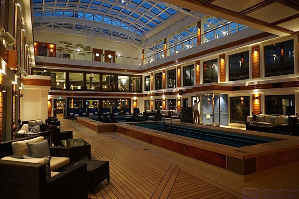
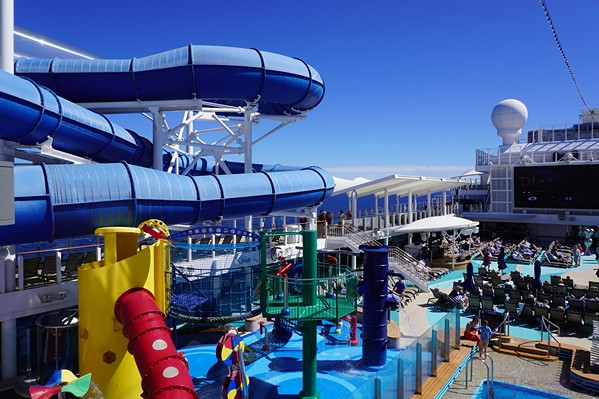
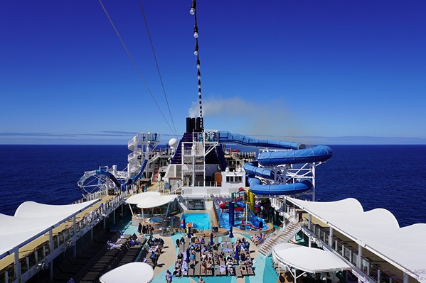
The HAVEN swimming pool and hot tub area.  The area is open all the way to the ceiling of deck 19.  The ceiling is retractable, but we never saw it opened during our cruise.  The opening on deck 19 has lounge chairs all the way around.  There is also access to the outside portion of deck 19 that is part of the HAVEN.


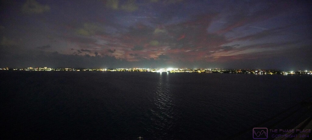
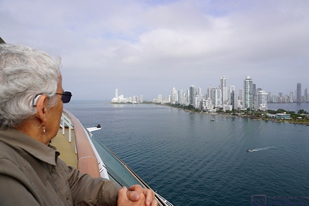
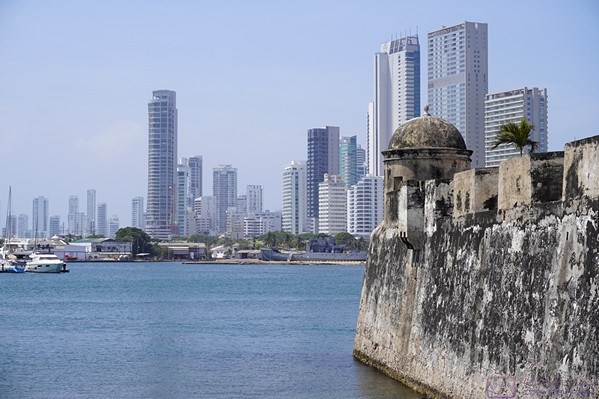
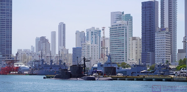
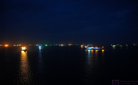
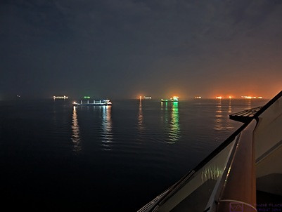
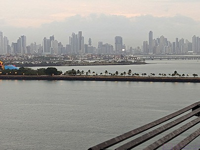
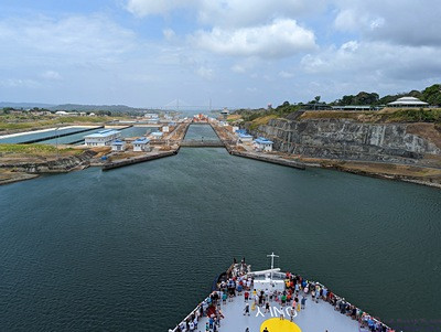
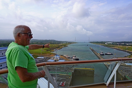
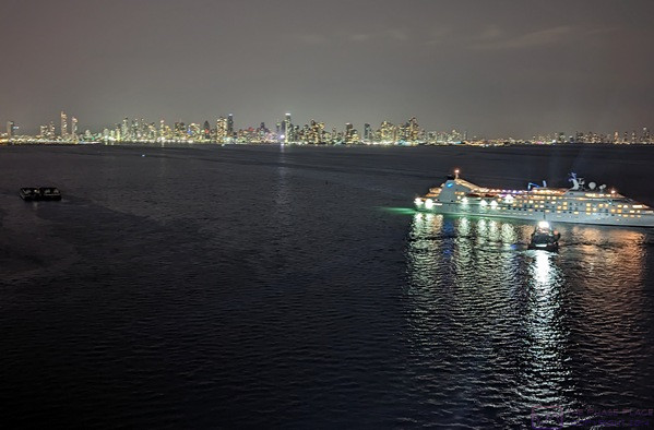
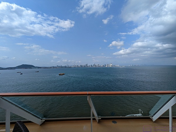
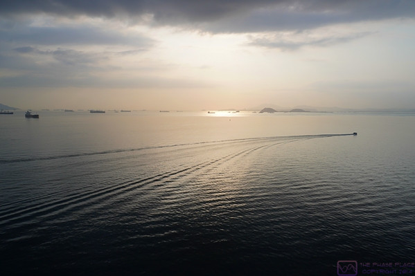
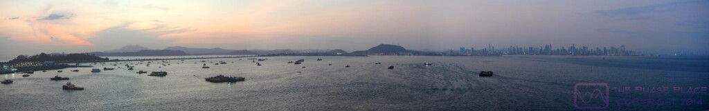
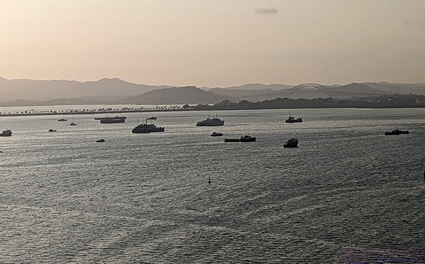
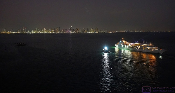
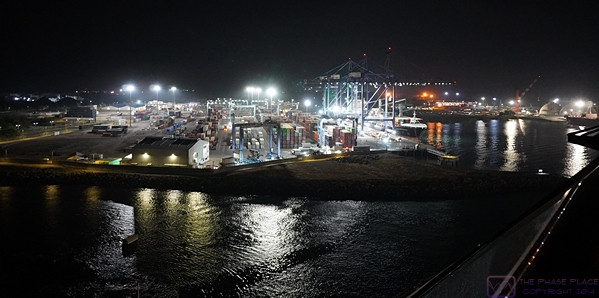
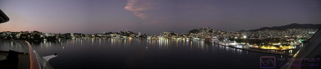
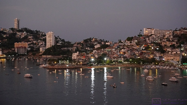
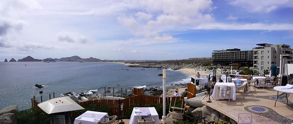
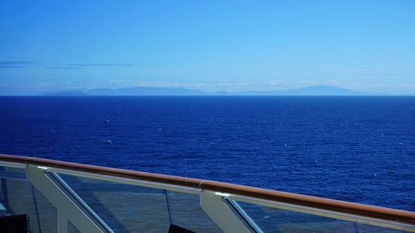
We arrived at the Port of Miami around 7 AM.  Our departure from Los Angeles was in late afternoon light under heavy mist and rain, so we didn’t really see any of the California coast.  With our approach to Miami, however, it was still dark and the sky was clear.  From our first sighting of lights along the shore, it took several hours to actually get to the cruise ship terminal.  While we might prefer national parks as places to visit and explore, there was no denying that the Miami skyline, lit up in the dark, is an impressive, urban sight.


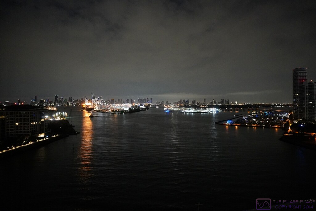
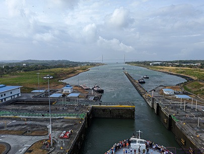
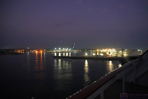
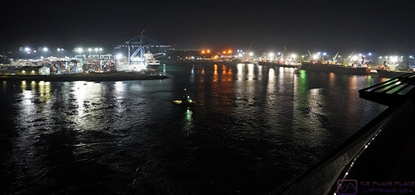
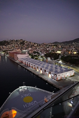
Coming into the Port-of-Miami under the cover of darkness.  The cruise ship terminals are straight ahead.  (Click for a higher resolution image on appropriate devices.)

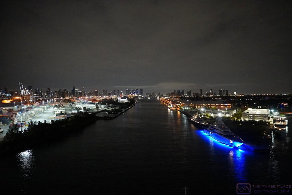
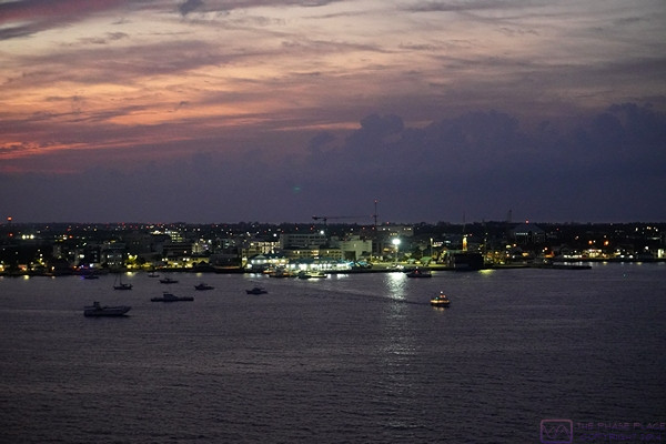
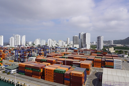
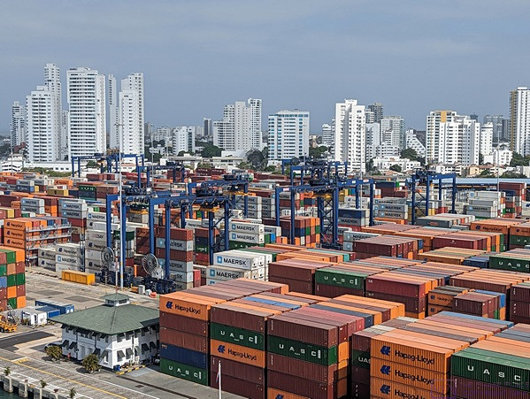
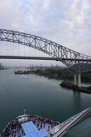
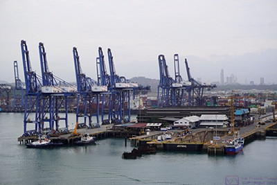
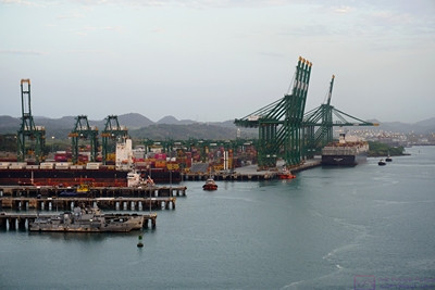
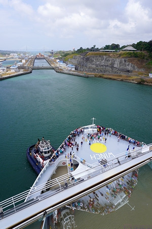
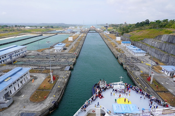
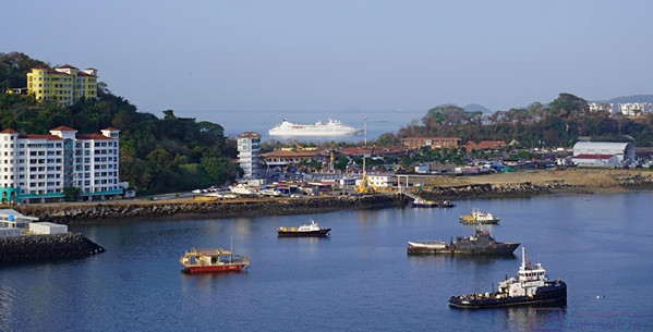
Heading towards the cruise ship terminals with the Miami skyline in the background; container dockyard on the left, superyachts docked on the right.  (Click for a higher resolution image on appropriate devices.)

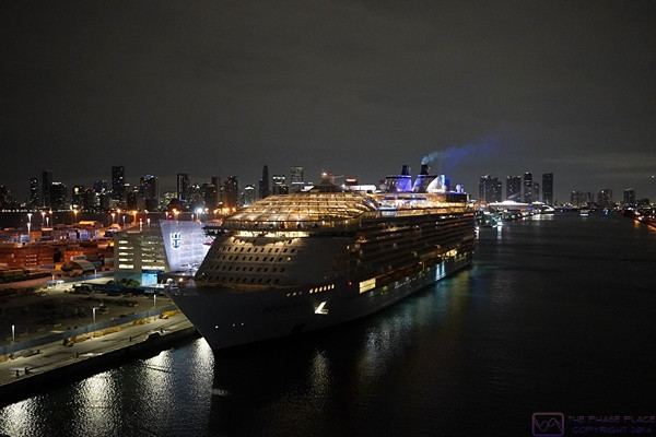
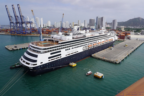
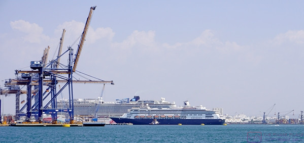
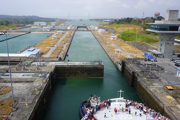
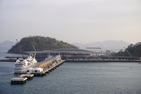
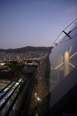
The Royal Caribbean Harmony of the Seas at its Miami terminal on the left.  The Harmony of the Seas is even bigger than the NCL Joy.

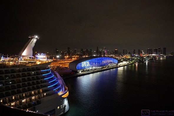
As we come alongside the RC Harmony of the Seas, the NCL cruise ship terminal comes into view on the left.

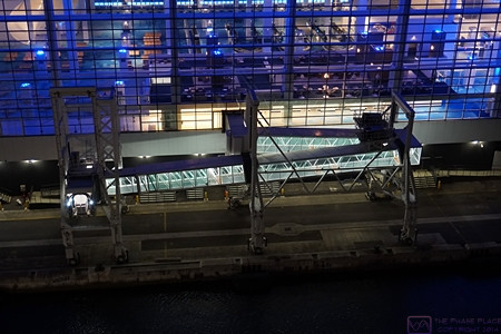
The NCL terminal is very modern.  This photo shows one of the two enclosed gang planks.  They are similar to the jetways used at airports.  The whole structure moves parallel to the edge of the dock on rails and the opening for the ship can be adjusted (up and down) to match the boarding deck.

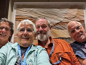
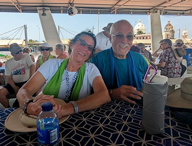
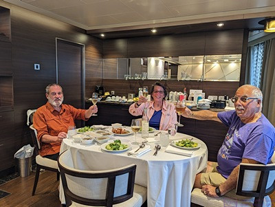
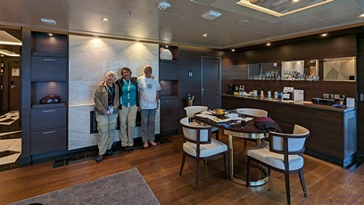
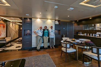
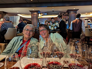
A final selfie of the “fab 4” by the maître de station of the HAVEN Restaurant.


As soon as we began disembarkation things got busy and we did not take any more photos until we reached the Orlando area.  The Norwegian Cruise Line terminal is a large, modern facility designed to make embarkation and disembarkation smooth and relatively easy.  We elected to take our own luggage with us and had priority disembarkation as a result.  (We each had an individual carry-on size rolling suitcase and each couple had a larger rolling suitcase that we checked when flying.)  We cleared in through US Customs quickly and found our way to the taxi / ride-share area where we booked a larger Uber to get the four of us and our six suitcases to the car rental area at Miami International Airport where we had reserved a car with Enterprise Car Rental for the next leg of our journey.

The rental car area was a new/large terminal in itself, and picking up our rental car was a relatively smooth, painless process.  We upgraded the size of vehicle at the counter for a small extra charge.  We also verified that we could use the toll roads.  The toll road system uses “toll-by-plate” and the tolls would be billed to Enterprise and passed along to us.  We were on our way by 9 AM and headed north on the Florida’s Turnpike towards Orland.  Our first destination was the boarding facility near Walt Disney World to retrieve Nancy and Paul’s mini-Goldendoodle, Bella, who was boarded there for the duration of the cruise.  (It was an amazingly nice boarding facility with a great staff, so Bella was in good hands while her servants were away on holiday.  She even had her own private “suite” with access to an outside area.  Sometimes “a dog’s life” is a pretty good life.  )


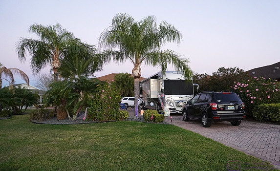
Nancy and Paul’s lot/pad at Mount Olive Shores North (MOSN) with their American Eagle motorhome.


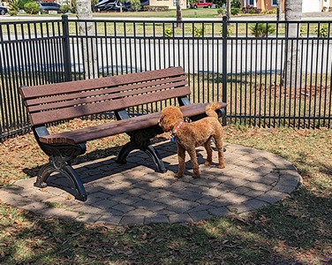
Bella, Paul and Nancy’s mini-Goldendoodle, at the MOSN dog park.

With Bella in hand, we headed southwest on I-4 towards Lakeland, a route with which we were all too familiar.  Traffic on I-4 was as bad as usual, but eventually loosened up.  Soon enough, we were exiting for Polk City.  We arrived at Mount Olive Shores North (MOSN), where Paul and Nancy have a lot with a pad for their Class A American Eagle motorhome, a short time later.


Even through I wasn’t feeling well, we decided to go to Ford’s Garage in Lakeland for dinner.  Bella was with us, so needed their outside seating as dogs are allowed there.  We abandoned that idea shortly we arrived as the wait was going to be at least an hour.  We considered other dinner options, but ultimately decided to return to MOSN and pickup some pizzas in Polk City on the way.   We had a flight booked for the next morning from Tampa International Airport to Detroit Metropolitan Airport (DTW), and spent the night in Paul and Nancy’s motorhome.


SUNDAY 12 March – Closing the Loop

We were up early in order to be ready to go and skipped breakfast.  We said our “farewells until next time,” and “thanks yous,” “and left MOSN around 8 AM for the approximately 1-hour drive to Tampa International Airport.  This early on a Sunday morning the traffic wasn’t too bad, and returning the rental care was quick and easy.  Our flight home on DELTA Airlines was schedule to depart at noon, so we found some seats near our gate, got some coffee and bagels/muffins, and doodled on our iPads will we waited.

Our incoming flight was delayed so we waited a bit longer, but it was no big deal for us.  A couple sitting nearby was a bit anxious, however, and we struck up a conversation.  They were headed to Amsterdam (Netherlands) via a connecting flight out of Detroit Metro Airport.  Their window to get off of our flight onto their next one was already uncomfortably small, but I think we made it out of Tampa International Airport in time for them to make the connection in Detroit.

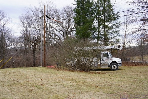
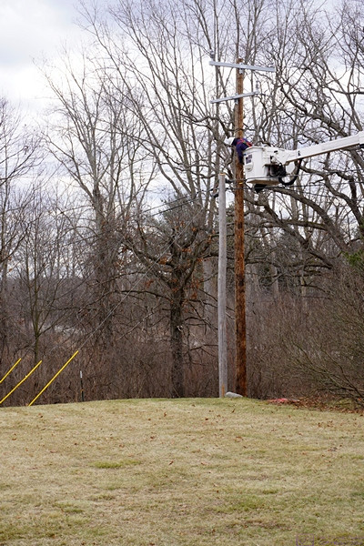
Our daughter was tracking our flight, and drove to DTW to pick us up and take us back to her house, where we left our F-150 while we were gone.  Back at her house, we transferred all of our luggage into our truck, ready to return to our house.  The truck started just fine, but displayed a warning message about the charging system, and the battery light stayed on.  Linda Googled the message and found that it was likely that our battery was not charging and our range might be limited a 20- to 30-minute drive.  Knowing that, we thought we might make it home, and started on our way.  We didn’t get very far, however, before deciding that this was not a good idea, especially later on a Sunday afternoon, whereupon we turned around and returned to our daughter’s house.  She was happy to let us borrow her car to get home and we promised to return it in a day or so.  It was not the conclusion to our epic adventure that we envisioned, and the problem was resolved over the next few days, but that’s another story for another post.

20230309-12 – Georgetown, Cayman Islands & a sea day

THURSDAY 09 March – Georgetown, Cayman Islands

This post consists of some narrative and 12 photos with captions.  ]

Our approach to Georgetown, Cayman Islands at first light.  (This image is 1920×862 pixels.  Clicking on the image might allow it to be viewed at full resolution on a device with sufficient resolution.)

Center frame; the tender dock and Port of Entry station at the heart of Georgetown, Cayman Islands as sunrise approaches.


Our penultimate port of call was Georgetown, Cayman Islands.  The port lacks a deep-water marina, so cruise ships “anchor out” and the guests “tender in.”  There are quite a few things to do on the island, and there were numerous shore excursions from which to choose.  This was not our first visit to Georgetown, however, and we were content to just go ashore and stroll around for a bit.  As port towns go it’s not very interesting.  Most of the things to see and do are elsewhere on the island(s).


Cloud figures; a horse plays with a hippopotamus on its back.

One of the tenders (shuttle boats) tied up alongside the NCL Joy.  Cruise ships are BIG; tender boats are small.

The NCL Joy is joined by the Carnival Glory cruise ship in the harbor.

Welcome to the Cayman Islands:  Nancy, Linda, and Paul.

Welcome to the Cayman Islands; Bruce, Nancy, and Paul.


The Cayman Islands in general, and Georgetown in particular, is known for its (offshore) banking industry.  We were here as part of our 2nd Holistic Holiday at Sea cruise in 2013, so we knew the town itself is relatively small, without too much high-rise architecture, and is very walkable, but without very much to see and do.  It seemed unchanged to us since our last visit.  The two most novel things about our time here were:  1) an actual police officer directing traffic, and;  2) the number of cruise ships in the harbor; four at one time (as best I recall).  The Joy departed at 5 PM for the final leg of our journey.


The Cayman Islands Parliament building and part of the plaza that it faces.  A lot of the buildings in Georgetown are white or light colored, so Paul is wearing his favorite tie-die shirt to add a splash of color.

When in Georgetown there isn’t any doubt as to its history and affiliation with England.  Even they way they post “NO PARKING” signs is very polite.

The Celebrity APEX cruise ship (left) has joined the NCL Joy (right) and Carnival Glory (center) in the Georgetown anchorage.  There’s a 4th cruise ship anchored here as well, but not visible in this photo.


In larger ports that can handle multiple cruise ships simultaneously, it’s a bit mind-boggling how many people they can disgorge into a waiting community.  Equally amazing, are the number of businesses (and people) that are in place at each port to service, and indeed depend on, these large number of visitors.  Cruise ships have their purpose, however, and we had thoroughly enjoyed our time on the NCL Joy and the places it stopped.  Perhaps someday we will return to some of these locations on our own, as well as others that our cruise skipped, and stay long enough to get a better sense of what they are really like.  But if not, at least we have experienced them, however briefly, and been keenly aware that we were in places that were very different from where we have spent most of our lives.


The NCL Joy puts its port side bow thruster to work to spin the ship 180 degrees around its mid-point.  Not shown (not visible from our port-side suite baloney) is that the starboard side stern thruster is also being used.

The Celebrity APEX has already completed it’s 180 degree turn and is headed out to sea as our ship completes its turn to do the same.


FRIDAY 10 March – At Sea

We sailed all evening on the 9th, all day on the 10th, and into the early morning of the 11th.  We had our last dinner meal aboard in the Haven restaurant on the 10th.  After dinner, we gave gratuities to the key crew who had made our trip extra special, namely:  Isidro (our Butler), Harold (our Stateroom Attendant), Patrick (the head Haven concierge), and Melody (the Assistant Concierge in charge of the Haven restaurant).  These gratuities were in addition to the ones that all guests pre-pay and are (presumably) divided up (in some equitable way) between the entire crew (except for the butlers and the Haven concierges, as we understood it).  These four people, however, had made our time onboard memorable in the best possible way.

Over the course of the day, I developed an irritated throat that got worse with time and eventually moved to my sinuses.  Not the way I wanted to end the cruise, but there wasn’t anything I could do about it except for symptomatic treatments, until we got ashore in Miami, Florida and back to Paul and Nancy’s place at MOSN in Polk City, Florida.

20230307-08 – Cartagena, Columbia & a sea day

TUESDAY 07 March – Cartagena, Columbia

This post has some narrative along with 22 photos with captions.  ]

After finishing our daytime transit of the Panama Canal on March 6th, we were at sea for the rest of the evening and overnight into March 7th, arriving at the cruise ship dock in the harbor at Cartagena, Columbia around 10 AM.

Our first full view of the harbor area of Cartagena, Columbia in the early morning haze.  We are already past the entrance in the breakwater into the outer harbor but have some ways to go before enter the inner harbor and get to the port/dock.

Linda takes in the upscale water-front area of Cartagena as the NCL Joy prepares to enter the inner  harbor.

The Holland America Zandam at the cruise ship dock.  We are pulling on the other side of the dock.  The Zandam is a big ship, but is dwarfed by the Joy.

Cartagena is a major shipping port.  This container facility is just one of many that we passed on the way into the dock.


The Zandam, a Holland America cruise ship, was already there when we arrived.  Cartagena is Columbia’s main Caribbean port.  It is mostly commercial, but the Columbian Navy has a base here, and there are marinas for pleasure craft and sightseeing boats.  We were amazed, however, at the number of containers stacked up in the shipyard and the number of gantry cranes that were in use moving them around.  Outside of the commercial and cruise ship docks, however, the city around the harbor is very modern and (we were told) has become a safe, inviting place for tourists.


This photo provides another view of the container shipyard adjacent to the cruise dock/port area, very close to a lot of commercial and residential buildings.  We counted at least 21 of the blue gantry cranes in this shipyard, and it seemed at times that most of them were busy moving containers around.  There was also a constant flow of tractors coming in to drop off or pick up containers.  (Photo by Linda.)

On our bus ride to the Old City, we saw lots of juxtapositions of old and new.  The old stone work in the foreground is 16th century.  The high-rise buildings in the background are late 20th to earl 21st century.

This photo was typical of the Cartagena streets that our excursion bus took to get to the Old City.  While the look and feel of the place was different from what have experienced for most of our lives, it was also fascinating.


Like Antiqua, Guatemala the Spanish presence in Cartagena dates back to the very beginning of the 16th century.  The Walled Old Town by the sea is still intact, and is another UNESCO World Heritage Site.  The four of us booked a shore excursion that involved a bus ride from the dock to the Old City, a walking tour of the Old City, and then a 1-hour boat ride around the harbor.  As part of the harbor cruise, we got a close-up look at the Caribbean fleet of the Columbian Navy base, which includes two small submarines and a 3-masted sailing vessel named Gloria (presumably for training cadets).  While on our cruise, we watched the Holland America Zandam back out from the dock, turn around and head for the ocean.


The entrance to the Old (walled) City.  This photo only provides a glimpse into the tourist crowd that awaited us inside the walls.

Many of the streets in the Old City were like the one pictured here, running straight for short distances before turning in a different direction.

Linda and Nancy enjoying a funny moment.  (They do this a lot.)  Paul is focused on something else.

The inside of the Cathedral in the Old City with its massive, carved altar.

A closer view of the altar with someone praying in the foreground.

There was a lot of variety in the architecture of the buildings in the Old City so it’s not really possible to say what was “typical.”  This style, however, was in the mix.

Cartagena was the seat of the Spanish Inquisition in the Americas, and it was administered from this building, now a museum dedicated to this part of Columbia’s history.

The Caribbean fleet of the Columbian Navy is based Cartagena, and moored in plain sight.

The Holland America Zandam backing out of its berth at the cruise terminal.  The NCL Joy is behind it, and difference in size is obvious.

A selfie on the little harbor cruise ship.  It appears that we were satisfied with the experience.  (Photo by Linda.)

It appears that Nancy and Paul also enjoyed the harbor cruise.  (Photo by Linda.)

A pair of Macaws at the zoo/shops that make up the entrance the cruise terminal.

Another pair of Macaws at the zoo/shops terminal entrance area.

The same pair of Macaws as the previous photo.  Such beautiful birds.


Following our harbor cruise, we were bused back to the cruise terminal, which we entered by walking through a small outdoor zoo and then past some gift shops.  Although farther north than Panama City, the climate, even at this time of year, was more tropical – warm and humid – and the birds reflected that.  We were always aware that we were getting a superficial “tourist eye’s view” of Cartagena, but nonetheless enjoyed our brief time in Cartagena, Columbia and felt like this was another port-of-call where an overnight stop might have allowed a closer, more relaxed acquaintance with the place and its people and culture.

The Norwegian Joy left Cartagena at 6 PM and headed for our next port, sailing all evening, all the following day, and overnight into March 9th.


WEDNESDAY 08 March – At Sea

We spent the entire day sailing NNW in the western Caribbean Sea, out of sight of land.  The weather was pleasant with blue skies and water and white, puffy clouds.  The only photo I’ve included shows the monitor in our suite.  Our present location is approximately half way to our destination of Georgetown, Cayman Islands.  The right end of the upper information banner shows that we have sailed 3,767.1 NM (nautical miles) from our starting point at the Port of Los Angeles.  We sailed overnight before finally sighting land around sunrise.


The monitor in our suite showing our current location, heading, and speed, along with other information, including our total distance sailed since departing the dock at the Port of Los Angeles.


While we enjoy seeing land from the ship, and getting off the ship at ports to explore, we also enjoyed our days at sea.  Far from being boring, sea days provided a chance to relax and explore/enjoy the many amenities the ship had to offer.  While cruise ships can take you to amazing places there is no doubt that the ships themselves (and especially the staff) are part of the experience.

20230306 PCC 9of12 – Transiting the Panama Canal

MONDAY 06 March – 51 miles between oceans on a ship

[  NOTE:  Most of this post consists of 36 photos with captions.  This is being posted more than 3 months after the fact – some of the details might be inaccurate and some of the photos might be out of sequence.  ]

Going through (transiting) the Panama Canal was the main reason for going on this cruise, and the experience did not disappoint.  The American Society of Civil Engineers considers it one of the seven wonders of the modern world.  (We have no seen all of the wonders of the world, ancient or modern, so we will take their word for it.)


The NCL Joy moving into the queue for entrance to the southern end of the Panama Canal.

The ocean in the vicinity of Panama City and the entrance to the Panama Canal was crowded with ships waiting to make the transit.  Ships can book a date/time to start the transit, but it is much more expensive than just waiting in line.  Ships with non-perishable cargo and less critical delivery timelines choose to wait their turn and get the lower price.  The fee for the NCL Joy to transit the Canal was approximately $750,000 USD.  The pricing structure for the Canal is very complicated.  (Photo by Linda)

The NCL Joy left the dock at 5 AM to be in position for the 8 AM scheduled start of our transit.  It was dawn by the time we were moving towards the entrance of the Canal and were opposite our starting point.  Part of the Panama City skyline forms the background of this photo, taken by Linda.

Starting into the marked channel that leads to the Panama Canal.  Our ship was docked in the harbor on the other side of the small hills to starboard (right).

The Norwegian Joy left the dock in Panama City at 5 AM and we were up to see it off.  We spent the entire transit in our front-facing 18th deck stateroom; usually on the balcony.  We even took our meals in our room, one of the few times we took advantage of this perquisite.

The Puente de las Americas (Bridge of the Americas) ahead.  Channel markers to the left and right of the ship are visible.  The hill on the right had the radio towers/antennas used to communicate with the ships using the Panama Canal.

Approaching the Puente de las Americas (Bridge of the Americas).  This bridge is considered the (unofficial?) southern terminus of the Panama Canal.  Note the crowd of guests gathered on the foredeck of our ship.  This area is normally only open to crew, whose quarters are located foreship near this level.

The Bridge of the Americas to port (left) of the ship just after our balcony passed under it.  We are now (officially?) in the Panama Canal, but still some way from the first set of locks.

Large commercial/cargo docks to starboard (right).

More commercial/cargo docks to port (left).


Ships transiting the Canal are queued up in the ocean and then proceed along a well-marked channel when cleared in.  The Bridge of the Americas is considered the southern terminus of the Canal and the Puente Atlántico (Atlantic Bridge) at Colon is considered the northern terminus.  Passing under either of these bridges is a cause for celebration on cruise ships.  And so, it was for us too; we finally opened our bottle of “welcome on board” champagne and toasted the moment.

The original 2-flight Miraflores Locks are to starboard (right).  The newer (2016) 3-flight Panamax class Miraflores West (Cocoli) Locks are to port (left).  We used the newer locks as the NCL Joy is too large for the original ones.  Both sets of locks are still referred to as the Miraflores Locks.

The NCL Joy lined up to enter the Miraflores West (Cocoli) Locks.  The tug boat is positioned to block the Joy from going in yet, and to render maneuvering assistance if/when needed.  (Photo by Linda)

The double lock gates are sliding open so our ship can move from the first to the second/middle basin.  The NCL Joy is just over 1,000 feet long; too big for the older/original locks at either end of the Canal, but much smaller than the maximum 1,400-foot length the new locks can accommodate.  A third phase of lock building is in the planning stages with locks that will accommodate even bigger ships.  (Photo by Linda)

As our ship entered the Miraflores West (Cocoli) Locks, we could see other ships to starboard (right) using the original Miraflores Locks.

The structure center-right in the photo is the sliding lock gate that will close behind the ship once it is fully in the lock basin.  The green surface on top is a road that allows Canal staff to get from one side to the other (when the gate is closed, obviously).  All of the new locks use these massive sliding gates.  The original locks using swinging gates.

The “Cocoli control tower” for the Miraflores West Locks.  We had one more basin after the one we are currently in.  Each of the basins is an “elevator) that works like a bathtub.  When filled with water any boat(s) in the basin are raised in elevation.  When the water is drained, they are lowered.  When the water level is the same on both sides of a gate, it can be opened or closed, allowing ships to enter or leave the basin.

Exiting the last basin of the Miraflores West (Cocoli) Locks northbound.  Miraflores Lake can be seen ahead to starboard (right).  Because of the geology of this part of the Canal Zone, the original southern lock system consists of two flights in the Miraflores Locks and then a single flight in the Pedro Miguel Lock.  The body of water in-between is named Lake Miraflores.  The new West (Cocoli) Locks achieve the change in elevation in a 3-flight (staircase) lock system.  The two channels reunite just north of the Pedro Miguel Lock.


There is a lot of information available online and in books about the Panama Canal.  It’s a long, complicated story, and not a happy one in most regards.  I was glad I had taken the time to read about this before being here (Panama Fever, by Matthew Parker).  The engineering is amazing, and the location is beautiful, but it has a context and only became a reality at enormous cost in money, lives, and political relations with the countries of Central and South America.


The Miraflores Locks Visitor Center and Control Room just left of center in the photo.

A smaller ship exiting the Miraflores Locks.


Regardless of which way you go through the Canal, the trip begins and ends with locks, three at each end, with Gatun Lake in-between.  The average sea level of the Pacific Ocean end of the Canal is only 20 cm higher than the average sea level on the Atlantic Ocean (Caribbean Sea) end.  Because this difference is so small, the original “vision” for the Canal was a sea level transit with perhaps one lock.  However, the tidal range on the Pacific Ocean end is 20 feet whereas on the Atlantic Ocean end it is 3 feet.  Thus, locks were going to be needed at each end just to account for this difference.  The fact that the Canal also had to cross the Continental Divide, ultimately meant that ships would have to change elevation by even more than the difference in sea levels, and the locks would have to accommodate this difference in elevation.

Gatun Lake is the largest man-made lake in the world, and was formed by damming the Rio Chagres.  The Rio Chagres was a raging river that would rise 20 feet during floods.  It had to be “tamed” (controlled) if the Panama Canal was ever to become a reality.  There are three locks at each end to accomplish the 85 ft change in elevation from sea level to the level of Gatun Lake.  New locks were built at each end, alongside the original ones, to accommodate larger ships and were opened in 2016.  Just north of the southern locks (Miraflores /  Lake Miraflores / Pedro Miguel are the old ones and Miraflores West (Cocoli) are the new ones.  I think Lake Gatun “officially” begins at the northern end of the Miraflores Locks complex.

Heading north from the Miraflores Locks area we came to the Culebra Cut.  Generally considered the most difficult part of building the Canal, it is a massively excavated passage through the Continental Divide.  The Canal was taken up 85 feet and through this area as it offered the best chance of actually getting through the divide.

The official length of the Panama Canal is 51 miles, which doesn’t seem like much, but it took the NCL Joy about 9 hours to make the trip, including the locks at each end.  As we sailed under the Atlantic Bridge we (officially) entered the Caribbean Sea (Atlantic Ocean) and continued on to our next port, sailing all night to get there by sunrise.

Following are the bulk of the photos from the transit:


The Centennial Bridge at the Culebra Cut.  (Photo by Linda)

Paul, Linda, and Nancy with champagne glasses ready to toast our passage through the Culebra Cut.  (Linda is holding my glass while I take this photo.)  The “cut” was dug through the Continental Divide, and was the most difficult part of the Canal to create.

The sides of the “cut” are terraced to prevent erosion, which was a huge problem during the excavation of this passage through the Continental Divide.  (Photo by Linda)

Panama is a beautiful place with lush flora.

Panama is also a place with a long and troubled history.  This compound to starboard (right) is where Manuel Noriega was held before being extradited to the USA for trial.  (Photo by Linda)

At this point, we are through the Culebra Cut and passing the town of Gatun on the right.  This town within the Canal Zone is the base of operations for much of the Canal maintenance.  Note the massive barge crane at the center-right edge of the photo.  This crane, named Titan (nicknamed Herman the German), is able to lift the older swinging lock gates for repair and maintenance.  A part of the history of the construction and operation of that Canal, Titan was built by Nazi for servicing U-Boats (submarines) during WW II.  At maximum height, the top of the boom is 374 feet above the water.  Like everything else connected with the Canal, it is massive.  (Photo by Linda)

We are passing a southbound cargo ship (tanker?) on Lake Gatun.  (Passing was always portside-to-portside.)  Most of the Panama Canal consists of Lake Gatun.  The lake was formed by a dam on the Rio Chagres near the northern end, and is still the largest man-made lake in the world.

Another view of Lake Gatun.  Channel markers are visible to port (left).  It was a generally lovely day for the transit with a mix of blue skies and clouds.  It was warm, but not uncomfortable on the deck (which always had a breeze from the movement of the ship) and we could go back into the stateroom if/when needed.

The clouds have filled in somewhat as we approach the northern end of the Canal and the end of the transit.

Approaching the new (2016 Panamax class) Gatun East Locks at the northern end of the Panama Canal.  The cargo ship that entered the Canal ahead of us this morning is in the locks.   The original Gatun Locks are off to the port (left) side out of the frame.

A small crowd of guests remains at the bow platform of the NCL Joy as we approached the Gatun East Locks and prepared to be lowered down to the level of the Caribbean Sea (Atlantic Ocean).  (Photo by Linda)

We are now close enough to the Gatun East Locks that a tug boat has taken up position on the port side of the bow to help guide the NCL Joy into the first basin.  (In a Q&A with the Captain of the NCL Joy, he was quite blunt about not needing the assistance of tug boats when maneuvering the Joy at docks, or elsewhere, and found their presence more bothersome than helpful.  I think he felt the same way about harbor pilots.)

As we entered the first basin of the Gatun East Locks, the ponds used as part of the system for emptying and filling the lock basins were visible on the port (left) side of the ship.  These ponds conserve some of the massive amount of water needed to operate the locks, where all of the water to fill the locks flows by gravity.

The water level in the first (Lake Gatun) basin has been lowered and the water lever in the second basin raised so that both basins are at the same water level, allowing the sliding gate to be opened so the NCL Joy can move to the second basin.

As the last lock gate opens, the NCL Joy has finally completed its journey from the Pacific Ocean, up and over (through) the continental divide, and back down to the Caribbean Sea (Atlantic Ocean).  It was quite a trip and we certainly had “the best seats in the house.”  (Photo by Linda)

As the NCL Joy exits the last basin at the current level of the Caribbean Sea, Paul points out the Puente Atlántico (Atlantic Bridge) and the Caribbean Sea beyond.

Passing under the Puerto Atlantic (Atlantic Bridge) and into the Caribbean Sea (Atlantic Ocean).


It was around 5 PM local time as we passed under the Atlantic Bridge, marking our transit time at 9 hours.  From here, the ship headed north (N) and then northeast (NE) for a short way  before turning East East North (EEN) on a fairly direct course for Cartagena, Columbia where we were scheduled to enter the harbor around sunrise.


As we pass through the breakwater that protects the harbor at Canal terminus at Colon, Panama we sailed into the Caribbean Sea and points east.


20230305 PCC 8 of12 – Panama City, Panama; Gateway to South America

[ This post contains 12 photos with captions. ]

SUNDAY 05 March – Panama City, Balboa, and the Panama Canal Zone


A photo from last night of the other cruise ship next to the NCL Joy just after leaving the dock.  It will head around to the right (west) and position itself in the queue to enter the Panama Canal tomorrow morning.  (Photo by Linda.)

The other cruise ship heading towards the Pacific Ocean entrance to the Panama Canal just before 8 AM for the beginning of its scheduled transit of the Canal.  The ship left the dock next to us last evening to queue up in Panama Bay for its transit this morning.  A lot of ships move through the Canal every 24 hours, and it’s imperative that ships with reservations arrive at the first lock (at either end) exactly on time.

Panama City was the only port where we stayed overnight; in this case for two nights, before transiting the Panama Canal.  This meant that passengers had a chance to go ashore last night and take in the life of the city after sunset.  It also meant that passengers (and some crew) had a full day today to explore the area, either on a shore excursion or on their own without fear of not getting back to the ship on time.


The road leading out of the port/dock area and onto the causeway to the mainland.  (Photo by Linda.)

Paul and Nancy arranged a private tour of Panama City while we signed up for one of the shorter ship-arranged shore excursions.  Our excursion was aboard a motorcoach with an excellent tour guide and focused mostly on the southeastern end of the Canal Zone in Balboa, now a NW suburb of Panama City.  (The Panama Canal runs from Panama City northwest to Colón at the other end.)  We had read about the history and operation of the Canal in the book Panama Fever (by Matthew Parker) before arriving here, and the history/technology of the Canal was what interested us most about the area.  The following, however, is excerpted from the Wikipedia entry “Panama Canal Zone”:


The Panama Canal Zone … was an unincorporated territory of the United States, located in the Isthmus of Panama, that existed from 1903 to 1979. It was located within the territory of Panama, consisting of the Panama Canal and an area generally extending five miles (8 km) on each side of the centerline, but excluding Panama City and Colón.  Its capital was Balboa.

The Panama Canal Zone was created on November 18, 1903 from the territory of Panama; established with the signing of the Hay–Bunau-Varilla Treaty, which allowed for the construction of the Panama Canal within the territory by the United States. The zone existed until October 1, 1979, when it was incorporated back into Panama.

In 1904, the Isthmian Canal Convention was proclaimed. In it, the Republic of Panama granted to the United States in perpetuity the use, occupation, and control of a zone of land and land underwater for the construction, maintenance, operation, sanitation, and protection of the canal. From 1903 to 1979, the territory was controlled by the United States, which had purchased the land from its private and public owners, built the canal and financed its construction. The Canal Zone was abolished in 1979, as a term of the Torrijos–Carter Treaties two years earlier; the canal itself was later under joint U.S.–Panamanian control until it was fully turned over to Panama in 1999.


(Photo by Linda.)  The Biomuseo (Bio-Museum) building.  From the Wikipedia entry “Biomuseo”:  “The Biomuseo is a museum focused on the natural history of Panama, whose isthmus was formed very recently in geologic time, with major impact on the ecology of the Western Hemisphere.  Located on the Amador Causeway in Panama City, Panama, it was designed by renowned architect Frank Gehry. This is Gehry’s first design for Latin America. The design was conceived in 1999 and the museum opened on 2 October 2014.  The Biomuseo highlights Panama’s natural and cultural history, emphasizing the role of humans in the XXI century. Its galleries tell the story of how the rise of the isthmus of Panama changed the world.” …


Although no longer under direct US control or military protection, the “Canal Zone” still exists as a highly secured area.  This is one of many entrance gates.  The lettering on the arch reads “CANAL DE PANAMA”.  (Photo by Linda.)

While the long-term goal is to have the Canal operated and maintained by Panamanians, it remains the case today that many of the people operating the canal are US citizens who are also training Panamanians to take over those roles.


Much of our shore-excursion focused on the infrastructure that was built to house the administration, construction, and health care facilities as well as the housing needed by the canal employees, and U.S. military bases and personnel.  These facilities remain in use today, some still attached to canal operations while others are being converted into private or other public uses such as housing, schools, and health care facilities.

One of the many housing areas in Balboa original built to house the thousands of U.S. workers who oversaw the building and operation of the Canal.


The main administration building of the Panama Canal Company, still in use for its original purpose today by the Panama Canal Authority, part of the Government of Panama.  The operation of the Canal is a large, technically complex endeavor, and generates a significant portion of the revenues that flow into the Government of Panama.  (Photo by Linda.)

A view of the Miraflores Locks from the Visitor Center observation building, looking back towards the Pacific Ocean.  Between the road and the lock basin are the train tracks for the “mules” that control the movement of the ships through these locks.  The Miraflores locks are the original ones but are still in use for all but the newest/largest ships, which do not fit the length, width, or draft limitations.  The new locks, which accommodate much larger ships, are out of sight to right in this photo.  (Photo by Linda.)


One of the control buildings for the Miraflores Locks.  The gates are closed, separating the basin on the left at a low-water level, from the basin on the right at a high-water level.  Water flows in and out of these basins by gravity.  The gates are only swung open when the water level on both sides is exactly the same.  This is conceptually the same technology that was used hundreds of years ago in Great Britain to create the canal system there; although the scale is much larger here.  The newer locks (opened in 2016) do not use swinging gates.  They use sliding doors (like pocket doors) instead.  (Photo by Linda.)


We were there!  (Photo by Linda.  Not photoshopped, promise.)


The U.S. Embassy.  The Torrijos–Carter Treaties treaty that returned sovereignty of the Panama Canal Zone to Panama as well as primary responsibility for its defense, nevertheless also preserved that right of the USA to intervene militarily if the Canal and its neutral operation (open to ships of all nations) should be threatened at any time in the future.  (Photo by Linda.)


A view of Panama City from the balcony of our stateroom.  The Joy remained at the dock until early the next morning, when it departed to queue up for the transit.


20230304 PCC 7of 12 – At sea & Panama City, Panama (Day 1)

[ This post has 25 photos with captions. ]


SATURDAY 04 March – Enroute to, and arrival at, Panama City, Panama

Again, our original itinerary had us stopping in Puerto Caldera (Puntarenas), Costa Rica but the revised itinerary skipped this stop and went directly to Panama City, Panama.  We would have liked to stop in Costa Rica, but recalled that shortly before NCL changed the itinerary in early October 2022, the US State Department had issued a travel advisory against visiting the country.  We don’t know if this was the reason for the change, but it seemed to be more than coincidental.  Something similar might have been true for Nicaragua, but we did not recall any advisories regarding travel there.  It was possible that the other changes in the itinerary might have been a domino effect from the loss of the Costa Rica stop, but we were never informed of the reasons for the changes.  And  it’s worth noting that these kinds of changes are always part of the booking contract; the cruise lines do not guarantee their itineraries.


We were at sea for most of the day, however, and made good use of the time.  This was the only day that the NCL Joy was doing “behind the scenes” tours of the ship.  We knew ahead of time that this experience would be very limited, and signed up for the tour (they treat it as a “shore excursion”) as soon as possible after we got on the ship in the Port of Los Angeles.  It turned out that they only offered the tour on this day while we were at sea, and only offered two groups, both of which were limited in the number of participants.  Here are some images of parts of the ship where I was allowed to take photos or there was something interesting to see.

A view of the main kitchen under the Manhattan dining room at the aft of the ship.

The Linda/Nan culinary team enjoying their tour of the NCL Joy main kitchen facilities.


A view of the laundry facility.  The machines to the right are used to press certain clothing items, such as officers’ uniforms.

Another view of the pressing portion of the laundry facility.


Some of the washing machines in the laundry facility.


This machine irons napkins.  The napkins shown here (with the blue banding) are unique to the buffet dining area.  The laundry facility handles approximately 6,000 of these napkins every day.


This machine irons and folds bedding.  The operator hangs the sheet and then the arms spread apart and feed it into the rollers.


Folder sheets coming off of the machine in the previous photo.


Our behind-the-scenes tour of the NCL Joy included a visit to the bridge.  Shown here is the helm/navigation station in the center (side-to-side).  The bridge covers the entire width of the ship at the forward end of Deck 14, and extend beyond the sides of the ship on both the port and starboard sides.  All of the bridge officers have their living quarters immediately aft of the bridge.  We also got to visit the engine control room (but not the engine room, for safety reasons).  I found all aspects of the ships operation to be fascinating, but the control room and bridge caught my interest in particular.

A view towards the port side wing station of the bridge.


The port side wing station looking aft.  The ship can be driven from this location, which is used when docking using the port side of the ship.  The pilot has a clear view of the port side of the ship, for and aft, as well as down through a glass portion of the floor.

There are a lot of controls at the port side wing station, and yet it had a beautiful, clean layout.


The view looking aft from the port side wing station of the bridge.


We were never south of the equator on this cruise, so that experience is still somewhere in our future.  While I did not make note of our most southern latitude, it had to occur somewhere between the southern tip of Isla Jicaron (7.2 deg N) and the southern edge of the peninsula southwest of Panama City that forms the western edge of the Gulf of Panama (also 7.2 deg N).


Prior to this, our furthest south latitude was around 16 deg N when we visited Roatán, Honduras on our second Holistic Holiday at Sea cruise on the MSC Poetia in March 2013.


An example of the map that was constantly available as part of the ship/route information on the monitors in our stateroom.  The NCL Joy’s location is the yellow arrow with the red circle, center bottom of the screen, heading north into Panama Bay.  Panama City is the orange area ahead of (N) and slightly to the left (NNW) of the ship.  The Pacific Ocean terminus of the Panama Canal is at Panama City (Balboa) and runs NW to it’s Atlantic Ocean (Caribbean Sea) terminus at Colon.  Gatun Lake is a major portion of the Canal.

This larger view of the area shows the location of our ship relative to both North and South America.  The ship’s track is shown from (just before) Acapulco, Mexico to Puerto Quetzal, Guatemala, and then to Panama City, Panama.  Our next port of call after transiting the Panama Canal will be Cartagena, Columbia, so it’s clear that our farthest south latitude was achieved as we rounded the peninsula to the southwest of Panama City.

I included this photo to give a better sense of our location relative to the equatorial portion of South America as well as the relative closeness of Africa.

Linda contemplates our arrival in Panama City.  The coast of Panama is faintly visible on the horizon.

Panama City sits on the northeast side of the Pacific entrance to the Panama Canal.  It is the capital of Panama, and has a modern, impressive skyline facing the ocean.  It is sometimes compared to the Miami (USA) shoreline, and has become a jewel of, and gateway to, South America.  And yes, it is considered to be in South America, the official dividing line between North and South America being the Panama Canal (which runs from SE to NW when going from the Pacific Ocean to the Caribbean Sea).

As we came into Panama Bay and approached Panama City, we saw more and more ships “anchored out”.  The number was impressive.  We eventually learned to many (most?) of them were waiting to transit the Panama Canal.  Ships transiting the Canal are able to make a reservation or can anchor in the harbors on either end and wait for an opening.  The wait can be as much as three (3) weeks, but is less expensive than a reserved entry time.

Coming into the cruise ship dock and terminal area.  This area is at the end of a long, man-made causeway, so Panama City proper is not really accessible by foot and requires some form of transportation to get into town.  A major improvement project was underway while we were there, but was not an issue.  A smaller cruise ship was already at the dock.  The ship in the distance has just exited the Panama Canal.

Panama City had lots to offer, however, and was the only port where we stayed overnight; in this case for two nights.  We are not “night life” people, and did not leave the ship this evening, but other passengers went ashore to explore and take in the life of the city after sunset.


The next day, Paul and Nancy arranged a private tour of Panama City while we signed up for a ship-arranged shore excursion, which I cover in the next post.  In the meantime, here are a few more photos from today:

A view of the Panama City skyline as Paul and I observe the docking process from our stateroom balcony.  (Photo by Linda.)

We were scheduled to arrive at the dock in Panama City around dinner time, so we opted to have dinner in our stateroom, allowing us to conveniently watch the whole process.  Panama City is visible through the doorwalls and the location map is showing on the monitor


A better view of our meal.  Salud!  (Photo by Linda.)


A composite image of 10 photos of the Panama City harbor skyline and the causeway that leads out to the cruise ship terminal and dock.  The water on the other side of the causeway leads (to the right) to the beginning of the Panama Canal.

The Centennial Bridge, visible in this photo, is usually taken as the official Pacific Ocean terminus of the Panama Canal.  (Photo by Linda.)

The Panama City skyline at night, as the other cruise ship leaves the dock to position itself in the Bay for its scheduled transit of the Panama Canal.


202303(02-03) PCC 6of12 – Puerto Quetzal & Antigua, Guatemala & a sea day

[ There are 23 photos in this post.  Most of the text is in the form of captions. ]


THURSDAY 02 March – Puerto Quetzal & Antigua, Guatemala

Arriving at the dock in Puerto Quetzal, Guatemala under the cover of darkness.  It was a tricky entrance, but the captain handled it like he was parking a small car in an empty parking lot.

One of the active volcanos we passed on the motorcoach ride from Puerto Quetzal to Antigua, Guatemala.  (Photo by Linda)

Antigua, Guatemala.  Our motorcoach was parked on this street, over the rise in the road, along with many others.  In the background, Volcán de Aqua towers over the city and was visible from most places.

We arrived at Puerto Quetzal, Guatemala around 7 AM.  Guatemala has a relatively short Pacific coast, and Puerto Quetzal is the only port of any size.  It is primarily an industrial port, but more than willing to welcome and accommodate cruise ships.


There was nothing of interest for tourists in the immediate port area, but that was OK.  We had signed up for a shore excursion to Antigua Guatemala, a 2-hour bus ride from sea level to 1545 m (5069 ft).  A relatively small old city nestled high up in the mountains, it is surrounded by volcanoes, some of which are still active.  To the south, Volcán de Aqua, dominates the skyline at 3,766 m (12,356 ft).  One of the volcanoes was “smoking” as we drove past.


A small slice of the Mayan history portion of the Jade Museum in Antigua, Guatemala.  Those of us walking the city on our own gathered here first to use the restrooms and learn a bit about history of the area and city.

Antigua was Guatemala’s colonial capital from ~ 1543 to 1773 when it was severely damaged by an earthquake and the Capital was moved to present day Guatemala City.  Many of the buildings were restored, however, and it is now a UNESCO World Heritage Site renowned for its Spanish Colonial architecture.


We did not do a guided tour, but merely wandered around the city soaking in the sites.  We also learned that there are still many people in Guatemala with Mayan ancestry, and 31 dialects of the Mayan language are still spoken here.  This corroborated what we had learned some years ago on our visit to the Mayan ruins at Tulum in the Yucatan peninsula.  We were definitely in a place that was different from any place we had ever been before, and we enjoyed our walk through history.


A street seller of hats crosses the central plaza in front of the main government building.


The main government building on the north side of the central plaza.

Proof that we were here.  The two of us in front of the government building.


This cathedral fronts the central plaza on the east side.

The central isle leading to the altar of the cathedral.


The entrance arch to the main cathedral complex.

On north side of the entrance arch looking back to the south.  Note how Volcán de Aqua to the south towers over the city of Antigua.


The front façade of the cathedral.  I believe the building to the left is the monastery.

As we walked the streets of Antigua, Guatemala, we often saw openings like this that appeared to lead into very inviting courtyards.  Some of them were hotels, some were retail spaces, and some appeared to be private residences.  The street-facing parts of most buildings had a very old and minimally maintained appearance, but we suspected that once away from public view, the interiors were much nicer.


I had to get a picture of this, as it was not something I’ve ever seen in the USA.  This van has Argentina plates and the wording under the window, “De Argentina Hasta Alaska” makes it clear what journey the owners are on.


A view down a less crowded street somewhat away from the center of the city.  Many buildings here were rebuilt/restored after he devastating earthquake of 1773, but not all of them.  There were several abandoned/decaying churches, like this on (on the right) throughout the city, but many others were still in use.

A view down another street, again away from the center of the city.  The closer we were to the center of the city the more the streets were choked with vehicles.  Most of the streets and avenues, however, where “Una Via” (one way), which they needed to be as there was usually only enough space for one vehicle to get through.

The remains of this church were not far from where our motorcoach was parked.  I believe it was one of the buildings damaged in the 1773 earthquake, and never rebuilt.

I am interested in motorcoaches, of course, but the main reason for this photo was to capture the shear number of these conveyances that had descended on Antigua the day we were there.  On the other side of the plaza there are ~10 motorcoaches on each side of the dead-end street.  (They all backed in.)  The street on our side of the plaza had a similar number of motorcoaches in the same arrangement.  40 motorcoaches times an average of 50 passengers each is ~2,000 people.  It sounds like a lot, but there were many, many more people than that on the streets of Antigua while we were there.

Because some of the shore excursions were of very long duration (over 8 hours) the NCL Joy did not leave Puerto Quetzal until after sunset.  Although tugboats were at the ready, the captain backed the ship out, reversing how he had brought it in early this morning in the dark.  Some very impressive maneuvering, indeed. (The Joy is over 1,000 feet long and (~130) feet wide.)

Since our stateroom faced forward (towards the bow) we were treated to a spectacular view of the commercial shipyard lit up and working.  The number of containers being handled here would only be exceeded by what we later saw in Cartagena, Columbia.  But that will have to wait for a few more days.


FRIDAY 03 March– At Sea

After leaving Puerto Quetzal, Guatemala, we continued cruising along the Pacific Ocean coasts of Nicaragua and then Costa Rica.  Land is just barely visible in the haze towards the left side of the photo, but I do not know how far south we were by this point.

Our original itinerary had us in San Juan del Sur, Nicaragua today but the revised itinerary turned it into another day at sea.  We were disappointed that Nicaragua was removed from the itinerary, but glad to have had the chance to visit Antigua, Guatemala.  Plus, our sea days were quite comfortable aboard the Joy.  It was during this leg of the trip that we saw occasional large pods of dolphins, flying fish, and a large number of sea turtles, singly or in small groups, float past the ship.  These were highlight experiences for us, but difficult to capture in photos.  We spent many hours of rapt attention focused on the water ahead of the ship, looking for the telltale signs of ocean life.

Dolphins off the port bow coming towards the ship!  Make that, a LOT of dolphins.

The ship had stumbled upon a superpod of dolphins and we had a front row seat to the show.  Some quick research revealed that dolphins usually live in family groups of 10 to 12 individuals, but sometimes these units gather in superpods.  Our best guess was that there were at least a couple of hundred individuals in this group.  We assumed they were hunting and had found a large school of fish, but we had no idea what kind.

2023(0228-0301) PCC 5of12 – Acapulco, Mexico & at sea

[ There are 8 photos in this post.  Much of the text is in the form of captions. ]


TUESDAY 28 February – Acapulco, Mexico

We arrived in the harbor at Acapulco, Mexico in the pre-dawn hours and proceeded to moor at the cruise ship dock under the first vestiges of the rising sun.  This is a composite image of 10 photos showing a 180-degree view from our stateroom balcony.  The image is actually 1920×418, so might be viewable at that resolution if clicked and displayed on an appropriate device.

The NCL Joy slowly nudges up to the dock at the cruise ship terminal.  The building with the open doors facing the water was eventually filled with motorcoaches waiting to take cruise ship guests on numerous shore excursions.


A view from the inside end of our front balcony.  You might be able to see through the glass at the right down into the Haven front lounge on deck 17 below.


A view of Acapulco looking forward from our stateroom balcony.

We arrived in Acapulco, Guerrero state, Mexico and docked at the cruise ship area.  We had not arranged a shore excursion here, opting instead to disembark and wander around on our own.  As a general rule, we would never wander very far on our own as the ship will not wait for us if we are late getting back.  With ship-organized shore excursions, however, you are guaranteed that the ship will not leave without you (as long as you don’t separate yourself from the excursion guide/group).

We disembarked from the Joy and strolled along the sidewalk between the main road and the shore towards the up-scale end of town across the harbor.

Looking back towards the NCL Joy from the promenade along the shore leading away from the cruise ship terminal.  You don’t really understand the size of these large cruise ships until they next to something that provides a sense of scale.

Acapulco was noticeably larger than Cabo San Lucas but we confined our walking to the area NE of the dock.  Once the hangout of Hollywood elites (a long time ago), the “party” had since shifted to Cabo.  There is still a lot of money and nice housing here, but we did not see those areas up close, and what we did see did not entice us to return.  We got the impression that Puerto Vallarta would have been more interesting, and were disappointed that it had been removed as a port-of-call from the itinerary.

A view of the Acapulco harbor as the NCL Joy heads back out to sea.  (This is a composite of 10 photos and might be viewable at 1920×294 if clicked on an appropriate device.)  We arrived this morning in the dark but departed around 5 PM.


WEDNESDAY 01 March – At Sea

One of the TV channels on the ship provided continuous information about the ship’s position, heading, and speed, as well as weather information.  We often had this on when we were in the stateroom, with the sound muted.  Even though the Joy was consistently doing 20 to 22 knots, the distance down Mexico’s Pacific Ocean coast is considerable.  One of the things we did not anticipate was that we rarely had clear skies at night.  I never discovered the actual reason for this, but my presumption was the warmer and somewhat more humid air the farther south we traveled.

Our last look back at Acapulco, Mexico  from the port side of our stateroom balcony as the NCL Joy leaves the harbor and heads out into the Pacific Ocean.

202302(26-27) PCC 4of12 – Cabo San Lucas, Baja California Sur, Mexico

[ There are 12 photos in this post.  Much of the text is in the form of captions. ]


SUNDAY 26 February – Cabo San Lucas, Mexico

A pleasant morning on the balcony heading towards Cabo San Lucas, Mexico.  In this view looking towards the center of the ship, the bulkhead at the far end of the balcony is the port side wall of the open space above the center of the Haven front lounge on deck 17.

We arrived in Cabo San Lucas, Baja California Sur (BCS) state, Mexico around 11 AM.  Cabo does not have a cruise ship dock, so we anchored out and took tenders to the NCL dock in the commercial/tourist marina area.


This was not the first time we had set foot in Mexico, having spent the 2014-15 snowbird season in Quartzsite, Arizona, and visiting Los Algodones in northern Baja California (on the California USA border).  It was also not the furthest south we had been, at ~N22.87o.


In the morning hours heading into the Cabo area, we finally saw whales!  Humpback whales, specifically.  Always an amazing sight, we never tire of seeing these magnificent mammals of the sea.


As part of our second Holistic Holiday at Sea cruise on the MCS Poetia in March 2013, we visited Playa del Carmen (N20.63o) and Tulum (N20.215o) in Yucatan state, Mexico (Yucatan peninsula), and Roatán, Honduras (N16.264o).  When I retired in 2012, we also got near the southern tip of the island of Hawaii (the big island) (we got to ~N19.058o).  (The farthest west we have been, to date, was the island of Oahu, Hawaii, ~ W158o)

More of our stateroom balcony looking to the port side of the ship.  It curves around and continues down the port side past the master bedroom/bathroom suite.  The first portion is accessible as part of this main/front deck.  A small portion farther aft is only accessible from the master suite.

With land now clearly in sight, Linda contemplates our journey to the southern tip of the Baja California peninsula and Cabo San Lucas.

Four photos were used to create this composite image of the main cruise terminal tender dock area in Cabo San Lucas, Baja California Sur, Mexico.  (You might be able to see it full size on an appropriate device by clicking on it.)  The harbor was deep enough for the NCL Joy, but there are no cruise ship docks.  Small boats (tenders) are used to transport guests and crew to/from shore.  This was our first port-of-call after leaving the Port of Los Angeles, and we were glad to see that crew members were allowed shore call, depending on their ship duties at the time we were there.

Another view of the main marina area, a bit further on around to the right from the previous composite image.  There were some big private yachts here, in addition to lots of more normal sized, but still very nice, pleasure boats.  There were also a lot of condo / timeshare developments here, and the port area was lined with shops and restaurants (of course).  Cabo has a reputation as a party town and can be noisy around the harbor until late into the night (according to some Youtube channels I follow).  We left around dinner time, so were not bothered by any of that.

Our ship, the Norwegian Cruise Lines (NCL) Joy.  (You might be able to see it full size on an appropriate device by clicking on it.)  As this is the port side, our stateroom is visible at the very front (bow/left) on the first enclosed deck down from the top.

These rocks are WSW of the port/marina portion of Cabo San Lucas.  El Arco (The Arch rock) is visible.  Our sightseeing boat got a bit closer, but the area was crowded with lots of smaller personal boats.

I noticed that many of the motorcoaches being used to bus cruise ship quests to their various venues had this unusual mechanism on their steer tires.  It appeared to be a tire inflation device designed to allow the wheel/tire to turn, but I have no idea if that was actually the case.

We had booked a shore excursion and made our way to the rendezvous point.  The excursion started with a boat trip around the harbor that included a view of El Arco (The Arch rock).  Back at the dock, our group was then escorted to a waiting motorcoach.


We visited a glass factory with a glass blowing demonstration.  The factory makes various objects, both functional and decorative, out of recycled glass and has been in operation for quite a long time.  From the glass factory, we visited a viewpoint on a headland across the harbor from the main port area, and had some light refreshments.  Our tour guide, bus driver, and the people operating the boat were all very gracious and spoke English well enough that we could understand them without difficulty.

The glass-blowing demonstration in progress.  We are sitting in the back/top row of a set of wooden bleachers.  The small parking lot was crowded with motorcoaches when we arrived, and was still crowded when we left.  There was another cruise ship in the harbor at the same time as us, and this is a popular shore excursion destination.

While the glass factory was interesting, and the viewpoint was nice, our general impression of Cabo was that we did not need to return anytime soon.


It has a reputation as a party town, with restaurants, bars, and timeshares crowded into and around the port/marina area.  The harbor is often crowed with boats and loud music can be heard late into the night.  At least that’s the impression I have gotten from Youtube videos.  All of this was congruent with our first-hand experience of the place.  Our stateroom in the Joy really did provide a “haven” from all of that.  The ship departed at 7 PM and continued south, so whatever partying might have occurred after dark, we were none-the-wiser.


MONDAY 27 February – At Sea

The final product of the glass-blowing demonstration; a turtle with a sombrero and bottle of tequila.

In early October, 2022 NCL changed the original itinerary for this cruise.  We were supposed to be in Puerto Vallarta, Mexico today, but spent the entire day at sea instead and overnight into the 28th.  This part of the cruise took us across the mouth of the Sea of Cortez and then along the Pacific Ocean coast of the mainland of Mexico.


The roof leading from the workshop/demonstration area to the showroom / retail market area.  The roof is a famous feature of this facility, and one of the reasons tourists visit this business.

Besides dining, on “at sea” days we took in the shows in the main theater and checked out The Social, a small venue with comedians and other entertainment.


We had almost all of our meals with Paul and Nancy, but on many of our “at sea” days, they had dinner in one of the specialty restaurants.  We did not make use of the specialty dining during the cruise and dined at the Haven restaurant or in the Garden Café (buffet style) on these occasions.  We found the buffet quite acceptable, and enjoyed the variety of things that were available, including vegan options.

A view of the harbor at Cabo San Lucas, Mexico looking southwest towards the main port/marina area from restaurant / event venue on a headland on the northeast side of the bay.


202302(24-25) PCC 3of12 – The Norwegian Joy:  Embarkation, Departure, and the Ship

[ There are 25 photos in this post.  Some of the text is in the form of captions. ]


FRIDAY 24 February – Embarkation and Departure

The rainy weather moved into the Long Beach area overnight but our Uber was able to pick us up under the canopy in front of the Staybridge Hotel near the Long Beach airport and drop us off at the Port of Los Angeles (also in Long Beach) under similar cover.  We had an embarkation window of 11:30 to noon, and arrived just ahead of that time.  We had received text messages yesterday changing our terminal, and had the Uber driver take us to the new location.  Upon arrival at the terminal, we were a bit perplexed, as our ship was nowhere in sight.  The terminal was also not what Nancy and Paul expected, based on previous experience with NCL, and not what we had been told to expect with respect to the Haven (ship within a ship) “experience” on the Joy.

Everything seemed “makeshift” and that, indeed, turned out to be the case.  The Joy was at a different dock, but the high winds of the last few days had damaged the tents that had been set up to serve as the welcoming and processing center, so those operations had to be moved last minute to our present terminal.  A separate waiting area had been created for guests in the Haven, but it wasn’t a comfortable lounge and we waited for quite a while before being escorted on a long walk to an area with several dozen motorcoaches were waiting to shuttle us to the ship.  It turned out that NCL had been scrambling since yesterday to hire as many of these motorcoaches as they could find in the area.

At dinner in the Haven Restaurant (photo by Paul or Nancy).

Once our bus was full, we were then driven to where the ship was actually docked, and went through the actual embarkation process, which was not especially well organized.

We had been told we would have separate, priority access to the ship and be taken directly the Haven in time to have a relaxing lunch, but that didn’t happen, as the process of getting from the terminal onto the ship was quite lengthy, the Port of Los Angeles staff did not appear to know what they were doing, and some of the PoLA security people were actually a bit rude.

Linda, Nancy, and Paul in our stateroom.

We eventually made it to our room, however, as did all of our luggage.  Our bottle of champagne was there waiting for us, even though the ice had melted by now, but we were not in a festive enough mode to enjoy anyway, and decided to save it for some other occasion.  While not the embarkation we expected, in the end, we were all in our stateroom in the Haven with all of our luggage, and were able to relax before going to dinner.

Bruce, Nancy, and Paul in our stateroom.

The ship was scheduled to depart at 4 PM and actually pulled out closer to 5 PM under heavy mist.  Once out of the port, the Pacific Ocean had big swell, but the Joy handled it well.

The ship can accommodate up to 5,000 guests, but there we not that many on board this particular cruise.  We had dinner in the Haven restaurant, a place we would visit frequently during the cruise and be one of the highlights of the ship for us.

Back in our suite, which was certainly the main highlight of the ship for us, we unpacked our luggage and set up our bedroom and on-suite bathroom.  We also met our butler, Isidro, and our stateroom attendant, Harold.  It was immediately obvious that we would be treated to a very high level of service on this cruise.  As something we were not accustomed to, it that took us a few days to become comfortable with this.  We eventually did, but we never took it for granted.

The following photos are a fairly complete tour of our stateroom:

The common area (living/dining) portion of our stateroom and one of the three doorwalls to our forward port side balcony as seen from the entry hallway.

Our stateroom entry hallway.  On the right (in this photo) from the entry door are a toilet room, a closet, and the door to our bedroom.

Our stateroom common area.  The “fireplace” did not produce heat, but did make a pleasant, low intensity light.

Our stateroom common area viewed from the bar.  The sofa was comfortable, and could convert into a bed, although we did not need to use it in that configuration.

The master bedroom, with the entrance to the master bathroom suite.


A partial view of the master bathroom (vanity and toilet alcove).


A partial view of the master bathroom (tube, shower, and dressing mirror).


Our bedroom as viewed from the murphy bed, which is currently folded into the wall, looking towards the door from the hallway.


Our bedroom as viewed from the murphy bed, which is currently folded into the wall, looking towards the desk and closet/storage area.  The on-suite bathroom is in the space behind the TV, entered from the hallway on the right.


A view of the murphy bed and entry door in our bedroom.  The bed is folded into the wall, making a sofa available.  We had our stateroom attendant (Harold) fold the bed out and leave it that way for the duration of the cruise.

A partial view of our on-suite bathroom (shower stall and part of the toilet).


Leaving the Port of Los Angeles in Long Beach, California, as seen from the common area of our stateroom looking out across our forward port side balcony.  It was cold, windy, and rainy, with limited visibility, but we were finally on our way.


SATURDAY 25 February – At Sea

Our first morning in our stateroom enjoying Nespresso in our NCL provided robes.  Good friends in a good place.

We were at sea all night on the 24th, all day on the 25th, and overnight into the 26th headed south along the California coast and then along the Pacific coast of Baja California and Baja California Sur (south), Mexico.

The sea eventually settled down a bit, but the coast was often shrouded in haze and/or clouds.  We were also far enough off shore that we couldn’t see land most of the time anyway.  (My presumption was that we were probably in international waters so the ship could operate the onboard casino.)  We took this time to familiarize ourselves with the ship, starting with the Haven.

The Pacific Ocean and the west coast of Baja California, Mexico, as seen from the balcony of our forward /  port side stateroom.  This was some of the best/clearest weather we had on our cruise down the coast.

The Haven is NCLs “ship within a ship” concept.  On the Joy, it occupies the front portion of Decks 17, 18, and 19, the front part of 19 being an open roof deck area.

The upper / aft deck of the NCL Joy had a 9-hole miniature golf course.  We played a round (and came back another day with Paul and Nancy for another one).

Deck 17 has a lounge with large windows across the entire front of the ship with a small buffet area that was stocked for a light breakfast or afternoon snack.  Just aft of the lounge were staterooms (all with outside balconies).  In the center was a small swimming pool, hot tub, and lounge chairs.  The area above this was open all the way to a retractable glass ceiling above Deck 19.  (We never saw the roof retracted.)  The aft portion of Deck 17 was a small lounge, small bar, and the concierge desk.  Behind the bar and concierge disk were the service elevators, which the concierge staff used to get us to the theater and to/from the embarkation deck.

The upper / aft portion of the ship also features a 2-level race track with electric formula style cars.  This is the pit area.  Cars are allowed to race head-to-head.  We did not try this activity, but it was interesting to watch people racing.

The forward portion of Deck 18 consisted of the two “Owner’s Suites” (2-bedroom staterooms), one on the port side (that was ours) and one on the starboard side.  In-between the two owner’s suites are the high ceiling of the front-center portion of the main lounge, with a library aft of it.

The remaining length of the port side, and about half of the starboard side, were staterooms, again all of them with outside balconies.  The aft portion of Deck 18 was the Haven restaurant (starboard side) and kitchen (center portion).

Every stateroom in the Haven had butler service, and one of the perks of staying here is that you can have your meals (from the Haven restaurant) in your room.  One of favorite perks of being in the Haven was that our butler brought coffee and breakfast baked goods every morning around 6:30 AM.

By sunrise, we had traveled far enough south to get to beautiful, clear weather and calmer seas.  Since we would be at sea all day, we took the opportunity to familiarize ourselves with the ship.  We were also able to see the Baja California, Mexico coast at times.

A portion of the outdoor lounging, walking, entertainment, and water activities area of the ship as seen from the aft potion looking forward.

This is a composite image of part of the Pacific Ocean coastline of the Baja California peninsula of Mexico.  Land is visible just at the horizon, along with some clouds, but probably too small to see in this photo.  The photo file is larger, and this image can be clicked to see it at a larger size on a device with a larger screen.

The outdoor lounging, walking, entertainment, and water activities area of the ship looking aft from the walkway above the large outdoor video screen.

Above the Haven (at the front of the ship) is the Star Wars laser tag area.  It has two entrances, fore and aft, for two competing teams to enter and battle it out.  Linda and I had just entered the aft portal as the venue was not in use.  We did not do this activity, and never saw or heard anyone else using it.


This display shows the layout of the entire Star Wars laser tag venue.


Linda and Nancy at the wine tasting.

Shipboard activities also opened up.  Linda, Nancy and I (Bruce) booked a wine tasting while Paul booked a Single Malt Scotch tasting.  The wine tasting was run by the wine director (head sommelier?) for the ship and featured red wines.  It was unusual, but very well done, in that we tasted the wines in the reverse order from what is normally done, working from the sweetest to the driest, and pairing food items with each wine that were both appropriate and inappropriate.  This approach allowed us to actually experience and start to understand why each type of wine is usually paired with certain foods.

202302(22-23) PCC 2of12 – Home to LA on DELTA

[ There are no photos for this post. ]


WEDNESDAY 22 & THURSDAY 23 February – Air Travel

Although we had done a lot of preparation, today was finally the first day of a big adventure that we had not planned on doing.  That is to say, Nancy (of Paul and Nancy) had booked one of the 2-bedroom Haven suites on the Norwegian Cruise Line (NCL) Joy for a 15-night, 16-day cruise from Los Angeles, California to Miami, Florida by way of the Panama Canal.  They invited us to come along, and it did not take long for us to accept the invitation.  We had to pay the “added passenger” fees that covered food, entertainment, and gratuities, as well as any shore excursions or specialty dining we wanted to do, but that was still an unbelievable bargain for us.

We left early in the morning and drove to our daughter’s house.  We left our F-150 there and she drove us to the airport.  Our flight’s departure was a little delayed, which was not a problem for us, but did get us out of the Detroit, Michigan area just ahead of a brewing winter storm.  The flight was uneventful, but a major storm was affecting much of California, and we arrived in Los Angeles to very strong winds.  Heavy rain was causing flooding in Ventura County, just north of LA, prompting evacuation orders, and higher elevations all over the state were getting large quantities of snow.  All of this precipitation was easing or erasing serious drought conditions that had developed, in some places, over the last 20 years.  It was serious weather situation for much of the state, but it was still nice to be in So-Cal at this time of year.

This was a trip of firsts for us, starting with ordering an Uber to get us to the Staybridge Suites in Long Beach where we were sharing a 2-bedroom suite with Paul and Nancy.  Their flight from Orlando, Florida had arrived during the morning, and they were already checked into the room by the time we arrived.  Embarkation for the cruise was on Friday the 24th, but we had all flown in on the 22nd just to make sure we (and our luggage) were there before boarding the ship.  That gave us two nights to relax and adjust to the change in time zone.  We had pizza and salad delivered for dinner on Wednesday, and used the restaurant in the Holiday Inn next door for dinner on Thursday.

On the 23rd, Paul and I walked to the nearest CVS, about a mile from the hotel, to pick up some water and other last-minute sundries.  When we got back from our quest, we could tell that Linda and Nan had been up to something.  Neither of them is very good at keeping secrets, so we quickly learned that they had booked us on yet another cruise, this one on the MSC Magnifica.  It would depart from Genoa, Italy on January 5, 2025 and return there 116 days later (May 1, I think), having circumnavigated the globe, with much of that time in the Southern hemisphere.  It’s a long trip, with a price attached, but they booked it because the price was incredibly reasonable for what was on offer.  But more on that at some point in the future.  As of this moment it is not a certainty that we will actually go on this journey, but our deposits have been paid (they are refundable).


202302(20-21) PCC 1of12 – Preparing for a 15-night Cruise on the NCL Joy

[ Note:  This is the first of 12 posts covering a 15-night/16-day cruise from Los Angeles, California to Miami, Florida via the Panama Canal.  There are no photos for this post.  These posts were delayed due to work on the barn project and the time required to select and process photos.  Regular posts covering the barn project, travel, and general topics will resume after these 12 posts have been published. ]


20-21 February — Pre-Trip Preparations

As mentioned in my previous general post, Linda started packing for our upcoming Panama Canal cruise on the Norwegian Cruise Line (NCL) Joy (with our friends and RV travel buddies, Nancy and Paul), several days before our flight to Los Angeles, and I shifted my attention away from the barn project towards travel preparations shortly thereafter.  We made our final packing decisions for the trip on the morning of the 21st and, just after lunch, checked-in for our flight to Los Angeles the next day on DELTA Airlines.

I spent that afternoon finalizing blog posts for December 2022, our holiday trip to Disney World and Universal Studios, and the electric utility work that took place in January 2023.  I had all of those posts uploaded by 4:30 PM and was done with blog posts until after our cruise.

As also mentioned in my previous general post, I bought a new digital camera, settling on a Sony a6400 (APS-C) with a 16-50 mm E-mount zoom lens as the best compromise of size, weight, performance (specs), and price.  The cruise would be its first big test.


202302(01-21) – General Update (not the barn project)

WEDNESDAY 01 February — TUESDAY 21 February

Although this post is not (primarily) about the barn project, I did spend a lot of time during this period working on the electrical plan and researching devices, particularly lighting fixtures.  Happenings specific to the barn project will be covered in separate posts following this one.


WEDNESDAY 01

 I decided to buy a new digital camera for our upcoming Panama Canal cruise on the NCL Joy with our friends (and RV travel buddies) Nancy and Paul.  I wanted something small and light but good quality.  My birthday was just a few days away, so that was my additional “justification” for buying it (not that I really needed one).  After weighing various factors, including cost, I settled on a Sony a6400 with a 16-50 mm E-mount zoom lens.  I placed the order with B & H Photo Video, which has been my go-to place for photography equipment for a while now.

This will be my third Sony digital camera, and I have been very satisfied with the first two; a DSLR-a100 and a DSLR-a99.  ABIR, the DSLR-a100 was Sony’s entry into the digital camera space in 2006, having absorbed the Konica-Minolta A-mount system and lenses.  I have a fairly complete Minolta 9000 35mm film camera kit, and the fact that I could use my existing lenses with this new Sony camera was a big decision factor.  The only limitation was the 10 Mp APS-C sensor.  Besides the inherent resolution, this also meant my lenses produced more magnification than on a full-frame 35mm body.

I used the a100 a lot and eventually bought the DSLA-a99.  This was Sony’s highest end body at the time, with a full-frame (36mmx24mm) 24 Mp sensor, but maintaining the A-mount system.  Both of these bodies are true SLR designs, with flip-up mirrors.  The a99 is large and heavy, especially with the additional bottom-mount battery pack (like the motor drive attachments of old), but I like the way it feels in my hands.


FRIDAY 03

The new camera arrived today.  The a6400 has an APS-C sensor (25.1mm x 16.7mm) with the same 3:2 aspect ratio as a full-frame 35 mm sensor (36mm x 24mm), so it presents an image format with which I am familiar and comfortable.  That said, it is definitely small and light weight.  Significantly, it has a 24 Mp sensor, so the same resolution as my a99!   Also, the 16-50mm zoom lens provides the same field of view as a 24mm-75mm zoom lens on a full frame sensor camera.  This is similar to the range I have on my Sony/Zeiss 24mm-70mm zoom lens, which I use with the Sony a99 most of the time.  The kit lens is not of that quality, of course, but I am looking forward to the images I get from the new combination.  I still like my Sony a99, and I absolutely love my Sony/Zeiss 24mm-70mm zoom lens, but the combination is heavy, and I felt it was too much camera to take on this particular cruise.

The big tradeoff, of course, was the E-mount system for the lenses.  But it’s not like I had a choice within the Sony product line as Sony had officially abandoned the A-mount system sometime after I purchased the.  (The did bring out an a99-ii with a 42 Mp sensor, with a year of when I bought the a99, but the price was just too steep for a hobbyist.  Still, in retrospect I wish I had bought it.)  The other major difference (besides price) was that the a6400 is a “mirrorless” camera; the viewfinder, like the rear screen, is just a small monitor.  Again, this has it’s good and bad points, and the web, including Youtube, is cluttered with articles and videos that get into all of this.


SATURDAY 04

My birthday was on Saturday and the 14’ Werner Twin (2-sided) step ladder that I order from Lowe’s on December 3rd finally arrived at the store, so Linda and I went to pick it up in the F-150.  In order to carry it home, I had to move and re-secure the three large Rubbermaid tubs that collectively hold about 300 pounds of sand to add weight to the drive axle during the winter.  I needed to create a space in the center of the truck bed to allow the narrower top end of the ladder to sit in the bed (vertically) all to way to the front wall behind the cab.  Even then, with the tailgate down, the lower half of the ladder hung out way past the end of the lowered tailgate.  We took additional ratchet straps and large rubber bungee cords to lock it in place, and tied red plastic flags on the protruding end for the short trip home.  The ladder was strapped closed along with two packing boards.  As delivered, it weighed 86 pounds, and the combination of size and weight was quite a handful for the two of us.  But I have a lot of wiring to do in the barn, some of it 16 or more feet above the floor.  I did not want to do that with an extension ladder, and the only one we have is the Little Giant aluminum convertible unit that can be configured as a 14’ extension ladder.


SUNDAY 05

We had the family over for brunch to celebrate my birthday.  It’s always lovely when the entire immediate family is able to gather.


WEDNESDAY 15 February

The Motor City Electric Utilities boom truck in the SE corner of our yard.  The new utility pole (on the right) is already in the ground.


The wires have been moved to the new utility pole and the old pole has been “topped” in preparation for removal.

It turned out that the crew from Motor Cities Electric Utilities showed up this morning to replace the pole in the SE corner of our property.  In fact, it was same crew that was here in January to work on the pole for the house/barn and then started to work on this other pole before deciding to leave.  This pole replacement was NOT part of the barn project, however, but a regular maintenance item intended to replace an old pole with a new/taller one, with the added benefit of helping raise the lines across our driveway a bit higher.  (The new pole for the barn is also taller than the old one, and also helped raise the wires across our driveway and where they cross the street to the SW corner of our property.)


While they were working, I got a call back from the C/S person at DTE.  She had checked on this pole, and found out it was not a DTE work order, and had (probably) been initiated by either AT&T or Comcast (those would be the other two choices).  I thanked her for checking into this and getting back to me, and let her know that a contracted crew was here doing the work.  What surprised me about this was that I was under the impression that the utility easement was granted to DTE Energy, that the utility poles belonged to them, and that all other users “leased” access on the poles from DTE.  But then, the gas line that was run through our subdivision in 2013 is owned and operated by Consumers Power, and it was installed in the same utility easement, so perhaps I don’t correctly understand the arrangement(s) between these various companies viz-a-viz the rights to use the easement.


The old utility pole being lifted out of the ground by the crane on the boom truck.


As I thought about all of this, I remembered that back in October, but sometime after I had initiated the work with DTE, someone was walking down the street checking all of the utility poles.  I presumed he was working for DTE, but perhaps he was there on behalf of all of the utilities that use these poles.


The AT&T terminal box (gray) and the Xfinity broadband cable (orange) relocated (temporarily?) to the new pole.  I have no idea whether DTE communicated with AT&T about this, but it was suggested to me that I would like have to submit a request to have this dealt with and “pester” them until it is taken care of.  For that matter, I suspect that the Motor Cities Electric Utilities crew closed out their job on the secondary pole, but I don’t know who with, and whether or not they notified Comcast/Xfinity, as our broadband cable comes from this secondary pole, and it looks to me like they should (need to) come tidy it up as well.  So, I don’t know much, but I do know this, the crews that dealt with the poles and the power lines, made it clear that they are not allowed to do anything with the phone and broadband cables, other than move them out of their way and re-secure them as best they can.

SUNDAY 19

No barn work today.  Linda had already been packing for our upcoming cruise, and it was time for me to get serious about doing the same thing.


TUESDAY 21


We made our final packing decisions for our trip this morning and, just after lunch, checked-in online for our flight to Los Angeles tomorrow.  I spent the afternoon finalizing blog posts for December 2022, our trip to Disney World and Universal Studios over the holidays, and the electric utility work that took place in January 2023.  I had all of those uploaded by 4:30 PM and was done with blog posts until after our cruise.