Category Archives: Natchez Trace Natl Pkwy

20231031_NTNP_14-14_End-of-the-Trace

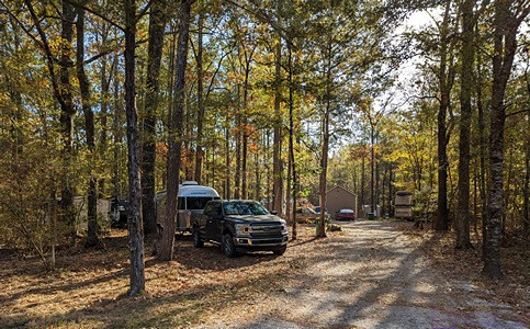
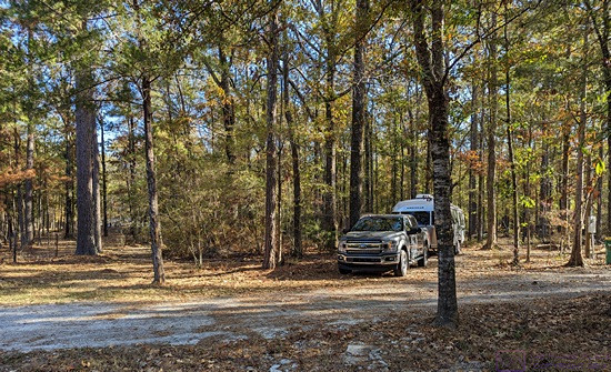
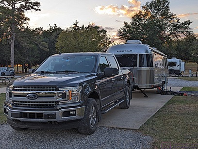
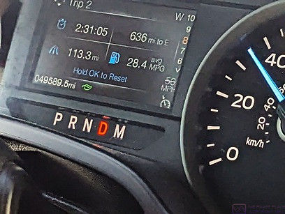
Note:  This post contains 17 photos with captions, and some minor narrative.  Photos by me (Bruce) taken with a SONY alpha 6400 or Google Pixel 6 Pro unless otherwise indicated.  (Photos by Linda taken with a Google Pixel 6.)


TUESDAY 31 October 2023 — NTNP 14 of 14 — End of the Trace:  Emerald Mound (again) and the Town of Rocky Springs, near Natchez, MS


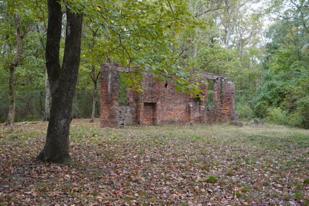
The only remaining wall of the Elizabeth Female Academy in Washington (West Natchez), Mississippi.  (See the next photo and caption.)


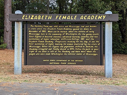
ELIZABETH FEMALE ACADEMY information sign.  Paraphrased from Wikipedia:  The Elizabeth Female Academy, founded in 1818 in the town of Washington (West Natchez), was the first female educational institution in Mississippi. It was named after Mrs. Elizabeth Roach (later Greenfield), who donated the land on which the school was located. The school closed in 1845, due in part to the relocation of the state capital from Natchez to Jackson, the general shift in the center of population, and several epidemics of yellow fever in the area. The site was reduced to ruins by a fire in the late 1870s. Part of a brick wall is all that now remains of the Academy buildings.

Learn more at:  Elizabeth Female Academy – Wikipedia


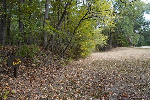
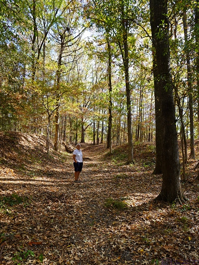
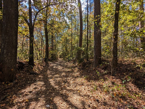
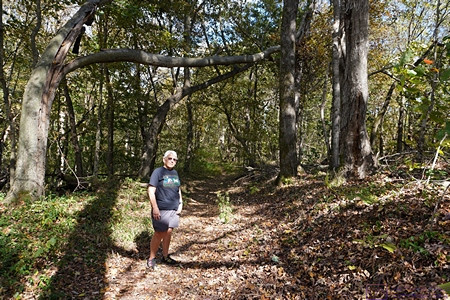
The small sign post at the lower left of the photo says Old Trace with an arrow pointing to the right.  This section of the old (original) trail starts at the opening on the left. 


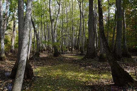
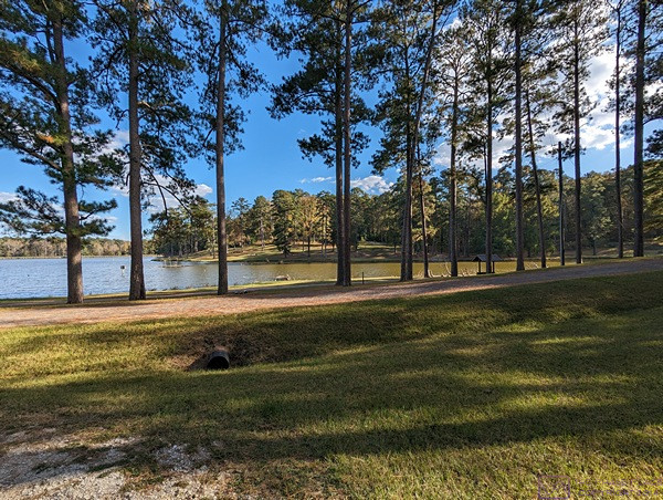
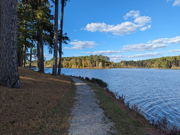
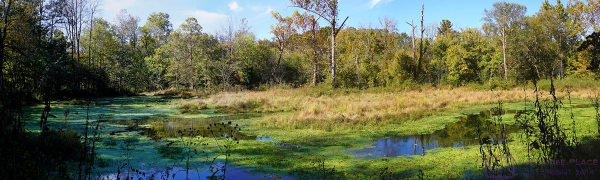
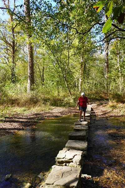
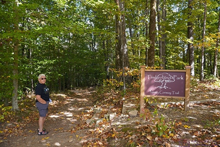
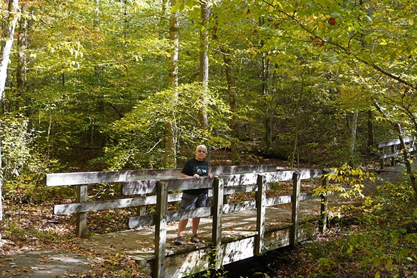
We walked on identified sections of the original (old) Trace when we could.  We enjoyed the short hikes and admired the natural beauty of these places but also thought about the arduous journeys that so many people made along this trail so many years ago and the history that surrounds it.


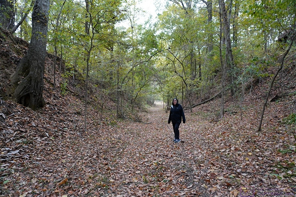
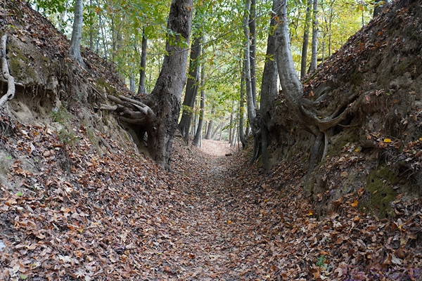
Over time and thousands upon thousands of footsteps, the path of the Trace gradually wore down below the surface level of the surrounding landscape.  As shown here , the depth at this point is over twice Linda’s height.


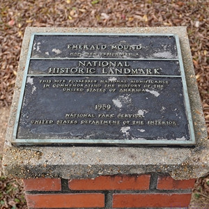
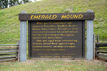
EMERALD MOUND NATIONAL HISTORIC LANDMARK plaque.  We returned to Emerald Mound today as we only had a brief visit yesterday, mostly the find it.


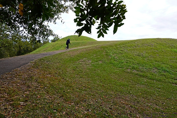
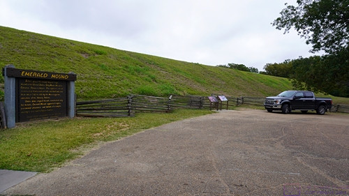
The trail leading to the top of Emerald Mound was paved but steep.  This photo gives a sense of the height of the mound from the parking lot.


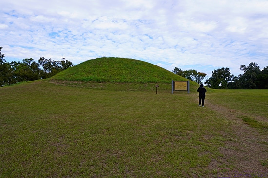
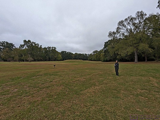
Linda on top of Emerald Mound heads towards a smaller mound and information sign.


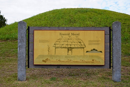
This information sign and graphic provided a visualization of how archeologists think the structures atop Emerald Mound were arranged, appeared, and used.


Another section of the Old Natchez Trace.  Sections like this are sometimes labeled “Sunken Trace,” but if that was the case here, I did not document it.


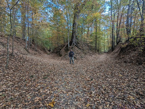
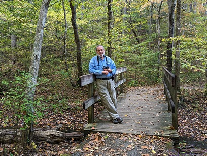
A picture of me for scale (and just because) at a point where the Natchez Trace splits into two paths.  We rarely saw splits like this, and have no idea how common or rare this was on the original trail.


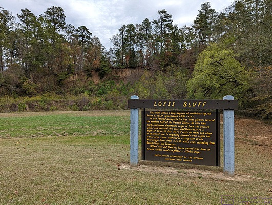
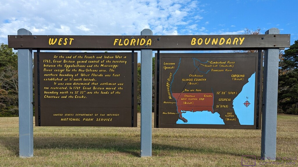
LOESS BLUFF information sign.  The loess bluff is the shear area behind the sign,  From MS Edge (Co-Pilot):  A loess bluff is a fascinating geological feature formed by the accumulation of windblown sediment known as loess.  Loess (pronounced LOW-ess) is a type of fine-grained, silty soil composed of particles deposited by the wind. It’s typically light yellow or tan in color.  During the Ice Age, glaciers covered the northern half of the United States. As these glaciers receded, they left behind vast expanses of bare land.  Continuous dust storms swept in from the western plains, carrying fine particles of dust and soil. These winds deposited the loess layer over the landscape.  The result?  Bluffs—steep, elevated landforms—made up of this windblown topsoil. Loess bluffs can be found in various regions around the world.  …  Mississippi also boasts its own loess bluffs, where nearly continuous dust storms during the Ice Age created a layer of sandy soil 30 to 90 feet deep.


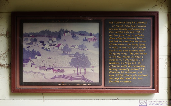
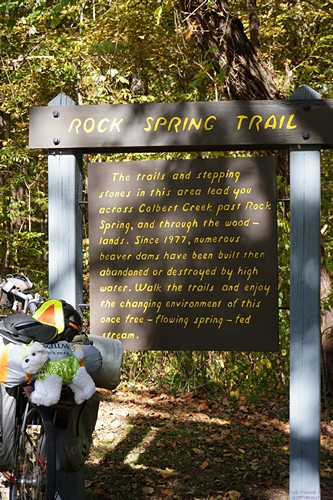
THE TOWN OF ROCKY SPRINGS information sign.  The town was first settled in the 1790’s.  In 1860 it had a population of 2,616 people spread over a 25 square mile area.  Over 2,000 of those people were slaves who tended the fields of cotton, the main crop that made this town possible.


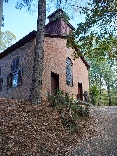
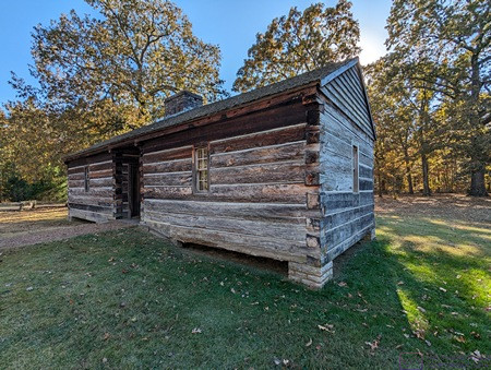
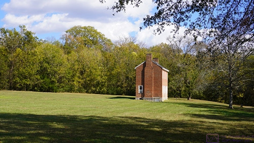
The historic Methodist church in Rocky Springs, Mississippi is the only remaining structure of Rocky Springs and continued to hold Sunday services until 2010.  The site and church are now maintained by the National Park Service.


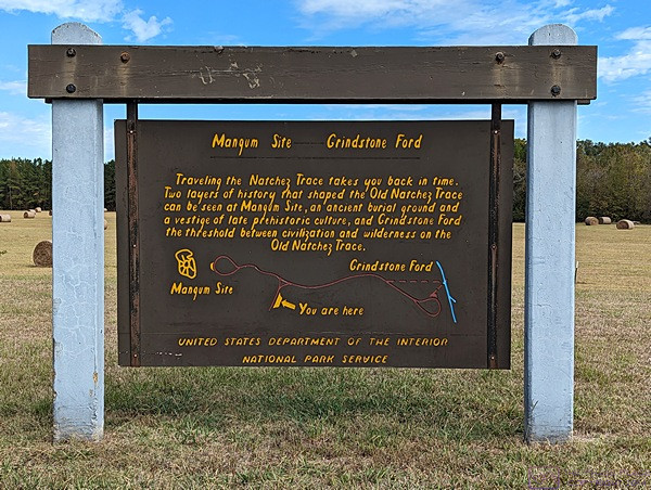
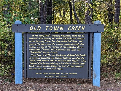
MAGNUM SITE and GRINDSTONE FORD information sign.  The Magnum Site is a prehistoric mound and the Grindstone Ford was the threshold between civilization and wilderness on the Old Natchez Trace.


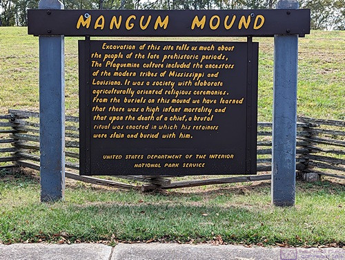
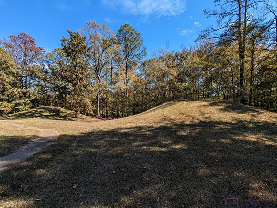
MAGNUM MOUND information sign.  Archeological excavation of this mound revealed much evidence about the prehistoric Plaquemine culture that was the precursor of the modern tribes of Louisiana and Mississippi.


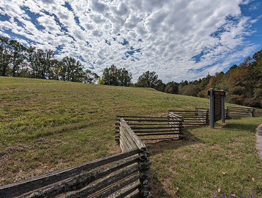
A view of Magnum Mound from near the information sign.


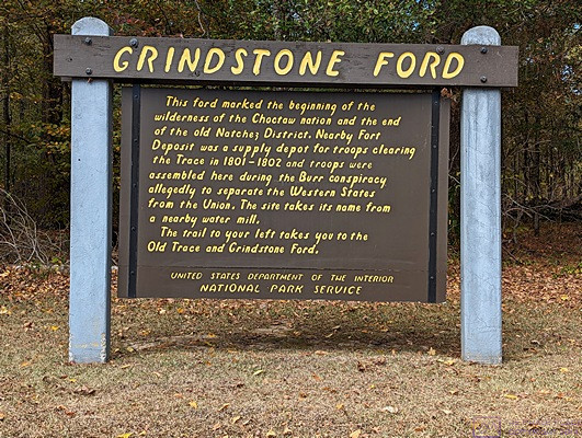
GRINDSTONE FORD information sign.  The FORD marked the end of the old Natchez Trace District and the beginning of the (wilderness of the) Choctaw Nation.  But it was only “wilderness” in the eyes of the Europeans who were moving into and “settling” the area.


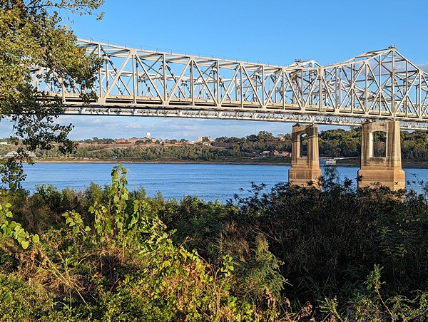
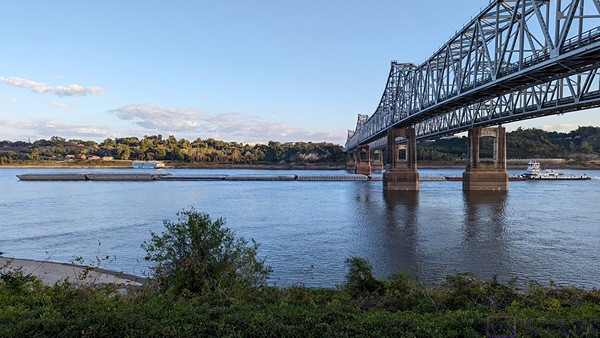
And that is the end of my 14th and last post on our trip down the Natchez Trace National Parkway.  It was a trip we had long talked about doing, and even planned for, and we were pleased to have finally done it.  Up next, our month in Gulf Shores, Alabama hanging out with friends.

20231030_NTNP_13-14_Emerald-Mound_GVNI_Natchez-MS

Note:  This post contains four (4) photos.  Photos by me (Bruce) taken with a SONY alpha 6400 or Google Pixel 6 Pro unless otherwise indicated.  (Photos by Linda taken with a Google Pixel 6.)


MONDAY 30 October 2023 — NTNP 13 of 14 — Emerald Mound and the Grand Village of the Natchez Indian, Natchez, MS


When we planned our trip, the itinerary included a 1-night stop for 31 October 2023 at The Great Mississippi Tea Company, another Harvest Host location, near Brookhaven, Mississippi.  We had stayed there once before and thoroughly enjoyed it.


EMERALD MOUND information sign.  Built on top of a hill, this flat-topped 8-acre mound was in use from 1300 to 1600 AD by the Mississippian Indians, predecessors of the Natchez Indians.  It supported temples, ceremonial structures, and burials for the civic and religious leaders of a complex society.  It is second in size only to Monks Mound in Cahokia, Illinois.


Besides being a nice place to camp for the night (strictly boondocking), the hosts/owners of The Great Mississippi Tea Company were delightful and very welcoming.  We were given a tour of the place—including the tea plants in the fields and the processing facility—and bought some things in their gift shop (of course).  But they also brought us a tea service in the morning of our departure.  That was a nice touch, very nice.


Another view of Emerald Mound from the parking lot and entrance to the trail that leads to the top.


We were very much looking forward to returning to The Great Mississippi Tea Company, but canceled the stop based on the weather forecast, which called for temperatures near freezing the night we would be there.  In previous posts, I have mentioned the various reasons we can’t really boondock in our Airstream travel trailer, but I didn’t mention one of the most important; it’s really not that well insulated, and that is especially a problem in cold weather.


In another part of Natchez, MS we visited the site of the Grand Village of the Natchez Indians.  The smaller mounds found at sites like this could be easily overlooked if care was not being taken to preserve them and tell their story to any/all who visit.  To learn more, visit the Wikipedia entry at this link:  Grand Village of the Natchez – Wikipedia


Before canceling our HH stay, however, we checked with the office at the River View RV Park & Resort to make sure we could extend our stay, as we could not check in at Luxury RV Resort in Gulf Shores, Alabama until Wednesday 01 December.  The park was not full and there was no difficulty extending our stay for an additional night (3 total).


A banner sign on the museum wall at the Grand Village of the Natchez Indians.


With that change in plans, we now had two full days to explore the southern end of the NTNP and the area around Natchez, Mississippi.


20231029_NTNP_12-14_Natchez-MS_Vidalia_LA

Note:  This post contains nine (9) photos.  Photos by me (Bruce) taken with a SONY alpha 6400 or Google Pixel 6 Pro unless otherwise indicated.  (Photos by Linda taken with a Google Pixel 6.)


SUNDAY 29 October 2023 — NTNP 12 of 14 — Natchez MS and Vidalia LA


Our truck and trailer backed into our wooded Boondockers Welcome parking spot at The HatchPad Off The Trace in the Farmhaven area of Mississippi.  No epic views, but a lovely, quiet spot in the woods that suited us just fine.  Our hosts’ house is farther back in the woods at the end of the driveway.  While not really visible in this photo, there is a shed to the right of their house with a washing machine and a dryer.  We were invited to use, and took advantage of the opportunity.  (Most commercial RV parks have laundry rooms, so we made use of those when available when needed.)


Today we completed our north to south transit of the Natchez Trace National Parkway at the south terminus in Natchez, Mississippi and then on across the Mississippi River to the River View RV Park & Resort in Vidalia, Louisiana, immediately across from Natchez.  In total, we drove all but about 10 miles of the 444-mile-long road, and that was only because a 10-mile stretch in/near Tupelo, MS was closed for construction/repairs.


Another view of our truck and trailer in our BW parking spot.  Barely visible near the center of the right edge of the frame is the electrical box where we were allowed to hook up to shorepower.


While not an “epic” trip, in comparison to some of the national scenic roads we have driven, it was a wonderful journey at a leisurely pace with light traffic and a nice mixture of scenery, culture, and history.  I mean, we took nine (9) days to pull our trailer from one end to the other a distance that we could easily have covered in two (2 days,) even with the trailer, or one (1) day without it.  But not on the NTNP, of course, which has a maximum speed limit of 50 MPH, with lower limits in some places.  No, this trip was an intentionally “slow roll” and was a kind of “bucket list” item that we had been trying to do for a while.


Natchez, Mississippi as viewed from Vidalia, Louisiana across the Mississippi River.  Most of the “downtown” area is to the left of the bridge.  The River level was very low.  The sand bar in the foreground is usually underwater and not visible.


As much as we would like to have the ability to dry-camp, our rig is only capable of doing that comfortably for a very short time in a very narrow temperature range.  We have two solar panels on the roof, but we do not travel with a generator, and our battery system is insufficient to run big loads.  We have propane for cooking, refrigeration, hot water heating, and forced-air space heating, but the last three appliances use DC power to run their control circuits, and the fan in the forced-air furnace is a real energy hog, precluding it’s use in cold weather precisely when we need i.  At the other extreme, we have two heat pumps which function as air-conditioners for cooling or can heat the rig efficiently in cool weather as long as it’s not too cold.  But they are 120VAC devices, and they still use a lot of power/energy.  Making the rig truly off-grid capable is something we discuss, but have not reached a conclusion on whether we will undertake the necessary modifications and upgrades.


There was a very nice walkway that went along the River by our RV park.  It extended up to and beyond the bridge, so we went for early evening stroll.


A closer view of the bridge with part of Natchez, MS visible on the horizon.


A barge being pushed (upstream, from right to left) by a tugboat (which seems backwards) passes under the bridge, being careful to stay in the center of the River in order to have sufficient underwater keel clearance.


Just beyond the bridge (on the north side) was the Vidalia Convention Center, a very nice-looking facility.


A selfie by the Vidalia Convention Center with Natchez, MS in the background.  I think the reason I never smile in selfies is that I am concentrating on framing the shot and also trying to remember to look at the lens, something both of us seem to have difficulty doing consistently.


Our site at River View RV Park & Resort on the western shore of the Mississippi River in Vidalia, Louisiana across the River from Natchez, MS.  And no, the name of the town has nothing to do with the onions, which get their name from Vidalia, Georgia.


While we were done traveling the NTNP with our travel trailer in tow, we were not quite done exploring the Trace, which I will cover in the post for tomorrow and the next day.

20231028_NTNP_11-14_West-Florida-Boundary_and_Vicksburg-MS

Note:  This post contains 11 photos with captions and a little narrative.  Photos by me (Bruce) taken with a SONY alpha 6400 or Google Pixel 6 Pro unless otherwise indicated.  (Photos by Linda taken with a Google Pixel 6.)


SATURDAY 28 October 2023 — NTNP 11 of 14 — West Florida Boundary and Vicksburg Civil War sites


Heading south on the Natchez Trace NP from our Boondockers Welcome site, our first stop was the West Florida Boundary parking area.  It was also a trailhead for a section of the Natchez Trace.  This photo provides a sense of scale to the trail and surrounding forest.


WEST FLORIDA BOUNDARY sign.  This image file is 1200×675 pixels and can be viewed a full-resolution on a suitable device.  The sign on the right with the map shows the territory known as “West Florida.”  The lower lower/narrow strip along the sea was the extent of the territory as of the end of the French and Indian War in 1763, at which time Great Britain gained control of the lands west to the Mississippi River.  The northern boundary of this area was set at 31 deg N latitude.  The region was quickly considered too restricted for settlement, and a year later (1764) the British (unilaterally) moved the northern boundary to 32 deg 28 min N latitude into the lands of the Choctaws and Creeks, approximately tripling its size.


This photo was taken at the Reservoir Overlook for the Ross R. Barnett Reservoir just on the NTNP near Ridgeland, Mississippi.  Our BW location was a bit northeast of here, closer to Canton, Mississippi.  The reservoir is on the Pearl River.  The photo is a composite of five images taken with the SONY alpha 6400.  It is 1200×327 pixels and can be viewed at full-resolution on a suitable device by clicking on the photo.


Another composite image from the Reservoir Overlook, this one taken with a Google Pixel 6.  (Photo by Linda)


The RESERVOIR OVERLOOK information sign.  The Ross R. Barnett Reservoir is formed by a large earthen dame and covers 50 square miles.  It is administered by the Pearl River Valley Water Supply District, an agency of the State of Mississippi.


Although our focus for this trip was the Natchez Trace National Parkway, we realized that we were close enough to Vicksburg, Mississippi that we decided to detour over there and have a look.  One of the major tourist destinations in the Vicksburg area is the Vicksburg National Military Park and the Vicksburg National Battlefield.  Once we were there, we discovered the USS Cairo Gunboat and Museum site within the NMP, and checked it out.  The museum was not open when we visited the site, but we found the ship, as shown in the following four photographs, fascinating.


USS Cairo Gunboat, Vicksburg National Military Park (NMP), Vicksburg, MS.


USS Cairo Gunboat, Vicksburg NMP.


Paraphrased from Wikipedia:  The USS Cairo was the lead ship of the City-class casemate ironclads built at the beginning of the American Civil War to serve as river gunboats for the Union.  Cairo is named for Cairo, Illinois. In June 1862, she captured the Confederate garrison of Fort Pillow on the Mississippi, enabling Union forces to occupy Memphis.  As part of the Yazoo Pass Expedition, she was sunk in the Yazoo River (a spur of the Mississippi River) on 12 December 1862 (near Vicksburg), while clearing mines for the attack on Haines Bluff.  Cairo was the first ship ever to be sunk by a mine remotely detonated by hand.  The remains of the Cairo can be viewed at Vicksburg National Military Park with a museum of its weapons and naval stores.


USS Cairo Gunboat, Vicksburg NMP.


USS Cairo Gunboat, Vicksburg NMP.


The remains of the ship were discovered in 1956 and salvaged in 1964-65.  It was listed in the National Register of Historic Places on 3 September 1971.  By 1980 Congress had authorized the National Park Service to accept the boat, move it to the Vicksburg NMP, and put in on display in conjunction with a museum to house the recovered artifacts and tell the story of the boat and its role in the Civil War.


One of the bunkers at the Vicksburg National Battlefield site.


This photo has nothing to do with the Civil War.  I’ve outlined the fuel economy readout on our F-150 instrumentation cluster.  Folks, you can’t make this stuff up; it really does say 29.1 (miles per gallon).  We had recently filled up the fuel tank and only traveled 39.3 miles, as shown in the lower left, so this was obviously light travel and slightly downhill.  Although this MPG is not sustainable under normal driving conditions, the number in the upper right indicates that we could travel another 747 miles before running out of fuel if we could maintain this MPG.


20231027_NTNP_10-14_BW_Canton-MS

Note:  There are no photos for this post.


FRIDAY 27 October 2023 — NTNP 10 of 14 — A Boondockers Welcome stop

We relocated to our next stopping spot today, a Boondockers Welcome (BW) host location named “The HatchPad Off The Trace” in the Farmhaven/Canton area of Monroe County, Mississippi.  We have been an active BW host site for some years now (whenever we are home), but have rarely used the program as a Guest.  In the search for places to stay along the NTNP, this one looked good, both for location and for the site itself.  And, indeed, it was.

The address was on a road that intersects the NTNP, and the site was not very far down the road.  It was wooded (see photos from Sunday 29 October), and the hosts were very nice.  In fact, we were vaguely acquainted, as it turned out, having both worked the Escapees RV Club Escapade (rally) in Essex Junction, Vermont in the summer of 2016.  They were part of the parking crew, while Linda worked in the office and I (Bruce) was the head photographer and put together the evening slide shows.  With fellow RVers, sometimes very experienced and sometimes brand new, there is always a lot to talk about.

Indeed, most BW hosts are (or were) active RVers, and all guests in this program must have a self-contained RV.  Self-contained means they can “boondock,” as indicated by the name of the program.  And this means they can carry, and arrive with, enough freshwater for their needs during their stay and have built-in tanks for capturing gray- (sinks, shower) and black- (toilet) waste water, with enough unused capacity to see them through their stay.  It also means they can camp without an electrical shorepower connection, either by using house batteries (with or without solar panels) and/or running a genset.  The reality, however, is that most BW hosts offer some level of electricity (which might entail a very modest donation if used) and many also have fresh water available, as well as Wi-Fi for connecting to the Internet.  A sewer connection or dump station, however, is relatively rare.

The Boondockers Welcome program shares a website and common ownership with the Harvest Hosts (HH) program.  HH and BW are similar in many ways, but different in a few important aspects.  BW host locations are almost exclusively private/residential properties (not condominium or apartment complexes).  Hosts configure their BW host profile on the website in terms of number of nights allowed (1 – 5 max), how far in advance a stay request can be made (ours is set to 60 days max), and how far in advance a request must be made, from same day to a week or more (ours is set to one day).  Each host also has a host calendar, and hosts can block out any dates for which they do not want to receive stay requests.  For instance, we do not accept stay requests unless we are home, but some BW hosts do.  Hosts also provide details about their site(s) (length, access, etc.), available amenities (if any) and donation amount (if asked for) to use electricity.

A “stay request” system is used as opposed to a “reservation” system.  The difference is that a BW guest submits a stay request to a specific host for a starting date and number of nights.  The host receives/reviews the request and then accepts or declines it.  If there are questions, communication is handled through a very good messaging feature of the website/app, but the host does not have to give a reason or explanation for not approving a stay request.  The host’s address, phone number, and other details are hidden from the guest until the request is approved.

The original idea behind the BW program was to allow RVers with a home base and some space, to provide a place for other RVers traveling through or visiting an area for a short time.  Basically, to get off the road without having to pay for a commercial or government campground, and meet some interesting RVers in the process.  The program has been a great success, and we continue to enjoy being a host when we are home.

Harvests Hosts locations, by comparison, are mostly business properties, but with the same basic idea of having someplace interesting to get off the road and “camp” for free for a night.  The thinking was that a lot of businesses have parking space large enough for one or more RVs, which would be available after business hours.  It is not unusual with HH that guests are asked to not arrive before a certain time, and to leave by a certain time the next morning so as not to interfere with normal business operations.  Originally, the program only allowed a one-night stay and lacked a system for making a stay request or reservation.  Under the new/second owners, a reservation system was added, and I think HH hosts can now allow a stay of more than one night.

Another difference from BW is that some of the host locations have things to sell; think wineries, breweries, distilleries, bakeries, orchards, museums, animal rescue facilities, etc.  Indeed, most of the original host locations were wineries and some vineyards (which are lovely places to spend a quiet night) followed by breweries and distilleries, but the program has expanded quite a bit as it is also very successful.  It even offers an add-on package for golf courses.  Because the hosts are businesses, there was always an “expectation” that guests would patronize the establishment.  Indeed, we have stayed at several HH locations that were wineries.  They were all wonderful, but proved to be the most expensive “free” camping we’ve ever done.  <<smile>>   But then, we got lots of bottles of really nice, interesting, local wines and met interesting people.

Not to put too fine a point on it, but while the terms “boondocking” and “dry-camping” are often used interchangeably, some folks insist that there is an important distinction, and the difference has to do with where you are camped.  In both cases your RV does not have any hookups (utilities like electric, water, and sewer, phone, cable, etc.) but when boondocking, i.e., camping in the “boonies”, if you run out of anything (water, propane, food, etc.) or need to dump your waste tanks, it might be a very long trip to get to someplace where you can take care of those things (appropriately and legally).  This is also sometimes referred to as “wild camping” (especially in Europe).

While BW can be, and HH usually is, dry-camping, this is sometimes also referred to as “driveway surfing,” a term that derives from “couch-surfing,” which is finding short-term overnight accommodations on someone’s sofa.  Indeed, the CouchSurfing.com platform is the “Air B&B” of couch surfers.  That’s not to say that a BW or HH host location might not be remote—they can be—but they are generally close to civilization with relatively easy access to products and services.  We have, for instance, had BW guests choose our location because of its relatively convenient access to medical facilities, shopping, and/or family/friends.

20231026_NTNP_9-14_Choctaw-Boundary

Note:  This post contains 8 photos.  Photos by me (Bruce) taken with a SONY alpha 6400 or Google Pixel 6 Pro unless otherwise indicated.  (Photos by Linda taken with a Google Pixel 6.)


THURSDAY 26 October 2023 — NTNP 9 of 14 — Choctaw Boundary


The JEFF BUSBY PARK information sign told us that Thomas Jefferson Busby, U.S. Congressman from Mississippi, introduced a bill on February 15, 1939 authorizing a survey of the Old Natchez Trace.  This was a direct result of the research and persistent lobbying of the Daughters of the American Revolution (DAR) to create the Natchez Trace National Parkway and resulted, four years later, in the historic road being designated a unit of the National Park System.  This park commemorates his role in the Parkway’s establishment.


Our explorations today of the Natchez Trace National Parkway (NTNP) included some of the section between Tupelo and Jackson, Mississippi, within reasonable driving distance of the campground, which is near Ackerman, MS.


These are Swamp Tupelo trees.  There might also be Bald Cypress trees in this swamp, at least we recall seeing both at one point along the NTNP.  The name Tupelo is of native origin.  From the National Forest Foundation website:  “The name “tupelo,” a common name used for several varieties of Nyssa trees, literally means “swamp tree” in the language of the Muscogee (Creek) Nation (ito ‘tree’ + opilwa ‘swamp’).”


CHOCTAW BOUNDARY  The map on this information sign shows the territory ceded to the USA when “…tribal leaders in central Mississippi signed the Treaty of Doak’s Stand, ceding rich cotton lands in the delta region east of the Mississippi River for approximately thirteen million acres in the Canadian, Kiamichi, Arkansas, and Red River watersheds in southeastern Oklahoma.  The history of the Choctaw Nation in Oklahoma began with the signing of this treaty on October 8, 1820 and ratified in Congress January 8, 1821.  To a much greater extent than we realized when planning this trip, the history of the Natchez Trace includes the history of the native people who occupied this land for a very long time prior to the arrival of Europeans in what became known as North America.


A trip down the NTNP is a trip through more than just American and native history.  Before the British and the eventual founding of the USA, the French and Spanish were here, as the following photo explains:


PEARL RIVER  This information sign tells that Pierre Le Moyne (Sieur) d’Iberville (a French soldier, explorer, colonial administrator, and trader) sailed into the mouth of this river in 1698 and discovered pearls, thus the origin of the name.  A hundred years later, the Natchez Trace avoided marshy lowlands by following a route between the Pearl and the Big Black Rivers for about 150 miles.  Since 1812, the last 75 miles of the river have served as the boundary between Mississippi and Louisiana.  D’Iberville is noted for founding the colony of Louisiana in New France.


Here’s the information sign explaining the TUPELO-BALDCYPRESS SWAMP.  These trees take root in summer when the swamp is mostly dry, but the seedlings have the somewhat unique ability to survive and thrive in water that that is deep enough to kill other plants.


CHOCTAW BOUNDARY (complete sign).  This image is 1200×742 pixels, and can be viewed full size on devices with suitable screen resolution.  In addition to the map shown in the third photo in this post, it includes the two wing signs, labeled INDIAN TREAT and DOAKS STAND.  The sign on the left indicates that a line of trees crossing the (now) Parkway just to the left marks part of the boundary that was agreed to in the aforementioned Treaty.


This FRENCH CAMP information sign tells yet another story of how a place got its name.  Around 1812, Louis Leflore first traded with the Choctaw Indians in the area northeast of the Trace.  Because he was of French nationality, the area was referred to as French Camp.  The name stuck and is still used today.  Interestingly, he married a Choctaw woman and their son, who changed his name to Greenwood Leflore, became a Choctaw Chief and a Mississippi State Senator.  The City of Greenwood and the County of Leflore are named for him.


This panorama shows another view of the Choctaw Lake Campground while Linda and I are out for an early evening stroll following our day exploring another section of the NTNP.


20231025_NTNP_8-14_Choctaw-Lake-CG

Note:  This post contains 7 photos.  Photos by me (Bruce) taken with a SONY alpha 6400 or Google Pixel 6 Pro unless otherwise indicated.  Photos by Linda taken with a Google Pixel 6.


WEDNESDAY 25 October 2023 — NTNP 8 of 14 — Choctaw Lake Campground, Choctaw Lake Recreation Area, Tombigbee National Forest, US Forest Service (USFS)


Our very generous campsite backed up to a spur of Choctaw Lake in the Choctaw Lake Recreation Area.  Our trailer rear bumper was still quite a way from the water and the site was elevated well above the Lake level.

If you look carefully, you will see a “walking stick” on the trunk of this tree, mid-frame.  I did not have a convenient way to show the scale of this insect, but I estimated it to be 6” – 8” long.  I have always been fascinated by these creatures.


Many years ago, when we were much younger, we were tent campers.  On a few occasions we camped in national forest campgrounds.  Some of these “campgrounds” were remote and very rustic.  While that is no longer “how we roll,” the campgrounds in some of the national forest recreation areas are a bit more developed.  Our basic requirements are: 1) a relatively level, and sufficiently large, site (but not necessarily paved); 2) Electricity at the site, and 3) a dump station.  A bathhouse is appreciated, but an outhouse (pit toilet) in place of a dump station is a “no go.”


Choctaw Lake CG more than met our basic requirements.  As with all of our camping spots, we stayed here for two nights, and used the full day to continue exploring the NTNP.


Another view of our site at Choctaw Lake CG.  Both the USACoE and USFS campsites included substantial concrete picnic tables.  This site also had something we had not seen before.  Note the black, upside down, “J-hook” at the left of the image.  Every site had one of these.  There were for hanging a camp lantern.  We didn’t have a camp lantern to hang (or didn’t want to dig ours out), but we thought this was a nice amenity that all campsites should adopt.


And another photo of our site at Choctaw Lake CG, taken by Linda and featuring yours truly.  (Photo by Linda)


And yet another shot of Choctaw Lake while strolling the USFS campground near the shore.


We have no idea what this was, and the staff at the Choctaw Lake CG didn’t either.  It was clearly some kind of living organism, and the staff indicated that biologists have been here to study it, but also didn’t know.  I am not one for swimming in lakes, rivers, or oceans, but if I was, I would have given this lake a pass.  Even so, I thought it was visually very interesting.


This gravel path extended along the lake shore for quite some distance.  The developed area actually wraps around Choctaw Lake far to the right, out of the frame.


20231024_NTNP_7-14_Brices-X-road-NBF

Note:  This post contains 8 photos.  Photos by me (Bruce) taken with a SONY alpha 6400 or Google Pixel 6 Pro unless otherwise indicated.  (Photos by Linda taken with a Google Pixel 6.)


TUESDAY 24 October 2023 — NTNP 7 of 14 — Brices Cross Roads National Battlefield


Brices Cross Roads National Battlefield sign.

The Natchez Trace National Parkway (NTNP) passes through a part of the “deep South” that was heavily impacted by the Civil War.  From Wikipedia (paraphrased):  Brices Cross Roads National Battlefield site memorializes the Battle of Brices Cross Roads in which a U.S. Army force was defeated by a smaller Confederate force commanded by Major-General Nathan Bedford Forrest on June 10, 1864, but nevertheless secured Union supply lines between Nashville and Chattanooga, Tennessee.  The 1-acre site is a grassy park with a flagpole, a memorial monument, two cannons, and some information signs.  The monument and site are very similar to that at Tupelo National Battlefield.  Brices Cross Roads, however, is the only component of the National Park System designated a “battlefield site.”  I felt that last point was interesting in and of itself.


WITCH DANCE information sign.  The site of local lore, also part of the history of the Natchez Trace.


LINE CREEK information sign.  A long time ago a nearby creek that flows through this valley was accepted as the boundary between the Chickasaw and Choctaw nations, and remained so until both tribes moved to Oklahoma in the 1830’s.  The course of the creek has changed over the years, but the name has stuck.


OLD TRACE information sign.  A 200+ year old section of the “Old Trace” is preserved here, and we walked it.  The sign describes the difficulty of creating and maintaining a nearly 500-mile-long path through the wilderness and how readily nature seeks to reclaim the ground, as shown in the next photograph this section of the trail/road.


Maintaining this 10-foot-wide section of the Old Trace involves constant work.  Without continuous human intervention, nature would, it its own time, completely reclaim this path.


Elements of Exchange.  Although the type is too small to read in this photo, the map highlights the territories of the Eastern Woodland nations and discusses the materials that served as “currency” for trading purposes.


These are obviously mounds, and the photo was taken about 4 minutes after the previous one, so I know they were in the same general area, but we failed to photograph a sign telling me about their significance.


OLD TOWN CREEK information sign.  This gist of the historical factoid reported here is that in the early 1800’s ordinary Americans could not be bothered to learn the Chickasaw names for their villages and other landmarks and features.  Thus, a nearby village was dubbed “Old Town” and the name eventually became attached to the creek that runs through the valley.


20231022_NTNP_5-14_TN-AL-MS-state-lines

Note:  This post contains 13 photos.  Photos by me (Bruce) taken with a SONY alpha 6400 or Google Pixel 6 Pro unless otherwise indicated.  (Photos by Linda taken with a Google Pixel 6.)


SUNDAY 22 October 2023 — NTNP 5 of 14 — Tennessee-Alabama-Mississippi State Lines

Today was our full day at Fall Hallow CG/RVpark/B&B.  The weather was nice, and we took advantage of it to further explore the section of the NTNP from here south a way, having explored from here north yesterday.  Fall Hallow CG is in Hohenwald, Tennessee, but traveling south from here, the Trace cuts across the northwest corner of Alabama.  The first photo below is for Pharr Mounds in Mississippi.  Subsequent photos show the signs for the Mississippi and Alabama sides of their common border along the Trace.


PHARR MOUNDS information sign describing the largest and most important native American archeological site in northern Mississippi.  The pre-European tribes in this area where part of the much larger and more extensive Mississippian mound culture, whose center was in Cahokia, Illinois.


Ancient mounds co-exist with present day agricultural use of the land.


Part of the dashboard in our F-150.  Yup, it shows an average fuel economy of 28.4 MPG.  The F-150 is capable of this when not towing the trailer, the fuel tank has just been topped off, good driving, light traffic, and flat roads with no stops.  (Photo by Linda)


Crossing into Mississippi from Alabama on the NTNP.


I walked to the other side of the road to photograph the matching sign entering Alabama from Mississippi on the NTNP.


The terrain in this area was not all flat, and afforded views like this on occasion.


Information sign for ROCK SPRING TRAIL which crosses Colbert Creek and meanders through woodlands to get to Rock Spring.  The sign indicates that since 1977 numerous beaver dams have been built here and subsequently destroyed by high water.


This panorama of Rock Spring is a composite of four images made with Microsoft Image Composer.  The resolution if 1200×360 pixels, and can be displayed at full resolution on a device with a suitable monitor.


This is a bicycle repair station at one of the rest areas in this section of the NTNP.  It has a “rack” for hanging the bike, all of tools one might need (suitably tethered to the post), and an air pump with integrated air pressure gauge.  Although not yet mentioned in this series of blog posts, bicyclists were much in evidence all along the NTNP and this was not the only such repair stand that we saw.  Most of the cyclists were self-contained.  Some of them camped in the NTNP campgrounds while others stayed in motels just off the Trace.


A all-purpose, 3-way water/drinking fountain at the same rest stop as the bicycle repair stand; Left portion for filling water bottles, center for drinking, and bottom right for “Fido.”


2

STATE LINE information signs.  This set of signs describes the boundary between Tennessee (right, north) and Alabama (left, south).  The image is 1200×675 pixels, and can be displayed at full size on a device with appropriate resolution.


McGLAMERY STAND information sign.  It says that “a stand was an inn or trading post—sometimes both—established along a well traveled route.”  The one here was established in 1849.  It did not outlast the Civil War, but the nearby village still retains the name.


Linda picks her way carefully across a stone portion of trail where it crosses a very wet area.

20231021_NTNP_4-14_N-end_and_Meriwether-Lewis

Note:  This post contains 7 photos.  Photos by me (Bruce) taken with a SONY alpha 6400 or Google Pixel 6 Pro unless otherwise indicated.  Photos by Linda taken with a Google Pixel 6.


SATURDAY 21 October 2023 — NTNP 4 of 14 — North end NTNP and Meriwether Lewis

Today was a relocation day in which we moved the travel trailer from the Grand Ole RV Resort in Goodlettsville, Tennessee to Fall Hollow Campground, RV Park, and B&B in Hohenwald, Tennessee.  Again, we camped here for two nights.  As RV parks go, this was not a great place and we did not have a great site.  But we had a FHU site, and the campground was located the desired distance from our previous RV park, so it served its purpose of moving us on down the road and using the full day (tomorrow) to explore the next section of the Trace within reasonable driving distance of the RV park.


The Meriwether Lewis Memorial.


A reproduction of the Grinder House (I think) where Meriwether Lewis met his demise.

The Natchez Trace National Parkway is not just a pretty drive on a nice paved road; it is that, but it is much more.  Although 440 miles long between it’s northern and southern termini, it is sometimes narrow enough that you could throw a ball across it.  In the wider sections, it is still rarely even a mile wide.  It is also a trail (Trace is French for trail) through history, and that history includes the indigenous people that lived in this part of what became North American long before Europeans arrived on the continent, and were still very much here as the USA expanded westward in the many decades following the War of Independence.


A plaque marking the site of the actual Grinder House where Meriwether Lewis died.

We quickly discovered, but were not surprised, that the National Park Service had done their usual exemplary job of making an overarching view of this history available to those travelers who were willing to take the time to read information placards, walk the trails, and ponder the few remaining remnants of a past era.

And, as history is want to do, there were intersections with other aspects of USA history that we did not know about or expect.  One of those intersections had to do with Meriwether Lewis, of the Lewis and Clark Expedition, and the Louisiana Purchase.  Lewis, who was President Thomas Jefferson’s private secretary, ended up in this area of the Trace, very much in debt as a result of the expedition.  Despondent about the inability of the Government (congress) to reimburse him for expenses, he took his own life on October 11, 1809.  Perhaps we learned this in our high school American History class but if so, I did not recall it.  We did not learn why he came he, so that is a question left for the reader.

The following photos highlight a few additional aspects of this portion of the NTNP.


Information sign for the STEELE’S IRON WORKS site.  Dating from 1820, a charcoal burning furnace located here was used to make pig iron.  Metal Ford crosses the Buffalo River just beyond this sign.


Metal Ford was a natural rock ledge that made it possible to cross (ford) the River at this place by the Steele’s Iron Works.  Crossing creeks, streams, and rivers was one of the many challenges of transiting the Trace.


Linda captures a picture of me positioning myself to get a photo of Metal Ford at the Steele’s Iron Works site, NTNP.  (Photo by Linda.)


And here’s the photo I took of Metal Ford at the Steele’s Iron Works site, NTNP.


20231020_NTNP_3-14_North-end-of-the-Trace

Note:  This post contains 13 photos.  Photos by me (Bruce) taken with a SONY alpha 6400 or Google Pixel 6 Pro unless otherwise indicated.  Photos by Linda taken with a Google Pixel 6.


FRIDAY 20 October 2023 — NTNP 3 of 14 — Natchez Trace National Parkway (NTNP), North Terminus


Yesterday afternoon, we arrived at the Grand Ole RV Resort in Goodlettsville, Tennessee with a 2-night reservation.  We have stayed here before, and really like the park.  Prevost’s “Nashville” service center is actually in Goodlettsville, just a mile or so from the RV park, and that is what originally brought us here.  It’s about 12 miles to downtown Nashville, so on previous visits we used the RV park as a base to explore the city, something we did not feel we needed to repeat this time, even though it is a vibrant and interesting town.  Our focus on this visit was on the Natchez Trace National Parkway.


The NTNP has quite a few bridges and overpasses, either for the parkway itself or for highways that cross it.  This one was located by the north entrance sign and was a wonderful piece of civil engineering.


Timberland Park and the Natchez Trace Trail.  The NTNP is a long, slender unit of the National Park Service with a paved road running its entire length.  Within the boundaries of the NTNP, however, are historic sites as well as hiking and equestrian trails.  A few sections of the original Natchez Trace (French for trail) still remain and can be hiked.

In planning this trip we discovered that transiting the NTNP while camping in a larger RV, and/or not being able/willing to boondock (dry camp), would be a challenge.

There are National Park campgrounds within the boundaries of the Parkway, but they are:  1) designed for small vehicles; 2) only available on a first-come/first-served basis (no reservations); and 3) only setup for boondocking (no hookups at any of the sites).  Years ago (over a half century), when we were newly married, these are the kinds of campgrounds we sought out, but we were tent campers back then, and places like this allowed us to avoid motorhomes and trailers and have a more rustic experience.  Not anymore.


Entrance sign at the north terminus of the NTNP.

The combination of our 2020 Airstream Flying Cloud 27 FBT (front bed twin) travel trailer with our 2019 Ford F-150 XLT short-bed FX4, is 49 feet long.  (Our bus/car combo was about 60 feet long and the bus/truck combo would be about 66 feet long if we ever decide to use it that way.)  At this point in our lives’, that’s just too much vehicle to not have a guaranteed place to park it each night where we know it will fit.  We are also not really set up for boondocking in the TT, except in very moderate weather, so we like to at least have electricity available.


The NTNP winds through hills and across flat lands over its length.  The northern end, in particular, was hilly and often afforded views such as this.

As for our exploration of the NTNP, we were unsure about whether we would find pull-outs and parking lots that could accommodate the length of our rig.  With that in mind, we decided we would use our planned overnight “stopping spots,” not all of which were campgrounds, as bases from which to explore the NTNP in detail using just the F-150.  And that is what we did with our first full day at the Grand Ole RV Resort.  Following are a few photos of things we saw on the northern end of the NTNP.


The information sign for THE GORDON HOUSE, one of the few relatively intact historic structures remaining along the NTNP.  This is the style of sign used within the NTNP to explain a site of historical interest.


A view of the Gordon House from a slight distance.


OLD TRACE WALK information sign.  A few sections of the original trail remain.  Pull-offs and parking lots were located to park and walk these sections if desired.  We did so at most opportunities, unless they were wet/muddy.


Linda stops for a photo on a section of the Old Trace.  The trace was originally a foot path from Natchez, Mississippi to the Ohio River near Cincinnati, Ohio.  As such, it was not very wide.  Log rafts were constructed near Louisville, KY and Cincinnati, OH to float cargo down the Ohio and Mississippi Rivers to Natchez.  In Natchez, the cargo was sold along with the rafts, and the traders walked back to do it again.  It was eventually widened and improved for military and commercial use, but remained a rustic trail through the wilderness.


TOBACCO FARM – OLD TRACE  As the area through which the Trace passed became more settled by Europeans, farms and business, such as inns, mills, etc. grew up along its length.  Being in the south, tobacco was a major crop.  This sign marks the site of tobacco farm.  To the right of the sign is a tobacco barn (shed) with tobacco drying in it which allowed a glimpse into the past.


I believe this is a replica of the original tobacco shed that was here.


The title of this information sign is “Cherokee Removal Routes.”  The area through which the Trace passed was occupied by native Americans, and had been for a very long time.  A big part of the history of the Trace has to do with these people; their histories, cultures, and ultimate treatment at the hands of European settlers and the US Government.  In its usual fashion, the National Park Service (NPS) tells this story as part of the NTNP experience.


There were a lot of small creeks, drainages, and streams in the Parkway.  Footbridges like this one were placed on trails where needed, making for a nice hiking experience for modern day visitors.  Linda stops while I take a photo.


Turnabout is fair play.  I pose on a footbridge while Linda takes my picture.  (Photo by Linda)


20231019_NTNP_2-14_Walton-KY_2_Goodlettsville-TN

Note:  This post contains 3 photos.  Photos by me (Bruce) taken with a SONY alpha 6400 or Google Pixel 6 Pro, unless otherwise indicated.  (Photos by Linda taken with a Google Pixel 6.)


THURSDAY 19 October 2023 — NTNP 2 of 14 — Walton, KY to Goodlettsville, TN

We had a slightly shorter drive today so we planned a slightly later departure and took the early morning to see some more of the Benton Family Farm in Walton, Kentucky, where we camped last evening as members of the Harvest Hosts program.  Besides being a working farm, they host a lot of school groups.  A group arrived with five or six buses before we pulled out, so we got to watch the children explore part of the farm.  The owners knew they were coming, of course, and had positioned us last night so we would not be blocked in by the school buses this morning.


The school children climb into wagons for a ride around the Benton Family Farm in Walton, KY.


Our travel trailer next to a line of school buses.  Walton Family Farm.  Walton, KY.


School children, and their parent/chaperones, by one of the goat pens.  Judging by their sizes we figured these were early elementary age students.  Walton Family Farm, Walton, KY.  (Photo by Linda.)


Our destination today was the Grand Ole RV Resort in Goodlettsville, Tennessee.  We had stayed here before, liked it, and found it to be a convenient stopping point when traveling down I-65 through Kentucky, Tennessee, and beyond.  Linda reserved a full hookup (FHU) site for two nights, which would allow us to begin our exploration of the Natchez Trace National Parkway tomorrow.

While our plan was the drive the entire 440-mile length of the Parkway with our trailer in tow, we had also decided that the best way to explore the NTNP was to camp for at least two nights each time we stopped, unhook the truck from the trailer, and use the truck to explore any pull-outs that interested us.  We had a guide book to help us figure out what was available to see and do along the way.


20231018_NTNP_1-14_Departure

Note:  There are 3 photos in the post.  Photos by me (Bruce) were taken with a Google Pixel 6 Pro or SONY alpha 6400, unless otherwise indicated.  (Photos by Linda taken with a Google Pixel 6.)


WEDNESDAY 18 October 2023 —  NTNP 1 of 14 — Departure

The planning was done, the reservations were made, and it was finally time to start our long-anticipated journey down the Natchez Trace National Parkway.


A friendly goat at the Benton Family Farm in Walton, KY.  (Photo by Linda)


Our first day’s drive took us from our home in Michigan to the Benton Family Farm, a Harvest Hosts location in Walton, Kentucky, a bit south of Cincinnati, Ohio.  This was a familiar drive down US-23 in Michigan and Ohio and then I-75 through Ohio and into Kentucky, but a new Harvest Host location for us.  We pulled out around 9 AM for the 290 mile / 5-hour drive, which got us through Cincinnati before the evening rush hour, and arriving at the Benton Family Farm mid-afternoon.  A phone call brought someone out to greet us and show us were to park.


Harvest Hosts (HH) and Boondockers Welcome (BW) locations are presumed to be “dry camping” sites without any hookups or other amenities/services.  However, many BW, and some HH, sites offer some sort of electrical hookup, usually for a small donation, and that was the case here.  Potable water is also sometimes available, but the ability to dump waste tanks is virtually non-existent.  With that in mind, we arrived with a mostly full fresh water tank, full propane tanks, and empty black and gray waste tanks.  In general, this is how guests are expected to arrive.


Goats in the goat pen by the goat barn.  Benton Family Farm, Walton, KY.  (Photo by Linda)


We’ve been members of the Harvest Hosts (HH) and Boondockers Welcome (BW) programs for quite a while now, and a host location for BW for as many years, but have made limited use of each program as guests in that time.  They started as separate programs and we were acquainted with the respective owners, both of whom eventually sold.  They are now combined under a single ownership with an integrated website, but the website keeps the two programs separated, which works well for us as a BW host.


Bruce poses with the very large “welcome pig” at the Benton Family Farm, Walton, KY.  (Photo by Linda)