Note: This post contains 13 photos. Photos by me (Bruce) taken with a SONY alpha 6400 or Google Pixel 6 Pro unless otherwise indicated. Photos by Linda taken with a Google Pixel 6.
FRIDAY 20 October 2023 — NTNP 3 of 14 — Natchez Trace National Parkway (NTNP), North Terminus
Yesterday afternoon, we arrived at the Grand Ole RV Resort in Goodlettsville, Tennessee with a 2-night reservation. We have stayed here before, and really like the park. Prevost’s “Nashville” service center is actually in Goodlettsville, just a mile or so from the RV park, and that is what originally brought us here. It’s about 12 miles to downtown Nashville, so on previous visits we used the RV park as a base to explore the city, something we did not feel we needed to repeat this time, even though it is a vibrant and interesting town. Our focus on this visit was on the Natchez Trace National Parkway.
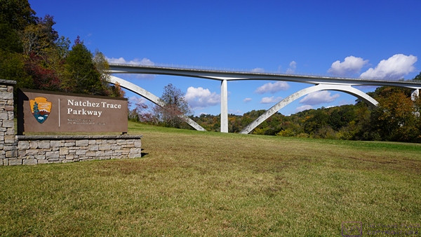
The NTNP has quite a few bridges and overpasses, either for the parkway itself or for highways that cross it. This one was located by the north entrance sign and was a wonderful piece of civil engineering.
Timberland Park and the Natchez Trace Trail. The NTNP is a long, slender unit of the National Park Service with a paved road running its entire length. Within the boundaries of the NTNP, however, are historic sites as well as hiking and equestrian trails. A few sections of the original Natchez Trace (French for trail) still remain and can be hiked.
In planning this trip we discovered that transiting the NTNP while camping in a larger RV, and/or not being able/willing to boondock (dry camp), would be a challenge.
There are National Park campgrounds within the boundaries of the Parkway, but they are: 1) designed for small vehicles; 2) only available on a first-come/first-served basis (no reservations); and 3) only setup for boondocking (no hookups at any of the sites). Years ago (over a half century), when we were newly married, these are the kinds of campgrounds we sought out, but we were tent campers back then, and places like this allowed us to avoid motorhomes and trailers and have a more rustic experience. Not anymore.
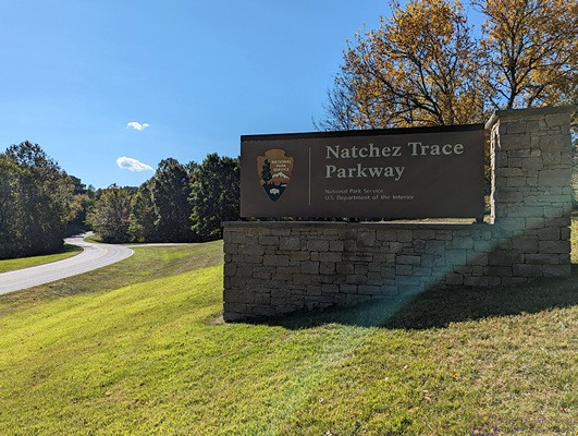
Entrance sign at the north terminus of the NTNP.
The combination of our 2020 Airstream Flying Cloud 27 FBT (front bed twin) travel trailer with our 2019 Ford F-150 XLT short-bed FX4, is 49 feet long. (Our bus/car combo was about 60 feet long and the bus/truck combo would be about 66 feet long if we ever decide to use it that way.) At this point in our lives’, that’s just too much vehicle to not have a guaranteed place to park it each night where we know it will fit. We are also not really set up for boondocking in the TT, except in very moderate weather, so we like to at least have electricity available.
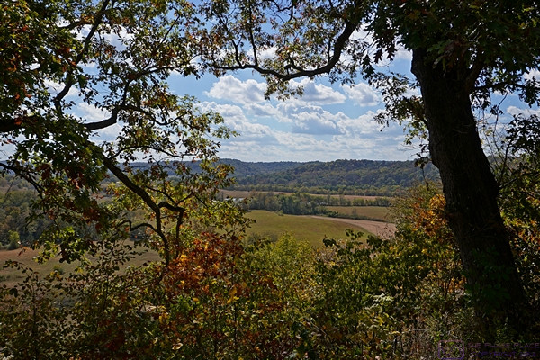
The NTNP winds through hills and across flat lands over its length. The northern end, in particular, was hilly and often afforded views such as this.
As for our exploration of the NTNP, we were unsure about whether we would find pull-outs and parking lots that could accommodate the length of our rig. With that in mind, we decided we would use our planned overnight “stopping spots,” not all of which were campgrounds, as bases from which to explore the NTNP in detail using just the F-150. And that is what we did with our first full day at the Grand Ole RV Resort. Following are a few photos of things we saw on the northern end of the NTNP.
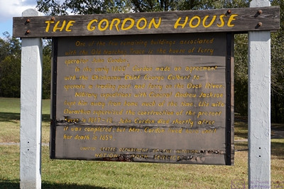
The information sign for THE GORDON HOUSE, one of the few relatively intact historic structures remaining along the NTNP. This is the style of sign used within the NTNP to explain a site of historical interest.
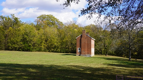
A view of the Gordon House from a slight distance.
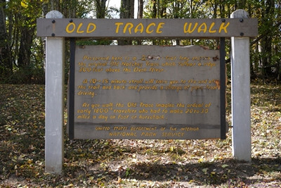
OLD TRACE WALK information sign. A few sections of the original trail remain. Pull-offs and parking lots were located to park and walk these sections if desired. We did so at most opportunities, unless they were wet/muddy.
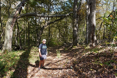
Linda stops for a photo on a section of the Old Trace. The trace was originally a foot path from Natchez, Mississippi to the Ohio River near Cincinnati, Ohio. As such, it was not very wide. Log rafts were constructed near Louisville, KY and Cincinnati, OH to float cargo down the Ohio and Mississippi Rivers to Natchez. In Natchez, the cargo was sold along with the rafts, and the traders walked back to do it again. It was eventually widened and improved for military and commercial use, but remained a rustic trail through the wilderness.
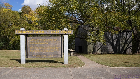
TOBACCO FARM – OLD TRACE As the area through which the Trace passed became more settled by Europeans, farms and business, such as inns, mills, etc. grew up along its length. Being in the south, tobacco was a major crop. This sign marks the site of tobacco farm. To the right of the sign is a tobacco barn (shed) with tobacco drying in it which allowed a glimpse into the past.
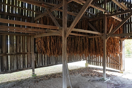
I believe this is a replica of the original tobacco shed that was here.
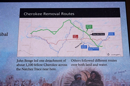
The title of this information sign is “Cherokee Removal Routes.” The area through which the Trace passed was occupied by native Americans, and had been for a very long time. A big part of the history of the Trace has to do with these people; their histories, cultures, and ultimate treatment at the hands of European settlers and the US Government. In its usual fashion, the National Park Service (NPS) tells this story as part of the NTNP experience.
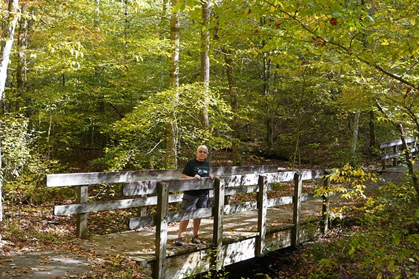
There were a lot of small creeks, drainages, and streams in the Parkway. Footbridges like this one were placed on trails where needed, making for a nice hiking experience for modern day visitors. Linda stops while I take a photo.
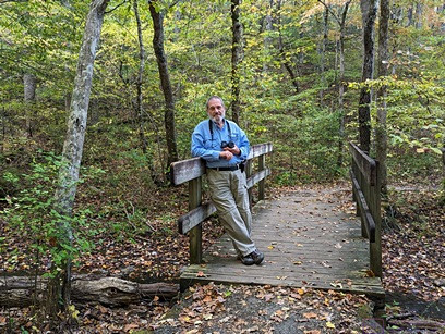
Turnabout is fair play. I pose on a footbridge while Linda takes my picture. (Photo by Linda)
…