Category Archives: NP-NM-NWR

20220912 – Acadia National Park and Bar Harbor, Maine

MONDAY 12 September

(There are 11 photos in this post, distributed throughout the text.)

I woke up around 3 AM to the sound of light rain but went back to sleep.  We were both up by 7 AM and had one cup of coffee each.  Breakfast was fresh blueberries (jumbo size) and a slice of Rob’s Cranberry Walnut Bread, lightly toasted and buttered.

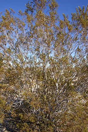
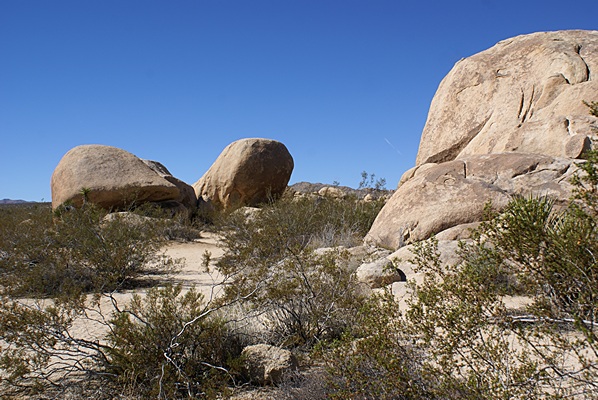
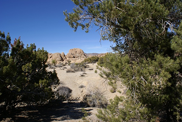
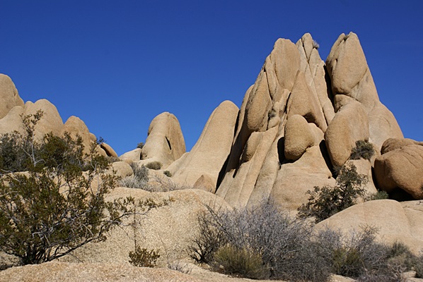
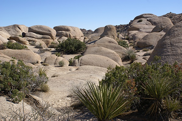
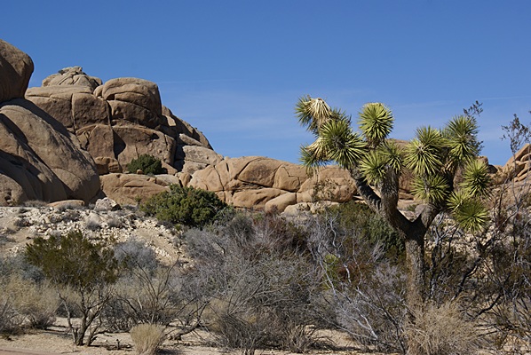
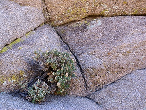
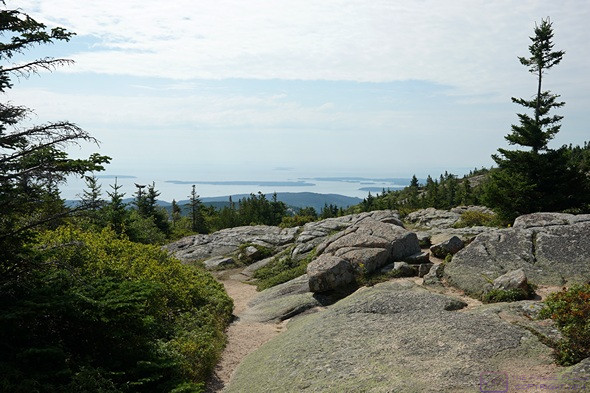
This is how much of the top of Cadillac Mountain in Acadia National Park looks.  Because of the micro-climate (altitude, winds, moisture, sunlight, temperatures, etc.) there are some flora found here that are only found much farther north into New Brunswick, Canada.

Our main activity for the day was a visit to Acadia National Park.  The Hulls Cove Visitor Center is on Hwy-3 (Bar Harbor Road) on the NE coast of Mount Dessert Island (MDI).  Hadley’s Point Campground is also on Hwy-3, at the northern tip of MDI.  We left at 9:45 AM and it took ~5 minutes to get the Visitor Center.  The parking lot was very full, but there were spaces at the far end (of course), where we prefer to park anyway.  The Visitor Center was mobbed, and there was no way we were going to get to the front of the line and still make our timed entry onto Cadillac Mountain Road.  Linda got one of the park staff to give her a map, but he didn’t seem very happy about doing it.

The view to the south from the summit of Cadillac Mountain in Acadia National Park, Maine.

We headed into the park on Paradise Hill Road, which became the Park Loop Road a little way before we arrived at the Cadillac Mountain Road Entrance Station at 10:30.  (Our timed entry reservation was for the 10:30–11:00 AM window.)  We were cleared through at 10:40 AM, and picked up a plastic park pass “hanger” in the bargain.  (The hanger holds one of our Senior Pass cards and hangs from the rearview mirror so it can be seen through the windshield.)

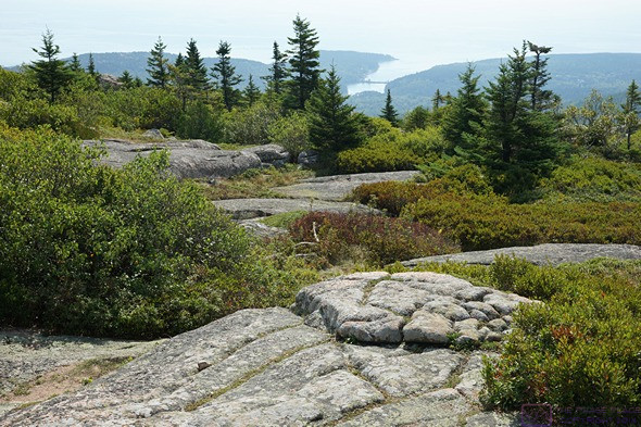
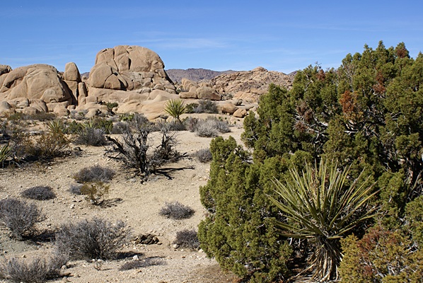
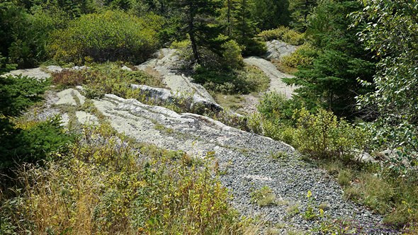
The view to the SSE towards Otter Cove as seen from the summit of Cadillac Mountain in Acadia National Park, Maine.

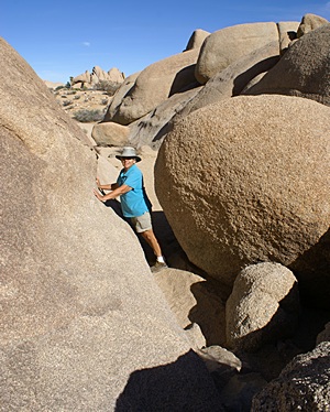
Cadillac Mountain Road was very cool to drive.  It had some nice scenic pullouts, but we passed those by on our way to the top.  The parking at the summit was already crowded, since once you are there you don’t have to leave until you want to. We pulled in to a spot in a small parking area just before the main lot, and walked the short extra distance to the summit.

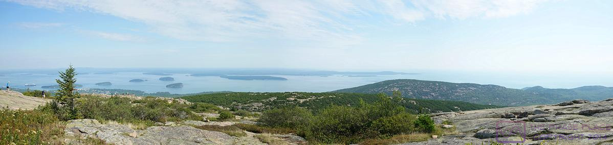
This is a composite image of six photos take from the summit of Cadillac Mountain in Acadia National Park, Maine.  The left edge is north and the right edge is southeast, more or less.  The compositing was done with Microsoft Image Composite Editor (ICE).  The photo is 1198×234 pixels, but displayed at 599×117.  Click to view full size on a compatible device.

It was a very sunny but hazy day, not ideal for pictures, and quite warm on the summit, with no shade.  We walked the Summit Loop Trail, an easy and well-defined 1/2-mile loop around part of the top of the mountain.  BTW: Cadillac Mountain is the highest mountain on the eastern U.S. seacoast at 1,527 feet AMSL.  On the way back down, we pulled into a couple of the scenic pullouts (or Lookoffs, as the are called in eastern Canada), but did not get out.

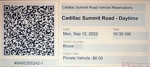
The confirmation /ticket for our timed entry reservation to drive up Cadillac Mountain in Acadia National Park, Maine.  Linda booked this online, and the confirmation/ticket came as an e-mail.  We could have printed it (we have a small printer with us), but easier to just open the document on my computer and take a picture of it with my phone.  The park staff at the entrance station had handheld scanners for readying he QR code on a phone, and that was what most visitors did.

Once back down to the Park Loop Road, we headed back towards the Visitor Center and stayed to the right for the one-way Park Loop Road.  (Most of the Park Loop Road is one-way, going clockwise from its northern starting point at Paradise Hill Road, except for the stretch from there south along the western edge of the park the Wildwood Stables.)   The road was two-lane, and parking was usually permitted in the right lane near major attractions, but prohibited elsewhere.  And the street parking was absolutely needed, as the park was mobbed.  Fortuneatly for us, we were only doing a scenic drive-through today.


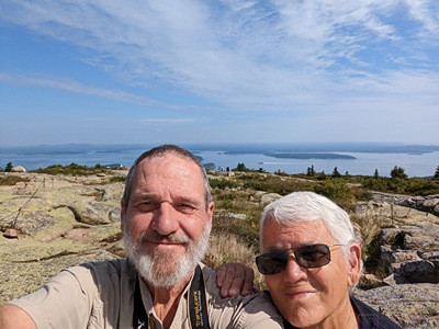
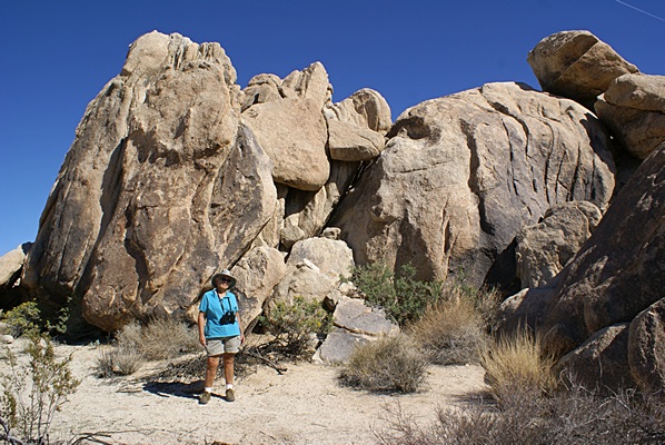
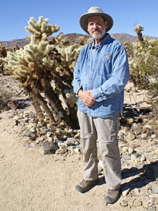
The requisite “we were here” selfie from the top of Cadillac Mountain, Acadia National Park, Maine.  We are looking south.

We had only visited Acadia NP once before, almost 20 years ago, and did not recall it being this crowded.  (A local supervisor for the Island Explorer bus system told us later that it has only become overwhelmingly crowded since about 2017.)  Our recollection was that we just drove up Cadillac Mountain when we wanted to, and had no difficulty finding places to park at the attractions, such as Sand Beach and Thunder Hole.  (The operation of the National Parks is a delicate balance between protection/preservation and access/recreation, and the massive number of people now seeking to visit the larger and more famous parks has become a real challenge for park managers.  It looked to us like Acadia NP was doing a good job, but I wouldn’t be surprised if they ultimately have to institute a reservation system just for park entry.)

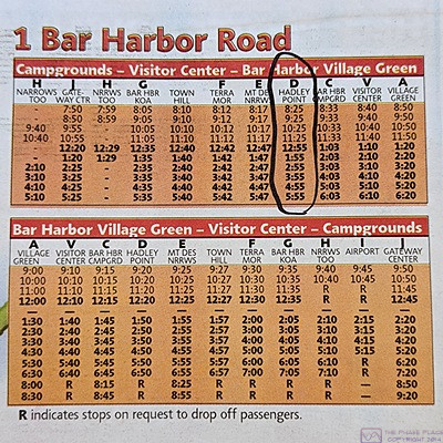
The time table for the Island Explorer #1 Bar Harbor Road bus.  The top table is for when the bus is in-bound to Bar Harbor.  The bottom table is for when the bus is out-bound.  Column D (circled in the top table) is our campground.  It was a fabulous system and we planned to use it on Wednesday to re-visit the National Park.

We were going to stop at the Hulls Cove Visitors Center on the way out of the park, but the parking lot was still packed.  Part of the reason it was full is that visitors doing serious bicycling through the Park, park here and start their rides from here.

Back at camp we had Fritos and roasted red-pepper hummus for lunch, and each had 1/2 of a pear.

One of the things we learned about upon arrival yesterday was the Island Explorer transit bus system.  The service began in 2002, and has received massive support from L. L. Bean since the beginning.  It is free to use, and has 12 bus routes linking Bar Harbor with hotels, inns, and campgrounds, destinations in Acadia NP (including campgrounds) and neighboring village centers.  The buses currently in use run on propane, which burns much cleaner that petroleum fuels.

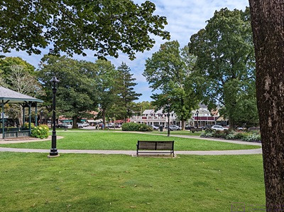
This green space is near the center point of Main Street in Bar Harbor, Maine and offered a nice place to sit on a park bench in the shade.  It also served as the main terminal for the Island Explorer bus system.  Given how crowded Main Street was, the Village Green was only lightly used.

Our campground was one of the scheduled stops, so we caught the 2:55 PM pick-up and rode the bus to the Village Green in Bar Harbor.  I like to ride on buses.  I don’t mind driving (we’ve put over 7,300 miles on the truck this trip), but I don’t like parking in cities, especially tourist towns like Bar Harbor.  The Village Green was a grass square with trees and crisscrossing paths.  One whole side, and part of a second side, served as the central “terminal” for the bus system (routes 1, 2, 3, 6, 7, & 10).  The other main “hub” was the Hulls Cove Visitor Center (routes 1, 4, & 5) and the Southwest Harbor / Tremont area, which had a dedicated bus (route #11).  (Take the #7 Southwest Harbor bus to get there.)  (Route #8 is the Schoodic Woods area of the park.  I was unable to find any information about route #12.)

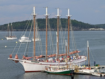
The S/V Margaret Todd coming into Bar Harbor with the sails down.  She’s a 4-masted schooner that is 151 ft long (overall) with a 23 ft beam, and displacement of 150 tons.  She drafts 5’9” with the centerboards up, and 12 ft with them down.  She flies seven sails—a main on each of the masts and three foresails (jibs and genoas)—with a sail area of 4,800 sq. ft.

We arrived at the Village Green around 3:20 PM, and walked the main commercial street for about 90 minutes.  It’s a quaint place, in a touristy sort of way, and we enjoyed strolling through town and down to the harbor.  As it was Monday, some of the shops and eateries were closed, but most were open and had customers.  Indeed, there were a lot of people in downtown Bar Harbor this afternoon.  Some of them were almost certainly passengers from the two cruise ships anchored out in Frenchman Bay.  The larger one was the Celebrity Summit (1950 passengers) and the smaller one was the Regent Seven Seas Navigator (490 passengers).  But even without cruise ships, there are a LOT of hotels, inns, cottages, B&Bs, and campgrounds in and around Bar Harbor, and the rest of Mount Dessert Island, and Bar Harbor is the place that many visitors, like us, gravitate to at some point.

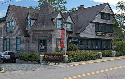
The Abbe Museum in Bar Harbor, Maine.  There were many old buildings in town, but I took this photo because I thought the building was interesting and there weren’t cars and people in front of it.  (There was a very modern addition on the back, not shown in this photo.)  We did not have time to go in, but I looked it up later.  From the museum’s website:
“In recent years, the Abbe has grown from a small trailside museum, privately operated within Acadia National Park, to an exciting contemporary museum in the heart of downtown Bar Harbor. In 2013, the Museum became the first and only Smithsonian Affiliate in the state of Maine. 
At the Abbe’s downtown museum, visitors find dynamic and stimulating exhibitions and activities interspersed with spaces for quiet reflection. The history and cultures of the Native people in Maine, the Wabanaki, are showcased through changing exhibitions, special events, teacher workshops, archaeology field schools, and workshops for children and adults. From spring through fall, the Abbe’s historic trailside museum at Sieur de Monts Spring continues to offer visitors a step back in time to early 20th century presentations of Native American archaeology in Maine.”


While walking, I spotted a pillow in the display window of My Darling Maine with embroidered Puffins on it.  Linda really liked it, so she bought it.  They put it in a protective plastic bag and set it aside for us to pick up later on our way back to the bus.  At the Espresso shop across the street from the pillow place, Linda got an iced coffee.  I wanted something like a Frappuccino, but none of the coffee shops in town had anything like that.


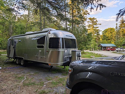
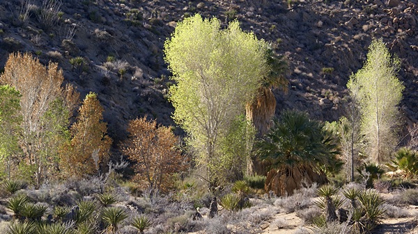
Our trailer in site 21/22 at Hadley’s Point Campground.  This view conceals the uneven and unlevel reality of the site.  It also gives the appearance that fall might be under way, but that is a trick of the light.  We did see the beginning of color in the trees and bushes around Mount Dessert Island, but the color palette here was still overwhelmingly green.


When we had walked all we cared to, we found a shaded bench in the Village Green and watched the world go buy while we waited for the 5:30 PM pick-up of the #1 Bar Harbor Road bus.  We had the same seats going back, with the same couple seated just in front of us.  Small world.


We were back at our trailer by 6 PM and Linda started working on dinner right away.  We started with a nice green salad with peanuts, vegan blue cheese, and raspberry vinegarette dressing.  The main course was  organic Lumaca Rigata pasta (from Napoli, Italy) with arrabbiata sauce and mushrooms sauteed with dried shallot flakes (we forgot buy onions yesterday).  The arrabbiata sauce had a bit of kick, which we both liked.

The rest of the evening was the usual reading, games, puzzles, photo processing, and writing.

2016/03/03 (R) Edison Ford Estates

Our plan for today was to visit two places in southwest Florida that we had not gotten to yet; the Edison Ford Estates in Fort Myers, and Sanibel/Captiva Islands.  As usual when we plan to leave early and be away from the coach for the day we did not make coffee or eat breakfast.  Linda walked down to Mara’s motorhome to tend to her cats while I took care of ours.  I then loaded the camera gear and a few other things in the car and drove down to Mara’s rig to pick up Linda.  We stopped at the local Bank of America ATM and then at Dunkin Donuts for coffee and a bagel for Linda.  (I had my vegan apricot bearclaw pastries from Publix.)  Suitably provisioned we headed down FL-31 to Fort Myers.

Linda stands by one of the many magnificent trees at the Thomas Edison and Henry Ford Estates.  Fort Myers, FL.

Linda stands by one of the many magnificent trees at the Thomas Edison and Henry Ford Estates. Fort Myers, FL.

The southern terminus of FL-31 is at FL-80.  From there it was about five miles (west) to the city limit of Ft. Myers.  We continued on FL-80 through downtown, which is an attractive and very upscale part of the city, to where it ends and turns into McGregor Boulevard.  Shortly after turning onto McGregor we pulled into the parking lot for the Edison Ford Estates complex at 9:30 AM.

The Edison & Ford Estates abound in botanical delights.  Fort Myers, FL.

The Edison & Ford Estates abound in botanical delights. Fort Myers, FL.

The Edison Ford Estates is a historical complex that preserves the winter estates of Thomas Alva Edison and Henry Ford on the east bank of the Caloosahatchee River in Fort Myers, Florida.  The Edison estate was named Seminole and the adjacent Ford Estate was named The Mangoes.  There are two identical houses on the Edison Estate and a more modest house on the Ford Estate.  Other buildings and structures include caretaker quarters, garages, a small office for Edison, a swimming pool, a cistern and water system, gardens, and lots of exotic trees.  When it was originally developed the Edison Estate included a pier that extended 1,500 feet out into the Caloosahatchee River.  It had trains and transport cars and was initially used to bring in all of the materials to build and landscape the Estate as these had to get to the site by ship.

Both men were workaholics and although they only used these estates for a few weeks in the winter they worked as well as socialized while here.  Indeed, Edison had a lab on the property where extensive work was done on trying to find a plant source of latex, the key material needed to make rubber, which could be quickly and easily grown in the U.S.  Edison and Ford, along with Harvey Firestone, formed a biological research company to finance this research, and presumably profit from any positive outcome.  Some 17,000 plants were tested and the one that emerged as most viable was Goldenrod.  Ford and Edison had almost 1,300 patents between them, and Edison is still the only person to have been awarded at least one U.S. patent every year for 65 contiguous years.  His greatest invention, however, could not be patented; the modern research and development laboratory.

Bruce poses by one of the large trees at the Edison Ford Estates.  Linda used this image for one of the weekly postcards she made and had sent to grand-daughter Madeline.  Fort Myers, FL.

Bruce poses by one of the large trees at the Edison Ford Estates. Linda used this image for one of the weekly postcards she made and had sent to grand-daughter Madeline. Fort Myers, FL.

We wrapped up our visit to the Edison and Ford winter estates at 2 PM and headed on down McGregor Boulevard, the boulevard of Royal Palms, towards Sanibel Island.  Our initial destination on the island was an organic vegan cafe named Sanibel Sprouts.  We did not have any trouble getting onto the island or getting to the restaurant but the traffic backed up to exit the island reminded us of our recent experience in the Florida Keys and was more than a bit concerning.

For lunch we split the Mexican salad.  The salad used a base of arugula, a dark leafy green with its own unique, slightly peppery taste that was very well suited to the dish.  A vegan “taco meat” mixed with ground walnuts added depth and texture, and a dressing with cumin tied it all together.  We then split an order of waffles which consisted of two waffles topped with strawberries and bananas and served with real maple syrup.  Both dishes were excellent and I asked the cook how the waffles were made.  She indicated that they used the King Arthur brand gluten-free general purpose baking flour (rice flour based), Earth Balance soy-based vegan butter substitute (5 scoops), almond milk, and vanilla flavored Stevia sweetener.  They were fluffy, light, crispy on the outside, and very tasty.  Yum.

The two Edison winter homes are mirror images of each other and joined by a covered walkway.  Edison Ford Estates, Fort Myers, FL.

The two Edison winter homes are mirror images of each other and joined by a covered walkway. Edison Ford Estates, Fort Myers, FL.

After lunch we continued deeper into Sanibel Island.  We saw a sign for the J. N. “Ding” Darling National Wildlife Refuge Visitor Center and pulled in.  There was a one-way road through a section of the Refuge but it was a “U. S. Fee Area” ($6 per car).  We checked to see if Linda’s Golden Access Pass was valid for entry.  It was, so we went in.  Although the skies had become overcast the drive through the Refuge was an unplanned event and an unanticipated treat.  We got see a variety of birds but the highlight included two different opportunities to see White Pelicans, one of which also included Roseate Spoonbills and other birds.  White Pelicans are the second largest bird in the continental U. S. (Behind the California Condor) with a wingspan of nine (9) feet.  We also saw a couple of alligators which surprised us as the water here is connected to the Gulf of Mexico.  Indeed, the tide was coming in while we were there.

The Edison-Ford-Firestone partnership maintained an active, working laboratory on the Fort Myers estate that had year-round staff.  Edison and Ford only spent a few weeks each year at their winter homes, but worked whenever they were here.  Fort Myers, FL.

The Edison-Ford-Firestone partnership maintained an active, working laboratory on the Fort Myers estate that had year-round staff. Edison and Ford only spent a few weeks each year at their winter homes, but worked whenever they were here. Fort Myers, FL.

From the end of the drive through the NWR we continued on to the north end of Sanibel Island and drove over the short bridge to Captiva Island.  We drove to the end of the road, turned around, and drove back.  There is a lot of “island commerce” on Sanibel Island.  Captiva Island, by comparison, is mostly residential, vacation rental, and resort properties.  Many of the homes were massive, elaborately landscaped costal properties.  I estimated that houses of 3,000 to 4,000 square feet were common, 5,000 to 6,000 square feet were numerous, and some of them had to be 10,000 to 15,000 square feet.  We tend to think of the really expensive real estate in Florida being in places like Naples, Marco Island, Miami Beach, and West Palm Beach, but it’s hard to imagine that any of them are more expensive than the island mansions we saw on Captiva Island.

Rare White Pelicans at the J. N. “Ding Darling” National Wildlife Refuge & Bird Sanctuary on Sanibel Island in Florida.  The White Pelicans are the second largest birds in North America, and the largest members of the pelican family.  This photograph does not do justice to their size, which includes a nine foot wingspan.  The pink birds (lower right) are Roseate Spoonbills.

Rare White Pelicans at the J. N. “Ding Darling” National Wildlife Refuge & Bird Sanctuary on Sanibel Island in Florida. The White Pelicans are the second largest birds in North America, and the largest members of the pelican family. This photograph does not do justice to their size, which includes a nine foot wingspan. The pink birds (lower right) are Roseate Spoonbills.

The drive back down Captiva and Sanibel was smooth and flowed right along as far as the restaurant.  At that point we encountered the traffic backup we had seen coming in.  Traffic was not moving at all and people were pulling out of line and turning around.  Our map showed that there was an alternate way to get back to the causeway.  We suspected that the turn-arounds were locals who were headed that way so we decided to do that as well.  The traffic could not be worse and we would get to see a different part of the island.

That proved to be the case and we were only in a stop-and-go back up for about 10 minutes instead of the one-to-two hours I figured it would take if we stayed on Periwinkle Way.  We were off the island by 6:45 PM and headed back to the mainland on FL-867.  Fairly quickly we were on FL-865 headed more easterly but on a faster road.  We eventually got to US-41 (the Tamiami Trail) and headed north.  Not too far along I spotted a Panera and we stopped to get coffee.  We continued north as far as Colonial where we headed east to I-75.  From there it was five miles north to FL-80, three miles east to FL-31, and 36 miles north to our RV resort in Arcadia.

An alligator just shows its head (left center).  J. N. “Ding Darling” National Wildlife Refuge & Bird Sanctuary, Sanibel Island, FL

An alligator just shows its head (left center). J. N. “Ding Darling” National Wildlife Refuge & Bird Sanctuary, Sanibel Island, FL

We got back to our coach at 8:10 PM.  Linda grabbed a flashlight and the keys for Mara’s rig and walked down to take care of her cats.  I unloaded the car and then took care of our cats.  I planned to check my e-mail and then settle in to watch our usual Thursday evening TV programs, but my computer and the scheduled programs altered my plan.

This Ibis was a little farther behind this alligator than the photos makes it appear, but not that much.  Being behind an alligator is not necessarily any safer than being in front of one.  J. N. “Ding Darling” National Wildlife Refuge & Bird Sanctuary, Sanibel Island, FL.

This Ibis was a little farther behind this alligator than the photos makes it appear, but not that much. Being behind an alligator is not necessarily any safer than being in front of one. J. N. “Ding Darling” National Wildlife Refuge & Bird Sanctuary, Sanibel Island, FL.

Our e-mail servers were not responding so I shut down my computer and all of our network/comm equipment and restarted everything in a specific order.  Disaster!  My computer would not log in and claimed to have missing authentication components.  This is the second time my ASUS laptop has crapped out since I upgraded it to Windows 10, and I was pretty unhappy about it.  At this point I do not have any confidence its stability, especially its update process, and think it was clearly not ready for release.  Unfortunately not upgrading really wasn’t an option.

I watched Charlie Rose on PBS followed by Tavis Smiley and a program on Black artists.  That was followed by This Old House and Ask TOH.  I think I restarted my computer several times before it finally “healed” itself and allowed me to log in.  With all of those TV programs as background I finished most of this post, off-loaded photos, and backed them up to the NAS.  I tried my e-mail again and was finally able to access it.  It was 2 AM when I finally went to bed, which had not been my plan when I got up this morning.


2016/02/12-15 (F–M) Everglades Update

2016/02/12 (F) Full Circle

We got up, showered, got dressed, and went down to breakfast around 8 AM.  We were packed, checked out, and had the car loaded by 9 AM.  We headed north on the Ronald Reagan Turnpike, exited at some miles later, and headed west.  FL-94 ended at FL-997 where we headed north.  In looking at a map later, we would probably have been better off to get on FL-997 right from the hotel.  There was major road construction on FL-997 all the way to US-41, but traffic moved along at the 50 MPH posted speed limit.

At US-41 we headed west.  This is Miccosukee Indian territory, as indicated by the Miccosukee Resort and Gaming facility (Casino) at the NW corner of Fl-997 and US-41.  A short way to the west this stretch of US-41 (the Tamiami Highway between Tampa and Miami) is bordered by Everglades National Park on the south and the Francis S. Taylor Wildlife Management Area on the north.  It eventually leaves both of these and runs through the heart of the Big Cypress National Preserve.

We pulled in to the ENP entrance for the Shark Valley Visitor Center and immediately and got stuck in the line of cars waiting to get in.  The parking lot had filled a few cars ahead of us and it was now a one car out, one car in situation.

Once we were in we checked out the tram ride to the Shark Valley Observatory Tower seven miles one way due south into the Everglades.  It was a two (2) hour narrated round-trip and cost $24 per person ($19 for seniors).  You can hike or bike out to the tower for free (after gaining admission to the NP).  We did not have that much time so we walked part way down the road along an open channel of water about 15 feet wide and found lots of wildlife photo opportunities, including birds, a large turtle, and alligators.  The most interesting thing we saw was a cluster of at least a dozen young alligators, ranging from one to two feet in length, piled up on top of one another.

A little farther west we left US-41 and drove a small 2-lane road for 38 miles.  The first half was paved and the second half was good gravel.  It was a lovely, slow drive with a maximum speed limit of 30 MPH and a few nature photo opportunities along the way.

A Black Vulture near the Shark Valley Visitor Center, Everglades NP, FL.

A Black Vulture near the Shark Valley Visitor Center, Everglades NP, FL.

After rejoining US-41 we continued west through the Big Cypress National Preserve as far as FL-29 with Everglades NP once again on our left.  We then headed south through Everglades City and re-entered the park.  The Gulf Coast Visitor Center was very small and did not have the ENP shirts we had seen at the Flamingo Visitor Center and were now hoping to buy.  The vendor operated gift store did not have them either.  The only things you can do from this point in the park are explore the NW coastal portions by canoe, kayak, or pontoon boat.  We did not have time for any of that on this quick visit so we pulled up the address for our RV park in the GPS unit and pushed on.

We had a better look at Everglades City on the way out of town and decided that it was an interesting looking little place.  A traveling carnival of some considerable size was setting up in the middle of town, literally.

Back at US-41 we continued west as we were still somewhat east of the north-south line through Arcadia.  The only other route home from here would take us north on FL-29 and then back east on I-75 and eventually back through LaBelle and up the west side of Lake Okeechobee.  That would be a much longer trip and it was already starting to feel like it had been a long day.

We left US-41 at Collier Blvd. and traveled north about seven miles to I-75 north.  Traffic was heavy, congested, and stop-n-go initially but eventually freed up.  We traveled about 39 miles to exit 141 at Ft. Myers and headed east a few miles to FL-31.  Our final 38 miles were straight north to Arcadia where FL-31 ends at FL-70 just west of our RV resort.

From the Shell station in Arcadia on Tuesday morning to our coach at 5:45 PM today we put 919.4 miles on the car’s trip odometer.  The speedometer on the car reads slightly high, probably because the tires are not factory original specifications, so our actual mileage may have been slightly less by about one mile for every 60 miles traveled.  That would be approximately 15 miles for our trip, making the actual mileage perhaps 905 for the four days, for an average of 225 to 230 miles per day.  That’s a lot of driving, but the purpose of our trip was to get a first glimpse at a lot of south Florida that we had not seen before.

We brought a few things in from the car, spent some time with our cats, and then visited with Ron and Vera (who did not even realize we were gone), before walking over to Mara’ rig for dinner.  Mara made a pot of vegan chili and a wonderful salad which we enjoyed with a glass of her favorite Malbec.  We talked about our trip, how the kitties did in our absence, and discussed the logistics of Michael’s upcoming visit.  We returned to our coach around 9:15 PM, finished unloading the car, unpacked a few things, adored our cats, and relaxed with our iPads for an hour before going to bed.

2016/02/13 (S) Yard Sale

I was up at 7:30 AM, partially prepped the coffee, and then unpacked clothes and hung them up or put them in the laundry hamper.  Linda got up sometime after, after which I ground the coffee beans and finished making our morning coffee.

We noticed last night that a few folks had things sitting out in their front yards suggestive of a garage sale.  This morning there was quite a bit of commotion outside and we noticed several yards just from our rig with lots of stuff sitting out on tables and/or the ground.  Clearly Big Tree Carefree RV Resort was having an official yard sale event today.

We had granola for breakfast and then strolled through the resort.  Based on one comment we overheard we got the impression that the yard sale might have started yesterday but there was still lots of stuff available.  We are not yard sale people, as a rule, and our real destination was the laundry room.  Most of the parking spaces were taken but the room was empty and none of the machines were in use.  We walked back to our coach, loaded our laundry, computers, and iPads in the car, and drove over to the laundry room.

I got the laundry into a washing machine while Linda got her computer going and connected to the park Wi-Fi system.  I then started my computer and got online.  Her computer screen came up dark.  It has done this many times in the past, but not recently.  We think it may be related to the battery, but we are not sure.

Our main reason for bringing our computers over was to download our e-mails from the last four days.  BCM, in particular, has a habit of sending me large files as e-mail attachments or links to large files in a Dropbox, which I prefer.  I had at least 118 e-mails but no large attachments.  I did not get a count from Linda.  Both of our computers are also set up to automatically sync our Dropbox account, and one of the things it does is automatically backup four WordPress websites.  We only had 2.5 GB of data left on our Verizon account to get us through February 19th, so we wanted to transfer as much data as possible via the park Wi-Fi system.

Once the laundry was dry, folded, and hung, we returned to our coach where Linda put on her swimsuit and then joined Mara at the pool.  After putting the clean clothes away I rebooted and reconnected our computers and iPads to our local network and turned on the NAS.  Once everything was up and running I connected the camera and off-loaded all of the photos from the last four days; just over 400 total.  I got a bite to eat and then put on my swimsuit, gathered up my towel and a pair of dry shorts, and went over to the pool to join the ladies.

BP20160212_01732_400x300

A Purple Gallinule near the Shark Valley Visitors Center, Everglades NP, FL.

When I arrived Linda and Mara were sunbathing.  The pool was cool even though it is heated but once I was in and swimming gently I generated enough heat from muscle activity to be comfortable.  I swam for about 1/2 hour and then sat in the hot tub with the whirlpool turned on and positioned myself to vigorously message my lower back.  Linda had taken the soap when she went so I took that along with my towel and shorts and used to shower to rinse off the chlorine and get cleaned up.  I returned the soap to Linda and walked back to our coach.

I doodled on my iPad while Linda read a book when she returned to the coach.  She left at 4 PM to walk to the grocery store with Mara while I laid down on the sofa to take a nap and Jasper curled up next to me.  I was aware of Linda’s return, gradually woke up, and finally got up.

Linda invited Mara to come for dinner.  While she busied herself with the preparations, I went through all of the photos from our trip to Everglades National Park and Key West and backed them up to our NAS.

While I was looking at photos ESET Smart Security kept popping up messages letting me know that it needed my attention.  I opened it and it presented me with a loooong list of critical and recommended updates.  Given our data situation this month I deferred those until I can take my computer back to the office/laundry/activity building and use the resort Wi-Fi system.

For dinner Linda made a nice green salad and a “pasta” dish using an edamame and mung bean fettuccine style noodle.  Mara came to our coach around 6:45 PM and brought a vegan chocolate mousse for dessert.  It was based on blended avocados and it was a delicious finale to a scrumptious meal.  There was a nice orange glow in the western sky but it was too dark by then to eat outside.  It was also getting chilly following sunset so we ate inside and polished off a bottle of Barefoot Pinot Grigio between the three of us.

Mara left a little before 9 PM and we turned on the TV to see if anything interesting was on.  One of the PBS stations was showing a three part drama titled Arthur & George based on a true life event in the life of Sir Arthur Conan Doyle and starting Martin Clunes (Doc Martin) as Doyle.  Linda went to bed part way through the third episode but I stayed up to watch it as it was very well done.  I flipped channels for a while after that but nothing else held my attention and I finally went to bed sometime after midnight.

2016/02/14 (N) Valentine’s Day

We were still tired from out whirlwind trip to south Florida and slept in this morning.  When we finally got up Linda made pancakes for breakfast, this being Sunday and all.

It’s a good thing we have our 2 GB of bonus data for the next couple of billing cycles.  Between the Windows 10 upgrade on two computers (most of which we did using the RV resort Wi-Fi), the upgrades to the iOS on both iPads, the inevitable updates to applications on all four devices, and quite a bit of work on BCM articles as well as our personal website/blog, we have had to monitor/manage our data usage very carefully for the January 20 through February 19 billing cycle.  Even with being gone for four days to the Everglades and Keys, and taking our devices to the activity building to use the Wi-Fi, we will be very close to our limit by this Friday, which is the 19th.

There are at least eight alligators in this image and several more outside the frame.  Shark Valley Visitors Center, Everglades NP, FL.

There are at least eight alligators in this image and several more outside the frame. Shark Valley Visitors Center, Everglades NP, FL.

My computer was indicating that I had 22 updates available which meant that Linda’s computer probably had a similar number.  One of them was a Windows 10 cumulative update which I knew would be large so I took both computers to the library and did the updates there.  I then spent part of the day processing and backing up photos before turning my attention to blog posts.  Even with our data situation I uploaded several from mid-October and prepared several more.

We had a relatively easy day otherwise and I did not record all of the details which are now mostly lost to me.  Brenda Phelan called around 5:15 PM to let me know our tire and windshield covers were ready but she and Bill were headed out for a couple of days on windshield cover appointments.  They would be back on Wednesday and we deferred dealing with delivery until then.

For dinner Linda made a mushroom bourginione with macaroni.  She used a Lindeman’s 2014 Shiraz to make it and we also drank some before/with our meal.  She bought a pint of Soy Delicious Cookie Dough non-dairy “ice cream” the other day and we had that for dessert.  After dinner we settled in to watch our Sunday evening TV programs, including Downton Abby.

2016/02/15 (M) Ready, Set, No

We had our usual morning of coffee, juice, and granola for breakfast.  Our fresh water tank had dropped below the 1/3 level yesterday or the day before.  The monitor only indicates Empty, 1/3, 2/3, and Full so once it drops below 1/3rd I have to check it visually.  Fortunately the tank is translucent polyethylene and is located behind a door such that I can see the water level when the lighting is right.  Given how we are parked, facing southwest, the light is best in the morning as access to the tank is from the driver side of the bay.

The tank was down to the 1/8th level, which is about 15 gallons.  We might have gotten one more day’s use but there was no reason to run the tank dry and the pump works better with a full tank.  I dumped both waste tanks and refilled the fresh water tank.  I checked the hardness of the water coming out of the softener after the tank was full and it was indicating somewhere between 0 and 1.5 gpg.  I updated my Excel spreadsheet accordingly.

An Anhinga that just caught something to eat.  Shark Valley Visitors Center, Everglades NP, FL.

An Anhinga that just caught something to eat. Shark Valley Visitors Center, Everglades NP, FL.

Linda had work to do today on family tax returns and set up her computer on the temporary dining table while I continued to work at my computer on the desk.  I selected and processed a couple of photos from our visit to Everglades National Park for Linda’s weekly postcard to Madeline.  I then selected and processed photos to include in the blog posts for the dates of our visit to the Everglades and Keys.

Brenda Phelan had also sent us an e-mail yesterday regarding our tire covers.  I replied to that and indicated that we might pick them up on Wednesday when she and Bill are back at their shop in Lakeland.  With that done I started preparing for a 3:30 PM telecom meeting of the FMCA National Education Committee.  I printed off six documents:  meeting notice, agenda/notes, short survey results and sampling information, and the long survey results and sampling information.  All told it was 55 sheets of paper, but I wanted/needed to see the survey results printed out.

At 3:29 I dialed in and was the first caller, which I though was odd.  I doubled checked the meeting notice and realized the meeting was Wednesday the 17th.  I knew that, but historically we have always met on Monday afternoons and I just had it in my head that we were meeting today.  The upside us that I have more time to digest the data and think about how I want to handle the fact that the sample/response was too small (in my expert opinion) for the results to be considered representative of the FMCA population.

We had leftovers for dinner, after which we settled in to watch the X-Files and Lucifer on FOX as our usual Monday evening programs on CBS were preempted by the Grammy Awards, which did not interest us.  At 10 PM we switched to PBS and watched a documentary on Stephen Hawking, followed Charlie Rose.  Rose’s show was focused on Supreme Court Justice Antonin Scilia, who passed away over the weekend.


2016/02/10 (W) Everglades NP, FL

An American Crocodile at Flamingo, Everglades NP, FL.  The Everglades is the only place in the U. S. where you can see both alligators and crocodiles in the wild.

An American Crocodile at Flamingo, Everglades NP, FL. The Everglades is the only place in the U. S. where you can see both alligators and crocodiles in the wild.

We were up at 7 AM and took long, hot showers; a real luxury for folks currently living in a motorhome.  We had breakfast in the hotel as it was included in the price of the room.  We then headed back to Everglades National Park.  We wanted to spend the early part of the day deeper in the par so we drove straight through to Flamingo.


It was a little warmer and sunnier today, which would be nice for going on the Backcountry Tour.  We thought we would take the 11 AM boat until we found out that it’s a one hour and forty-five minute excursion with no access to a restroom.  That was, unfortunately, a non-starter for me.  We were both disappointed, as the only way to really see the Everglades is by boat or air.  Driving, biking, and hiking is very limited.


An Osprey surveys its territory near the Flamingo Visitor Center.  Everglades NP, FL.

An Osprey surveys its territory near the Flamingo Visitor Center. Everglades NP, FL.

Our trip to the Flamingo service center area was not wasted.  I photographed a pair of Osprey in a nest on the communications tower atop the Flamingo Visitor Center and photographed two adult birds in another Osprey nest in a tree by the marina.  We joined a walking tour led by a Park Ranger.  Just in the area near the visitor center we saw manatees in the marina, an American Crocodile by the canal, and lots of birds, especially Pelicans and gulls.  I took lots of pictures.


This large alligator was at Nine Mile Pond in Everglades NP, FL.  I estimated it to be 12 feet long.  It had its eyes open but was very still.  The kayakers in the back are at least 30 feet away.

This large alligator was at Nine Mile Pond in Everglades NP, FL. I estimated it to be 12 feet long. It had its eyes open but was very still. The kayakers in the back are at least 30 feet away.


Eventually we left Flamingo and started working our way back towards the park entrance, stopping at several places along the way to walk some of the available boardwalks and trails.  At Nine Mile Pond we spent quite a while observing and photographing a very large alligator.  Presumably a bull (male) I estimated his length at 12 feet.  These large adults weight approximately 100 pounds per foot, so I estimated his weight at 1,100 pounds.  I took lots of photos.


There is flora everywhere in the Everglades, but these palms have beautiful patterns when the light is right.  Everglades NP, FL.

There is flora everywhere in the Everglades, but these palms have beautiful patterns when the light is right. Everglades NP, FL.

We also stopped at Mahogany Hammock and hiked the trail and close to the park entrance we revisited the Royal Palm area and ventured part way out on the Anhinga Trail.  It was late afternoon and the sun was low enough to give us some nice color, the first we have had for the last two days.  I took a few landscape photos and then Linda spotted a turtle so I concentrated on it for a while.

I noticed the water lily pads moving and caught a glimpse of what looked like a large fish.  The Lilly pad disturbance was moving and something was clearly underwater causing it.  I was standing there watching the Lilly pads move when an alligator surfaced, revealing its head from behind its eyes to the tip of its snout.  It stayed there quite a while and I took pictures while a small crowd gathered.  It remained motionless except for its right eye, which was wide open and studying us carefully.  It eventually moved over by the boardwalk and we were able to look straight down at it through clear water that allowed us to see its entire length clearly.  It finally swam under the boardwalk and did not reappear.


Much of the Everglades is what appears to be grassland but is actually wet.  These “water prairies” are broken up by areas of slightly higher ground that support trees and bushes.  The highest point on the main road that goes to the Flamingo area is four (4) above mean sea level, and I seem to recall that it is the highest natural point in the whole national park.  Everglades NP, FL.

Much of the Everglades is what appears to be grassland but is actually wet. This vast “water prairie” is broken up by areas of slightly higher ground that support trees and bushes. The highest point on the main road that goes to the Flamingo area is four (4) above mean sea level, and I seem to recall that it is the highest natural point in the whole national park. Everglades NP, FL.

By this time the light was fading and the temperature had cooled to 60 degrees F.   We returned to our car and put the address of the Panera near our hotel in the GPS navigation system.  We headed there directly, only stopping at the park entrance to photograph the park boundary sign.


This alligator surfaced about eight feet from the edge of the Anhinga Trail.  The length of an alligator, in feet, is roughly equal to the number of inches from its eyes to its nostrils, something you want to estimate rather than try to measure.  Everglades NP, FL.

This alligator surfaced about eight feet from the edge of the Anhinga Trail. The length of an alligator, in feet, is roughly equal to the number of inches from its eyes to its nostrils, something you want to estimate rather than try to measure. Everglades NP, FL.

At Panera we had vegetable soup and the new couscous salad.  Linda had done all of the driving today but I drove us back to the hotel after dinner.  We settled in for the evening and watched Nature and Nova on PBS before going to sleep.


2015/04/10 (F) Bandolier Natl Mon and Santa Fe NM

[Note: Photos from today are in an image gallery at the end of the post.]

Our sleep last night was interrupted by the receipt of e-mails on our phones (and iPads) informing us that our house had lost utility power and our whole house generator had started and was running.  As we learned later from studying the event log (using our Kohler OnCue software) the power had flickered several times, causing the genset to start and then stop, until the power finally failed (or was disconnected by the utility company) and stayed off, causing the genset to start (and stay on) and the transfer switch to shift the house from the utility lines to the genset until the utility power was eventually/finally restored.  This, of course, is exactly what the generator and transfer switch are designed to do and the reason we have them installed.

We got up around 7 AM, left around 7:45 AM, and were kept abreast of the generator’s status as we drove.  We headed east on I-40 as far as Moriarty and then headed north on NM-41 towards Santa Fe.  Just before reaching the southern edge of the greater Santa Fe area NM-41 merged into US-285 north.  We continued on US-285 well north of Santa Fe and then headed west on NM-502 towards Los Alamos, and the Los Alamos National Laboratory (LANL), before turning south on NM-4 towards Bandolier National Monument (BNM).

I visited BNM 26 years ago with our son but this was Linda’s first visit.  BNM is remote but my recollection was that it was worth the drive and that proved to be the case.  We had a couple of “conversations” with a female ranger (?) at the visitor center who had a rather annoying superior attitude, the first time in my 63 years that I have had a less that wonderful encounter with someone from the NPS, but we were there to see ruins and managed to get the information we were seeking.

LANL, the home of the atomic bomb and still the center for nuclear research in the U.S.A., is actually spread out over a vast, remote region northwest of Santa Fe.  We saw a sign for a museum which we presume was in the town of Los Alamos, but did not check it out.  Museums take a lot of time to see and usually involve an admission fee, which is all the more reason to spend the necessary time to tour them properly.

Albuquerque and Santa Fe have a least a dozen fabulous museums between them, maybe each, and we would need to spend 3 – 4 weeks camped somewhere between the two cities, or two weeks in one and two weeks in the other, to visit most of them and not be exhausted by the time we were done.  We are actually making our way towards home and only spending a few days in the area to get a sense of the place and visit a few places.  Full- and extended-time RVing are NOT full- or extended-time vacationing.  If we approached what we are doing with the attitude that we had to see everything everywhere we went, and do so in the limited amount of time available, we would quickly be broke and exhausted.  We plan to be back this way in the future and will have a better idea of what we want to see and do when we return.

We left BNM and returned to Santa Fe by reversing our route.  We navigated to Old Town and found ourselves in heavy traffic on narrow streets looking for a place to park.  Our tour guide map of the area showed public parking but we drove past those locations without seeing the referenced space.  We did see several parking garages, but I had the ham radio antenna on the roof of the car and could not pull in.  We finally spotted a parking space along a small park area at the northeast corner of Old Town and parked there at no charge.  Almost all of the parking in Santa Fe involves parking meters or pay lots but we did not have any change with us, so if we had not spotted this parking space we would not have stopped to see Old Town.

We were glad, however, to find this parking spot as it was a short walk to Old Town which is a fairly compact/dense area.  Our first stop was the Loretto Chapel with its famous spiral staircase.  The staircase is a 23 foot high double helix that makes two 360 degree twists from the floor to the choir loft.  It does not have a center column and was originally supported only at the top and bottom, although several “supports” have been added to stabilize it against the vibrations of modern vehicular traffic.  The choir loft was originally accessed by ladders but when the church became the chapel for a girls’ school run by the Sisters of Loretto the ladders were not considered appropriate.

The story behind this staircase is that the Sister’s prayed a novena to St. Joseph, the patron saint of carpenters, for a staircase to the choir loft.  The chapel is small and any conventional staircase would have taken up too much space.  A carpenter appeared not long after the novena and built the staircase using only simple hand tools.  He did not give the sisters his name or ask for any compensation.  He left without any indication of where he came from or where he was headed and was never seen or heard from again.

Given the mystery of this event, some came to believe that the carpenter was St. Joseph himself.  Of more interest to architectural scholars is the engineering “mystery” of how the staircase was constructed.  It was unclear from our visit whether the carpenter worked in secrecy, but whether he did or not the Sisters apparently did not make/keep any record of the details of the work.  As originally constructed the staircase had an inside railing but no outside railing, which would certainly have lightened its visual and actual weight and made for a rather interesting climb.  (The outside railing was added many years later but does not add anything structural to the staircase.)  The treads and risers are all connected on the inside and outside edges so the staircase is a continuous spiral which is an inherently strong shape.  Indeed the double helix shape of the staircase is the same shape as strands of DNA, discovered over 100 years after its construction.  The more practical problem for me turned out to be the difficulty of photographing it as the chapel is small and dim but has very bright stained glass windows.  BTW: the chapel is now privately owned and admission is $3 per person.

From the chapel we walked back to the central plaza.  The north side of the plaza is the Palace of the Governors.  Originally built in 1610-1612 it was the seat of Spanish government in this area.  It was then the seat of Mexican government here and finally the government of the United States of America.  It has the distinction of being the oldest, and longest continuously occupied, government/public building in the U.S.A., although it now houses a history museum.  Also of interest is the covered sidewalk that runs the entire length of the building.  It was packed from one end to the other with Native Americans selling their jewelry and other craft items.  We read later that this has been going on for a very long time.  In spite of all of the art galleries, jewelry stores, and boutiques in Old Town Santa Fe I would probably buy something from one of the Native sellers if I was in the market for these kinds of items.

We were not here to shop, however, and had not had lunch so having had a look at the place we put the address for the Thai Vegan restaurant in the GPS and headed south on Cerrillos Road (NM-14) in search of dinner.  Thai Vegan was the top rated vegan restaurant in the Santa Fe area on Happy Cow.  We arrived at 4:25 PM and discovered that they were closed from 3 – 5 PM.  No problem; we just sat in the parking lot and waited.  Vegan restaurants are not (yet) common and after two fairly long, active days of sightseeing Linda was looking forward to not cooking dinner tonight.  The service was friendly and the food was OK; not the best vegan restaurant food we’ve ever had, but good enough.  They make their own vegan “ice cream” and it was very good.  I had coconut and Linda had green tea.

We were done with dinner by 6:15 PM and sunset was not until 7:30 PM so we drove home on NM-14, the Turquoise Trail, through Madrid and other small towns on the eastern foothills of the Sandia Mountains.  It was a beautiful and fun drive and we got back to our coach almost exactly 12 hours from when we left this morning.

Most of the shops in Madrid were closed but the bars and restaurants were open.  It is an old mining town that became a ghost town, got re-discovered in the 1970s, and became an artists’ colony.  Many of the old mining shacks have been reclaimed and turned into homes.  The town has a rough, funky appearance and we would like to return sometime during the day to check out the shops and galleries.  But not on this trip.  We have some long driving days ahead of us and would like to have a day to clean the coach, recharge the water softener, and relax.  For Linda that means online word games and looking at her new Vegetarian Southwest cookbook.  For me that means working on our website/blog.

.

2015/04/07-09 (T-R) North by Northwest

2015/04/07 (T) Space Nuts

Our friend and Alamogordo tour guide Bell Moore, points to her Gulf War service brick at the Alamogordo, NM Chamber of Commerce.

Our friend and Alamogordo tour guide Bell Moore, points to her Gulf War service brick at the Alamogordo, NM Chamber of Commerce.

We have always been intrigued by outer space and the human desire to go there and learn about the universe so in that sense we probably qualify as “space nuts.”  Indeed our first destination this morning, after picking up Bell at her house, was the New Mexico Space History Museum near the New Mexico State University Alamogordo campus at the northeast corner of town.

The museum sits on high ground at the base of much higher mountains and offered a commanding view of Alamogordo and the Tularosa Basin.  The white sands of White Sands National Monument were clearly visible, including airborne gypsum sand blown into the air by the strong southwesterly winds.  We examined the outside static displays which included remnants of a WWII German V-2 that was test-fired at the White Sands Proving Grounds after WWII, went off course, and crashed just southeast of the location of the present day museum.  Alamogordo was much less developed then than it is now, but it was still very lucky that it did not land in a populated area.

Admission to the museum was $6 per person (senior rate) which was a fair price.  We took the elevator to the 4th floor and then worked our way down using the ramps that connect the floors.  As you might expect, the museum places special emphasis on the role of New Mexico in the development of missile technology and space flight, in particular Holloman Air Force Base and White Sands Missile Test Range (formerly White Sands Proving Grounds).  The museum had an excellent collection of space and missile related artifacts with excellent explanatory signage.  As with most good museums it would have taken a long day, or several shorter visits, to actually read everything.

A view towards Alamogordo from the outside display area at the New Mexico Space History Museum.

A view towards Alamogordo from the outside display area at the New Mexico Space History Museum.

Even with the white gypsum sand blowing in the wind you can see great distances.  It was thus odd to contemplate that the Trinity Site, which lies some 60 miles NW of the museum, might be visible from where we were standing.  This is the place where the first nuclear bomb was exploded and the flash, followed by the mushroom cloud, must have been visible here in Alamogordo, and the sound surely must have been heard.

From the museum we headed north on US-54 towards Tularosa and stopped at the Eagle Ranch aka Heart of the Desert pistachio farm, processing facility, vineyard, and winery.  We tasted a variety of pistachios and sampled five wines.  Two of the wines appealed to us so we bought a couple of bottles of each.  We also bought several bags of the green chile pistachio nut meats.  We drove next door to check out McGinn’s Pistachio Farm and Winery and sampled more nuts, including some pecans.  We only had a few minutes so we did not buy anything and headed back to Eagle Ranch for the 1:30 PM tour.  The tour lasted 45 minutes and we gained some insight into how pistachios are pollinized, harvested, processed, and packaged.  Pistachio trees are not pollinated by bees or insects but rather by the wind.  Because of that pistachio plantations intersperse a mail (pollen producing) tree after every 8th female (nut bearing) tree.  The location of the male trees is offset in each subsequent row so the pollen as the maximum opportunity to find its way to all of the female trees.

The exhaust nozzle of a Saturn V rocket engine.  It is more than wide enough for a person to stand up in it.

The exhaust nozzle of a Saturn V rocket engine. It is more than wide enough for a person to stand up in it.

After the tour we finished the trip into Tularosa to have lunch at the Tulie Cafe.  It turned out to be closed on Tuesdays, so we headed back to Casa de Suenos.  Bell had a cheeseburger and we both had taco salads with beans instead of animal protein.  Bell enjoyed her cheeseburger and the salads were good.  The red and green salsas that came with the warm tortilla chips were excellent.

On the drive back we stopped at the Alamogordo Chamber of Commerce where there is a display recognizing all of the military personnel from the Alamogordo area who served in Desert Storm.  Each person has a brick with their name and rank at the time of their service.  Bell showed us her brick and I photographed it and took a picture of her pointing to it.  We then spent a little time in the small museum before driving Bell back to her house.  Considering that she did not know us very well when we arrived on Wednesday she was a gracious tour guide and enthusiastic ambassador for her home town.

An Army tactical missile and launcher at the New Mexico Space History Museum.

An Army tactical missile and launcher at the New Mexico Space History Museum.

Back at our coach Linda called the Route 66 RV Park in Edgewood, New Mexico to verify that they were open and had spaces available.  The answers were ‘yes’ and ‘yes’ so that is where we are headed tomorrow.  Linda checked the weather forecast and there is a high wind warning out starting tomorrow afternoon and running into the overnight hours.  In light of that information we decided we would leave first thing in the morning and try to get to our destination before the winds really kicked up.  With that in mind we went ahead and hooked up the car.  I then dumped the holding tanks and cleaned the bus windshields while Linda did a small load of laundry.

Although not fancy, Desert Paradise RV Park was an excellent place to stay and we would certainly stay here again.  It is right off the main highway, but tucked behind some commercial buildings and very quiet.  It is convenient to Alamogordo, Holloman AFB, White Sands National Monument, the White Sands Missile Test Range, and destinations in the mountains to the east that we did not visit.  The RV sites are large with easy access, the clubhouse facilities are very nice, and the Wi-Fi was the fastest and most solid we have experienced all winter.

2015/04/08 (W) Moving North and West

Today was a travel day for us which meant we skipped breakfast and coffee.  We only had a little over 220 miles to travel and would normally have targeted a 9 AM departure time.  The weather forecast, however, was for very strong and gusty winds with a high wind warning starting at noon for the area where we would be traveling.  The jet stream was responsible for the wind, having dipped far south over North America and dropped in altitude.  We got up a little after 7 AM and pulled out of our site at the Desert Paradise RV Park at 8:14 AM.

The remains of a WWII German V2 rocket that was test-fired at White Sands Proving Grounds just after the war ended.

The remains of a WWII German V2 rocket that was test-fired at White Sands Proving Grounds just after the war ended.

We took the US-54/US-70 Relief Route that bypasses most of Alamogordo just west of the city.  The drive up US-54 through Carrizozo and on to Vaughn was scenic and uneventful, even with the occasional construction zone.  We were traveling north to northeast so the winds out of the southwest were mostly on our tail and helped push us along.  It also made for a much quieter ride than usual by reducing the net wind speed at our windshields.

Around 11 AM we picked up US-60/NM-285 in Vaughn and turned west.  That is when we got the full brunt of the wind which seemed to be out of the west.  Linda checked the weather for the area and it was showing sustained winds of 34 MPH out of WSW with gust higher.  Driving the bus at 60 MPH into a 30+ MPH headwind is the same, in terms of wind resistance, as driving it 90 MPH through still air.  The bus only has so much horsepower and was not able to sustain 70 MPH into this wind, not that I wanted to go that fast anyway.  I found that both the bus and I did better if I left the transmission in 4th gear and set the cruise control at 55 MPH.  Even with that configuration it was producing more power and higher exhaust gas temperatures than it would have without the headwind.

The view to the west from the 4th floor of the New Mexico Space History Museum.  The "white sands" are visible on the horizon and blowing into the air.

The view to the west from the 4th floor of the New Mexico Space History Museum. The “white sands” are visible on the horizon and blowing into the air.

NM-285 split from US-60 in Encino and headed northwest while US-60 headed southwest.  Our northwesterly track meant we had a strong crosswind component and some headwind.  We continued to climb and the terrain became more steeply rolling hills.  I was able to travel 63 MPH through this stretch of the trip, which was fast enough, and maintain at least 55 MPH on the steeper hills by getting on the accelerator coming down to low points, staying on it up the other side, and dropping the transmission into 4th gear as the speed and RPMs started to drop.

When we reached Clines Corners and entered I-40 westbound we once again had the wind mostly in our face and I decided to run at 55 MPH in 4th gear.  These were the strongest winds of the drive and had also become very gusty which, combined with Interstate highway traffic, made this the most challenging and stressful park of the trip.

Linda poses with the world's largest pistachio.  Note the wind-blown hair.

Linda poses with the world’s largest pistachio. Note the wind-blown hair.

Most of the drive was also a gradual but steady climb which meant the engine was again usually producing more power than it does on level terrain.  We were at an elevation of 4,341 feet ASL in Alamogordo but by the middle of the drive had topped out at over 7,200 feet ASL and never dropped below 6,000 feet ASL the rest of the trip.  That, combined with the wind resistance, meant the engine ran a bit hotter than normal for most of the drive.  Although the engine coolant temperature never rose above 195 degrees F the pyrometers indicated closer to 700 degrees F, climbing to 850 to 900 degrees F on steeper/longer grades and dropping to 300 degrees F (or less) on down slopes. The pyrometers normally run 500 to 550 degrees on level terrain.  The turbo boost also ran a few PSI higher than it normally does on level terrain and often climbed above 12 (on the new gauge) and several times peaked at 15 on the steepest grades.  I rarely see turbo boost readings on the new gauge above 15 and the maximum I have ever seen is 16-17.

Google Earth Pro indicated that we would encounter up and down grades on this route near 6.0% but an average of only 0.9% upgrade overall.  There were many hills on NM-285 that were 4% and several that were probably 6%, but they were short climbs and the bus handled them well.  Indeed, the coach ran very well all day including how it handled the wind.  It was a lot of work for me, but it was doable.

We went on a free tour and bought wine and green chili seasoned pistachios at the Eagle Ranch

We went on a free tour and bought wine and green chili seasoned pistachios at the Eagle Ranch

We took exit 187 off of I-40, looped back to the east on Old Route 66, and a mile later pulled into the Route 66 RV Park in Edgewood, New Mexico.  As we entered the RV Park there was a sign with a phone number to call so Linda called it.  The owners were away from the park but gave us directions on the phone to get into site # 12.  The park is built on a north-facing slope with a sweeping view in that direction and all of the sites are cut from the hillside.  Site #12 had full hookups with 50 A electric and easy pull through access.  It was also very wide so we did not have to squeeze the bus in and could park our car next to the bus instead of behind it.  The site was not perfectly level but it was close enough that we were able to level the coach using the built-in air-suspension leveling system.

The owners returned while I was hooking up the shorepower and Linda was arranging the interior.  She got us registered and then we unhooked the car.  With our arrival chores completed Linda sautéed onions, red bell peppers, and kale and heated up two Tofurkey brand vegan Italian sausages.

Route 66 RV Park has two Wi-Fi signals so I used the Wi-Fi Analyzer app on my smartphone to see how the 2.4 GHz band looked.  As usual there were lots of signals trying to use Channel 6 (in the center of the band), and a few signals at lower Channels, but the park’s second access point was on Channel 11 all by itself, so I connected our WiFiRanger Mobile-Ti to the second access point.  We then got our computers out, powered them up, and got them connected to the Internet.

A close up view of Bell's Gulf War commemorative brick.

A close up view of Bell’s Gulf War commemorative brick.

The wind continued to blow and the gusts increased in strength.  We were both tired and had slight headaches, perhaps from the higher altitude, the stress of driving in the wind, the lack of our morning coffee, or some combination of the three.  Whatever the cause we both drank some water and then took naps.  When we finally got up Linda sautéed some fresh green beans and reheated the last of the seitan mock stroganoff and served them with quartered apples.

After dinner we experimented with different directions for our TV antennas and found one that captured a lot of stations, including the local PBS affiliate.  Given the winds we appreciated the advantage of having OTA TV antennas that are contained in low profile, aerodynamic housings.  We would not have been able to deploy a conventional crank-up antenna under these conditions.

The door of the early 18th century mission church in Old Town Albuquerque, NM.

The door of the early 18th century mission church in Old Town Albuquerque, NM.

I checked the fresh water tank gauge as Linda was doing the dishes and it was below the 1/3rd level.  I got the water softener and separate pre-filter out of the front bay and hooked everything together.  Once I turned on the water I could see that the level in the tank was ~1/4.  It took about 35 minutes to fill the tank and the water softener was depleted by the time it was full.  That means I will have to regenerate the softener, a task I have come to dislike with our present equipment.  Once the tank was full I disconnected everything and returned the equipment to the front bay.  The low temperature for this evening is forecast to be 36 degrees F so I did not want to leave the water filters, softener, and hoses outside with water in them.

Linda read and watched TV while I processed photos from our drive to/from Bouse, AZ back on March 2nd.  We drove through a very strong storm on that drive and captured a few interesting pictures.  I looked at my draft blog posts for early March and decided to consolidate the posts for March 1 – 3.  I got the compilation done but was too tired to upload it to WordPress, integrate the photos, and generate all of the tags, so I went to bed.  The wind continued to blow and gust strongly but I eventually fell asleep to the gentle (sic?) rocking of the coach.

2015/04/09 (R) Albuquerque, New Mexico

The forecast low for last night here in Edgewood, New Mexico was 36 degrees F.  The actual low turned out to be 28 degrees F, so I was glad that I disconnected the fresh water equipment last night and stowed it back in the front bay.  Linda was up before me this morning and when I got up the temperature in the coach had only dropped to 66 degrees.  We were very comfortable in our sweat pants/shirts but I turned on the electric heaters briefly to warm it up a few degrees.  We have not used space heating in quite some time.

One of the many little seculded plazas in Old Town Albuquerque, NM.

One of the many little seculded plazas in Old Town Albuquerque, NM.

I made a pot of coffee and it occurred to me that our mild headaches yesterday may also have been influenced by the lack of our usual morning brew.  Not that we consume a lot of caffeine in the morning.  I usually make 6 – 8 cups of coffee and it is always half decaffeinated beans, so we each get 1.5 – 2 cups of caffeinated coffee.  Not a lot, really, but probably enough that our bodies don’t like it if we skip a day.  Linda made oatmeal for breakfast, after which I uploaded my blog posts for March 1, 2, and 3 (2015).

Linda spent a little time looking at recommendations on RVillage for what to see and do in and around Albuquerque and Santa Fe and did some additional research online.  We decided to head for “Old Town” Albuquerque by way of Historic Route 66.  That turned out to be especially easy as our RV Park is on Old Route 66 which is Central Avenue in Albuquerque and runs right across the southern edge of Old Town.

One of the many very old doors in Old Town Albuquerque, NM.  I think doors make interesting subjects for photographs.

One of the many very old doors in Old Town Albuquerque, NM. I think doors make interesting subjects for photographs.

We left Edgewood around 9:45 AM and drove the 20 miles to Albuquerque on Route 66 which is closely paralleled by I-40.  Route 66 has lower speed limits than I-40, and once we hit Albuquerque we had a lot of stoplights, so it took about an hour to get to Old Town but we got a good look at that part of Albuquerque.  Most of the available parking around Old Town is in pay lots and, not knowing anything about the area and what else might be available, we went into one of the first ones we came to.  We also did not know how extensive the area was or how long it would take to see it so we paid for all day parking.

Our first stop was a plaza with public restrooms.  The visitor information center was in the same plaza and a very nice lady helped us with maps, brochures, and advice based on personal experiences.  Old Town dates from the early 1700’s.  It features a lot of low, (faux) adobe style buildings, but very are historically old.  Most of the shops sold art and jewelry but there were a few were T-shirt shops and places to eat.

SONY DSC

An interesting fireplace under a Ramada in Old Town Albuquerque, NM

We went in one t-shirt shop and saw several things that we really liked.  Just down the street we struck up a conversation with a Native American gentleman, David Ramirez, who had some wonderful paintings that were part of a large scale, long-term project he is working on.  He was from the Chippewa Tribe in Mt. Pleasant, Michigan and attended the University of Michigan in Ann Arbor years ago to study art.  We were very tempted to buy something but we were just at the beginning of our stroll through Old Town and did not want to carry merchandise, so we got his business card with his contact information and decided to ponder whether we wanted to make such a purchase.

From Old Town we continued west on Central Avenue looking for Coors Blvd. NW and then Atrisco Dr. NW and Western Ave. NW which finally brought us to Unser Blvd. NW and the entrance to the Petroglyphs National Monument Visitor Center.  After checking in and stamping our NPS Passport we had to drive another two miles north on Unser Blvd. NW to an area of the Monument where there is a short loop road to stops at two parking lots and provides access to three hikes.  One of the hikes involved a rough path that climbed a couple of hundred feet up a steep hill, but it was worth the effort.  We took our time and saw lots of petroglyphs as well as sweeping views of the Albuquerque metropolitan area far below us to the east.  Indeed, one of the trail markers informed us that we were exactly 5,280 feet above mean sea level.

Some pretty flowers along the trail at Petroglyph National Monument, NM.

A cactus in bloom along the trail at Petroglyph National Monument, NM.

From the Monument we worked our way east over the Rio Grande (river), north on 2nd Street to NM-556 (Roy Ave. NE) which crossed I-25 and became Tramway Road NE.  Tramway took us east along the north edge of Albuquerque towards the Sandia Mountains and then turned south to run along their western base.  Tramway eventually intersected I-40 which we got on going east for the 20 mile drive back to the Route 66 RV Park in Edgewood.  Tramway is so named because of the cable car that operates from a base at the northeast corner and takes passengers up to the top of the Sandia Mountains.  The tram was closed for service but we would not have gone anyway regardless of the price.  Linda does not do Ferris wheels, ski lifts, and cable cars.

When we got back to our coach Linda reconstituted one of the dried Hatch chiles we bought at Hatch Chile Sales in Hatch, New Mexico and used it to season a southwestern style beans and rice dish.  After dinner I worked with the consolidated draft blog posts for the days of the Escapade RV rally but did not have the time to select a few photos from the 3,000+ that I took during the event.  We planned to leave early tomorrow for Santa Fe and Bandolier National Monument and I needed to get to bed.


2015/04/04-06 (S-M) Ancient Modern

2015/04/04 (S) Gila Cliff Dwellings

We decided to visit the Gila Cliff Dwellings National Monument (GCDNM) today.  It is only 94 miles from Deming but it is a 2.5 – 3.0 hour drive.  From Deming we took US-180 to Silver City where we picked up NM-15.  NM-15 is placarded as a “mountain road” and crosses the Continental Divide as it runs through the Gila Wilderness to the little town of Gila Hot Springs and then on to the GCDNM where it ends.  It is marked in our road atlas as a scenic road and it was all that and more.  The road itself was an adventure and afforded a range of experiences from dense forest to switchbacks and hairpin turns to distant views as it ran along mountain ridges.  We took our time and enjoyed the ride, stopping to take a few pictures along the way

We crossed the Continental Divide twice today.  This was the crossing on NM-15.

We crossed the Continental Divide twice today. This was the crossing on NM-15.

We eventually reached the GCDNM Visitor Center where we obtain more information about the Gila Wilderness area, the Monument, and the ancient cliff dwellings.  The cliff dwellings are in a canyon about two miles from the Visitor Center.  A road leads from the Visitor Center to a parking lot at the mouth of the canyon.  A ranger gave us an interpretive trail guide and quick overview of what we would see and what would be required to see it.  It turned that we were not in the Monument yet.  We started up the trail by crossing over a small stream on a foot bridge and on the other side actually entered the Monument, which is only about 600 acres.  The Monument, however, is surrounded by the vast and remote Gila Wilderness, so the Monument is there specifically to protect and manage access to the cliff dwellings.

The trail wound up the south side of the creek that runs through the canyon to a point beyond the cliff dwellings, which are all built into natural openings in the south-facing north wall of the canyon, before crossing to the north side of the creek.  The trail was good, but fairly rugged; definitely not a place for wheelchairs or flip-flops.  It also afforded some views of the cliff dwellings.  Once on the other side of the creek the trail climbed steeply and was narrow with steep drop-offs at a few points.  By the time we got to the first of eight compounds we felt like we had earned the right to see them.

There are three aspects to the Gila area with cooperative management.

There are three aspects to the Gila area with cooperative management.

The Gila cliff dwellings are very accessible once you get up to them allowing a close up look at these fascinating remnants of an ancient way of life.  One of the things we learned is that the term Anasazi, which translates roughly as “ancient enemy” is no longer being used to describe the people and culture that inhabited this area until sometime around 1300 AD and built these dwellings.  The accepted name is now Ancient Puebloans, which more clearly establishes the nature of how these people lived and maintains a connection to the Native Americans who still inhabit the southwest U.S. and northwest Mexico, many of whom claim direct descendancy from these ancient people.  We enjoyed our visit to GCDNM and felt it was more than worth the drive.

Native American leader Geronimo and his people lived in this area.

Native American leader Geronimo and his people lived in this area.

NM-15 to GCDNM is a dead end road so some backtracking is necessary on the return trip.  We like to see new things so south of Gila Hot Springs we took NM-35 through Mimbres, back across the Continental Divide, and down to San Lorenzo on NM-152 which we took back west towards Silver City.  Much to our surprise we came upon one the Chino Copper Mine and pulled into a fenced public viewing area on the highway.  Chino is still an active open pit (strip) mine and is an almost incomprehensively large whole in the ground.  After trying to take a few photographs we continued on and took a small side road to Bayard and US-180 and returned to Deming.

We did not get back to the SKP Dreamcatcher RV Park in time for the start of happy hour at 4 PM but we did make it back in time to socialize a bit with folks before everyone went back to their rigs for dinner.  We struck up a conversation with Rick and Mary who had just arrived today.

2015/04/05 (N) Deming to Alamogordo

An HDR image of some lovely green plants on the hike up to the Gila Cliff Dwellings.

An HDR image of some lovely green plants on the hike up to the Gila Cliff Dwellings.

We were up at 7 AM, and a light breakfast, straightened up the bus and took showers.  I ran into Chris Baby in the men’s room (that’s his name).  I met Chris at the recent Escapade at a couple of the Xscapers social events.  He is one of the new generation of 20-somethings that is giving full-time RVing a serious try.  I find it fascinating and refreshing to meet this new generation of RVers.  We hooked up the car and used the restroom by the office one last time.  Linda then called the Desert Paradise MH & RV Park in Alamogordo and they said there was plenty of space and we did not need a reservation.  We visited briefly with fellow RVillage, Rick and Mary, whom we met at happy hour last night.  They had checked our RVillage profile and discovered that we were also fellow Freethinkers.  That would not have happened without RVillage.

I had been indicating in the last few posts that we were headed to Albuquerque, New Mexico from here, and we were actually planning on finding an RV Park closer to Santa Fe.  We changed our minds and decided to visit a friend in Alamogordo, New Mexico and see the sights around there before heading to an RV Park about 20 miles east of Albuquerque.  We had targeted an 11 AM departure but we were ready to go before that and pulled out around 10:45 AM.

The drive over I-10 east to I-25 north to US-70 was smooth and uneventful.  US-70 going east from I-25, however, climbs steadily heading out of Las Cruces and then very steeply for several miles before topping out.  It then drops steeply for many miles into the Tularosa Basin and through the White Sands Missile Test Range.  Once down to the valley floor the road is level across the range running past White Sands National Monument, Holloman Air Force Base, and into Alamogordo, New Mexico.

The westernmost of the Gila Cliff Dwellings.

The westernmost of the Gila Cliff Dwellings.

We did not have any difficulty finding the Desert Paradise MH & RV Park or getting in and parked. The park uses a self-registration process (Iron Ranger) for short-term guests and there was only one rig in the short-term area so we had our pick of sites.  Linda took care of registering us while I connected the shore power and took care of the rest of our exterior/systems arrival routine.

The park has a conveniently located building with two bath/shower rooms, a laundry, and a central club house room with a kitchen in one corner, TV viewing area in another corner, and a library with sitting area in another corner.  I happened to meet the park manager, Wes, while I was in the building and Linda obtained the Wi-Fi password from a women in the laundry.  We connected our WiFiRanger to the Park’s “N” signal and it was solid and fast; as good, or better, than what we normally see with our Verizon Mi-Fi.

A panoramic photo of the open pit Chino Copper Mine near Silver City, New Mexico.

A panoramic photo of the open pit Chino Copper Mine near Silver City, New Mexico.

Although the drive from Deming to Alamogordo was short, both in terms of miles and time, it was hard on the bus and on us so we decided to stick around the coach and rest.  That also gave me a chance to continue working on blog posts and related tasks.  Before settling in to my work I called Butch and got Bell’s phone number and gave her a call.  She was very excited that we were in town and we arranged to meet up with her tomorrow morning.

2015/04/06 (M) White Sands Natl Mon

Bell arrived at our campsite at 8 AM.  We cleaned out the back seat of our Element and found space for a small cooler and three disc sleds.  We gathered up our stuff, loaded it wherever it would fit, and headed to White Sands National Monument (WSNM) about 13 miles southwest of Alamogordo.  The white sands are a unique natural phenomenon.  The WSNM shares management responsibilities with the White Sands Missile Test Range.  The Tularosa Basin is the birthplace of U.S. efforts and the first atomic bomb every exploded was detonated at the Trinity site on the north end of the test range.  This part of New Mexico, with its Puebloan ruins and nuclear facilities is a place where ancient and modern meet and somehow coexist.

We drove the loop road through the dunes twice, stopping at different places to climb, photograph, and slide down on the disc sleds.  The loop road is not paved but, rather, is plowed to keep it open.  WSNM is interesting and different from most National Monuments in that visitors are encouraged to “play” on the dunes.  There are many very large parking areas, picnic areas with sun shelters, a horse staging area, and places where the park rangers hold programs and lead walks.  You can hike out into the dunes and you can even backpack/camp in them (after registering and getting a permit).  This use is permitted because the sands are still being formed and constantly restoring their natural appearance as the move across the floor of the Tularosa Basin.  They are a slow but powerful and persistent force of nature; unique and wonderful to experience.

Almost as amazing as the white sands are the things that manage to grow in them.  The sands eventually obliterate everything in their path.

Almost as amazing as the white sands are the things that manage to grow in them. The sands eventually obliterate everything in their path.

The Visitor Center was not open when we arrived so we stopped on our way out.  We watched the film that was running, stamped our NPS Passport, and then wandered around the gift shop but did not buy anything.  We then drove back towards town and pulled into the Visitor Processing Station for Holloman Air Force Base.

Bell retired from the U. S. Air Force after 20 years of service, so she has access privileges to Base and its facilities.  There is a food court in the Base Exchange building and we ate lunch there.  The commissary and other community facilities were also located in that area but we did not go in any of them.  We went instead to the see the static display of aircraft that have been based at Holloman AFB over the years.  Holloman is a Tactical Air Command (TAC) base, and the 49th fighter wing has flown many different jets over the years, including the McDonnell Aircraft F-4 ‘Phantom’ and F-15 ‘Eagle’, both of which my father helped design (structural engineer).  More recently the YF-117 Stealth fighter was based here and the wing currently flies the F-22.

A panoramic photo of part of the White Sands National Monument.  The loop road only goes through a small portion of the dunes.

A panoramic photo of part of the White Sands National Monument. The loop road only goes through a small portion of the dunes.

Bell, and her husband Jim, were stationed at Holloman 17 years ago when they retired.  The liked Alamogordo and decided to stay.  They own/operate the local cab company (Dollar Cab) which provides transportation services locally and also travels as far as Albuquerque to get people to/from medical facilities and care providers.  They also own Moore’s Auto, a used car sales and automotive service business that is now run mostly by their son.

We were back at our bus by 2 PM and arranged to pick Bell up tomorrow morning at 8:45 AM for another day of sight-seeing in and around Alamogordo.  Being back mid-afternoon I had some notion that I would get a lot of work done on our blog but it was very warm in our coach as we had to leave the roof vents closed due to the strong winds.  We were also both feeling a bit ‘off’ due to the heat and the larger-than-usual lunch we ate, so we turned on the air-conditioners and took naps.

Bell and Linda in front of an F-15 in the static display area at Holloman AFB.

Bell and Linda in front of an F-15 in the static display area at Holloman AFB.

When we got up an hour later we felt better and Linda started researching the U. S. Army Corps of Engineers park at Cochiti Lake north of Albuquerque.  She downloaded and activated Google Earth Pro (GEP) and started looking at routes.  One of the nice features in GEP, which is now free, is the ability to plot a route and get its elevation profile.  We both got involved in looking at possible routes out of the Tularosa Basin (I already had GEP installed on my laptop) and discovered that the only way out that did not involve significant up and down grades was south to El Paso, Texas.  We did not enjoy the drive through El Paso in December and it was the opposite direction from where we want to go.  We had planned to take US-54 north to US-380 west to I-25 north to Albuquerque /Santa Fe but changed our mind when we saw that US-380 is not a designated truck route and has one section with a 10.8% grade (climbing) going west.  Santa Fe is also above 7,000 feet so we started looking for RV park options near I-40 east of Albuquerque.

We had the leftover seitan mock stroganoff for dinner.  Linda found a PBS station and we watched Antiques Roadshow.  She went off to bed to read and I compiled another blog post and uploaded it before turning in.


2015/02/12 (R) Joshua Tree NP Images

Here are 19 additional images from our trip to Joshua Tree National Park in southern California on February 12, 2015.  Click each thumbnail to view the entire image.  (The largest dimension of any image is 600 pixels, so these can be viewed on a tablet.)

2015/02/12 (R) Joshua Tree National Park

Note:  Most of the images from our visit to JTNP are in a separate Gallery Post with the same date.

We set an alarm for 6 AM (MST) and got up shortly thereafter.  We had a few fresh strawberries for breakfast, gathered up the things we needed to take with us, and hit the road at 7:15 AM MST.  We stopped at Albertson’s supermarket in Blythe, California for a few grocery items and a small bag of ice for the ice chest we borrowed from Butch and Fonda.

South/Cottonwood entrance to Joshua Tree National Park in California.

South/Cottonwood entrance to Joshua Tree National Park in California.

By 8 AM PST (9 AM MST) we had exited I-10 and were headed into the Cottonwood entrance to Joshua Tree National Park (JTNP).  The visitor center did not open until 9 AM, but one of the volunteers suggested we drive down past the Cottonwood Campground to Cottonwood Springs.  There is a grove of very large palm trees there due to an underground source of water that has seeped out of rocks for centuries.  We hiked a short way up a much longer trail then hiked back to the car.   The morning sun was still low enough in the sky to make a nice light for photographs.  We returned to the visitor center, which was now open, and stamped our National Parks Passport.

Bruce in the Cholla Garden, JTNP, CA.

Bruce in the Cholla Garden, JTNP, CA.

We drove through the park towards the north entrance stopping along the way to read Point Of Interest signs and go on short hikes.  The Cholla Cactus Garden was particularly interesting.  The southern/eastern part of the Park is Colorado Desert (a portion of the Sonoran Desert).  The north entrance is accessed from Twenty Nine Palms, California.  We left the park, got fuel, and stopped at the visitor center to stamp our NP Passport.

We drove back into the park, backtracked slightly, and then headed for the NW entrance.  The NW part of the park is Mojave Desert; higher and dryer than the Colorado Desert.  We stopped and hiked the 1.3 mile Skull Rock Trail, which passed through the appropriately named Jumbo Rocks Campground.  We then took a short spur and drove up to Keys View.  From there we could see Indio and Palm Springs in the valley far below.  Mt. Jaucinto formed the backdrop for Palm Springs and behind that we could see the snow-capped peak of Mt. Gorgiano, the tallest mountain in Southern California at over 11,000 feet.  On the way back to the main road we saw a coyote.  It decided to cross the road just in front of our car, so we got a very good look at it.  Joshua Trees were everywhere in the northwest part of the Park as they favor the Mojave Desert climate.  We stopped and hiked the Barker dam trail, another 1.3 mile loop through strange but beautiful rock formations.

JTNP has lots of grand views of unusual rock formations, but there is also lots to see on a small scale.

JTNP has lots of grand views of unusual rock formations, but there is also lots to see on a small scale.

I took a lot of photographs during the day.  As we headed towards the northwest entrance it was getting late in the afternoon and we drove past roadside exhibits (information displays) and trail heads that we would have liked to hike.  We exited the park into the town of Joshua Tree and headed west in order to get to Palm Springs.  JTNP is high ground, especially the northwest part of the park where we were at 5,300 feet above sea level.  Palm Springs is in a valley that eventually leads down to the Salton Sea, whose surface is 247 feet below sea level, so we had quite a bit of altitude to lose.  CA-62 (29 Palms Hwy) heading west out of Joshua Tree goes through Yucca Valley and then drops in a straight line at a steep grade for miles passing through Little Morengo Heights and Morengo Valley and finally winding through Morengo Canyon before reaching the valley floor.

20150212-02385

The hiking trail at the Skull Rock area of JTNP had a few challenges.


We turned left onto N. Indian Canyon Road which took us southeast and then turned south past the west edge of Desert Hot Springs and straight down into the west edge of Palm Springs.  Our reason for coming here was food, specifically the Native Foods Cafe on E. Palm Canyon Drive.  Now a small chain of vegan restaurants, the one in Palm Springs was the first to open.  We both had the Reuben sandwich and split an order of cole slaw and sweet potato fries.  Vegan cupcakes for dessert put a nice exclamation point at the end of a very tasty meal.

After dinner we drove to Indio and checked-in to our motel.  It was nice to be able to take long, hot showers.  We tuned the TV to the Weather Channel and watched back-to-back-to-back episodes of Prospectors.  Our interest was a lot higher than it might have been because our friends, Butch and Fonda, have gotten interested in rocks and minerals.  The air-conditioner was noisy in a way that made it difficult to sleep yet turning it off made the room stuffy.  The alarm clock went off at 3 AM.  The radio was not tuned to a station and the volume was all the way up.  I was completely wide awake by the time I figured out what was going on and put an end to it.  For what we paid to stay there it was not a very satisfactory experience.  I would think that checking the alarm clock would be part of the housekeeping routine when turning a room but apparently not.