We finally fell back asleep last night and woke up around 7:30 AM. The price of the motel room included breakfast. The only things they had that we could eat were bagels, English muffins, orange juice, and coffee, but that was enough.
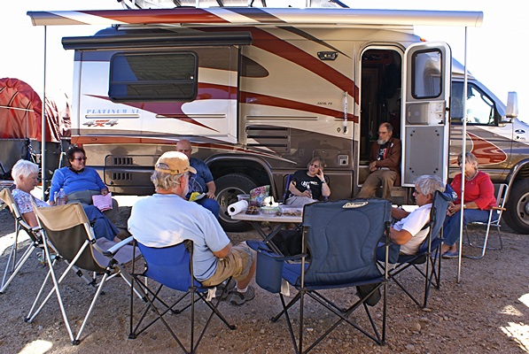
FMCA Freethinkers gathered at Steve & Liz Willey’s RV. Peg Leg Monument, Borrego Springs, CA.
When planning our 2-day trip we thought about driving down the east side of the Salton Sea and stopping at The Slabs, Salvation Mountain, and East Jesus on our way to our Freethinker gathering at Peg Leg. From our motel in Indio that would have turned a one hour trip into a three hour trip. After a less than restful night and a late, slow, start to the day that did not appeal to us. We took CA-86 down the west side of the Salton Sea and then headed west on the Borrego Salton Sea Way (S-22) towards Borrego Springs.
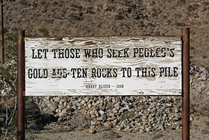
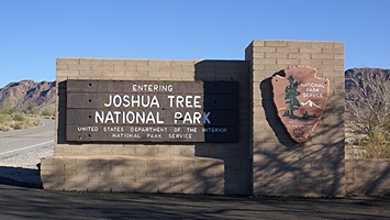
The sign says it all.
A few miles before reaching Borrego Springs we reached the 90 degree bend in the road where Henderson Canyon Road splits off to the north. A short way up Henderson Canyon Road was the entrance to a clear dirt area full of RVs. We had finally reached the Peg Leg Boondocking area. I recognized the pile of rocks from pictures and then spotted Steve and Liz Willey’s motorhome. It had several other motorhomes parked near it and we figured that was our FMCA Freethinkers group. When we pulled up in the car the group was assembled under the shade of the Willey’s patio awning. There was one couple there that we met for the first time just a couple of weeks ago in Quartzsite. We introduced ourselves to everyone, unloaded our chairs, and joined the group.
The Peg Leg Smith monument and State Historical Marker.
We sat in the shade of the patio awning, protected from the intense rays of the sun, with a view of the mountains and a cool, refreshing breeze. We got out some snacks and others did the same, creating a community snack buffet in the process. We talked (and snacked) for five hours. We had not yet seen Borrego Springs or the giant metal sculptures in the desert so around 3 PM we made plans to meet up with the group at 4:15 PM for dinner at Assaggio’s. Liz gave us a guide to Borrego Springs that included a map showing the locations of all of the sculptures. We packed up our chairs and our food and headed out Henderson Canyon Road towards Galleta Meadows at the north end of town. On our way to the Meadows we came across a self-serve fruit stand and bought a 10 pound bag of freshly picked grapefruit for $3.
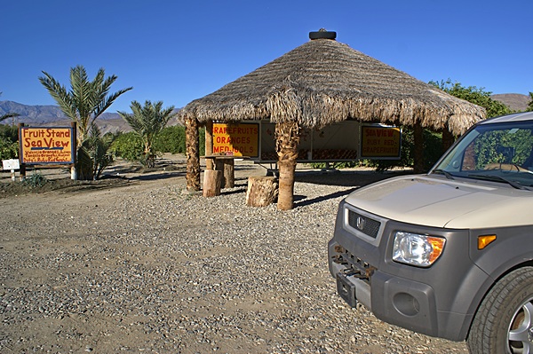
The self serve fruit stand on the north end of Borrego Springs, CA.
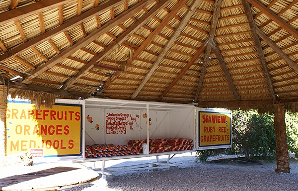
Fresh picked oranges and grapefruits, $3 per bag. (They were delicious.)
Galleta Meadows was the vision of Dennis Avery and the sculptures have all been done by Temecula, California sculptor Ricardo Breceda. Most of them are on the north end of Borrego Springs Road and those are the ones we saw. We drove around the downtown area, which was small but quaint and attractive, and then headed back east on Palm Canyon Drive towards the airport where Assaggio’s restaurant was located.
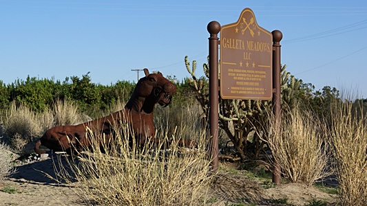
Galleta Meadows in Borrego Springs, CA.
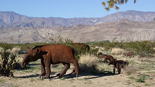
Most of the sculptures are of animals.
We were on time but most of the rest of the group was already there and seated. Assaggio’s is an Italian restaurant owned and operated by folks of Chinese descent. They had a small menu of Chinese selections but everyone stuck with the Italian menu. Linda and I had garden salads with vinegar and oil dressing and the vegetable linguini. Italian is usually a safe restaurant choice for us in terms of getting something vegan to eat, but we have been surprised several times by how badly prepared our food has been. Assaggio’s wasn’t the worst Italian food we have ever had, but it was not very good. As with Quartzsite and other places we have ventured (or will) the experience of Borrego Springs and Peg Leg were not about dining out; it was about being in this place with these people.
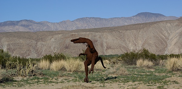
This dinosaur was obviously happy to be in Galleta Meadows.
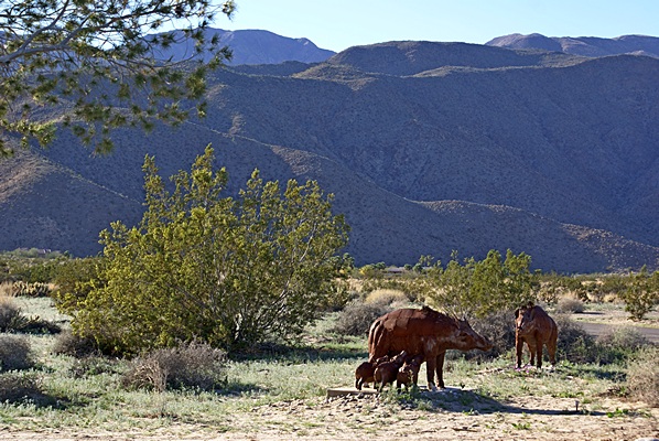
Most of the sculptures are placed in natural settings.
By the time we were done eating and talking it was almost 6 PM PST and the sun had already dropped behind the very high mountains to the west. There was still some lingering daylight, but we knew it would fade long before we made it back to CA-86. Linda entered the address of our camp back in Quartzsite and we set off for our winter home two hours and 45 minutes away.
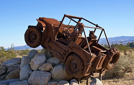
A tribute to the iconic vehicle of the west.
Because CA-86 runs in a NW-SE direction, the GPS took us through Mecca, California and onto Box Canyon Road. Box Canyon Road ran through the Mecca Hills Wilderness and we did not encounter another vehicle along its entire length. The road intersected I-10 at Cottonwood Springs Road where we entered Joshua Tree NP early yesterday morning. We lost an hour crossing into Arizona and changing from PST to MST. We pulled into our parking spot at 9:45 PM with just under 500 miles on our trip odometer. It had been long couple of days but we had many new experiences and a lot of fun.
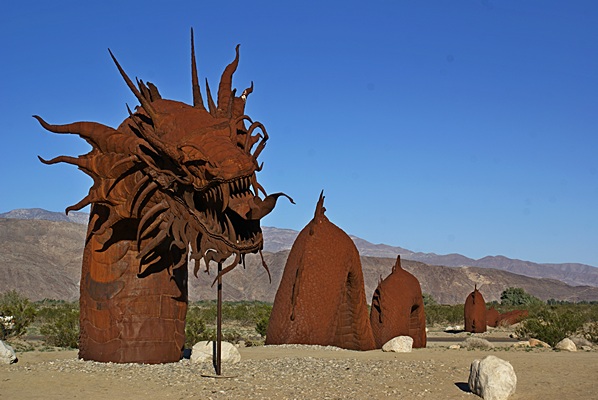
This serpent is over 60 feet long and spans a road (between the second and third hump).
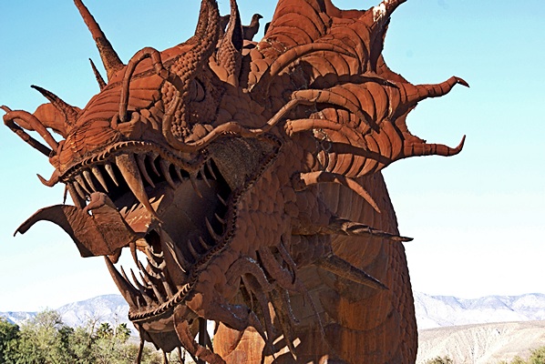
The sculptures are all metal and some of the details are very intricate.