Monthly Archives: July 2022

20220728 – Leaving Nova Scotia (for now)

THURSDAY 28 July

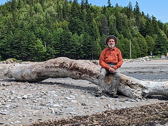
(Caution:  Long reflective post ahead with only one photo.)

I was awake before 6 AM but did not get up until 7 as we had a somewhat leisurely morning on tap.  I followed my usual morning routine; start my computer, feed the cat, put the kettle on to boil, make coffee, create yesterdays blog post in WordPress, and publish it.  (I wrote the text yesterday in Word and had already selected and processed the photos.  Creating the post was just a matter of copying and pasting the text, uploading the images, inserting them into the post in the proper places, and adding captions.  When it looked “OK” I clicked the Publish button and voila, another blog post.)  By the time the hot water was ready, Linda had also gotten up, so I made coffee for both of us.

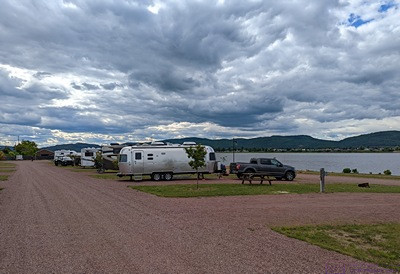
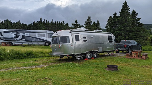
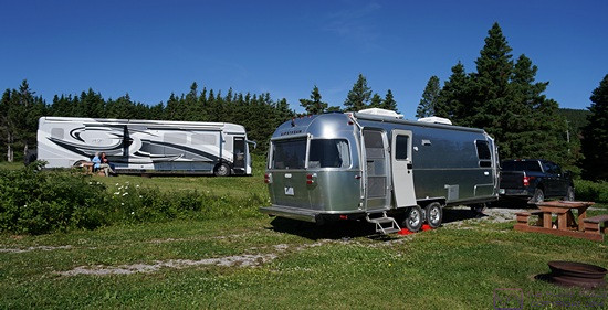
This post covers our final day in Nova Scotia (for now) up to the point where we arrive at the Marine Atlantic Ferry Terminal in North Sydney.  But first, we had to vacate our nice 50A 3-way (full-hookup) site at the North Sydney / Cabot Trail KOA and move to a temporary site as the KOA was fully-booked.  As well it should be.

This proved to be a wonderful little KOA in a great location.  After suffering a serious decline in business for the two years of the COVID-19 pandemic (2020-2021), business here has really rebounded.  As one of the owners told Linda this morning, “this is not a place that locals come to camp, we are completely dependent on tourists.”

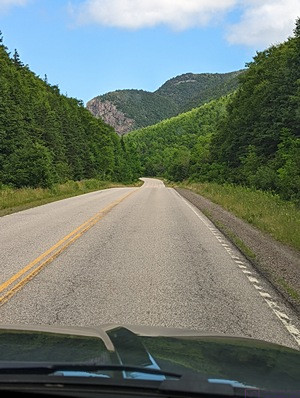
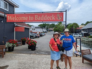
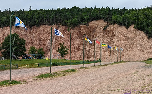
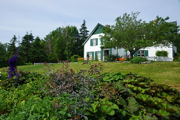
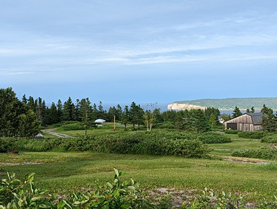
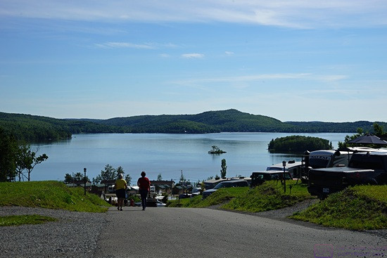
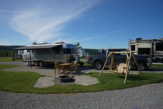
It’s not fancy (it is not listed as a Resort, Holiday, or Journey) but the bathrooms/showers were nice, the laundry was very useable (outdoors, but covered), the power at our site was excellent, the Wi-Fi was solid, unlimited, required a password, and was fast (early morning and late evening).  The setting was also somewhat dramatic, and, it had good access to North Sydney and Sydney (for shopping), as well as being a great base for exploring the Cape Breton area, including St. Ann’s (Gaelic College), Baddeck (Parks Canada Alexander Graham Bell National Historic Site), and the Cabot Trail and Cape Breton Highlands National Park (Parks Canada), all of which I have covered in previous posts.

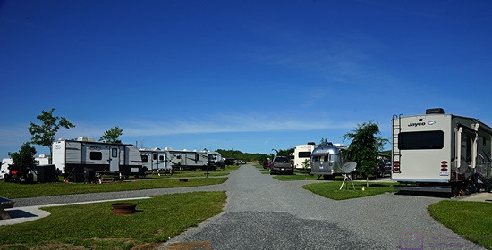
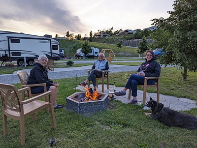
Of particular importance to us, however, was that it was well-positioned as a staging area for RVers taking the Marine Atlantic Ferry from North Sydney to or from either Channel-Port-aux-Basque or Argentia, Newfoundland.  (Newfoundland and Labrador are two distinct places that form the single Province of Newfoundland & Labrador.)  In our seven nights here, we met a number of RVers who were planning to take the ferry to,  or had just returned from, Newfoundland.  We also saw lots of RVers come in late (even after dark), although these arrivals were likely not ferry related.  The owners here were friendly, regular folk, who work hard and want their guests to have a good stay and a fair price.  They were out every night in their golf cart leading arrivals to their sites in the dark.

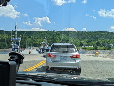
Not long after we arrived here, we started to think about the fact that we had to shut off the propane in our Airstream before boarding the ferry, and that meant we would not have refrigeration.  We were aware of this, but had not quite thought through the logistics of the situation.  As I have described previously, this led to us buying Styrofoam cooler and starting to think about when we had to check out of the KOA and when we could arrive at the Marine Atlantic North Sydney Terminal.  Checkout time was 11 AM and the earliest we could get to the ferry terminal was “after the previous ship has departed.”  Or after the prior ship had arrived, or something to that effect.  What we knew for certain was that we had to be there at least 2 hours before out scheduled departure at 11:15 PM.

We eventually realized that we should have booked an extra night at the KOA and then left around 7 PM for the approximately 30-minute trip to the terminal.  We checked with the office to see if we could book the extra night and stay in our site. That wasn’t possible, and they had no other sites, but they offered that we could pull up alongside a storage area that backs up to their very large driveway, where we would be able to plug in to a 30A outlet.  That was all we needed to run the refrigerator, and would position us well when it was time to leave.  They cost would be 1/2 the normal rate for a 30A+Water site.

With all of that by way of background, I went over this morning to see if perhaps, just, maybe the reservation coming into our site (#18) had cancelled or delayed.  Nope.  And there were still no other sites available.  No problem.  I gladly paid for the previously discussed half-day solution.  Someone had already occupied one of the storage sites, which the park is using as overflow camp sites.  That gave us additional flexibility as to how we could position the trailer.

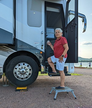
We wanted to be good guests and be out of our site by 11 AM.  We had a light breakfast of toasted raisin bread and then set about breaking camp, mindful that we were moving to a different spot in the campground, and would have plenty of time to properly prepare the trailer for road travel.  We pulled out at 10:50.  I spent a few extra minutes trying to find the most level spot, side-to-side, that I could as we did not plan to go through out normal leveling process or unhook the truck from the trailer.  I found a spot where the curb side of the trailer was only 0.50” low.  The trailer tongue was about 5” low, but we were able to reduce that to under 2” with the tongue jack.  We got the power plugged in and then deployed the patio awning, as the curb side of the trailer was facing SSW and the sun was very bright.  The air temperature was in the upper 60’s F (lower 70’s eventually), so we opened the windows, the door, and turned on the ceiling exhaust fan.  Our thermometer eventually said it was 82 F inside, but it was very comfortable.

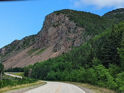
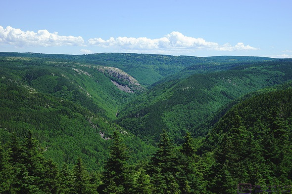
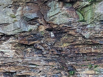
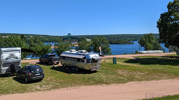
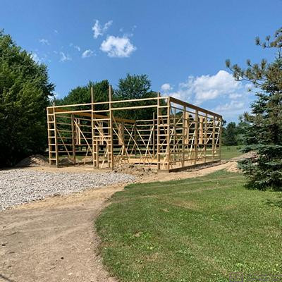
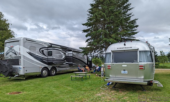
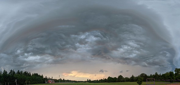
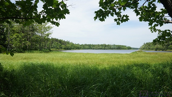
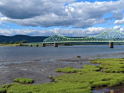
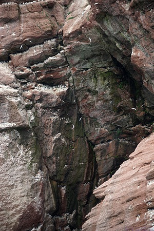
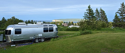
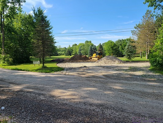
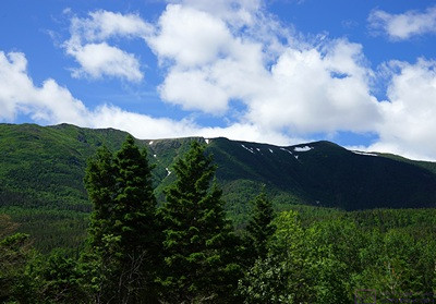
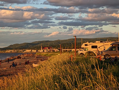
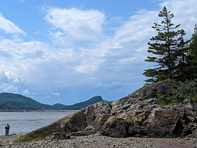
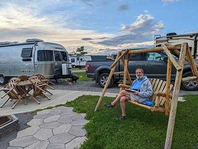
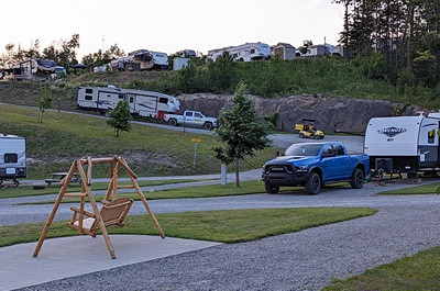
We were much closer to the bath house in the new location, so we both took showers there.  Linda then took over a load and laundry (same building) and did that.  Linda then worked on reconciling finances.  We were very close to the rock cliff, so I tried to get some photos of our rig with the cliff as the background, then started working this blog post.  Here’s the one I liked best:

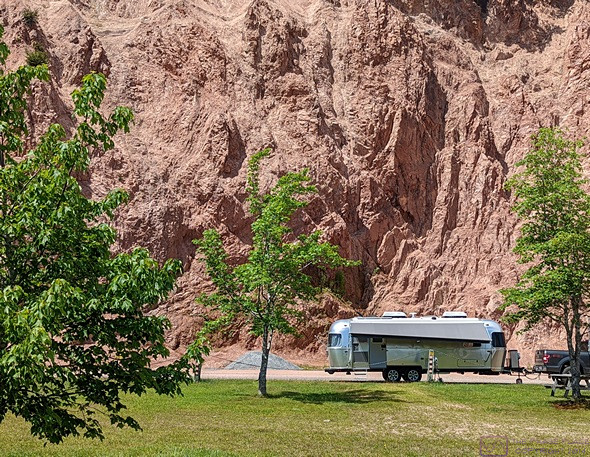
Our Airstream in its temporary site by the rock cliff at the North Sydney / Cabot Trail KOA, New Harris, NS.

We managed to reduce our perishable food to point where it would fit in our Styrofoam cooler along with an assortment of freezer packs, and nothing was irreplaceable.  Lunch was cheese and crackers and we finished off a bag of Fritos for an afternoon snack.

Mid-afternoon, Linda was trying to reconcile our reservation confirmation with the information on the Marine Atlantic website.  They didn’t quite match up, so I called customer service.  A woman with a pleasant and patient phone manner confirmed that our reservation information was correct, and we would be sailing on the MV Highlanders.  That was a relief.  We are excited, but also a bit apprehensive, about this crossing, not only because of food storage, but because Juniper-the-Cat while have to stay in the trailer during the crossing and we will not have access to her.  She will have food, water, and litter, but it will be a strange experience for her.  It’s only 96 miles, but will take about 7 hours of actual sailing.

The Newfoundland & Labrador time zone is 30 minutes later than the Atlantic Time Zone, so leaving North Sydney, Nova Scotia at 23:45 on the 28th we should arrive at Channel-Port-aux-Basques, Newfoundland at 06:45 on the 29th.  Having never done a ferry like this, however, we did not know how long it would take for them to embark and disembark all of the vehicles and walk-on passengers.

As part of working out the logistics for all this, our research showed that there was or Sobey’s supermarket in Corner Brook, NL that opened at 7 AM, and was at least a 2-hour drive from the ferry terminal on our planned route.  It was at least another 75 miles from there to our KOA in Rocky Harbor, NL, so another 90 minutes driving time.  The published check-in time at the KOA was 1 PM, so we figured we would try to spend enough time at the Sobey’s, or in their parking lot after shopping, to arrive at the KOA as close to 1 PM as our driving and navigation skills allowed.

Late in the afternoon we packed a suitcase and changed into our trave clothes.  Dinner was shelf-stable soup (add hot water to the container) and we finished up the container of shelf-stable orange juice.  We started our final travel preparations at 7 PM and pulled out of the KOA at 7:30 in order to arrive at the ferry terminal while there was still daylight and well ahead of the deadline for checking in.

The details of the actual ferry experience will be in the next blog post.


20220727 – The Cabot Trail & Skyline Trail, CBH-NP, NS

WEDNESDAY 27 July

(Note:  These photos are in order, but do not necessarily match the text that flows around them.  That’s why pictures have captions.)

I was up early enough to upload the blog post for yesterday, make a cup of coffee, and feed the cat.  When Linda got up, we had raisin toast for breakfast.  Simple, but effective, as we had a long day ahead of us.

Today was devoted to (almost) circumnavigating the northern part of Cape Breton Island clockwise on the Cabot Trail.  We left at 8:11 AM and headed back down Hwy 105 (the Trans-Canada Highway) past Baddeck and picked up Hwy 30, the (unofficial) starting point for the Cabot Trail loop near Nyanza.

The Cabot Trail (Hwy 30) headed north along the west coast of Cape Breton Island, Nova Scotia (photo by Linda).

For context:  The entire trail is a 298 km (~ 186 mile) loop road with a total elevation gain (uphill climbs) of over 17,600 ft. (~ 5,415 m) and is used by motor vehicles and bicycles.  At its northern end, a portion of the trail passes through, or along the edge of, Cape Breton Highlands National Park.  The road is two lanes except for an occasional turn or passing lane, and the shoulders are often narrow or non-existent.  This made for fun getting around the bicyclists, who were numerous.  Major portions of the road are posted at 80, 90, or 100 km/hr, but slowdowns to 70, 60, or to km/hr are common, with even slower speeds on hairpin turns.  The road surface is fabulous in some places and very rough in others, so you can’t always travel comfortably at the posted maximum speed limit.  The road is rarely straight or level and has some dramatic sections with 12% grades and switchbacks.  Grand views are found all along the trail, and there are scenic turnouts (lookoffs) to fully enjoy the views.  They were always in use.

There are a lot of large cliffs along the Cabot Trail. Some of them plunge into the sea (but not this one). (Photo by Linda.)

Before we had gotten very far to the northwest, we encountered a road closure and had to follow a posted detour.  The detour turned out to be quite some distance on a narrow, twisty, 2-lane road that was being completely rebuilt and involved flaggers and escort vehicles for traffic control.  At one point the lane that was open to traffic was dirt.  We were glad to have the FX4 (off road) version of the F-150.


The beginning of the Skyline Trail (after the parking lot)., Cape Breton Highlands Natl Park, NS. A good gravel trail with very few trip hazards. The trailhead is at ~ 1,300 ft. ASL.

Not knowing how much more of this kind of stuff we might encounter, the detour felt like a bad omen, but it was a beautiful drive otherwise and, as we got deeper into Cape Breton Island and the Cape Breton Highlands, we imagined that it must be similar to driving through the Scottish Highlands with high, steep hills plunging into lakes of unknown (to us) depth.  Once we made it to the west coast of the island, Hwy 30 followed the shore to the northeast.  It was very different from the east coast we had driven with Paul and Nancy when we first arrived on Cape Breton Island.  The land between the sea and the hills was broad and relatively flat with few trees.  It made for open feeling with good views all around.


Linda on the Skyline Trail, Cape Breton Highlands Natl Park, NS

Just beyond Cheticamp we saw a sign for the Aucoin Boulangerie & Bakery in Petit Etang and pulled in to the already crowed overflow parking lot.  For being a small place in a small town, the line was out the door.  It probably helped that they sold sandwiches to go, and were right on the highway just before it turned and climbed up into the National Park.  We surmised that locals and repeat visitors to the area were already well-acquainted with this place.  We splurged and each had a blueberry turnover.  And yes, they were yummy.

The open forest along the Skyline Trail in CBH-NP. A budworm infestation in the 1970s killed large areas of Balsam Fir, allowing Birch trees to flourish. A favored food of Moose, they flourished as well, alternating the forest in the process and preventing it’s regrowth.

The National Park is a gem, with numerous hiking trails and campgrounds.  Our specific interest for today was the Skyline Trail on the western edge of the park.  This trail is rated as easy and relatively flat.  As we have learned, that does not necessarily mean we would agree with that characterization.  AllTrails describes it as “a 4.9 mile heavily trafficked out and back trail located near Cheticamp, Nova Scotia, Canada that offers the chance to see wildlife and is good for all skill levels. … Route Type: Out & Back; Length (total): 4.9 mi (~ 7.9 km); Elevation Gain: 633 ft. ( ~ 195 m); Difficulty: Easy.  Yah, right.

The Boardwalk (and giant staircase) at the end of the Skyline Trail. The last several hundred feet go down the face of a cliff by a couple of hundred feet. No photo of that. (Photo by Linda.)

We didn’t see any wildlife, but we did see a LOT of people on the trail.  And that was OK.  It was nice to see people out being active and a National Park getting the attention it deserves.  Besides, it was a nice day for hike through a forest, with the temperature in the upper 70s F and cloud cover, at least initially.  And the hikers just naturally spread out along the trail.

The end of the trail is a boardwalk and towards what we thought was the end, it cascaded down the side of very steep cliff for another 200 feet.  We overhead another hiker say to her party “do I get a sticker or a medal if I walk down there and back up?  Because if not, I’m staying here.”  We concurred with her thinking on this matter as we did not see any amazing photo opportunities arising out of the additional time and effort.  For that matter, the Skyline Trail had a loop section, in case we wanted to make it an even longer hike.  We didn’t, and started back the way we came after spending time admiring the views and taking some photos.

A experimental reforestation area along the Skyline Trail. It covers an area equal to 9 football fields and is fully enclosed by a Moose proof fence with gates to allow hikers through.  (The fence is visible in the right side of the frame near the center.) The gates do not reach the ground, so smaller animals have access to the area.

From this point, the Cabot Trail (Hwy 30) ran north to the McKenzie River Valley and then dropped from the highlands to the sea on a 12% grade with switchbacks, before finally turning east, crossing the McKenzie River and entering Pleasant Bay.  It then traversed the northern reaches of the park eastbound over to Neils Harbor.  We encountered one other construction project, this one in the park, but it was short and didn’t take much time to get through.  But before doing all of that, we ate the BP&J sandwiches that Linda had packed and had a few Fritos.  We brought water this time, and actually drank it.

A view of the McKenzie River Valley from a lookoff along the Cabot Trail.

From Neils Harbor down to Salty Rose’s & the Periwinkle Cafe, just north of Ingonish, the road and scenery were still new to us.  The café was the northern extent of our previous drive on the Cabot Trail.  We had a nice lunch there last time, but today we just drove by.  The scenery and road from this point south were just as nice and interesting as the first time, but we did not feel compelled to stop at scenic pullouts (lookoffs).

A view of the Cape Breton coastline looking north from the McKenzie River lookoff of the Cabot Trail.

We got back to camp around 5 PM, although this included an extra 40 minutes to drive about 24 km round-trip in towards North Sydney on the T-CH, refuel the F-150, and return to camp.  Start-to-finish, it was a 9-hour day and we traveled at least 200 miles.  If you are able to arrange your travels accordingly, it probably makes sense to take two or more days to do the Cabot Trail in a point-to-point fashion as there are campgrounds for tents and smaller RVs, as well as Inns, rental cottages, and other forms of lodging for non-campers.  Fuel is available, and there are quite a few restaurants.  Grocery stores, however, are not one of the Cabot Trail’s strong points.

We finished the vegan chorizo for dinner and then I got to work processing photos and writing this post.  By 10:15 PM the temperature had dropped.  Before closing the trailer door for the night, I went outside to check the sky.  The air was crisp, the sky was mostly clear, it was dark enough for all the major stars and constellations to be visible, and I could make out the Milky Way, albeit very faintly.  Tomorrow begins a new phase of our adventure; our first time putting the Airstream on a ferry, and our first trip to Newfoundland.  But more on that in a subsequent post.

20220726 – The Gaelic College, St. Ann’s, Cape Breton Island, Nova Scotia

TUESDAY 26 July

I was up before 6 AM for no particular reason other than being ready to get out of bed and start my day.  I fed Juniper-the-cat, made a cup of coffee, finished the blog entry for yesterday, and posted it.  Breakfast was toasted cinnamon raisin bread, which set offthe smoke detector.  That was a first for this trip.

Our main focus for today was a visit to The Gaelic College (Colaisde na Gàidhlig) in nearby St. Ann’s, Nova Scotia (Cape Brenton Island).

From the College’s website ( https://gaeliccollege.edu/ ):

“Colaisde na Gàidhlig is first and foremost an educational non-profit institution, offering year-round programming in the culture, music, language, crafts, customs, and traditions of the immigrants from the Highlands of Scotland. The only institution of its kind in North America, students of all ages and skill levels visit the College every year to study under some of the finest instructors in Nova Scotia Gaelic culture.”

The main building of The Gaelic College, presumably administrative. We entered here through the gift shop.

The Gaelic College is small, with about six main buildings and an outdoor amphitheater.  We entered through the gift shop and paid the 10$/person fee to attend a cultural experience.  The program was held in the Great Hall of the Clans, which also housed the museum displays.  We were early, so we perused the museum and learned things about which we were previously unaware.


The Great Hall of the Clans (An Talla Mór).

We learned that Gaelic is a language group with two branches, each of which have three branches.  From Wikipedia (Scottish Gaelic): “Scottish Gaelic, also know as Scots Gaelic and Gaelic, is a Goidelic language (in the Celtic branch of the Indo-European language family) native to the Gaels of Scotland.  As a Goedelic language, Scottish Gaelic, as well as both Irish and Manx, developed out of Old Irish.  It became a distinct spoken language sometime in the 13th century in the Middle Irish period.”  The other branch consists of Briton, Cornish, and Welsh.

The Scottish Gaelic alphabet consists of 18 characters, with completely different phonics from English.  Of particular interest to me was the fact that the language, music, and dance are intimately connected and the songs have a specific feature in which there is a one-to-one relationship between notes and syllables.

MacKenzie Hall (Talla Mich Coinnich) .

Our cultural experience was in two parts of ~90 minutes each, with a one-hour break for a lunch and cèilidh (KAY-lee).  First was a presentation on kilts by a master kilt maker.  Next was a fiddle player who was joined by a dancer and then followed by someone who taught us a few words and an easy song which we sang while going through the motions milling a woven fabric.


The amphitheater and a view of the countryside.

We would have like to attend the cèilidh in the McKenzie Hall multi-purpose building, which in this case was a performance by college staff and students, but it was combined with the luncheon for 15$/person.  The price wasn’t a problem, but there was nothing on offer in terms of food that we could eat, and we don’t like paying for meals we can’t actually consume.  We continued to peruse the museum and walked the grounds.  The location of the amphitheater allowed us a view of the surrounding countryside.

A bagpiper in traditional attire plays in front of the main building by the road.

After lunch we got an explanation and demonstration of weaving.  This was followed by a presentation on storytelling that included stories in Scottish Gaelic with English translations.  All of the presenters throughout the day were very good and it was clear they were passionate about, and deeply committed to, preserving and sharing their cultural heritage.  On the way out of the gift shop to our truck, a young man in appropriate attire was standing out by the road with his bagpipe.  We had seen him sitting inside when we arrived but didn’t know why he was there.  Now we did.  All told it took about 5.5 hours of our day, but it was time well-spent as we enjoyed it very much, and the price was right.

The daytime high temperature only reached 80 degrees F so we opened up the trailer and turned off the heat-pump.  We restocked the refrigerator with cans and bottles of water and then moved many of the dry-goods containers from the pull-out pantry to the storage compartments under the sofa.  We walked the campground and dropped off a bag of trash before stopping to chat with the neighbors who are also from the States.  I took a nap and got a shower while Linda fixed dinner.  Our evening meal was vegan chicken tenders and improvised macaroni and cheese (also vegan).  The later was more like pasta and cheese as Linda wanted use up the remaining cascatelli pasta.

20220725 – Chores & Errands, Sydney, NS

MONDAY 25 July

I did not get up until 7 AM this morning, and Linda got up not long after.  On travel days, Paul and Nancy tend to get an early start.  We knew this would be no exception, and wanted to be up to say “safe travels and see you down the road.”  They pulled out around 8 AM and we gave them a proper “royal wave” send-off.  It was in the upper 60’s F, with a nice breeze, so we opened up the trailer to enjoy the fresh air and take a break from the noise of the heat pumps.  We are glad to have them, but they are not quiet when operating.

With another hot day on tap we planned to hang around the RV park and take care of some chores in the cooler temperatures of the morning.  Top of the list was laundry, the first time on this trip we would be doing it in a RV park laundry facility.  But first, coffee, a few iPad games and puzzles, and breakfast.  We also spent some time figuring out what we wanted to do with our remaining time in this area.  Rain/heat is on tap for tomorrow, so we will try to visit the Gaelic College in St. Ann’s for their “cultural experience.”  Wednesday is supposed to be cooler and dry, so we plan to finish our exploration of the Cape Breton Highlands National Park, including the Skyline Trail.

I was catching up on some blog posts I follow using Feedly, and decided to go back and read the ones I had written so far about this trip.  It’s useful to see how they look on a tablet after they are published as I create/edit them on a laptop computer.  In general, I was pleased with my writing and the photography, but found way too many typos (or mis-spellings) so I will have to go back and edit them.  As a diary of our trip, I want them to be accurate.  To the extent that anyone else reads them, I want them to be well-crafted.  With people checked out of the park, the Wi-Fi was not getting slammed, so I figured I could do this during the day, but never found the time.  Tomorrow, perhaps.

As noon approached the thermometer in the rig was reading 80 degrees F.  There was still a fair cloud cover and a good breeze, so it was not uncomfortable, but it was beginning to feel warm rather than cool.  I wanted to hold off closing up and turning on the heat-pumps as long as possible, but it was inevitable that we would need them, especially as the wind was too strong to safely deploy the awnings and shade the trailer.

We gathered up the laundry, which included stripping the beds, and carried it up to the laundry room around 10 AM.  Three other campers were already there, but one washing machine was still open.  We got into a conversation with two of them, and Linda was still taking to them when I returned to our rig.  I worked on the blog posts for yesterday and today, and transferred/edited the photos from yesterday until Linda texted me to come pick up a finished load of laundry.  At 12:30 PM it was 82 F in the trailer, so I closed it up and turned on the heat-pumps in cooling mode.  The final load of laundry was done about then as well, and Linda carried it back to the trailer.  We put away the clean clothes and left the beds for later.

One of our big tasks before boarding the ferry for Newfoundland on Thursday is to use up as much of our frozen/refrigerated food as possible, making sure whatever is left will fit in our Styrofoam cooler along with the freezer packs.  We split a sandwich for lunch.

Linda (lower right) at the Big Fiddle statue in Sydney, NS.

Linda and Nancy went to North Sydney the other day for groceries but did not find everything they wanted at the Atlantic Superstore.  The largest city in the area is Sydney, so we decided to drive there after lunch to do our final shopping before sailing to Newfoundland on Thursday evening.  (Both cities actually no longer exist as independently governed entities, having dissolved in the mid-1990s to become part of the Cape Breton Regional Municipality.  The Sydney area still has the largest population on Cape Breton Island by a wide margin.)

Bruce (lower right) at the Big Fiddle in Sydney, NS (photo by Linda).

Our first stop was the Joan Harriss Cruise Pavilion to see the Big Fiddle.  The statue was designed and built by Cyril Hearn in 2005 and, at 60 feet, is the tallest fiddle in the world.  The fiddle is associated with Keltic music and culture.  The pavilion had shops and a restaurant.  One shop sold Scottish hats, scarves, tweed jackets, and kilts.  The were pricey, of course, but they were nice.

Our next stop was a Sobey’s supermarket for non-perishable items.  Some fellow RVers at the KOA had just returned from Newfoundland and told us that we would need bug netting, so we went to Walmart looking for some, as well as a short (10 to 15 feet) potable water hose.  No joy on either of these items, so we tried the Home Depot next to Walmart for the water hose but no luck there either.  Our final stop was the Canadian Tire store across the street.  They didn’t have the water hose either, but they had the bug netting.  Score!

The shopping complex was at the terminus of NS-125, which was our route back to North Sydney where we picked up the T-CH/Hwy-105 back to the KOA.  We doodled for a while before dinner, which was a simple affair of vegan chorizo on a bun and corn with a little vegan butter and black pepper.  I made my bed while Linda cleaned up a few dishes.  We then went for a walk to drop off the trash and recyclables and continued on around the RV park.

We chatted for a while with the two couples that were parked on either side of Paul and Nancy in Cavendish, PEI and are now camped in the two sites to our west.  A couple of rigs farther on, we chatted with the couple who have the other Airstream in the park.  It is also a Flying Cloud, 25 rear bed, 2021 model year.  They came here from the Vancouver, British Columbia, area and are headed to Newfoundland on the Atlantic Marine ferry on Wednesday.  Their first stop is the Rocky Harbor KOA, so we will see them on Friday when we get to there.   It has become apparent that many of the people who are camped here are either going to Newfoundland in the near future, or have just returned from there.

Back at our trailer, we turned off the heat-pumps and opened the windows.  Linda made her bed and then got out the container of dairy free passion fruit and lemonade sorbet.  It was a nice finale to the very spicy chorizo, and got one more thing out of the freezer.

20220724 – Happy Anniversary and A. G. Bell NHS, Baddeck, NS

SUNDAY 24 July

First off, our What 3 Words location here at the North Sydney  Cabot Trail KOA is “steamy.provide.rally”.  I forgot to capture and post this when we first arrived.

We are back in a dome of hot/moist air, with excessive heat warnings for daytime high temperatures of 90 degrees F +/- (29 to 33 degrees C), “humidex” readings of 36 to 40  C (96.8 to 104 F) and lows barely in the 60’s F.  Temperatures moderate a bit near the coast, but not much.  Fortunately, our electrical power is good and our two heat pumps have been functioning well in cooling mode.

Paul and Nancy will be observing their 33rd wedding anniversary on the 29th of this month, but will already have left the RV park by then.  We were going to take them out to dinner in Sydney (Regional Municipality) this afternoon but first decided to visit the Alexander Graham Bell National Historic Site (Parks Canada) in nearby Baddeck, NS.  Baddeck is just off Hwy-105 (the T-CH), about 25 minutes from the RV park.

An early patch cable telephone switchboard.

The A. G. Bell NHS was another fine example of what we experienced with Parks Canada locations.  Besides a nice building complex, it contained a lot of well-curated artifacts, large and small, with associated information.  We learned that Bell was born in Edinburgh, Scotland and came to Canada at the age of 23.  He eventually ended up in the USA, where his famous “first telephone call” with his assistant, Watson, took place in the Boston area.  An old/small patch-cord telephone was on display and reminded Linda that her mother had once worked as a telephone operator.


Alexander Graham Bell did pioneering work with tetrahedrons as structural elements.

He and his wife, Mabel (deaf from the age of 5 and a former pupil of Bell’s) eventually bought property in Baddeck, which reminded him of Scotland, and built a marvelous estate.  (The house/estate is still owned and occupied by their descendants, and is not open to the public.)  We learned quite a bit about this couple and their long active careers and lives.  Besides deaf education and telephony, A.G.B. was involved in aviation, hydrofoils, and the structural use of tetrahedrons, to name a very few of his interests and investigations.

The three amigos outside the Alexander Graham Bell National Historic Site in Baddeck, Nova Scotia.

Mabel managed their estate and had deep interest in conservation and ecology.  They were both well-ahead of their time and we came away with a new found admiration for their contributions to a wide range of subjects and for the kind of people they were.  Bell’s life-long passion, however, was teaching the deaf to speak.


Airplane and Hydrofoil, just two of A. G. Bell’s many interests.

Baddeck was a small but charming port town with an active marina and lots of pleasure boats anchored or sailing the Bras d’Or Lake. And it was a busy town on this day.  The Lake is punctuated by headlands and bays, but ultimately is connected to the ocean via the Bras d’Or Channel, which is the body of water we can see from our RV park and over which the Seal Islands Bridge takes the Trans-Canada Highway into North Sydney, Nova Scotia.

Linda and Nancy outside The Freight Shed Restaurant in Baddeck, Nova Scotia.


Some quick online research indicated that The Freight Shed Waterside Restaurant might be a good place to eat lunch, and we decided to give it a try instead of driving all the way to Sydney (Regional Municipality).  We had a bit of wait to get a table, but it was outside and under cover, and there was enough of breeze to keep it comfortable.  We all got something different to eat and everyone indicated that their meal was tasty.  After lunch I took Hwy-205 along the lake back to Hwy-105 and returned to camp.

The rest of the day we relaxed in camp (hid in the air-conditioning) until the sun dropped low enough and it cooled off enough to sit outside comfortably.  We had both left our awnings out while we were away from camp to try to shade our rigs.  Ours were fine, but Paul and Nancy’s awnings had automatically retracted.          Normally that would be a good thing, as that is what they are designed/intended to do, but something on the big patio awning had apparently gotten tweaked.

A couple of seasonal campers had seen this happen and let Paul know.  He fussed with it for a bit before one of the locals eventually brought his pickup truck to the site and used it as a work platform to reach the awning.  (These awnings are mounted on the edge of the roof, about 12’6” off the ground.)  They were finally able to get the awning to go in correctly and then Paul promptly disconnected the power from the awning motor so it could not be “accidentally” deployed.  This awning will now be out-of-operation until they return to the American Coach Factory and Service Center in Decatur, Indiana, to have it fixed.

Situations like this are always a bit anxiety provoking, and it was our last night camping together on this trip, so Nancy got out the bottle of Cyser Mead they bought on PEI and we split it four ways; a nice cap to the evening and our joint travels.  While enjoying our beverages, we reviewed the shore excursions that were currently listed for our Panama Canal cruise in February 2023 and made selections for each port of call.  The Norwegian Cruise Line concierge service is supposed to contact Nancy in about 35 days and she wants to have all of our selections ready to book.

20220723 – The Cabot Trail and Cape Breton Highlands Natl Park, Nova Scotia

SATURDAY 23 July

I awoke at 5:30 AM to bright sunshine and blue skies, got up, fed the cat, and went back to sleep.  I got up to stay at 6:30 AM, early enough to make a cup of coffee and upload the blog post for yesterday before Linda got up and fixed breakfast.  The Wi-Fi connection to the Internet at this KOA is strong and fast when very few people are using it, and that has generally been early in the morning.  We had egg and cheese “toasties” (to borrow a term from my favorite English Youtube channels) made from Just Egg patties.  Yum.

View of the east coast of Cape Breton looking south from the Cabot Trail.

Our objective for today was to drive a portion of the Cabot Trail from St. Anns to Ingonish, stopping at the Cape Breton Highlands National Park Ingonish Beach Visitor Center and doing a short/easy hike in that area before continuing to Ingonish for lunch and then heading back.  With a high temperature of 88 degrees F forecast for today, we wanted to leave at 9 AM, an earlier start than usual, and be back by mid-afternoon at the latest.  Between breakfast and departure, we set the two heat-pumps to cooling mode and deployed all of the awnings to keep some of the intense sunlight off of the trailer.

View of the east coast of Cape Breton Highlands looking north from the Cabot Trail (photo by Linda).

We took the F-150 for this drive; it’s very comfortable for four people, performs very well in hilly/curvy terrain (ride, handling, performance, and fuel economy) and has very effective air-conditioning.  Looking at maps last night, Linda saw that we could shorten our round-trip driving time by at least 30 minutes if we took the Free Ferry from Englishtown (Rte. 312) rather than driving down to St. Anns to pick up Highway 30 (The Cabot Trail) directly.  This proved to be a good choice as we got to ride on a car ferry, it was free, and it was cool so, triple-bonus.  (The Ferry is owned and operated by Nova Scotia as part of the highway system.)

The three amigos on the Cabot Trail.

Three slightly different amigos on the Cabot Trail (photo by Linda).

There were food and craft offerings at various places along the Trail, and we made note of some we wanted to visit on the return leg.  Much of the Trail was woods, rock, and water, but it was all beautiful and some of the views from high up were stunning.  The Cabot Trail alone is an amazing work of road building.  It was fun for me to drive, and I think everyone else enjoyed it too.

My new hat from the Cape Breton Highlands National Park Ingonish Beach Visitor Center gift shop.

Every Parks Canada location we have visited has been wonderful, with good facilities and great people.  The Ingonish Beach Visitor Center was small, but they had a baseball style cap that really spoke to me.  At Ingonish Beach area we hiked the Freshwater Lake Trail.  It followed the edge of Freshwater Lake and then turned into the forest, but remained level throughout.  There was a warning sign about coyotes, and what to do if you encounter one along the trail, but we did not.


Freshwater Lake at the Ingonish Beach area of Cape Breton Highlands National Park.

Along the Freshwater Lake Trail at the Ingonish Beach area of Cape Breton Highlands National Park.

The Keltic Inn from Ingonish Beach, Cape Breton Highlands NP.

Across the bay we could see the Keltic Inn on a bluff, so we drove there to have a closer look.  It looked like a lovely place in a splendid setting to spend some time.  There is also a Scottish links-style golf course there, so a super spot for a golfer.   Back on the Cabot Trail headed to Ingonish, we passed signs for two NP campgrounds.  If we ever return to this area, we will definitely try to book sites in Parks Canada campgrounds.

Linda’s research on vegan dining options led us to Salty’s Rose & Periwinkle Café in Ingonish.  We both had a veggie hummus sandwich with sweet potato chips, and they were excellent.  Paul and Nancy both had lobster  rolls.  On the drive back we stopped at the Celtic Quilts shop, the Wreck Cove General Store, and Cabotto Chocolates.  The quilt and chocolate shops both appeared to be in small, reclaimed churches.

Salty’s Rose & Periwinkle Café.

The quilts on offer were all locally made and very nice, but seemed a bit pricey.  The proprietor made the knitted items, which were also nice.  She was delightful, with something of a Scottish brogue.  The General Store was nothing to write home about; lacking any of the authentic historical charm of the one in Wah Wah, Ontario (if it’s even still there).


The woman at Cabotto Chocolates was pleased to find out we were from Michigan.  She was from Ontario originally, but lived/worked near Lansing for years.  They wanted to return to Canada but felt Ontario was too expensive.  Given where they live and work now, it appeared to us that they had found a great alternative.  Without us asking, an older woman (one of the owners) in the back room explained to us what she was making and the equipment she was using.  Their most unusual offering was “ruby” chocolate.  It was dark pink in color with a slight fruitiness and a consistency similar to “white” chocolate.  We bought several different things here.

Waiting to board the Englishtown Free Ferry (photo by Linda).


From this point it was just a matter of driving back to the KOA via the Englishtown Ferry.  On the approach to the dock, we saw a Bald Eagle sitting in a short tree on the right side of the road.  We got back around 3 PM, a little later than we intended, but the extra stops were worth the time.  We were glad to see that our air-conditioning had worked as intended and kept the rig comfortable (and safe) for Juniper-the-Cat.  The electrical service at this campground has been excellent.

For the rest of the afternoon, I processed photos and Linda took a nap before starting dinner preparations.  Nancy brought over mushrooms and an 8-pack of pasta for Linda to use, and keep some of it for later use.  I got to choose the pasta, so we had organic Tri-Color Farfalle (bow-tie) Pasta with mushrooms, onions, garlic, sun-dried tomatoes, and zucchini sautéed in olive oil.  This evening’s wine was a sparkling Pinot Grigio + Chardonnay.

After dinner we sat outside for a while but small flying bugs posed a nuisance.  The sun had slipped below the ridgeline behind us and it was starting to cool off, so Paul set up their propane firepit, hoping it would also help with the bugs.  It didn’t, and we all called it quits at 9 PM and retired to our respective RVs for the night.

After I put the finishing touches on this post, I spent a few minutes doing puzzles on my iPad Pro before getting ready for bed.  It was around midnight, and I decided to see if the stars were visible.  The night was generally clear and the sky was dark except for the horizon to the east, in the direction of North Sydney.  There was still some light pollution in the RV park due to lights on various RVs and buildings, but the stars were visible like I have not seen them in a long time.  The Big Dipper (Ursa Major) was very bright just above the ridge to the northwest, and all of the stars in the Little Dipper (Ursa Minor) where visible.  I saw two “shooting stars,” one low in the west and one low in the east.  I stayed out for a while and let my eyes adjust to the dark, and was able to see the Milky way spread across the sky from roughly south-southwest to north-northeast.  It wasn’t very bright, but it was definitely there.  I did not bring a tripod for my camera, so no Astro-photography on this trip, but it was a treat that reminded me of the star-gazing I did as a child.

20220722 – Donelda’s Bird Island Puffin Tours, Englishtown, NS

FRIDAY 22 July

(Edited Sunday, July 24, to change “Elizabethown” to “Englishtown”)

Our meals today consisted of: fresh fruit with yogurt for breakfast; mayo style potato salad for lunch (Linda), and; potato pancakes with sour cream for dinner (Nancy).  Both potato dishes were made with a medley of the PEI potatoes we bought at the Masstown Market a few days ago, and they were both very good.

Getting to see Atlantic Puffins has been near the top of Linda’s list of experiences she wanted to take away from this trip, and pretty high on my list as well as Paul and Nancy’s.  Our main activity today was Donelda’s Puffin Tour boat to Bird Island.  Last night, Paul reserved four seats for the 10 AM sailing.  We left at 9 AM for the 20-minute drive to Englishtown, just to make sure we were not late.  The boat was a converted fishing boat moored at a well-used dock along with several actual fishing boats.  The ticket office was a shack.  The bathroom was a port-a-potty.  Definitely not an upscale operation.  A hand written sign indicated that the boat did NOT have a toilet.  The total sailing time was 2.5 hours, so I elected to stay behind.  I returned to camp after the boat departed, and came back in time for its return.

In addition to Atlantic Puffins, they saw several other bird species, including numerous Bald Eagles, and Grey Seals.  The seven photos of Bird Island were taken by Linda using a Google Pixel 6.  There are a few photos from before and after the trip.  Before photos taken with a Sony alpha 99.  After photos taken with a Google Pixel 6 Pro.  The last three photos are at the North Sydney / Cabot Trail KOA.

The Englsihtown free Ferry.  This will be our shortcut to the Cabot Trail.

Morning overcast and fog from the dock at Donelda’s Bird Island Puffin Tours.

Waiting to board the Puffin Tours boat. It’s a long step down. The tide must have been part way out.

Boarding the Puffin Tours boat. Big steps and no handholds.

A Bald Eagle with a fish (that the boat threw out). The Eagles come when they see the boat. (Photo by Linda.)

A Grey Seal watching the boat. (Photo by Linda.)

Two Grey Seals keeping a watchful eye on the passing boat. (Photo by Linda.)

Atlantic Puffins on Bird Island, Nova Scotia. (Photo by Linda.)

Two Bald Eagles on Bird Island. (Photo by LInda.)

Bald Eagle on a cliff at Bird Island. (Photo by Linda.)

Can you spot the Atlantic Puffins? (Photo by Linda.)

Another misty shot from Donelda’s dock while waiting for the boat to return.

The three who saw Puffins returned from their cruise to Bird Island.

The Seal Islands and eponymously named bridge.

Province & Territory flags at the entrance to the North Sydney / Cabot Trail KOA. The granite rock face was blasted in the late 1950’s and early 1960’s to get the material needed for the approach to the Seal Island Bridge. The face is very high.

A selfie at the North Sydney / Cabot Trail KOA with the Seal Islands Bridge in the background. Just because.


20220721 – Elm River RV Park to North Sydney / Cabot Trail KOA, NS

THURSDAY 21 July

I was up at 7 AM, a little late for me on this trip, and fixed a cup of coffee.  I put the finishing touches on the blog post for yesterday and then created it in WordPress.  I really like WordPress.  I had my laptop hot-spotted off my phone since I was unable to stay connected to the Elm River RV Park Wi-Fi.  When Linda got up, she played here usual morning games.  About the time I was done working, I got a text message indicating that I had used my 0.5 GB of high-speed data and would be slowed down until midnight EDT.  Linda has gotten this message several times, but this was a first for me.  The slow down is to 3G speeds, which are unusable even for simple e-mail.  We knew going into this trip that we would have to manage data usage, the same way we would have to manage electrical power usage when on a 30A RV service.

We moved the trailer today from the Elm River RV Park in Debert (Truro area) Nova Scotia to the North Sydney / Cabot Trail KOA in New Harris (North Sydney area), Nova Scotia.  It was one of our longest legs of the trip so far at 303 kilometers (182 miles), so we pulled out at 9:30 AM.  The travel time, however, was our typical 3-1/2 hours.  That was due to all but a few kilometers of the route being on the limited access Trans-Canada Highway (104 E and 105 E).

Somewhere along the Trans-Canada Highway in Nova Scotia (photo by Linda).

Hwy 104 was excellent, even in an 18 km construction zone, and usually posted at 100 km/h or 110 km/h, which meant I could sustain 62 to 65 mph over long stretches of road.  A lot of it was also 4-lane divided, so it was easy to get around the occasional slow-poke (which was usually an RV).  Hwy 105 was a bit rougher, but we often had the road to ourselves.  It was a beautiful drive, the good road enhanced by blue skies and amazing views.  There were a lot of up/down grades, and it was warm outside, so we ran with the a-c on and averaged 11.1 mpg for the leg.

Our sites at the North Sydney / Cabot Trail KOA overlooking Great Bras d’Or Lake and the Seal Islands Bridge.

We arrived at the North Sydney / Cabot Trail (NSCT) KOA at 1 PM, with Paul and Nancy about 2 minutes behind us.  Once again, we have adjacent 3-way (50A) pull-through sites.  The NSCT KOA is terraced into a steep hillside overlooking the Great Bras d’Or Lake with a massive red rock cliff behind.  We are parked facing east towards the lake.  Of all the RV parks we’ve stayed in so far, this is the most dramatic setting, and one of the best views.

We each had a banana for breakfast, so we were hungry by the time we finished setting up camp at 2:30 PM.  Paul and Nancy had gone in search of a fish/seafood restaurant to have lunch, which meant we would not be having a communal dinner this evening.  Linda fixed scrambled eggs (Just Egg) with vegan bacon and toast (with vegan butter and fruit spread) for our main meal of the day.  Yum.

A view of the front of the barn showing two vehicle door openings with the entrance door in-between (photo by Mike G).

NSCT KOA provides password protected Wi-Fi with a strong signal, so we had no problem connecting our various devices.  It’s still a public network, so we had appropriate settings enabled for dealing with that.  It occurred to Linda last night that we should contact our insurance agent (Kim) and let her know that we are having a pole barn built and need it insured.  I e-mailed her late last night and heard back from her early this morning.  She put one of her associates on it (Eric) and he e-mailed us while we were traveling.  Once I was online, I was able to reply to him.


As a bonus, I received another nice photo of the barn project from our neighbor Mike, who is keeping an eye on the house for us.  Thanks, Mike!

This part of Nova Scotia is in for a serious heat wave while we are here, so we are very glad to have 50A electrical service.  We ran both heat pumps in cooling mode this afternoon with only minor voltage drops starting from a respectable 121 – 123 VAC.  We also left the strong winds behind, which allowed us to deploy our awnings and partially shade the trailer from the sun.

There is a lot to see and do during our seven days in this part of Nova Scotia.  Things on our list include: Cape Breton Highlands, Cabot Trail, and Cabot Trail National Park, Edison and Marconi National Historic Sites and preparations for the Marine Atlantic Ferry crossing to Newfoundland.  With regards to the later, we made a trip into North Sydney to buy a Styrofoam cooler as we have to turn on the propane for the ferry crossing.  Walmart did not have any, but Canadian Tire did.  But first on our list was a boat trip out to Bird Island to see the Atlantic Puffins.  Paul made the reservations for tomorrow morning while we were enjoying a propane campfire.


20220720 – Masstown Market & Creamery, NS

WEDNESDAY 20 July

Revelry was at 0600 this morning.  No bugle, just sunshine.  I worked on photos and the blog while enjoying my morning coffee. We left our Keurig coffee maker at home and brought our electric kettle for this trip to cut down on storage and waste.  We have a single cup pour-over coffee filter holder and have been enjoying Gevalia coffee, both regular and decaf.  The coffee is good, but the whole process has been more labor intensive, and taken more time, than we thought it would.  We also have instant (freeze-dried) coffee and will be using that more going forward.

The wind died down a bit overnight, but ramped back up this morning, blowing 20 MPH out of the W to SW.  It was a beautiful day, with partly cloudy skies, but the wind continued unabated all day.  Breakfast was toasted bagels with vegan butter and spreadable vegan cream cheese, a fairly common breakfast for us.

We did not have much planned for today other than a visit to the Masstown Market and the Creamery, across the street.  It was, however, the first day of our sixth week of the trip and the beginning of our last week traveling and camping with Paul and Nancy.

Juniper in the shirt closet. It’s one of her favorite places in the Airstream.

After breakfast we trimmed Junipers claws, which we have needed to do or a while but kept forgetting.  She tolerates the process but definitely does NOT enjoy it.  What she does enjoy is getting in the shirt closet, especially during the morning.


Elm River RV Park fills propane tanks, so during a morning walk of the campground we checked at the office.  The fill service was by weight, 1$ per pound plus tax.  We checked our tanks to see if they needed to be topped up.  One was full and the other one appeared to be about half full, which would have been 15 pounds.  We disconnected the partial tank and carried it back to the office.  Within the hour, the park manager dropped it off at our rig.  It took 8 pounds, so that is all the propane we have used in five weeks on the road.  It fuels our furnace, range, and grill, and can fuel our hot water heater and refrigerator.  Both of the later usually run on 120 VAC, but we have been running the refrigerator on propane going down the road to keep our food cool.  I don’t like doing that, but I don’t like eating or throwing away spoiled food, either.

The central courtyard at The Creamery. Dairy to the right, meat & wine to the left.

With the propane tank re-installed, we went to Masstown Market, less than a mile from the RV park.  We took the F-150 so I could top up the fuel tank. The Market was nice, and we picked up a few things, including a 5 lb. bag of PEI potatoes.  We had hoped to eat lunch there, but the only options were heavily meat or fish options.  We noticed the Creamery across the street, but returned to camp and had a sandwich for lunch.

The creamery equipment room.

We spent the early afternoon reading and/or napping and, in general, just having a somewhat lazy day.  Mid-afternoon, we went to the Creamery.  It consisted of three sections:  1) the central court; 2) the cheese shop, and; 3) the meat market.  The central court had an ice cream shop at the far end with a seating area above.  There were also several people setting up small stations to sell various items.

On the left side was the cheese shop and the actual creamery.  On the right side was the meat market, which also sold wine.  Both the cheese shop and the meat market had an amazing variety of jellies, jams, mustards, sauces, etc.  For kind of being in the middle of nowhere, they had really nice, unique products for sale.

Dinner was an improvised potato dish consisting of Yukon Gold potatoes, onions, garlic, mushrooms, zucchini, bell pepper, and mixed greens with a little bit of shredded cheese and sour cream (both vegan for us) to top it off.  A Cabernet Sauvignon was already open, and I opened the Riesling Gewürztraminer we bought at the Market today.  After dinner we watched episodes/parts V and VI of Obi-Wan Kenobi.  The wind died down and we had some color as dusk descended on the RV park.

Sunset afterglow at Elm River RV Park, NS, with our Flying Cloud.


20220719 – Cavendish KOA, PE to Elm River CG, Debert, NS

TUESDAY 19 July

As the title suggests, today was a relocation day.  Our stay on Prince Edward Island had come to an end, as had our fifth full week on the road, and it was time to move on to a new campground (our 12th of the trip) and a new Province (our fifth of the trip).  I would be the first time either of us had been in Nova Scotia (New Scotland).

As forecast, it started raining in the middle of the night and was still raining when I got up at 7 AM.  The rain was persistent, but not consistently heavy, with occasional lulls.  A check of future radar indicated that it would taper off and be done by 10 AM, but we wanted be on the road by then, and needed to start our final departure preparations an hour earlier.  Raincoats where in order and we had an umbrella at the ready, but all we had to contend with was an occasional light mist.

We pulled out of our site at 9:45 AM, and hour behind Paul and Nancy.  The weather was dreary and traffic was light, both on the island and once we were back on the mainland.  In order to take us on the shortest/fastest route, our GPS wanted us to take the ferry from …, PE to Pictou, NS.  Nope, we’re saving our ferry rides for Newfoundland and Labrador.  We paid our exit toll and used the Confederation Bridge.

Elm River RV Park in Debert, near Truro, Nova Scotia.

Our destination was Elm River RV Park in Debert, Nova Scotia and, once we were off of Prince Edward Island, our route was mostly the Trans-Canada Highway and the roads were mostly in good condition.  The park was easy to find and access and it was easy to get into our 3-way pull-through site next to Paul and Nancy’s, level the trailer, and set up camp.

Just the two of us, at the Fundy Discover Center on the Salmon River in Truro, NS.

We don’t usually plan any activities or outings on re-positioning days, but our campground was only 15 minutes from Truro which sits at the far end of the Minas Basin where the Salmon River empties into Cobequid Bay, the far northeast extent of the Bay of Fundy.  Linda was searching online for things to do in the area and found that the Fundy Discovery Center, in Truro, was a place where we could witness a “tidal bore” on the Salmon River.  These happen on the incoming tide at specific times, and the next one was due to occur at 5:55 PM ADT.  We left a 5 PM and drove over to see this rare event.


I say “rare” because tidal bores only occur on a very few rivers in the world.  Where they do occur, they occur regularly as part of the tide cycle.  The Discovery Center had excellent information boards that explained how tides work and the factors that determine if a river experiences tidal bores.  I was surprised to learn the very high tides in the Bay of Fundy originate at the continental shelf off of Boston, Massachusetts and involve a resonance phenomenon that is almost perfectly timed with the tide cycle of the moon and sun.

The Salmon River at Truro, shortly after the tidal bore had passed. The water is flowing upstream from left to right.

Tidal bores are rated from 1 to 4, 4 being the strongest/largest, and this one was rated to be a 2 this evening.  The frontal wave appeared to only be 12 – 18 inches high, but it was impressive because we calibrated our expectations.  While not a tsunami, it was clearly there and it was the leading edge of a massive amount of water moving quickly upstream and filling the river in a surprisingly short time.  And we were still five hours from high tide.  I shot video but could not include it here due to size.

Some “Fun(dy)” facts:  1)  Highest tides in the world occur at Burntcoat Head in the Minas Basin, 47.5 feet on average and 53.6 feet maximum; 2) At mid-tide the flow of water through the narrow Minas Passage near Parrsboro Nova Scotia exceeds the (estimated) combined flow of all other rivers in the world; 3) As 9 to 16 billion tonnes of water flow into the Minas Basin, the surrounding countryside tilts slightly under the enormous load.

Back at camp, Linda contributed frozen vegan pierogies to the evening meal.  Nancy prepared them by boiling and then pan frying in vegan butter and served them with scallions and sour cream (vegan for us, of course).  Leftover Thai ramen salad and fresh grapes completed the meal.  This evening’s wine was Cabernet Sauvignon.

After dinner we watched the 4th installment of Obi-Wan Kenobi.  It was the last episode we saw before leaving on this trip, but a first viewing for Paul and Nancy.

20220718 – Island Touring, PEI

MONDAY 18 July

My objectives for today were to:  1) Sightsee the eastern third of Prince Edward Island, including PEI-NP units and Charlottetown; 2) Top up the fuel in the truck, and; 3) finally make it into a Tim Horton’s and buy a donut.  I know, I know, they’re not vegan.  But, it’s Tim Horton’s, in Canada.  You just have to.

During our morning coffee Linda checked the weather forecast, which is part of her morning routine.  It indicated rain starting around 3 AM (tomorrow morning) with percentages in the high 90’s past the check-out time of 11 AM.  That added a 4th objective, to do as much outside departure preparation as possible this evening, including packing the truck and positioning it in front of the hitch.  The forecast also showed rain throughout the day at our destination, about three hours away, so it looks like we will be hitching up and unhitching in the rain.  Oh well.  No complaints; we have had marvelously good weather up to this point in our journey.

A small but operational lighthouse at Brakley Beach, PEI-NP, PE.

Paul and Nancy had other things to do today, so we left at 9:30 AM and went exploring on our own.  We headed east on Hwy 6 almost immediately pulled into Avonlea Village just to see was it was about.  We decided we would stop there for a closer look on the way back to camp.  We continued on Hwy 6, and made our way to the Brakley Beach in the Dalvey-by-the-Sea section of Prince Edward Island National Park.

It was a short walk to the beach on a nice boardwalk, but we noticed quite a few people heading back towards the parking lot with identical badge holders and headphones plugged into devices around their necks.  I stopped a gentleman who looked like he might talk to me to see if they were part of a tour.  They were, but not just a tour, a Road Scholar tour.  In yet another episode of “it’s a small world after all,” it turned out they were from Birmingham, Michigan.  His wife joined him, and we had a nice chat, and learned to Road Scholar is the rebranded Elderhostel program.

The Black & White Café and Bakery in St. Peter’s, PEI.

We continued on Hwy 6 to its terminus at Hwy 2 and continued east.  Our next destination was the Greenwich section of PEI-NP.  To get there, we had to go around the tip of St. Peter’s Bay and through the town of St. Peters.  We spotted a sign for the Black & White Café and Bakery, saw it as we entered town, and pulled in to have lunch.


The inspiration for the name of the Café.

Their vegan offering was a Vegan Grilled Cheese sandwich.  That might sound ordinary, but it was not.  House-made Rye bread, Tomato Jam and a Pesto Fauxmage, with a consistency similar to hummus.  It was unusual, interesting, unexpected, and absolutely delicious.  The name of the café, btw, was inspired by BLACK & WHITE Choice Old Scotch Whiskey, a bottle of which was on display.  After lunch we continued on to the Greenwich section of  PEI-NP and when for a short (1.1 Km) hike.  By this time the temperature had already topped 80 degrees F, and we did have time for a longer walk.

We back-tracked to St. Peters and saw a road sign that informed us this was the place where immigrants from Scotland first settled on PEI.  That explained some of the other town names and street names we had been seeing in this part of the island.  We continued on Hwy 2 to its junction with the beginning of Hwy 4 and headed south towards Montague but turned west on Hwy 3 before getting there.  Hwy 3 ended at a junction with Hwy 1, the Trans-Canada Highway, which we followed west into Charlottetown.

Charlottetown is THE major city on PEI and I wanted to have quick look.  We managed, quite by accident, to find the old/historic part of town.  Most of the city, however, was pretty much like any other city its size (~36,000) with many of the same chains of stores we see in the USA.  The island itself has a population of ~165,000.  PEI is the smallest Canadian Province, in terms of both area and population but is, in fact, the most densely populated.  Driving around it feels very sparsely populated outside of Charlottetown.

Avonlea Village.
Building at left is the actual schoolhouse (relocated) where L. M. Montgomery taught.

We took Hwy 2 west out of Charlottetown to Hwy 13 north to Cavendish.  I topped up the fuel tank at the Petro Canada at the intersection of Hwy 13 and Hwy 6.  We stopped at Avonlea Village, walked around and took a few photos.  The “village” consists of a few old/authentic buildings and modern constructions done in the style of the late 19th century.  The buildings are all retail outlets now for things like coffee, hamburgers, ice cream, and artisanal artifacts.  Of interest to us was one of the old buildings which had been the schoolhouse where Lucy Maud Montgomery taught in the 1890’s.  We didn’t buy anything and headed back to camp, which was literally walking distance from where we were parked.

We were back in camp around 3:45.  Linda gathered up a load of laundry and we took it to Paul and Nancy’s rig.  We will eventually have to use campground laundry facilities, which is fine, but we appreciate having access to their residential washer and dryer until then.  I returned to our trailer to work on photos.

It was warm again today, so dinner was a cold ramen noodle salad that Nancy prepared while we were out exploring, and the leftover potato salad.  Cold dishes are particularly satisfying on warm, summer days.

I did not want to take care of departure preparations in the dark tonight or the rain tomorrow, so I returned to our trailer to take care of as much of this as I could.  Linda returned with a basket of clean laundry.  She finished washing a few dishes and then walked to the office with Nancy to return the gate cards and get their $20 deposits back.  I added water to the fresh water tank so we don’t have to hook up in the rain at the next campground.  I then dumped the black and gray tanks and put the waste hose and fittings away.  I backed the F-150 up close to, and aligned with, the trailer hitch.  I disassembled the fresh water treatment system and Linda help put everything away.  There is still more to do to get ready to leave, both inside and outside, but this will greatly reduce the amount of outside time.

We returned to Nancy and Paul’s rig and enjoyed the campfire.  As the sun set, the temperature dropped.  Eventually the fire was no longer able to keep the chill away so we took our camp chairs and went home.  We put away the clean laundry, remade our beds, spent a little time with our electronic technology (reading and writing) before going to bed.

20220717 – Potato Museum, PEI

SATURDAY 16 July addendum

The barn/workshop project is moving along (photo by B. A. Fay).

Bonus content, courtesy of our son.  He took his daughters with him to check on our house and sent a photo of the progress on the barn/workshop project.  Posts and headers are up for the two side walls.


SUNDAY 17 July

We had four main objectives for today:  1) Check out a better route to get back to the Confederation Bridge when we leave on Tuesday morning;  2) Visit the Canadian Potato Museum & PEI Potato Country Kitchen in O’Leary, Prince Edward Island and have lunch there; 3) Mail several post cards, and; 4) Get out our WeberQ grill for the first time on this trip and grill some hamburgers.  As part of 4), Nancy made potato salad in the morning before we left, and Linda bought corn-on-the-cob at the store the other day.

O’Leary is on the far western end of Prince Edward Island, so we checked out our possible exit route first, which was slightly west and mostly south, and then back-tracked to the west.  The eastern and western thirds of PEI are almost islands unto themselves, and we wanted at least get a sense of them.

Our best route back to the bridge will be Hwy 6 W to New London — Hwy 8 S to Ross Corner — Hwy 1A through  Central Bedeque, Middleton, and Albany to Borden-Carleton and the entrance to the bridge.  These are major roads on PEI and generally in good condition without sharp turns.  There are a few round-abouts, and the turning radii tend to be small for long wheelbase vehicles, but they lack real curbs so you can drive over the edge.

We back-tracked up Hwy 1A to Route 2 near New Annan and headed west.  The western third of PEI is much flatter than the central section.  We have yet to visit the eastern third.

When we finally arrived at the Potato Museum, the parking lot was almost full.  We planned our arrival for lunchtime and were looking forward to eating at the PEI Potato Country Kitchen as the menu focused on potato dishes, including fresh cut French fries.  In anticipation of this, Linda and I skipped breakfast.  To our great disappointment, the restaurant was closed on Sundays and Mondays “due to a staffing shortage.”  We had also planned to tour the museum, so we paid the entrance fee and went in.

Linda and Nancy holding up the giant potato at the Canadian Potato Museum in O’Leary, PEI.

The museum was in two sections: 1) Informational exhibits with smaller artifacts, and 2) an adjoined building with larger farm and processing equipment.  The exhibits were well enough done, but the lighting was dim in some areas, making it hard to read.  The exhibits explained the history of potatoes as a food, their varieties, cultivation, harvesting, and processing, as well as the large number of diseases and pests that affect them and what the modern potato industry does to control them.  The equipment building had limited information displayed about each item.

We then spent some time researching whether there was any place else to eat, in town or on the way back to camp, and concluded that there was not.  Before leaving, Linda bought a bag of potato chips.  They were made in New Brunswick, and we didn’t know if the potatoes even came from PEI.  We all had a few as a snack to hold us until dinner, which we agreed we would prepare and eat earlier than usual.

We have a tree on the west side of our site at the KOA, which afforded better shade than Paul and Nancy had at their rig, so dinner this afternoon was at our place.  The weather was very nice and the menu included grilled items, so that meant cooking and eating outside.  And that in turn, meant we finally got to get the gas grill out of the truck and use it for the burgers and corn (finally justifying my insistence that we bring it along).  Everything was very yummy; a perfect summer picnic meal.  Paul and Nancy returned to their rig after dinner and we went down later for the campfire.

20220716 – PEI Natl Pk, Anne of Green Gables Heritage Cntr (& other things)

SATURDAY 16 July

I was up early enough to put the finishing touches on the blog post for the last two days.  I used the new Wi-Fi access code I got yesterday, and it worked, so I was able to upload the blog without having to hotspot my Google Pixel 6 Pro smartphone.  The cellular signal here is strong, but I am limited to 500 MB per day, which I try to keep in reserve for use while driving, hiking, or critical/sensitive online activities.  I decided to just leave my computer on with the Wi-Fi connected and see how that played out.

We tried to Facetime with our son and two youngest grand-daughters at 9:30 AM.  The Wi-Fi here in the park is very good, but they must be speed limiting certain services, such as video streaming.  We got to see the grand-daughters for a few minutes but ended up just talking on the phone.  One of the things I was pleased to learn was that Madeline (9-1/2 years old) has started reading this blog, beginning with the first post for this trip.  In day camp last week, Sadie (3-1/2 years old) learned about why dinosaurs vanished due to an asteroid hitting the earth.  Once the call was wrapped up, our son was taking the girls with him to check on our house and take a few photos of the barn/workshop project, which he sent along later.

The house at Anne of Green Gables Heritage Center.

With a nice day on tap, weatherwise, Nancy and Paul picked us up at 9:45 AM to go explore some features of the island.  Our first stop was the Anne of Green Gables Heritage Center unit of Prince Edward Island National Park (Parks Canada).  We started in the Exhibit area and read most of the information placards about the life and literary work of Lucy Maud Montgomery, the author of the novel Anne of Green Gables, about whom we previously knew very little.  We were really only familiar with the Anne of Green Gables story from the PBS series based on the novel and did not know that she wrote three more novels about Anne and the town of Avonlea.  We were impressed to find out that over her lifetime she wrote and had published 20 novels, 500 short stories and 500 poems, with hundreds of the short stories and poems being published prior to the Anne of Green Gables novel, which was her first.

Linda, Nancy, and Paul entering the grounds around the house and garderns.

We knew that the story was inspired by her experience growing up and living on Prince Edward Island.  The house that Anne goes to live in is based on an actual house that belonged to her aunt and uncle (a brother and sister) and where Montgomery spent a lot of time and walked in the surrounding woods.  The house and woods still exist, and are what of the Heritage Center unit protects and preserves.  The house is restored to be as similar as possible to what it was like in the late 19th century when Montgomery was a young girl.  We also learned the Avonlea was inspired by the town of Cavendish, where the house/park is located, as it existed then.

Anne of Green Gables translated into 40 different languages.

The novel has been in continuous print since it was first published in 1908, and the Exhibits area displays copies in 40 different languages.  Based on the covers, it was interesting to see how Anne’s appearance was changed to match cultural norms for each language/country, and we wondered if the descriptions of Anne and Avonlea in each translation were also different?  And if so, how different the story must be?


We timed our arrival well as the place was not crowded.  We admired the gardens around the house and then walked through on the self-guided tour.  It was very much of the era.  Most rooms were small, heavily wallpapered, with dark furniture pieces.  All four of us hiked the 1.2 Km Haunted Woods trail.  Linda and I then hiked the 0.9 Km Lover’s Lane trail.  Both names are from the novels, but Montgomery spent time in these actual woods.

Paul & Bruce after the Haunted Woods hike.

By the time we finished the second hike, a lot of additional visitors had arrived at the center, including the tour bus from our campground that was taking an Adventure Caravans group out for the day.  For some people, visiting the Heritage Center (and Montgomery’s house and burial place just down the road) are something akin to a pilgrimage, as the Anne stories have been enjoyed for six generations by people all over the world.

From the Heritage Center we drove the short distance to the Cavendish Beach section of Prince Edward Island National Park.  We ambled out a boardwalk to a point where stairs went down to the beach and just observed the crowd, which was large, enjoying the sun, sand, and water of the Gulf of St. Lawrence.  (PEI-NP is mostly along the north-central shore, with 68 Km of ocean front, much of it beach.)  On the way back out to Hwy 6, Nancy pulled into the entrance station for the Cavendish Campground and asked if we could drive through to check it out.  The Park Ranger said “sure” and handed her a campground map.  We were surprised, but pleased.  We didn’t overstay our welcome, but saw enough of it to know that it would be a lovely place to camp.

An interesting plant the Garden of Hope, PEI.

Our next destination was The Preserve Company.  As the name implies, they make preserves, jams, jellies and sell tea.  It turned out that they also have a restaurant.  We looked at the menu and decided we could get something to eat there, so Linda put her name on the waiting list.  The Adventure Caravans tour bus had gotten there ahead of us and taken up a significant portion of the restaurant, but they were just finishing up when we arrived.  That gave us 20 minutes to peruse the store and try the samples of their various products.  They were all good, some especially so, but we didn’t buy any.  We have a tendency to buy more jams and preserves than we can actually use in a reasonable amount of time.  They don’t go bad if left unopened, of course, but we only have so much room to store things in the Airstream.

A view from one of the upper trails at the Garden of Hope, PEI.

The dinning area was nice, with lots of light and a nice enough view.  The food took a looong time to arrive, but that has been something of theme on this trip and it was good when it did.  Paul said the clam chowder soup was outstanding.  We were headed back to the car when I spotted a sign with an arrow pointing the way to the “Garden of Hope.”  There seemed to be nice flowers down the path so we had a look.  The path merely led us to a self-serve entrance station where donations were asked for.  An offering was made and we proceeded in.  The garden turned out to be extensive and impressive, and would have taken 2 to 3 hours to fully and carefully explore.  There is only so much you can research and discover about a place before going there, and the Garden of Hope underscored that we could easily spend weeks on PEI rather than the five nights we have booked.  But that’s been true of every place we have been on this trip.

Another rare photo that includes Bruce. Island Honey Wine Company tasting room.

Our next stop was the Island Honey Wine Company tasting room and farm.  Farm?  Yes.  IHWC is a meadery, and they grow some of the ingredients they use, including lavender.  They also have bees, but there is a major honey producer nearby, so their source of honey is very local.  They make five different meads, four which were included in a paid, but very reasonably priced, tasting.  In order of tasting, they were:  Wildflower, Haskap, Cyser-Apple, and Lavender, all 14% alcohol by volume except the Cyser-Apple, which was 13.5%.  All of these were described as being “table wine” style as opposed to a more traditional mead.  I found them to be delicate and subtle, but we liked them, and found the Lavender to be the most unique and interesting.  The fifth mead was their Nectar Sweet, the 2019 Platinum medal winner at the National Wine Awards of Canada in Prince Edward County – Ontario.  We bought a Lavender and a Nectar Sweet to take home.  I suspect we will be over the duty-free limit by the time we enter he U.S.A., so there will be some tax to pay at the border.

We were almost done with our explorations for the day, but had one last stop to make.  Paul wanted to see a lighthouse, and Linda located one in Rustico which was sort of on our way back to camp.  Rustico was an interesting (funky) and very busy little fishing town on a bay with major oyster farming operations.  The lighthouse wasn’t functional, but Paul got a picture of it anyway.  It felt like we were in the middle of nowhere, but we were back at camp in surprisingly little time.  Having eaten a late lunch, we agreed to skip and communal dinner meal and just have snacks.

Back at camp, I copied and edited photos and then started working on this post.  At 7 PM we took our camp chairs down to Paul and Nancy’s rig and sat around the campfire until almost 10 PM when the dying embers of the fire no longer provided adequate warmth and we returned to our rig.

20220714-15 – NB to PEI & Cavendish KOA, Prince Edward Island

THURSDAY 14 July

Today was a repositioning day, as we moved the travel trailer from Bouctouche Baie Chalets & Camping in Saint-Edouard-de-Kent, New Brunswick, to the Cavendish KOA Holiday in Cavendish, Prince Edward Island (PE).  We chose the faster highway route, with an estimated travel time of only 2 hours and 15 minutes.  Check-out time was 11 AM and check-in time was 2 PM.  The office said we could check out late as long as we were out by noon.  The KOA had a $20 early arrival fee.  We pulled out at 11:58 AM.

A Canola field on Prince Edward Island.

The route was Hwy 11 to Hwy 15 to Hwy 16.  Although mostly two lanes, they were limited access and generally good roads.  Much of it was 100 Km/h, with some slowdowns to as low as 60 Km/h in a couple of construction zones.  There were also a couple of places with only one lane open and flaggers or stoplights to control traffic flow.  We crossed the Confederation Bridge and then followed what seemed like a circuitous route of back roads.  We didn’t mind as the roads were OK, and we enjoyed the rural/agricultural scenery, which was beautiful.  It was obvious that PEI is a developed island, quite different from where we have been most recently, and that Cavendish is something of a tourist town.  We finally arrived at our new campground at 2:30 PM.  (We checked a map later, and our route was actually fairly direct.)

Arrival at the Cavendish KOA Holiday was interesting.  The entrance area had a building that we took to be the office, but just a parking lot in front that was too small for RVs.  I spotted the entrance gates by a building labeled “Security,” but did see an obvious staging area for arriving RVs, so I pulled up to the gate on the right, figuring it would open.  It didn’t.  The security building was closed but had a sign saying to register at the office, so Linda hopped out and went over there.  (We found out later that there was space for two arriving RVs marked on the ground, essentially in the road, but I didn’t see them.)

It took Linda about 15 minutes to get us registered, during which time I had no intention of backing up from this location.  (She had to fill out a form for the cat and under “type” she listed “black.”)  It became moot as three more RVs arrived and lined up behind me.  Vehicles with passes were able to get in using the left gate, so no harm no foul.  Getting to/into our site was easy (W3W=unequal.pitch.cobs).  Our full-hookup (3-way), 50A, pull-thru site was only slightly off-level both side-to-side and front-to-back, and we were able to level and disconnect the trailer fairly quickly thanks to our LevelMatePro+.  This device/app has proven to be an excellent purchase.  We were not parked next to Paul and Nancy, who had left and arrived much earlier, but were close enough to walk easily between the rigs.  This park was a little tighter than the last two on side-to-side spacing, but it was OK for our needs.

As with KOA campgrounds in general, and especially Holiday campgrounds in tourist areas, this is a family-oriented, well-equipped facility and operation, with scheduled activities for children.  And that was also fine with us.  We were family campers when our children were young, and we remember how much we enjoyed it, so it was nice to see other families doing the same.  A real bonus to this KOA was the free, unlimited, fast Wi-Fi, which was a bit of surprise given the number of rigs/people that were here.

Dinner was leftover macaroni salad and bulgur salad at Paul and Nancy’s rig.  We started a campfire first (around 5 PM) as it was a bit chilly, and brought our plates out to eat by the fire.  We had a small glass of Bodacious Smooth Red with the meal and a very small glass of Inniskillin Ice Wine for afterwards.  We eventually went inside and tried to watch Episode 1, Part 3 of Obi-Wan Kenobi, but it was buffering constantly.  We went back to our rig, used our iPads for a while, and went to bed early, surprisingly tired for not having had a very hard day.


FRIDAY 15 July

We will be on PEI for five nights, so we were not feeling pressured to get out and be tourists today.  Besides which, we had heavy ran overnight with more forecast for the day and, at best, it was overcast, chilly, and a bit damp.  We also had chores and errands to take care of.

Linda and Nancy had both been cleaning out things they didn’t need and wanted to donate to the Humane Society.  They also needed to make a grocery store run and Charlottetown, about an hour away, was where they needed to go to do all of these things.  PEI is an island, but it’s a big one.

Paul had been in touch with his American Coach (Rev Group) “concierge service” regarding the bedroom slide-out motor brake, but still did not have a definitive answer about the “lever” that manually engages and disengages it.  (This brake is supposed to lock the slide-out both in and out, but had somehow moved to the manual disengaged position, allowing the slide-out to creep out about 1/2” while driving.)  I found some possibly useful additional information online suggesting that this brake is actually a clutch pack consisting of a plastic disc with metal discs on either side clamped tight with a spring.  When the switch is pressed to move the slide in or out, the clutch is released electromechanically.  The lever we were trying to find and move disengages the clutch altogether.  This insight, however, did not help me figure out what to move and how to move it.

Paul already had the access panel off when I got to the coach so I had a second go at finding and moving the lever and was finally able to do so.  For context this lever is covered by a rubber dust boot, so we could not actually see it and everything we were doing was by feel.  We were also working with incomplete and inaccurate information based on a prior model of this mechanism.

What I finally figured out, and would like to have known up front, was that the lever was a “scissor” design.  It had two vertically oriented “blades” sticking out horizontally, in the closed position, i.e., one aligned with the other.  The “front” blade was free to move up about 22.5 degrees relative to the rear blade, which was stationary.  In the aligned position the motor brake was disengaged.  With the front lever up, the brake was engaged.  This design, or at least the way the brake was installed, appeared to open the possibility of the moveable lever dropping down into the disengaged position on a bumpy road.  And we had spent the last few weeks on some really bumpy roads.  The technician eventually called Paul back and confirmed that we had done it right and that “no,” the lever should not move on its own under bumpy road conditions; hypothetically, as that is unproven.

When I returned to our rig, I got my computer connected to the park Wi-Fi and then worked on this blog post.  At some point the Wi-Fi connection dropped and when I tried to reconnect, it said my code was “invalid or expired.”  Nuts.  Linda and Nancy returned from their run to Charlottetown around 12:45 PM where they found a Sobeys supermarket for the grocery shopping.   They also stopped at the Price Mart and at the Humane Society.  We had sandwiches for a light lunch and then Linda reorganized some of the food storage to make room for what she had just bought.  Juniper lost here lunch, so Linda ended up taking a throw rug down to Paul and Nancy’s rig to wash.

The start of the Haunted Woods Trail at the Anne of Green Gables Heritage Center, PEI.

By mid-afternoon the rain threat had vanished and the sun was peeking through the clouds, so we decided to venture out for a bit, just the two of us, and headed to the Anne of Green Gables Heritage Center, just around the corner from our campground.  The Center is part of the Prince Edward Island National Park (Parks Canada), so we figured they would have park guides and trail maps, and they did!  We did not spend much time there as we planned to return tomorrow with Nancy and Paul.  We drove out to the Cavendish Beach area, again PEI-NP, just to see how to get there and then drove west for bit on Hwy 6 through Stanley Bridge before turning around and returning to camp.

While meal preparations were underway,  I hooked up our waste tank discharge hose to complete our 3-way services connections.  I then got out the mini grease gun and added some grease to the two pivots for the weight distribution (WD) bars of the Propride 3P hitch, which was a bit “creaky” on the drive yesterday.  I also used a spray lubricant on the yoke and the two WD jack swivel linkages.  Nothing else looked out of order on the hitch.

As long as I was working in this area, the motor cover on the tongue jack has a small bubble level on top secured with three small screws.  The bubble is not centered when the trailer is level, which I find annoying.  I thought the screws might allow it to be adjusted, but I needed a special screwdriver and did not want to dig one out of my toolbox.  Instead, I tried to adjust the entire cover, which is held with four screws, two on each side.  That sort of almost kind of worked.  Not that it matters, as the LevelMatePro+ works really well, but this would be convenient to get “close” to level without the use of additional technology.

Dinner tonight was vegan lasagna, prepared by co-chefs Linda and Nancy, and it was amazing.  We finished off an open bottle of un-oaked Chardonnay, which paired nicely.  We built a campfire before eating but did not light it until we were done.  The fire proved to be fussy, requiring constant fanning to get enough oxygen to make flames instead of smoke.  The fire pits here are just that, small (24”) metal rings completely buried in the ground, with no way to adequately draft.

While enjoying the fire several of us heard an occasional deep rumbling.  I eventually noticed some rather dramatic clouds to the northwest and Linda confirmed on radar that a thunderstorm cell was moving towards us from the Gulf of St. Lawrence.  I walked to the end of the campground to get clear of the trees and used her Pixel 6 phone to take a few photos.  When the first raindrops appeared, we took our camp chairs and headed back to our trailer.  Not long after the rain started for real, and eventually got very heavy for a while, with thunder and lightning.

Here are four of the photos of the storm clouds:

Storm clouds approaching Cavendish, PEI. Image created from three photos using MS Image Composite Editor (ICE).

Storm clouds approaching Cavendish KOA, PEI.


The same storm clouds. Strange weather laterly.


Storm clouds. “The beast” arrives, bringing thunder, lightning, and rain.


20220713 – Irving Eco-Centre & Kouchibouguac NP, NB

WEDNESDAY 13 July (edited on 17 July)

Today was the beginning of our 5th week on the road and our last night at Bouctouche Baie Chalets & Camping in Saint-Edouard-de-Kent, New Brunswick.  The campground is mostly occupied by “seasonal” campers whose RVs never leave, but has been a fine base of operations for exploring the area.  The cellular service here has been marginal, but the Wi-Fi has been quite usable.

The Irving Eco-Centre buildings and initial stretch of the Le Dune de Bouctouche boardwalk.

Before heading back to Kouchibouguac National Park (with Nancy and Paul this time) we headed south on Route 475 to the “Irving Eco-Centre, La Dune de Bouctouche.”  We have seen Irving gas stations throughout our Canadian travels, but were unfamiliar with the company previously.  From the web “Irving Oil operates Canada’s largest refinery and Ireland’s only refinery, along with more than 900 gas stations and a network of distribution terminals spanning Eastern Canada and New England.”  Based on our visit to the Eco-Centre, they are a company that has put some money back into the communities they serve.

The bay (baie) side of the Dune. The seascapes are a palette of greens.

ABIR, the Eco-Centre was established in the late 1990’s to protect the 12km long Bouctouche Dune while providing access and education.  The dune and beach are accessed via an 800m long elevated boardwalk going south from the main center complex.  As a special bonus, we were able to see wind turbines on the horizon located on Prince Edward Island on the other side of the Northumberland Strait.

A display in the information center of the modern oyster farming gear (two floats on a wire cage).

From the Eco-Centre we continued south on Route 475.  Paul and Nancy had driven this stretch previously, and wanted us to the see the extensive oyster farming operations.  The furthest extent of our travels was the town of Bouctouche.  From what we saw driving through the town, this was a larger town that is doing well with nice public park spaces.  We picked up NB-134 and headed north through the countryside to Kouchibouguac National Park.  (BTW:  the park name is pronounced “koo-she-boo-qwak” with no separation between the syllables and only a slight emphasis on the last one.  It comes from the Mi’gmaq language, native to this area, and means “river of the long tides.”  The main body of water in the park is the Kouchibouguacis.)

We had selected several shorter/loop hikes and started with the Mi’gmaq Cedar trail.  It was mostly in a cedar swamp, but emerged near fresh water.  It was warmer than yesterday, with more direct sun and less wind, and we found the mosquitoes to be a bit much, even with insect repellent.  We decided to forego the other woodland hikes and headed to Kellys Beach.  After a brief stop for a bite to eat, we all headed out the boardwalk to the Northumberland Strait (Gulf of St. Lawrence).  To complete our visit to this wonderful park, we drove to the end of the road, stopping at the South Kouchibouguac campground area (we didn’t drive into the actual campground) and the La Source picnic area.

By this point in the day, we were all ready to return to camp.  Having taken the slower trip on NB-134 several times now, we opted for a quicker return via Hwy-11.  Tomorrow would be another repositioning, so Linda gathered up our laundry and took it to Paul and Nancy’s rig while I went ahead and positioned the truck for easy hook-up to the trailer in the morning.

While I was fiddling with the truck, one of the other campers stopped to chat.  He was out walking his Golden Retriever / Yellow Lab mix and our Airstream had caught his eye.  He was one of the seasonal “residents” and had already been here for 8 weeks, even though they only live 30 minutes away.  But 30 minutes to west is very much “inland” whereas here they are “at the coast” which, no doubt, has some influence on weather as well as well as things to do.  And there’s a swimming pool.  I enjoyed this interaction as seasonal campers, here as most everywhere, form a community, and transient visitors are not part of it.  If wave as we walk the park roads folks usually wave back, but they are not interested in talking to us.  We did get a lot of folks walking past the rear end of the trailer and stopping to stare at it.  We weren’t sure if it was the first time they had ever seen an Airstream travel trailer (unlikely) or were surprised to see a Michigan license plate.  Either way, it was fun to watch them.

For dinner, Nancy made two salads—macaroni and bulgur—both served chilled, with slices of a baguette and a little butter (vegan).  We opened a bottle of Bodacious (brand) Smooth Red wine and enjoyed a nice, cool meal on a warm evening.

While Linda was finishing our Laundry and Nancy was finishing the dinner preparations, I looked at the motor brake switch for their bedroom slide-out.  The brake switch is located behind a small panel on the foot end of their bed platform, retained by four screws.  It is currently in the disengaged position and needs to be put in the engaged position.  Paul had documentation on the location of the switch and release lever that was supposed to allow the main switch to change position.  I could see the mechanism, although reaching it was awkward (of course, it’s an RV).  He had not been able to find the release, however, and neither was I.  Hopefully another call to their factory contact will yield the needed additional information to allow us to take care of this.

Back at our rig, I transferred photos from my camera to my laptop computer, went through them, and selected/edited a few for this post, all from the Irving Eco-Centre.  Tomorrow, we head to Prince Edward Island.

20220712 – A Walk in the Woods

TUESDAY 12 July

(dans le respect de Bill Bryson)

National Parks, whether in the U.S.A., Canada, or elsewhere in the world, are special places that have been set aside to protect and preserve areas and things that are unique and important.  Some offer places of historic and cultural significance, while others offer grand views, sweeping vistas, or put the power of nature on display in the form of mountains, raging rivers, waterfalls, volcanoes, lakes and oceans.  Some protect habitat for rare or endangered flora and fauna, while others protect more subtle places, such as prairies, tundra, and quiet woodlands.  And most of them balance their protection and preservation mission with maintaining access for people to experience, enjoy, and learn from them.

Kouchibouguac NP Visiter Center. New Brunswick appears to have a thing about really big red chairs.

Today we visited our second Parks Canada location of the trip, Kouchibouguac National Park (and got to use our Parks Canada annual pass).  We went without Paul and Nancy as they had to attend to some other business.  The forecast high temperature was 80 deg F, with constant winds out of the west of 20 mph.  We could not leave the windows open in the Airstream so we set the main heat pump to cool before we left.

We are camped on the northeast coast of the New Brunswick, towards the southern end of the Acadian cultural region of the province.  Since we took Highways 11 and 8 yesterday to get here, we decide to take smaller coastal roads to the park.  This kept us in sight of water, on bridges over numerous rivers, and through the villages of Rexton, Richibucto, and Saint-Louis-de-Kent (birthplace of the Acadian flag).

The Osprey Trail near Black Point in Kouchibouguac NP.

The national park occupies the area on either side of the Kouchibouguacis River, the First Nation meaning of which is “long tidal river.”  It’s an apt name, but the park also has a long coastline on the Gulf of St. Lawrence.  It has extensive hiking, biking, and multi-use trails, as well as a beach area, and several campgrounds.  It was also an obviously excellent place to use a canoe or kayak.


A view from the Osprey Trail.

We went there to see it, of course, but especially to hike.  After stopping at the Visitor Center, our main hike for the day was the Osprey Trail and spur to Black Point, far up the road on the northeast side of the river.  Changes in elevation were relatively minor, which made for an easy, but great, hike over the 5.3 Km distance.  It was essentially a quiet walk in the woods, although water was often in sight through the trees, and the trail occasionally went close to the shore.

A porcupine that hangs around the snack bar deck at Kelly’s Beach.

PHOTO – 300x300_porcupine-(L)

By the end of the hike, we were a bit thirsty and hungry.  The only food available in the park was at the Kelly Beach area at the far end of the road the runs up the southeast side of the river and begins at the aforementioned visitor center.  It was a nice drive to get there, and we made note of the turn-offs and parking areas for several shorter hikes we want to do with Paul and Nancy tomorrow.


The porcupine climbed a tree and went to sleep.

We got a couple of beverages and an order of French fries at the snack bar and while we were enjoying those, a porcupine made an appearance.


A view of the lagoon from the Kelly’s Beach boardwalk.

We then walked out the boardwalk to the Gulf, stopping to admire the scenery, feel the wind (steady at over 20 mph), and try to capture images of some of it.

Signs in three languages. We were used to English and French, but the signs here also include the local First Nation language.

We returned to camp via NB-134, part of which we had driven on the way to the park.  It’s a slower, curvier, bumpier road that Hwy 11, but more scenic.

A view of the salt marsh from the Kelly’s Beach boardwalk.

Back at camp, the trailer was warm inside, but not uncomfortable.  We tried opening some windows but the winds were still too strong so we left the air-conditioning running.  I started off-loading and processing photos from the park while Linda began preparing sweet and sour tofu with brown rice for dinner.

Paul and Nancy came down around 6 PM and brought wine.  The “Bodacious White” (Niagara, ON) was to our liking, a “smooth, fruit-forward …” style (according to the label).  Basically, a touch of sweet and low acidity that seemed to pair well with the main dish.  After dinner, we sat outside and talked for a bit before they returned to their rig as it was much too windy to have a campfire.

We were getting ready to retire for the evening when we realized we had no shorewater.  Whatever the issue, it was quickly resolved.  Our fresh water tank was still at 38% (about 15 gallons), enough to meet our most basic needs for the next 36 hours.  Still, the brief outage served as a reminder that we need to keep our on-board water supply at or above 50% of the tank capacity at all times.  100% would be even better, except for the added weight when traveling.

The moon was full tonight, but I did not bring a tripod on this trip and so I was unable to photograph it.

20220711 – Campbellton, NB to Saint-Edouard-de-Kent, NB

MONDAY 11 July

Today was a repositioning day, taking us from Campbellton RV Camping in Campbellton, New Brunswick to Bouctouche Baie Chalets & Camping in Saint-Edouard-de-Kent, New Brunswick.  I was up early enough to post the blog entries for the 9th and 10th.  We had coffee and toast and then set about our departure preparations at a relaxed pace.  There was a possibility of rain but it did not materialize.  We pulled out at 9:30 AM ADT.

Our route was Hwy-11 to Hwy-8 and back to Hwy-11, exiting at Saint-Anne-de-Kent onto NB-475 to Chockpish and then through Saint-Edouard-de-Kent to our destination.  Hwy-8 essentially bypasses the Acadian peninsula in the northeast corner of New Brunswick, whereas staying on Hwy-11 would have taken us along the entire coast.  We would have loved to do this drive along the Gulf of St. Lawrence and through lots of small villages, but it would have doubled our driving time, which was already estimated at 3-1/2 hours.

The roads were mostly good—some of the best we have been on in Canada—with a few bumpy spots and two constructions areas.  Highways 11 and 8 were similar to U.S. Interstate Highways with limited access and bypassing the cities and towns along the way.  The maximum speed limit was usually 100 Km/h.  The short leg on NB-475, a smaller 2-lane road, required two turns of ~135 degrees.  With no oncoming traffic, I was able to use as much of the road as I needed and made the turns without any difficulty.  We pulled in to the campground at 12:45 PM

Linda got us registered and got our site assignment, park maps, and list of amenities and rules.  The sites were grass, and only five feet longer than our combined rig length, but wide enough to provide adequate separation from other campers to the sides.  We got into our site (W3W=hike.turnout.flake) easily enough.  Although it looked fairly level, we had to raise the left side 1.5” and the front ~4.5”  From check-in to completely set up took a little over an hour.  It was warm, about 80 degrees F, so we ran one of the heat pumps in cooling mode.  The power in the park proved to be very good, with voltage around 121 VAC that barely dropped under heavy loads.  We were still leveling the trailer when Paul and Nancy pulled in.  They left ahead of us this morning, but stopped for fuel along the way.

For dinner, Linda fixed a nice “Asian” salad and served it with fresh cherries and slices of a baguette.  Paul and Nancy walked down from their site and brought a bottle of Rose’.  For dessert we had Passion-fruit Lemonade Sorbetto (vegan).  It was a lovely, light meal.

We are about 200 meters from the Gulf of Saint Lawrence, but a somewhat longer walk to get to a public beach, which we did after dinner.  When we returned to or site we chatted for a while, but did not have a campfire.  The winds had been strong all day and were forecast to continue around the clock for the foreseeable future.  The persistent wind has been the most unexpected aspect of the trip (so far).

20220710 – Campbellton RV Camping and the Restigouche Esplanade

SUNDAY 10 July

Because of our location and time zone, sunrise here was not until 5:30 AM and we managed to sleep in until 6:30 AM.  The only thing on our agenda for todays was chores and errands, so we had a leisurely morning to enjoy our coffee.  When we got around to it, breakfast was vegan sausage and eggs, with orange-cranberry bread and orange juice.

The salmon fountain in Campbellton, NB. The waterfront along the Restigouche River east of the bridge is beautifully developed with this fountain as the centerpiece. Salmon are integral part of the culture here.

We took our laundry over to Paul and Nancy’s rig and Linda started the first load.  We then went for a walk on the path that ends at the west end of the RV park and heads east towards the bridge.  This path, the Restigouche Esplanade, runs along the Campbellton waterfront for a long way, to the river side of a divided boulevard.  We walked perhaps a half mile (???) from Camp and then back, but it went much farther.  We came across a fountain featuring a large metal salmon.  The adjacent road was closed and had activities drawn on it.  Several artists were painting the salmon fountain.  There was a bandstand, but no band, and couple of really large red chairs.


A city worker was emptying trash containers and took time to chat with us about the city and the surrounding area.  He confirmed that there are a LOT of Moose in this part of New Brunswick, from here all the way to Moncton (and the Celebration Bridge Prince Edward Island).  The challenge won’t be seeing them, it will be not hitting them with a vehicle.

One of two “big red chairs” near the salmon fountain, with Linda for scale.


Linda and Nancy made a run to the local IGA and scoped out our departure route for tomorrow.  I had spent much of the day working on the blog, but while they were shopping, I decided to tape up the plastic u-channel trim in the front left bay of the trailer.  This trim covers the edges of the opening (for the bay) where two pieces of body panel meet.  The panels are riveted together, as is almost everything on the trailer.  Two of the rivets (upper left corner) had failed and the panels had pulled apart.  The gap at the corner was about 3/8”.  The trim was designed to surround the edge when the panels were clamped together with no gap and would not fit this area.  I was going to tape the trim to the ceiling temporarily, but decided to just fix the panels instead.

I had a small drill (it’s a tight space to work in), a rivet installation tool, an assortment of aluminum rivets, and the proper drill bits to go with the rivets.  It turned out to be a relatively simple matter to drill out the old rivets, squeeze the panels together with the pliers on my Leatherman tool, and install two rivets.  (This would have been a bit easier if I had used my channel-lock pliers, but they were in the tool box in the bed of the truck and I did not feel like digging them out.) As long as I was at it, I drilled a new, larger hole and installed an additional, and much larger, rivet in the corner.  I then worked the u-channel trim piece back on, called it good, and put everything away.

When Linda returned, we had a quick lunch that finished off the last two vegan hotdogs and an apple.  Quick, easy, tasty, and got stuff out of the refrigerator.

We used half a tank of gasoline on the drive yesterday and I like to start out on travel days with a full tank to avoid having to pull into a fueling station with the travel trailer.  The nearest filling station was an Ultramar.  We had seen these throughout Quebec but had not used one yet.  It was pay-at-the-pump, VISA accepted, menus in English.  The three grades of gasoline were 87, 89 and 91 octanes for 1.99$/L, 2.02$/L, and 2.06$/L respectively, but the 87 and 89 were 10% ethanol while the 91 did not contain ethanol.  I thought the engine had been idling just a bit rougher than normal, so I topped up with the 91-octane product.  If nothing else, it was the same price we had been paying (or less) throughout Quebec.

We spent some time considering our route for tomorrow and decided to forego coastal scenery in favor a more direct and faster route:  Hwy 11 as far as Bathurst, Hwy 8 to Miramichi, and Hwy 11 to Saint-Edouard-de-Kent, our next destination.  This meant we would miss the section of Hwy 11 that runs along the edge of the Acadian peninsula, but would add several hours to the trip.

Sunset over the Restigouche River from the RV park.


For dinner, Nancy made vegan Brazilian stroganoff using mushrooms and pickles.  Yummy.  We had maple sap wine from Domaine Acer with dinner and then small glasses of Inniskillin Ice Wine by the campfire while the sun set over the Restigouche River and the mountains beyond.


20220709 – Perce, QC to Campbellton, NB

SATURDAY 09 July

Au revoir, Quebec — Hello, New Brunswick.

Today was a travel day, taking us from Chalets Camping Nature Ocean in Perce, Quebec to Campbellton RV Camping in Campbellton, New Brunswick.  Our route was the now familiar QC-132, which followed the coast for most of the distance, occasionally heading inland to go over or around a headland or other shoreline obstruction.  The road was mostly OK, often smooth but occasionally rough and/or bumpy.  Traffic was light and there were no construction delays.

The weather was lovely; blue skies with scattered clouds and temperatures in the upper 60’s and to low 70’s.  We passed through many small villages and few slightly larger towns, all of which simply line either side of the highway.  The posted maximum speed on QC-132 is 90 Km/H, but was slowed to 80, 70, or even 50 Km/H through the towns and villages, or on sharp turns.   The larger the town, the longer the stretch of developed road, but the slowed allowed for more relaxed travel and better sight-seeing.  There were a few grades steep in the 7% to 9% range, enough to be marked but no big deal given what we had already driven through to get this far.

With few exceptions, the houses were charming and well-kept.  White was a favorite color with a contrasting roof and/or trim, often red.  As with our entire journey through the Gaspésie region, the churches have silver-colored steeples, and sometimes roofs as well.  There’s a history to this practice, which involved the requirement in the Roman Catholic Church for ecumenical things to be made of precious metal.  Gold being too expensive, silver was the metal of choice in “new France” and this somehow got carried over to the color of church steeples and even roofs.  We suspected that most of the steeps were painted, but in a couple of larger towns they appeared to be polished metal.  We presumed that none of them were actual silver.

This part of Quebec, and the coastal part of New Brunswick we are headed into, are still part of the Appalachian Mountain chain, so our view was of water and mountains for the entire trip.  We were reminded of our trip (many years ag) up the Washington State coast north of Seattle, when we discovered that we really liked being near large water (Anacortes) and seeing mountains (North Cascades).  Water is ever-changing and always interesting, while marinas and ocean-side towns have a unique charm.  Mountains are dramatic, with surprises around every corner and grand views, but we find them a bit confining.

The J. C. Van Horne Interprovincal Bridge from Quebec to New Brunswick over the Restigouche River from Campbellton RV Camping.  Yet another tidal salmon river.

The boundary between the two provinces at Campbellton is the middle of the (Riviere) Restigouche River.  The J. C. Van Horne Interprovincial Bridge connects the two sides.   (At night, the lights on the Quebec side were yellow-orange while the lights on the New Brunswick side were white.)  As an aside, when we entered New Brunswick, we also entered the Atlantic Time Zone, currently on Daylight Savings Time (ADT).  Even though we were well west of where we started (and now ~ due north of the easternmost point of Maine), we lost an hour when we crossed the bridge.  Knowing the earliest arrival time, we had planned our departure with the time zone change in mind.

Campbellton RV Camping is a municipal park located on the edge of the river just west of the bridge, so it was easy to find and enter.  Being owned and operated by the city, it is a very nice facility, what you might expect from a community with the resources, willingness, and sense of pride to build something nice for locals and guests alike, including excellent/free Wi-Fi.  We made extensive use of the Wi-Fi to get online and update apps (on six devices), check e-mail, and take care of any other deferred tasks.

Our rig/site at Campbellton RV Camping looking upstream over the Restigouche River. Hills in the background are in Quebec.

Our site (W3W=options.exhibit.provoking) was in the front row, facing the river, with small mountains on the Quebec side.  (Mont) Sugarloaf Mountain, a New Brunswick provincial park, was directly behind us.  The only problem with the campground was that all of the sites in the area where our site was located slope down towards the river.


The slope was “only” 2% – 3%, but that’s huge for an RV that needs to be level, side-to-side and front-to-back, both for comfort and, in our case, the proper functioning of our absorption refrigerator.  Every rig that was already here either had their front tires on tall sets of leveling blocks or had bult-in leveling jacks extended to get the tires completely off the ground.  Yikes!  That’s a major “no no” when leveling an RV.  The best placement on our site had us 1.5” low on the driver side and 7.5” low in the front.  We were able to deal with that, but were close to our limit front-to-back.  Other than puzzling out how to best us our leveling equipment, and dealing with the wind, the rest of our setup went smoothly.

Paul and Nancy’s rig with Linda for scale as to how off level the sites were.

We had the same persistent winds all day that we have had since we entered the Gaspe peninsula.  I was vaguely aware of them while driving, but the Propride 3P (pivot point projecting) hitch kept the Airstream lined up behind the F-150.  It is an amazing piece of technology, and with no possibility of sway (mechanically impossible), it made for a relatively relaxing drive.  By the time we reached Campbellton the winds were steady out of the west at 20 mph, adding a chill to the already cool air coming over the mountains and down the river valley.

Once we were settled in, we went for a walk around the campground, as is our practice, weather permitting.  The registration building was much too big for just that purpose, so we stopped in to investigate.  It turned out to also house a small gift shop, a tourist information table, a small museum devoted to the Restigouche River and salmon fishing, and a restaurant.  The menu included some vegan possibilities, so we arranged for the four of us to have dinner there later.

The Tourist Information lady was very nice and very helpful.  We walked away with a very comprehensive and well-designed guide to the province that included an excellent map.  New Brunswick is the largest of the three Maritime Provinces, but only has 750,000 people.  Canada is a BIG place, and most of it is sparsely populated.  The part of Eastern Canada that we have been in is also devoted to salmon and salmon fishing.  It’s not just a sport, it’s part of the culture.  Almost every river we crossed had two names, and the second one was always Riviere Saumon.  At one point we finally realized that this sign, always below the first sign, was a different color (darker brown) and was merely indicating that this was (yet another) designated salmon river.

We dined at the Krave Restaurant on site for dinner.  Our waitress was friendly and had personal knowledge of the extensive local Moose population.  The food was acceptable, nothing to rave about, but it met our need for someplace we could walk to from our rigs, and not have to cook and clean up at the end of long day.

20220708 – Parc national ‘ile-Bonaventure-et-du-Rocher-Perce

FRIDAY 08 July

Rocher (the rock) from Bonaventure Island.

Our plan for today was to take a boat ride around “Parc national ‘ile-Bonaventure-et-du-Rocher” (National Park Bonaventure Island and Rock) just off the coast of Perce, Quebec.  Linda’s research last night indicated that there were two boat companies doing these rides and providing service to/from Bonaventure Island.  She was going to make a reservation for the four of us, but they could only be made for parties of 20 or more, and appeared to be unnecessary anyway.  The cost would be 45$ per person for a 75 minutes narrated tour around the Rock and Island with the option of getting off the boat onto the island to hike and visit historic buildings.  Otherwise, the ride back to Perce was an additional 15 minutes.  The “Rock” and the island, together, make up the “Parc national ‘ile-Bonaventure-et-du-Rocher,” a Quebec provincial park, so exiting the boat onto the island would mean paying the 9.50$ per person provincial park entrance fee.

Birds on the east cliffs of Bonaventure Island (Linda). Photo stylized as an oil painting.

The rock is an iconic, often seen symbol of the province, and the island is a significant bird sanctuary.  With over 250 species recorded (migratory or nesting), the highlight of the island is the birds that nest in the cliff faces.  In particular, the island is a major nesting place for the Northern Gannett with over 50,000 pairs recorded this season.  But there are also Cormorants, Kittiwakes, and many other species.   It is one of those “wonders of the natural world” that we thought would be well worth the 90$ to see.  And it was.

Bonaventure Island cliffs—steep and rugged—with a few birds.

Paul and Nancy decided not to hike on the island and returned to the mainland for an early lunch while we went ashore.  We could have paid our entrance fee in cash, but a QR code marked “English” took us to the Sepaq website (Parcs Quebec) when Linda made a “reservation,” paid the fee, and got a confirmation code.  There was a gift shop, café, and restrooms in the dock area.


Northern Gannetts nesting on the cliffs of Bonaventure Island.

The Bonaventure Island cabin of artist Kittie Bruneau.

There was a system of trails on the island, three of which went over the top of the island and through the woods to the other side where the nesting cliffs are located.  These trails had enough elevation gain that they were all marked “intermediate.”  A fourth trail ran parallel to the coast facing Perce and was lined with the homes and other buildings of the community that once existed here.  Most of the buildings were well preserved and maintained.  Some were open for hikers, and others are opened only for escorted tours.  The island became a bird sanctuary in 1919 by international treaty, and the last human inhabitants were removed in the early 1970’s.

Bruce on the trail next to a Cow Parsnip plant.


There was a plant that we thought was giant Queen Anne’s Lace, but Google Lens identified it as “Cow Parsnip.”  (We had an excellent cellular signal on the island.)

Our boat left the mainland dock at 9 AM and arrived at the Bonaventure Island dock around 10 AM.  The available return boats after that were at 11:30 AM, 1 PM, 2:30 PM, and 4 PM with the final return passage at 5 PM.  We decided to  hike the coast trail for the views and photo opportunities, with the goal of taking the 1 PM boat back to Perce.


A Grey Seal takes a look around.

Along the way, we discovered informative signs about the history of the island and its inhabitants.  We also saw quite a few Grey Seals.  Their Latin classification is “Halichoerus grypus” which translates as “hook-nosed sea pig.”  They are a “true (earless) seal.”  Locally they are apparently referred to as “horse seals” as the shape of their heads resemble that of a horse.  They are not small animals, growing to a length of 10 feet, weighing up to 4,400 pounds, and eating 22 pounds of food (fish, squid and eels) per day.  They are curious creatures, and were often positioned vertically with the heads out of the water so they could look around and watch the passing boats and hikers.

Chalets Camping Nature Ocean on the hillside as seen from Bonaventure Island. Our Airstream is upper left in the yellow oval.

Since we could see the entire length of the island from our campsite, we figured we could see our campsite from the island.  I was fairly sure I had found it, but this photo confirmed it.  Our travel trailer is in the little yellow oval in the upper left corner.

We were back in the dock area by 12:15 PM, got something to drink and split a piece of raspberry bread while waiting for the 1 PM boat.  We visited the gift shop (boutique) looking for post cards, but they did not have any.  There was a larger boutique back in Perce, and Linda found several post cards there for our youngest grand-daughters.

Paul and Nancy had lunched at “La Maison du Pecheur” near the dock and were relaxing in some large wooden lounge chairs on the boardwalk, waiting for us to come back.  They had already walked the town, and we were not interested in window shopping, so we headed back to camp.  Since they had dined out, and everyone was a bit tired, we agreed to each take care of our own dinner this evening and retreated to our respective homes on wheels.

Rain was forecast to begin around 2 PM so I put the stinger in the F-150 receiver, stowed the two foldup lawn chairs in the truck bed, and positioned the truck with the stinger ready to back into the trailer hitch in the morning.  Linda took a load of laundry over to their rig.  We then settled in to get some work done.  Linda entered receipts in Quicken and reconciled bank balances while I worked on blog posts.  Dinner was a simple affair, after which Linda read and I continued to work on blog posts.  I was going to start reviewing e-mails and cleaning up my e-mail inboxes, but it’s a long and somewhat tedious task and I was too tired to start.

Rain was still in the forecast through 11 PM, and finally started at 9:15 PM with a flash lightning and thunder.  But we should have dry conditions for our final departure preparations in the morning.  We plan to pull out around 10 AM.  Check-in time at our next stop is 2 PM, and the drive is only about three hours, but we will be crossing into New Brunswick, which is currently on Atlantic Daylight Time where it is an hour later than here in Perce.

20220707 – Forillon National Park and Gaspe, Quebec

THURSDAY 07 July

There were several reasons we booked an RV park in the Perce area:  1) It was a good distance from Saint-Anne-des-Monts, 2) our research had not turned up good options near Gaspe, and 3) It wasn’t too far from Forillon National Park (FNP).

The park was our focus for today.  We had to drive back north through Gaspe and then east into the park.  This should have taken about and hour but was closer to 90 minutes due to a detour around a bridge closure.  The sky was clear, the sun was warm, and the winds were mild.  A perfect day to visit a park and go hiking.

FNP is a true national park run by Parks Canada.  It occupies the easternmost tip of the Gaspe peninsula and, like all national parks, exists to protect a unique landscape, habitat, or cultural/historic site.  It also provides recreational opportunities when and where appropriate.  Even though most of the park is inaccessible, even to backpackers, FNP ticked all of those boxes.

The marsh by the west entrance and visitor center at Forillon National Park (Parks Canada).

Our first hike was out a narrow spit of land with the Bay of Gaspe (and a beach) on one side, and a marsh on the other.  We walked along the beach for a while and then found the trail and the marsh observation shelter.  FNP is heavily forested with a large and diverse flora.  Black Spruce thrive here, a tree normally only found much farther north in Canada or in Russia.

The Gulf of St. Lawrence from eastern end of Forillon National Park (at or near the eastern most point of the Gaspe peninsula).

We then drove over the mountains (on QC-132) to the main visitor center on the Gulf of St. Lawrence.  We hike a boardwalk trail, complete with informational signage.  Three of us then hiked out to the Irish Memorial (1.2 Km round trip), erected in remember of the lives lost when the ship “Carricks” sank of this very spot in the 1840s, loaded with people from County Sligo, Ireland trying to escape the potato famine and establish and new and better live in North America.

The “Irish Memorial”. Erected to remember those who perished when the sailing vessel “Carricks” sank just off the coast at this point, in sight of land after sailing from Ireland in the 1840s.

Though limited, we were satisfied with our time in the park and the time it took to get here was worthwhile.  On the drive back to camp we also noted that there appeared to have been more options to camp in the Gaspe area, including in FNP itself (although not with Paul and Nancy’s big rig) as well as many rental chalets.  We all agreed that we could have spent more time in this area, and would like to return someday.

We stopped in Gaspe for fuel and to do some minor grocery shopping at an IGA.  A minor disappointment was that we had not allowed time to just drive around a bit and see the city, which looked charming.

It was a long day for us, having left camp at 9:30 AM and returned at 5:45 PM.  We had already agreed on leftovers for dinner, so minimal preparation was needed for the evening meal.  I took the time before we ate to investigate the loose propane tank cover.  Fortunately, the threaded rod was not loose at the base.  The special nut on top that was slightly loose, but could not loosen any further due to a locking mechanism.  I removed the lock, repositioned the tanks slightly, tightened everything back down, and locked it.

There was already a chill in the air, but we decided we needed to have a campfire because, well, camping.  Paul drove to the campground office (it’s a long walk from our sites) and bought a bundle of firewood.  He built a nice fire—one of the best so far—and we enjoyed it until it dwindled and the cold became dominant once again.  We retired to our respective rigs and I think we were all early to bed as we had plans to head out earlier than usual to take a boat trip to the Rock and Bonaventure Island.

20220706 – Ste-Anne-des-Monts to Perce, QC

WEDNESDAY 06 July

Today was the beginning of our third week on the road, which is about half of the time we will spend caravanning with Paul and Nancy and a bit less than a quarter of our total planned trip.  It was a repositioning day, leaving Camping Ancre Jaune in Saint-Anne-des-Monts, Quebec and driving to Chalets Camping Nature Ocean in Perce, Quebec.  We have three nights booked here, our last in the province of Quebec for this trip.

There was a possibility of rain overnight into this morning, so I did most of the exterior departure preparation last night.  The rain did not materialize in the morning, so it did not take long to finish the departure process in relative comfort.  It was strongly overcast, however, and remained so for the entire trip.

Our route was mostly QC-132 along the northwest coast of the Gaspe peninsula, with occasional turns inland to go around bays or headlands that plunged into the sea.  At one point we were even in the clouds!  Most of the bays had towns along them, and were fed by rivers flowing down from the mountains.  It was the most dramatic scenery of the trip so far.  It was a challenging but fun drive.

We saw a lot of this on the drive today. 14% grade with sharp turns and low speed limits at the bottom.

Challenging?  Yes, our most challenging drive yet, and the truck performed well.  The road was very good, the best stretch of QC-132 so far, but was rarely straight and had lots of ups and downs.  There was quite a bit of road maintenance taking place as well, and it seemed that every small town had a major bridge repair underway, reducing traffic to one lane controlled by stoplights at either end, perhaps a dozen places in all.  There was even one repair that was long enough to require an escort vehicle.  But it all went smoothly, and we were able to travel 90 KmPH much of the time, slowing down to 80, 70, or even lower (55, 45, 35) for some curves, which always seemed to be at the top or bottom of steep grade.  It was nice to have to slow down to 50 KmPH (~32 MPH) going through the towns as I was able to see them a bit better.

The sign is for a 17% grade downhill into Perce, QC.

Speaking of grades, this stretch of road had them.  7% to 10% grades were common, and we saw at least one 12% and one 14%.  And these were just the ones going down.  Uphill grades are not marked and there were an equal number of them.  The winner, however, was the final descent into Perce, at 17%.  While steep, most of these grades were not very long.  The F-150 powertrain (3.5L V6 twin-turbo ecoBoost with 10-speed, multi-mode transmission) handled all of the climbs and most of the descents with relative ease.  The F-150 has a hill descent assist feature to keep the speed to 20 MPH or less at 2,000 RPM, and I used this feature on the 14% and 17% grades.  The travel trailer has also held up well, other than the few minor things I have previously mentioned.


And here it is. The first viiew of Perce, QC. End of “the rock” at left. Bonaventure Island at the top.

Just as we reached the northwest corner of Forillon National Park, we took QC-197 along the west edge of the park rather than staying on QC-132 which follows the coast all the way around the park and into Gaspe, QC.  QC-197 is the designated “transit” (truck) route to Gaspe, so using it was the wise decision.  We also took QC-198 south from Gaspe to bypass the stretch of QC-132 around the small peninsula there that is a marked “tourist” route, and not advised for larger vehicles.  These two bypasses saved a few miles and additional steep grades in an otherwise longer than usual driving day.

Rain was forecast for much of our travel, including our destination, and we caught up to it before we reached Gaspe.  It was there waiting for us when we reached Perce, but it was always light.

Perce is an attractive little tourist town, the main draw being “the Rock” and Bonaventure Island, both part of the Parc national de Bonaventure, another Quebec provincial park.  The Rock was first visible has we got closer to Perce, and it is large.  It is possible to walk out to it during low tide.  Bonaventure Island is a major nesting and resting place for migratory and local birds.

As we drove through Perce to our campground on the south side of town, it was busy with tourists walking about in the rain with rain gear and umbrellas.  Chalets Camping Nature Ocean turned out to be an interesting and lovely campground, set up for both RVs and tents, as well as offering lots of rental cabins (chalets).  It looked and felt more like a really nice state park than a private/commercial campground, with large, well-spaced, sites separated by hedgerows of varied plants.

Our campsite at Chalets Nature Ocean. Paul and Nancy’s rig behind to the left.

Our site (W3W=disapperars.imperious.carpeted) was at the very back of the campground, which sloped up away from the road and the Gulf of St. Lawrence.  It looked dubious at first, but turned out to only be slightly out of level and was easily compensated for with our equipment.  We were parked with the trailer on a north-south orientation, facing north, and high enough up to have a clear view of Bonaventure Island.  We set up in a light/occasional drizzle; the first time on this trip that we have had to make camp in any sort of inclement weather.  But it wasn’t bad and we got it done.  And it’s not like we had a choice.  When you RV (or camp in general) you simply do what you have to do.

Both rigs on a nicer day, weatherwise.

I had noticed recently that the cover for the propane tanks was not sitting level.  When I checked, I found that it was loose.  My first thought (which always seems to go to the worst possible outcome) was that the threaded rod that secures the tanks and the cover was coming loose.  Yikes!  I did not take the time to investigate and correct whatever was wrong at the time due to the weather, and left it for the next day.

We could see all of Bonaventure Island from our campsite

The biggest problem we had was that the lids on several of our bulk food containers popped off and some of the contents bounced out.  This is the second time this had happened, and we have no idea why.  The container lids have a good, strong seal.  A serious change in altitude would cause an increase in the internal air pressure, but the mountains here are not that extreme.  In fact, the mountains in the Gaspe peninsula are the northern extent of the Appalachian Mountain chain.  Perhaps the bouncing of the rough roads had caused the ingredients to bang against the inside of the lids and push them open.  But that seemed unlikely, especially with things such as sugar and quinoa.

The view of the campground to east of our site. We are at the back of the park, at the highest point.

For dinner Nancy made vegan chili with jackfruit and lots of other ingredients.  It was great, one of the best we have ever had (and Linda makes a very good vegan chili too.)  By the time we finished dinner it was 7:45 PM.  It had stopped raining and there was still plenty of daylight, so we drove into Perce to look around and perhaps get some ice cream (P&N) or sorbet (us).  We selected a Creamerie and Resto we had noticed on the drive in.  The restaurant was open, but the ice cream counter had stopped serving.  They told Paul it was “too cold” for ice cream.  We stopped at a shop that sold t-shirts and other things, looked around, and chatted with the owner.  We made a mental note to return on Friday.  Back in camp, and lacking firewood, we retired for the evening.

July 5, 2022 – Errands and Chores

TUESDAY 05 July

We are at 49.124… deg. Latitude and –66.511… deg. Longitude (W3W=constraint.magpies.fairly).  That puts us farther north than we have ever traveled by land and somewhere near the eastern edge of the Eastern Time Zone.  We are here only two weeks after the summer solstice, so the sun rises early in the northeast, travels high overhead, and sets late in the northwest.  At this location, it rises over water and sets over water.  With the right cloud conditions, the sunsets are beautiful.  The sunrises probably are too, but we are not up in time to see them.

My first awareness this morning that it was not completely dark outside was at 03:22, but I suspect the first glow of morning occurred sometime before that.  The winds calmed down a bit overnight, but started up again with the appearance of the sun.  By early afternoon they were steady out of the west at 20 MPH.  We don’t know if this is typical, but persistent wind seems to be a feature of this location.

Just a simple camping breakfast with our travel companions.

For breakfast, Nancy made baked vegan French toast.  She prepared it the night before using Just Egg and other ingredients poured over 1” thick slices of a freshly bough baguette from Metro market and topped with sliced apples.  The assemblage soaked overnight in the refrigerator and then baked in the morning.  She also made an apple/almond caramel sauce.  The French toast was paired with Mimosas, made with orange juice and the sparkling Maple syrup “wine” from Domain Acer.  We ate outdoors in the cool air and warm sun so, basically, a simple camping breakfast.

We then turned our attention to chores, Paul and Nancy are full-time RVers, and we are temporarily the same while traveling.  We had a big day yesterday, so errands and chores were on tap for today in advance of another travel day tomorrow. As retired people on an extended travel adventure, we are not on “vacation” and are not trying to cram every day full of activities.

It’s hard to miss Camping Ancre Jaune (the yellow anchor).

We paused to chat with our other neighbor, Guy, a thoroughly charming fellow.  He was cutting up some bread and I asked if it came from the Metro market.  He said they shop there but this bread came from L-Hotel Cie, just across the street from the Patisserie and Boulangerie, which was also very good.  Guy is a retired air traffic controller.  He and his wife reside in Montreal, but had been at Camping Ancre Jaune for the last six weeks while he working as an aerial surveyor on a crop-dusting plane flying out of the Saint-Anne-des-Monts airport, which was just across QC-132 from our campground.


Camping Ancre Jaune Office.

Our chores included straightening up and cleaning the interior of the trailer (Linda), dumping the waste water tanks (Bruce) and cleaning the truck (Bruce).  The truck bed, and everything in it, had a fine coating of grey dust as a result of our drive around the east end of Parc national de la Gaspésie.  I emptied out the entire bed and Linda help dust of everything.  She and Nancy then headed to the Metro market as grocery shopping was her major errand of the day.  While they were away, Paul cleaned the inside of their coach and I cleaned the truck bed, interior floors, and dashboard and dumped the waste water tanks.

One of the many driftwood sculptures at the sculpture park, and throughout the city of Saint-Anne-des-Monts.

Mid-afternoon we walked to a nearby sculpture park.  The sculptures were all made from driftwood, and were very interesting.  They were spread out in a way that did not allow me to photograph the whole place.  The wind was still strong from the west, but the sun was warm, which was a pleasant combination.  Linda knew we could walk all the way to the center of town on sidewalks and a boardwalk, so we kept on going.  We eventually turned back and came up QC-132 looking for the Marie 4 Patisserie and Boulangerie.  Once there, we each had a cup of coffee and split a small vegan brownie with raspberry puree and vanilla cream.  We bought two more to take home for dessert after dinner.

I wanted to wash the grey dust from yesterday’s drive around the east end of Parc national de la Gaspésie off of the truck.  There was an auto wash not far away so I drove over there.  It was a coin operated self-serve (pressure wash) facility in a separate building that was part of the Esso fuel station and pizza restaurant complex.  The machine took Loonies (1$) and twonies (2$) coins.  We had been collecting them along our way, but I did not have any with me, so I returned to camp.

For dinner, Linda made vegan fish stew.  While she was preparing it, I returned to the car wash and rinsed off the truck, but not before stopping at L-Hotel Cie and buying a loaf of orange-cranberry bread.  I got enough high-pressure spray to do the entire truck once for just one twonie, and concentrated on the wheel wells, wheels, tires, and windows.  As long as I was there, I topped up the fuel tank.  I knew I had not filled it yesterday, and it took another 25 liters.  The price was 2.06$, which the best I’ve seen since entering the Gaspe peninsula.  For the second time on this trip, the pumps did not take credit cards.  The young man inside the building spoke perfect English and confirmed that I filled first and then paid.  And they took American Express.

The vegan fish stew was outstanding.  We had this same dish on Christmas Day with the family’s Italian themed Feast of the Seven Fishes.  It was excellent then, and excellent again.  We had slices of fresh baguette and a Pelee Island un-oaked Chardonnay with the meal.  Linda split the two vegan brownies for dessert.  All-in-all, just another simple camping dinner in a lovely place with good friends.

Friends on the beach for sunset at Camping Ancre Jaune.

After dinner, I put the stinger in the truck receiver and positioned the truck in front of the trailer hitch, ready for docking in the morning.  We also disconnect all of the fresh water apparatus and stowed it away.  All that left for tomorrow morning was to disconnect the shorepower, raise the stabilizer jacks, connect the truck to the trailer, and remove/stow the wheel chocks and levelers.  Rain was forecasted for overnight through the morning, so this would minimize the time required to finish our departure routine.


Linda at sunset on the beach.

Last, but not least, we went to the beach to walk and watch the sunset.  As we headed west down the beach an older gentleman walked out towards us from the first house adjacent to the campground.  We thought he was going to tell us this was private property, which it is not, but he must have heard us speaking English and just wanted to talk.  He was a thoroughly delightful fellow, who winters in the Ft. Lauderdale area of Florida, and just wanted to chat with someone in English.  We picked up some good tips from him about things to see and do in the Gaspe and Perce area.  I photographed the sunset until the light was fading and then we returned to our rig for the night.


A lone fisherman in the St. Lawrence River at sunset from the beach at Camping Ancre Jaune.


July 5, 2022 – Bus Barn/Workshop Site Prep & Foundation

Special Blog Post

While we are traveling, we are having a pole bar built to house the RVs and provide space for a workshop and storeroom.  Permits were pulled just as we were leaving.  On July 1st we got the first official photographs from the builder.  The following show the preparation of the site (barn pad and driveway tie-in), the removed top soil in the low area NE of the barn, and the trenched footings having been dug and the concrete poured.  Captions on the photos explain the rest.


Bulldozer with dirt and gravel viewed from across the street at the driveway egress.

Bulldozer and Gravel – 2, Laser level is to the right.  Top soil is in the low spot NE of the barn site.

Bulldozer and Gravel, Dirt and Gravel piles, laser level visible to the right.

Barn pad and poured concrete footings viewed from the NE corner.  The road runs downhill to the right and so does the existing pull-thru driveway coming in from the left.

More to come as work progresses and images arrive.


July 4, 2022 – Parc national de la Gaspésie, QC

MONDAY, 04 July

Parc national de la Gaspesie from Discovery Center

The main part of today was devoted to exploring the Parc national de la Gaspésie.  Indeed, this park is the one of the reasons we looked for an RV park in Saint-Anne-des-Monts.  The park was created in 1937 to protect the flora and fauna of a unique ecosystem that included alpine, tundra, caribou and moose.  It is the last place that Caribou are found south of the St. Lawrence River.  Since that time, it has also become a mecca for hikers, bikers, campers, canoeists and kayakers, perhaps the preeminent spot in Quebec.  This was another of the Quebec provincial parks that they call a “national” park, but are not under the management of Parks Canada and do not recognize the Parks Canada pass.

Friends on the Saint Anne River Trail.

The park was about 40 Km from our RV park.  QC-299 starts at QC-132 in Saint-Anne-des-Monts and heads south towards the park.  The road was good and marked 90 KPH most of the way, so it took less than 30 minutes to reach the park boundary.  We expected to find an entrance station there, but there was just a sign.  Our map had indicated that QC-299 runs all the way through the park, out the south side, and r on going, so it’s a public throughway.


Saint Anne River rapids.

We knew there was a visitor (discovery) center about mid-way through the park and that was our initial destination.  At the discovery center, we learned that we did, indeed, need our paid reservations (which Linda had made the night before) and that there were staff throughout the Parc who might ask to see our confirmation if we came across them.  We also got a map that showed the trails and camping areas.  A staff member highlighted the three “easy” hikes in the surrounding area.

Saint Anne Trail carpet of green.

We decided to hike the La Chute Sainte-Anne trail which started just across QC-299 from the discovery center and ran south between the road and the Saint Anne River (Riviere Sainte-Anne) with access to a viewing platform for the Saint Anne waterfall (Chute Sainte-Anne).  Further along it crossed over QC-299 and became the La Lucarne trail back to the discovery center with the La Lucarne viewing platform at the highest point.

La Lucarne Trail. It was steep and rugged.

The park encompasses a dramatic terrain of modest (3,000 – 4,000 foot) but steep mountains with river valleys and lakes.  It was a dense woodland, and everything that wasn’t road or water seemed to have a thick covering of green trees and plants.  The Sainte Anne trail had its ups and downs, but the La Lucarne trail seemed vertical at times.  It might have been a language issue at the discovery center, or perhaps a different cultural calibration of the meaning of “easy,” “intermediate,” “difficult,” and “expert” as applied to a hiking trail.  In spite of being labeled as “family friendly” in the map guide, there was no way this was an “easy” hike.  The two trails combined were 4.2 Km (~2.6 mi) with a time of ~90 minutes.  It was not easy and it took us longer, but we made it.


Friends stop to rest on the La Lucarne Trail.

Back at the discovery center we rested on the deck and had a vegetable juice blend for calories and hydration.  Everyone was tired, but we looked at what other “easy” hiking options might exist.  The best options were down Rte 11, but Routes 14 and 16 formed a loop around the eastern portion of the park.  We decided to drive the loop counter-clockwise, starting with Rte 16 and ending up on Rte. 14.  The roads were gravel and often very rough.  Not “off road” but a good test of the F-150.  We had hoped to see Mont Jacques-Cartier, the highest point in the Gaspe peninsula at 1270 m (~4,128 feet), but most of the time the trees were close to the edges of the road and tall, so our views were out the front and rear windows of the truck, and some of them were very good.


A path in the woods.

By the time we got back to QC-299, everyone was tired and waved off looking for another hiking trail so we headed back to Sainte-Anne-des-Monts.  It was a worthwhile visit to a special and spectacular place and we were all glad we went.


When we got back to Saint-Anne-des-Mont, we crossed QC-132 and pulled into the Metro grocery store parking lot.  Nancy needed a couple of baguettes for dinner tonight and breakfast tomorrow and we went in to check it out for a possible reprovisioning trip tomorrow.  It was a very nice store.  Dinner was vegan cream of mushroom soup, made from scratch, with sherry and freshly baked croutons.  The remainder of the baguettes will be used for a special breakfast dish, to be revealed in a later post.

Saint-Anne-des-Monts from the beach in front of our campground at sunset.

When I got our folding chairs out of the back of the truck, I discovered that the bed cover is not dust proof; everything was coated with a fine grey powder, acquired on the Rte 16 -14 loop around the Parc.  Cleaning the back of truck would have to wait until tomorrow.  For now, we relaxed for a bit after dinner and then went to the beach to watch the sun set, something for which this area is noted.


Selfie on the beach at Camping Ancre Jaune.

There were quite a few people there already, some with lawn chairs, some sitting on large pieces of driftwood, and others sitting or lying on the sand.  The campground only allows fires on the beach and there were several already going, even beyond the borders of the campground, which is private housing in both directions.   We stood and waited, and finally started taking pictures as the color developed.  When the sun drops low in the sky the temperatures follow so once the color faded, we returned to our rigs for the night.

All good blogs end with a sunset, right?  So here it is.

Sunset over the St. Lawrence River from the beach at Camping Ancre Jaune, Saint-Anne-des-Monts


July 3, 2022 – Saint-Anne-due-Monts, QC & Camping Ancre Jaune

SUNDAY, 03 July

Caution – long blog post ahead without pictures.

Due to our experience trying to visit Parc national du Bic (provincial park) yesterday, Linda decided to try and make a reservation last night for Parc national de la Gaspésie (provincial park).  She was able to book entry for all day Monday for four adults.  Admission was 9.50$ per person, paid in advance by credit card.  (The $ following the amount indicates that this is Canadian dollars.)

Today was a travel day, and our destination was Camping Ancre Jaune in Saint-Anne-des-Monts, Quebec.  We were looking forward to the drive as most of it would be on QC-132 (RTE-132) along the coast of the St. Lawrence River.  We targeted a 2 PM arrival at Camping Ancre Jaune and planned an 11 AM departure from the Bas St-Laurent KOA.

Juniper (our cat) was in a bratty mood this morning.  First light was around 04:00 with sunrise around 04:50.  With the arrival of morning light, she started her routine of pawing at window shades and walking on and around us in bed.  I managed to hold out until 6:30 AM and finally got up, but I didn’t mind.  Being up early means a quite campground and coffee, with time to work on this blog or a few puzzles, have a light breakfast, and still prepare for departure at a leisurely pace.  Until something changes that.

While taking care of outside tasks, specifically dumping the waste tanks, I noticed that the bracket which holds the handle and shaft for the Main (black) Tank dump valve had lost two of its four mounting rivets.  Going down the road in that condition did not seem like a good idea so we set to fixing it.  We came up with a decent, albeit temporary, solution involving 3M VHB (Very High Bond) double-sided tape and a 12” cable (zip) tie.  That little repair took at least 20 minutes out of leisurely prep time.  We took care of most everything else and then set about hooking up the truck to the trailer.

This hitching process has mostly gone smoothly since we wrote down the steps and follow them, but not today.  Try as I might, I simply could not get the stinger aligned with the hitch.  Part of the problem was that the truck was casting a shadow directly behind itself.  The shadow obscured the stinger and then the hitch opening just when I needed to see them the most clearly.  I got out and looked (G.O.A.L) repeatedly and finally got it lined up.  The rest of the process and departure was smooth from there, but we had used up another 20 minutes of prep time.  We were still shy of the required noon check-out time, and did not have to be at our destination at any specific time, so we were not under any real pressure, but I was frustrated by having to make the unexpected last-minute repair and then struggling with the hookup.

Based on our previous relocation, we decided to put the center console up and put Juniper’s carrier between us on the front seat.  She seemed to do better there, but ultimately Linda put the carrier on her lap.  It was easier for her to reach inside the carrier and allowed Juniper to see outside and have some sun on her face (which she likes).  We set the destination in the on-board GPS and pulled out.

The drive made up for the delays and frustration.  We were on QC-132 Est and then the A-20 Est, through woodlands and farm fields, until it ended somewhere past Rimouski.  A left turn via a roundabout took us north a short distance back to QC-132 Est.  For the rest of the way we were usually in sight of the St. Lawrence River.  It was very wide by this point, but the far shore was still visible.  In some places the road was flat and next to the water.  In other places it rolled up and down and twisted left and right through large hills or along bluffs near the river.  This is beautiful country that reminded us a bit of the Maine coast, but not exactly the same.

The weather was near perfect, with temperatures in the upper 60s F and mostly sunny skies.  The numerous small coastal towns were generally neat and tidy and picturesque, although we did not get any photos.  The road surface was another matter.  Smooth in a few places, but very rough in many more.  The speed limit was usually 90 KPH (~56 MPH), but occasionally dropped to 80 KPH (~50 MPH), and anywhere from 70 to 50 KPH going through towns.  Somewhere along the way we left the Bas St. Laurent Tourist Region and entered the Gaspésie Tourist Region.

We found our campground without difficulty.  This was the place where we were “in the book” via a phone call, with no other confirmation of our stay.  When making the reservation Linda originally had a less than wonderful interaction with a male you couldn’t, or wouldn’t, speak English.  In a subsequent phone call, she spoke to a woman who was able and willing to speak English.  We knew we had sites 46 and 47, both full-hookup (3-way, or 3-service) 30A, but did not know the daily rate.  The same woman was in the registration office and as both sweet and helpful.  The daily rate was 40$ + tax, cash only.  She did not require payment before parking us, and said we could “go to town and get cash and pay her sometime while we were there.”  That’s the second time on this trip we got something before paying for it.  The first time was the day we visited Domaine Acer when I stopped at a remote fueling station where I filled first and the went inside and paid.

We were in our site 47 with Paul and Nancy in site 46, both parallel to the river with us one site closer.  That worked well as we had a view of the river and they could see past us in front and over the top.  Once the trailer was level, we went about “setting up camp.”  That’s when Linda found that the upper hinge on one of the under-sink cabinet doors had come loose.  This happened once before with a different cabinet door, and was easy to reattach.  No so this time.  I looked at it but could not see what was wrong.  I left it for later as Paul was working on a bay door latch problem and I wanted to assist with a possible fix.  The door had come unlatched while driving today, twice.

I also wanted to better secure the Main Tank dump valve handle support bracket.  A drill, drill bit, pop rivet, rivet gun, and a half hour to find and use this stuff, is all that was required.

I then returned to the cabinet door hinge but was not able to diagnose and resolve the problem.  There was a curved piece that was supposed to hook around a pin, but it wouldn’t hold.  Clearly it had not held up to the rough roads but I could not see anything that was broken.  The hinges are adjustable, and a bit complex, to allow the doors to be installed and then perfectly adjusted for fit.  They have locking tabs, and I could not get the bottom hinge loose, which would have allowed me to remove the door and examine them from a better angle or take them apart.  In the end, I snapped the hinge back together and wrapped it in tape while Linda held it in position.

We walked down to the water but the breeze was strong and cold.  Campfires are allowed on the beach, but not at the RV sites.  A lovely idea, but too windy for tonight.  We sat outside with Paul and Nancy, our backs to the wind and setting sun until the sun was no longer warming and went into their rig for a bit.  I brought over the bottle of Emilio Lustau Los Arcos Amontillado Dry Sherry that Linda bought for me at the LCBO in Ottawa.  Unfortunately, it was not to my taste, so the bottle was donated to future cooking projects.  What I like, but can rarely find, is Lustau East India Solera, which is a sweetened Oloroso.

When we returned to our rig, we both noticed an odor but could not identify it.  We had a few cookies while I worked on the blog and Linda played an online game.  We forgot to manage our meager 30A electrical supply, and I was running one of the heat pumps while the electric heating element for the hot water heater was also on.  The heat pump had cycled fine, but then tried to start and quit.  What?  A quick glance and I saw that the microwave clock was dark, as was the plug in volt meter.  I looked outside and the Hughes Power Watchdog EPO was dark.  We had tripped the circuit breaker and had no AC power to the rig.  It was also not at the location of our connection, but somewhere else in the park.  It was after 10 PM.

The overnight low was forecast to be 50 F, so we would have survived without power, but not been able to charge our various devices.  I walked up to the little registration office to see if they had an emergency phone number.  There were several names and phone numbers, but everything was in French.  I picked the first one listed and called Caroline.  She answered, and spoke enough English to be helpful, so I guessed that I had reached the same woman who registered us and us parked.  She patiently explained where the circuit breaker was located but I would need a flashlight.  Lucky for me I have one built into my phone.

I found the circuit breaker box in question on site 24 across for our site (46).  It had a lot of circuit breakers, but none labeled “46.”  As I was about to call Caroline back, she walked down and said it was a different box by site 48, just on the other side of the Class B parked next to us.  Yup, that was the one.  I apologized profusely for bothering her at this late hour, but she seemed to indicate that it was genuinely OK.  I left the hot water heater off, made sure the HVAC equipment was off, and went to bed.  If you have an RV and use it, things will have to be fixed.  If you have a “50A” RV (lots of electrical loads) plugged into a marginal 30A service, you will have to actively manage your electricity usage.  We knew this, of course, but forgot to pay attention.


July 2, 2022 – Parc national du Bic (Provincial), QC

SATURDAY, 02 July

I was up and 6 AM and Linda was up shortly thereafter.  I know that might sound crazy, but the sunrise here at the moment is 04:40.  Linda is usually in bed by 10 PM and me by 11 PM, so we have both had our quota of sleep by this time in the morning.  It’s also a great time to get online and take care of blog posts, play games, or research things.  Quiet hours at the Bas Saint-Laurent KOA Resort are 11 PM to 8 AM, and we see few, if any, people out and about in the morning before 8 AM.

My objective for the blog of one post for each location where we camp, with a few photos and even fewer words, has not worked out.  The fact is, it’s not my “style” and, to the extent that the blog is a travel log for us rather than entertainment for an audience, the short form approach does not work for me.  Besides, now that I am getting back into the rhythm, I am remembering how much I enjoy doing it, especially when seeing new things and getting to photograph them.

Paul in front of the bagel stand in St. Simon, QC

The weather forecast for today was a bit tricky, but we decided on a mid-morning departure even with a chance of rain between noon and 2 PM.  We took the F-150 again, and dropped off our laundry basket when we picked up Nancy and Paul at 10:30.  We headed to QC-132, and turned left/west (ouest) into St. Simon.  Our objective was to find the Bagel Vending machine, which we did, right next to a small open-air market (March).  We got the photos we came for, but took a pass on the bagels.


Yes, that is a bagel vending machine

Our main destination for the day was the Parc national du Bic (a Quebec provincial park) back east on QC-132 just past St. Fabian and St. Fabian-du-Mer.  I missed the turn into the main entrance and had to find a place to pull off and turn around.  There was a line to get in and when we finally got to the window, the ranger, whose English was marginal, said we could not come in.  Nothing personal, mind you, it’s just that we did not have a reservation and the park was “fully booked.”  Well shucks, we certainly did not see that coming.


Park Bic. Trees upper left are on the island, part of Parc national du Bic.

Paul was able to locate a nearby location named Bic Park, so we headed there.  A small twisting road took us along the edge of a golf course to a small parking area, beyond which we could walk to the St. Lawrence River and an island.  The tide was out, so we were able to get to the island along an elevated isthmus.  The high tide mark was obvious from the detritus line, at which the isthmus would still be above water, but just barely.

Not sure what this is. I called them Sea Grapes.

The island turned out to be part of the Parc national du Bic.  A sign said it was a protected area and seemed to indicate that we could not hike into the woods.  Not that we could have anyway as they were very dense.  We walked around the edge, both above and below the high tide mark.  Besides lots of rocks, there was evidence of crabs and mussels, but a sign on the way in said not to harvest them due to contamination.

Linda at Park Bic (lower left corner)

By this time, we were all ready for a bite to eat, so the search was on for someplace with vegan options.  It looked like Rimouski was our destination and I headed there.  A Korean restaurant appeared promising, but we ultimately decided on a Copper Branch location on the north/east end of town.  When we got there, we discovered a Thai restaurant and a “Risto 9” restaurant.  Having had a good experience in Ottawa, we stayed with our Copper Branch choice.  As before, three of us had an Asian Poke bowl.

Bruce at Park Bic

The drive back to camp took us through a residential area before getting to the A-20.  Just before getting back to the KOA, we detoured into the small town of Saint Mathieu-de-Rioux to have a look before leaving the area tomorrow.

Back at camp, we stopped at the office on the way in and Paul bought a bundle of firewood for this evening.  We then them at their rig and returned to ours, where Linda had planned on taking a nap and I had planned on working on photos and the blog.  But sometimes life has other plans, and a mishap with a bottle of Sandeman’s Ruby Port had us spend the next hour or so cleaning up the mess.  But these things happen, and when they do there is nothing to be done about it except to deal with it, which we did.

By this point there was no time or interest in cooking dinner, so we had vegan hotdogs and potato chips.  We then had a phone chat with Brendan, Madeline, and Sadie, but mostly Sadie, just ahead of their departure in the morning for a northern Michigan get-away.  The girls sang happy birthday for Ama, and then Sadie sang a song she made up.  It took quite a few minutes, but it was charming.  Nancy arrived (in her car) with our laundry just in time to catch the end of the song and then to take us back to their site.  We brought the blankets from our beds, which had wine spots, to lauder while we sat by the fire and finished the bottle of Madeline mead from Schramm’s.  As the sun set, the air cooled, the sky lit up with color, and the fire was warm.  When the fire and light had faded, we walked back to our rig with our blankets.  We folded and hung laundry, made our beds, had a few cookies (more than usual) and went to bed.


July 1, 2022 – Oh Canada – Domaine Acer “Winery”, BSL, QC

FRIDAY, 01 July

We went exploring today.  After studying maps and guide books for a while this morning, we decided to head up QC-132 (NE) along the coast as far as Rumouski.  From there we planned to head inland (SE) and then southwest before turning northwest and working our way back to QC-132 and then back to camp.  Along the way we passed Bic National (Provincial) Park, which we planned to visit tomorrow.  I (Bruce) was driving, which left Linda and Nancy free to research places where we might find baked goods, including bread and pastries.

They found three of them in Rimouski that sounded promising, so we picked one,  Patisseries & Gourmandises d’ Olivier on St. Germaine and headed there via “Business” QC-132, unsure if they would be open on Canada Day.  They were, the offerings were spectacular, and they accommodated us in English.

The second one was closed so we put in the address for the third one, Boulangerie Folles Farines.  It was back about 8 miles in Bic.  Road construction after we exited QC-132 resulted in an interesting detour through a lovely little town, but we found it.  Again, they were open and the products on offer were very nice.

The final road into Domaine Acer. Gravel and steep. 4-wheel drive engaged, because I could.

We still wanted to do our “loop” so I headed back towards Rimouski, this time on the regular QC-132 (Autoroute Jean-Lesage).  Near Rimouski, we exited onto Chemin Sainte-Odile heading southwest into the “hills” with Lac-des-Aigles as our initial destination.  By this point Nancy was already researching wineries in the area.  The only one that was at all convenient to our route was Domaine Acer – Magnifier l’erable in Auclair.  It was a bit further south from where were had planned to turn north, but we were not pressed for time.


In the parking lot of Domaine Acer

Auclair is east of Lac-Temiscouata “National” (Provincial) Park in very hilly country.  The final few kilometers where on steep gravel roads, and I got to put the F-150 in 4-wheel drive.  That was fun!

Were we ever glad we decided to visit this place?  Yes, we were!  It was not technically a winery.  All of their beverages are made from fermented maple syrup using traditional winemaking techniques, including a “champagne method” (2nd fermentation in the bottle) sparkling version.  No grapes or other fruit are used.  The young lady tending the tasting room was very friendly and knowledgeable and spoke enough English to make the tasting experience educational and fun.

Domaine Acer tasting room and store building

The tasting included four offerings (not the sparkling one).  Two were dry – with only a little residual sugar – one from early harvest and one from late harvest.  There was a slight difference between them (to may taste) and they reminded me of delicate wines.  The other two were on the sweet end, again one from early harvest and one from late.  These two were more distinctly maple, with the late harvest being a bit more intense.  They reminded me of ports, both in the mouth feel and richness.  Guess which ones we bought?  😊

Domaine Acer tasting room and host. We didn’t get her name, but she was very sweet.  We liked this place very much.

The tasting also included two different maple jellies and two different maple butters.  The jellies were early harvest and late harvest, while the “butters” with and without walnuts .  They were all excellent, but the maple butters where more unique, and the one with walnuts was our favorite.  BTW: there is no butter in maple butter.  It’s just maple syrup that is whipped to a creamy, butter-like consistence.


The Domaine Acer cafe. Rustic but refined. An assortment of tapas (but not called that). (Linda is trying to be as tall as Nancy.)

By this point it was after 3 PM and everyone was a bit hungry and we had at least an hour drive to get back to camp.  No problem, Domanie Acer had a small, quaint café in an adjacent building.  Nothing fancy, food wise, but a nice assortment of small items that could be shared.  All of them were very tasty.  Our energy restored, and pleased to have discovered Domaine Acer quite by accident, we headed back to the Bas Saint-Laurent KOA Resort.  With a forecast of rain, we skipped the evening campfire and retired to our respective rigs for the night.


Our patio swing


June 30, 2022 – Happy Birthday and a Travel Day

THURSDAY, 30 June

Happy birthday, Linda.

Our drive today was to the Bas Saint-Laurent KOA Resort near Saint-Mathieu-de-Rioux, QC.  Check in time was 2 PM and our estimated travel time was ~ 2-3/4 hours.  With no major construction slowdowns or urban traffic to deal with, we targeted an 11 AM departure.  That allowed for an early breakfast and a leisurely departure routine.  We pulled out of the Quebec City KOA Holiday at 11:08 AM.

Lac Saint-Mathieu from the upper campground at the top of Rue Principale. It’s steeper than it looks.

The first part of our route was, once again, the Trans-Canada Highway (T-CH) which was still the A-20 in this area.  We were on a NNE track all day, roughly parallel to the SE edge of the St. Lawrence River headed into the Gaspe peninsula.  The road was mostly good, traffic was mostly light, and the scenery was all new to us, a lovely, a mix of beautiful lush green farm fields, rolling hills covered in trees, and occasional massive outcrops of rock.  The temperature and partial cloud cover allowed us to run without the air-conditioner on.

Our patio site.

Our only navigational mis-que came near the end.  Near Riviere-du-Loup we left the A-20 for QC-132.  At Trois-Pistoles, both the F-150 GPS and Google Maps on Linda’s phone told us to turn right.  I saw a sign for our next destination that indicated 22 Km straight ahead, but Linda didn’t see it and we decided to follow the GPS route.  We ended up on some smaller back roads, driving past farms, and eventually along the south side of Lac Saint-Mathieu before arriving at the RV resort from the south instead of the north as planned.  Our GPS units do not know that we are towing a trailer and thus are not routing for an RV.  On the plus side, I got to use the F-150 downhill assist feature on a 13% grade.  I’m happy to report that it works very well.

The road into our site. We were not at the very top.

We caught our first sight of the Bas Saint-Laurent KOA Resort as we rounded a corner and saw the southwest side of large, terraced hill.  Our initial impression was that the campground was built vertically rather than horizontally.  It was unlike anything we had every seen.  We pulled in to one of the multiple check-in lanes around 2:30 PM and Linda went in to register us.  We were registered for a 50A 3-way (full hookup) back-in patio site, but Linda had sent an e-mail before we left to see if we could move to a pull-thru site with same amenities.  She never got a reply to the e-mail, but they had us on a pull-thru site at check-in, so them must have gotten it.

The area around the resort looks like this. The ridge to or SW has a ski slope.

This was a big, busy campground with lots of rigs already here and more arriving in advance of Canada Day.  One of the women at the registration desk spoke English, so Linda was in-n-out fairly quickly. They had at least three people on golf carts (probably more) leading folks to their sites and I followed one of them as instructed.  Our site was in the “mountain top” area, and the road up (straight up) probably a 12% grade, plus or minus.  The resort was, quite literally, built around, up the side, and on top of small mountain (hill) and was unlike anything we had ever seen.  It also turned out to be one of “those” places with lots of “rules.”  Although apparently in the middle of nowhere, we had to have a different colored wrist band each day for access to the swimming pool area.

The road to the lower campground from Paul and Nancy’s site.

As always, it took a few extra minutes to get the trailer parallel to the edge of the patio with the truck sufficiently straight ahead that we could lower the tongue jack.  It took quite a few quick iterations of G.O.A.L. (Get Out And Look) but we got it done.  We were 2” low on the passenger/patio side, but the Anderson levelers took care of that.  We chocked them and the tires as before but got out the X-chocks for the first time on this trip and secured the tires on each side of the trailer.  We then proceeded with unhooking the truck.  The X-chocks did the trick and the stinger slid out of the 3P hitch smoothly with no movement of the trailer.  Success, finally.  We had the trailer/campsite fully set up by 3:30 PM and sat down to a light snack and cold beverages.  (W3W=scams.sunken.itches).

A warm fire on a cool evening with friends.

Paul and Nancy had arrived a bit ahead of us, having stayed the course on QC-132 and coming into the park from the north.  They were in the lower campground, but had to go up a hill in order to go back down the hill to get to that area.  We could see the lake from the front of our site, but they were much closer to the beach, which was part of the small portion of the campground on the other side of the main road.

Linda holding a bottle of Madeline mead from Schramm’s Mead. Paul and Nancy saved this for her birthday.

Even though it was her birthday, Linda made dinner for the four of us.  (Nancy burned her right hand on one of the homemade vegan marshmallows and has been on light kitchen duty until it heals.)  She made a nice green salad with strawberries, blueberries and peanuts to start.  The main course was cascatelli pasta with sun-dried tomatoes, onions, mushrooms, garlic in olive oil.  And wine, of course.  She prepared the meal in our rig and we ate at the dinette as it was too sunny to use the patio table.

After dinner we all went to Paul and Nancy’s rig to enjoy a campfire.


June 29, 2022 – Chores and Errands

WEDNESDAY, 29 June

No photos from today; just words.

Not every day is an epic adventure.  We had good weather on tap for today up until around dinner time, but we had various chores and errands to attend to in advance of a travel day tomorrow and decided not to venture back into Quebec City.  We had also planned to go out to dinner to celebrate Linda’s birthday, albeit a day ahead of time, to try and take advantage of restaurant offerings in the greater Quebec metropolitan area.

The main chore was laundry and the main errands were grocery shopping and fuel for our pickup truck.  We have been making use of Paul & Nancy’s washer/dryer, so no need for campground laundromats yet.  Errands necessitated that I drive all of us in the truck (which everyone likes).  Everything was close by, less than a mile (1.2 Km) from the KOA, and close together, so very convenient.

Our first stop was Costco and it was crazy busy, with the parking lot almost full and people up and down all of the aisles.  After experiencing this, we understood better how folks here drive; it’s a cultural thing, apparently.  Individually, everyone we have interacted with has been pleasant and accommodating of our lack of French language.  Collectively, there seems to be a certain “me first/only” rudeness.

The next stop was Home Depot for a short fresh water hose, but they did not have any.  We then stopped at a Shell station for fuel.  I did not notice the button on the touch pad for “Language” selection, so I bluffed my way through the French.  But the sticker said they accepted AMEX.  It worked, and the screen switched to English, so voila.

Next up was the IGA Extra for our main/fresh groceries.  Although it did not say Super Marche, it was a very nice supermarket and we found everything we needed except for some first aid supplies.  A search using the GPS in the truck showed a pharmacy (pharmacies) close by, so we went there.  Our shopping done, we returned to camp where we spent a quiet afternoon before going to dinner.

Paul and Nancy wanted to treat Linda to a birthday dinner out, so she and Linda had researched vegan restaurants in the area.  One was closed on Wednesday and another one said it was open but didn’t answer the phone.  The best one in the area appeared to be Don Vegan, but it was back in Old Quebec by the Frontenac Hotel and required a reservation with a credit card deposit.  We opted instead to go to Boston Pizza nearby.  It was fine, they had a vegan pizza offering, and none of us had to cook or clean up.  Back at camp we all had a little wine, and then turned in for the evening.

It started raining, off and on, while we were at dinner and then steadily for awhile starting around 10 PM, but was forecast to be done by morning.