Monthly Archives: April 2024

20230904_T9-C6_Skagway-AK

Note:  This is the 9th of 16 posts about our 21-day trip that included a 17-day (16-night) cruise on the Norwegian Cruise Line (NCL) ship SPIRIT from Vancouver, British Columbia to Honolulu, Oahu.  This post has 27 photographs with captions and some narrative.  All photos taken by me (Bruce) using a SONY alpha 6400 or Google Pixel 6 Pro unless otherwise indicated.  (Photos by Linda taken with a Google Pixel 6.)


MONDAY 04 September 2023 — (T9,C6) Skagway, AK — Miners Camp, Bar & Brothel, White Pass & Yukon Railroad

This was day 9 or our trip and day 6 of our cruise.  We had three shore experiences, but they were booked as one shore excursion that provided transportation between venues and ensured we met the starting times for each one, including getting back to the ship on time.

The excursion(s) started with a bus ride to the Liarsville Gold Rush Trail Camp & Salmon Bake, a private reproduction gold mining camp.  It was nicely done, but only provided a sanitized glimpse at what life must have been like during the Klondike gold rush period, which started in 1896.  The “camp” we experienced was certainly much cleaner than the reality of a by-gone era of fortune-seeking in the Alaskan wilderness.  Our visit to the camp included panning for gold (we didn’t get any), a show in the Hippodrome (which was very good), and a buffet lunch (with LOTS of salmon on offer along with lots of side dishes).

Back in town, we toured the Red Onion Saloon and Brothel.  It was a brothel in its day, but is now a museum (of course), although the saloon is still a functioning bar.  Again, a somewhat “sanitized” glimpse, but a glimpse nonetheless, into another aspect of frontier life in the Klondike Gold Rush era.

Our third experience, and one of the highlights of our entire trip, was a ride on the White Pass and Yukon Railway from Skagway, AK through White Pass Summit (mm 20.4) and ending in Fraser, British Columbia (mm 27.7). The return trip to Skagway was by motorcoach, which is much faster than the return trip by train, but also gave us different views.

Paraphrased from Wikipedia (and other sources):  The White Pass and Yukon Railway was completed in 1900.  The 3-foot “narrow gauge” railway extended from Skagway, Alaska to Whitehorse in the Yukon Territory of Canada, a distance of 177 km (~ 110 miles).  It was built in two sections; the first from Skagway, AK north to Carcross, BC (67.5 mi) and the other from Whitehorse, YT south to Carcross (42.9 mi).

When first built, the railway transported would-be miners, equipment, and supplies to the gold fields in the Yukon Territory, as well as points along the route.  It continued to service mines all along the route until metal prices collapsed and the railway closed on October 7, 1982.  The route reopened from Skagway to White Pass Summit in 1988 (20.4 mi) for tourist traffic only, to Fraser, BC in 1989 (an additional 7.3 mi for a total of 27.7 mi) and then to Bennett, BC in 1992 (another 12.9 mi for a total of 40.6 mi).  The reopening from Skagway north was at the urging, and with the active support, of the cruise line industry, which was already calling on Skagway and saw the potential for a unique onshore experience.  (The parent company of Carnival Cruise Lines is a major stakeholder in the current railroad operations.)

The hope has always existed that the entire route would reopen someday.  A train from Skagway, AK reached Carcross Station, YT in 1997 for the “Ton of Gold Centennial Celebration,” a distance of 67.5 miles (~110 km), and this is the currently active portion of the original line.  On October 10, 1997 a special passenger train (invitation only) ran from Carcross Station to Whitehorse, affirming that the rails were still intact and usable.

Here are some highlights of our day in photos and captions:


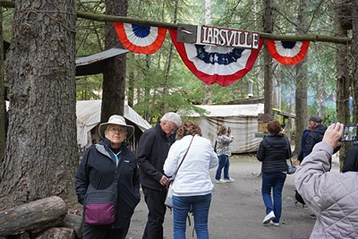
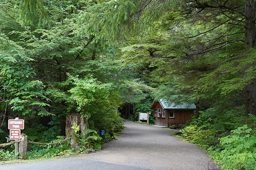
The entrance to Liarsville Gold Rush Trail Camp.  The “camp” is mostly based on tents displaying various aspects of camp life in the Klondike Gold Rush era.  “Rustic” permanent buildings on-site house a store, restrooms, and the Hippodrome entertainment venue.


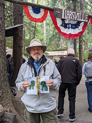
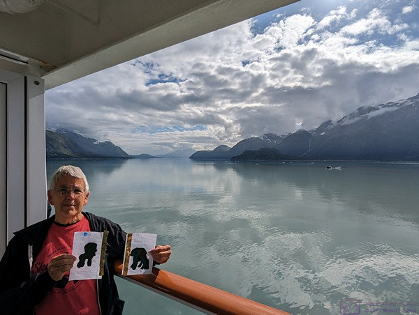
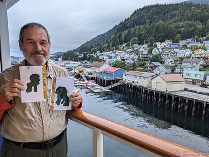
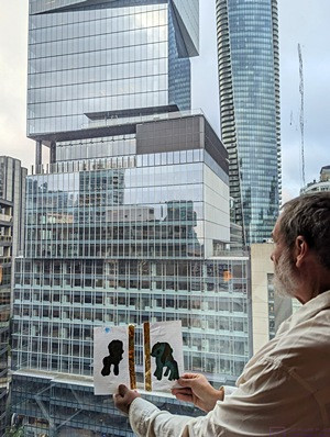
Our Liarsville location photo for grand-daughter Sadie with her Apa and Ama artworks.  (Photo by Linda)


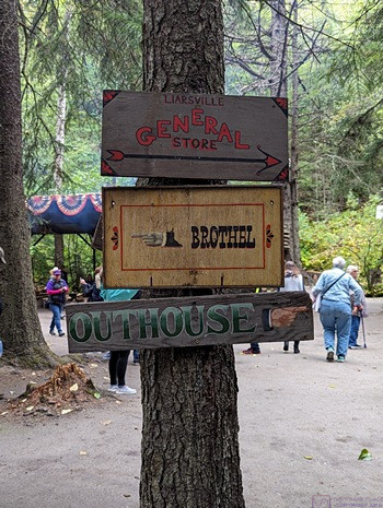
Signs to the most important places in the Liarsville camp (top-to-bottom): General Store, Brothel, and Restrooms.  (Photo by Linda)


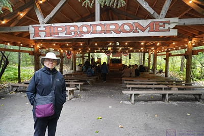
The Liarsville Hippodrome; a covered entertainment venue (that would not have been part of an 1897 Gold Rush camp).  (Photo by Linda)


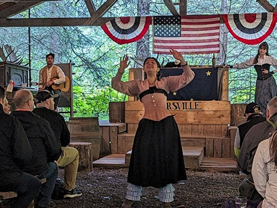
The young (to us) entertainers were very good.  (Photo by Linda)


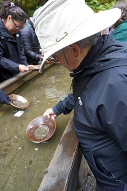
Linda pans for gold.  (She didn’t find any.)


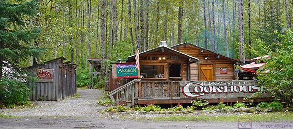
The Liarsville experience included a salmon bake luncheon.  Shown here is the Cookhouse.  It was here for tourists and employees and would not have been part of an authentic tent camp.


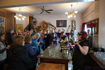
A view of the “back-room bar” at the Red Onion Saloon and Brothel.  The “madam” serves drinks to our tour group and “explains” the operation of the establishment.  The “rooms” are upstairs and we got to tour that area as well.


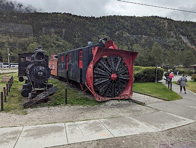
A massive snowblower used to clear the White Pass & Yukon Railway tracks.  My research indicated that it still works, and is still used, and is quite a sight to see in operation.  (Photo by Linda)


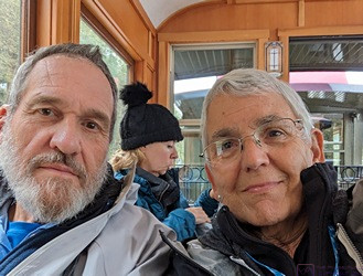
A rare selfie of the two of us.  We are in our Pullman-style train car as the train starts its journey up to White Pass Summit and Fraser, BC.  (Photo by Linda)


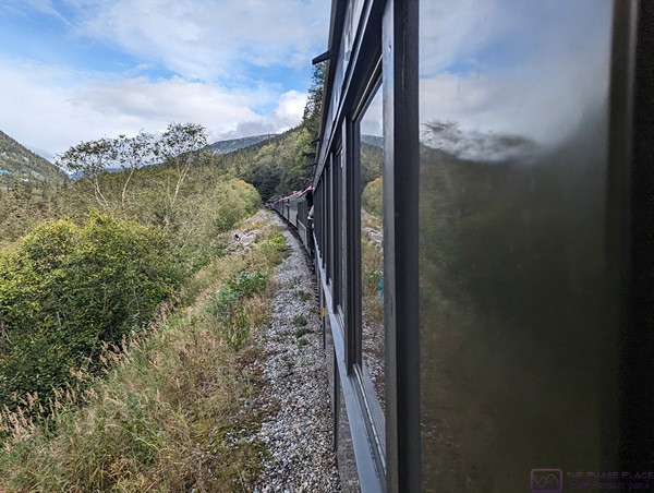
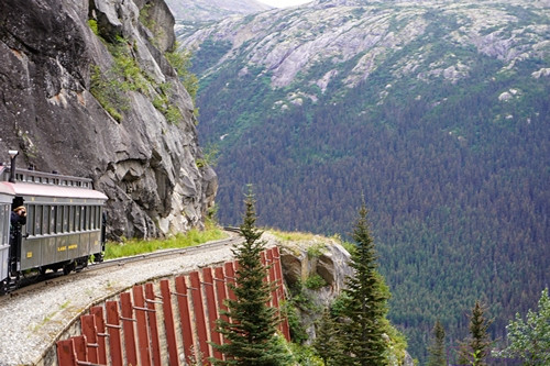
A view from of the left side of the train from in-between two of the passenger cars.  The views were constantly changing, and always amazing, but not always easy to capture from a moving platform with limited choices of shooting angle (and lots of other passengers also trying to take photos).  (Photo by Linda)


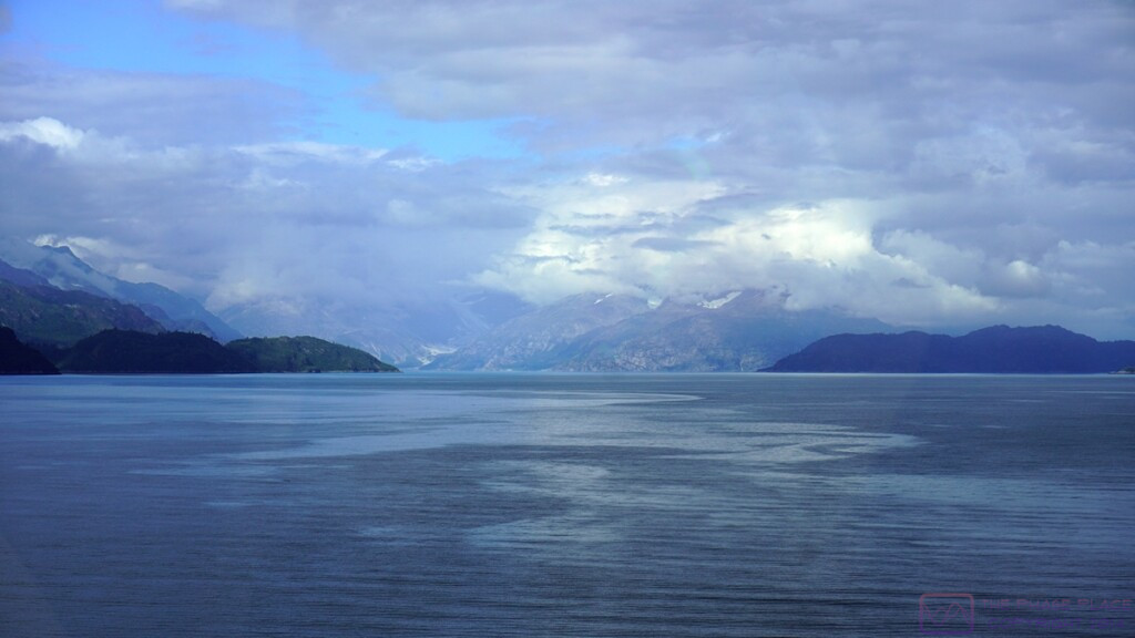
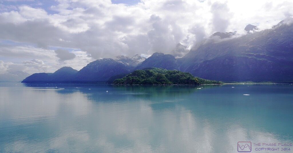
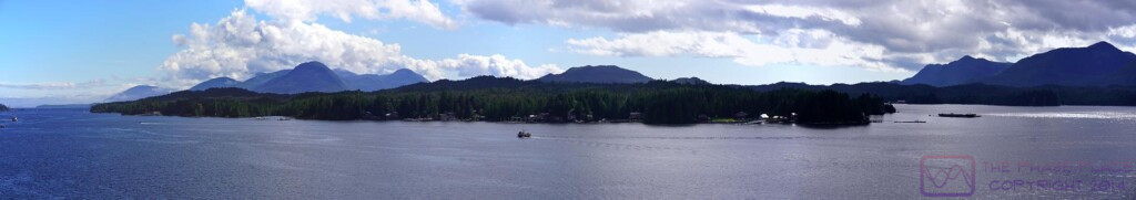
This a composite of two images that Linda shot with her phone.  The Coastal Range are some serious mountains.  (Photo by Linda)


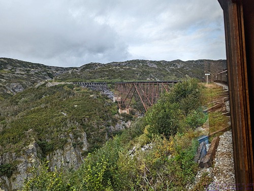
The train approaches one of several trestle bridges that span deep gorges.  The construction of this rail line was quite a feat of engineering and labor.  (Photo by Linda)


In the area around White Pass Summit, the highest surrounding peaks are in the 6000 to 7000 ft AMSL category.  The highest peak anywhere near Skagway is Mt. Fairweather.  Located 89 miles to the SW of town, near the ocean coast, it rises to 15,325 ft AMSL.  It is part of a range with numerous peaks in the 10K, 11K, and 12K foot ASL categories, and must be quite a sight to see from the ocean.  (Photo by Linda)


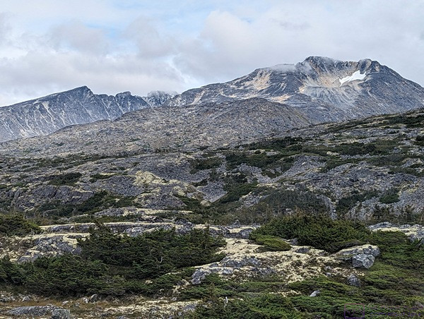
Mountains, mountains everywhere, with snow still present in the highest elevations.  (Photo by Linda)


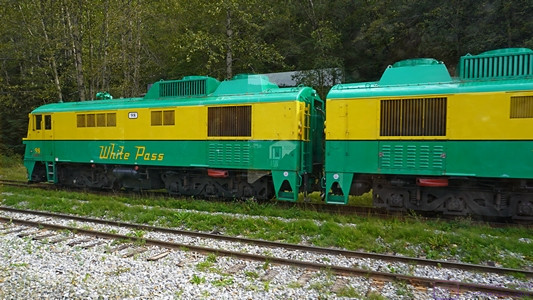
The WP&YR uses several different types of diesel-electric locomotives, and still operates a couple of steam engine locomotives.  Our locomotives were black with a red horizontal stripe, but I have been unable to identify the exact model.


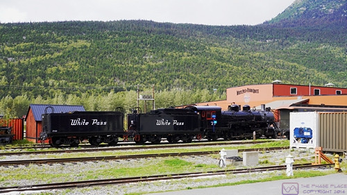
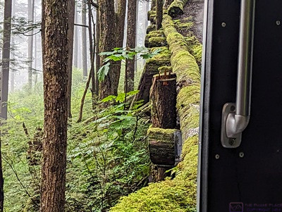
If this photo is of the maintenance yard, it is out of order.  The sequence number (assigned by the camera), however, indicates that it is in the correct order, so I’m not sure what is being shown here, but I have included it anyway.


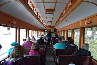
A view of our passenger car from the rear as Linda (closest person to the camera on the right) enjoys the scenery.


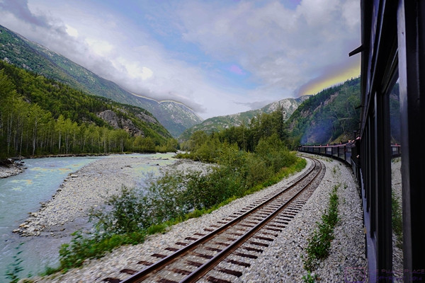
Somewhere along the White Pass & Yukon Route (the image has been manipulated, obviously).


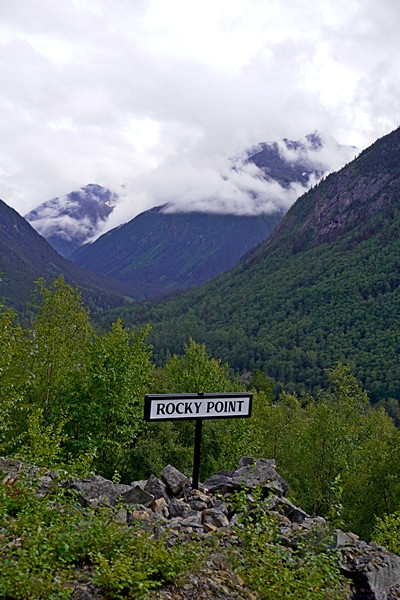
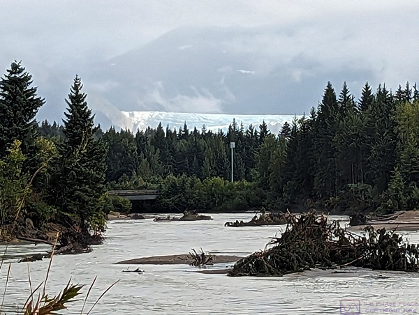
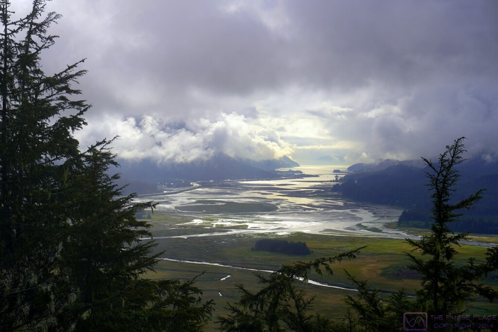
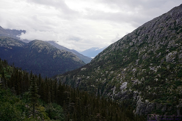
Well, this is obviously a view from Rocky Point, which is mm 6.9, so we still had most of the trip ahead of us.  The day was obviously cloudy, but the views were spectacular nonetheless.


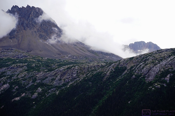
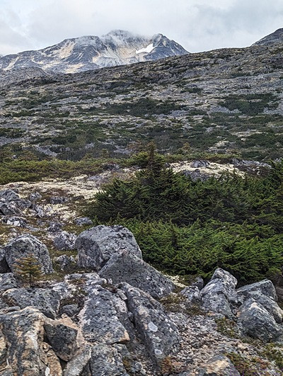
A jagged peak towers into the clouds.  Like I said earlier, the Coastal Ranges are serious mountains.


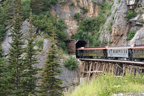
Our train crosses a gorge and disappears into a tunnel.  There are only two tunnels on the WP&YR route, Tunnel Mountain at mm 16.0 and a newer one (1969) at mm 18.8.  I was unable to determine which one this was after the fact.


The end of our train as it is about to cross a trestle bridge over a gorge and follow the rest of the train into a tunnel.
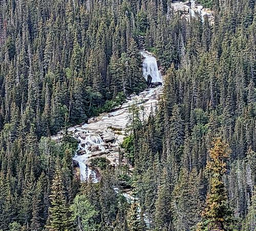
 

Distant views.


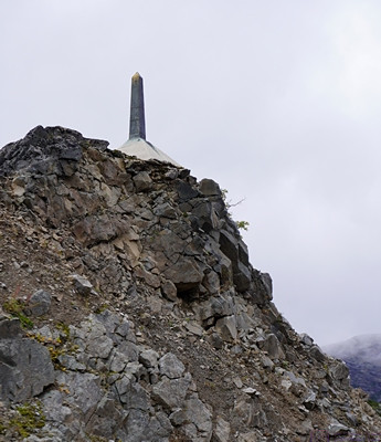
White Pass Summit and the monument marking the boarder between Alaska (USA) and British Columbia (Canada).  The Summit at White Pass is 2,864 ft AMSL.  The train starts in Skagway a few feet above sea level and climbs ~ 140 feet per mile traveled, on average.  That’s a 2.65% grade, on average.


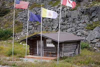
The (old) North West Mounted Police (NWMP) station.  I think this was right after crossing into British Columbia, but I’m not sure of the exact location.


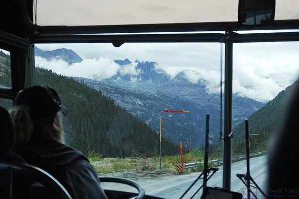
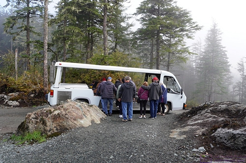
Our train ride ended in Fraser, British Columbia, where we cleared Canadian Customs before boarding a motorcoach for the return trip to Skagway via the Klondike Highway.


20230903_T8-C5_Juneau-AK

Note:  This is the 8th of 16 posts about our 21-day trip that included a 17-day (16-night) cruise on the Norwegian Cruise Line (NCL) ship SPIRIT from Vancouver, British Columbia to Honolulu, Oahu.  This post has 23 photographs with captions and some narrative.  All photos taken by me (Bruce) with a SONY alpha 6400 or Google Pixel 6 Pro unless otherwise indicated.  (Photos by Linda taken with a Google Pixel 6.)


SUNDAY 03 September 2023 — (T8,C5) Juneau (AK); Glaciers, Gardens, and Hatcheries

This was day 8 of our travels and day 5 of the cruise.  We signed up for a shore excursion to that included the Mendenhall Glacier, Glacier Gardens Rainforest Adventure (GGRA) (a private botanical garden and Yard Doctor Nursery), and the Macauley Salmon Hatchery.  The shore excursion started early and took most of the morning.

The Mendenhall Glacier is located in the Tongass National Forest.  Access is controlled and limited and, for whatever reason, our tour bus did have access today, so we only got to see the glacier from a distance.  Disappointing, certainly, but not the end of the world as we had just seen Glacier Bay National Park and Preserve yesterday.  We returned to the dock by noon and then walked around downtown Juneau, which is Alaska’s state capital.


Our tour bus stopped at a parking area that allowed us to walk north along a trail on the west side of the Mendenhall River, where I spotted this flower.


A stretch of the Mendenhall River, flowing strongly.  The Mendenhall Glacier is visible center frame just above the trees.  (Photo by Linda)


Glacier Gardens (GGRA) is known for their “upside down” trees.  Steve and Cindy Bowhay created this place, with the Rainforest Adventure opening in 1998.  Located within the Tongass National Forest, GGRA is a temperate rainforest environment.  The upside-down trees are just that; the lower portion of large trees and their root ball, inverted and stuck in the ground.  The top of the root ball is then used as a planter.  They are unique and delightful, with a wonderful variety of flowers and shrubs.


The GGRA Adventure involved climbing a small mountain through a dense forest in open-sided vehicles (shown later).  The road is constructed of logs in many places, with no shoulder and steep drop-offs in places.  There is a log curb, however, as shown in this photo, and our driver seemed to take safety seriously.  (Photo by Linda)


Another view of the road as seen from below.  The GGRA gardens were beautiful, and the views from the summit outstanding, but the road was an attraction in its own right, at least for those who are curious about such things (like me).  (Photo by Linda)


A view to the west (I think) from the summit of GGRA.  (Photo by Linda)


The extended wheelbase “vans” used to transport guests on the road to/from the summit of GGRA.


A small waterfall/feature at GGRA.  (Photo by Linda)


This planting bed at GGR caught our eyes.


A closer view of an interesting plant at GGRA.


Proof that I was here at GGRA.  (Photo by Linda)


Proof that Linda was also here at GGRA.  (Photo by Bruce using Linda’s Pixel 6.)


The landscaping at GGRA really was something.  This cascading stream looked very natural.  Glacier Gardens is not just a tourist attraction; is also a nursery and landscaping service for the greater Juneau area.


Our shore excursion concluded with a stop at the Macauley Salmon Hatchery (MSH), located northwest of Juneau on the Gastineau Channel.  Fishing in general, and salmon in particular, is a big industry in Alaska, of course, and there are many hatcheries and processing plants in the state.  The MSH is a working facility that is also open to the public for tours.  It was a great way to end our shore excursion.


The salmon run at MSH looking northwest.  The Gastineau Channel is to the left.  The tide was out and the water level was very low.


There were quite a variety of fish and crustaceans in the tanks at MSH.  I selected this photo because I thought it was an interesting composition.


The official (?) “Welcome to Juneau” sign.  We had, in fact, felt very welcomed everywhere we had been on this trip thus far.  (Photo by Linda)


We were not looking for it, but managed to stumble across the City Hall building for the “City and Borough” of Juneau.  The distinction must be important or the sign would not have mentioned it.  I wonder if the locals divide up into “townies” and “boroughies”?  And I wonder if “boroughies” is even a word?  (MS Word spell check doesn’t think so.)


I don’t recall what the significance of this building was, if indeed it had any special significance.  I photographed it because I liked its design and materials, and it had a cool totem pole.


This statue was in the plaza that is part of the State Capital complex, which included the Capitol, of course.  When I think of Alaska I think of many things, but especially Bald Eagles, Grizzly Bears, and Salmon.  This statue had two of those three, so …


We took this to be the main food/shopping street in Juneau, or at least typical of the retail sector in town.  Some of the shops and eateries might have been a bit more upscale, but not all of them, and the look/feel of the place was still very much coastal Alaska.  (Note:  The timestamp on this photo matches the time on the clock in the photo.  I love it when that happens.)


Like all of the coastal cites we visited, Juneau occupies land between the water and steep, high terrain.  Much of the city is built on the lower, flatter areas, when possible, but the land rises quickly and steeply as you move away from the water, and we saw plenty of structures up on the slopes that appeared to be mostly residences.  This staircase is very steep and long, and leads up to a building at the top that might be visible in this photograph.  (Photo by Linda)


Linda relaxes in our stateroom after spending the better part of 5+ hours ashore.  The ship in the background is the Seven Seas Explorer from the Regent Seven Seas Cruise Line.  It is one of their two new Explorer Class ships, the other being the Seven Seas Splendor.  ALL staterooms on ALL Regent Seven Seas ships are “suites” and come with butler service.  Regent Seven Seas offers a luxury cruise experience and tends to be more inclusive than most other lines, but with a fare to match.  In spite of being upscale, it is our understanding that these ships are quite relaxed, with freestyle dining, for instance.  They also tend to be mostly adult oriented, lacking some of the “entertainment” attractions on more family and “younger cruiser”-oriented lines.  I think we would enjoy this (or a similar) cruise line, if not for the cost.  (Winning a big lottery might chance that equation.)

20230902_T7-C4_Glacier-Bay-NPP-AK

Note:  This is the 7th of 16 posts about our 20-day trip that included a 16-night cruise on the Norwegian Cruise Line (NCL) ship SPIRIT from Vancouver, British Columbia north along the inside passage to Sitka, Alaska, and then across the North Pacific Ocean to the Hawaiian Islands, before ending in Honolulu, Oahu.  This post has 10 photographs with captions and some narrative.  Photos by me (Bruce) taken with SONY alpha 6400 or Google Pixel 6 Pro unless otherwise indicated.  (Photos by Linda taken with Google Pixel 6.)


SATURDAY 02 September 2023 — (T7,C4) Cruising Glacier Bay National Park & Preserve, Alaska

This was day 7 of our travels and day 4 of the cruise.  Our destination for today was Glacier Bay National Park and Preserve (GBNP&P).  We had an early departure from the port at Ketchikan yesterday, as it was a long sail from there to the Bay and our itinerary was planned to give us as much sailing time in the Bay as possible.  We anticipated that this would be one of the scenic highlights of our entire trip, and it was, in spite of less-than-ideal weather conditions.  The weather also made photography a bit more challenging, but I think we did okay.

Glacier Bay is a National Park & Preserve, so ships (cruise and otherwise) cannot just sail in as they please.  Access is controlled and cruise ships, in particular, have to book entrance for their itineraries well in advance.  They also have to stop near the entrance of the Bay and pick up a National Park Service Ranger/Historian, who remains on-board until the ship leaves the boundaries of the park/preserve.  The Park employee does double duty, both explaining on the P.A. system what the passengers are seeing, as well as (I suspect) “advising” the Captain about conditions in the Park so no harm comes to the ship or the Park.  Not a harbor pilot, of course, but an official Park presence for sure.  The Park employee is returned to their base as the ship exits the Park.


Our first large glacier appears on the port (left) side of the ship as it works its way north into Glacier Bay.  (Photo by Linda.)


Our APA and AMA “proof we were here photo for GBNP&P.  (Photo by Bruce using Linda’s phone.)


There were great views in every direction all of the time.  This photo is looking forward from the forward lounge.  The large glass windows distort the exposure and color.  I’ve corrected it as best I can.  (This image is 1200×675 pixels.  Clicking on it will display it full-resolution on a device with a sufficient screen resolution.)


The exposure on this photo was so bad I could not correct it.  I wanted to use it as it’s a nice shot of Linda and shows the forward observation lounge.  I adjusted it to make it “artsy.”


This is the same basic view as the previous two photos with an attempt at natural color corrections.  Some of the forward observation lounge windows are visible along with a few passengers for scale.


Winding our way around headlands as we sailed deeper into the Bay was exciting as we (literally) never knew what was around the next corner (even though we had a map of GBNP&P).  (Photo by Linda.)


Linda caught an especially nice photo of this headland with higher mountains behind.  I think this photo captures just how rugged GBNP&P is.  (Photo by Linda.)


The end of the Bay, ABIR.  The day started out overcast and grey, with weak light.  By later in the afternoon, the clouds had opened up a bit to let in light and reveal blue skies.  (This image is 1080×608 pixels, and can be displayed at full-resolution on an appropriate device by clicking on the image.)


Linda on the pool deck (13, ABIR) with mountains looming in the background, relatively close to the ship.  The experience of seeing the Park from a cruise ship was grand.


The land comes down to meet the sea as we sail south out of GBNP&P.  I liked the way this green island stood out against the somewhat monochromatic mountains and clouds.  (This image is 1200×628 pixels.  You know what to do.)

20230901_T6-C3_Ketchikan-AK

Note:  This is the 6th of 16 posts about our 21-day trip that included a 17-day (16-night) cruise on the Norwegian Cruise Line (NCL) ship SPIRIT from Vancouver, British Columbia Honolulu, Oahu.  This post has 14 photographs with captions and some narrative.  Photos taken by me (Bruce) with SONY alpha 6400 or Google Pixel 6 Pro unless otherwise indicated.  (Photo by Linda taken with Google Pixel 6.)


FRIDAY 01 September 2023 (T6,C3) Ketchikan, Alaska and Totem Bight State Historical Park


This was day 6 of our travels and day 3 of the cruise.  I’m not sure what time we arrived at Ketchikan, Alaska, but our first photos, taken from our balcony, appear to be from 6 AM local time.  If so, we were up early and dressed for the arrival.  The embarkation “sail away” is always a big deal, but we especially like arriving in a new port-of-call.  Cruise ships often arrive in ports very early in the morning to give their guests as much time as possible to go ashore (and spend money on shore excursions).  Departure is typically anywhere from mid-afternoon to early evening, depending on the distance/time to the next port.  These ships are able to set and course and speed and maintain it with considerable precision, so they have very accurate ETAs as a rule.   After a few photos, I presume we went in search of breakfast somewhere on the ship.


Proof of Arrival for grand-daughter Sadie.  The pony on the left (of the photo) is labeled “APA” (Grandpa Bruce) and the other one is labeled “AMA” (Grandma Linda).  (Photo by Linda)


We were docked starboard side in, so we had a view of most of Ketchikan from our stateroom balcony.  Most of the town is nestled between some small mountains and the water, and has an extensive waterfront.  This is a composite image of 4 photographs.


We booked a shore excursion to Totem Bight State Historical Park (TBSHP), which took up the late morning.  As we stepped ashore to gather by our tour bus, we were aware that this was the first time we had set foot on Alaskan soil.

One of things we noticed on the Coastal Alaska portion of this cruise was that many of the tour bus drivers/guides and venue guides were relatively young.  In conversation, we discovered that many of them were from Brigham Young University (Utah) and were here working seasonal jobs.  The reason is that BU has a semester schedule that makes it possible for students to take jobs in places like Alaska at times of the year when they are needed.  They also have a training program for tourist industry work, and many companies recruit from there as a result.  We were impressed that these relatively young folks had gotten their CDL-B (Commercial Driver’s License – Passenger Bus).


An information board on arrival at TBSHP.


A totem pole at the entrance into TBSHP.


The lovely, wooded entrance path into TBSHP.


The Lodge House at TBSHP.  Our tour guide provides scale for the carved figures that support the massive beams that support the rafter beams for the roof.


The Lodge House at TBSHP viewed from the entrance end.


A view of the Lodge House at TBSHP from the side, with several totem poles visible.


20

A view of the Lodge House at TBSHP from the side, with several totem poles visible.


Another interesting totem pole as we were exiting the TBSHP.


Upon return to the cruise ship dock, we walked the town for a while before returning to our ship well ahead of “all on board” time.


A view of one of the streets in Ketchikan.  Ketchikan was a neat little town, but busy with tourists and vehicles and difficult to photograph in an interesting or meaningful way.


This photo is from mid-afternoon, not long after leaving the dock in Ketchikan.  Seven images were composited to form this panoramic photograph.


These ships are part of the Alaska Marine Highway System, which is headquartered in Ketchikan, Alaska.  There is a major dry dock facility just out of frame to the left with a ship in it for repairs.

20230831_T5-C2_At-Sea on the Inside-Passage

Note:  This is the 5th of 16 posts about our 21-day trip that included a 17-day (16-night) cruise on the Norwegian Cruise Line (NCL) ship SPIRIT from Vancouver, British Columbia to Honolulu, Oahu.  This post does not have any photographs.

THURSDAY 31 August 2023 — (T5,C2) At Sea in the southern Inside Passage

This was the fifth day of our trip, and the second day of our cruise.  We left the cruise terminal in Vancouver, BC yesterday at approximately 3 PM local time and were scheduled to arrive in Ketchikan, Alaska early on the morning of September 1st.  That meant today was a “sea day.“  We had sailed overnight last night and would sail through the overnight hours again tonight—approximately 37 hours in total—before reaching Ketchikan, Alaska.  We tend to sleep well on cruise ships, perhaps surprisingly, as we are in an unfamiliar space with unfamiliar noises and sleeping on a mattress and pillows that are not our own.  Linda attributes this to the gentle movement of the ship (in nice weather) and perhaps the faint sound of water flowing as the ship glides through the ocean.

This cruise was going to have more sea days than most 2-week cruises as we would be crossing the North Pacific Ocean (NPO) from Sitka, Alaska to Nawiliwili, Kauai (Hawaiian Islands), a 5-night journey that would take five full days and parts of two others.  But this sea day was in the southern end of the famous “inside passage,” a route up the coast of British Columbia and Alaska that winds its way between the mainland to the east and the plethora of islands to the west.  As a route, it is more protected and (presumably) more scenic than the “outside passage” but, I presume, also trickier to navigate.  It’s not really optional, however, as the major cities here are mostly located on the mainland coast.  Going from outside to inside and back would add many, many nautical miles and hours to the journey and therefore $$$ to the cost of such cruises.  I presume it is also more scenic, with something to see on both sides of the ship most of the time.  An Alaskan coastal cruise is not just about epic scenery, however; it also about history, culture, and adventure, so the ships have to go to the cities if guests want to visit them which, of course, they do.

The weather was overcast and hazy during our initial passage, so we did not have any good photo opportunities until our arrival in Ketchikan.  Which was fine.  Sea days are a wonderful time to explore the ship in greater depth as well as just relax and enjoy the motion of the ship and the world floating by, if only ephemeral glimpses of land through the mist.  I found a book on the Bauhaus in the ship’s library, and spent some relaxing time reading it over the duration of the cruise.

20230830_T4-C1_NCL-SPIRIT Embarkation and Sail-Away

Note:  This is the 4th of 16 posts about our 21-day trip that included a 17-dat (16-night) cruise on the Norwegian Cruise Line (NCL) ship SPIRIT from Vancouver, British Columbia to Honolulu, Oahu.  This post consists of 13 photos with captions and some narrative.  Photos taken by me (Bruce) with SONY alpha 6400 and Google Pixel 6 Pro unless otherwise indicated.  (Photos by Linda taken with Google Pixel 6.)


WEDNESDAY 30 August 2023 — (T4,C1)  NCL SPIRIT Embarkation & Sail-Away, Le Bistro French Restaurant

Today was the fourth day of our trip, and the first day of our “Ice & Fire” cruise on the NCL cruise ship SPIRIT.  Embarkation was at the cruise terminal at the Port of Vancouver, which we had visited during the last couple of days to make sure we knew where it was and how to get in as pedestrians.  Given that it was only ~0.5 miles from our hotel, which did not have a shuttle service, we walked to the cruise port with our roller bag suitcases rather than take a cab or Uber.  I’ve mentioned previously that central/downtown Vancouver is a very walkable city, at least in nice weather.

Embarkation was relatively easy.  We checked our larger bags, and took our smaller ones on-board with us rather than leave them for the porters to deliver.  We had to wait for a while to gain access to our stateroom but once we did, we dropped off our bags and explored the ship.  We would naturally do this anyway, as there isn’t much else to (other than drink or swim) while all of the guests are being embarked, but we have also discovered that this is one of the “tips” that is widely shared on Youtube cruising channels.

We made an assumption that the scenery going up the inside passage might be better on the starboard (mainland) side of the ship, so we booked a balcony cabin on that side (the right when facing forward towards the bow).  We chose a room on Deck 9 near the fore-aft center of the ship.  This deck was high enough to have a good view and a near optimal location to minimize the effect of the ship’s movement by being near the ships center of gravity.  This minimizes both roll (side-to-side, worse the higher up you are) and pitch (fore-to-aft, worse the closer you are to the bow or the stern).  (The most movement is felt high up at either end of a ship.)


I hold two “cards” that our 4-year-old grand-daughter made.  We tried to photograph them each place that we visited and share the photos with her.  This photo was taken around 10 AM local time near the bow as the ship was docked “bow in” such that the bow was close to shore and the buildings of central downtown Vancouver, BC.  (Photo by Linda)

After getting to our room, we explored the ship for a bit and then had some lunch in the café (buffet).


This photo was taken from the forward lounge (the bow of the ship is visible).  The “sails” to the right of the ship are on the roof the terminal, which also houses Canada Place.  The upper deck by the sails is publicly accessible and affords a great, close-up view of docked cruise ships.


This photo is a view of the rear of the ship with the small swimming pool surrounded by lounge chairs arranged on stadium tiers.  The land in the background is North Vancouver on the other side of the harbor.


A rare photo of me on an upper/rear deck above the rear swimming pool looking towards the exit from the harbor and the bridge to North Vancouver.  (Photo by Linda)


Departure was scheduled for mid-late afternoon local time, and the ship started to move away from the dock around 3 PM, ABIR (and as evidenced by my photos).  We had a lovely cruise out of the Vancouver harbor, with lots of seaplane activity, something we don’t see much at home.  We watched the scenery go by for quite a while, but eventually went to dinner.


The ship has left the dock, and is making a backing turn.  This and the next three (3) photos were taken from the upper forward lounge though large plate glass windows.  This resulted in reflections and a heavy blue cast to the images, which I tried to correct.  Notice how the cruise terminal juts out like the bow of a ship, which was the architectural intent.


Another view of the Port of Vancouver Cruise Terminal.  The ship-like appearance is even more apparent here, with the “sails” flying above the building.


The ship is bringing the bow around towards the harbor entrance with the Vancouver skyline visible to port (left).


From Wikipedia:  “The Lions Gate Bridge, opened in 1938 and officially known as the First Narrows Bridge, is a suspension bridge that crosses the first narrows Burrard Inlet and connects the City of Vancouver, British Columbia, to the North Shore municipalities of the District of North Vancouver, the City of North Vancouver, and West Vancouver.”


The entrance/exit from the harbor is underneath a bridge (center of the frame) that connects Vancouver (left) and to the North Shores municipalities (right).


The ship is about to pass under the Lion’s Gate Bridge that connects Vancouver (left) to the North Shores municipalities (right).  The bridge marks (symbolically) the boundary of Vancouver harbor with the larger Pacific ocean.


Once the ship was out of the harbor and underway we eventually went to dinner.  Dining on NCL ships is “freestyle,” which means we did not have an assigned dining room, time, or table.  This is not true with all cruise lines, but it’s something we like and will look for on future cruises, regardless of the cruise line.  On this occasion, however, we had booked a table at Le Bistro, the specialty French restaurant.  I think we got two specialty restaurant meals as part of our cruise fare, and Linda thought it would be nice to use one of for our embarkation dinner, and she was right (of course).  We booked a 7:45 PM seating.  The setting was lovely and the food was amazing.


Linda models our table at Le Bistro, with lots of glasses waiting to be filled.


Our salad.  I think it had artichokes, but whatever it was, it was amazing.


I pose with what I presume was the main course.  Whatever it was, it was also amazing, because our recollection is that everything about this meal was amazing.  (Photo by Linda)


The Le Bistro dinner menu for this evening.  The reality of cruise ship dining is that we have to become vegetarians (or pescatarians) as true vegan options are very limited to non-existent, unless we only eat salad from the café/buffet venue.  (Photo by Linda)


Sometime during the day, and certainly before we went to sleep for the night, we unpacked our suitcases and found a storage place for everything.  We appreciated that the empty suitcases fit neatly under the bed and did not take up valuable closet or floor space.  Had they been a few inches thicker, they might not have fit.  Something to keep in mind for future cruises.

20230829_T3_Exploring-Vancouver-BC-2

Note:  This is the 3rd of 16 posts about our 21-day trip that included a 17-day (16-night) cruise on the Norwegian Cruise Line (NCL) ship SPIRIT from Vancouver, British Columbia to Honolulu, Oahu.  This post consists of four (4) photos with captions and some narrative.  All photos were taken with a Google Pixel 6 Pro by me (Bruce).


TUESDAY 29 August 2023 — (T3) Exploring Vancouver, British Columbia (CA) for another full day

This was the third day of our trip and the second of two full days we allocated to explore the City of Vancouver, British Columbia, Canada.  We were suitably impressed with our explorations yesterday and were glad we at least allowed a second full day.  Today we … well, I don’t know exactly what we did today, but I know what we did not do; we did not take very many photos.  As I am working on this blog post almost exactly 5 months after the fact, we are trying to recall highlights of the day.

Based on the available photos, it appears that we mostly consumed food but (ABWR) we mostly explored the area around our hotel on foot as our hop-on/hop-off passes expired sometime later in the day yesterday.  We recall walking along a street with a lot of shopping and food establishments in low-rise buildings and discovered a nearby Breka Bakery location.  Based on the time stamps on the photos, we returned there sometime in the evening and bought some bakery treats to bring back to our hotel room.  We vaguely recall that the weather was overcast with intermittent rain, which would explain why we took so few photos, or at least why we walked the area near the  hotel and I did not take any photos with the SONY alpha 6400 as I did not want to get it wet.


We had an early afternoon dinner at the restaurant in the downtown Vancouver Coast Coal Harbor Hotel.  L-2-R in the photo:  lettuce wraps, avocado dip & chips, and some kind of taco-like things (I think).  ABIR, they were very delicious and probably (mostly) vegan.  (Maintaining a plant-based diet is challenging when traveling, especially on a cruise ship. Meat and poultry can always be avoided, but fish, seafood, and dairy become more of a challenge.)


The time stamp on this photo is 03:51 (3:51 AM) on 30 August 2023.  The date/time stamp is UTC, and the local time in Vancouver is UTC minus 8.  That means this photo was shot at 7:51 PM on the previous date, i.e., 29 August.   Shown is a chocolate layer cake that Linda selected at the Breka Bakery outlet walking distance from our hotel.


This is what I selected from Breka Bakery.  It’s a crumb-topped cakey-thingy.  I do recall that it was delicious.  Knife and fork shown for scale.


This is a photo of the outside of the lid for the fold-up box that my crumb-topped cakey-thingy came in.  The packaging was as beautiful as the desserts.  Breka has seven (7) locations in the greater Vancouver BC area, and all of them are open 24 hours a day, 365 days a year.  It’s probably a good thing that we do have one of these near our home.  I think we discovered the one near our hotel while we were out exploring the area on foot, so that is apparently what we spent the day doing.

20230828_T2_Vancouver-BC-CA-1

Note:  This is the 2nd of 16 posts about our 21-day trip that included a 17-day (16-night) cruise on the Norwegian Cruise Line (NCL) ship SPIRIT from Vancouver, British Columbia to Honolulu, Oahu.  This post consists of 25 photos with captions and some narrative.  Photos were taken by me (Bruce) with a SONY alpha 6400 or a Google Pixel 6 Pro, unless otherwise indicated.  (Photos by Linda were taken with a Google Pixel 6.)


MONDAY 28 August 2023 — (T2) Exploring Vancouver, British Columbia (Canada)

This was the second day of our trip and the first of two full days we allocated to explore the City of Vancouver, British Columbia, Canada.  The city had been on our bucket list for some time, and it was exciting to finally be here.  We had read that it is an economically vibrant place that is very ethnically and culturally diverse, and looked forward to seeing and experiencing some of that in our relatively short visit before getting on a cruise ship.


A view of the skyscrapers near the Vancouver BC Coast Coal Harbor Hotel as we head out just after 7 AM to find coffee and a light breakfast.


A view from outside the downtown 49th Parallel Coffee Roasters.  The coffee shop was near our hotel and with excellent coffee and bread/pastry choices.  (Photo by Linda.)


IAs mentioned in yesterday’s blog post, the elevators in our hotel required our key card to access the floors various floors.  Not just the penthouse floors, but all of them.


I don’t recall what floor our hotel room was on; it was not the top floor (20), but it was fairly high up.  This is a panorama from the floor-to-ceiling window facing roughly south to slightly southwest.  Linda picked this hotel because it was a) close (walking distance) to the downtown train station and cruise port (Port of Vancouver), and b) not too expensive for its location.  It proved to be a nice hotel and a great location.


Our first destination today was Stanley Park, one of the “must see” things to do in Vancouver.  Located on the peninsula northwest of downtown Vancouver, it was walking distance from the hotel, but also accessible via the hop-on / hop-off bus.  This is a view from the park looking back towards downtown.


Linda photographed this map signboard to help us navigate this rather large (1,000 acres) park.  (Better/digital maps are available online from the City of Vancouver.)  The park was very green, with large trees and wonderful flower beds.  It is one of the premiere urban parks in North America and is a west coast rainforest ecosystem.  It has 17 miles of pathways and a 5.4-mile-long seawall.  It lived up to its billing, and was a wonderful place to spend a few hours and get in some “steps.”  (Photo by Linda.)


One of the highlights of Stanley Park are the authentic Totem Poles.


Another view of the Totem Poles in Stanley Park.  (Photo by Linda.)


Linda stands by the base of very large tree for scale.  Stanley Park is a west coast rainforest and has approximately 500,000 trees, many coniferous (Red Cedar, Hemlock, and Douglass Fir).  Although heavily logged in the late 1800’s, some of the trees are hundreds of years old, with the largest trees standing 249 feet tall.


The trees in Stanley Park are not all green.  There were scenes like this all along our walk through the park.


The flowering plants and shrubs throughout the park were also wonderful.


Another example of the beautiful flowering plants found along the paths.


The entrance to the Granville Island Public Market area.  From Wikipedia and Trip Advisor (via Bing):  “Granville Island is a peninsula and shopping district in the Fairview neighborhood of Vancouver, BC (Canada) across False Creek from Downtown.  Formerly industrial, today it is a posh artsy neighborhood filled with shops, eateries, breweries, and the Granville Island Public Market.  Arts and culture festivals are hosted here year-round.”  It was charming, and popular.


This photo of a street in the market area of Granville Island does not do justice to the place or how busy it was.  The Public Market was extensive, with lots of interesting vendors, but it was bustling with people, so we did not get a usable photo of the inside.


Our hop-on/hop-off tickets included access to the small ferries that go to various docks on False Creek.


We visited the Maritime Museum.  This is a view looking back towards downtown.


A panorama from the same vantage point.  Mountains surround the Vancouver metro area.  They are visible here, but often did not show up in our photos as the weather was hazy.  (Photo by Linda.)


Another view of skyscrapers (they are everywhere) from the ferry before landing at the Plaza of Nations dock and resuming on explorations by bus.


You have got to love a plant-based pizza and ice cream place named “Virtuous Pie.”  Being located in Vancouver’s Chinatown district was a bonus.  At least one source claimed it was the best pizza in North America.  We haven’t eaten every pizza in N.A., so we can not substantiate that claim but our meal, pictured here, was absolutely delicious.  Really good vegan pizza is not easy to make, but our pies were top shelf and their plant-based ice cream was also outstanding.


What you are looking at here is a steam-powered mechanical clock with four clock faces and most of the workings visible.  From AtlasObscura (paraphrased):  The clock is located in the Gastown district (central Vancouver), the city’s original/oldest neighborhood.  Vancouver has a central heating system that supplies steam heat to much of the city’s core, and the clock gets its steam from that system.


Another view of the steam clock, located in the 300 block of Water Street.  It was built in 1977 and sits atop one of the steam vents for the central heating system.  It is one of only a few functioning steam clocks in the world and is a “must-see” attraction, so we did.  There was a small crowd there along with us, which apparently is always the case, and the clock did not disappoint.  I actually shot a video with sound, but I am not posting it here (too many megabytes).


A composite image of the Disney Cruise Line ship WONDER as it departs the Port of Vancouver BC.  The large building center-left is the Vancouver Convention Center West.


The Canada Place portion of the Port of Vancouver BC Cruise Port Terminal.  The design of this port/terminal is suggestive of a ship, and allows the public to get an up-close view of docked cruise ships and watch them sail away and dock.  There is no admission charge as there are shops in the complex.


Looking west from Canada Place towards the Vancouver Convention Center West, the objects in the water to the right of the Convention Center are seaplanes.  These are not something we see very often where we live, but there were quite a few of them here, and we often saw them taking off or landing.


A view from the Canada Place portion of the Vancouver Cruise Port.  The Viking Cruise Line ship ORION is docked to the right.  As shown here, the public can get a very close-up look at the ship.

20230828-152232_A6401840_598x336  A view from the Canada Place portion of the Vancouver Cruise Port.  The Viking Cruise Line ship ORION is docked to the right.  As shown here, the public can get a very close-up look at the ship.

20230827_T1_Air Ice Water Fire Air

Note:  This is the first of 16 posts about our 21-day trip that included a 17-day (16-night) cruise on the Norwegian Cruise Line (NCL) ship SPIRIT.  Our trip started in Michigan with a flight to Vancouver, British Columbia where we spent a few days exploring the central/downtown area.  We then boarded the cruise ship and headed north along the inside passage to Ketchikan, Alaska.  We toured Glacier Bay and then made port calls in Juneau, Skagway, and Sitka, with interesting shore excursions in each port.  We then crossed the North Pacific Ocean to the Hawaiian Islands, visiting Kauai and Maui before ending in Honolulu, Oahu, again with interesting shore excursion in each port.

This post consists of 5 photos with captions and some narrative.  Photos were taken by me (Bruce) with a SONY alpha 6400 or a Google Pixel 6 Pro, unless otherwise indicated.  Photos by Linda were taken with a Google Pixel 6.


SUNDAY 27 August 2023 — (T1) Detroit, MI (USA) to Vancouver, BC (Canada)

The first leg of our Air – Ice – Water – Fire – Air trip was air travel from Detroit Metropolitan Airport to Vancouver International Airport via Seattle-Tacoma (SEATAC) International Airport.  Much like any other “vacation” travel that does not involve one of our RVs, we had the usual preparations for this trip.  There was trip planning, booking the ship, arranging the flights, deciding what to take (and what not to take), figuring out how to pack it, online check-ins, actually getting to/from our home airport and parking our vehicle (we used U.S. Park for the first time, and it worked well), clearing Customs and Border check-ins, physical check-ins for flights and the cruise, and navigating unfamiliar airports, train stations, cities, and a cruise port and.  All of that was work, of course, and although makes for an interesting experience, it doesn’t make for particularly interesting blog fodder.

What might be worth nothing, however, is that we originally planned to do this cruise in June 2024 from Hawai’i to Vancouver via the North Pacific Ocean and coastal Alaska.  This is sometimes referred to as the “Fire & Ice” cruise and we had booked it earlier in 2023.  Sometime during the year, however, we received an e-mail from NCL informing us that the cruise had been cancelled.  Disappointed, but undeterred, Linda found that the same cruise was available on the same ship starting in late August 2023, but sailing in the reverse order.


On the street in Vancouver near our hotel.

Well, alrighty then, apparently we were going on our second cruise of 2023!  We were excited about it, of course, starting with embarkation at the Port of Vancouver in Vancouver, British Columbia, Canada.  Vancouver would be a first time visit for us, and a place we had wanted to visit for some time.  Indeed, it was the first time we would be in any Province of Canada west of Ontario.  Although we plan to visit Alaska by RV in the next few years, this would also be our first time in Alaska, and we were aware that much of southeast coastal Alaska is best accessed by ship.


I have held a private pilot license since my early 20’s (a long time ago), and I enjoyed flying small planes, but I have no love for modern day airline travel, and Linda shares that feeling.  Flying out of Detroit Metropolitan Airport DELTA Airlines is our primary choice because Detroit Metro is a major hub for the airline and flies almost everywhere from there.  Their “service” seemed to be lacking this time, but we doubt that it’s any different/better with any other carriers.  We particularly dislike the luggage “self-check” system, which still requires us to interact with an agent, of which there never seem to be enough on duty to handle the number of passengers, resulting in long waits in long lines.  We do some of the work and DELTA gets to hire less people.

Adding to this annoyance is that they have special lines and agents for customers with higher loyalty levels, and these lines are often empty but the agents just stand around waiting for the next privileged customer to show up.  Once through the TSA security check-point (more on that in a minute) we object to people being allowed to bring suitcases/bags on a plane that are obviously too large to pass carry-on dimensions, even after being told (by public announcement) that this will not be allowed.  Add to that the small, cramped seats in the “main cabin”, a stupid loading order (front-to-back), and it’s just not much fun.  In fairness, our interactions with agents and cabin crew were pleasant and helpful, as usual, and things tended to work better once we are in the plane and in the air.  Until we have to deplane, which is always a zoo.  But again, to be fair, the other passengers tend to “play nice” and let people out of their seats as the plane empties out.


Another street view in our Vancouver hotel district.

The TSA security check-points are always a hassle, especially having to remove shoes, belts, etc. but on this occasion we encountered a new issue.  As we were getting in line (for the ordinary travelers, not those with TSA pre-check or other special security clearance credentials) the area was suddenly closed for a “shift change.”  Apparently the shift change involved a 100% rotation of personnel, necessitating the shut-down of the lanes.  We were directed to go through the check-point in the attached Westin Hotel; a considerable (1/2 mile) walk from where we were.  Once through security, we had an even longer walk (~ 1.0 mile) through the terminal to our gate.  Fortunately, we arrived at the airport plenty early to leave time for this kind of nonsense, but nonsense it was nonetheless.


A shot from the hop-on/hop-off bus.  Vancouver has some very interesting skyscrapers and other architecture.

When we have to fly, we typically have two roller cases each, one that just fits within the carry-on size requirements and one that is much smaller and fits easily under the seat in front of us if needed.  The airline rules do permit us to bring this combination on board, but we have taken to checking the larger bags and carrying the smaller ones onto the plane.  If we are going to be away for a long time, we will take one or two larger suitcases that must be checked.  As such, the smaller bags contain the essentials that we cannot afford to lose in transit: cameras, tablets, chargers, spare glasses, medications, personal toiletries, a change of underwear and socks, and our winter (down) jackets if required by the time of year and/or destinations.  If our larger bags on delayed or lost, the bags and contents are replaceable given some time to deal with the situation.  With that in mind, we always try to arrive at least one day ahead of embarkation for a cruise.  For this cruise, we arrived three days ahead of time, giving us two full days to explore a city we had heard so much about, and were excited to finally visit.


Another unusual skyscraper as seen from the hop-on/hop-off bus.

A direct flight from Detroit to Vancouver was not available, or at least not at a time that worked for us, and we ended up flying through SEATAC Airport in Washington (State) and changing planes.  Which was fine.  We had a bit of a wait for the second leg of our trip, but that was fine too.  Most importantly, our two checked bags arrived in Vancouver on the same plane that we did.

Once we had gathered our bags from the luggage claim in Vancouver, we made our way to the on-airport train station.  Vancouver has a train that runs from the airport to the train station in the heart of downtown.  The system was “self-serve,” and a bit confusing to us as first-time users, but we figured out quickly enough how to use a credit card to get through the entrance control gate and get on the correct train with our roller-cases.  The train ride was novel and fun, and we got our first ground level view of the Vancouver area.  Soon enough we were exiting the train at the downtown station.  The station was ~0.4 miles from our hotel and ~0.1 miles from the Cruise Port (in the opposite direction), putting our hotel only ~0.5 miles from the Cruise Terminal, which will be important a few blog posts from now.


Vancouver’s Chinatown was large and felt very authentic.  Vancouver is known as a cultural and ethnically diverse metropolis, and we saw clear evidence of that as we rode around on the hop-on/hop-off bus.  (Photo by Linda)

Linda had selected the Coast Coal Harbor Vancouver hotel for our three (3) nights in the city; partly for the reasonable cost and partly for its proximity to the train station and cruise terminal.  Rather than hail a cab or call an Uber, we walked to the hotel, rolling our suitcases as we went.  (If we were younger and more physically fit we might have opted for suitcases/bags that work like backpacks, but the wheeled cases were okay).  Once we arrived in what we thought was the correct location, it took us a few minutes to identify the entrance to the hotel, but once inside the check-in process was very smooth and the room, many floors up, was very nice with a view of some of the surrounding buildings.  It was the first time we had stayed in a hotel that required us to swipe our key card to use the elevator to access our floor.  This was true for all of the floors, not just the usual “penthouse” floor(s) at the top.


Our first impression of Vancouver was that it was an architecturally interesting, clean, vibrant city.  The hotel concierge gave us some brochures and suggestions about things to see and do during a relatively short stay, including places to eat (given our plant-based preferences).  He also suggested the “hop-on, hop-off” bus, which included a ferry service on False Creek, as the best way to quickly get acquainted with the city.  Vancouver is a large city, but its various districts and neighborhoods were very walkable.  We decided to have a first look at the city on the bus/ferry and then search out someplace to have dinner.