Category Archives: Newfoundland-Labrador

20220826&27 – A Travel Day; Goodbye Newfoundland & Labrador, Hello (again) Nova Scotia

FRIDAY 26 August

(Note:  This post contains 9 photos and lots of words.  Proceed with caution.)

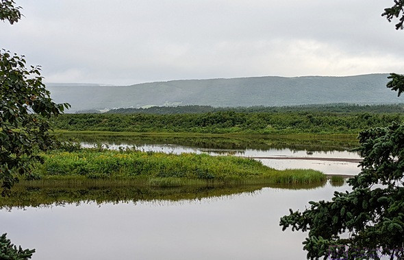
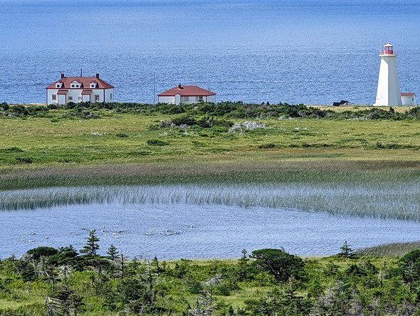
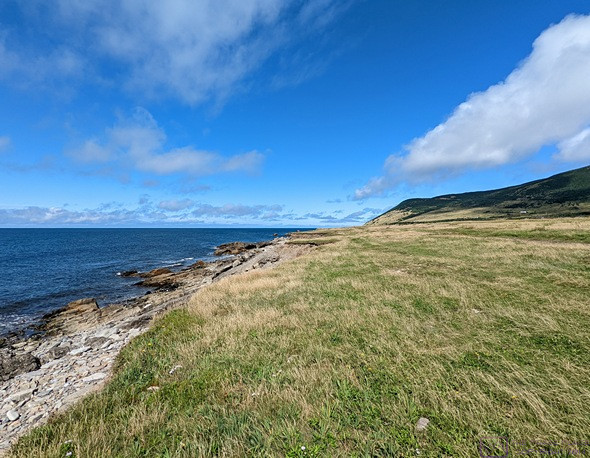
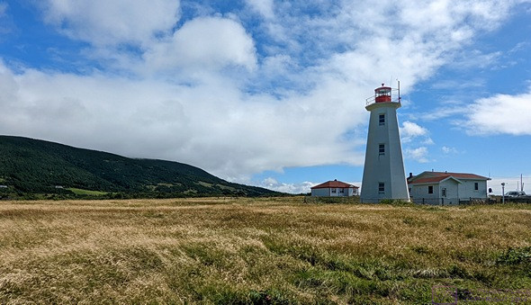
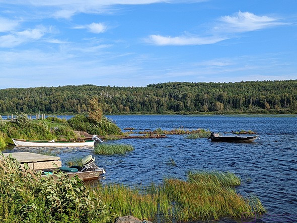
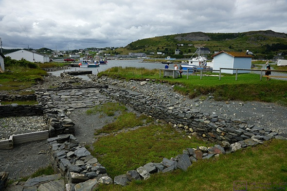
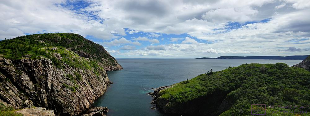
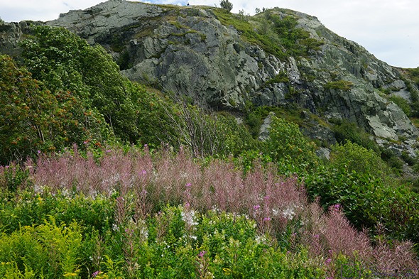
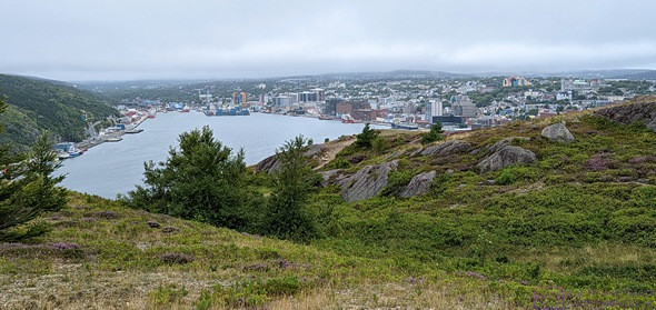
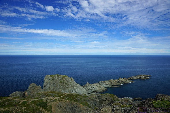
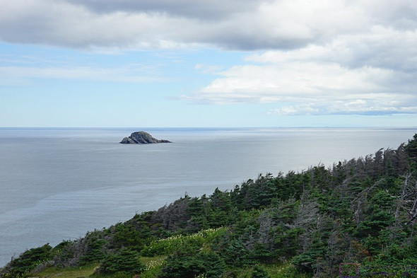
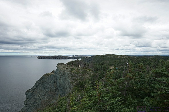
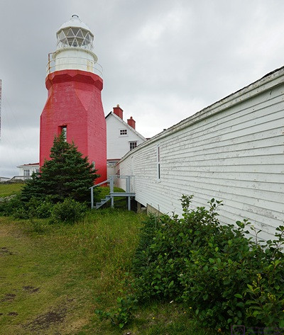
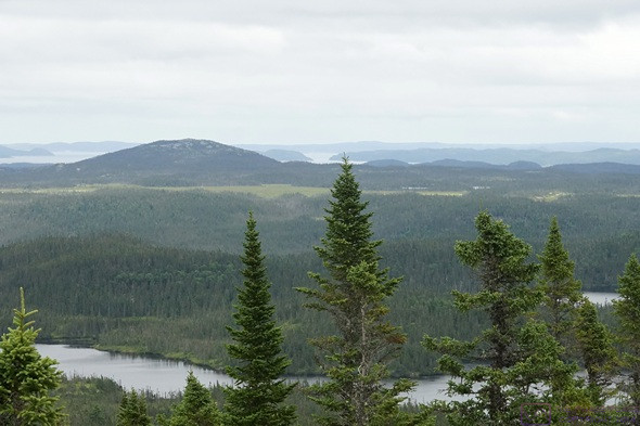
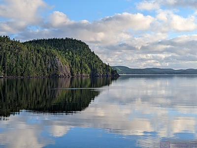
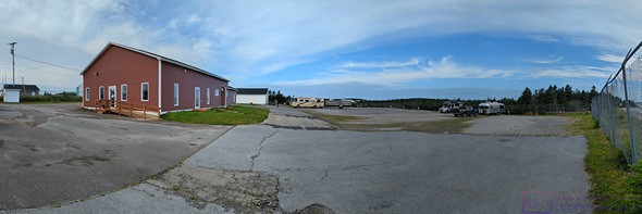
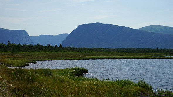
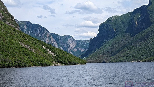
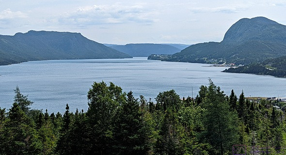
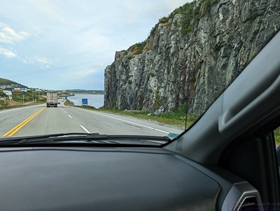
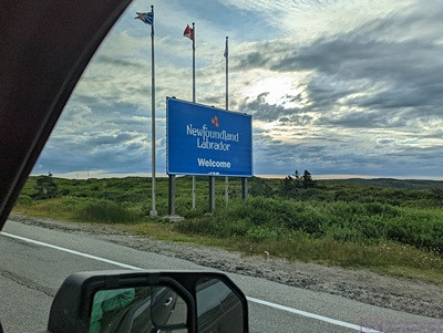
Today was a big day for us.  It was a major travel day, but also our last day in the Newfoundland portion of the Province of Newfoundland & Labrador, Canada.  We enjoyed our time here and are a bit sad to be leaving.  We saw and did a lot, but there was even more we did not get to see or do.  We wish we could have been here longer, but we still have half of Nova Scotia, and southwest New Brunswick, to explore before wrapping up or time in Atlantic Canada.  Even after re-entering the USA, we will be a month from home, with major stops in Bar Harbor, Maine, the Finger Lakes region of New York, and the Hershey area of Pennsylvania.

But the day started in a very relaxed way.  The difference was that we now understood the Marine Atlantic ferry process, so we knew what to expect and how to prepare for it.  As a result, we were not feeling the angst we experienced with of our first crossing at the end of July.

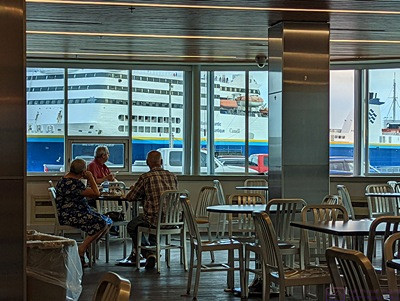
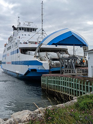
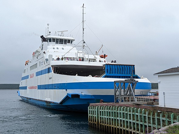
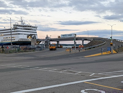
The MV Blue Puttees arrives at the Channel-Port-aux-Basque Marine Atlantic Terminal and prepares to dock.  It was quite a sight to look up from our table in the terminal cafeteria and see this ship right outside the windows.  (The windows in the cafeteria were clearly designed to provide an impressive view of the port/dock operations.)  The ship is just completing a 180 degree turn and starting to back into the loading dock area, which is around to the right of this photo.

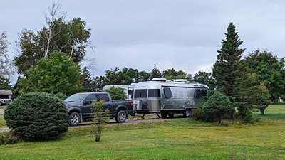
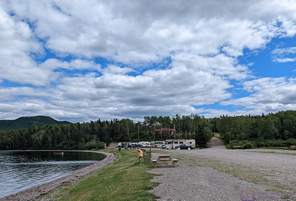
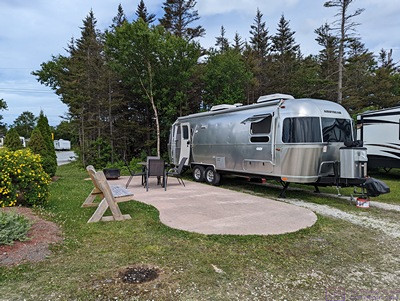
It also did not require an early start, which made for a more relaxing day.  We knew we could stay in the campground until at least 2 PM (normal check-out time here), and possibly into the late afternoon (if needed).  Equally important, we had determined yesterday that we could get to the ferry terminal any time after the morning ship left around noon.  That allowed us to sleep in, have coffee and breakfast, and take our time getting ready to leave.  Breakfast was our vegan versions of bacon, egg patties, toast, and fresh blueberries.

As much as we wanted to stay at the campground, with shorepower for the refrigerator, we also wanted to get to the ferry terminal and then relax there until time to board.  Equally important, the ferry terminal had functioning Wi-Fi and we wanted to take advantage of that.  We had enough experience running the refrigerator on propane that this was not a concern, and we knew the staging area was relatively flat/level.  Also, the weather was partly to mostly sunny, so the batteries and solar panels/charger would more than keep up with the small DC power draw of the refrigerator control board.

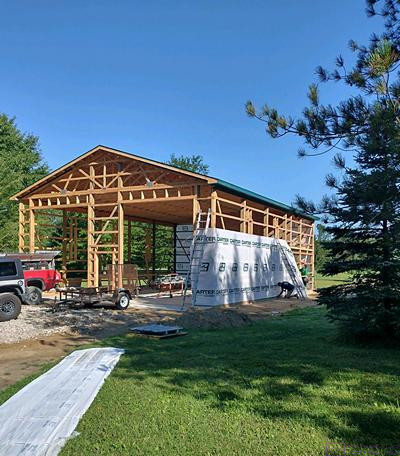
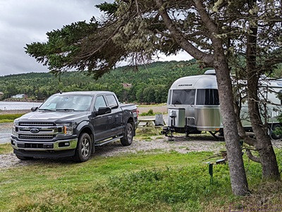
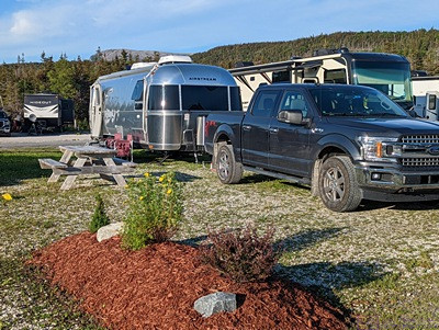
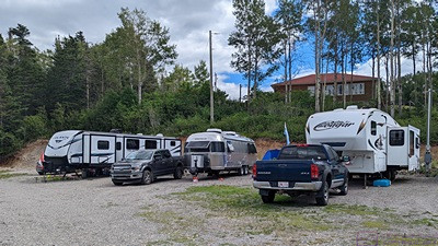
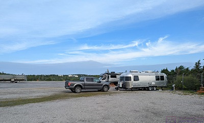
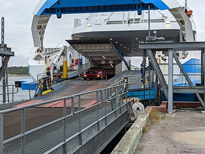
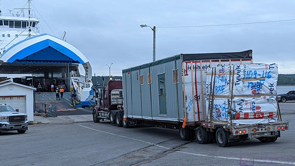
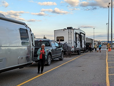
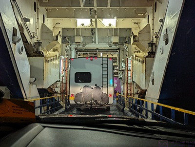
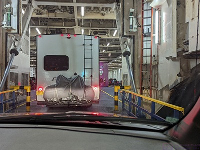
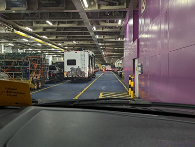
We targeted a 2 PM departure from the campground, and took our time breaking camp and hitching-up.  We’ve done this enough that we now had a good sense of how long our tasks typically take.  We pulled out a few minutes before 2 PM.  The 22 mile (36 km) drive to the ferry terminal took about 30 minutes.  It took about 15 minutes to clear security and get our boarding passes and room key, and then a few more minutes to clear the agriculture inspection and cleaning station.  (More details on this are in a caption for one of the photos.)  We drove around to the staging area and were queued up in Lane 9 (of 39).  We were first in line, and the first RV to arrive.  Quite a few trucks were already there, and a few other vehicles, but the massive staging lot was mostly empty.

Our cell phones appeared to be back in service, but we restarted them just to make sure.  We sent a few text messages and made a couple of phone calls to update our status with various people.  We tried to connect to the Marine Atlantic Wi-Fi system, but the signal was too weak.  I wanted to upload, assemble and publish several blog posts covering the past week.  They included photos, so I did not want to do this by hot-spotting my phone.

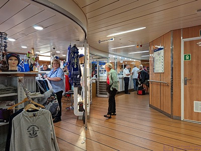
A view of the MV Blue Puttees ferry ship from the panoramic windows of the Marine Atlantic terminal cafeteria.  It is the sister ship to the MV Highlanders, that we took from North Sydney, NS to Channel-Port-aux-Basque, NL on July 28/29.  The ship is over 200 meters long and has 10 decks.  Decks 1/2, 3/4, and 5/6 are the cargo/vehicle decks.  Deck 7 is open seating after (with a coffee and snack bar), the concierge, gift shop and Wi-Fi lounge center, and the restaurant and bar forward.  Deck 8 is open seating aft and cabins forward while Deck 9 is reserved seating.  Deck 10 is the bridge forward with the heliport behind it, ship structure behind that, and a passenger accessible deck aft.

I took my laptop computer to the terminal and sat at a table in the cafeteria.  The Wi-Fi signal wasn’t that strong, but stayed connected and provided reasonably fast data rates.  I had two blog posts ready to go, so uploaded the photos to the media library in WordPress, and then assembled and published each one.  As long as I was in WordPress, I cleared the SPAM comments that the Akismet plugin had trapped.  There wasn’t anything else I could do in WordPress so I logged out.  As long as I was online, I checked e-mail and then logged in to the control panel for our domain, went to the SPAM quarantine, and cleared it out.  I then shut the computer down and went back to our trailer.  I had additional blog posts to work on, including processing photos.  This did not require me to be online, so I stayed in the trailer with Juniper-the-cat while Linda went to the terminal and updated her iPad.  In order to run the power supply for my computer, I needed AC power and turned on the inverter in the trailer.  As best I recall, we had never used the one in the trailer, but it worked great.  (We occasionally use the one in the truck, but the engine has to be on for it to operate.)

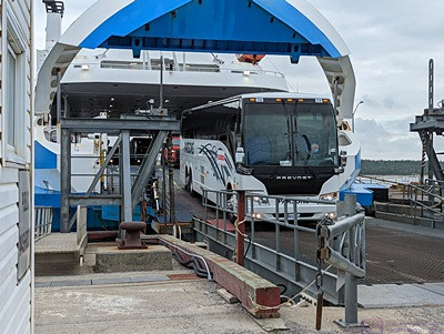
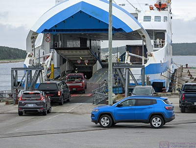
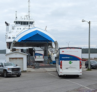
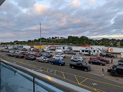
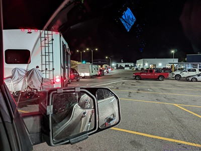
As the afternoon morphed into evening, vehicles started rolling in.  A trickle at first, but eventually a flood.  The longest queuing lanes are numbers 1 – 9, and this is where they staged most of the automobiles and pickup trucks.  I got the impression from the crew that specific lanes were used for vehicles with pets.  Land 10 was RVs and Lane 11 was ATVs.  After that came a mix of vehicles, including a tour bus in Lane 14 (I think).  From about Lane 16 on it was mostly large/long/heavy trucks, although not all of these lanes were in use.

By 5 PM we getting hungry and started tossing around ideas.  The only thing the cafeteria had that we would eat was French fries, but it had been a long time since we had any of those, so that was our dinner choice.  We walked back to the terminal and took my laptop computer and iPad along.  Dinner wasn’t fancy, but the fries were good, and very satisfying.  I uploaded, assembled, and published my remain blog posts and was caught up.  I also updated my iPad and phone.

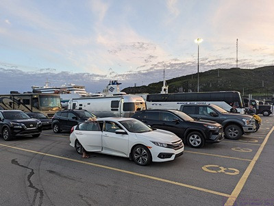
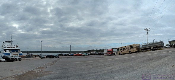
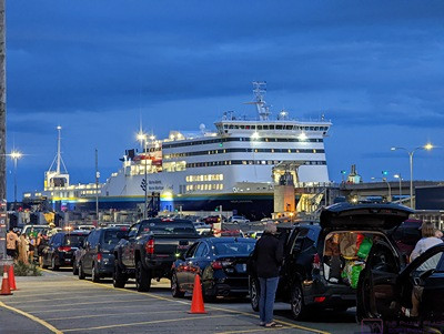
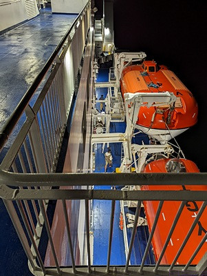
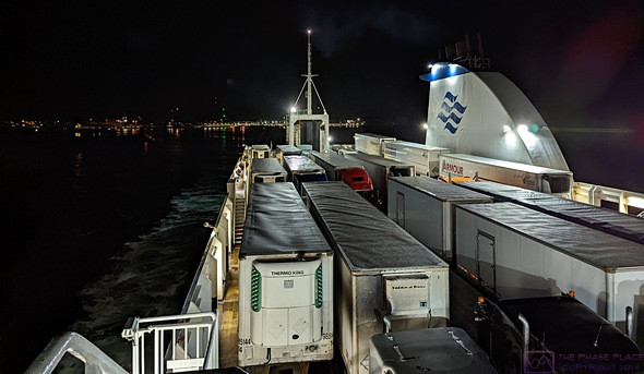
The staging area at the Marine Atlantic terminal in Channel-Port-aux-Basque with the MV Blue Puttees ferry ship in the background.  Our truck and trailer are center-frame, first in line in Lane 9 (the RV lane).

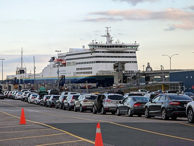
While we were eating and working, the MV Blue Puttees arrived in the harbor and commenced docking.  The cafeteria had big windows, and the ship wasn’t that far away, so it was really something to watch; like an elephant doing the slow, graceful dance moves.

MV Blue Puttees is the sister ship to the MV Highlanders that we were on to get to Newfoundland, and they load and unload in the same way.  We figured out that they dock at the North Sydney, Nova Scotia, terminal “bow in,” so that loading takes place through the bow.  At the Channel-Port-aux-Basque terminal, they have to dock “stern in” to unload as all of the vehicles are pointing in that direction.  (Obviously, both sides are equipped with the necessary hatches and loading ramps on each end.)  In order to dock “stern in,” the ship had to enter the harbor and then execute a 180-degree turn.  This was not a problem; the bow and stern thrusters on these ships can turn them around their mid-points.

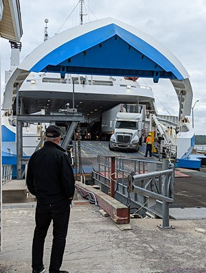
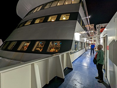
Once the ship was secured and the integral ramps were mated up to the adjustable shore ramps, the dis-embarkation began.  The ramps are on two levels, one directly above the other.  The upper loading ramp is dedicated to Decks 5/6, and was accessed by a long shore ramp.  Deck 5/6 is really just one double-height deck and is not fully enclosed, the stern-most part having nothing over it, and the rest being under the upper superstructure of the ship, but open to outside air.

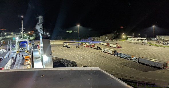
A night shot of the four entrance booths and the agriculture inspection building (to the left in the photo).  All vehicles come through a security checkpoint, and then the agriculture inspection building, before going to the entrance booths.  In our case, the security checkpoint had also been the entrance booth, but as the day wore on and the volume of incoming traffic increased, they opened the entrance booths shown here.  The entrance booth is where they verified our reservation, verified our identities, and gave us our boarding passes and cabin key.  (Passengers with reserved seating on Deck 9 would get their seat passes here.)  At the agriculture inspection building, they wanted to know if we had any potatoes, carrots, or turnips.  It turned out that the soil in Newfoundland has several organisms that could wreak havoc on the potato crops on the mainland.  The building was also a wash-down facility, like a car wash.  All of the ATVs, for example, got thoroughly rinsed as then came through the building.

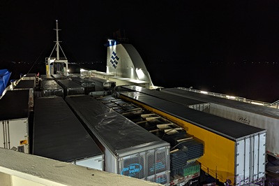
The lower ramp serves Decks 1 /2 and 3/4.  Again, these are double-height decks to accommodate tall vehicles like tractor-trailers and RVs.  Deck 3 was a little above shore level, and was unloaded before Deck 1.  Buses, RVs, vehicles with utility trailers, came off of Deck 3.  To unload Deck 1, the integral loading ramp is lowered internal to the ship.  This is the deck where most of the passenger vehicles are loaded, unless they have pets on board, in which case I think they load them on Deck 3.

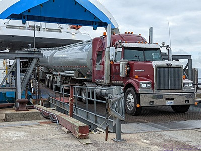
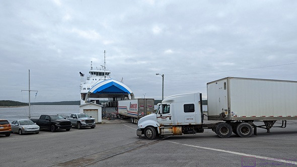
Marine Atlantic has special tractors that they use to unload “drop-trailers.”  We had heard this term but didn’t really understand it until the owner of one of the ATVs parked next to us explained.  Companies like “ARMOUR,” whose trucks we have seen everywhere in Eastern Canada, “drop off” semi-trailers in special holding areas at the Marine Atlantic terminals (including the one in Argentia, NL).  Marine Atlantic then uses their tractors and employees to load and unload these trailers from their ships.  Once the trailers are taken off the ships at the other end, regular over-the-road tractors/drivers pick them up and take them to their final destinations.  Although the trucking companies bay for this service, it allows them to move trailers between Nova Scotia and Newfoundland without having drivers make the trip with them.

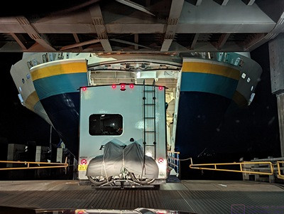
A view towards the stern of MV Blue Puttees showing the stern loading ramp for Deck 5/6 and part of the exposed portion of the deck.  The ship was mostly loaded by this point, with just a couple of tractor-trailers waiting to board.

Once the drop-trailers were unloaded, the embarkation process could begin.  But, built into the turnaround process was time to clean the ship, especially the cabins, and (we think) change out the operations crew.  (For the same crew to take a ship one way and then bring it back, they would have to work 30-hour shifts, which would not be safe.)  Because Deck 5 had a dedicated loading ramp, large trucks were some of the first vehicles to start going onboard.  For the lower ramp, loading started with Deck 1.  First on were ATVs and motorcycles, as these are relatively small and light and get parked along the outside edges of the deck.  Regular passenger vehicles were loaded next, and they put a LOT of them on Deck 1.  When Deck 1 was full, the internal ramp was reset for Deck 3, and it was finally out turn.

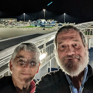
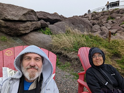
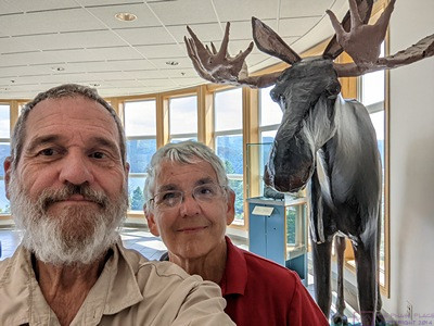
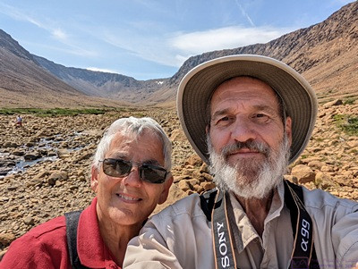
Our obligatory selfie looking towards the port side of MV Blue Puttees from the aft portion of Deck 10.  From here we could see all 39 lanes of the now mostly empty staging area.  The large blue building, center-top, is the terminal, which is actually shaped like a ship.

It had been made very clear to us yesterday, that we needed to through the check-in booths not later than 2 hours before scheduled departure.  Our ship was scheduled to sale at 11:45 PM, so that meant 9:45 PM.  When we finally boarded around 10 PM, all kinds of vehicles were still coming in.  To their credit, Marine Atlantic accommodated them.

The loading process took several hours and involved hundreds of vehicles and drivers.  It also involved dozens of Marine Atlantic employees working in a very coordinated way.  The coordination reminded me more of the Borg Collective than something centrally administered, but whatever their system, it definitely works.


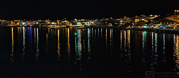
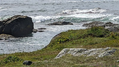
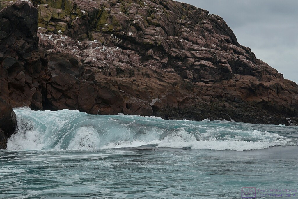
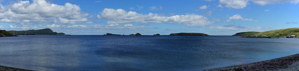
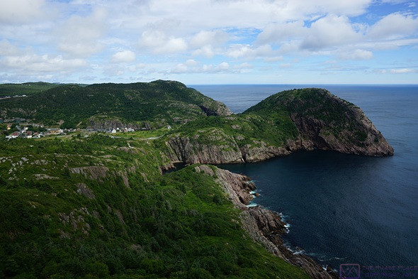
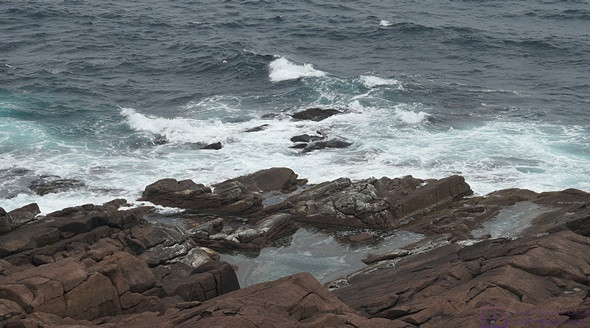
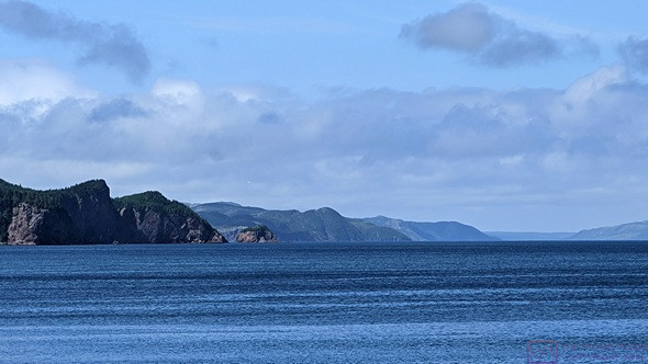
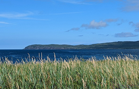
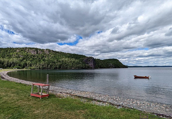
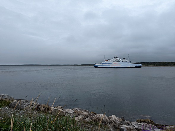
A view of the peninsula that forms the south side of Channel-Port-aux-Basque Harbor, as seen from the starboard side of MV Blue Puttees, sailing to the left in this photo.

Even through RVs were some of the last vehicles to load, we were on the ship much earlier than the last time.  We found our cabin, dropped off our suitcase, got some coffee, and then strolled around the ship.  The only real difference from MV Highlanders, is that MV Blue Puttees serves a table service breakfast while MV Highlanders has a breakfast buffet.  We stayed up long enough to watch the ship depart the dock and most of the harbor, and then turned in for the night.

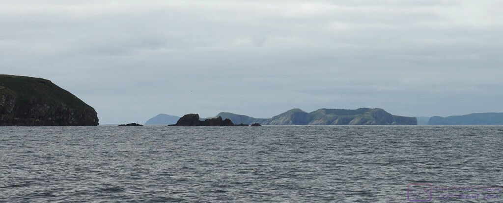
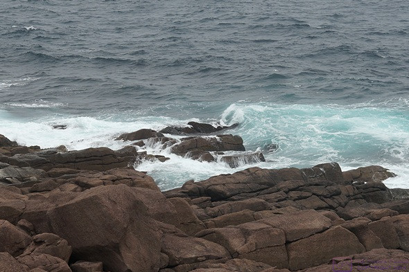
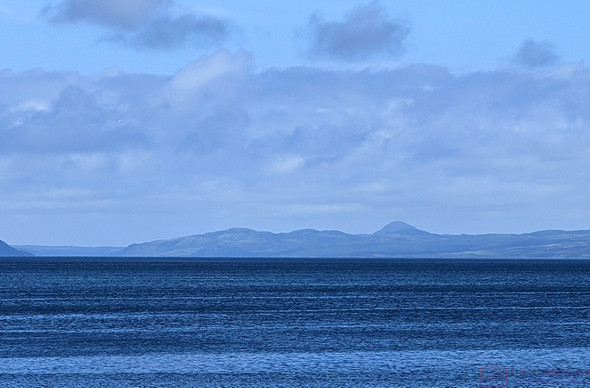
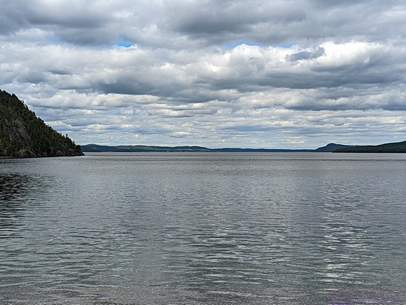
Our final view of Newfoundland as the MV Blue Puttees sails out of the Channel-Port-aux-Basque Harbor into the North Atlantic Ocean.


SATURDAY 27 August

Somewhere between Channel-Port-aux-Basque and North Sydney, we crossed the border between the provinces of Newfoundland & Labrador and Nova Scotia and moved from the Newfoundland time zone to the Atlantic time zone, gaining 1/2 hour in the bargain.  Our phones made the switch automatically, but we don’t know at what point they did that.

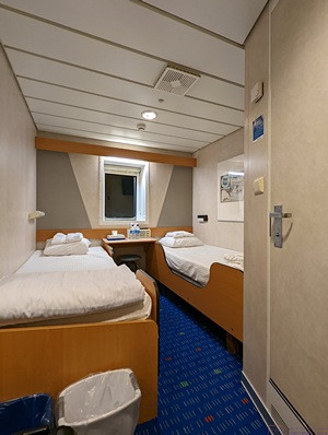
We had a nice enough cabin, albeit an interior one with no window to the outside.  It was a 3-berth, handicapped accessible one, so much more than we needed.  But it was all that was available when we booked this passage back in January 2022.  Neither of us slept well, however.  It might have been the late-night coffee, but I don’t think so.  The beds were very uncomfortable and the bedding was just strange and awkward to manage.  But mostly, it was the fact that the entire ship just vibrated constantly.  We had noticed this when walking around, but figured it would stop once we were underway.  It did not.  We did not recall experiencing this on MV Highlanders.

The breakfast announcement came at 6 AM Atlantic time and the 45-minutes-to-port announcement came 15 minutes later.  Linda took a shower, one of the real perks of having a cabin.  We got dressed and packed our suitcase and then went outside to  watch the emergence of dawn.

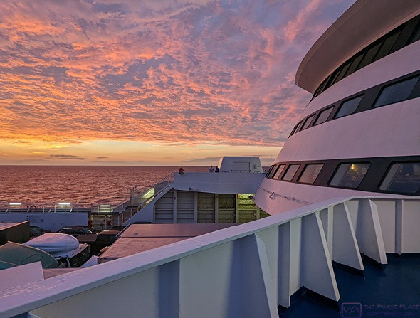
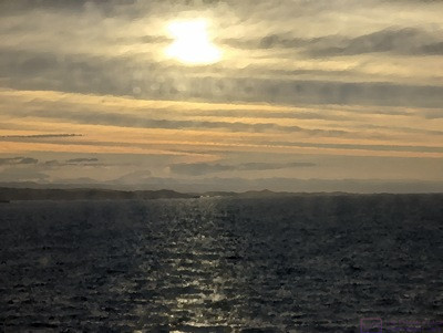
Just before sunrise, as seen from the starboard side aft outside portion of Deck 7.

We then went all the way forward on Deck 7 to the bar area (the bar was closed).  We sat by one of the front-facing windows near the centerline of the ship and watched it come into the North Sydney Harbor.  As it got close to the dock, we returned to our cabin and collected our suitcase.  Before going to bed last night, we established that we could take stairs from Deck 8 down to Deck 3, rather than wait for one of the elevators.  We headed down to Deck 7, but a crew member was blocking us from going any farther.  To either side of the stairwell, large groups of passengers had already gathered, waiting for the “return-to-your-vehicles” announcement.  When the announcement finally came, there was an orderly merging of the two groups and we were on Deck 3 shortly thereafter.

Although we were close to the front of our lane, we were in the far-right lane and knew the crew would move vehicles out of the center of the ship before moving us.  That allowed us a little breathing room to get Juniper-the-cat from the trailer and move her to the truck, and get ourselves ready to drive.  It didn’t take long after they started moving vehicles from the outside lanes, alternating left and right. Unlike the loading process, the unloading process moves right along As we pulled off the ship and around a corner to right, Linda spotted a large, open area and I pulled over there.  I turned the propane back on while she went to the trailer, turned on the refrigerator, and confirmed it was operating on propane.  She reported back the temperature was 48 degrees (F).  Not bad.  There were big enough spaces between vehicles as they came off the ship that I had no problem pulling back onto the exit road, which led directly out of the terminal to the Trans-Canada Highway (Hwy-105).  We got on the T-CH westbound, and were on our way to Elm River RV Park near Truro.

20220824&25 – A Travel Day, SMRVPark (GF-W) to GCRV&T (Doyles), Channel-Port-aux-Basque, and Cape Anguille Lightstation, Newfoundland

WEDNESDAY 24 August

It rained during the night, but had quit by the time I got up at 0600.  We each had a 1/2 cup of coffee (half-caff for me) and toast for a light breakfast.  We had dumped our waste tanks, disconnected our fresh water system, and lined up the truck after dinner last night, which simplified our departure routine this morning.  Our What 3 Words location here was “handles.mixers.restored” in case I forgot to mention that in the previous post.

Today was another long travel day.  Our destination was the Grand Codroy RV & Tent Campground in Doyles, Newfoundland, just 36 km (~22 mi) short of the Marine Atlantic Ferry terminal in Channel-Port-aux-Basque.  Linda had called yesterday to confirm that we had a site for two nights, with a late departure on Friday.  With that confirmed, she had called Kinsman RV Park in Corner Brook to let them know we would not be stopping there after all.

We started our final departure preparations around 0800 and pulled out of our site at 0906 with 440 km (~273 mi) in front of us and an estimated driving time of 4-1/2 hours. The route was almost entirely the Trans-Canada Highway, except for a couple of kilometers on either end, and was mostly good driving surface. We thought we would be driving through rain, but had a mix of clouds and sun until about an hour from our destination.  Traffic was light, and we had long stretches with no one behind us and very little oncoming traffic.

I got a text message in transit from our builder.  He wanted to call us in an hour or two.  He has not had to do that since we left in June, so we figured he had run into an issue with something.  Linda texted him back that three hours would be better (we thought we would be in camp by then).  In hindsight, we probably should have called him back right then as we had good cellular connectivity along the entire length of the T-CH.

In thinking about our time in Newfoundland, and our marathon 2-day drive from St. John’s back to Port-aux-Basque, we wished we had planned more days for the return leg, as there were more places we could have visited, and back-to-back long driving days was not our preferred style.  But we also felt we had done Okay with our planning as we had a “date certain” by which we wanted to be home to celebrate a certain someone’s 4th birthday.  And we still had a lot of things to see and do in places other than Newfoundland between now and then.

The Grand Codroy RV & Tent Campground has frontage on the Grand Codroy River which drains the Grand Codroy Valley.  The river is tidal, and widens out quite a bit as it flows to the ocean (to the left in this photo).

We arrived at Grand Codroy RV Tent Camping at 14:00 with under 1/4 tank of fuel and only 64 mte (miles to empty) remaining.  We averaged 10.5 mpg since filling up at the Irving station in Grand Falls-Windsor yesterday.

The campground was cash only.  That wasn’t a problem, but places really ought to tell you this when you call to book or confirm.  We were assigned site 36, a large back-in full-hookup (30A).  (W3W = “squid.patted.temptation”)  In fact, all of the sites in this part of the campground where very generously proportioned with trees and bushes here and there (but not “in” the woods) and nicely mowed grass.

We had to set up in light mist.  We were Level side-2-side without having to do anything, and a bit low in front.  Front-2-back leveling is much easier as it just involves adjusting the tongue jack after the truck and trailer are disconnected.  We got the truck unhitched, the trailer leveled, and plugged in the shorepower cord.  We had freshwater onboard, so I left the water and sewer connections for later.

Our one big disappointment was that we had NO Wi-Fi at our site NO cellular service.  We’ve been all over Newfoundland the past 27 days, and we’re pretty this is the first time we have not had a cellular signal that was at least good enough to send/receive text messages.  People like to talk about “disconnecting” from the world, but that has not been our objective.  We do not “work from the road” (much), but we are dependent on connectivity to make our travels work for us.

Our truck and trailer in site #36 at Grand Codroy RV & Tent campground.  It was a spacious site with nice trees and bushes, but not closed in.  This property was part of a provincial park at one time, but 10 acres was returned in modern times to the descendants of the original settlers from the mid-1800’s.  We did not find out if the campground was originally part of the provincial park, or developed after the transfer.

By the time we had checked-in and set up camp, it was going on 3 PM. We were hungry, of course, so Linda made grilled sandwiches for linner and served them with sliced fresh pears and peaches.  After or meal, we walked to the office and got the passwords for the Wi-Fi.  We were able to connect our phones to it, so we texted our children and our neighbor, Mike, about our lack of cellular service and spotty Wi-Fi for the next couple of days.  The staff said they had cellular “just behind the check-in building,” but no joy.  I was, however, able to switch my phone to Wi-Fi Calling (VOIP) mode, but Linda was not able to get her’s to do the same.  Our phones are similar, but not identical, and they do always behave the same way even through we are trying to access the same networks.

I called our builder back.  Our choice of roof shingle was no longer available and we would need to select a different one from new options he would e-mail to us.  He had also gotten the firm quote from the Overhead Door Company for our two large (12’w x 14’h) roll-up doors.  It was a bit higher than originally estimated.  He wanted us to review the cost and approve it since once the doors are ordered, they cannot be returned.  Also, the inspector had required him to change the stairs going up to the storeroom to get a code-compliant rise-run.  (My original design was a bit steep as I was trying to keep it from extending too far out from the enclosed shop/storeroom area.

With that important task taken care of, we took the truck to the Esso station (Mountainside General Store) and the T-CH and Hwy 406 to fill it up.  It took 108.294 L and 206.41$, almost identical to our fill up yesterday at the Irving station in Grand Falls-Windsor, but with slightly less expensive (1.906$) gas as they only had regular grade.  Linda came along just in case there was a cellular signal there, but there wasn’t.  (Sad face.)  We are in extreme southwest Newfoundland.  Even though it is the location of one of the two ferry ports, it’s a remote, sparsely populated area dominated by the Long Range Mountains that extend up into the western peninsula and central highlands.

We returned to camp and relaxed for the late afternoon, and I napped for about an hour until dinnertime.  Dinner was oriental style ramen soup and crackers with peanut butter or strawberry jam.  After dinner we each had a small glass of the Moose Juice wine we got from the Auk-Island Winery in Twillingate.  It’s a Blueberry and Partridgeberry wine, and a bit unusual.  It is not sweet, and has a bitterness, which is different from being tart.

We spent the remainder of the evening playing games and working puzzles.  I set up my computer before going to bed, but deferred working on the blog until tomorrow.


THURSDAY 25 August

I don’t recall what time I went to bed last night, but I was up at 0500 this morning.  I worked on a Katana Nonogram puzzle I had started last night, but could not complete it.  I restarted it, but still had a mistake somewhere.  I was obviously making a logical error, but couldn’t see what it was, so I set I aside.  The Katana puzzles tend to be more difficult than the Pic-a-Pix from Conceptis.  Morning is a good time to work on the blog, so I turned on my computer and settled in to account for our activities yesterday.

Linda got up a little after 7 AM, and made our first cups of coffee.  We continued to have connectivity woes.  Her phone was hooked to the park Wi-Fi all last evening, which allowed her to play some of her games, but it would not connect this morning.  She even walked over to the check-in building with it, but kept getting an “IP configuration error.”  Grrrr.  She likes to play Words With Friends while drinking her morning coffee, and it requires an Internet connection.  My phone, however, seemed to be retaining its connection.  I was able to capture our What 3 Words location and even pull up Google Maps.  (Throughout the course of the day we actually restarted them several times in different location.)

Breakfast was bacon strips and egg patties with toast and butter (all vegan, of course).  During breakfast we discussed the possibility of trying to change our ferry crossing to the day passage tomorrow, which departs Channel-Port-aux-Basque at 11:30 AM.  Loading would begin at 0930, so we would need to be checked in by 8:30, which would require us to pull out of the campground NLT 0800.  Very doable, but some logistics would be involved to make it work

First, we would need to check with the North Sydney / Cabot Trail KOA to see if we could get a spot for tomorrow night.  IF that was possible, we would then need to see if we could change our reservation to the 11:30 sailing AND get a pair of adjacent reserved seats in place of the cabin, which we would not need.  And IF that was possible, we would need to call the NS/CT KOA back and actually book a site.  We would then need to call the Elm River RV Park and let them know we would be arriving a day late and only for one night.  A lot of pieces would need to fall perfectly into place for this to happen.

We are near Cape Anguille, the westernmost point of land on the island of Newfoundland.  It’s a modest drive out past the Grand Codroy River, which our campground abuts.  There is also a stone lighthouse Rose Blanche, about a 45-minute drive east of Channel-Port-aux-Basque along the south coast.

With a forecast for partly sunny skies and a very low chance of rain, we decided to go for a drive to see what we could see, and stop at the Marine Atlantic terminal to see about changing our passage.  We took our technology along on the chance (in the hope) that we would have cellular service and be able to download notifications and e-mails.

We drove narrow, winding streets through a modest residential area of Channel-Port-aux-Basque to get this cape with a small, public parking area.  We did not see any signs identifying it by name, but we could see the double steeple church downtown from there.

We headed directly to the ferry terminal, which proved to be a useful trial run for tomorrow.  A staff member at the security entrance directed us on the service road to the terminal.  Before going in, we called the North Sydney / Cabot Trail KOA.  Yes, they had a 30A 3-way site if we wanted it.  The ticket agent could get us on the morning ferry, but there were no reserved seats left.  I wasn’t surprised about the seating, but was surprised they still had room for our 50 ft. long rig.  We decided to leave things unchanged.

Before returning to our car, we had a long chat with the security guard about things to see and do in the area.  He even had specific suggestions for all kinds of places we could park our trailer (for free) and go for hikes or for food before coming to the terminal.  Once again, a friendly, helpful Newfoundlander.

I wasn’t sure if the tide was coming in and/or the wind was from the south (more or less), but the waves were crashing on these rocks at the cape on what appeared to be an otherwise relatively calm day.

We appreciated his advice and took it into consideration before deciding what to do.  But first, we sat in the truck in the terminal parking lot and got online.  I could see a Wi-Fi antenna on the side of the building, but we could not get a usable signal.  (We presume it will work in the terminal tomorrow, and possibly in the staging area.  I need so serious Internet connectivity for a while to upload and assemble blog posts, and hope to get that done while waiting to board the ship, as we will be in the staging area for a long time.)  We were able to get a usable Verizon partner connection, however, and used that to download notifications and e-mails.  We had one from our financial advisors about scheduling a review via ZOOM, and I replied to that.  Our builder had not yet sent the info we need, so I hope he sends it tonight.  If not, it will be Saturday before I can check again.

We left the ferry terminal parking lot and drove to the Canada Post in downtown Channel-Port-aux-Basque so Linda could mail two post-cards.  We then drove around town just to have a look and ended up at the tip of a little peninsula with some nice rocks and crashing wave.  Our picture-taking for the day started here in earnest.

We drove past the turn off for the Cape Anguille Lighthouse which got us higher up for this view.  (Photo by Linda.)

We eventually got back on the T-CH eastbound and took it up to Hwy-407, a bit short of Hwy-406 back to the campground.  This highway went south and then west out to Cape Anguille and the eponymously named Lighthouse.  The lighthouse is operational, and there is a small Inn there.  But the main reason for our visit was that Cape Anguille is the westernmost point of Newfoundland.  The drive and the scenery were a bonus.

The view off to the NNW from in front of the Cape Anguille Lightstation.  Cape Anguille is the westernmost point of land on Newfoundland.

On the return drive we branched off onto Hwy-406 and took it back to the Esso station at Mountainside General Store on the T-CH.  We had driven about 90 miles since filling up yesterday at an average MPG of 23, so I figured the truck would take about 4 gallons (~15 L) of fuel.  I ran the pump a bit slower to really top it off.  I was chatting with another customer when it reached 16 L and started to overflow.  That was a first—I’ve never overfilled this tank before—and will get us from our current location to Elm River RV Park in Nova Scotia on Saturday (~200 mi) with plenty of fuel to spare.

Back at camp, the weather was really nice, with the temperature in the mid-upper 70s (F), a light breeze, and blue skies backing various cloud formations moving through the area.  .Winds here are not always light, however.  The stretch of the T-CH between here and Port-aux-Basque is known as the “Wreckhouse” area.  There are warning signs at either end with electronic displays of the current wind conditions.  The winds were basically along the highway at 11 – 14 km/hr.  Under certain weather conditions, however, the flow down off of the Table Mountains that parallel the highway on the east side.  The maximum wind gust recorded here was 200 km/hr (~124 mph).  I didn’t have a chance to look it up, but I think that’s a Category 3 hurricane.  Needless to say, winds like that hitting a high-profile vehicle broadside will flip it over like a toy.

The view looking back at the Lightstation.  The other buildings include a technical support for the Lightstation, which is a fully functioning aid-to-navigation, and the Lightstation Inn.  We couldn’t tell if the Inn was actually open for business.  It looked like it could be, but we did see anyone around.

We both took naps.  Once I got up, we went for a walk around the campground.  It was a bit larger than we realized, but not huge.  The sites in the back/north section were much closer together.  Still adequate, but it made us appreciate even more the site we had been assigned.  We started down a woodland trail, but didn’t go very far as there were a few bugs and dusk was starting to set in.

When we got back from our walk, I started working on the blog.  I was able to get my phone connected to one of the park Wi-Fi networks, turn on the hotspot, and get my computer connected to Internet.  The connection remained surprisingly usable long enough for me download e-mail and then log in to our WordPress site and upload the photos and text for the blog post covering our visit to the Witless Bay Ecological Reserve on the 21st, but I was not able to assemble and publish it before the connection slowed down and then became unusable.  At that point, I turned my attention to writing this post, which did not require me to be online.

By 8 PM we were both hungry enough to eat something, but not a large meal.  Pretzels and hummus to the rescue, with the last of the Moose Juice wine, followed by the last two tofu mango (pudding) desserts.  This meal also allowed me to keep working.  I wrapped up writing around 9:30 PM and transferred the photos from my phone to my laptop computer but did not take the time to process them.  I worked puzzles on my iPad until I went to bed.

I checked my phone before turning in, and had a text message from our builder with four photos of the barn.  The windows were in and the siding was almost done.  It looked good, and should be a nice addition to our property and lives.  I will include a few photos in a separate update post.

Tomorrow is a big travel day but without the angst of our first ferry crossing at the end of last month.  It will also not require an early start.  We can stay in the campground until 2 PM and can get to the ferry terminal anytime after the morning ship leaves around noon.  That will allow us to sleep in, have coffee and breakfast, and take our time getting ready to leave.  The drive to the ferry terminal will take about 30 minutes, so we should be queued up in the staging area by 3 PM.  The refrigerator will run on propane until we have to shut it off for boarding.  If we need to use our AC adaptors or power supplies, we can run one of both of the inverters.  We have never used the one in the trailer, and only occasionally used the one in the truck.

20220822&23 – Pippy Park CG (St. John’s) to Sanger Memorial RV Park (Grand Falls – Windsor), NL

MONDAY 22 August

(Note:  There are 8 photos for this post, but they are all associated with the 2nd day.)

Today was a travel day for us, and we had a longer way to drive than usual.  That meant and early start and that, in turn, meant no coffee or breakfast.  We targeted a 9:00 AM departure, and actually pulled out of the campground at 8:58 AM.

Our destination was Sanger Memorial RV Park in Grand Falls – Windsor, Newfoundland, a 424 km (~263 mi) drive and the closest city to half way between St. John’s and Channel-Port-aux-Basque.  Our mapping and navigation devices said it would take ~ 4-1/2 hours.

Our hitch up procedure went smoothly, as it pretty much has since we developed our checklists and started using them.  We had nice weather for the drive, starting out cloudy and cool and eventually becoming sunny and a bit warm.  Except for a couple of miles on either end of the trip, our route was the Trans-Canada Highway (Hwy-1) west.  This stretch of the T-CH is very good, some of the best road we have driven in Newfoundland.  It’s posted 100 km/hr maximum for most of this length except in Terra Nova National Park where it’s typically 80 or 90 km/hr.  There were the usual slowdowns to 70 or even 60 km/hr at major road intersections or areas of roadside development, but the navigation systems take that into account when estimating arrival time.

We pulled into Sanger Memorial RV Park at 13:38.  Linda took care of our registration and we were in our pull-through, full-services site (#43) by 13:50.  (Our What 3 Words location is “handles.mixers.restored”.)  We had to level side-to-side about 1.5”, but we got that done fairly easily and completed the rest of our un-hitching/arrival routine.  The temperature was in low 80’s (F) by now and even though the humidity was comfortable, we turned on the main heat-pump in cooling mode.  Being on a 50A electrical service, we also turned on the electric element for the water heater.

We were hungry by this point, but Linda wanted to get a load of laundry started, so she stripped the beds and headed over to the laundry room, which was only three sites away from ours’.  With a load in the washer, she made a breakfast meal for “linner”; Bagel sandwiches with Just Egg patties, cheese, and sausage patties.  (All vegan, of course.)  Just part of the program to use up refrigerated and frozen items as much as possible before getting on the ferry to Nova Scotia this Friday.

Getting the laundry done made a more hectic afternoon than either us would have liked, but it needed to be done and our next/earliest opportunity would be on Saturday, but more likely next Monday.  If nothing else, you gotta have clean underwear.  😊  The laundry room only had two washing machines and one dryer.  The washing machines took quarters but ran a load in about 30 minutes.  The dryer did not take any money or have a card slot or keypad for a code.  A sign said to go to the office and pay the 3$ cost for a cycle, which was ~70 minutes.

As I was getting ready to walk to the office to take care of this, a notification popped up that a good friend of ours had died in an accident, with a suspicious link.  The notification appeared to be from Messenger, the messaging app that Facebook uses, but I don’t, because almost every message I’ve received proved to be bogus.  It turned out that I gotten a similar message a week or so ago, but I thought it had come from the person rather than being about them.  As I was walking to the office, I got a call from our friend Pat letting me know that both of these notifications were bogus.  Indeed, later in the day a third one popped up for yet another friend.  The commonality among all of these, beyond Messenger, was that they were all members of the two converted bus groups we belong to.  It appeared to me that someone ‘s account got hacked (which is why I hate Messenger) and the hacker gained access to their address book and was , perhaps, successful in then hacking additional account.  I’ve done surprisingly well not using Facepuke while on this trip.  I should delete my account, but there are groups I belong to that I find genuinely useful and interesting, including “Camping Eastern Canada.”

Like Pippy Park CG in St. John’s, Sanger Memorial RV Park is a municipal campground that is part of a larger day-use park along the north side of the Exploits River.  Trails from the campground lead down to the river front, and we went for stroll while our laundry was in the dryer.  The campground had password protected Wi-Fi, with Wi-Fi access point (or router) in/near the laundry building, but the signal was weak, we had trouble connecting some of our devices, and the data transfer rate was very slow when we were able to use it at all.  I used the “inSSIDer” program on my laptop to examine the Wi-Fi signals in the area.  Indeed, the Park Wi-Fi was a single radio on the 2.4 GHz band, with a weak signal and a low data rate.  Yeah, that’s not gonna work too well.

We were admittedly “spoiled” after the Wi-Fi at Pippy Park, even with the connectivity issues we eventually encountered, and needed to recalibrate our expectations.  Our cellular signal was also weak, but we were able to use our phones to get to the Internet and hotspot them to get my computer online.  Our iPads were fine, and never seem to have any difficulty connecting to anything.

We had a light dinner:  garlic hummus with chips, and a bowl of fresh fruit and then went for another stroll around the campground.  Another airstream had pulled in during the afternoon (making three in our section of the campground) and parked two sites down from us.  The trailer, and the white Ford F-250 looked familiar.  The door was open so we shouted “hello.”  Sure enough, it was Don and Soon, who we first met at the Gros Morne – Norris Point KOA.  It turned out that the had been at Pippy Park CG the entire time we were there, in the same section of the campground as us, but we never crossed paths.  They had also been to L’Anse-aux-Meadows around the same time we were.  Like us, they were headed to Grand Codroy RV/Tent Camping Park, just north of Channel-Port-aux Basques, to catch the ferry back to North Sydney, Nova Scotia.  There reservation was for the next day (24th); ours is for the 26th.  Newfoundland is a big place, but a small world.


TUESDAY 23 August

I was up early, in part to see if I could connect to, and actually use, the rather anemic park Wi-Fi.  Before going to bed last night, I had started downloading the 14 app updates pending on my iPad Pro and left it on and plugged in to charge.  This morning, seven of them had completed.  I was still connected to the Park Wi-Fi, but had to reconnect to the iStore and initiate the remaining updates.  All of them completed successfully, albeit extremely slowly.

PHOTO – 300x323_parasol-whitetop_SMRVPk…  We saw this flowering plant while walking around Sanger Memorial RV Park and Gorge Park.  Google Lens identified it as Parasol Whitetop.

We saw this flowering plant while walking around Sanger Memorial RV Park and Gorge Park.  Google Lens identified it as Parasol Whitetop.

I made a cup of coffee while waiting for my iPad to finish updating.  When my iPad was done, I finished a multi-Sudoku game I had started last night.  With that done, I returned to working on the blog post for this past Sunday.  The post was written but I still needed to select and edit photos.  My initial impression of them on Sunday was not very favorable.  But with the passage of 36 hours, and having better (darker) light conditions in which to work, I managed to pick and process 14 of them.  Again, it was a cloudy day and the lighting was not ideal, but I was satisfied with my choices and manipulations (which I try to not overdo, other than straightening and cropping).


Sanger Memorial RV Park is a municipal park.  Between the RV park and the Exploits River is the municipal Gorge Park, accessible from the campground via a short trail.

Today was my sister’s 67th birthday, so we both sent her “happy birthday” wishes via text message.  It’s not as nice as getting a card in the mail, but Linda has found keeping up with cards to the grand-daughters to be a challenge.  In the past, we had an app that allowed us to create a postcard, image on one side, text and address on the other, apply a personal stamp, and have it printed and mailed from a business in San Diego, California.  The owner never made any real profit from it, had reached his mid-70’s, and shut it down this year so he could travel.  We couldn’t fault him for that, but we miss that service as it allowed us to send Mads a post card once a week like clockwork, and wanted to do the same for Sadie.

Atlantic Salmon dominate the local culture.  This larger-than-life statue was at Gorge Park.


We decided to redo our COVID-19 tests this morning.  We were both negative.  We’ve been feeling back to normal, more or less, for a week now, but it was a relief to have objective evidence that we are not sick or contagious.


This Atlantic Salmon in the underwater viewing tank swam by to check us out.

Our son, daughter-in-law, and two youngest grand-daughters got home on Sunday from their 3-week trip to Banff National Park (Parks Canada) and back.  The girls had Monday to settle back into their home routine, but were anxious to talk to us.  We Facetime with them when we can, but our Internet connection at Sanger Memorial RV Park would not support that, so this was voice call only.  Both girls seemed to have genuinely enjoyed their “camping” trip out west, which was very nice for us to hear.   We were impressed with how much Sadie’s speech has improved, but then, she’s quick to point out that she is  “almost four.”

The outflow from the Grand Falls-Windsor Dam runs through a dramatic gorge.

After our telephone chat with the grand-daughters, we drove the short distance west to see Grand Falls Windsor and visit the Salmonid Interpretation Center.  This is where a non-profit organization was created to work with the hydroelectric company and the provincial and national government to reclaim the Exploits River as a significant habitat for the Atlantic Salmon.  This involved cleaning up the river and creating an infrastructure that would allow Atlantic Salmon to get around hydroelectric dams as well as natural obstructions and reach spawning grounds much deeper in the river system.  The hydroelectric dams, starting with Bishop Falls, had cut off access to most of the river and its tributaries, but this project resulted in the Salmon reaching places in the watershed that could not reach naturally.

The Grand Falls with a low water flow were still impressive.

The Salmonid Interpretation Center explains all of this and allows visitors to view some of the “fish ladder” structure, including a subsurface viewing area into a holding tank.  But the tank serves another, very important, purpose.  Using an automated video recording system, the fish in the holding area, which are headed upstream, are counted every hour and then released to continue their journey.  Not that long ago, they only counter 1,200 fish getting to this point.  This year they have counted 45,000 and they believe the watershed is capable of getting that number up to 100,000 or more.

There was a short trail to a viewing area, and I was able to get a few photos with my phone of the waterfall.  It’s been an unusually dry summer here, and the center staff “apologized” for the low water levels and flow rate.  We still though it was impressive, but based on the film we watched, it must really be something with the snow melt and spring rains.

Linda, framed by a driftwood art piece of an Atlantic Salmon.

There used to be two towns here; Grand Falls, located south of the T-CH, and Windsor, located north of the T-CH.  In fact, the guy in the trailer next to us, explained that the two towns used to be divided by the Trans-Newfoundland Railroad tracks.  Once the railroad ceased to operate, the tracks were removed.   They amalgamated on January 1, 1991 to become the single town of Grand Falls-Windsor.  It wasn’t until we found this out that the name made any sense.  But then it seemed to me that it was hyphenated incorrectly, and should be Grand Falls – Windsor, but it’s not.  (Note the spaces on either side of the long hyphen.)  The area, especially the Exploits River, is now well known for its Atlantic salmon and actions taken to address their sustainability.

From the Salmonid Interpretation Center, we drove to the Irving Oil fuel station in the Grand Falls part of town.  On the way, we took a detour through the downtown area.  It was bigger than we expected, and quite nice, especially the Town Hall.  The fill up at the gas station was a record for this trip; 108 L and 210$.  It will be similar tomorrow, as we have slightly farther to drive than we did yesterday.  Our neighbor at the RV Park said there used to be a marker about 10 miles west of here for the mid-point of the Newfoundland Trans-Canada Highway.  The highway was completed in 1965 and was a big deal.

We still had some items to launder, so I handled that chore for a change, which gave Linda a chance to sit outside and read.  I took my iPad and sat in the laundry room, where I had enough Internet access to play a few games and catch up on some blog posts using Feedly.  We won’t need to do laundry again until we get to the KOA in Halifax, Nova Scotia six days from now.

Dinner was a simple meal of vegan Italian sausage on bun (with mustard) and baked beans.  We always keep an eye on the weather forecast, so we knew that rain would likely start around 7:30 this evening and continue through the night and into the morning.  Since tomorrow is another long travel day, we will be leaving a bit earlier than usual in the morning.  To minimize having to work in the rain tomorrow, we went out after dinner and drained the waste tanks, stowed the sewer hoses and adapters, disconnected and stowed the shore water system components, and put our camping chairs away.  I also installed the stinger in the truck and lined it up with the 3P hitch.  We were just finishing around 7:30 PM when it started to sprinkle.

The barn getting the vapor barrier wrap installed in preparation for siding.  (Photo by Keith-the-lawn-guy.)

The rest of the evening was spent doing what we often do, with Linda reading a book and me working on photos and blog text.  I did get a text message from Keith-the-lawn-care-guy with a photo of the barn showing the vapor barrier “house wrap” being installed and siding waiting to go over it.  I had not bugged Chuck-the-builder in a couple of weeks, so I texted him to request a couple of update photos.


20220821 – Witless Bay Ecological Reserve, Newfoundland

SUNDAY 21 August

(Note:  There are 14 photos in this post, all of them having to do with the Ecological Reserve.  They are distributed throughout the post, with captions.  Most of them are higher resolution than they appear in the post.  You might be able to click on them to see them full-resolution and actually see the birds.)

I was up later last night than I should have been, but I had things I wanted to get done before I went to bed.  Linda was up before me (again) this morning and I got up at 7:45 AM.  Linda made coffee while I started up my computer.  Much to my surprise, it connected to the Park Wi-Fi.  We had to leave at 10:15, so I did not have much time to do anything online, what with breakfast and all (I ate the last vegan raspberry strudel stick).  I decided to leave my computer turned on and connected to the park Wi-Fi while we were away for the day in the hope that it would still be connected when we got back.

Our main focus for today was a boat tour with O’Brien’s Whale & Bird Tours, operating out of Bay Bulls, Newfoundland to the Witless Bay Ecological Reserve (WBER).  WBER covers a group of four uninhabited islands at the mouth of Witless Bay, which is the next bay south of Bay Bulls.  (The islands are:  Gull Island, Green Island, Great Island, and Pee Pee Island.)   The islands are a major breeding ground for a variety of sea birds, including the Atlantic Puffin, Common Murre, and Leach’s storm-petrel.

The four islands that make up the Witless Bay Ecological Reserve are un-habited and off-limits to human visitors except for scientists from Memorial University.  The coastline of most of the islands look like this.

We took O’Brien’s Whale & Puffin Tour Boat to see birds, but the geology was equally interesting and impressive.

The weather today turned out to be cloudy, but no rain and only a light wind.  Since we would be out in the open water on a boat, we dressed in a couple of light layers and took our rain coats (as wind breakers) and light weight hoodies.  I took the SONY a99 DSLR with my good Zeiss 24-70 mm zoom lens.  I have a 100-300 mm Minolta zoom lens, which is lighter and might have been a more appropriate choice, but it does not have the same optical quality as the Zeiss.

Bay Bulls is almost due south of St. John’s, and was only a 35-minute drive from our campsite at Pippy Park using Allandale Road to the Trans-Canada Highway to Hwy-2 to Hwy-3 to Hwy-10 (The Irish Coast Drive).  This was basically the same drive we did yesterday coming back from Lord Baltimore’s Colony of Avalon in Ferryland, another 45 minutes south on Hwy-10.

There are a few sea gulls on these rocks, but I just liked the shape and colors.

Common Murres.  There were hundreds of thousands of them on the islands.

The F-150 has an integral Tire Pressure Monitoring System and I tend to keep an eye on the tire pressures.  I seemed to recall that when I checked them on Friday after the service appointment they was as expected/requested.  Today they were reversed, which is to say, the “front” tires were reading 45 psi and the “rear” tires were reading 41 psi.  No way was that correct.  I “ass”umed the technician had not reprogramed the system to account for moving the tires, but made a mental note to check the truck tires when I added air to one of the trailer tires once we got back to camp.

More Common Murres, and a few sea gulls.  One of the gulls is actually the top predator on these islands, even in the presence of Bald Eagles.

Puffins hanging out by their burrows.  They dig burrows deep into the hillside.  Each pair lays one egg each breeding season.  They mate for life, but are solitary except during breeding season spending 8 months apart each year by returning to the same burrow and mate (if they have survived) each year.

We arrived the required 30 minutes ahead of our 11:30 AM sailing, got our boarding passes (Linda had made our reservations online) and got in line.  The started loading the ship at 11:20 AM, and pulled away from the dock right on time.

The crew was very good, as they usually are on tour boats;  friendly, knowledgeable, and entertaining.  It was a great outing in which we got to see a LOT of birds, some of them on the wing, of course, but most of them perched on steep hillsides and rocky cliffs.  The tour guides shared a lot information about the birds here, and pointed out things they saw.  We (Linda, especially) finally got to really see Puffins.

A closer view of the Puffins.  The boat got reasonably close to the shore, but the birds are small and I did not have a long enough focal length lens to get good photos of individual birds.

This photo shows the Puffin burrows more clearly.  Note the sea gull hanging around center-top, looking for an opportunity to get a meal.

The Witless Bay Ecological Reserve is home to the largest colony of breeding Atlantic Puffins in North America, and the second largest colony overall at approximately 500,000 individuals, just behind the one in Iceland.  A very large colony of Common Merre also breed here and the Reserve hosts the second-largest colony of Leach’s storm-petrels, roughly 700,000 pairs.

We saw lots of Puffins and Common Merres, but also various sea gulls and a dozen Bald Eagles.  The gulls and the eagles are predators here, so the Puffins and Merres breeding success is a numbers game.

When the boat got back to the dock, we spent a few minutes in the gift shop where Linda found a really nice T-shirt with an embroidered Puffin and “Newfoundland”.

Although difficult to see in this photo (click to enlarge?) this hillside is covered with thousands of Common Murres packed closely together.

On the drive back to camp we made several stops.  First was the Sobeys in Mt. Pearl to top up our stock of non-perishable food and pick up a few other sundry items.  Next was a nearby Pet Valu for another box of Dr. Elsey’s cat litter, but they only had it large bags.  Linda did a quick search for other pet supply stores and was surprised to find a PetSmart not far away. And they had what we were looking for.  From there we took Old Placentia Road to its terminus at Kenmount Road and stopped at the Irving filling station to top up the fuel tank.  The pump I selected wasn’t working correctly so I moved to another one and fueled up.  Our errands done, we returned to camp via the now familiar route through the heart of Memorial University on Prince Philip Dr.

There are a few birds in this photo, but I just liked the composition.

Back at camp, Linda started preparing dinner; angel hair pasta with onions and garlic lightly sauteed in olive oil before adding sun-dried tomatoes, shitake mushrooms, and vegan Italian sausage.  We used the last of our vegan parmesan (sprinkle) cheese.  We did not have wine, which would have been nice, because we forgot to put a botte in the refrigerator this morning before we left.

While Linda did her thing in the kitchen, I got out the VIAIR air-compressor and brought the pressure up slightly in the driver-side front trailer tire.  After I put everything away, I installed the stinger for the 3P hitch in the truck receiver and positioned it in front of the trailer, ready to hook up tomorrow morning.  I did not, however, remember to check the truck tires and put everything away when I was done; until I was writing this part of the blog much later in the evening.

The group of Common Murres, center-frame, are guarding a chick.

This is what the North Atlantic Ocean does on a relatively calm day.

Skip ahead to 8:30 PM.  With darkness coming on fast, I went out to check one of the tires.  I selected the driver side drive tire.  It was 38.5 psi.  Well, that ain’t right, folks.  I checked the driver side steer tire and it was 42.5 psi.  I had not driven on them for at least 4 hours, and I was pretty sure the Ford dealer had actually rotated them based on visible tire wear, so I concluded that the technician had not, in fact, adjusted the pressures as I requested, if indeed the service writer ever passed that information along.  To say that I was not happy would be an understatement.

I got Linda to help me by using her phone as a flashlight and got the VIAIR air-compressor back out.  Naturally, it’s stored in the most inaccessible place in the bed of the truck, but then I very rarely need to use it.  I inflated the driver-side rear tire to 48.0 psi and bled it down to 45.0 psi  I then bled the driver-side front tire down to 41.0 psi.  I repeated this for the passenger side.  By this point I was not feeling the whole “living the adventure” aspect of this situation, but it definitely fell into the “you gotta do what you gotta do” category and, upon some reflection (looking for silver linings) we had just avoided a potential disaster of hauling the trailer with under-inflated drive tires.  Another positive was that the compressor is easy to use, works well, and is relatively quiet.  It also stores nicely in its own bag.

The Witless Bay Ecological Reserve Islands.  This photo is a composite of two photos, made with Microsoft’s Image Composite Editor.

PHOTO – 590x393_14_…  Linda and fishing boats as our O’Brien’s tour boat returns to dock.

Linda and fishing boats as our O’Brien’s tour boat returns to dock.

As a final check, and partly to satisfy my own curiosity, I turned the ignition on in the truck to see what the integral TPMS would report.  42 psi for both steer tires, 46 psi for both drive tires.  So, it appears that the technician DID reprogram the position of the tires, which is a big deal, but did NOT adjust the pressures.  Linda said the outside ambient air temperature was 58 deg F, so these were good settings, and I can live with the 1 psi discrepancy between my digital air pressure gauge and the integral Ford system.  The minimum pressure to support the maximum load is 39 psi for all four tires and the maximum cold inflation pressure for the tires/wheels is 50 psi.  I like to the run them higher when towing, especially the drive tires, as that axle is near its GAWR, and the higher pressure makes the tires stiffer which results in better handling.

But I digress.  After dinner I still had a solid, usable Internet connection via the Park Wi-Fi.  First, I transferred today’s photos from the SONY a99 to my laptop.  I then finished editing the blog post for yesterday, adding in the photo references and writing the captions, before uploading, assembling, and publishing it.  I then turned my attention to the post for today, but have the detour to deal with the tire pressures, it was clear that I was not going to get it written and get the photos selected, processed, and captioned before bedtime.

Our time here in Pippy Park is coming to an end, and tomorrow is a big travel day.  Our destination is Sanger Memorial RV Park in Grand Falls-Windsor, some 420 km (~260 m) west on the Trans-Canada Highway.

20220820 – Lord Baltimore’s 1623 Colony of Avalon NHS, NL

SATURDAY 20 August

(NOTE:  There are 17 photos in this post, all but one of which have to do with our visit to the NHS.  They are distributed throughout the post with captions.)

We had bright sun when I got up but dark clouds in the west.  This combination always makes for dramatic lighting.  And what better to photograph than a 2020 Airstream Flying Cloud and a Ford F-150.

I slept in this morning and finally got up around 7:45 AM.  Linda got up just before me, so she made our morning coffee.  I checked to see if my computer would connect to the park Wi-Fi.  It wouldn’t, but I did not expect that anything had changed since last night.  For breakfast, I had one of my (vegan) raspberry strudel sticks and Linda had a piece of the molasses raisin bread we bought at Sobeys the other day.  We both took showers, after which I dumped the contents of the waste tanks.

This is a composite image of Ferryland Harbor.  The Colony of Avalon archeological site is at the right side at the base of the hill, inside the small protected harbor.

The main building for the NHS.   It houses: admission, museum, archeology lab, and administration for the Foundation.

This photo gives an idea of the arrangement and appearance of the museum in the main building.  It was very nicely done and the main public display of artifacts was here.

An iPadOS update (15.6.1) was available, so we installed it on both of our tablets.  In looking at the network configuration of my iPad Pro, I noticed that it was using IPv6 on a 5 GHz Wi-Fi band.  I presumed that Linda’s iPad was doing the same.  I wondered if the problem we were having with our laptop computers might be related to IPv4, or perhaps to a 2.4 GHz Wi-Fi band.  I had checked last night, and my laptop computer is configured to use both IPv4 and IPv6, so it seemed unlikely that this was the problem.  I checked my phone this morning, and it was connected to the Pippy Park Wi-Fi on a 2.4 GHz, band, so the loss of 2.4 GHz service did not appear to be the problem either.  It’s “a riddle wrapped in a mystery inside an enigma.”  (Winston Churchill).

This is the other non-historic building that is part of the NHS.  It houses: Tetley’s Tea Room (restaurant and tea bar), dinner theater, gift shop, and 17th-Century Kitchen.

In thinking about our last two full days in the St. John’s, Newfoundland area, we knew we wanted to visit the Lord Baltimore’s 1623 Avalon Colony National Historic Site.  It’s south of Witless Bay, and we will be in that area tomorrow for a boat trip to see the Witless Bay Ecological Reserve, so our initial thought was to do both things tomorrow.  But we also wanted to return to Peaceful Loft this evening for an early dinner (before 5 PM) and possibly do laundry later in the day tomorrow.  The weather forecast for today and tomorrow was good, and we decided to just do the extra driving and visit the Avalon Colony NHS today.  Google maps said it would take about an hour and 15 minutes to get there.

This is the beginning of the site of the archeological dig at the end of the harbor and the base of a large hill.

There was wind in the forecast for today, because there is always wind in the forecast here.  We closed up the trailer and turned on one of the heat pumps in cooling mode, just to make sure it didn’t get too warm.  We made sure Juniper-the-cat had her afternoon meal in her food bowl and plenty of water in her water bowl, and were out the door by 10:30 AM.

The flat stones are the original forge.  The tow wooden posts in front would have been the location of the anvil, quench pot, and other smithing apparatus.  The two tall poles in the back mark the likely location of the bellows support.  The retaining walls correspond to the location of the original building.

Most of the drive was on Hwy-10, which was eventually also signed as “The Irish Loop.”  And no sooner did we see the first such sign, we began seeing businesses, and signs for businesses, as well as road names of Irish derivation.  Hwy-10 was a basic 2-lane road.  The speed limit was sometimes 80 km/hr, but frequently dropped to 50 km/hr, and often for quite a few kilometers.  It repeatedly climbed to high ground and dropped back down close to sea level at towns nestled at the ends of bays, and was rarely straight.  In other words, a fun road to drive.  What we did not see on the drive, or when we arrived at the Avalon Colony National Historic Site, were the Parks Canada signs with “Parky the Beaver.”

This photo shows the excavation occurring on at least three different levels (depths).  It was amazing how deeply buried the site was after “only” 400 years.  Our tour guide explained that sites such as this colony often abandoned after being attacked or suffering damage from weather.  But people often returned and rebuilt on top of what was already there.  The layering that occurs from this multiple use over time is both challenging and interesting for the archeologists.  Note the white house in the background with the travel trailer to its right.  The owner of this house is the person who found some “interesting bits and pieces” while digging for worms on his property.  He took them to the archeology department at Memorial University where they were immediately recognized as significant finds.  Permission was granted to dig three test holes.  The first one was where the travel trailer is now parked.  The archeologists new immediately that this was an old site of great importance,  probably the lost Avalon Colony.

This photo shows what remains of the walls of one of the buildings.  The buildings here were made from stacked stone and had slate roofs.  They had fireplaces that served for heating and cooking, and their locations are clearly visible.

The site included a museum and offered a guided tour of the archeological site for 13$ / person (senior rate), which we gladly paid as our Parks Canada Family Discovery Pass did not apply here.  (I looked this up later in the day and found the following from the Wikipedia entry National Historic Sites of Canada – “As of July 2021, there were 999 National Historic Sites, 172 of which are administered by Parks Canada; the remainder are administered or owned by other levels of government or private entities.”)  The museum required the paid admission, but we could have visited the “dig “ for free.

This photo shows the excavation working its way up the hill.  Evidence indicates that the main part of the colony was surrounded by a palisade (wooden post wall) about seven feet high.  It was not clear to us if the archeological work here has yet determined the complete scope of the colony, especially outside the palisade.

The Lord Baltimore 1623 Avalon Colony NHs is owned and operated by the Avalon Colony Foundation, although the National Trust for Canada seems to also be involved.  The site itself is located on a natural harbor and there were two modern buildings, lots of parking, and the archeological dig site.  One building contained the reception area, museum, archeology lab, and administration functions.  The other building contained Tetley’s Tea House (a restaurant and tea bar), a dinner theater, a gift shop, and a “17th Century Kitchen.”  The archeological site was a short walk down to the end of the harbor from the second building, so everything was in close proximity.


The archeologists are fairly sure that this was the house of Lord Baltimore.  It’s larger than the others, and was a full 2-story building.

We had an hour to wait for the next tour, so we watched a short film about the discovery of the site and the archeological work that has taken place to date.  When took our time in the museum reading about the history of the place and looking at the artifacts on display.  We learned that I   n 1623, Sir George Calvert (Later Lord Baltimore) obtained a charter for this part of southeast “New-found-land” and named the peninsula after the Arthurian Isle of Avalon.  However, cod fishing had been taking place along this coast since at least the early 1500’s by Basque, Portuguese, and French fisherman, and eventually English fisherman as well.  The practice at the time, however, was to “wet salt” the fish and keep them in the hold of the ship until returning home.  Calvert sought to establish a permanent settlement and land-based drying racks came into use there.

Careful inspection of this photo will show rocks in the upper middle portion arranged running from a little upper right to a little lower left.  This was done for drainage.  There are also drainage stones just in front of the horizontal timber, running from the right edge of the frame to the left.

Some of the history of what happened here, and when, was known but the exact location of the colony had been lost to time.  The story that fascinated us was the discovery of the site in the 1990s, and the archeology that has taken place here since then, and is still on-going today.  The initial archeological work was under the direction of an archeologist from Memorial University (which happens to be located adjacent to Pippy Park).  We got the impression that archeologists and archeology students from there are still very much involved in the on-going work.  There are even programs for visitors to participate for an hour or a day.

Avalon Colony had a cobblestone street, parts of which have been excavated.  Based on what has been done so far, they know that most of the street lies under the modern paved street that is now part of the working harbor.

We were glad we went on the walking tour of the “dig”.  There were only four of us, and the young man doing the tour did a nice job of explaining what we were seeing at each stop.  Had we been here on a weekday, we might have seen archeologists working the site, and been able to see the lab.  Timing really is everything.


This building was at sea level and was the working dock and storeroom.  Waste flowed down to here and was (in principle) washed away with the tide.

As the physical structure of the site has been revealed, and artifacts unearthed and identified, they have led to a deep insight into early colonial English life in North America.  The following sites provide more information:

From Parks Canada (www.pc.gc.ca)  “Colony of Avalon National Historic Site of Canada is a 17th-century archaeological site 60 kilometres south of St. John’s, Newfoundland.

From the Colony of Avalon Foundation (colonyofavalon.ca) “Colony of Avalon in Ferryland Newfoundland is a premiere historical destination and archeology dig.

From the National Trust for Canada (nationaltrustcanada.ca)  “The Colony of Avalon is recognized as the best preserved early English colonial site in North America.  Today, on-going work at the Colony is changing the way we understand the past.

The gardener had a house outside the palisade, perhaps because they arrived later and there was no more room inside the enclosure.  Shown here is a recreation of what the garden probably looked like.  Of note is the “woven” fence.

We spent a few minutes in the gift shop and Linda bought a Puffin Christmas tree ornament.  The 17th-Century Kitchen is normally part of the tour, but they were short-staffed, and the “cook” was minding the gift shop.

Modern day fishing boats moored in the inner harbor.

When we concluded our visit, we decided to head directly to the Peaceful Loft restaurant in St. John’s for an early dinner.  What we found when we got there was that downtown St. John’s on a lovely Saturday afternoon was a madhouse of people.  What we did not find was a place to park.  Linda’s foot was sore from our long hike yesterday and we decided to bale out on our dinner plans and return to camp.  We considered going to Blaze Pizza for an early dinner, but decided to dine in.  While Linda prepared our dinner, I powered up my laptop and was thrilled that my computer connected to the park Wi-Fi!  We were not here all day, so I have no idea what, if anything, someone might have done with the system.  I only had time before dinner to check my e-mail and back up some files.  I set the computer aside, but did not shut it down.

This is a view from the north end of the colony site looking out through Ferryland Harbor to the North Atlantic Ocean. The first gap from the right was the only navigable passage out to the ocean.  Everything to the left is a chain of islands that are connect to the mainland with shallow water depths in-between.

Dinner was a simple affair of fish fillets with tartar sauce, Daiya Deluxe Cheddar Style Cheezy Mac, orange juice, and fresh strawberries.  All vegan, of course.  We had some Skinny Pop microwave popcorn later in the evening for a snack.

When I went to use my computer again, it had disconnected from the park Wi-Fi and would not reconnect. I ran the Windows networking trouble-shooter and tried shutting down and restarting my computer, but nothing worked.  I concluded that the park has a serious problem with their Wi-Fi Router,  which is not going to get fixed before we leave on Monday morning, and I did not need to spend any more time dealing with it.  I connected my Pixel 6 Pro to the park Wi-Fi (which worked great) and then turned on the hotspot feature and connected my computer to that (which also worked great).  I had access to unlimited high-speed Internet on my computer, and was able to efficiently upload and assemble the blog post for yesterday.  In spite of this technology glitch, we both still really like this campground.

20220819 – Return to Signal Hill NHS & Quidi Vidi, Newfoundland

FRIDAY 19 August

(NOTE:  This post covers three different things.  It has 14 photos.  All but one of them have to do with the middle thing, but they are spread throughout the post.  All of the photos have captions.)

It rained overnight, hard at times, but was finished by sunrise. Our normal morning routine was altered today as I had an early appointment to take the F-150 in for an oil change, tire rotation, and brake check.  I needed to have the truck at the dealership between 7:30 and 7:45 AM, so I was up at 6 AM, fed the cat, made a cup of coffee (half-caff), had a raspberry strudel stick (vegan) and got dressed; all as quietly as possible so as not to wake Linda.

Linda was still asleep when I left around 7:25 AM.  I was at Cabot Ford Lincoln by 7:40 AM but wasn’t completely clear on the process and had to ask someone where to park the truck.  When I went inside to the service desk, I was 6th in line, and it was obvious that a number of customers had already been processed.  So, I didn’t really have an appointment, as such, but I was part of the expected work load for the first half of the morning.  It was a scene from our long distant past, as this is how Tom Holzer Ford in Farmington Hills, Michigan handled their service department.  I asked the service writer, Mitchell, if they could do the SYNC 3 update and the navigation system map update and he said he would check on it.  I also indicated that I did not run the tires at the standard pressures, and asked that they set the front tires to 41 psi and the rear tires to 45 PSI.

This is the sign as you come up Signal Hill Road that welcomes you to the eponymously named National Historic Site.  I actually photographed it as we were walking up to the visitor center parking lot at the end of our hike.

Cabot Ford Lincoln is a large, and very nice dealership, with two customer lounge areas.  The main one, near the service desk, had a counter seating area with a microwave oven, coffee dispensers, a TV, and several waiting service customers.  At the other end of the building was a smaller area with a large window behind a 2-person sofa, two individual chairs, a corner table, and a desk with a computer.  No one was there, so I got a cup of coffee and sat there, by myself, in peace and quiet.

I brought my iPad Pro and used the guest Wi-Fi, which was very good.  In the time I was sitting there, I managed to clear out all of my pending Facebook notifications and most of the entries in my g-mail account.  Even then, g-mail says I’ve used 86% of my 15 GB storage allowance, so I will have to figure out why that percentage is so high and what to do about it.  They are willing to sell me more storage, of course, but that is not the solution I want.  A check of Google Photos indicated that I have only used 40 MB of my 15 GB photo storage allowance, and yet I have a LOT of photos there. ???  It appears that these are separate storage pools, but I don’t actually know if that is the case.

The car was ready at 10:15 AM with a fresh charge of full-synthetic oil, a new oil filter, and the tires rotated and set to the pressures I had requested.  Mitchell said they had to replace the oil drain plug as it was “going bad.”  That’s an unusual part to have fail, but inexpensive enough to replace, and not something I would want to have fail on the road.  He also pointed out that the rear brakes were at 6 mm; still OK, but will likely need to be serviced not long after we return home in October.  He was not able to find anyone who knew how to do the SYNC 3 and map updates, and the shop foreman was off today, so he couldn’t ask him.  Oh well, If I can’t figure it out once we are home, I will have Brighton Ford take care of it.  I can make actual service appointments there, with a specified drop-off time.

A composite image of St. John’s Harbor and City from Signal Hill National Historic Site, Newfoundland.  Six separate images were combined to get this photo.  This photo is 1550×374 pixels.  Click to see it enlarged.

When I got back to the trailer around 10:30 AM, Linda had been up for a while, had coffee and breakfast, and cleaned the trailer, including mopping the floor.  It’s a small space, and we try to keep it neat and tidy, but it is also a “camper” and needs to be cleaned regularly.  The cat is part of that as she plays in her water bowl and tracks water and litter on the floor.  Still, it’s a small space and does not take a lot of time to clean.  Linda was also ready to go do something and been looking at possible options.  We considered several National Historic Sites in the Avalon Peninsula, but they were either long drives, minor sites, or close to someplace we already planned to be on Sunday.

A view of Cabot Tower towards the beginning of our loop hike to Quidi Vidi Village (Kiddy Viddy) from the National Historic Site visitor center.

The weather was nice, with partly cloudy skies and forecasted high temperatures in the 70’s, and we really wanted to do some easy hiking.  We decided to return to the Signal Hill NHS visitor center and hike down to the village of Quidi Vidi (Kiddy Vidi), along Quidi Vidi lake, and back to the NHS visitor center, which involved several different named trails and some roads.  Our research suggested this would be an easy loop hike of about 6.5 km (~ 4 mi).  We would likely not be back in time for Juniper-the-cat’s afternoon meal, so we left it for her before we took off, and checked that she had ample water.

A view of Cape Spear from the trail up to Cabot Tower.  The Cape is the faint sliver of land at center frame, left.

The drive over to the NHS meanders through St. John’s, which we enjoy.  From the end of the NHS visitor center we took the “green” trail, which took us back up past the Queen’s Batter to Cabot Tower.  From there, we took the trail from the end of the parking lot up to “Ladies Lookout,” which is actually the highest point on Signal Hill, and was the site of a decisive victory by the British over the French that finally secured St. John’s for the British.  The story of Ladies Lookout is that women from St. John’s climbed up here to look for the returning ships of “husbands, sons, and lovers.”  They must have been very fit, because it was quite a climb getting up there.  This was clearly not going to be the “easy” hike we had anticipated.  From Ladies Lookout, the trail was downhill all the way to Quidi Vidi Village, but it was a long and beautiful hike along the rugged coastline of the NHS.

The previous four photos were of views we had seen on our first visit to NHS, but under very different weather conditions.  Starting with this photo, the views were new to us.  The “Ladies Lookout to Quidi Vidi Trail” went over the highest point in the Signal Hill NHS and then dropped all the way to the village of Quidi Vidi, at sea level.  The coastline was beautiful and dramatic and I was glad to have good light and sky.

Once we got to the Village, the food court area we had seen the other day was open.  There were several food trucks and a brewery tent, and there were lots of people about, but it was not crowded.  It was 1:30 PM and we were both a bit hungry.  We split a falafel sandwich from the Global Eats food truck and it was good.  Linda had hibiscus tea and I had ginger lemonade.

The trail was steep, but Parks Canada had provided very good wooden staircases where needed, and observation platforms at key viewpoints.

Quidi Vidi Village is sort of wrapped around Quidi Vidi Harbor, a small fishing harbor with a narrow passage to the ocean.  After lunch, we walked up to Quidi Vidi Lake, which sits about 15 m (~49 ft) above sea level.  A massive amount of water was cascading out of the lake into the harbor below, so we presume the lake was actually part of a river or has some other sources of significant inflow.  A trail goes all the way around the Lake, but the trail back to the NHS visitor center came off the far-left end, so we went that way.  Many portions of the trail along the Lake had very nice boardwalks and everywhere else it was gravel, so easy walking.

From the Boathouse, we headed away from the Lake, straight up.  Okay, that’s an exaggeration, but we immediately started gaining back a lot the altitude we had given up coming down to Quidi Vidi from Ladies Lookout.  The NHS visitor center is well above sea level, so we new we would have an uphill hike to get back to it.


In spite of having gotten a trail map at the NHS visitor center, taken pictures of map signs, and having Linda track our progress on her smartphone, we had confusion at several trail intersections about which way to go.  In the end we got back to the Johnson Eco-Center, although we had planned to take a trail directly back to the visitor center.  No matter; either way we had to gain elevation.  From there, we had a short, but steep, hike along the road back to the NHS visitor center.

This flight of stairs dropped straight down for a long way before reaching a landing and changing direction to the left.  The water in the upper left corner of the photo is a small portion of Quidi Vidi Lake.


For the hike, Linda recorded ~10,500 steps (~ 5 miles) on her Fitbit, which indicated that we had done 66 flights of stairs, or about 660 feet.  (The Fitbit uses air pressure to determine changes in altitude, and considers a “flight of stairs” to be a pressure change equivalent to 10 feet of elevation change.)  While neither of us considered this to be an easy hike, we were pleased with how we did.


This headland jutted out into the ocean just before our final descent into Quidi Vidi Village.  I think the other side of it (to the left) forms the southern edge of the narrow entrance to Quidi Vidi Harbor.

We were back in camp by 3:30 PM and I was eager to upload my posts for yesterday and then get to work processing the photos from today and writing the blog post, but my Windows 10 laptop could not connect to the Pippy Park Wi-Fi.  What?  It’s been solid and fast the whole time we’ve been here and was working great late last night before I turned off my machine.  Both of our phones and both of our iPads were able to connect.

I ran the Windows network “troubleshooter” and got the message “ ‘Wi-Fi’ has an invalid IP configuration. ”  What?  That was the first time I had ever seen this status message.  Normally, the troubleshooter has been able to fix network problems by resetting the wireless adapter card, but not this time.


This is a composite image of three photos that starts on the left with the tip of the headland in the previous photo, and then pans to the right.

To check if I had a Wi-Fi adapter problem, I turned on my phone’s hotspot.  My laptop found it right away and had no problem connecting to it.  As a final check, Linda turned on her laptop computer, which is quite a bit newer than mine, and hasn’t been hooked to the park Wi-Fi since we got here.  She got the same result I did.  Ugh.  I was at loss to understand why iPadOS and Android devices could connect to the system (and get Internet service) but two different Windows 10 laptops, from two different manufacturers, made at two very different times, could not.

Our view of Quidi Vidi on our final descent into the Village.  This has been a small, but active fishing harbor and town for a long time and has the quaint architectural charm to you expect, or at least hope to find in such a place.

Linda needed to update our financial information, and always connects to the hotspot on her phone for this, so she took care of that while her machine was on.  I had writing and photo editing to do, neither of which required an Internet connection, so I carried on with my work.

Someone was in the park working on the Wi-Fi system the other day, but everything was still working fine after they left.  Around 5:30 PM we decided to walk down to the registration area to report our problem and see if they had any information.  We talked to a nice young man who took our info and site number and texted everything to his supervisor.  He indicated that Bell Aliant provides the fiber-optic Internet feed to the park (I knew it had to be fiber-optic!) and that they were in here again today and probably messed something up.  We chatted with him for quite a while about our time in Newfoundland and how much we liked it.

A view of part of Quidi Vidi Harbor.  A mix of working and pleasure boats tied up by simple, but nice, dockside buildings.  The exit from the harbor to the ocean is at the right edge of the photo.

We had just gotten back to our trailer when a staff member came by in a golf cart.  I flagged her down to let her know that we did not have a black plastic liner bag for trash can (every site here has its own trash can).  She had some in the cart and put one in, but she was actually on her way to reset the Wi-Fi, which originates in a small building in our section of the campground (again, as I suspected).  She did that and then came back to our trailer to see if we were now able to connect.  We were not.  She was checking the signal on her phone, and said it appeared to be very slow.  We hope they are able to get this resolved tomorrow but, if not, it was good while it lasted.  I will try to upload blog posts by connecting to the hotspot on my phone, but my daily data allowance is a meager 500 MB.

Quidi Vidi Harbor is at sea level (of course) but Quidi Vidi Lake is at 15m (~49 ft) above sea level.  A lot of water was pouring out of the lake and down this cascade into the harbor below.  This led me to presume that the lake was probably a river with a dam, and there were two weirs just ahead of the cascade.  A Google search after we got back to camp filled in the missing details.  The Maritime Barrens Ecoregion is a 49.1 square kilometer watershed that drains into the lake.  The heavy rains of the last couple of days probably contributed to the significant outflow from the lake while we were there.

I continued to work and Linda continued to read into the evening.  We had some color in the clouds for sunset, which was nice, but nothing photo worthy.  The rain was out of the forecast for the time being, but the winds were strong and grew in strength.  Some of the gusts rocked the trailer, a little bit.

Before giving up and going to bed I decided to hotspot my phone.  Before turning on the feature I noticed that the description said I could use the hotspot feature to share a “Wi-Fi or mobile connection.”  Interesting; I had always presumed that the phone could EITHER connect to an external Wi-Fi source OR be a Wi-Fi source.  It never occurred to me that it could do both.  My phone was already connected to the Pippy Park Wi-Fi and I figured I had nothing to lose, so I turned on the hotspot feature.  A short time later my hotspot appeared on my computer in the list of available Wi-Fi networks.  I selected it and the connection was quickly established.  Wow.

I saw this scene on our final hike up Signal Hill Road from the Johnson Geo-Center to the Signal Hill NHS Visitor Center. The pink flowers are fireweed.  It’s found all over Newfoundland, but we never tire of seeing it.

With this new found connectivity, I was able to upload all three blog posts for Thursday, August 18, 2022 and delete the 60+ spam comments that had accumulated since the last time I did this a day or so ago, AND check my e-mail, AND log in to our web-hosting service to release or delete all of the e-mails that were trapped in the SPAM filter (I’ve been trying to do this more frequently so list isn’t so long).  And, just in case I was inadvertently using my cellular data, I got all of that done before midnight, which is when my 400 MB cellular data allowance gets reset.  I would still prefer to connect my computer directly to the park Wi-Fi, but knowing that I have a viable work-around removed a lot of stress just before I went to bed.  I like it when that happens as I sleep better.

Our Airstream Flying Cloud travel trailer at Pippy Park CG, St. John’s, Newfoundland.  The first day we’ve had here with lots of blue sky.

….

20220818 3/3 – Military History at Cape Spear, St. John’s, NL

THURSDAY 18 August

The third aspect of Cape Spear that made it worthy of being a National Historic Site was its military history.  Without recounting all the details, which can be looked up online, the location of Cape Spear had strategic importance for the defense of the coast.  In particular, its location had a sweeping view of the North Atlantic Ocean leading into the entrance to The Narrows and subsequently into St. John’s Harbor.  As mentioned in a previous blog post, St. John’s was the final staging point for the merchant marine supply convoys, and their Navy escorts, to England during WWII.  As such, it was also a prime target for the NAZI Wolf Pack submarines.

The No. 1 rifle platform as viewed from the No. 1 Ready Room.  The ready rooms are where the on-duty soldiers were stationed, ready at a moment’s notice to operate their assigned rifle.  Barracks, a mess hall, and other buildings were located elsewhere on the site, behind the high ridge and out of sight of the enemy.  But so to were the rifles and bunkers.  These rifles were supported by a complex mechanism that not only allowed aiming, but also absorbed recoil when fired, and kept them lowered and hidden from view until brought into firing position.  A counter-balance was used to offset the weight of the guns when raising them and firing them.  In effect, they were not visible from the ocean until the were raised and fired after which they immediately disappeared again.  The mechanisms are long gone, but the graphic information panel explaining all of this was fascinating.

Very little remains of the military presence that was once here, as is also the case at the Signal Hill NHS (visible from Cape Spear), but what remains was very impressive and gave us a sense of the “spare no expense, just do what’s necessary” mentality that comes into play during an armed conflict where everything is on the line.

This is the No. 2 rifle.  A wooden platform has been added around it so visitors can get an up-close look.  As best we could remember, and verify online, they are made of steel, are 367 inches long (30.5 ft or just over 9 m), and weigh 67,000 pounds.  They have a 10” bore and fired a 510 lb. shell.  Both rifles were in service in New Jersey, USA in 1898 and were sold to Canada in 1941 for use in coastal defense during WWII.  A well-trained crew could fire one of these rifles about every 2 minutes.

What remains, however, is an extensive underground reinforced concrete bunker complex that was built to support two very large artillery rifles.  (These have “rifled” bores, not the smooth bores that classify something as a “gun.”)  Most of the complex was dark and drab, so I didn’t photograph it.  Basically, the layout consisted of two “disappearing” artillery rifles, each of which had a “ready room” and tunnels leading deep into the hill for storing projectiles and charges.  Each tunnel bent part way along as a safety precaution.  Off of the tunnels were the bunkers (store rooms) for the projectiles (shells) and charges, which were always stored separately.  An overhead trolley crane system was used to move the projectiles and charges to the areas in front of the ready rooms, and opened onto the rifle platforms as show in the first photo.


This is where the No. 2 Ready Room opens out to the No. 2 rifle platform.  It provides a sense of the massive reinforced concrete involved in building this bunker system.   And yet, it was not visible from the ocean.

20220818 2/3 – Historic 1836 Lighthouse, Cape Spear NHS, Newfoundland

THURSDAY 18 August

This is the second of three posts for this date.  It’s about the Historic 1836 Lighthouse at Cape Spear, St. John’s, Newfoundland.  It’s shorter than the first post and mostly consists of pictures with captions.  Besides a Parks Canada pass to access the site, a separate admission ticket was required to tour the inside of the lighthouse building.  Our Parks Canada Family Discovery Pass took care of that for us, no extra charge.  The lighthouse was changed many times over the years, but restored to something like its original form, including period appropriate furnishings, after the light beacon mechanism was moved to the “modern” lighthouse in 1955.

This first photo is of a plaque that explains why the Cape Spear Lighthouse is of historic importance.  Note that lighthouses in eastern Canada tend to not be very tall as they are usually located on very high ground adjacent to the ocean.  Also, the design, a wooden building wrapped around a stone tower, is not something we had ever seen or heard of the USA.  In the states, lightkeepers houses tend to be separate buildings that might or might not be attached to the actual lighthouse tower.

This plaque indicates that the Cape Spear Lighthouse comes under the Heritage Lighthouse Protection Act.

I often find the quality of light to be interesting in a small, old room illuminated by a window.  The wooden building that surrounds the lighthouse tower had two floors.  This bedroom is on the main/1st floor, just inside the entrance.

This wasn’t just a lighthouse; it was also a signaling station.  This 1st floor room is the “business office” of the facility.  In the back corner is a cabinet with the signal flags.  They were large, to be visible at a distance, both by ships at sea and by the lighthouse & signal station at the entrance to The Narrows that lead into St. John’s Harbor.  A door leads out directly to the signal “mast” which is, literally, built just like the mast of sailing ship would have been in 1836.  There is photo of this at the end.

This is the corner of the parlor.  I couldn’t get a photo of the whole room, but this table and tea service in the corner is what caught my eye.  There is a couch (sofa, davenport, etc.) to the right, out of the frame.  Typically, it was a family that lived here, not just a solitary light keeper / signalman.  I didn’t include photos of all the rooms, but the 1st floor also had a kitchen/dining room with a large stone fireplace.

These stone stairs are part of the stone/brick lighthouse tower at the center of the building.  This area was closed to the public as it lacks appropriate handrails and other safety measures.  The beacon is no longer there, but the view would have been great.

The 2nd floor of the building was very interesting, but could not be shown in a single photo.  There are three rooms plus the stairwell from the 1st floor, arranged in such a way that we could walk completely around the core tower.  This photo is the first room to the right after coming up the stairs.  One of the barrels in the corner says “Sperm Oil.”  At the time this lighthouse was built, oil from Sperm Whales was the fuel for the light.  Continuing counter-clockwise, the next room was a workshop, and then another bedroom.

This barrel of rum was on the 2nd floor landing.  Apparently, the lighthouse ran on Sperm oil and rum.

The 1836 Cape Spear Lighthouse and Flag Pole in context.

A closer view of the flag pole showing the stepped mast and tapered yardarm.  Of course, every good post ends with a sunset or a selfie.  No sunset today, so selfie it was.


20220818 1/3 – Cape Spear National Historic Site, St. John’s, Newfoundland

THURSDAY 18 August – The Easternmost Point in North America

It rained most of the overnight, with occasionally strong and gusty winds, but it let up by the time I got out of bed this morning.  I got the blog post for yesterday assembled and published before breakfast. Breakfast was avocado toast on hot dog buns as our sliced bread had gone moldy before we could us all of it.  In spite of an overcast and rainy forecast, it appeared that we might have little to no rain between 10 AM and 2 PM.  That was more than enough time to visit Cape Spear National Historic Site, and we made that our plan for the day.

Cape Spear is known for its lighthouses, one historic and one operational, but is probably most famous for being the easternmost point of land in North America.  From the tip of this Cape, any direction of travel from north through east to south is the North Atlantic Ocean.  The nearest land is to the north, through the Labrador Sea to Greenland.  Perhaps less well know is its military history, especially with respect to WWII and the Battle of the Atlantic.  I’ve split our visit up into three posts: 1) the site and modern lighthouse; 2) the Historic 1836 lighthouse, and; 3) the military use.  This is post #1.

Although only about 19 km (~12 mi) from our campground, Google Maps said it would take about 30 minutes to get there.  The first part of the route was through residential areas and the downtown harbor district of St. John’s, so low speed limits with lots of stop signs/lights and traffic.  Even after we left the dense urban area, the speed limit was often 50 km/hr (~31 mph) and sometimes only 30 km/hr (~19 mph).  There was one stretch that was posted at 80 km/hr (~50 mph), but the road was curvy and had to get over a high ridge to get to the Cape, so lots of up and down, and some slowing down on downhill curves.  On the higher elevation portions of the route, we had clouds drifting across the road.  It was pretty neat, actually.

This is a view of all (most) of the buildings taken from near the parking lot.

When we arrived at the Site, the parking lot was not full, but there were already a lot of vehicles.  As with Signal Hill NHS yesterday, it was nice to see lots of visitors at this site on a cool, overcast, Thursday.  The site is quite large, so we were rarely in close proximity to other visitors.  Like every other Parks Canada site we have visited, it was well conceived and maintained.  Our annual Discovery Family Pass got us in for free, of course, including our “ticket” to tour the historic 1836 lighthouse.  But that is the subject of the 2nd of these three posts.

Most of this post is photos (17) with captions.  There is some additional text at the end.

Starting at the Information Center at the end of the parking lot, Linda showed them the photo on her phone of our Discovery Pass we got our “ticket” to tour the Historic 1836 Lighthouse.  We then headed up these stairs to the current Lighthouse.  There was also an art gallery run by the Canadian Coast Guard Alumni Association and a building that looked like it was a café, but was closed for renovations.  The site is not level, and we did a fair amount of walking today.

Another view of the modern lighthouse, art gallery, and café buildings as seen from higher up the hill at the historic 1836 lighthouse.

Most of the lighthouses along the eastern seaboard of Canada are not very tall.  This photo shows why.  Like elsewhere in Newfoundland, we found this to be a dramatic yet subtle landscape.

The clouds were flowing through the site from right-to-left in this photo.  We were standing near the historic lighthouse, which is the high point of the site, and these clouds where just below our eye level.

We were headed towards the easternmost point and away from the modern lighthouse and looked back to see this.

Here we are moving towards the easternmost point on a trail that drops down off the higher ground and follows the shore as closely as it safely can.  There were frequent warning signs cautioning visitors that the cliffs and rocks were dangerous and to stay on marked trails.  The site is also covered in low vegetation that is both hardy (with respect to climate), and delicate (with respect to being stepped on).

Linda standing by the “official” rock and plaque that mark the easternmost point in North America

Bruce standing by the same “official” marker rock (photo by Linda).

A close up of the plaque on the marker rock.  It reads: 47o31’25” N and 52o 37’ 10” W.  There was no additional information as to exactly what location these coordinates refer to, i.e., was this the location of the “marker” rock, or the location of the actual easternmost point.  This rock is in the middle of a platform with a railing, and there is land around it in all directions, so it is clearly not, literally, the easternmost point.  This latitude and longitude convert to 47.523611o LAT and –52.619444o LON in decimal degrees.  This accuracy, to six decimal places, is sufficient to locate a point on the earth’s surface with a 10’ x 10’ square using the What 3 Words app on my smartphone.  I intended to verify our location using the app, but I forgot.

Based on the layout of the site and the marker rock, it’s possible that the easternmost point is the rock that appears to be just off shore but possibly connected to the shore at low tide.  Not that it really matters; the entire coast around Cape Spear is rugged and dangerous, and was being pounded by an ocean that wasn’t even that agitated.  If the easternmost point is “out there” no one in their right mind would try to go stand there.  In any event, the marker rock was close enough for us.  Even if we couldn’t stand there, we know we saw it and were very close to it.

Every Parks Canada location we have visited has had at least one pair of big red chairs.  Here there located in a flat area below the platform with the marker rock, easily accessed by a short trail.

Another view of the rugged coast being pounded by the ocean.

This sign post was near the marker rock.  It shows the direction and distance to the other four “corners” of Canada, all of which are in National Parks managed by Parks Canada.  The southernmost point in Canada is at Point Pelee, Ontario, 2,400 km from the signpost (and relatively close to our home in Michigan).  From Wikipedia:  “The first national park established for conservation, Point Pelee is the southernmost point of the Canadian mainland, and also includes the southernmost point overall on Middle Island.”  The western most point in Canada is in Kluane National Park and Reserve, 5,500 km from the signpost.  From Wikipedia:  “The border between Alaska and the Yukon runs in a mostly straight line along the 141st meridian, making it difficult to pinpoint exactly one spot to be the westernmost in the country, but for one that is particularly scenic, head to Kluane National Park and Reserve.”  The northernmost point (in Canada) is in Quttinirpaaq National Park, 4,000 km from the signpost.  From Wikipedia:  “Quttinirpaaq National Park is located on the northeastern corner of Ellesmere Island (Cape Columbia) in the Qikiqtaaluk Region of Nunavut, Canada. It is the second most northerly park on Earth after Northeast Greenland National Park. In Inuktitut, Quttinirpaaq means “top of the world”. It was established as Ellesmere Island National Park Reserve in 1988, and the name was changed to Quttinirpaaq in 1999, when Nunavut was created, and became a national park in 2000. The reserve covers 37,775 km², making it the second largest park in Canada, after Wood Buffalo National Park.”  Canada is a BIG place, but Parks Canada has it covered.

Another view of the coastline around to the NNW of the site.

As we were headed back to the parking lot on a trail, I spotted what appeared to be Moai head, upper right corner, like the ones on Easter Island. I turned out to just be a flat rock, and only had this appearance when viewed from this angle.

This is the navigation screen in our F-150.  The red triangle is our truck in the parking lot of the Cape Spear National Historic Site.

While we were at the Cape, I got a call from Cabot Ford Lincoln.  The receptionist, who had been off work the last couple of days, had just gotten the message that I had called on Tuesday and was responding to it.  Even though I had already booked an appointment for Friday morning, it was nice to have my call returned.

We have had the truck for over three years now, and have not updated the navigation system in that time, so I have been trying to figure out how to update it.  My Ford Pass app on my phone says I am eligible for a free map upgrade.  It’s 15 GB, but doesn’t tell me how to actually do the upgrade.  It turns out I have to first update the SYNC 3 feature, and then update the map, which I can apparently do by Wi-Fi or USB or have the dealer do it.  I like the last option, and will ask about that when I take the truck in tomorrow morning for the oil change.

Before returning to camp, we stopped at the Sobeys supermarket on Topsail Road.  That took us through a whole other part of the St. John’s area.  On the way back to Pippy Park we drove through the Memorial University main campus on Prince Philip Drive, so Linda finally got to see it.

We got back to our trailer around 2:15 PM.  After putting away the few perishable grocery items, we had a light lunch of cheese on crackers and split an apple and a pear.  I took a lot of photos today, so I settled in to select the ones for the blog and process them.  I spent most of the rest of the afternoon and evening editing photos and writing.

For dinner, Linda made a green salad (spring mix) with fresh blueberries and strawberries and a raspberry vinegarette dressing.  Yum.  The main course was mushroom risotto.  Yum, yum.  We had a Rheinhessen 2020 Classic Riesling (Qualitätswein) with the meal.  Smile.

20220817 – Signal Hill National Historic Site (Parks Canada), St. John’s, Newfoundland

WEDNESDAY 17 August

(There are 16 photos in this post, all having to do with the National Historic Site.  The weather was heavy overcast with mist around the tops of the hills.  The photos are the best I could do in these conditions.)

We both stayed in bed this morning until about 7 AM when I finally got up to feed the cat and make our morning coffee.  Linda was up before the water had come to a boil.  With the excellent Internet we have here, there’s no need to be up before the sun to get online.  Breakfast was bagels.  We had not yet formulated a plan for the day, beyond two things that I wanted to accomplish first thing.

Number one was finding out what I needed to do to get the oil changed in the F-150.  To that end, I drove to Cabot Ford Lincoln on Kenmount Road, just a few miles from our campground.  Kenmount Road turned out to be “auto dealer row,” along with “shopping road.”  The Avalon Mall was there, as well as lots of small strip malls with all kinds of businesses, including food and drink establishments.  I stopped at an Irving fuel station on the way and noticed a Blaze Pizza next door.  We might have to go there while we are in town.

Part of the information display area of the Visitor Center at the Signal Hill National Historic Site in St. John’s, Newfoundland.

The Ford dealership was very nice.  And, yes, I needed an appointment, so the service writer set me up for first thing Friday morning.  While not “technically” necessary according to Ford’s service intervals, I’ve always figured that oil is the least expensive preventative maintenance I can do on an engine, and we’ve been pulling the trailer through mountainous terrain since beginning of July.  It will be full synthetic plus an oil filter, of course.  They will also rotate the tires and check the brakes.  The rear tires are more worn than the front tires at this point, and checking the brakes is just prudent.  Given our mileage to date, we will put more than 10,000 miles on the truck by the time we get home, and it will be time for another oil change.

Back at camp, I finally called Woodland Airstream and talked to Joyce, who coordinates service appointments and warranty claims.  I was pleased to find that Erich, the service manager, had put me on the schedule to drop the trailer off on Monday, October 17 based on the conversations and text message we exchanged back in May.  I need to send Joyce our list of repair issues so she can start to investigate warranty eligibility.  I planned to do that this evening or tomorrow morning.

A view of the Signal Hill NHS Visitor Center looking ~SE (I think).

Linda had been checking the weather and considering our options for the day.  It looked like the serious rain would not start until sometime after 5 PM.  The Signal Hill National Historic Site was one of the things we wanted to do in the area.  It was just on the north side of St. John’s Harbor, only 15 – 20 minutes away, and that’s where we decided to go.  Another incredible Parks Canada site, Signal Hill NHS sits atop a hill on the north side of the entrance to the Narrows which leads into St. Johns Harbor.  Like always, we started at the Visitor Center and learned that the hill stands 167 m (~543 ft) above the North Atlantic Ocean, and the location has a long and significant history for many reasons.

Our first view of St. John’s, Newfoundland, from the Visitor Center at the Signal Hill NHS.

The small building, upper left, is the Powder Magazine (reconstruction) for the Queen’s Battery located to its right behind the hill.

A view of St. John’s Harbor and Town from the trail leading to the Queen’s Battery.

First, it is believed that John Cabot’s (Giovanni Caboto) 1497 expedition, under the patronage of King Henry the VII of England, landed at this location on the far eastern shore of present-day Newfoundland.  The more supported supposition is that the expedition made first landfall in what is now southern Labrador and then explored along the northern and eastern coast of Newfoundland before arriving at the entrance to St. John’s Harbor.


From Wikipedia ( en.wikipedia.org/wiki/John Cabot ):  “To mark the celebration of the 500th anniversary of Cabot’s expedition, both the Canadian and British governments elected Cape Bonavista, Newfoundland as representing Cabot’s first landing site. However, alternative locations have also been proposed.”  It is generally accepted that the men in Cabot’s expedition were the first Europeans to set foot in what is now North America since the Norse explorations of Vinland and the establishment of the Viking Settlement at L’Anse-aux-Meadows by Leif Erickson 500 years earlier.  St. John’s has been inhabited ever since by people not of native origin, making it the longest continuously inhabited, and the easternmost, city in North America.

A wider view of St. John’s and the harbor from the Signal Hill NHS.

PHOTO – 300x398_Heather-at-SH-NHS … There was a wonderful variety of low vegetation at the site.  This small, light purple, plant is common heather (Calluna vulgaris).  (From Wikipedia, it “is the sole species in the genus Calluna in the flowering plant family Ericaceae.”)  It was everywhere at this site, but this was the first place we have seen it during our travels.

There was a wonderful variety of low vegetation at the site.  This small, light purple, plant is common heather (Calluna vulgaris).  (From Wikipedia, it “is the sole species in the genus Calluna in the flowering plant family Ericaceae.”)  It was everywhere at this site, but this was the first place we have seen it during our travels.

But that was just the beginning.  The waters off the east coast of Newfoundland were an incredibly rich fishery that ultimately drew the French and the English to these shores.  The long periods of conflict between England and France were contested all over the globe, and St. John’s became one of those places in North America.  Signal Hill occupied an incredibly strategic location and was eventually developed for military purposes to defend the Narrows leading into St. John’s Harbor.  There was a matching fort on the hill on the south side of the Narrows.  These two sites changed hands between the British and the French until the British finally prevailed, as they did elsewhere in North America.


A view from  trail looking up towards Cabot Tower (top-left) and the Powder Magazine (top-center/right).  This was very representative of the appearance of the site as we climbed closer to the top of Signal Hill.

A view of the Basilica Cathedral of St. John the Baptist and surrounding Ecclesiastical District in St. John’s, Newfoundland, as seen from Signal Hill.

Once the territorial dispute was settled, Signal Hill developed as a location for signaling ships approaching the Narrows and signaling St. John’s about the arrival of such ships, and it is from this period that the location got its name.  This signaling was done with flags, and Signal Hill is the site of the Cabot Tower, built between 1898 and 1900 to continue the port signaling service which originated in 1704; flag signaling continued from the deck of Cabot Tower until 1958.

While the Signal Hill NHS offered plenty of “grand views,” my eye was offered pulled towards smaller details of the site, such as this rock surrounded by heather.

But something else historic took place here on December 12, 1901 when Guglielmo Marconi received the first transoceanic wireless signal from a station in Poldhu, Cornwall, England in a former military barracks on Signal Hill.

The site saw a resumption of military activity during WWI, but became a significant site once again during WWII as St. John’s was the final staging area for the merchant marine convoys and their naval escorts departing for England.  These convoys, along with trans-Atlantic aviation, were the supply lines that made the Allied presence in Europe possible.

This view of the Signal Hill NHS Visitor Center, looking west from above on the trail, gives a context to its location.

The communications capabilities in place at Signal Hill by that time played a major support role in the Battle of the Atlantic.   From Wikipedia:  “The Battle of the Atlantic, the longest continuous military campaign in World War II, ran from 1939 to the defeat of Nazi Germany in 1945, covering a major part of the naval history of World War II.”


The approach to Cabot Tower from the parking lot.  My particular interest in this site and tower was its role in communications; first, signaling with flags, and then, its historic role in the first wireless (RF) trans-Atlantic communication.  Marconi was here (as the saying goes).  The Tower has two floors and a roof deck, all open to the public.  The first floor is a gift shop and the second floor is an information display on Marconi and wireless communications.  It was this room where Marconi actually had equipment set up.  An amateur radio station is located here.

As a Canadian National Historic Site, all of this history is available to visitors, and the parking lots at the Visitor Center and Cabot Tower were crowded on this Wednesday in August.  But there are also lots of hiking trails, and some of the best views of St. John’s and its harbor.  We bought several T-shirts in the Cabo Tower gift shop.  (An unusual purchase for me, to be sure, but they had one that I liked.)


The amateur radio (ham) station in one corner of the 2nd floor of Cabot Tower.  A local amateur radio club maintains and operates this station and a display case contained some of their QSL cards.

When we were done at Signal Hill, we drove around to Quidi Vidi just to the north.  It was a charming little enclave reached on narrow, twisting, steep roads.  The main area had lots of food trucks and what looked like a festival green, but there was no obvious place to park, and lots of “no parking” signs.  We are always a little puzzled by places like this that seem to want to be a tourist destination, but lack the ability to accommodate tourists.  It was drive-through experience for us.

The information display on the 2nd floor of the Cabot Tower.  This room originally held Marconi’s wireless communication equipment and operator stations.

Both Signal Hill and Quidi Vidi were north and east of our RV park, so one of them (probably Quidi Vidi) was now the farthest east we have traveled, but I did not capture GPS coordinates.  The farthest east point of land in all of North America is Cape Speer, again north and east of our RV park.  It’s a bit farther than we ventured today, about 15 miles, and we plan to make it there before we leave the area next Monday.


This plaque, in the entrance to the Cabot Tower, marks the 500th anniversary of John Cabot’s discovery of Newfoundland and the 60th year of Queen Victoria’s reign.

Before returning to Pippy Park, we meandered through St. John’s without the aid of the electronic navigation, eventually reaching Kenmount Road where I started my day at the Cabot Ford Lincoln dealership.  I wanted Linda to see what was available in              this area in terms of any shopping we might want/need to do.  A quick search located a Sobeys nearby, but not on Kenmount Road.  To get back to camp, I wanted to take Prince Philip Dr. as it passes through the main Memorial University campus.  I missed the turn, if a turn was even possible.  Elizabeth Avenue was my back up plan (that’s how I came back from the Ford dealership this morning.  I missed that turn as well, so our route ended up being Freshwater Rd. to Empire Ave. to Allendale Ave. and then Nagle’s Pl. and the entrance to the campground.  It was actually nice to miss turns and not have to worry about.  When towing the trailer (or driving the bus with the car behind it) missing turns is a BIG DEAL.

PHOTO – 590x533_NL-as-cntr-world …  I really liked this graphic on an information board outside of Cabot Tower.  (I altered the colors to make the water light blue and the land a slight tan.)  It shows St. John’s, Newfoundland at the center of the largest circle, with concentric circles going out from there.  Just above the center is the North Pole.  Meridians radiate out from there and it is encircled by lines of latitude.  It was a unique way to visualize Newfoundland & Labrador’s “place” in the world.

I really liked this graphic on an information board outside of Cabot Tower.  (I altered the colors to make the water light blue and the land a slight tan.)  It shows St. John’s, Newfoundland at the center of the largest circle, with concentric circles going out from there.  Just above the center is the North Pole.  Meridians radiate out from there and it is encircled by lines of latitude.  It was a unique way to visualize Newfoundland & Labrador’s “place” in the world.

We were back at our trailer by 4:30 PM and ready for dinner, so Linda heated up the leftovers from last night.  They were just as good the second time around.  We had the two oranges from the restaurant for dessert.  Early evening, we started to get a light, intermittent drizzle but it eventually turned into a full-on rain event.  Not a storm as such (no lightning or thunder), although the government weather service said a thunderstorm was possible after midnight.  It was not a torrential downpour, but a total accumulation of 10 – 20 mm (0.4 to 0.8 in) was expected by morning.  Eastern Canada, in general, and Newfoundland, in particular, really needs rain and this system looked to produce quite a bit over a large portion of the island over the next few days.  We will adjust our outings accordingly.

Linda read most of the evening while I worked at my computer.  I shot 105 photos on my Pixel 6 Pro today, so I had a bit larger task than usual selecting ones for this post and processing them.  Later in the evening we popped a bag of Smart Pop microwave popcorn.


20220816 – Bellevue Beach CG to Pippy Park CG, NL

TUESDAY 16 August

A popup camper boondocking on the isthmus as seen from the freshwater lake side in the early morning light and mist.

Well, today turned out differently than originally planned but we are, if nothing else, willing to be flexible with our plans when we need to be.  We were supposed to be at the Bellevue Beach Campground for two nights.  In checking the weather last night, and again first thing this morning, it looked like if we stayed another night, we would be breaking camp, hooking up, driving, unhooking, and making camp in the rain tomorrow morning.  But if we left today, we could do all of those things without the rain.  The weather at Bellevue Beach had also turned cloudy overnight and we actually awoke to fog on the lake and hills, so the idea of driving 5 hours round trip to visit Bonavista and Elliston (Puffins!) seemed even less appealing than it did before.  Getting to our next campground a day early also meant we would have an extra, full day to explore the St. John’s area, where there were lots of things to see and do, even in the rain if necessary.

The Isthmus in the early morning light and mist.

A decision had to be made, but we don’t like to make decisions on an empty stomach, so we had our usual morning coffee and then avocado toast for breakfast.  This decision also required information, namely, could we get into the Pippy Park Campground a day early AND snag the same site we already had booked for the following five nights?  I called the campground and the answer was … yes!  Earliest check-in time was 1 PM, and the Park was only about 1-1/4 hours’ drive time, but we did not have to be there right at 1 PM, so no rush.  We went for a walk around the RV portion of the campground and then along the beach on the ocean side of the isthmus.

A green ground cover plant with hints of red and orange.  A sign that fall is just around the corner here in Bellevue Beach, Newfoundland?

We saw a bird yesterday (a black headed gull of some kind) on the beach that did not try to move when I approached it so I presumed it was injured or ill.  I photographed it but did not include the photo in yesterday’s blog.  The tide was in compared to our walk yesterday, but the bird was still there, just above the water line.  It was dead, lying on its back (it was upright when we saw it yesterday) and something had started to eat the underside.  I couldn’t tell the order of events, but the end had come for this creature.  I felt bad for it, and hoped it hadn’t suffered too much or for too long, but nature is harsh that way.

A fireweed plant against a bright green fir backdrop.  A common sight while walking the Bellevue Beach Campground RV loop.

By the time we finished our walk it was almost 11:30 AM.  Without rushing, we started preparing for our departure.  The process went smoothly (we really like our arrival and departure lists).  We were ready to go by 12:30 PM, but it was closer to 12:45 pm by the time we pulled through the gate and out onto Hwy 201 (Main St.).  On the way out, we let the campground know that we were leaving early to avoid weather and that our site was available.  We did not ask for a refund.

The entire trip, except for short distances at each end, was on the Trans-Canada Highway.  The T-CH in this part of Newfoundland is a really good road and we rolled along at 100 km/hr without interruption and only an occasional slowdown to 70 km/hr at intersections with other secondary highways or developed areas.  As we got closer to St. John’s it became a limited access, 4-lane divided highway, but we also picked up more traffic.

We also saw a lot of this grass plant while walking the Bellevue Beach Campground and isthmus.  It happily joins the fireweed behind in this open patch of the woods.

In spite of the fact that we were headed south and east towards the North Atlantic Ocean, the terrain continued to be quite hilly, with many long grades.  Again, this part of Newfoundland reminded us of the terrain up towards L’Anse-aux-Meadows at the tip of the western peninsula; rocky hills with shorter flora and lots of “ponds.”  (Some of what they call “ponds” here would definitely be called “lakes” back home.)

As we approached St. John’s, we got an alarm beep on our Tireminder TPTMS for the trailer tires with an indication of “leaking.”  That’s not something we ever want to see, but we have the system for a reason.  (A similar system is built-in to the F-150.)  I kept a close eye on the pressures and did not see a leak taking place.  I also checked the temperatures and they seemed normal for the ambient temperature, cloud cover, and road conditions.  The ambient temperature had dropped from the mid-70s to the mid-60’s, which would cause a minor reduction in pressure.  We had also been traversing relatively high elevation terrain and were starting to work our way down in altitude.  Again, this would cause a minor drop in pressure.  The pressure in all four of the tires, as well as the spare, had dropped a little, but not in an unexpected way, and the drops were consistent across all the tires.  The readings were stable, so I suspect it was a false alarm, perhaps triggered by the cold inflation pressures being slightly lower than when we started the trip back in mid-June and set the alarm thresholds.  The pressures are still more than sufficient for proper tire function.

We arrived at the Pippy Park entrance gate / registration booth just before 2 PM.  Linda had us registered and moving to our site (#149) in short order (W3W=”line.toddler.march”), a pull-through, 3-way/50A with Wi-Fi.  At -52.730… W longitude, this is the farthest east we have every driven or camped.  Indeed, St. John’s is the easternmost city in North America, but not the easternmost point of land.

The site had an uphill slope as we pulled in, but I could see that there was a section that looked to be flat and level.  I was able to position the trailer fairly easily so that it was level, side-to-side, less than one inch high, front-to-back, and with the truck aligned so we could put the tongue jack down and easily disconnect the truck from the 3P hitch.  We think this was the first site we have had on this trip that was level, side-to-side, and also the closest to level, front-to-back.  We like it when that happens.

Even without having to level, it took us until 3:30 PM to make camp and finally sit down to a late lunch of southwestern vegetable soup and crackers with crunchy peanut butter.  This was because of some additional tasks that we do not normally do.

One of those was to drain the fresh water tank and refill it (to 50% capacity) along with a very dilute bleach mixture (Camco freshening agent).  Pippy Park is a municipal campground set in a much larger municipal park, and the water here is municipal, so fully treated.  Just what we needed to refresh our on-board water supply.  I like to keep the fresh water tank at 50% capacity (about 20 gallons) to keep some weight low over the trailer axles, but also in case we find ourselves stopped somewhere unexpectedly without hookups.

The tap already had a pressure regulator, so I did not use ours and just moved the hose over to the shore water connection.  I also did not use the filter or softener.  That simplified our usual setup quite a bit, and will shorten our departure routine by 15 – 20 minutes.  The water pressure was the best we have seen on this trip.   I went ahead and connected the drain hose for the waste water tanks while it wasn’t raining.  Last, but not least, I got the VIAIR air-compressor kit out of its storage tub in the bed of the truck in anticipation of checking the trailer & truck tires manually and adjusting them.  I didn’t do that today, as the tires need to be at ambient temperature, but I will before we leave here.

Pippy Park Campground is very nice, which is to say, it’s very much to our taste.  It’s a good-sized place, but only a small part of a much larger urban park.  Most of the sites are on loops through thick woods, and are back-in with water/septic/electric(15/30A), but they also have space for tents .  Each site is surrounded by forest on three sides and affords a lot of privacy.  Our site was in the section of the campground that has full-service pull-through sites with 50A electrical and Wi-Fi.  The sites are out in the open, but well-spaced and the entire section is surrounded by trees.  It’s been described as “like a state park with a really nice RV park.”  We agreed with that description and were happy with our site.

After having had no usable Internet access at Bellevue Beach, even from our smartphones, we were anxious to see how good the Park Wi-Fi was.  We connected our various devices to the system, which is password protected, and it was amazing!!!  Response times and data rates appeared to be on a par with what we get from our xFinity broadband service at home and we were able to update numerous apps on our tablets and smartphones very quickly.  I started my computer, logged in to our WordPress website, and assembled/published the blog post for yesterday in about 15 minutes.

We have put 5,264 miles on the F-150 since we pulled out of our driveway on June 15th, a combination of towing and touring, and the odometer currently reads 31,544 miles.  The service interval for the oil is 10,000 miles, but we’ve been towing in mountains and I would like to get the oil changed while we are in St. John’s.  I searched for Ford dealers in town and Cabot Ford Lincoln came up.  It was also relatively close to our campground, so that was a bonus.  I tried to call them, but just got shuffled around through an automated menu system.  All I wanted to know was if I had to make an appointment, or did they have “quick lane” service for oil changes?  I left a message with the automated receptionist, but did not get a return phone call.  In fact, a listing also came up for a Quick Lane business located at the exact same address, so I wanted to know if that was part of the dealership.  I clicked the website link and got the master website for this franchise.  I gave it my City and Province and it said there were no Quick Lane locations here.  Arrrgh.  I will probably drive to the Ford dealership tomorrow morning and see if I can sort something out in person.

Since St. John’s is an actual city (as opposed to a town or village), Linda checked Happy Cow to see if there were any vegan restaurants here.  Veggie/vegan places often pop up, but pure vegan restaurants are rare.  And when we find one, it’s usually near a college or university, and a bit of funky place.  In this case, one vegan restaurant popped up; Peaceful Loft.  And it was downtown, not near the local university.  The last time we ate at a sit-down restaurant was last month at Salty Rose’s & The Periwinkle Café in the Cape Breton Highlands of Nova Scotia, and that was actually counter service.

We were both feeling much better, and well enough to go out for dinner, so we headed out around 6 PM with the restaurant address in the F-150 navigation system.  The fastest/shortest route took us past Memorial University and then through an extensive neighborhood of beautiful homes, some of them very large, before yielding to a more urban setting of colorful row house arrayed on streets that ran every which way and intersected in unusual ways.  These are known as the “jelly bean” houses because of the way they are painted.  Those houses, in turn, gave way to a business district, which is where we found the Peaceful Loft among other Chinese restaurants.  The whole trip took 20 minutes and the closer we got to the restaurant the more it reminded us of San Francisco, California.  St. John’s is built on and around large hills, some of which have steep slopes, and roads tend to go directly from here to there.  It was all very cool, and quite a departure from our experiences in Newfoundland thus far.

The Peaceful Loft had a nice vibe.  It was run by an older couple, husband and wife, who were originally from Macau.  He handled the front of the house (customers and phone orders) and she did the cooking.  He was very gracious and kept apologizing for how long things were taking.  He tried to talk us out of the vegan Abalone, telling us it was “too expensive and tastes like seafood.”  We assured him that it was not a problem; we wanted to try new things, and actually appreciated and enjoyed not being rushed through our meal.

L-2-R, our two main dishes, Stir-fried Singapore Rice Noodles, and vegan Abalone with Vegetables and Rice, and our sauces.

The menu was extensive, but before we were allowed to order, we were served hot tea, soup, and three sauces.  All of the sauces were home-made daily, and we sampled them while waiting.  If the tea or sauces got low, they were promptly refilled.  We ordered spring rolls for an appetizer, and two main dishes: Stir-fried Singapore Rice Noodles, and vegan Abalone with Vegetables and Rice.  Oh, my goodness, the food was amazing.  There were only seven other diners while we were there, and we were able to interact with the proprietor quite a bit, which made the meal all the more memorable.  He boxed up the leftovers for us, and we will get another entire meal out of them.  He included two oranges for later.  We told him we would probably be back on Saturday, and he suggested we get there before 5 PM as they get busy after that and wait times increase.  Fair enough.

The F-150 navigation system took us back to Pippy Park pretty much the reverse of how it got us downtown.  We knew there were TV stations in St. John’s, so Linda turned on the TV and scanned for channels.  It found two: the CBC and Canada’s Superstation.  We watched a few minutes of Jeopardy and turned it off.  As much as we watch TV, and stream programs at home, we haven’t really missed it while traveling.

An update photo of the barn project (photo by Keith).

During the evening I received a text message from Keith (the lawn care guy) with a photo of the barn.  The roof is on, the gable overhangs are framed out, and the concrete floor is poured.  Notice the interior wall that is going up on the right-hand side towards the rear.  This is the front wall of the workshop.  There will be a storeroom on top of the workshop.  The envelope around these two rooms will be fully insulated.


20220815 – Gander to Bellevue Beach Campground, NL

MONDAY 15 August

A final look at the pond across from our site at the County Inn Motel & RV Park in Gander, Newfoundland.  (This was not representative of our views, in general.)

We woke to a pleasant morning, with scattered clouds, sunshine, and cool temperatures.  Our five nights in Gander had come to an end and it was time to move on.  Although more time than we needed, it was a good place from which to explore the area.  We also had convenient access to shopping, and it turned out to be a good place to just sit and rest and continue to recover from our bout with COVID-19.  Had we not been ill, we would likely have done some additional exploring.


Yesterday, a 5th-wheel trailer pulled into the site to our right and we recognized the owners as the couple we had met at the Long Point Lighthouse in Crow Head the other day.  They were leaving this morning as well, and I got a chance to chat briefly with the husband before the pulled out ahead of us.

We each had one cup of coffee (mine was half-caff) and for breakfast a bowl of cereal with blueberries.  With a 10:15 AM departure target, we took about an hour to get ready to leave, and actually pulled out of the Country Inn Motel & RV Park at 10:33 AM. We would have been out on time, but spent 15 minutes trying to enter an address for our next destination into the F-150 navigation system, without success.

Sometimes the entry in  the GPS database (if it exists at all) is different from what it “should” be, and unless we enter it just right, we get the “no matches found” message.  We tried searching for “Bellevue Beach Campground” and it found one, in Kentucky, USA.  Really?  Surely the GPS knows we are in Newfoundland, Canada.

We could have entered the GPS coordinates, which Linda had, but we weren’t sure how to do that with the system built into the F-150.  Besides, Linda could see clearly on her phone exactly how to get there, so we did not want to take the time to figure it out right then and there.  It is, however, something we need to figure out how to do.

The route was really simple:  Exit the RV Park onto Hwy-330 south for a few miles to the T-CH (Hwy-1) east for ~120 miles to Hwy-201 north for a couple of miles to the Bellevue Beach Campground.  Except for a short stretch of Hwy-201, the roads were all in excellent condition, and we rolled along comfortably.

On the T-CH, the posted maximum speed limit was usually 100 km/hr (61 mph) except when passing through Terra Nova National Park, where the maximum speed limit was either 80 km/hr (50 mph) or 90 km/hr (56 mph).  We encountered a few construction zones with 50 km/hr (31 mph) speed limits, but they were short and we never had to wait to get through.  There were a LOT of hills, some with long and/or steeper grades, but also frequent passing lanes.  The cruise control on the F-150 was able to maintain the set speeds going uphill, so the grades were not too steep.  It did pretty well holding the speed going downhill as well, but I did have to apply the brakes from time to time.

We arrived at the Bellevue Beach Campground entrance at 1:08 PM and Linda got us registered.  We could not tell if this was a private park or a municipal park, but either way it had that small, “we don’t put a lot money into maintaining this place” kind of look and feel.  No campground map with a route to our site, for instance.  But the price was right, the location was what we needed, and the setting was very nice, as shown in the photos that follow at the end of this post.

We had some momentary confusion trying to find our site (#89) as Linda confirmed it was a pull-through, but it wasn’t.  We did really well, however, getting the trailer backed in and level, and were done setting up by 2:20 PM.  Our What 3 Words location was (W3W=trashing.fluctuates.lighters).  We are at 47.635… (N) latitude, -53.778… (W) longitude.  We’ve been farther north, but this was the farthest east we had traveled in North America up to this point in our trip.

While we were setting up camp, a large 5th-wheel trailer pulled in and parked a few sites away from us.  We recognized the owners as a couple we had met and talked to at the Gros Morne – Norris Point KOA.  The couple in the trailer next to them recognized us and waved, so I think they were also at the same KOA at the same time.  We did not get a chance to talk to them today, but will likely cross paths tomorrow.

We had a quick lunch of garlic hummus with potato chips (Linda) and veggie straws (me).  We then went for a long walk around a part of the RV portion of the campground, and then down the isthmus Vinland Trail and back up the beach.  When we got back to the rig, Linda started making vegan German potato salad for dinner to go along with vegan Italian sausages on buns.  The cool breeze from the south that greeted us when we arrived earlier had intensified to the point where we had to close the door and most of the windows in the trailer.  The rest of the evening Linda read and I processed photos and put the blog post together.

Before turning in for the night I checked outside to see what the sky conditions were like.  Some stars were visible, but there were some thin clouds and light pollution, so not a “dark sky” area.  But I did get to see the moon rise, which is always a treat.

Our truck and trailer neatly tucked into our corner back-in site (89) at Bellevue Beach Campground, in Bellevue Beach, Newfoundland.  We had trouble finding it because the lady at the registration office assured Linda it was a “pull-thru” site.  Apparently, she meant “you pull through the campground until you find the site, and then you back in.”  Water and electric (30A) as promised on the phone.  The site looks nice from this point of view, and we had a nice view of a freshwater pond looking back from the trailer in this direction.  Not shown is the trailer that is just off the rear of our trailer, or the one that is in woods just on the other side of our trailer.  The pond is separated from Trickle Bay by an isthmus.  The campground occupies part of the isthmus, and a trail goes to a small village at the other end.

A view of our truck and trailer in site 89 from the other side.  The location of the “services” (water and electric) was a bit unusual, but our shorepower cord and fresh water components were able to reach.  The site was not flat, but we were able to position the trailer so it was only 1/2” low on the driver side and only 1-3/4” high in the front.  That’s about as good as we have encountered on the whole trip, and getting level was fairly easy.  A small portion of the freshwater pond is visible behind the truck.  We are obviously in the RV portion of the campground, but most of the sites are here were for tents in a separate area.

A view of part of Tickle Bay from the bay side of the isthmus.  Tickle Bay is a small bay at the southwest end of the much large Trinity Bay.  The land to the left is part of the Avalon Peninsula.  The low area, center-right, is Bull Arm.  The land to the right of Bull Arm is the Bonavista Peninsula.

In this view, Bull Arm is center-left, and the land to the right is the beginning of the Bonavista Peninsula, which extends a very long way out into the North Atlantic Ocean from here.

From a bit farther down the beach on the isthmus.  Land on the left is the Avalon Peninsula.  Low area in the center is Bull Arm.  Land to the right is the Bonavista Peninsula.

This is the land that forms the other (east) side of Tickle Bay, as seen from the Vinland Trail that runs along the isthmus.  It’s a small peninsula that ends at Tickle Harbor Point.  Collier Bay is on the other side of this peninsula.  Looking at our map, we could not determine the location of Tickle Harbor, or if it even exists, but it’s a large-scale map with limited detail.

A large flock of these bids where feeding along the beach on the bay side of the isthmus, just beyond of the reach of the waves that were breaking onto the shore.  We think they were Sanderling (Sandpipers).

The best shot I had that allowed us to identify these birds as probably being Sanderling Sandpipers.

20220814 – Our Last Day in Gander, NL & Thoughts on Connectivity

SUNDAY 14 August

(There are no photos for this post.)

It rained gently overnight and we awoke this morning to overcast skies and light drizzle.  But that was OK; we knew the rain was coming and this part of Newfoundland needs the moisture.  Since we have been on the island, the fire danger signs have been “very high” or “extreme.”  I got up just before 7 AM.  Overnight lows made it into the mid-50s (F), but it was still 65 (F) in the trailer (according to our electronic thermometer that never agrees with the temperature sensors for the two heat-pumps).  A bit chilly, but warm enough to be comfortable in my usual morning attire of sweatpants and sweatshirt.  I fed the cat and turned on my computer to continue working on the blog.  Linda got up a little later, and made our morning coffee.  We like our morning routine, which is essentially the same as when we are at home (minus Youtube videos).

Last night, I was able to upload the blog posts for this past Thursday and Friday.  This morning I was able to process the photos from yesterday, finish writing the blog post, and upload it to WordPress, all before breakfast.  The Wi-Fi/Internet connection was very good all day yesterday and continued to be very good this morning.  This is not normally an issue for us in the USA, as we have a Verizon Jetpack with an unlimited data plan, but here in Canada we are limited to 500 MB per day for each phone ( 1 GB total), if Verizon has a roaming agreement with the local carrier, and we have had to depend on some level of usable campground Wi-Fi.

Until yesterday morning, we had two large RVs in the spots immediately to our left/driver side.  They were blocking our line of sight to what I think is the Wi-Fi antenna, perhaps the only one for the entire park.  (I have not seen any evidence of any other outside antennas, and Linda had NO Wi-Fi signal at the laundry building, which is just across the entrance driveway from the office at the end of the motel building.)  I think that signal blockage was, in part, responsible for our weak signal, which would not stay connected and wasn’t very fast when it did.  It’s possible/probable that not as many people were trying to use it, as rigs have left recently, and I have generally had good connectivity early in the morning and late at night, even with the RVs blocking our line of sight to the antenna.  (It’s also possible that the router could be configured to only accept a limited number of simultaneous connections.)  Whatever the technical explanation, it was working well at the moment.  Indeed, two B+ motorhomes pulled into the two vacant sites next to us during the morning.  They pulled far enough forward (for their own purposes) so as to not block our view of the antenna, and the Wi-Fi continued to be solid and fast.  We like it when that happens.

As a note for the future, we need to add a Wi-Fi Ranger to the trailer, especially for any future travels in/through Canada (to Alaska, the western Provinces, or a return to the eastern Provinces) or perhaps Mexico (unlikely).  We have one on the bus, but it’s installed and I have no interest in un-installing it.  Besides, it’s an older unit, and they have newer/better technology now, including dual band 2.4/5.0 GHz units.  These units cannot create a usable signal where none exists, and they cannot change the speed at which the main Internet gateway/router is interacting with the hosting provider, but they CAN make a big difference in situations with marginal signal strength.  The same is true for cellular boosters, which we should also install.  By capturing and amplifying the weaker signal, and sending back a much stronger one, they are able to maintain a solid connection and reduce or eliminate the need to resend packets which were unusable due to errors.

The other option, of course, is Starlink.  Starlink has finally been made available for mobile/RV use, and for use in Canada, but is not without its technical and other issues.  I’m not a big Elon Musk fan, and there are some serious downsides to the low earth orbit satellite clusters.  But these satellites are not in a geosynchronous orbit (high-altitude equatorial-plane) and are visible when traveling farther north, which is key.  It’s not something we would need for domestic travel, and there is a cost attached to it, not to mention carrying around the additional equipment, but it’s a potential solution that cannot be dismissed out-of-hand.

Since we weren’t going anywhere today, we didn’t have breakfast until after 10 AM.  It was a full spread consisting of:  scrambled eggs (Just Egg), sausage links, bacon, toast with butter (all vegan, of course) and strawberry jam, grapefruit, orange juice (organic), and what was left of our morning cups of coffee.  Why?  Well, because Linda is feeling better and felt like cooking, but also because we had the ingredients and needed to use them.  We will be taking the ferry back to Nova Scotia in less than two weeks, and that means we have to start using refrigerated and frozen items with the aim of having very little of either left prior to boarding the ship.  Even with the short (7 hour) passage, we will be without refrigeration for at least 10 hours.

But that’s not for a little while yet, and we still have places to go and things to see before we leave the Province of Newfoundland and Labrador.  For not ever having been here, I think we did pretty well in planning our travel, lodging, and sight-seeing.  But there is so much we haven’t seen or done, or only glimpsed in passing.  If we ever got back here, I could see arriving in May and leaving in September.  It’s that big, that beautiful, and there is that much to do.  And the people are just so darn nice.

In the early afternoon, we both took Rapid Response COVID-19 Antigen self-tests.  Mine was negative, but Linda’s showed a faint line at the “T” mark.  She developed symptoms a day later than I did, which was 12 days ago.  My lingering symptoms continue to be slightly worse than hers, but that was not a surprise as I tend to have perpetual sinus issues (pre-existing condition).

We skipped lunch in favor of light snacks throughout the afternoon.  The intermittent drizzle eventually stopped, but the overcast skies and cool temperatures continued, so we enjoyed some hot tea.  By 5 PM the temperature was only 64 (F) with a light breeze, but we like these weather conditions as we do not have to run the furnace or the heat-pumps (heating or cooling).  True campers adjust to their surroundings with clothing, which they regard as equipment.

Linda ventured outside long enough to take a bag of kitchen garbage to the dumpster and I went out long enough to hook up the drain hose for the waste water tanks.  Those were our big outside chores for the day.  I took a break from working on my computer and took a nap while Linda read.  Once I was up and about, she took a nap.  It’s the way we roll.

I worked a couple of easier picture puzzles (Nonograms) before trying one that wasn’t quite as easy.  After restarting it for the 4th time, I put it aside.  While logical and deterministic (single-solution) in their construction, some of them have enough empty spaces that I have to guess at squares to fill in early in the solution.  When I guess wrong (which is most of the time), the puzzle typically “falls apart” a few steps later, and does so in a way that I cannot recover.  The only recourse at that point is to reset the puzzle and start over, which I am not always in the humor to do.

Dinner was chicken tenders with macaroni and cheese, the vegan versions of which are quite acceptable.  (We were supposed to have fish fillets with tartar sauce, but picked up the chicken tenders by mistake.  We use both, and like both, so it was fine.)  After dinner I went outside with our clippers and trimmed my beard (it was overdue).

Our next RV park is Bellevue Beach Campground in Bellevue Beach.  Linda called earlier in the day to confirm check-in time.  It’s 1 PM.  It is 140 miles, and should take about 2.5 hours from when we pull out until we check in, so we will target a 10:15 AM departure.  We will only be there for two nights, a stop-over on our way to St. John’s, but the website shows an attractive setting on an isthmus between the ocean and a freshwater pond, not unlike Goodyear’s Cove, but larger and nicer.  We will have a water/electric site, but will leave the Country Inn Motel and RV Park with empty waste tanks, so we won’t need the dump station as we will transport the waste water with us to the RV park in St. John’s, where we will have a full-hookup site.


20220813 – Solemn Remembrances

SATURDAY 13 August – Gander, Newfoundland, Canada

I was up at 6 AM today and Linda was up shortly thereafter.  We had both gone to bed early enough last night that we were as rested as we were going to be.  I have to be really tired to spend more than 7 hours in bed.  We are both feeling better, day by day, but are not yet fully recovered.  We still have annoying symptoms and tire more quickly than we would like.

The reason I was up early was to try and use the RV park Wi-Fi to update a long and growing list of apps on my iPad and, secondarily, on my Pixel 6 Pro smartphone.  Linda likes to play word games in the morning (such as Wordle and Words With Friends) that require a (functioning) Internet connection.  I’m happy to say that we were (finally) able to get usable Internet via the Park Wi-Fi and get things done.  My iPad updates alone probably added up to more than 3 GB.  I had 34 app updates, most between 100 and 300 MB.  The Gmail app alone was 398 MB.  Clearly, the 500 MB of data we each get from Verizon every 24 hours doesn’t begin to cover the size of these updates.  The phone updates tend to be smaller, but equally or more numerous.  Windows updates can also be huge, but not always.

I got to choose what we had for breakfast, so breakfast was pancakes and sausage links, both vegan (of course).  After breakfast, Linda was reviewing our confirmation for Pippy Park Campground, in St. John’s, Newfoundland, and noticed that it was for a NO WI-FI site (back-in, trees, full-services, 30A).  Humm.  Their website indicated that they had sites with Wi-Fi, but only in one loop.  We have reservations there for 5 nights starting the 17th, and that would be a long time to go without access to some usable level of Wi-Fi.  Linda had me call them, and I was able to change the reservation to a pull-through, full-services (50A) site with Wi-Fi for only a few extra dollars per day.  We were surprised, but pleased, that we were able to do this only a few days in advance of our arrival.

The Entrance to the 101st Airborne crash site memorial.  The site was tastefully developed and beautifully maintained.

We had nice weather on tap for today, partly cloudy with high temperatures reaching up into the 70s (F).  But we had things to do around camp (laundry, grocery shopping, rest, catch up on blog stuff), and felt we had made good use of our time the last two days.  There were, however, two local things that we still wanted to do, so we set off mid-morning to do those.  Both of them were memorials to events that involved or touched Gander and the USA.

Walking over the entry bridge into the site, with flags on the right, the names plaque ahead, and the peace statue left of that.  The cross is downhill to the left.

The Silent Witness statue speaks to the peace-keeping roll of this group of soldiers.

In December, 1985, Arrow Air Flight MF1285R, a chartered Douglass DC-8-63CF, was flying a detachment of the U.S. Army 101st Airborne Division back to their home base at Fort Campbell, Kentucky, after completing their rotation doing peacekeeping duties in the Sinai Peninsula.  The flight was by way of Cairo/Egypt, Cologne/Germany and Gander/Newfoundland.  The flight made it to Gander late in the evening of December 11, where the plane was serviced and refueled.  It took off in the pre-dawn hours on the 12th, but failed to gain altitude and crashed on the very steep, rugged terrain between the end of the runway and Gander Lake.  Onboard were 248 members of the 101st Airborne, and 8 crew.  All 256 people perished in the crash.

In the Silent Witness statue, the children hold olive branches and look to the soldier.  The soldier’s gaze is towards the cross down the hill.  His gaze and the cross are lined up looking in the direction of Fort Campbell, Kentucky, where the 101st Airborne Division was based.

An online search turned up the following from Wikipedia:

Icing conditions and pilot error as a result of weight and reference speed miscalculations leading to collision with trees…”

And this from  Sandford.org …

“Fatal Plane Crash in Gander, Newfoundland, December 12, 1985. Washington D.C: U.S. Government Printing Office. 766-882. This portion of the Subcommittee report provides the CASB’s majority opinion that ice accumulation on the wings caused the crash.”

The icing was not surprising given the location and time and year.  As a licensed private pilot, pilot error is always difficult to hear.


Looking back up the hill from the statue towards the flags.  From Left to right, they are:  Canada, USA, Newfoundland & Labrador, Gander, and 101st Airborne.

The cross down the hill marking the way home to Fort Campbell, Kentucky.  The entire memorial site is built on the actual location of the crash.

A memorial was established at the crash site in 1995 and was accessible from the Trans-Canada Highway via a gravel road at the runway centerline light towers.  The site was beautifully conceived and maintained., with five major features: Entry bridge, flags, names plaque, peace statue, and cross.  Like the site of all tragedies, it was a sobering experience to stand there and think about why it existed.


Linda at the 9/11 Compassion Memorial in front of the Gander, Newfoundland Town Hall.  The banner describes the musical “Come From Away” based on Gander’s role in the tragedy.

The other intersection of Gander and the USA was, of course, 9/11.  As an immediate consequence of the terrorist attacks on the USA, all air traffic in North America was quickly grounded.  Prior to the development of true trans-Atlantic aircraft, Gander had been the major waypoint between the US and most of eastern Canada, for flights to/from the other side of the ocean.  Because of its location, and the fact that the airport was, and still is, operational, 38 flights were diverted there.  Those flights had over 6,500 people onboard from 93 different countries.  The people of Gander, indeed of this entire region (including Appleton and Lewisporte) came to the aid of these stranded travelers and saw to it that they were housed, fed, and entertained, and had access to medicines and telephones.  These events became the basis for the musical “Come From Away.”  Development began in 2013 and it was finally produced for the stage in 2015.  It has been in production ever since (possibly with some off time for COVID).

The Compassion Memorial, small and simple, commemorates goodness in the midst of evil.

Linda’s online research indicated that there was a 9/11 memorial in Gander, apparently  at an air museum at the airport.  We drove to the airport, but the memorial wasn’t there.  Neither was the museum, for that matter.  We stopped and asked a couple of women who were walking where we might find it/them.  Well, the air museum was in Appleton, at least 20 km back down the T-CH to the west.  But one of them thought there was something at the Gander Town Hall.


The 9/11 Compassion Memorial Plaque.

We put “Gander Town Hall” in the GPS, and it took us directly there.  And there was, indeed, a small memorial there.  A simple acknowledgement of the events, and Gander’s humanitarian role.  It included a small piece of one of the “twin towers,” a gift to Gander from the NYFD.

On the way back to camp, we stopped at the Ultramar fuel station and topped up the F-150.  We then stopped at Walmart and picked up a few grocery items.  Back at camp, we gathered up the laundry, including the bedding and towels, and drove to the RV park bathroom/laundry building, at the other end of the park.  Two washing machines and two dryers, 2$ each per load (2 loonies).  Not bad.


Linda started one load of laundry and we then used the showers, in turn, and added the towels to the second load of laundry.  She stayed with the laundry while I returned to the rig to work on blog posts.  Linda had reading material, but as able to make phone calls to her sister, Marilyn, and friend, Diane.  Happy birthday, Marilyn!

It was sunny, and not too windy, and the trailer was starting to heat up.  I deployed the awnings on the trailer to keep the heat gain down and managed to keep the trailer comfortable without running the heat-pumps (in cooling mode).

The rest of the day we worked, read, did puzzles or played games, napped, had dinner, etc.  RVing is not all mountain roads, grand vistas, and spectacular shorelines, although there is plenty of that.  For dinner, we had a green salad with raisins and peanuts, the leftover bow-tie pasta, and grapes, and finished off the Bodacious Smooth White wine.  So, we had grapes in three forms for dinner!  We finished off our last package of cookies for dessert.

We have one more day in Gander, but the forecast is for rain.  We planned to stick around camp and take it easy before moving the trailer again on Monday.  Given the forecast, I put the awnings back in, put the 3P stinger in the truck receiver, and put the lawn chairs back in the truck bed.  With no plans to move the truck before Monday morning, I positioned the truck in front of the hitch, ready to hook up.  The only things I still need to do before we leave is connected the dump hose for the waste tanks, and add some water to the fresh water tank.  I might even drain it completely and refill it to the 50% level, but all of that will wait for tomorrow, or even Monday morning.

20220812 – Twillingate, Newfoundland

FRIDAY 12 August

Again, I am writing this late the following day and have lost some of the details and chronology of events.  I do recall that the day started with one cup of coffee for each of us, half regular half decaf, and breakfast was avocado toast, which is one of our favorites.  Our objective for today was to visit the village of Twillingate, and get all the way out to the lighthouse at Crow Head.

Our route was NL-330, Gander Bay Road, also known as “The Road to the Shore” and the “Kittiwake Coast.”  The address of our RV park is (technically) on Gander Bay Road, so that was about as easy as it gets.  While the drive was not that many miles, it was a mix of 80 km/hr through unpopulated areas and 50 km/hr as we approached and drove through areas with businesses and residences. We left around 9:30 AM to allow plenty of time to get there, enjoy the area, and get back by late afternoon.

Route NL-340, “The Road to the Isles,” starts at the T-CH near Lewisporte, and goes to Twillingate, so we eventually left NL-330 for NL-340.  Like all of the drives in this northern coastal region of Newfoundland, the scenery was wonderful.  The land here is rocky and rugged, and the winter climate is harsh, yet flora flourishes here, tenaciously getting a foothold wherever it can.  And all of this terrain is surrounded and punctuated by beautiful, clear water, both fresh and salt, as the bays and inlets of the North Atlantic Ocean run deep into the landscape.  Indeed, as we progressed along the route towards Twillingate it became quite clear that we were crossing from one island to the next, thus “The Road to the Isles.”

A view of Twillingate Harbor from the west shore looking out to the North Atlantic Ocean.

This was Linda’s photo of the buildings and wharf.

This is what we had been expecting from seaside towns in Newfoundland.

When we finally reached Twillingate we discovered a larger town than we expected with an actual fleet of fishing boats.  The town sprawls around Twillingate with most business at the southern end.  There was a hospital here, as well as restaurants, shops, art galleries, and museums; yet another place that would be interesting to explore if we were camped here and had a few days.  We parked at a small public area on the west side of the harbor, took a few photos, and studied the map.  We quickly figured out that the lighthouse was not in Twillingate, but farther on down the road in Cow Head.  And so, we continued our journey, but not before stopping at the local Foodland store for some snacks, and to use the restroom, as we had not seen any other evidence of public restrooms in our drive through town.

A view looking east from the Long Point Lighthouse area.

Now on Batrix Island, we drove through the village of Crow Head and out to the point where the Long Point Lighthouse sits high on sheer bluffs hundreds of feet above the water.  The Lighthouse was interesting, but the setting was spectacular.  A local, who comes here every day, stopped to chat with us and showed us how to spot the whales feeding in these waters.  Now retired, he had at one time been a lighthouse keeper.  Though visually small, we saw at least three whales actively feeding.  Earlier in the year (May and June) icebergs can been seen from this vantage point.  It’s hard to describe in words just how incredible this place was, so here are a few pictures instead.


The view looking N from the observation platform at the Long Point Lighthouse.  The next land in this direction is Greenland.

Even after Batrix Island plunges into the ocean, smaller islands remain.

An extensive trail system runs through this whole area, often close to the edge of these cliffs, and going down hundreds of feet to the ocean.

The Long Point Lighthouse and associated buildings.


Bruce by the Long Point Lighthouse (photo by Linda).

The actual Long Point Lighthouse was no longer active, or at least not operating while we were there, but there was a lot of other monitoring equipment on the premises.  It wasn’t clear if the lighthouse and associated buildings where in public or private ownership, but they were in need of maintenance. The keeper’s house was now a museum, and there was an admission charge for the museum and to go inside the lighthouse.  We took a pass on that.


An interesting part of the lighthouse building complex.  The camera is level and the windows are plumb.

This section of the lighthouse building complex connected the tower and keeper’s house to a smaller building at a lower level that appeared to have been a café or snack bar at one time, but was clearly no longer in service.


We had seen several signs for the Auk-Island Winery.  We were curious and wanted to check it out.

On the way back through Twillingate, we left NL-340 for a couple of kilometers to find the Auk-Island Winery.  The building contained a small restaurant and the wine tasting and retail area.  We did not eat in the little restaurant (we are still wearing our masks in public) and did not do a tasting.  We spent some time studying their products, all non-grape northern climate fruit wines.  We bought a bottle Moose Joose (Blueberry and Partridgeberry).  The partridgeberry is a small, juicy, sour berry.  The plant is native to Newfoundland and grows wild.  It is related to the cranberry and is known internationally as the lingonberry.  Buying a wine without tasting it is always an iffy proposition, at best, so our choice was based on the combination of unique local ingredients.  The bonus was that we again had access to bathrooms.

I do most of the driving, but Linda offered to drive us back.  She thought I might enjoy just being able to look at the scenery and/or sensed that I was tired, but I think the drive in looked like fun and she wanted to do it.  Fair enough.  I did enjoy looking at the scenery, I was tired, and yes, it was fun.  Without having to concentrate on the road, I nodded off a few times on the way back to camp.

We were ready for dinner by the time we got back to the RV.  We had vegan BLTs, potato chips, and grapes.  Not too much work, and very satisfying.  After dinner I transferred the day’s photos from the SONY a99 and both of our Pixel 6 phones, but was too tired to process them or start writing today’s blog entry.

Sunset over our Airstream at the Country Inn Motel & RV Park.  There were no fires in the area, this was strictly sunset color.

While I was working, an uninteresting sunset suddenly exploded with color.  I grabbed my phone and took a few pictures.  We did not have much sight-seeing planned for our last two days in Gander, and I planned to use some of that time to get caught up on the blog.


A close up of the most intense part of the event, because all good blog posts end with a sunset.


20220811 – Terra Nova NP (PC), NL

THURSDAY 11 August

I did not get to this blog post until the afternoon of the 13th, so I have “lost” some of the details.

The main focus of today was Terra Nova National Park (Parks Canada), some 50 miles east of Gander on the Trans-Canada Highway.  The weather forecast was for cloudy conditions all day and some possibility of rain, but with highs only in the 60s (F).  We went anyway, leaving mid-morning.  This park was one of the two main reasons we booked an RV park in Gander, and we were not disappointed.  From the official park website:

“… The wonder and drama of Canada’s most Easterly National Park, Terra Nova. It’s a magical place where the land and sea compete for your attention, where the island boreal forest reveals its natural and cultural secrets as you hike a trail and where you can experience an evening of theatre under the stars. This place is ready for your next adventure-make it your own!”

The Park is an official “dark sky” area, but to experience this we would need to be camped in the park.  One of the “lessons learned” from our first trip to Newfoundland, and Eastern Canada for that matter, is that we would want to try and camp in the National and Provincial Parks if possible.

Again, from the park website:

“A ragged-shaped oceanside park of sheltered inlets, islands, headlands, ponds, forests and bogs across 400 square kilometres (154 square miles), Terra Nova is perched on the northeast coast of Newfoundland, a three-hour drive from the provincial capital of St. John’s.

Though easily accessible by the Trans-Canada highway, it is a traditional island wilderness with abundant wildlife like black bears, lynx, ospreys, moose and the rare indigenous Newfoundland marten.

Join a campfire sing-along, touch sea critters in a tank, enjoy live performances under the  stars. Arrange a guided, interpretive park tour or explore the park on your own for a day or on a multi-day camping trip.

Ten hiking trails range from kid and wheelchair-friendly nature strolls to challenging treks. Canoe or swim in Sandy Pond, kayak rugged shorelines. In winter, strap on snowshoes or cross-country skis for a backcountry experience.”

This display in the Visitor Center had life size skeletons of a dolphin (top, complete) and Humpback whale (bottom, front portion only) for size comparison.

Our first stop was the Visitor Center, where we picked up maps, got suggestions for easy hikes, and watched several short films about the park.


The loop trail by the Visitors Center, Terra Nova National Park, Newfoundland offered another lovely walk in the woods.

We did a short loop hike with minimal elevation change.


These lichen were plentiful along the Visitor Center loop trail.

The flora along the trail was varied and interesting, but this light-colored lichen really caught our attention.  They appeared white to our eyes, but the photos revealed hints of color.  Linda used Google Lens to identify them as the fungus “Cladonia stellaris.”

From Wikipedia: “Cladonia stellaris or the star-tipped cup lichen is an ecologically important species of cup lichen that forms continuous mats over large areas of the ground in boreal and arctic regions around the circumpolar north.

A 270-degree panorama shot from the top of Ochre Mountain, the 2nd highest point in Terra Nova National Park.

Based on the advice we got from the staff at the Visitor Center, we headed farther east on the T-CH and drove to the top of Ochre Hill, the 2nd highest point in the park.  We hiked the trail that loops around the top of the mountain to the base of the fire watch tower.  The tower stairs were open to ascend, but we chose not to.  Linda is not crazy about heights, and neither of us felt like making the climb.  Besides, we had great views in all directions from the trail and viewing areas.

The ubiquitous “red chairs” that Parks Canada so thoughtfully places throughout the park at vantage points that invite one to sit and observe and contemplate (or perhaps just rest).

The views were sweeping, and we could see a long way in every direction, even with the overcast conditions.

The deep bays of this area bring the North Atlantic Ocean well inland, but there are also many rivers that flow to the sea and freshwater ponds.

Our next destination was Blue Hill, the highest point in the park.

This was the view I liked best from the top of Blue Hill, shot as a panorama.  Again, the red chairs, always in pairs, are placed to enjoy good views.

Here is the same basic view.  Linda is in the chair on the right.

Bruce takes his turn in the right-hand chair.  (Photo by Linda.)


Part of the bay/harbor at Salvage, NL


The park staff had also suggested that a drive out to Salvage at the tip of the Eastport peninsula was a worthwhile trip.  The route was NL-310, “The Road To The Beaches” back to the west from the Blue Hill road.  Like much of Newfoundland, this was an out-and-back drive, taking us in and out of the National Park and passing through the villages of Sandringham and Eastport.  It is self-described as “The Festival Capital of Newfoundland and Labrador.”  From Wikipedia:

“Historically and archaeologically, the Eastport Peninsula has been host to human settlements and activity for at least 5000 years by a variety of Indigenous cultural groups, including the Maritime Archaic, the later Groswater and Dorset, and most recently Beothuk peoples”

I thought these rock formations were visually interesting.

The drive to Salvage just one lovely view after another, and village itself was picturesque, in a remote and dramatic setting.  But we did not see any obvious places to park and the overcast conditions reduced my motivation to take photos.  Sometimes it’s OK to just look at what is front of me and not think too much about photographing it. The views were just as nice on the drive back.


It was late afternoon by the time we got back to our RV and we were ready for dinner.  Linda made her standard pasta dish, but with multi-colored bow-tie pasta.  They are all wheat pasta, but the green ones have spinach, and the red ones have tomato added to the mix.  Linda prepared her usual base recipe, with onions and garlic sautéed in olive oil with red pepper flakes, and then mushrooms and sun-dried tomatoes added in.  She still had some vegan Italian sausages, so she cut those up and added them to the dish.  The dish is delicious without the sausage bits, but they definitely kick it up a notch.  We topped it with vegan parmesan “cheese” (“sprinkle cheese” to our youngest grand-daughters).  We had grapes, red and green, and liquid (we were feeling well enough to each have a small glass of wine).  We had tofu pudding for dessert.

We had managed to not make the day too long or too strenuous but were nonetheless tired, and I was not up to processing photos or writing the blog entry for today.  Games, puzzles, reading, bed.

..

20220810 – Goodyear Cove CG (South Brook) to Country Inn Motel & RV Park (Gander), NL

WEDNESDAY 10 August

Today begins our 9th week on the road.  We have been in Newfoundland for 12 nights and, in spite of being ill for at least half of them, we have loved every day here.

Goodyear’s Cove (South Brook, NL) at the south end of Hall’s Bay, with “calm winds and flat seas.”  (Photo by Linda.)

It rained overnight, which this area certainly needed.  (Major forest fires have been burning south of here, but pose no threat to our location.)  The rain had ended by sun up, and the bay was very calm, so … photos (of course).  We were both up by 7:30 AM and each had one cup of coffee, half regular half decaf, but skipped breakfast.

A closer look at the west side of Goodyear’s Cove at the south end of Hall’s Bay.

Goodyear’s Cove Campground was quiet, with nice neighbors and a good view of Hall’s Bay.  It was only a 2-night stop, but turned out to be a great place to shelter from the rain, isolate, and just rest.  Admittedly, it’s easier to stay put when the whether is less amenable to being outside.  We wish we’d had more chance to interact with our neighbors, but we kept to ourselves for their sake.

Our next RV park was in Gander, just over 100 miles to the east.  The entire trip would be on the Trans-Canada Highway, so approximately a 2-hour drive.  Linda checked with the park yesterday about check-in time.  They weren’t specific, but suggested “lunch time.”  We had requested a “pull-through 3-services” site, but did not have a confirmation.  In fact, it wasn’t clear that we had been assigned to any specific site yet, so we wanted to get there before noon to increase the chances that we would get such a site.  We settled on an 9:30 AM departure and started “making ready” around 8:30 AM.

Our site at Goodyear’s Cove was water and electric only, with no dump station on the premises.  We did not hook up the shore water and used our fresh water tank instead, so we did not add weight to the trailer, merely redistributed it.  But that meant we would be traveling with some contents in the black and gray waste tanks.  Not a big deal, but added incentive for us to get a site with a sewer connection.

As I said, our route was the T-CH and it was in very good condition, with a 100 km/hr. maximum speed limit most of the way.  Part way into the drive, we started seeing Adventure Caravans stickers in the windows of mostly larger Class A motorhomes.  We also started seeing oncoming Airstream travel trailers, plural.  We exchanged headlight/highbeam flashes with the first one, and then the second one, and then several in a row, and then then just kept coming.  We were not counting, but would estimate as many as three dozen in total over our remaining distance to Gander.  Almost all of them had their “Big Red Numbers,” and we felt bad that we did not have ours on our trailer, as we had been unable to find them at home when I was finally ready to put them on.

Linda searched online and eventually determined that it was an Airstream Club International (ACI) group; The Viking Trail Caravan 2022.  The caravan started on June 23rd at the Marine Atlantic Ferry Terminal in North Sydney, Nova Scotia (déjà vu).  They are spending 55 nights in Newfoundland across 18 different camping locations before returning to the North Sydney terminal (déjà vu, again).  They will see/experience some of the same things we did, plus many more, including Labrador, a whale-watching boat tour, and lots of local food culture.  The caravan description was clear that this was not a “glamping” trip and that all participants needed to be able/willing/prepared to handle maintenance and repairs on their rigs.

The view looking south from our site at the Country Inn Motel & RV Park.  (Old, faded signs still say “Trailer Park” but newer signs say “RV Park.”)

Our destination in Gander was the Country Inn Motel & RV Park.  Only a couple of miles off of the T-CH, it was easy to find and access, even though the address we had was wrong.  Upon arrival, it was immediately obvious that this is not a “destination” RV park, but that was fine with us.  We selected it as a base of operations to explore the area, and it turned out to also be convenient to any shopping we might need to do.

I took care of the registration this time.  We got site 28 (W3W =thundering.percussion.reinvest), a south-facing pull-through with  water/electric/sewer.  It turned out that there are 12 such sites, one of which appeared to be permanent, all in a row, facing a woodland with a pond.  No complaints.

Lunch was sausage, egg, and cheese bagel sandwiches.  All vegan, of course.  It was a bit more substantial than our recent meals, and a good, tasty choice.

After lunch, we went on a grocery run to the Dominion store.  We’ve seen these before, but it was our first time shopping in one.  It was a decent grocery store, but also had a lot of isle space devoted to non-food items.  The NL liquor store was adjacent to, and had an entrance from, the Dominion.

I worked on photos and the blog for bit, but was relieved of those tasks when Bill called and we had a long chat.  Although this was the first I had heard about it, he “did a Bruce” about a month ago.  That’s apparently what we now call the act of falling in a service pit.  He got badly bruised on one side, but nothing broken and no concussion.  I guess that means he did a “mini Bruce.”

We spent some time looking at the weather forecast for the next two days and thinking about what we wanted to visit and when.  Terra Nova National Park (Parks Canada) was top of our list, but we also had great access to the coastal areas north of Gander.  Indeed, there are multiple peninsulas that project up into the North Atlantic Ocean with out-and-back highways that lead to places like Twillingate, where you can see icebergs and whales at the right times of year.

Somewhere in there I think we both took naps.  I also updated my laptop computer, as yesterday was “patch Tuesday” for Windows (10) and related programs (.NET Framework, Office, Threat Intelligence, Malicious Software Removal Tool, etc.).  Keeping this stuff up-to-date is the first line of defense in keeping the system safe and operating smoothly.

For dinner, we finished the chickpea salad, served on lettuce with toast on the side.  After dinner was more puzzles (me) and reading (L).  I was too tired to maintain the focus needed to select and process photos or write blog text.

Bedtime came early for both of us.

20220808&09 – GM-NP-KOA to Goodyear’s Cove CG, NL

MONDAY 08 August – IT’S A MOOSE!!!

The sunset last night was nothing special until it was sudden, but briefly, dramatic.  I grabbed a quick shot, did not include it in the last blog post, so here it is.


I also did not include a photo of our site (#78) at the Gros Morne – Norris Point KOA near Rocky Harbor, NL in the previous blog post.  This was our second time at this KOA in just over a week.  (Photo by Linda.)

I was up early enough to create the blog post for August 7 and 8.  Even at this early hour, the Wi-Fi / Internet was not as responsive as I expected.  Two families, obviously together, had pulled into the two sites to our right yesterday with lots of children and lots of tech toys, so I wondered if folks were also up early and working/playing online.  No matter, I got done what I needed to do.

Today was another repositioning day, so we had our usual departure routine to follow.  Our next destination was the Goodyear’s Cove Campground near South Brook, Newfoundland.  It would be a short drive (distance/time) and was just an intermediate stop on our way to Gander.  Linda was checking stuff online and saw several reviews that indicated this campground had NO services.  She was certain we had booked a 30A water and electric site, but it was all done on the phone with no printed confirmation.  That left us wondering if we should try to make alternate arrangements at the last minute.

We were only going to be there for two nights, and could survive with no services as along as we pulled in with sufficient fresh water on board, but we wanted to know for sure.  She called the phone number she had but got a recorded message with the office hours.  Goodyear’s Cove is a municipal campground, so she called a phone number for the city of South Brook.  A very nice lady gave her the direct number for the campground, but she could not call until 9 AM.  It was not yet 9 AM, which is also when the KOA office opened, so we here on hold until then.

We started discussing options, but check-out time was 11 AM, so we did not have a lot of time to make phone calls and decisions.  As a rule, we do not like changing reservations, but will when we have to.  The three most obvious options were: 1) See if we could find another RV park in the area; 2)see if we could extend our stay in our present location (and site) for one or two nights, and/or; 3) Check-in to our Gander location one or two nights early.  Or some combination of the three.  Ugh.  Waiting is the worst when you need information to make decisions.

Linda was finally able to reach someone at the campground and they confirmed that we had requested a 30A pull-through 3-way site.  What they actually had was a back-in 30A water-electric site and there was no dump station on the premises.  I had already dumped our waste tanks and had a half tank of fresh water, so that would work.  Still, it turned out not to be the relaxed start to our day that we had anticipated.

We pulled out of our site at the Gros Morne – Norris Point KOA at 10:45 AM.  Our destination was only ~200 km (~124 mi) and ~2-1/2 hours drivetime  The route was easy, Hwy-430 (The Viking Trail) back down to its starting point at the Trans-Canada Highway in Deer Lake, and then the T-CH to the campground, right on the north side of the highway.  The drive was largely uneventful, with nice weather and lovely scenery.  The roads were the usual mixed bag, mostly good but occasionally not.  They place markers for bad potholes, which is helpful, but not as helpful as actually patching them.  It’s a big province with a harsh climate and, on balance, they seem to do a very good job with the major roads.

As we were nearing Deer Lake, Linda shouted “It’s a Moose!”  I looked to the right just in time to see a moose head up out of the drainage ditch and disappear into the forest.  We’ve been seeing caution signs for moose since we got to the Gaspe peninsula and were starting to think we would never see one.  Now we had!  And it was very exciting.

We arrived at Goodyear’s Cove Campground around 1:15 PM.  Linda went to the office/window to check us in and then came back to the car.  What now?  Cash only, no credit cards.  Not a problem, we are traveling with a certain amount of Canadian currency but, once again, it would have been nice to know this ahead of time.

The steep entrance road is to the right of the RVs.  We had to back our trailer in front of this row of rigs and then angle it around into the 2nd to last site (at the far end of this row).  The guy to our left was kind enough to move his truck and car, although perhaps it was for his own self-preservation.  (W3W=”clumsy.horn.stocky”)

All of the sites are down a steep driveway from highway level to the water level of Halls, Bay.  Most of the sites here did not, in fact, have any services.  The no-services (boondocking) sites are on a barachois, a narrow stretch of land that separates the salt water Halls, Bay from a fresh water pond.  There are only about eight water-electric sites, all together at the east end of campground and backed up to a steep hill with the office and bathhouse on top, but they did have one reserved for us.  The site, however, gave new meaning to the idea of a “back in” RV site.

Our travel trailer in its site at Goodyear’s Cove CG, South Brook, NL.

All of the sites were angled slightly towards the west, facing the Bay, and our site was 2nd from the far/east end.  Linda suggested, and I agreed, that the only way I was going to back into the site was to first back the trailer down the road in front of them for at least 100 feet before turning into the site.


This was the view from our site.  Not bad, even in cloudy weather.

I am the first to admit that I am not that good at backing up the trailer.  I’ve gotten better at both pulling and backing into a site and getting it straightened out relative to the truck, but I have had almost no experience backing it straight for a long distance.  I’d like to say it was an “interesting and enjoyable learning experience” but the truth is, I just wasn’t feeling the love at that moment.

The south end of Hall’s Bay, a deep, and deep water, bay on the north coast of Newfoundland (The Whale Coast).  Land to the left is the Green Bay (Baie Verté) Peninsula.

But we got it in, and it was definitely a team effort.  We executed our arrival routine, which went smoothly and then had ramen for lunch.  In fact, I only hooked up the electric.  We had sufficient fresh water onboard and I did not want to fuss with hooking up and unhooking the shore water system.  We were both ready for nap by this time, but went for a short walk first to check out the campground and Hall’s, Bay.  The view from our site is actually quite nice.

No doubt our (my) reaction to the events of the day was colored by the fact that we are still ill, so uncomfortable to a certain extent and definitely very tired.  But once we were set up, we had no where we had to go and nothing we had to do except rest and get better.

After our naps we settled in to use our iPads.  There was no campground Wi-Fi, but we able to hot-spot our phones as needed.  Strangely enough, we are able to receive text messages that include photos, but we were not able to send them from here.  Neither of us had used up or daily 500 MB data allowance, so perhaps it had something to do with the carrier we were roaming on.  When confined to the trailer, it’s nice to have usable Internet access.  Perhaps tomorrow our technology will work better.

We used our iPads, sans Internet, to play games, work puzzles, and read until we were tired enough to go to bed.  The overnight low temperature was forecast to be 50 degrees F, so we closed up the trailer, but did not turn on the furnace or heat-pumps.  We got several text messages from our son and daughter-in-law with photos of the family enjoying themselves at Banff National Park (Parks Canada).  We were very pleased to see/hear that the grand-daughters appear to be having a great time and are very impressed with where they and what they are seeing.


TUESDAY 09 August

The clouds moved in overnight and the rain eventual came this morning.  We both slept in.  It was cool in the rig, and we turned on the furnace once we were both up and enjoying our coffee.  We had some of Linda’s homemade granola for breakfast.  I decided to read all of my blog posts for this trip, starting from the first one.  I enjoyed revisiting all of the places we have been and the things we have seen and done.   I found typos in every one of them, which was discouraging, but it’s not practical at this point to go back and edit them.  We doodled on our iPads until we got a text message from our friend Kate, which resulted in a welcomed exchange that went on for a while.

Late in morning, I got my laptop computer out and set it up while Linda prepared chickpea salad for our dinner.  I off-loaded the few new photos that we had taken and picked a few for this post, which I worked on for part of the afternoon.  For lunch, we snacked on hummus using Fritos.

The four most surprising things about Easter Canada, so far, have been: 1) the persistent, strong winds; 2) how many people smoke; 3) the lack of recycling (at least at campgrounds and RV parks), and; 4) that Fritos have been almost impossible to find (we have not found the Scoops version at all.)  Internet here is spotty, but that was not surprising.  All first-world problems, I know, but still …

Around 1:30 Linda needed to change positions and moved from the dinette, where we spend most of our time in the rig (when no sleeping) and lay down in bed to read.  A nap soon followed.  I was ready for a nap by 2:30 PM.  Juniper had already laid claim to my bed, so I used the couch, which is actually my preferred napping spot anyway.

After our naps Linda read and I worked a color Pic-a-Pix (picture) puzzle.  The larger ones can be quite challenging, especially if they have a lot blank squares.  (These puzzles provide counts for each row and column of the number of each color in the order in which they appear.  Filling in squares is completely a matter of logic, as a square has to work for both its row and column.

Around 6 PM there was a knock on our door.  It was our neighbor (husband) to the east, come over to check that we were OK.  Since they had not seen us outside all day, even with the rain, they were concerned.  We were touched; that has never happened to us before in any campground or RV park.  We explained that we were normally quite sociable, but were both “under the weather” and trying to minimize contact with people, but let it go at that.

We finally had dinner around 7 PM.  Chickpea salad on a slice of toast and apple sauce.  Simple, easy, and tasty.  Paper plates and plastic utensils minimized cleanup.

After dinner there was another knock on the door.  This time it was our  neighbor (wife) to the west, with whom Linda had a conversation when we first pulled in and were setting up.  She had brought over some Newfoundland style squid.  Again, we were touched, but Linda explained that we were vegan and would feel bad accepting it and not eating it.  I’m not sure she really understood the whole vegan thing (neither did Sun back in the Gros Morne KOA) but she accepted that it wasn’t something we were going to eat.  But we are used to used to that.  People who are not vegan (or vegetarian) genuinely do not understand why we would choose to eat that way.  If they are somewhat more aware, they will often ask “religion or health?”  That’s what Don did back in Gros Morne, but he and Sun were world travelers and had come in contact with a lot of different cultures and practices over the years.

We had been told that the best thing about Newfoundland are the people, that they are caring and generous and willing to help strangers.  While almost all of our interactions with people here have been friendly and helpful, this was the first time we had experienced this part of “Newfie” hospitality.

The rain resumed around 7:30 PM.  It looked like it might continue for a while, was supposed to be out of here by morning.  Linda continued to read a book (with actual paper pages) and worked on my picture puzzle.  I finished the puzzle sometime after 8 PM and decided to try to upload this post to WordPress by hot spotting off of my phone, but no luck.  I will try again once we are set up at our RV park in Gander.  We are able to do certain things but not others.  I’m not sure what cellular service we are connected to here, but perhaps it is one with a more limited Internet/data agreement (if any) with Verizon.

Tomorrow will be another repositioning day, so a bit a work on both ends, but should be an otherwise easy day with only ~177 km (~110 mi) to travel with a drive time of about 2 hours.  We won’t be in a hurry to pull out, but would like to be at our next location around noon.  We will be up early enough that all of our departure routine will take place in the morning and an easy pace and pull out around 10 AM.

20220806-07 – SBRV Park to GM-NPKOA, Newfoundland and Downtime

SATURDAY 06 August

(There are no pictures for this post, sorry.)

Today was a repositioning day, taking us from the St. Barbe RV Park in St. Barbe, Newfoundland back to the Gros Morne – Norris Point KOA near Rocky Harbor, Newfoundland.  Our energy level was low, so we took our time getting ready to leave.  I took the F-150 to the Ultramar fuel station next door to the campground and topped up the tank.  All of the RVs that were here overnight, as well as two tent campers, were gone before we pulled out around 10 AM.  Some headed to the ferry terminal for the 8 AM ship to Blanc-Sablon, Quebec and the rest headed on down the road.  One of the tents belonged to a couple traveling on bicycles.  We passed them somewhere on Hwy-430 south.

Unlike the drive to St. Barbe on Wednesday, the weather was clear and we got to see the surrounding landscape and coastline, much of which was previously obscured by rain, mist, and fog.  It was an easy drive of ~ 228 km (~ 141 mi) that took about 3 hours and we were checked in at the Gros Morne – Norris Point KOA shortly after 1 PM.  We were assigned site 78, a pull-thru 3-services (30A electric) site  (What3Words = ”conserved.gracefully.fearfully”).  We were set up by 2 PM and then had Kimchi Ramen for lunch.  At 2:30 PM we made a quick trip into Rocky Harbor, stopping at the PharmaCare (for more medications and tissues), the post office (to mail post cards), and the Irving fuel station (to top up the tank in the truck).  When we got back to camp, we both took long naps.

As I had previously posted, I started to not feel well this past Tuesday evening after our boat tour of Western Brook Pond in Gros Morne National Park.  When we moved on Wednesday from Rocky Harbor to St. Barbe, Linda had also started to feel a bit off as well.  In spite of that, we visited the Viking Settlement National Historic Site in L’Anse-aux-Meadows, one of our two main reasons for coming this far north in the western peninsula of Newfoundland.  By Thursday evening we both suspected that our “really bad colds” were actually something else, and used some of the Rapid Antigen Tests we brought with us.  Bingo, we were positive for COVID-19.  For sure, we were not going to Labrador on Friday, but the St. Barbe RV Park turned out to be a wonderful place to just sit and rest before returning to the Gros Morne KOA today.

Linda looked at the Health Canada website and saw that all five of the currently active variants are present on the island (OMICRON BA.1 – BA.5).  We don’t know for sure exactly where/when we came in contact with the virus, but it was not a complete surprise that we did.  But it did surprise us that we finally succumbed to it.  We had the original 2-dose Moderna vaccine followed by two booster shots, one not long before entering Canada.  We have also used vitamin supplementation to support/boost immune system function.  Indeed, we have been face-to-face with friends in the last 6 months who had it, and did not get sick ourselves.  We didn’t think we were immune, and don’t mind that we finally “caught it” as we will now develop natural immunity, but suffering through the symptoms is the price we are paying.

The Health Canada website indicated that we needed to self-isolate, avoiding contact with others if possible, and wearing masks if not.  We can do that, and were glad to see that there was not a reporting requirement.  Changing our itinerary isn’t practical, however, as we have every night booked, especially our return passage to Nova Scotia on the Marine Atlantic ferry, but timing wise this will work out OK.

For our two nights at the Gros Morne KOA, we will just “stay home.”  Our next two nights will be in South Brook.  We don’t have any “must do” things planned for there and will keep to ourselves.  After that we will be five nights in Gander.  We definitely have things we want/need to do there, including grocery shopping, but we should be much healthier by then and, importantly, not infectious.  We will also have the flexibility of sufficient time to work around the weather if necessary.

When Linda got up from her nap, she made macaroni salad and put it in the refrigerator to chill for tonight’s supper.  I was feeling better by this evening; not great, but better.  Linda is a day behind me, so still under the weather.  After the discomfort fades, what remains is the overwhelming tiredness.  Or perhaps it’s just the we are “retired,” as in “I was tired before and now I’m tired again.”


SUNDAY 07 August

I was in bed by 11 PM last night and was up a 6 AM this morning.  Seven hours is about all I can spend lying down before I have to get and do something else, at least for a while.  Linda turned a little earlier and got up a little later, but soon enough we were both having our morning coffee.  Breakfast was bagels, the last of the ones we got at Panera before we left home.  Linda had saved a cinnamon crunch for me so that was a treat.

Our plan for today was to stay in the trailer and rest while we continue to recover from “the virus.”  Rain was also forecast.  On its own, it would not have prevented us from going out, but we needed an “inside day” anyway, to take care of tasks on our computers.  Linda needed to update our financial records and reconcile our credit card and cash receipts.  She also needed to download and deal with e-mails, which she only does when her computer is on to do the finances.

My computer is on almost every day so I can process photos and work on the blog.  If I have Internet access, I usually download e-mails and scan through them.  If there is something important, I deal with it or mention it to Linda, but I rarely take the time to deal with all of them.  That is to say, make a decision about what to do with each one:  Delete it immediately, read it, reply to it, take some action based on it, or file it.  I usually let this build up to the point that when I get around to it, it’s a time-consuming, tedious task, which is why I put off doing it in the first place.  In other words, a perfect chore for a rainy day where I am not going to go anywhere or do anything else anyway.

And so, we worked until we were done, or at least tired and wanted to take a break and rest.  Lunch was nuts and fruit and chips, easy to eat while we worked.  Mid-afternoon we both laid down and took naps.  In an unusual variation in her behavior, Juniper-the-Cat snuggled in next to me (instead of on top of one of us) and napped as well.  We got up about 90 minutes later, but Juniper wasn’t done and went back to sleep.  She does that a lot; she’s an older cat.  We had hot tea.  Linda checked in on the world (iPad).  I worked on the blog for today, and decided to just append it yesterday’s a make a single, longer post.

For dinner, we had the rest of the macaroni salad Linda made yesterday, followed by more tea and some cookies.  Hot liquid is soothing, and we are conscious of the need to stay hydrated.  And cookies are, well, cookies, and you need something to make you feel good when you are sick.  The evening was a time to use our iPads to read and play games or solve puzzles.  I deferred creating blog posts in WordPress until morning, when our Wi-Fi access to the Internet will be usable enough to get it done.

Tomorrow will be another travel day for us.  Our next stop, Goodyear’s Cove in South Brook, is only a 2-hour drive from here, so we will aim for a late morning departure.  That will allow us to sleep in a bit, and still make for a relaxed morning and departure routine.

20220805 – SBRV Park and Southern Labrador Ferry, St. Barbe, NL

FRIDAY 05 August

I had a rough night with my cold symptoms and got up around 3 AM.  I doodled on my iPad until 4:30 and then arranged some pillows and cushions on the sofa so I could lie down on my back with my head elevated.  That seemed to help, and I was able to sleep, sort of, until 6:30.  Linda did not sleep well either, and was up by 6:45.  Never underestimate the physical and psychological power of coffee in the morning.

A panoramic view of the municipal RV Park in St. Barbe, Newfoundland, from near the entrance gate.  Our rig appears father away and smaller than it really is.

Although not a “destination” RV park, this place has more than met our needs and I wanted to share a few photos of the park and the Southern Labrador ferry terminal across the street.  This ferry is operated by Labrador Atlantic.  The Friday schedule had the ferry leaving Blanc-Sablon at 8:30 AM (Newfoundland time) and arriving in St. Barbe around 10:15 AM, so I wanted to get some photos of that as well.

Our rig in site #4 at SBRV Park, with 2-way service (water and electric).  It has been a pleasant, quiet place to stay with added interest from the Southern Labrador Ferry operations and traffic.

The facilities building at the RV park is really nice, so we took advantage of that, first for showers and then to do laundry.  And Internet access, of course.  On the way back from her shower, Linda was chatting with our neighbor (two sites down from us), and learned that they had just come over on the ferry yesterday from Blanc-Sablon, Quebec.  They are traveling in an Isata 3 Series class C motorhome, and had just traversed the Trans-Labrador Highway, which was only recently completed.  Now THAT, is an epic road trip.

The Labrador Atlantic ferry terminal shares part of a building with a motel and restaurant, just across the street from the entrance gate to the RV park.  The dock and staging area are ~ 1/4 mile on down the road.

After finishing my second cup of coffee I went over to the building and took a shower.  The laundry room here has three washers and three dryers and we were the only ones using them, so it was a major laundry day, with towels and bedding in addition to clothes.  Linda did the laundry while I walked down to the ferry dock around 10:00 AM to watch the unloading and loading operations and take a few pictures with my Google Pixel 6 Pro smartphone.  (I was not up to using the big camera today, and the quality of the phone photos is excellent.)  Here are my selections:

The QAJAQ W ship at its dock in St. Barbe, Newfoundland.  The area to the right in the photo was the staging area for passenger vehicles, pickup trucks with smaller trailers, and some smaller RVs.  Most larger RVs and tractor-trailers were lined up, nose-to-tail along both sides of the road coming in.

The first vehicle to disembark was a tractor-trailer parked near the center of the ship, side-to-side.

The second vehicle out was also a tractor-trailer.  It was parked in the far-right lane (as you face the ship).  It was impressive to watch the driver steer this combo around to the center and straighten out enough to drive it off the loading ramp.       

I was amazed by what came off of the ship next.  This was a double tanker.  My best guess was 90 – 100 feet long.

A Prevost H3-45 tour bus exits the ship.  Not being articulated, like a tractor-trailer, it had its own maneuverability issues, but the driver handled it flawlessly.  But I know how long it was … 45 ft!  And it was a Prevost H model, so I had to photograph it.

Once all of the large vehicles were off the ship, I could see that the cargo deck was open on both ends and that there was also an integral loading ramp at the other end of the ship.  I then noticed that the deck was painted with five (5) numbered lanes.  Because of their size (width), the large vehicles were only loaded in four columns.  But wait, there’s more!  Part of the deck (to the left in the photo) raised up and smaller vehicles started coming out.  And they kept coming, and coming, and coming.  It was impressive just how many vehicles, of all sizes, configurations, and weights were on this ship coming back from Blanc-Sablon, Quebec.

Once all of the arriving vehicles (and some walk-on passengers) had disembarked, the crew started reloading the lower cargo hold of the ship with smaller vehicles.  Again, I was amazed at how many they got in before closing the deck hatch.

Next, it was the Big Boys turn.  The way the staging area is arranged relative to the loading ramp, the big tractor-trailers did not always have a straight-in approach.  I admired the ability of the drivers to manipulate these big rigs onto the ship.  Even after boarding they might have to pull them to one side or the other into their designated lane and get them straightened out so as not to block an adjacent lane.  I never saw one of them have to back up to accomplish this.

Two Tour buses (MCI J4500) had been parked at the terminal building this morning and then moved to the staging area by the boat.  Lacking articulation, the were perhaps even more challenging to maneuver into place, but the drivers did not seem to have any difficulty putting them exactly where the boarding crew wanted them.

They saved the best, or at least the largest for this crossing, for last.  This tractor was pulling a low-boy trailer with an auxiliary pup at the end.  It was transporting a portable worksite building and some associated cargo, and was wider than a normal semi.  Two axles on the trailer, one on the pup, two drive axles on the tractor with a bogie axle ahead of them, four tires on each axle, and the two steer tires.  That’s 7 axles and 26 tires.  They had left space for him in the one of the two center lanes, pulled him right in, lifted the integral loading ramp, and lowered the bow (or stern) to seal it up.

The QAJAQ W, loaded and seaworthy, pushes away from the dock (bow/stern thrusters) and then pulls out into the basin.  It did not turn, as I expected, and headed out as oriented.  Unlike the Marine Atlantic ship M/V Highlanders, when had a definite bow and stern, it appears that the QAJAQ W can sail in either direction.  Visible in this photo is the passenger deck, which presumably had comfortable seating, bathrooms, and a snack bar.

The QAJAQ W makes its way out of the harbor towards the Gulf of St. Lawrence.  It will take about 1 hr. 45 min. to reach the dock in Blanc-Sablon, Quebec.  Any vehicles headed directly to Labrador will cross the border roughly 30 minutes after they disembark.

With laundry and photos taken care of, we had a late breakfast of vegan egg and cheese sandwiches and split a banana.  We planned to stay in camp and have an easy day otherwise.  I took my laptop computer to the building and published the blog post for yesterday.  As long as I was online, I downloaded e-mail and went through it quickly.  There wasn’t much that needed attention, so I marked most of the entries “read” without actually looking at them, and deleted some obvious spam.  I had hoped to take the time to actually clean up my inboxes, filing or deleting e-mails as appropriate, but that tends to be a tedious, and time-consuming, job and I wasn’t feeling up to it.  Maybe at our next stop, as we will be there two nights and plan to just rest and continue to get over our colds.  We both lay down around 1:30 PM and took naps for a little over 2 hours.

When I got up, I made us both a cup of tea as hot liquid seems to make us feel better.  Besides, we were slightly chilled as it was overcast and drizzly most of the day, and the high temperature never climbed above the mid-60s F.  I off-loaded all of the photos from this morning and then selected and processed the ones for this blog post.

As an aside, right after putting the new litter tray into service, we discovered and addressed an issue with the design that allowed urine to escape even through Juniper-the-cat was using it correctly.  It’s larger, and she seems to like it, so all is well on the kitty bathroom front.

Dinner was ramen once again.  My choice.  Kind of like vegan chicken soup.  And grapes, green and red.  We like grapes.  There were already four other RVs here when we sat down to eat at 6 PM, and another one came in as we were finishing our meal.  That made six, including us, An SUV with a cartop carrier, and another one pulling a pop-up camper, came in around 7:30 PM.  The RV Park can probably accommodate 18 rigs, if they are parked correctly, although some sites do not have any services.  We suspect that most the rigs that have arrived today will be boarding the first ferry in the morning. The ferry was scheduled to depart Blanc-Sablon, Quebec at 6 PM (Newfoundland time) and arrived in St. Barbe at 8 PM, sounding its horn as it came in, so we might pick up a few more RV in the park tonight.  It will certainly be a relatively busier night compared to last night, but we expect it will be just as quiet.

I don’t usually post the blog entry for the day until the next morning.  Because we are traveling tomorrow, and my computer won’t connect to the park Wi-Fri from the trailer, I decided to post this evening before going to bed.  If anything of interest happens before midnight, I will mention it tomorrow’s post.


20220804 – Viking Settlement NHS, L’Anse aux Meadows, NL

THURSDAY 04 August

Our W3W location at St. Barbe RV Park (NL) is “quirky.profiting.coverings”.  We are at 51.202310 degrees (N) Latitude, -56.777957 degrees (W) Longitude.  I wasn’t sure I had included this in my August 3 post.  If I did, and it was different, that’s only due to where I was standing when I captured our location.  The trailer has not moved since we got here.

High on the hill above the parking lot were these sculptures of Norsemen looking to the west.

I was up at 6 AM to take my cold and flu medication (OTC), then cat, coffee, computer.  I worked on blog posts but was not able to create them in WordPress as my computer was having trouble connecting to the RV Park Wi-Fi signal from within our trailer, even though our iPads seem to work OK.  I can take my computer to the building this evening and work from there.  Everything is ready, so it should go quickly.

The Viking Settlement NHS Visitor Center.

Our objective for today was to visit the Viking Settlement National Historic Site (Parks Canada) in L’Anse aux Meadows, Newfoundland.  The site is at the northern end of the western peninsula, but not quite the farthest point north on the island, which is the tip of one of the two peninsulas just west of L’Anse aux Meadows (towns of Cape Norman or Ship Cove).  Even so, it was 145 km (~ 90 mi) north and east of our RV park.

The longhouse, one of three reconstructed buildings on the site (photo by Linda).

Since we had pretty much scrubbed taking the ferry to Labrador, this was the farthest north we would travel in Newfoundland, and in Canada.  Indeed, it’s the farthest north either us have ever been by land-based travel.  Our map apps indicated ~ 1 hr 45 minutes driving time to get there, so we planned to leave at 8:15.  That meant we had breakfast earlier than usual; toasted bagels and orange juice to get the day started.

The costumed interpreter we encountered when we first entered the reconstructed longhouse.  He explained the relationship between the four tales of Vinland and archeological reality.  (Photo by Linda.)

Although Linda also started coming down with a cold last evening, she still felt better than I did, and suggested that she drive today.  That sounded good to me.  We had a heavy cloud layer but, unlike yesterday, a clear line of sight.  Most of the trip was on Hwy-430 (The Viking Trail, of course), with the last 22 km on Hwy-435.


One of the two costumed interpreters we met in the reconstructed longhouse.  She was knitting.  (Photo by Linda.)

Hwy-430 hugged the west coast for a while before turning east and heading inland.  As we got north of Flowers Cove, we noticed land across the water to our left (northwest).  It was hazy, but it was definitely there, clearly visible well above the level of the ocean.  Checking Google Maps, we eventually determined that it was Labrador, about 10 miles distant.  We lost sight of Labrador when we turned east, but could see it clearly again once we reach the Viking Settlement NHS.  (We cannot see Labrador or Blanc-Sablon, Quebec from St. Barbe, Newfoundland, as the mainland coastline curves towards the west, away from the island.  In thinking about why the ferry takes travels a greater distance and take almost two hours to go between St. Barbe, NL and Blanc-Sablon, QC we reasoned that the two terminals must be deep water ports.)

The two other reconstructed buildings.

The Viking Settlement NHS is an archeological site of historical significance.  The four tales of Vinland describe how the Norsemen, who moved from the (now) European mainland  (Scandinavia) and Hebrides Islands to (what is now) Iceland and then to (what is now) Greenland, continued their journey west and south, eventually finding what they called “Vinland.”  (Interesting point, the correct term for these people, men and women, is Norsemen, and they were traders.  The term Viking only applies when they are engaged in raiding.  Only men were Vikings.)  These tales, written long ago about events that took place almost 1,000 years ago, are part mythology, of course, but the presence of the Norse in Iceland and Greenland is historical fact.  It was long suspected (or at least hoped by some people) that they were the first Europeans to set foot on (what is now) North America.

Bruce eyeing the sod construction at the corner of this reconstruction longhouse to see if there is an interesting photo opportunity.  He took the photo, but it wasn’t that interesting after all.  (Photo by Linda).

Based on the tales, a husband-and-wife team of archeologists searched for a place where the Norsemen might have had an encampment.  Their search eventually led them to the L’Anse aux Meadows area of present-day Newfoundland.  They questioned locals about the possible existence of “mounds” and were taken to “the old Indian camp.”  Based on what they saw, which wasn’t much to the untrained and uninformed eye, they knew they had found something of potential importance.  They conducted an archeological investigation from 1960 to 1967, and many locals helped with the work.  The mounds were where buildings had once stood, but it was the discovery of artifacts, including iron, that finally provided the evidence that the Norsemen had been here, about 1,000 years ago.

A view of an island off the coast.

There’s more to the story, of course.  The Norsemen almost certainly interacted with indigenous people while here, as the tales include mention of such encounters.  Butternuts and butternut wood fragments were also found at the site.  These came from present day New Brunswick, so the Vinland described in the tails extended well beyond present day Newfoundland and Labrador.  The four tales of Vinland, even with the unavoidable changes that occur with oral history, apparently contained more than a grain of truth.

A more complete view of the cove at the Viking Settlement NHS.

Artifacts are displayed in cases in the Visitor Center while the archeological site is an easy walk away.  Archeological sites are not usually very interesting to look at, in and of themselves, but we find them fascinating.  You just have to be able and willing to think about where you are and what existed and happened there a long, long time ago.  1,000 years ago, people had traveled across the forbidding North Atlantic Ocean in small wooden boats with wool sails, made it to this exact spot, and established an encampment that lasted about 10 years.  To help most of us visualize what life was like for these people, Parks Canada has also reconstructed part of the encampment adjacent to the archeological site, complete with costumed interpreters.  They also offered guided tours, a feature we have seen, and enjoyed in other parks.

We came across this dragon on our walk at the NHS.  Bruce isn’t Norse, but he was born in the year of the dragon, so there’s that.  (Photo by Linda.)

But the real historical significance is something else.  Described in a 15-minute film at the Visitor Center, Completing the Circle focuses on the fact that the encounter between Norsemen and Indigenous people at L’Anse aux Meadows completed the human migration out of Africa that began 100,000 years ago.  Moving out of Africa, “modern” humans moved north into what is now Europe and east into what is now Asia.  About 25,000 years ago, people from the Asian branch crossed a land bridge into what is now Alaska, and moved down through what is now The Americas (North, Central, and South).  When the Norsemen met the Indigenous people on Newfoundland, it was the first time the branches of the African migration had met, and human beings had now encircled the planet Earth.


The trail we walked went up onto a cliff at this point.  Linda is up, looking out over the ocean.

In addition to the archeology, the Viking Settlement NHS has 80 km2 of low, rocky hills covered in vegetation but almost devoid of trees; a very different landscape from what we have seen in Newfoundland up to this point, with a beauty all its own.  A 2.4 km trail through the west portion of the grounds made for a lovely walk, with good views of the Labrador coast.

If you look closely, you can see Labrador.

As long as we had come this far, we drove to St. Anthony.  One the way we passed “St. Brendan’s Motel” and stopped to take a picture.  We had not done any research on this town, and found it quite unremarkable.  The big things to see/do all involve a Dr. Grenfell; Museum and Property, etc.  That did not interest us, so we did not bother trying to find them.  We stopped at the Foodland store, and bought a loaf of bread, a box of tissues, a small box of granola bars, and Gatorade for me to drink.  We then headed back to St. Barbe, stopping briefly at the PharmaCare in Flowers Cove for bottled water.

PHOTO – St-Bs-Motel  We spell our son’s name this way, so we had to take a picture.  Besides, it’s a colorful paint scheme.  (Photo by Linda.)

We spell our son’s name this way, so we had to take a picture.  Besides, it’s a colorful paint scheme.  (Photo by Linda.)

It had not been a hard day, but we were both feeling the effects of not being completely well.  We had some hot tea and then Linda napped while I worked at my computer.  Linda was going to make mushroom risotto for dinner, but it turned out that we did not have any rice on board.  Mushroom pasta was the backup option, but the two containers of mushrooms had gone bad.  We ended up having ramen and crackers.  Again; simple, easy, and tasty.

After working on this blog post for awhile after dinner, I took my computer to the building and created the actual posts in WordPress.  There were three rooms where I could work, one of which had a TV on.  Another one had a table and chairs, so I worked there.  There was only one other RV in the park, plus the park manager in the office, so the Wi-Fi was solid and fast, and the WordPress process was smooth and relatively quick.  As long as I had a good Internet connection, and checked e-mail.

Back in the trailer, I plugged in our Western Digital Passport portable hard drive (USB) and backed up all of the work from the last few days.

When the day started, we still had a glimmer of hope about taking the ferry to Labrador (via Quebec) tomorrow.  With both of us having developed colds, any chance of that was off the table.  While a bit disappointed, we were glad that we at least got to see it from afar.

Although we don’t feel like we have been pushing ourselves overly hard, tomorrow will be a day of rest and light chores before we move the trailer again on Saturday.  We have two more nights booked at the Gros Morne – Norris Point KOA, and then our journey takes us east across the island, ultimately reaching St. John’s before returning to Channel-Port-aux-Basques to take the Marine Atlantic ferry back to North Sydney, Nova Scotia.

20220803 – Gros Morne KOA to St. Barbe RV Park, NL

WEDNESDAY 03 August

(There are no photos for this post.  Sorry.)

First off, happy birthday to our son, Brendan.  He too is on an epic road trip with his family as I write this, traveling west across southern Canada bound for Banff National Park and Lake Louise.  We know it will be an amazing experience, especially for Mads, who is at an age where she will be awed by what she sees, and remember it for the rest of her life.  She already has some travel experience, and likes it, so I suspect this trip will fuse in her a lifelong desire to travel.

That’s certainly what happened to me as a pre-teen when my parents to us (me and my sister) on a three-week trip of the “west.”  I still recall the anticipation of seeing the Rocky Mountains for the first time, and being awe struck when they finally came into view.  Of course, we also got to see the Grand Canyon (of the Colorado) NP, Yosemite NP, and Disneyland.  On a trip a few years later, we went to Yellowstone NP and Grand Tetons NP.  But we also did trips closer to home as well, such as the springs of Missouri.  For our honeymoon, Linda and I went tent camping out west (Colorado and the four-corners area) for three weeks.  And, early in our marriage, we even went on a trip with my parents to Wisconsin and Minnesota.  Linda did not get to travel much as a child, but she has as an adult, especially in retirement, and she likes it.

Of course, there’s traveling and there’s traveling.  We started out as tent campers and eventually became RVers.  That’s a little different from planes, trains, automobiles, cruise ships and hotels/motels.  Nothing wrong with the later, and we’ve done some of that too, but we like RVing for North American travel.  We sleep in our own beds, eat our own food, and have our own bathroom.  Is it more cost effective?  Probably not, but we don’t travel this way to save on the cost; we do it for the experiences.

Any kind of travel can have its hassles, of course, such as terminals and security procedures for any form of public transport.  Or schlepping suitcases in and out of taxi cabs and hotel rooms.  Etc.  So too with RVing.  RVing takes some work, and it’s work you have to be able and willing to do, or you won’t enjoy the experience.  The biggest part of the work is breaking and making camp, i.e., getting the truck and trailer ready to change locations, and then setting it up for use once we arrive at a new camping spot.  And we are always at the mercy of the weather during this process.

Today was the beginning of our 8th week of the slightly more than 16 weeks we plan to be on the road.  And it was a repositioning day, and the forecast was for rain.  That’s less fun, for sure, but just like a motel room, when our reservation at an RV park is up, we have to leave.  And there’s a reservation waiting for us at the next stop.

We checked the weather last night and saw that it was supposed to start raining around 2 AM this morning.  And it did!  The rain was supposed to continue through the morning, so we took care of as much of our outside departure routine as we could last night.  We caught a break this morning when the rain turned out to be an intermittent mist and occasional drizzle.

I wasn’t feeling well last night, and I felt worse this morning, but we had to go anyway.  Linda checked online and found a pharmacy in Flower Cove, just north of our destination.  You do what you have to do.

We pulled out of our spot (site 60) around 10:45 AM, headed back to Hwy-430 (The Viking Trail) and headed north.  Our destination was the St. Barbe RV Park in St. Barbe, NL.  The speed limit was usually 90 km/hr., with occasional slowdowns to 80, 70, 60, and 50 km/hr. as we passed through the many small villages that dot this stretch of highway.  The road was mostly good, but had the usual bumpy stretches and potholes.  But we were please, in general, as we had been “cautioned” about the bad condition of the roads in Newfoundland, and presumed that this one, which access the long, remote western peninsula, would be the worst.  Thankfully, that did not prove to be the case.

The drive was very interesting, however.  As we headed north, the western peninsula became much flatter, and we drove through mist, light rain, and fog for most of the trip.  It had an otherworldly feeling to it, as oncoming vehicles appeared out of the mist like ghost ships.  We very rarely had anyone behind us, and only an occasional vehicle headed south.  As we got closer to St. Barbe, the southbound traffic increased considerably, and we figured the ferry from Labrador had recently arrived.

We arrived at the RV park around 1:30 PM, but the person who manages the park was not in.  We were told she had driven up to Flowers Cove to do some banking.  The pair of young men who were there did not seem to know much about the operation, but managed to put Linda on the phone with the manager.  She said to pick a spot and take care of registration and payment later when she got back.  There was only one other RV here, so we had our choice of spots.  The whole thing was pretty casual.

While the St. Barbe RV Park is not much more than a large fenced in parking lot, we originally chose it because it is walking distance to the South Labrador Ferry terminal and dock, and we had planned on taking the South Labrador Ferry over to Blanc-Sablon, Quebec and driving up into Labrador.  Also, there are very few RV parks in this area.  There is one much closer to the L’Anse aux Meadows Viking Settlement (Viking RV Park), but we would have had to tow the trailer another 180 miles (290 km) round-trip.  Given our plans, it made more sense to just drive the truck to the Viking Settlement and back in one day.

Based on a visual inspection, we chose site #4, as it seemed to be fairly level side-to-side and front-to-back.  I was able to back the trailer into the site without too much fanfare (yes!) and we had it level and disconnected from the truck quickly enough to be pleased with ourselves.  After that it was plug in the electrical power (30A) and make the trailer ready to live in.  A bonus was that potable water was available at the sites.  We though it would be electric only, so that was a nice surprise.

Linda heated up some soup for a late lunch, after which we drove up to Flowers Cove for some cold and flu medicine and throat lozenges.  The PharmaCare was on Hwy-430, so easy to find.  The NLC store (Newfoundland Liquor Commission) was next door, and much larger.  Based on the NLC stores we’ve seen, alcoholic beverages are an important part of the culture here.  No judgement, just an observation.

Back at camp, I took my meds and then took a nap.  When I finally got up, I got out all of the fresh water paraphernalia and hooked up the trailer to the potable water supply.  We also made use of the showers that are available here.  The building is very nice, with a large laundry room, men’s and women’s bathrooms, and a meeting room.  Wi-Fi is available, but doesn’t work well at the sites as it is just a small wireless router sitting in the office.  It is, however, quite usable from the meeting room.  It turned out that the RV park is owned/operated by the village of St. Barbe.

Dinner was potato salad and hot dogs.  Again, easy and simple, with very little time required to prepare or clean up.  After dinner we watched as traffic came off of the ferry and other traffic pulled on.  A few RVs came into the RV Park, but it was still mostly empty for the night, and very quiet.

The RV Park has a gate but they do not close it and just clip a rope across the opening to indicate they are closed.  One of the last RVs to come in was a large 5th wheel that had just gotten off the ferry.  The driver misjudged how to get his rig through the opening in the fence, cut his turn to tight to the right, and caught his patio awning on that gate pole.  I was watching him come in (from our trailer), heard the “crunch” and saw parts fly off.  He stopped briefly, but did not get out and look.  He then proceeded to drive in and rip his awning loose from his rig.  He pulled around the building and finally got out to see what had done.  He pondered the situation for quite a while and then backed into a site a few spaces down from us.  We felt bad for him, but probably not as bad as he felt for himself.  In any event, there was nothing we could have done to prevent what happened, and nothing we could do after the fact to help fix it.  It did, however, leave us wondering how much experience he had towing this RV.

Linda was off to bed early, and I worked on photos and blog posts before turning in for the night.

20220802 – Boat Tour of (Étang) Western Brook Pond, Gros Morne NP, NL

TUESDAY 02 August

In case I failed to mention it in any of my last four posts, our What 3 Words location in Site 60 at the Gros Morne – Norris Point KOA is “brilliant.cooperation.goodbye”.

Because I was up late last night star gazing, and we were not in a rush this morning, I slept in a bit and did not get up until 7 AM to start my morning routine (turn on computer, feed cat, wash and refill her water bowl, put away dishes from last night, make coffee, work on uploading blog posts).  By not getting up at 6 AM (or earlier) I had taken a chance that the campground Wi-Fi might not be usable.  Fortunately, it was, and I was able to publish the posts for the last three days.  If felt good to be caught up.  Linda also slept in, and got up around 8 AM.  We were both tired from yesterday.

Our hikes yesterday were “easy,” but the Tablelands hike was in full sun with lots of wind.  And we are not in the prime of our youth anymore.  We are healthy enough, and fit enough for what we are doing, but sometimes we get tired.  Indeed, one of the things we have been very conscious about, since we started extended-time RVing in retirement, is not being in “vacation mode.”  We try not to cram each day full of activity, and we take days as needed to do the necessary chores (laundry, rig maintenance, house cleaning) and errands (shopping) required to sustain us in our MAHU (Mobile Auxiliary Housing Unit).  And that includes time to just hang out around camp, relax, and visit with other campers.  At the same time, we are acutely aware that visiting places like Gros Morne National Park might be once-in-a-lifetime experiences for us, and we want to experience them as completely as possible in the days we have available.

But first, breakfast.  Both of us have recently had a hankering for pancakes, and this morning Linda had time to make them.  They were very yummy.  They are, of course, a delivery vehicle for maple syrup and jam.  But they are also quite tasty on their own.

After breakfast I walked over to the campground shower house.  I don’t mind the shower in our trailer, but we store things in there and have to remove them to use it.  Also, it’s small and does not have a powerful water flow when connected to 40 psi shore water.  All of which is OK, but sometimes it’s nice to have a long, hot shower.  With light winds and no rain in the daytime forecast, we decided not to use the heat-pump to cool the rig.  We left the trailer windows open and deployed the awnings to shade as much of the trailer as possible.  I also turned on the ceiling exhaust fan to move air through the rig.  We are very conscious of making sure the interior environment of our trailer is suitable for Juniper-the-cat.

The opening on the west end of Western Brook Pond, as seen from the trail leading to the boat dock.

One of the other “must see” features of Gros Morne National Park is the (Étang) Western Brook Pond.  One of the first things we did when we arrived at the Gros Morne – Norris Point KOA was find out how to book the tour boat and take care of that.  The boat is operated by BonTours through a special arrangement with Parks Canada, and it was easy to make a reservation online for the 1:30 PM boat today.

The dramatic nature of this valley was obvious as we entered it. GMNP, NL.

We knew before going that (Étang) Western Brook Pond is a long, narrow, east-west oriented freshwater lake with mountains on either side that plunge steeply into the water, suggestive of a Norwegian fjord.  It was formed by a glacier that once flowed all the way to the ocean but the deposits it left behind as it retreated eventually cut the valley off from the ocean and it filled with fresh water.  The iconic image of Gros Morne National Park is a view of this lake/gorge from above at the far east end, but the only way for most people to see it is by boat.  While Parks Canada has done an incredible job of providing vehicle access to trailhead parking lots, like most of this National Park, the pond is not directly accessible by vehicle, so walking was required.

We start to wind our way into the valley on Western Brook Pond.  A serious back-country hiker could climb down to the shore from the plateau above via one of the crevices, but the only way to really see this valley is on a boat. (Photo by Linda.)

The tour boat dock was at the west end of the pond, not too far from Hwy-430 (The Viking Trail), but we had to take a trail from the parking lot (at the highway) to the dock.  The parking lot was a 30-minute drive from the RV park, and the trail was a 6 km return (3 km one way), which took another 40 minutes.  Just to be safe, we left camp around 11:30 AM.

The pond looks straight on the park map, but the water actually winds around sections of the steep walls.  GMNP, NL.

The trail was basically a gravel road and was rated “easy”, with only modest changes in elevation, but there was no cover from the sun.  There was a café and restrooms (always appreciated) at the lake end.  Equally important, there was a lavatory on the boat.  We checked in at the registration desk in the main building and got our boarding passes.  Our boat was scheduled to start boarding at 1:15 PM and leave the dock at 1:30 PM.  By one o’clock a line was already forming, so we got in it.  We were close enough to the front of the line to get two seats together on the upper/outside deck.

We saw at least a dozen of these cascading waterfalls, but there were probably many more out of sight in the deep crevices that cut into the walls of the valley.  GMNP, NL.

Our boat was the MV Westbrook I, and two of the crew members (KJ and Jessie) also served as tour guides, explaining the geology of how this place came to exist and pointing out specific features.  The weather was hazy, but we could see the pond and surrounding mountains.  The light, however, was not ideal for photography.  Given the orientation of the pond, a later afternoon tour would probably have afforded better light, but some of those times were already booked, and we can only do what we can do.  There were also a lot of people on the boat and everyone was free to move around and take pictures, which meant that very few people actually got good pictures.  Even so, was it spectacular?  Yes, it was!


Like clouds, rocks sometimes form recognizable shapes, at least from certain angles.  The tour guides referred to this “face” as “the tin man.”

The Long Mountains, into which this valley is carved, are made of the oldest rock in the park at 1.25 billion years, and are mostly granitic gneiss.  While the valley has the classic U-shaped glacial cross-section, the upper 2/3rds of most of the valley walls are near vertical.  The walls rise 650 m (~ 2,015 ft.) or more above the surface of the pond.  The highest wall is ~ 700 m (~ 2,170 ft.).  For comparison, that’s 140 m (~ 434 ft.) taller than the CN Tower in Toronto, Canada.  The walls are also cut by numerous crevices that run deep into the mountains and up to the plateaus on top.


Here’s another rock formation that has a recognizable shape (photo by Linda).

The surface of the pond is ~ 30 m ( ~93 ft.) above sea level and is 165 m (~ 512 ft.) deep in the deepest place, so much of the water in it is below sea level, 60% in fact.  Water does flow out of the pond into the Gulf of St. Lawrence (Golfe du Saint-Laurent), but the flow is minor.  Water also flows into the pond as it falls and cascades from the plateaus of the Long Mountains, but just enough to make up for the outflow.  The pond gets 20 ft. of snow in the winter, but the plateaus get very little accumulation due to high winds.  We also learned that the water is so pure that it does not support much life.


The rock walls in the Western Brook Pond valley are very steep.

The pond is 16 km (~9.9 miles) long.  The east end is closed in a cirque, but there is a dock there.  The longest hike available in the park starts at this dock and traverses 35 kilometers over the Long Mountains to the base of Gros Morne Mountain.  There are no trails for this hike, and it takes an experienced back-country hiker 3 to 5 days, with map and compass (GPS), to complete it.  A special permit is required to do this hike.  You must have the necessary skills and equipment to do it on your own, or hire a guide from BonTours.


At the east end of the pond, the valley also ends in a cirque.An interesting side note was that the park has that ~ 3,400 moose and ~ 400 caribou reside within its boundaries.  They are free to move, of course, so the exact number varies.  The caribou are native to this area, but the moose are not.  The moose population is the densest in Newfoundland, averaging three (3) moose per square kilometer (~ 0.36 sq. mi.).  However, we have yet to see a moose.  Seeing a moose was high on our list, along with puffins and gannets.

Looking back at the east end of the pond as we start the return trip to the dock. (Photo by Linda.)

When the boat was about 20 minutes from the dock, a microphone stand appeared, followed by a microphone and some cords.  A few minutes later, KJ came up the aft stairs with a guitar and entertained us almost to the dock.  He was good, and Jessie accompanied him on the spoons.  They even got a few of the passengers to give the spoons a try.  The songs were upbeat and snappy and KJ was a good performer.  When he’s not crewing on a BonTours boat, KJ Hollahan runs Bobs Ya Uncle Entertainment ( bobsyauncleentertainment at gmail dot com ).  He had CDs for sale, and I bought one.  He’s also on Facebook and Instagram, of course.

Crewmember Jessie (left, playing spoons) and KJ Hollahan (singing and playing guitar)  entertained us for the last 15 minutes of the boat ride.

Once we were off the boat, we had a leisurely walk back to the parking lot.  On the way back to camp we stopped at the Parkway Irving station in Rocky Harbor to top up the fuel tank.  We are leaving in the morning for St. Barbe and try to start each new leg of the trip with a full fuel tank.  It’s 234 km up the Viking Trail, mostly north of our current location, and should take about 2-1/2 hours to drive.  Since we have pretty much decided not to take the ferry over to Quebec and drive into Labrador, the farthest north we will be on this trip is the Viking Settlement at L’Anse aux Meadows, another 137 km northeast of St. Barbe, and close to the northernmost point in Newfoundland.

By the time we got back to the KOA it was 5 PM.  The rig was not as warm as yesterday, but we closed up and ran the heat-pump for a while to cool it down more.

We had made arrangements this past Sunday for a late departure from the Kinsman RV park in Corner Brook on August 26 in order to get us to the Marine Atlantic Terminal in Channel-Port-aux-Basques at a good time.  While there, I noticed a “boil water” order.  Linda looked into this and there was indeed such an order in place.  We had two nights booked there, and that did not sound like something we wanted to deal with.  It was also 224 km (~ 139 mi) and almost 2-1/2 hours from the ferry terminal.

We had become aware of the Grand Codroy RV/Tent Camping Park from a sign at our current KOA.  It’s the closest RV park to the Marine Atlantic Terminal in Channel-Port-aux-Basques, only 40 km (~ 24 mi) and 30 minutes away.  I called them and was able to get a site for two nights (Aug 24 and 25) with late departure on the 26th.  It will be at least water and electric, and 3-way service if a site is available.  If not, they have a dump station. This will mean a long drive on the 24th from Grand Falls Windsor of 441 km (~ 274 mi) and 4-1/2 to 5 hours.  But we will be very well positioned to get on the ferry back to North Sydney, Nova Scotia on the evening of the 26th.

By this point we were both hungry, so Linda made dinner earlier than usual.  We had potato salad, vegan hot dogs, and fresh strawberries.  Simple and easy, but satisfying.

After dinner, Linda checked the weather forecast.  It called for rain starting around 2 AM and continuing through the morning.  While a wet departure appeared to be unavoidable, we wanted to minimize our exposure to the rain by doing what we could tonight.  I stowed the awnings, filled the fresh water tank to 75% capacity (~ 30 gallons), and then disconnected the shore water system, which Linda helped stow for travel.  I dumped the black waste tank and flushed it twice with about 10 gallons of water each time.  Finally, I dumped the grey water waste tank and then stowed all of the associated waste water paraphernalia.  I checked the torque on the trailer wheel lug nuts (they were all OK) and then positioned the truck in front of the trailer to expedite hitching up tomorrow.  (I got it lined up on the 2nd try!)  That left the electrical service, stabilizer jacks and chocks, and hitching up the trailer for tomorrow, as well as getting the interior of the trailer ready to go and moving technology, the cat, and us to the truck.  We are targeting a 10:30 AM departure, so we will not be rushed in the morning.

As an aside, we have now completed seven (7) weeks on the road.  That’s 49 nights so far.  We estimated $50 (US) per night, but suspect that our average cost has probably been closer to $40 (US), so about $2,000 (US) for RV parks.  In that time, the engine has run for 108 hours and we have traveled 3,977 miles (~ 37 mph on average), with an average fuel economy of 14.6 mpg.  That works out to approximately 272 gallons (~ 1,024 L) of gasoline.  Our fuel cost has averaged right around 2$ (can) per L, so we have spent about $2,000 on fuel.  We knew the exact cost for the round-trip ferry between Nova Scotia and Newfoundland, and made an allowance for food (groceries and restaurants) and entrance fees and tour costs.  Linda knows the exact costs, of course, or can figure them out if needed.

20220801 – Tablelands Trail & South East Brook Falls Trail, Gros Morne NP, NL

MONDAY 01 August

As July turns to August, we are nearing the end of the 7th week of our Atlantic Canada trip.  And, with our arrival on the island of Newfoundland, Province of Newfoundland & Labrador, it was officially an “Atlantic Canada” trip and not just a “Eastern Canada” or “Maritime Provinces” trip.  We’ve been camped in the heart of the Gros Morne National Park (Parks Canada) since our arrival, and it’s been wonderful; the place, the people, and the weather.  But, like all National Parks, it exists for a variety of special reasons.  And one of the most special was the Tablelands area in the south of the park.  But more on that in a bit.

Because I was unable to create blog posts late last night, I got up at 6 AM this morning and got right to work (after my usual morning routine).  The KOA Wi-Fi connection was solid, the signal strength was good, and the data transfer was fast enough to be able to work efficiently.  I had managed to publish one post last night on “Leaving Nova Scotia(for now)”.  This morning I was able to publish two more—one on our experience with the Marine Atlantic Ferry, and the other on our arrival in Newfoundland—all before having breakfast getting ready to leave camp for the day.  Linda slept in a bit, but was ready to leave before I was, as is almost always the case.

There is a passenger ferry that sails between Rocky Harbor to Woody point in about 15 minutes, but it’s people only, no vehicles.  The drive between these two towns took us about 80 minutes, give or take.

The light / barren mountain ahead is the Tablelands area of Gros Morne NP (photo by Linda).

The Tablelands is a flat-topped mountain area in the south portion of Gros Morne National Park.  And it was here that a geologist started to piece together the evidence that eventually turned plate tectonics (continental drift) from a hotly contested scientific hypothesis into a solid and accepted scientific theory.  It is considered one of the most important scientific advances of the 20th century and led to a UNESCO World Heritage Site designation.  That designation led, in turn, to the creation of Gros Morne National Park.

The southern tip of the South Arm of Bonne Bay from the Tablelands Visitor Center. (The Tablelands is to the right , out of the frame).

So, what was the evidence?  The Tablelands, and a few other areas in the park, is one of the few places on earth where the earth’s mantle was pushed above the earth’s crust in the collision between continental plates, AND it is accessible enough that people can walk on it.  We had read about this prior to coming to Newfoundland, and it was our top “must do” item in the park.

We finally saw a Moose! This one is paper mache, at the GMNP Visitor Center.

The Woody Point Visitor Center was very nice, with an information desk, café, gift shop, and display area detailing the geology of the park and its significance.  There was also an area devoted to a major project to collect detailed local knowledge from the inhabitants of the area about the geology, hydrology, flora, and fauna, including the plants and animals of the lakes and ocean.  Another area was set aside for exhibits which change over time.  The current one featured photographs of Labrador created by seven photographers from Labrador.

Julie, our Tablelands Trail interpretive guide.

It would be pointless for me to say any more about the specifics of the geology but those details were important to us, which is why we wanted to go on the guided trail hike.  Our guide was Julie, and she was very good.

Bruce doing his photography thing along the Tablelands Trail, GMNP (photo by Linda).

Julie had obviously learned and internalized what she needed to know to lead this interpretive hike.  She spoke with clarity and enthusiasm from knowledge rather than a script.  Equally interesting to us, and unexpected before getting there, was that about half of what she talked about and showed us along the trail was biology rather than geology, and the important connection between them in this place.  We also learned that nearby Woody Point is the snowiest place in all of Canada.  Not in Newfoundland; in the entire country.

Our guided hike group was large, probably 40 people, but Julie did a great job. This is the platform at the end of the “developed” trail, but off-hiking is permitted here as long as you are careful not to disturb the flora.  (Linda is third from the right in the red shirt, sitting on the bench.)

The guided hike took about 90 minutes to reach the end of the defined trail and Julie stuck around for a while to answer questions.  Many of the hikers were as curious to know more about her as they were about the Tablelands.  A graduate student in political economics with an interest in the environment and ecology, this was her 4th summer working for Parks Canada.  She had previously been at Banff National Park but applied for the assignment as an “Interpreter” in Gros Morne NP.

Selfie at the end of the Tablelands Trail which provides of view of the cirque behind us.

The Tablelands is on the south side of an east-west, “U” shaped valley that was gorged out by glaciers.  It is strikingly barren and other-worldly, in sharp contrast to most of the National Park.  Indeed, the other side of the valley is a balsam fir boreal forest.


Linda on the Tablelands Trail boardwalk near the end. The green ridge behind her is balsam fir boreal forest. The geology there is very different from the Tablelands mantle rock.

We lingered at the end of the trail and had a long chat with several other hikers.  One couple was staying at the same KOA as us, and owned the third Airstream travel trailer we noticed the other night.  And the husband was an amateur radio operator (ham).  And their home base was just west of St. Louis, Missouri.  We grew up in a northern suburb of St. Louis.  We then had a slow walk back to the trailhead parking lot, taking photos along the way.

We returned to the Visitor Center to check out the offerings at the café, but there wasn’t anything for us. We returned to our truck and had trail mix bars and water.  Before returning on Hwy-431 to Hwy-430 we drove through Woody Point.  It was an interesting mix of an authentic “Newfy” fishing village with a purposefully quaint waterfront designed to please tourists and locals alike.  We thought about stopping, but parking was higgledy-piggledy, and the eating establishments all appeared to be busy.

Linda had studied the park map and located all of the “easy” hikes.  One of them was the South East Brook Falls Trail, and she spotted the sign for the parking lot on the drive down to Tablelands.  It was a short (less than 1/2 mile) return trail that led to a waterfall with a 40 m (~ 132 ft.) drop.  I missed the turn, but found a place not to far along and turned around.  And I was glad I did.

Near the top of South East Brook Falls from the South East Brook Falls Trail.

Trails are considered “easy” in this part of the world if they have an elevation change of less than 100 m (~ 330 ft.).  What I don’t know is how that is measured.  Is it the difference in elevation between the highest and lowest point on the trail, or is the total amount of “up grade” elevation gain, i.e., trail that begins at sea level and then goes up to 10 m and back down to sea level 10 times.  Not that it matters.  What matters is the easy does not mean, flat/level, or that the surface/footing is easy to walk on our navigate.  The Tablelands Trail was designated easy, but had quite a bit of elevation gain, almost entire up from the parking lot to the end point.  Most of the trail was gravel, which was brought in and supported flora that the actual Tablelands rock did not.  But we often went off-trail, and where the footing was loose rock, and a bit trickier.

A selfie at the mid-trail stairs. Trail improvements like this allow a trail to be designated “easy.” We really enjoyed our walk on this short trail.

The South East Brook Falls Trail left the parking lot and immediately went downhill.  Literally, it went down the side of hill and into a forest.  And it continued to drop all the way to the waterfall.  There was a staircase mid-trail and another one at the end that led up to the top of the falls.  Stairs are also a feature of “easy” trails, apparently.  Presumably on a moderate trail we would have had to just scramble down these slopes and on a “hard” or “difficult” trail we would have to climb over boulders and fjord streams.  I supposed “advanced” or “expert” would mean technical climbing.

We didn’t bother with the top view as we could already see the water spilling over an ancient/hard granite ledge (~ 1.1 billion years old, IIRC).  Most of the waterfall was below our level.  We could not see it from our vantage point, and there wasn’t any way to get to the bottom and look up.  Not that we would have anyway; 132 ft. is a lot of elevation change.

These tree roots along the South East Brook Trail had a fairy tale quality,. so of course I had to take a picture.

If that sounds like we didn’t enjoy this trail, that was not the case.  It was a lovely dirt trail through a short, but nice stretch of forest.  There was light getting through the trees, but we were sheltered from the heat of the direct sunlight we had on the Tablelands Trail.  There were ferns everywhere, and lots of other plant life.  There were trip hazards in the form of rocks and roots, but the roots provided their own interest and beauty.

We enjoyed the drive to Tablelands and back.  Hwy-430 (The Viking Trail) through the park is an amazing stretch of highway engineering and construction that has gotten us into and through an even more amazing natural landscape.

It had been an interesting, informative, and active day and we finally felt the tiredness once we were back at camp.  Tired or not, we had things to do.  I deployed the patio awning to shield the rig from the sun. We closed up the rig and turned on one of the heat-pumps in cooling mode.  I then started transferring photos to my laptop computer. Meanwhile, Linda gathered up a load of laundry and took it to the RV park laundry room.  She then made potato salad and put it in the refrigerator for tomorrow night.

Based on recent conversations with a couple of different people, and some additional research on the South Labrador Ferry that sails between St. Barbe, Newfoundland and Blanc-Sablon, Quebec, we were coming to the conclusion that we would NOT do this day-trip in the truck.  In that case, we would not need to be at the RV park in St. Barbe for the four nights we currently had booked.

After visiting the northwest peninsula, we planned to return to the Gros Morne – Norris Point KOA on Sunday for one night before resuming our eastward travel on the Trans-Canada Highway.  We checked with the office, and they were able to add Saturday night to our existing Sunday night reservation for a 3-way/30A pull-thru site.  Our plan now is to stay in St. Barbe for three nights (instead of 4), which will give us a choice of Thursday or Friday to visit the L’anse aux Meadows Viking Settlement and St. Anthony’s, based on the weather.  It’s a long drive from St. Barbe to St. Anthony’s and the Viking Settlement, and we won’t have to pull the trailer those extra kilometers.

Just before dinner we got a text message from our son with a few photos attached, confirming that they had begun their trip to Banff National Park and made it to their first stop in Sault Ste. Marie with happy, smiling faces.

Dinner was sandwiches and fresh strawberries, after which I folded my clean laundry and put it away. The sun had dropped below the mountain ridge to the west, so we turned off the heat-pump, opened the windows, and I stowed the patio awing.  Linda went to bed early and I continued to work at my computer with the goal of catching up on blog posts and publishing them.  When I tried to log into WordPress, the response times were very long.  Rather than fight with slow Wi-Fi Internet, I decided to defer this the next morning.  When I went to close the door to the trailer for the night, I noticed that the sky was clear and dark and the stars were bright, so I took some time to just sit in one of the patio chairs and look at them.  Seeing the stars in a truly dark sky is high on my list of things I hope to experience on this trip.  There was still some light pollution from the RV park, but I let my eyes adjust and could see the Milky Way.


20220731 – A Shopping Trip to Corner Brook, NL

SUNDAY 31 July

“Wake up” time for me was around 6 AM, and “get up” time was closer to 6:30 AM.  Linda has been getting up fairly regularly around 7 AM, and feels she is sleeping better at night.  Here on the western edge of the Newfoundland time zone, and well past the summer solstice, first light and sunrise are at a later hour than we had experienced along the coasts of the Gaspe Peninsula and New Brunswick, Prince Edward Island, and the Cape Breton Island portion of Nova Scotia.  The time for those solar events will move earlier by the time we reach St. John’s, but not like we have experienced previously.

I made coffee (of course) and worked on the blog posts for the last several days.  We had the other two muffins for breakfast and then I went over to take a shower around 9 AM.  Just as I was getting ready to turn the water on, the lights and fan went out.  I put my clothes back on and stopped at the office to what was what.  It was also dark, and the staff indicated that the outage was triggered by something that happened in Rocky Harbor, and was affecting the entire area.  I returned to our rig and took my shower there instead.

The power outage was not going to be a problem unless it lasted a long time.  The refrigerator was running on propane, the house batteries were fully charged, and there was enough sunlight for the solar panels to keep them fully charged.  What was a problem was that Juniper-the-cat had started peeing over the edge of her litter tray, on the litter mat just in front of it.  Paul and Nancy had given us their stainless-steel tray after they lost their cat, Nala, while we were all in New Brunswick.  Our old plastic tray had become difficult to clean and we thought the stainless steel one would be better.  It was, for that purpose, but cats are funny and don’t always react well to changes in their environment.

The tray had a lower height than her old one, so Linda tried to modify the entry lip to make it higher, but that didn’t work.  When Juniper didn’t even bother to get in the litter tray, Linda thought perhaps the litter mat had acquired an odor, which signaled Juniper that is the place to do her business.  Tired of cleaning the litter mat, we stopped at the drug store in Rocky Harbor yesterday and bought leak proof absorbent pads to put on the floor in front of the tray.  That seemed to be working, but Linda had already decided that we needed a new litter tray.

An online search last night indicated that one might be available at the Value Pet store in Corner Brook.  Corner Brook is a 1-1/2 hour drive down Hwy-430 and Hwy-1/T-CH, but it’s the only city of any size in western NL.  As long as we were driving that far, we figured we would go to Sobeys and stock up a bit more on groceries, and buy some wine as Don and Sun were supposed to come to our patio tonight.

We left at 10 AM.  This was the first time we had driven this route in the opposite direction from our arrival.  Same mountains and lakes, but different views in different weather.  This is a grand landscape.

As we were getting closer to Corner Brook Linda looked up the RV park where we will spend our last two nights in Newfoundland (Aug 24 and 25).  The required exit was the first of four for Corner Brook, and was the exit we would be taking as we approached from this direction on the T-CH.  We decided to check it out, and see if we could arrange a delayed departure on the same site, or an additional night, if necessary.

The park was a kilometer or so from the highway and would be easy to get to with the trailer.  The staff at the registration booth found our reservation and indicated that no one was schedule to come in on the 25th.  They offered to add the night of the 25th to our reservation and work out the details when we arrived.  I indicated that we would probably leave between 4 and 4:30 PM in order to be at the Marine Atlantic terminal in Channel-Port-aux-Basques by 7 PM.  They suggested that there might not be any extra charge in that case.

Rather than return to the T-CH, we continued on to the Value Pet store on city streets.  We told the GPS to take the “shortest” route and ended up driving through a neighborhood of very narrow streets that reminded me of San Francisco.  Seriously, many of the roads ran straight down the hillside at what I took to be a 25% grade.  And there were cross streets, and there were stop signs at the intersections.  Etc.  It was all fine in the F-150, of course, but it reminded us that “shortest” route to a GPS is just that; not fastest, not easiest, just the least number of miles, even if only by a tenth.  Still, it made for an interesting and unexpected tour of a slice of the city most tourists probably never see.

The Value Pet store was in the shopping complex that included the Walmart we drove past on Friday, as well as a large Canadian Tire store and a Dominion store, so we might have been able to do all of our shopping there.  The Value Pet store had a good selection of litter trays and we found one that we thought would work.  It’s a tapered tray with a tapered lid with a swinging door.  By putting the lid on backwards, the lip at the bottom of the entry hole is very high.  We bought a couple of boxes of Dr, Elsey’s litter.  It’s what we use at home but rarely find in supermarkets.  Changing the brand/type of litter can also be a trigger for a cat.

Although the shopping complex was very convenient, we pressed on to the Sobeys.  This time we parked on the upper lot at the main entrance, sans trailer.  We picked up a few fresh items, a few refrigerated items and a few frozen items, along with non-perishables.  We want to make sure we are well-stocked before heading north to St. Barbe on Wednesday as we do expect to find much in the way of food markets.

The only thing we couldn’t buy at Sobeys was wine as it is only available in the Provincial liquor stores.  Fortunately, there was one just around the corner from the Sobeys.  We put the address in the GPS and headed that way.  When we got to the address there was nothing but houses.  This is the second time this has happened in Newfoundland.  The first time was in Rocky Harbor.  Linda checked on her phone, and could clearly see that we were on the correct road, but the GPS had taken us in the wrong direction.  I headed back the other way and we were there in no time.  The NLC was in the same building as a Colemans supermarket, so this might have been another grocery option.  We bought three bottles of wine and were on our way.

Although close to the Sobeys the GPS took us back to a different entrance on Hwy-1 via a different route.  We probably selected “shortest” route again.  You would think we might learn better after a while.  Soon enough, we were back on the Trans-Canada Highway headed north.  The weather was much better than it had been on Friday, and we had a very nice drive back to our KOA.

Back at camp we unloaded all of our purchases and Linda restocked all of the food items while I restocked the beverages.  I assembled the new litter tray while Linda removed the old one and cleaned it.  She suggested that I go to the office and get some wood for a campfire while she set up the new litter tray with litter.  We did have any kindling, or fire starter, or a lighter (or even matches), so I had to get those along with the wood.

In the camp office/store I asked when the power had been restored.  “About an hour ago.”  We had been in camp for at least 30 minutes, perhaps longer, so the power had been restored just before we got back to the RV park.

We had a telephone call scheduled with our son and his family at 5 PM EDT, 6:30 PM NDT.  They are leaving in the morning for a three-week vacation trip to Banff, Alberta in Paul and Nancy’s Winnebago BOLDT.  Madeline wanted to know where we were and what it was like.  Someplace special, and it was wonderful.  We assured her that she was about to also visit a lot of special places, and that it would be a wonderful experience.  We wished them safe and happy travels.

I arranged some of the wood in the firepit but didn’t light it.  We expected Don and Sun sometime between 7 and 8 PM, after they had eaten dinner.  Linda was outside reading and I was inside working at my computer when I heard voices.  It was Don and Sun.  They had parked their F-350 next to our truck and were sitting on our patio bench chatting with Linda.  They had just gotten back to camp from a shopping trip to Corner Brook.  They hadn’t eaten dinner yet, and were leaving tomorrow morning to head up The Viking Trail, so they waved off on the campfire and wine.

Linda by the campfire at our lovely patio site (61) in the Gros Morne – Norris Point KOA. The first wood campfire we have made on this trip. (Paul took care of the campfires while we were traveling togther.)

We only have an RV on one side of us and finally met one of the owners (the wife) and had a wonderful chat.  They were from Ontario, northeast of Toronto, and it was also their first time in Newfoundland.  They were leaving the KOA tomorrow and moving to their next location.  Once we concluded our chat, I lit our campfire and poured a couple glasses of wine (Bodacious Smooth White).  While sitting around the fire, several campers stopped to chat.  One was from the rig parked behind us (on the other side of some trees).  It turned out it was his rig that we followed onto the ferry late Thursday night.  Another couple were from Paradise here on the island.  We described our travel plans and they gave us lots of tips about things to see and do.  Local knowledge is hard to beat.  As the fire faded it got cool and we retired to the rig for the night.

I was still trying to get caught up on blog posts, but wanted to at least upload the ones having to do with taking the ferry from Nova Scotia to Newfoundland.  They still needed some writing and editing, as well as photo selection and processing, so I worked on that.  By 10 PM, I finally had a couple of them ready to go and started trying to create them in WordPress, but the Wi-Fi was slow and kept disconnecting.  Arrgh.  I even tried connecting to my phone’s hotspot, but that was also unusable.  The Wi-Fi has been pretty good at this KOA early in the morning (before 8 AM) and late in the evening (after 11 PM), but not this evening.  As midnight approached, it was obvious that I was not going to get it done.  I had to call it quits and get to bed, as we had an 8 AM departure planned to visit the Gros Morne National Park Visitor Center in Woody Point and then drive to the trailhead for the 10 AM guided trail hike of the Tablelands Trail.  Google Maps said it would take about 90 minutes to get there.

20220730 – Green Point Trail & Geologic Site, Gros Morne National Park (Parks Canada), NL

SATURDAY 30 July

Our drive yesterday from Channel-Port-aux-Basques to the Gros Morne – Norris Point KOA (near Rocky Harbor) took us along and through spectacular scenery.  The towns of Norris Point and Rocky Harbor sit on the northeast shore of Bonnie Bay, which runs deep into the south end of Gros Morne National Park.  The mountains that make up most of this park are the northernmost extent of the Appalachian Mountain chain.  The highest peaks are in the 800 – 900 m (2,500 – 2,800 ft.) range.  That does not sound that high, but the whole park is dotted with lakes, and the terrain plunges steeply wherever land meets water, including the ocean.  It’s another amazing place managed by Parks Canada.  Its nickname is “Canada’s Norway,” and it is the reason we booked 5 nights at this particular KOA. – Green Point Trail & Geologic Site, Gros Morne National Park (Parks Canada), NL.

Around 7:30 AM, we were sitting outside enjoying our morning coffee.  A red pickup truck parked in one of the spaces across from us and guy got out of the driver’s seat.  He walked over, introduced himself, and pulled up a chair.  He was friendly enough and just wanted to chat.  Fine by us.  He was here with his family, on their way to a family reunion in Twillingate.  Nothing unusual about that.  But it there was something unique about him in our experience thus far.  He had come over from Labrador on the South Labrador Ferry from Blanc-Sablon, Quebec to St. Barbe, Newfoundland.  And, he had been born in Labrador, grew up there, and still lived and worked there as a carpenter.  To the best of our knowledge, he was the first “native” Labradorian we had ever met (not native in the sense of a First Nation person).

Following coffee and breakfast, we were eager to start exploring the park, to the extent our physical abilities would allow.  Our research had indicated several “must do” experiences.  One was the Tablelands hike, where the earth’s mantle is exposed and you can walk on it.  Another was a boat tour of Etang Western Brook Pond.  But those were both things we needed to find out more about, and wanted to do on days when the weather would be nice.  We also wanted to rest a bit from our exciting but tiring experience getting from Nova Scotia to Newfoundland on the ferry.

A temporary Parks Canada Visitor Center was located in Rocky Harbor, so we drove there.  But first we stopped at the Pharmacy for incontinence pads.  No, it’s not what you think.  Juniper-the-cat has occasionally been peeing outside her litter tray onto the special mat we have for collecting litter off of her paws when she exits.

The Coastal Trail to Green Point along the Baker River.

There was a festival taking place in town with a main, fenced area set up behind the Visitor Center.  Parking was a bit crowded, but the Visitor Center was not.  One of the park staff talked us through the park map, map recommendations, and gave us a guide book.  An important piece of information was a listing of the guided tours/hikes the park offers.   Our best option for today was the Green Point Trail and Green Point Geological Site.  The trailhead was only a 10-minute drive up the road and we headed there.

Someone built the frame of a teepee (wigwam) on the beach where the Baker River flows into the ocean (photo by Linda).

The trailhead was located right off of Hwy 430 on the north side of Bakers Brook.  It was rated as an easy trail, and that proved to be the case.  It followed the edge of the brook out to the ocean and then followed the seashore north.  It was a 6 km “return” trail, which we now understood to mean it was an “out-and-back” trail and the total hiking distance was 6 km.

PHOTO – stitch

ONe of the many ponds in the marshlands along the Coastal Trail.

The trail followed the coastline to the north, usually along a low bluff set back slightly from the water’s edge and perhaps 15 feet above the level of the water.  It was mostly exposed, with large areas of grass and marsh, dotted with ponds and small streams.  There were also groves of Duck Amuck trees, small windswept, and entangled to form a sheltering canopy.  Some groves had openings that allowed you to go inside.  It was different and struck me as a suitable place for hobbits.

The Green Point Geologic Site at the north end of the Coastal Trail. This rock cliff has international significance to stratigraphy.

The wind was constant and strong, coming in over the ocean from the west. The trail was level, but offered quite a variety of surfaces, some which required careful and constant attention to foot placement. Towards the far end of the trail, it veered away from the coast and wound its way through balsam fir forest.  The trail was supposed to end at a PC campground, but headed back before reaching it.  The trail was busy, but not crowded.  We often stopped and stepped aside to let other hikers get past us.

The keepers house and light at Lobster Cove Head, now part of Gros Morne NP (photo by Linda).

When we were almost back to the parking lot, we met a couple just starting the trail and walking their rather large, 11-month-old white Goldendoodle named Toby.  They were from Pasadena, Newfoundland, just north of Corner Brook.  We thought it was an unusual name for Newfoundland.  It was founded, not that many years ago, by folks from Pasadena, California USA.  They confirmed what we had noticed on maps, that almost everything in Newfoundland (and Labrador), whether trail or road, was a “return” route.  Toby was very friendly and enjoyed all the attention we could give him.  When we finally wrapped up our chat and started for the trailhead barked rather sharply and startled us.  The husband apologized for not warning us that Toby does that when he wants to play and someone walks away.  No harm, no foul; it was just unexpected.

The Lobster Cove Head light seen from the cliffs below.

On the way back to camp, we stopped at the Lobster Cove Head Lighthouse.  It was still operational, but no longer manned, and was park of the National Park.  The keeper’s cottage was now a museum with a park staff person on site to answer questions.  The museum was mostly about life along the shores of Bonnie Bay and the ocean in times past.  Like all things National Park, it was well done.


Lobster Cove Head trail. LInda holds her hat on (the wind was strong).

From the lighthouse it was just a short drive into Rocky Harbor.  We drove along main street to the far end of town, just to have a look, and then back-tracked to Pond Road and took that up to W Link to stop at the pharmacy for some itch medication.  (Something got Linda’s foot while we were hiking.)


The Lobster Cove Head Light and House.

Back in camp, Linda made our reservations for the BonTour boat tour of Étang Western Brook Pond for Tuesday at 1:30 PM.  It’s a 1-hour drive north on Hwy-430 to a trailhead and then a 45-minute easy hike to the boat dock, so we will have to leave camp well ahead of that departure time.

I was working inside and Linda was reading out on the patio when I heard her talking to someone.  It was the couple, “Don” and “Sun”, we had met at the North Sydney / Cabot Trail KOA.  They also have a recent model year Airstream Flying Cloud 25 RBT.  Airstreamers, it seems, just naturally seek each other out.  The iconic trailers are also magnets for the curious.  We agreed to walk over to their site after dinner for wine and conversation, and perhaps a campfire.  At least that’s what WE thought we had agreed to.

After dinner we were getting ready to walk over to Don and Sun’s site, when I noticed interesting cloud formations developing over the mountain ridge to our east.  Naturally, I had to take photos of this phenomenon.

Unusual clouds form over/beyond the mountain ridge just to the east of the KOA.

We walked over to their site with two of our wine glasses and our bottle of Lavender Mead from the Honey Bee Meadery on PEI (I went back for our two camp chairs).  That was when we discovered that they had prepared dinner.  They did not know, of course, that we were vegan, but Sun quickly made a vegetable stir fry with oyster sauce while Don cooked their assortment of fish and seafood, purchased fresh that afternoon in Rocky Harbor.  The stir-fry was delicious.  They were not familiar with mead, but Sun seemed to like it.  Don started a campfire in their mid-sized SOLO stove/firepit.  After watching how efficiently it burned, we decided we should perhaps get the small version for camping, if we can figure out where to store it.  The Lavender mead was excellent, by the way, better than our memory of it from the tasting at the meadery.

The same clouds from a different location in the campground. They were steadily changing.

Originally from South Korea, they were long time residents of the Vancouver, British Columbia area.  Now retired and RVing, they had previously spent many years doing international hikes in almost 70 countries.  They did one month at a time, several times each year, and it took them decades.  Don took photos and Sun took notes as they traveled.  Don owned/operated a Korean language newspaper in British Columbia, so the notes and photos became stories in the paper.  We talked late into the evening (for us) and finally returned to our trailer at 11 PM.  We passed several groups sitting around campfires and just enjoying the evening and each other’s company, but the campground was already very quiet.

20220729 – Arriving in Newfoundland & Labrador

FRIDAY 29 July

On Hwy 1 (Trans-Canada Highway) shortly after disembarking from the MV Highlanders ferry in Channel-Port-aux-Basques, NL. (Photo by Linda.)

Unlike the boarding process, disembarkation was quick to the point of feeling a bit rushed.  We were no sooner off the ship and through the terminal gate when we were on Hwy 1, the Trans-Canada Highway, and working our way north out of Channel-Port-aux-Basques.  In the rush, we forgot that we needed to pull over somewhere, turn the propane on, and start the refrigerator.  We eventually saw an Irving fuel station with a large, easy in/out lot and pulled in there to take care of this.

We’re here! The “Welcome to Newfoundland-Labrador” sign makes it official.  (Photo by Linda.)

We had almost no fresh food with us at this point and needed to restock the refrigerator before we got to the KOA.  Linda’s research had turned up a Sobeys supermarket in Corner Brook.  Corner Brook was the largest city in western Newfoundland and was on Hwy-1 enroute to our first campground, so that seemed ideal.  The distance was ~ 220 km with estimated travel time of 2 hrs. 20 mins.  From there to the KOA near Rocky Harbor was ~ 125 km with an estimated travel time of 1 hr. 25 mins.  If we took an hour for the grocery shopping, we should arrive at the KOA just a few minutes early.

We passed a Walmart coming into town, but headed on to the Sobeys as we have had good experiences with them so far.  It turned out that the store was on the 2nd floor of a 2-story indoor mall in the heart of downtown.  The parking lot was small and not well-suited to a long/tall vehicle, but I found a place to park where I wasn’t blocking traffic and it looked like we could also get out without too much trouble.  We put Juniper back in the trailer so she could eat, drink, or use her littler tray.  Linda then went in to buy groceries and I stayed with the rig and the cat.  Lucky for us, I was parked alongside a Tim Horton’s.  I bought two cups of coffee, a bagel and a classic honey-dip donut as we had not eaten breakfast or had our morning coffee yet.  When Linda returned with the groceries, she loaded the refrigerator.  We put Juniper back in the truck and we were on our way.  She called the KOA to ask about early arrival.  Our site was available, so the timing was no longer an issue.

We had been “warned” about the condition of the roads in Newfoundland, but the man we talked to while waiting to board the ship said they were better than what we had already experienced in the Gaspe peninsula.  Most of Hwy 1 was in good condition up to Deer Lake where it turns east, but we exited onto NB-430, The Viking Trail.  This would be our main route up the western peninsula.  It had apparently been recently rebuilt and was in “like-new” condition.

Our 3-services patio site (#61) at the Gros Morne – Norris Point KOA near Rocky Harbor, NL.  (Photo by Linda.)

We pulled into the Gros Morne – Norris Point KOA around 1 PM and Linda went in to complete our registration and then set up camp.  Our site (#61) was a “3-way” (water, electric, and sewer) 30 Amp with “patio”.  That meant we had a pour concrete area on the curb side of the trailer with a table and four comfortable chairs.  It was, however, our first back-in site of the trip.

Even with pull-thru sites I had not yet managed to pull in and get straightened out on the first try.  And when I finally had the truck and trailer fairly well aligned, we still had to move the trailer slightly in order to level side-to-side.  Our back-in site had a wide road in front of it with empty parking spaces across from it.  That made it quite a bit easier to swing the truck around to initially position the trailer, and then back it into the site, more or less.  At that point it was just the usual back-and-forth to accomplish several things simultaneously:  1) Truck/trailer aligned so the Propride 3P hitch was close to centered (if this is not the case we cannot lower the tongue jack), 2) trailer tires on the two parallel gravel “pads,” 3) low side tires pulled up onto the Anderson Levelers for side-to-side leveling, 4) curb site of the trailer close to, and parallel with, the edge of the concrete patio, 5) trailer back in the site as far as possible while still having the entry steps open onto the patio, and 6) not backing into anything in the process.  As always, Linda served as spotter at the rear of the site, and I Got Out And Looked (G.O.A.L.) often.

With the trailer position and leveled side-to-side, we chocked the tires, disconnected the truck from the trailer, and leveled it front-to-rear.  I hooked up the electrical power while Linda moved Juniper from the truck to the trailer, and started setting up the inside.  The hook-ups (utility connections) where all together at the left/rear corner of the site and the left/rear corner of the trailer ended up close to them.  I set up the fresh water system, which is the most involved, and  then went inside to have a snack and something to drink.  When everything was situated, we went for a walk to check out the campground.

A grove of trees in the KOA with interesting late afternoon light.

The full-hookup sites here are spacious enough and somewhat open, while the water/electric sites are carved into the forest and offer visual privacy on three sides.  This is a KOA Holiday, so it has most of the family-oriented amenities.  It does not have a swimming pool, but it does have shoreline on a lake.  In fact, the entire lake might be part of the campground.  The Wi-Fi here is, once again, reasonably good, which is to say, the signal is strong and steady.  As expected, the data rate was low when everyone was up and using it, but I suspected it would be quite usable early in the morning and late at night.

I like to top up the fuel tank in the F-150 after we have towed the trailer to a new location so I drove to the Parkway Irving fuel station, propane, and convenience store in Rocky Harbor, only a few kilometers away.  As we have seen in other parts of Atlantic Canada, this was a “pump first, pay inside” facility.

Back in camp we just to took it easy until dinner time.  I processed photos from yesterday and today, but was too tired to work on the blog post.  We had two Beyond Meat burgers in the freezer that Linda had moved to the Styrofoam cooler for the crossing.  They got “smooshed” a bit, so she decided to crumble them up and make vegan sloppy Joes.  She added corn to the mix and served them open-faced with potato chips and sliced pears for a very satisfactory, easy meal.

I finally started working on the actual blog post(s) after dinner.  I checked e-mail at some point, and saw one from Akismet.  Akismet is the WordPress plug-in I use to filter out spam comments from the blog, so it is critical to the blog operating effectively.  I have a paid version that costs 1$/month, paid annually.  The payment date was today, and the charge did not go through.  It said they would retry the charge in a day or so.  Oops.  We had replaced our VISA cards earlier in the year, and this was one of the lingering subscriptions I had not updated.  We do not use park W-i-Fi for anything financial, so I turned on the hotspot on my phone, went to the Akismet website, and updated the information.

20220728-29 – Marine Atlantic Ferry MV Highlanders

THURSDAY 28 July into FRIDAY 29 July

(Note:  The photos are mostly in chronological order, but do not necessarily correspond to the adjacent text.  Captions matter.)

We started our final travel preparations at 7 PM and pulled out of the KOA at 7:30 in order to arrive at the ferry terminal a bit early and while there was still daylight.  Also, if you have not checked in by 2 hours prior to scheduled departure they cancel your booking and assign it to stand-by vehicles.

The Marine Atlantic Terminal in North Sydney, Nova Scotia has its own exit from Hwy 105 (the Trans-Canada Highway).  Actually, the exit to the terminal IS the T-CH as the ferries that run between North Sydney, NS and Channel Port-aux-Basques, NL are part of the Trans-Canada Highway.  On Newfoundland the T-CH goes all the way to St. John’s on the east coast, and is designated Hwy 1.

The RV lane, Marine Atlantic Ferry Terminal, North Sydney, NS.

We thought we would have to check in at the terminal to get our boarding passes, propane tags, and cabin assignment, but all of that was taken care of at the entry station.  While we waiting to pull up to the entrance booth, a MA agent with a measuring wheel rolled off the length of our rig, wrote in on a form, and handed it to me.  49 feet.  We told them 50 feet when we booked passage, so I was relieved that it was not more than that number.  We confirmed that we would have time to move Juniper from the trailer to the truck for boarding and then move her back to the trailer for the passage, and reverse those events on the other end.  We were told to queue up in Lane 12.

Passenger vehicles lined up to board the MV Highlanders ferry from North Sydney, NS to Channel-Port-aux-Basques, NL.

As we pulled in past the gate, it became obvious that there were many lanes for queueing up vehicles, and Lane 12 was the recreational vehicle lane.  A lot of vehicles were already in line, with all of the passenger vehicles in multiple lanes to our right, and all of the tractor-trailers and other commercial trucks in multiple lanes to our left.

One of the first things we noticed was how many people were out of their vehicles.  Many were chatting with their temporary neighbors or traveling companions, others were walking dogs, and some were having dinner.  One guy had set up dinner for his family on the roof of their Jeep pick-up.  It was all surprisingly relaxed and friendly and we got out of the truck and did the same.  In fact, we moved Juniper back into the trailer so she had access to food, water, and her litter tray.  A man stopped to chat with us, initially drawn by our Airstream Flying Cloud travel trailer.  He was from Newfoundland, and we enjoyed our conversation with this “islander.”

A view of the Marine Atlantic North Sydney NS Ferry Terminal.


We did not need to use the terminal for check-in, but realized that the person at the entrance gate did not give us the “Pet Onboard” placard for our windshield.  We went inside to see if we could take care of that without having to walk back to the main entrance gate.  Sure enough, the terminal is where walk-on passengers check-in and the agent gave us the placard.  The terminal was very nice, and I got a picture of the vehicle staging area from the second-floor observation deck.

A view of the vehicle staging area from the 2nd floor observation lounge of the Marine Atlantic Ferry Terminal, North Sydney, NS.

One of the things I was still unclear about was the tagging of our propane tanks.  I knew I had to shut them off, and I knew I had to “tag” them, but I wasn’t sure where to put the tags.  A MA employee eventually came around verifying that we had boarding passes and checking our IDs.  I explained that our propane tanks were under a cover, but he was not concerned about it.  He said I could put the tags on the tanks themselves (preferred) but anywhere nearby was fine.  If anyone wanted to check, they would open the lid on the cover.  I had to sign his log.  Linda went ahead and moved our remaining perishable items to the Styrofoam cooler and turned off the refrigerator.  I then closed the valves on both propane tanks and attached the tags directly to the handles at the top.

A tractor-trailer on the ramp to the upper cargo hold on the ship MV Highlanders, North Sydney, NS.

By not arriving at the last minute, we knew we would be waiting quite a while but the time passed quickly enough, up to a point.  That point was when 9:15 PM came and went and we still had not seen any vehicles board the ship.  In fact, from our vantage point we couldn’t really tell just how vehicles would get on.  Eventually we saw a tractor-trailer climb up an access ramp that curved around to (what turned out to be) the bow of the ship and enter through a large hatch, the door of which appeared to be the loading ramp.  And then nothing else moved for what seemed like a long time.  And then another semi, and then nothing.

As dusk becomes night, the casual social atmosphere eventually turns to anticipation of boarding.

As the daylight started to fade, the sociable atmosphere continued.  Clearly many (most) of these people had done this before, knew what to expect and when to expect it.  From the information we had received from Marine Atlantic, we knew there would be a PA announcement when we needed to return to our vehicles.  Indeed, the PA system was pretty good, and I could understand all of the announcements clearly.  The call to return to our vehicles came over the PA system at 9:20 PM, but we were already there.

The vessel we would be boarding was the MV Highlanders.  Here is some information about it from the Marine Atlantic website, Onboard Experience page:

“The MV Highlanders is named in recognition of the distinguished military service of the Highlander infantry regiments throughout Nova Scotia (now known as the Nova Scotia Highlanders and the Cape Breton Highlanders). These men and women continue to provide humanitarian assistance and peacekeeping services recognized throughout the world.”

And here’s the link to the technical information about the ship:

https://www.marineatlantic.ca/onboard-experience/our-fleet/mv-highlanders

The RV lane was the last to load, but we were finally moving. We did not use the ramp that many of the large trucks used.  (Photo by Linda.)

Eventually more semi’s made their slow roll to the ship and the lines of cars started to move as well.  That’s when we noticed that the cars were not going up the ramp like the trucks, but rather around and then underneath it to a lower deck loading ramp.  We also figured out that the RVs would be the last lane loaded and finally got to be part of the conga line into the ship.


PHOTO – 400×301 MA RV loading at lower level D3 through bow ramp (Linda)

Loading directly onto Deck 3 through the bow of the ship. (Photo by Linda.)

We watched the RVs ahead of us, because what else were we going to do.  Eventually the motorhome just ahead of us pulled into the ship and then it was finally out turn to board.  It was 10:30 PM.


Our turn! The bow hatch is the final loading ramp into the ship.  (Photo by Linda.)

The bay opening wasn’t generous, but it was wide enough, and the approach provided plenty of distance to get the trailer straight behind the truck before entering.  We had noticed quite a few MA employees out in the staging area in high visibility yellow and orange security vests and hard hats, initially checking in on vehicles and then eventually directing them when to start their engines and move forward.  The same was true for the ship boarding process; lots of MA employees in security vests and hard hats orchestrating the onboarding and placement of each vehicle.

And we are finally onboard.  The cargo hold is very large. (Photo by Linda.)

Once we were inside the ship we could finally see how it was being loaded.  Cars and motorcycles, being small and lighter, were lined up in multiple lanes along the hull and larger/heavier vehicles, including all of the RVs, where being pulled into the center.  Everything was nose-to-tail with just enough room to walk between vehicles.  The motorcycles were all strapped down to attachment points on the floor.

That’s our parking spot, straight ahead and way up there. The purple structure on the right contains the elevator(s). (Photo by Linda.)

I was directed to move one lane to our right and could finally see where we would be parked, almost at the rear of the ship.  This is also when we realized we would not be off-boarding the way we on-boarded, as we would all be driving out the stern.  Pets had to stay in the RVs unless staying in the onboard kennel or in a pet-friendly cabin.  Passengers are NOT allowed in the vehicle decks when the ship is underway.  We had to move Juniper from the truck to the trailer for the passage.  We felt a bit pressured to get this done quickly, but a MA employee told us we had time.

MV Highlanders, Deck 8, Starboard cabins hallway, looking towards the bow of the ship.

The PA system told us we were on Deck 3 (purple) and to remember the location of our vehicle on the deck.  We were then directed to go to the elevator tower, which we passed shortly after entering the ship.  Our cabin was on Deck 8, and would have gladly walked up but there did not appear to be a stairwell.


Our cabin for the night.

We had booked a 2-berth outside (window) cabin.  All of the cabins were on Deck 8 so we exited the elevator there and found our cabin (8115).  The cabin was very nice, but our main reason for having it was so we could (try to) sleep on the overnight passage.  While a daytime passage might have been more scenic, it did not work well for check-out and check-in times at RV parks.  The upside of a nighttime passage was the possibility of seeing a really dark night sky.  It had been a long day, but we left our suitcase there and went for a stroll to check out some of the ship.

We learned that all of the vehicles were on Decks 1, 3, and 5.  (My presumption is that this was really Decks 1-2, 3-4, and 5-6, the even number decks missing from the cargo holds to allow for the height of trucks and RVs.)  All of the passenger amenities were on Decks 7, 8, and 9, with Deck 10 being the bridge and heliport (forward) and roof deck (aft).

The ferry really was a mini cruise ship in some respects. This is Deck 7 mid-ships.  Gift shop, reception area.  Cafe / snack bar aft, bar and buffet forward.  Access to outside decks.

The passenger decks looked a felt a bit like a mini-cruise ship.  Deck 7 had a Reception (customer service) area and a gift shop mid-ships.  There was a stairwell near the elevators and just aft of that was a snack and coffee bar.  Everything else aft was seating.  The bow end of the deck had a bar and just aft of that a buffet.  The buffet was closed but would be serving breakfast early.  The bar was open and busy.  (Perhaps, like flying, some people have anxiety about an ocean crossing, even a short one.)  There was more seating up this way as well.  The seats were large and looked to be comfortable.  Good thing, as most passengers were going to sleep in them during the passage.  There was also access to outside areas on both sides where the lifeboats were stored.

Deck 5 aft as seen from Deck 7, starboard side. That’s a lot of tractor-trailers.

All of the cabins were forward on Deck 8, with more seating aft.  Deck 9 was all reserved seating.  Apparently, the seating on Decks 7 and 8 was first come, first served.  Not so on Deck 9, which was restricted access, so we didn’t get to see it.  A stairwell provided access to the aft roof section of Deck 10 from Decks 7 and 8 so we went up there to enjoy the brisk night air and watch the ship leave port.


Aft facing windows on Decks 7, 8, and 9 as seen from Deck 7, starboard side.

Scheduled departure was at 23:15 but the ship started backing out closer to 23:30.  The ship was large and heavy, but moved slowly and smoothly.  Once it was clear of the pier the combination of rudders and bow thrusters allowed it to turn around its center point until the bow was pointed in the required direction.  As midnight approached, we went back down to Deck 7.  We got a couple of cups of decaf coffee and took them back to our cabin to enjoy before turning in for the night.

View of the port side of the ship, looking aft from Deck 10 (the roof). The same kind of lifeboats used on cruise ships.

Seas were calm for the entire passage and we were barely aware of any movement of the ship.  We had a starboard side window cabin, and were traveling north, so I was aware of the first glow of morning.  We had both set alarms before going to sleep for 45 minutes before our scheduled arrival time at the Marine Atlantic terminal in Channel-Port-aux-Basques, Newfoundland.  The “45-minutes to arrival” announcement came over the PA system and our alarms went of a few minutes later.  The sun had already risen and the ship was sounding its fog horn.  A glance out the window revealed heavy, patchy fog.  We got dressed, repacked our little suitcase, and waited for the announcement telling us to return to our vehicles.  I continued to watch out the window and suddenly, there it was; our first sight of Newfoundland!


Land ho! Our first view of Newfoundland a little after sunrise. (Oil painting special effect applied as this was shot through a window.)

It took the full 45 minutes to go the relatively short distance into the harbor, turn the ship around, and dock it stern to so that all of the vehicles could exit.  Because we were near the front of the line, we suspected that we might be one of the first rigs off the boat.  We made our way to the elevators ahead of the return to vehicles announcement and waited.  We were able to get on an elevator fairly quickly and make out way to our rig.  We got Juniper back into the truck and were barely settled in ourselves when the RV in front of us pulled forward.  The Marine Atlantic crew member signaled for me to hold my position, and then motioned for me to go.  And just like that, we were in Newfoundland, almost 7 hours to the minute from when we left the North Sydney pier.  Well, technically, we had crossed the “border” between Nova Scotia and Newfoundland & Labrador about mid-way between the two terminals.  At some point my phone updated to the Newfoundland time zone and advanced the time by 30 minutes, so we hit Newfoundland at 8 AM by the clock.  Check-in at the Gros Morne – Norris Point KOA, 344 km (~ 214 miles) away was 1 PM.  Our estimated travel time was 3 hrs. 45 mins.