FRIDAY 12 August
Again, I am writing this late the following day and have lost some of the details and chronology of events. I do recall that the day started with one cup of coffee for each of us, half regular half decaf, and breakfast was avocado toast, which is one of our favorites. Our objective for today was to visit the village of Twillingate, and get all the way out to the lighthouse at Crow Head.
Our route was NL-330, Gander Bay Road, also known as “The Road to the Shore” and the “Kittiwake Coast.” The address of our RV park is (technically) on Gander Bay Road, so that was about as easy as it gets. While the drive was not that many miles, it was a mix of 80 km/hr through unpopulated areas and 50 km/hr as we approached and drove through areas with businesses and residences. We left around 9:30 AM to allow plenty of time to get there, enjoy the area, and get back by late afternoon.
Route NL-340, “The Road to the Isles,” starts at the T-CH near Lewisporte, and goes to Twillingate, so we eventually left NL-330 for NL-340. Like all of the drives in this northern coastal region of Newfoundland, the scenery was wonderful. The land here is rocky and rugged, and the winter climate is harsh, yet flora flourishes here, tenaciously getting a foothold wherever it can. And all of this terrain is surrounded and punctuated by beautiful, clear water, both fresh and salt, as the bays and inlets of the North Atlantic Ocean run deep into the landscape. Indeed, as we progressed along the route towards Twillingate it became quite clear that we were crossing from one island to the next, thus “The Road to the Isles.”
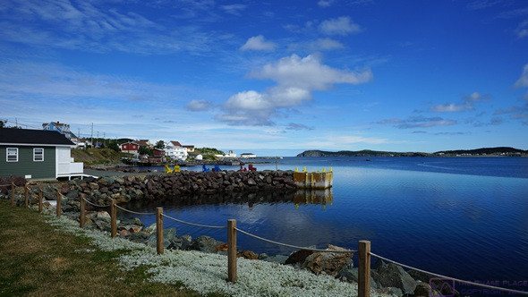
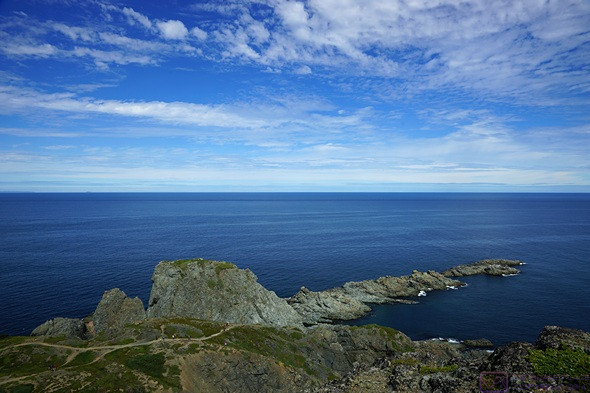
A view of Twillingate Harbor from the west shore looking out to the North Atlantic Ocean.
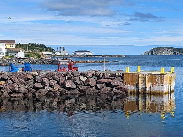
This was Linda’s photo of the buildings and wharf.
This is what we had been expecting from seaside towns in Newfoundland.
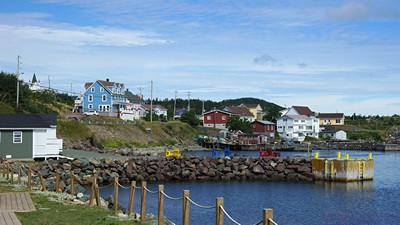
When we finally reached Twillingate we discovered a larger town than we expected with an actual fleet of fishing boats. The town sprawls around Twillingate with most business at the southern end. There was a hospital here, as well as restaurants, shops, art galleries, and museums; yet another place that would be interesting to explore if we were camped here and had a few days. We parked at a small public area on the west side of the harbor, took a few photos, and studied the map. We quickly figured out that the lighthouse was not in Twillingate, but farther on down the road in Cow Head. And so, we continued our journey, but not before stopping at the local Foodland store for some snacks, and to use the restroom, as we had not seen any other evidence of public restrooms in our drive through town.
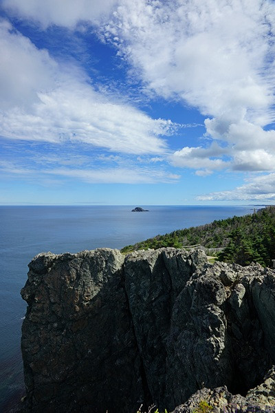
A view looking east from the Long Point Lighthouse area.
Now on Batrix Island, we drove through the village of Crow Head and out to the point where the Long Point Lighthouse sits high on sheer bluffs hundreds of feet above the water. The Lighthouse was interesting, but the setting was spectacular. A local, who comes here every day, stopped to chat with us and showed us how to spot the whales feeding in these waters. Now retired, he had at one time been a lighthouse keeper. Though visually small, we saw at least three whales actively feeding. Earlier in the year (May and June) icebergs can been seen from this vantage point. It’s hard to describe in words just how incredible this place was, so here are a few pictures instead.
The view looking N from the observation platform at the Long Point Lighthouse. The next land in this direction is Greenland.
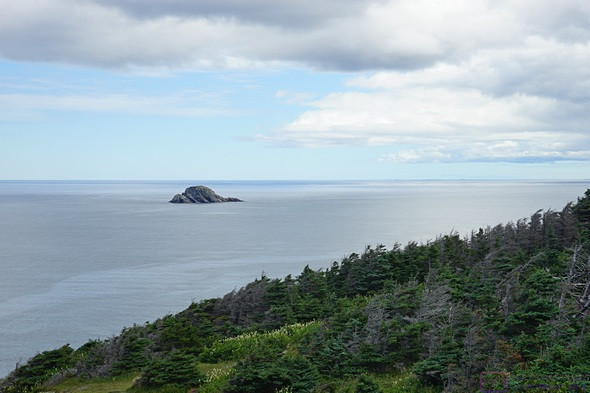
Even after Batrix Island plunges into the ocean, smaller islands remain.
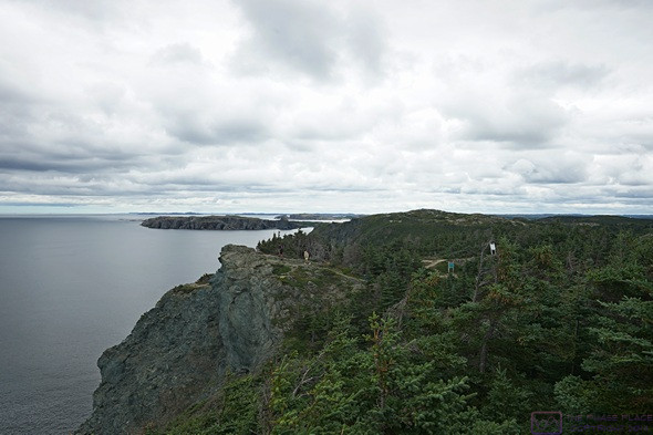
An extensive trail system runs through this whole area, often close to the edge of these cliffs, and going down hundreds of feet to the ocean.
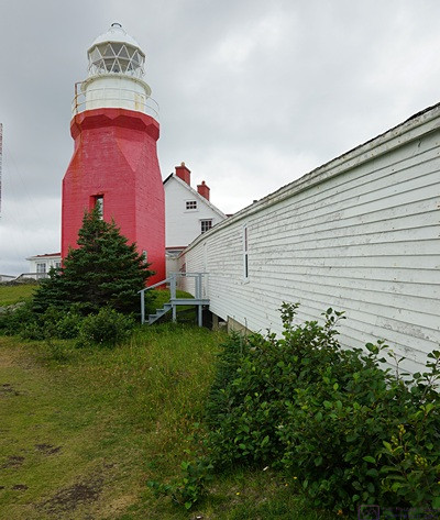
The Long Point Lighthouse and associated buildings.
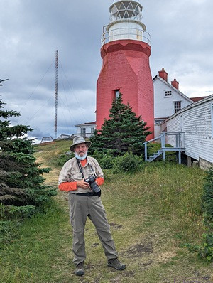
Bruce by the Long Point Lighthouse (photo by Linda).
The actual Long Point Lighthouse was no longer active, or at least not operating while we were there, but there was a lot of other monitoring equipment on the premises. It wasn’t clear if the lighthouse and associated buildings where in public or private ownership, but they were in need of maintenance. The keeper’s house was now a museum, and there was an admission charge for the museum and to go inside the lighthouse. We took a pass on that.
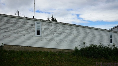
An interesting part of the lighthouse building complex. The camera is level and the windows are plumb.
This section of the lighthouse building complex connected the tower and keeper’s house to a smaller building at a lower level that appeared to have been a café or snack bar at one time, but was clearly no longer in service.
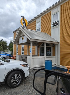
We had seen several signs for the Auk-Island Winery. We were curious and wanted to check it out.
On the way back through Twillingate, we left NL-340 for a couple of kilometers to find the Auk-Island Winery. The building contained a small restaurant and the wine tasting and retail area. We did not eat in the little restaurant (we are still wearing our masks in public) and did not do a tasting. We spent some time studying their products, all non-grape northern climate fruit wines. We bought a bottle Moose Joose (Blueberry and Partridgeberry). The partridgeberry is a small, juicy, sour berry. The plant is native to Newfoundland and grows wild. It is related to the cranberry and is known internationally as the lingonberry. Buying a wine without tasting it is always an iffy proposition, at best, so our choice was based on the combination of unique local ingredients. The bonus was that we again had access to bathrooms.
I do most of the driving, but Linda offered to drive us back. She thought I might enjoy just being able to look at the scenery and/or sensed that I was tired, but I think the drive in looked like fun and she wanted to do it. Fair enough. I did enjoy looking at the scenery, I was tired, and yes, it was fun. Without having to concentrate on the road, I nodded off a few times on the way back to camp.
We were ready for dinner by the time we got back to the RV. We had vegan BLTs, potato chips, and grapes. Not too much work, and very satisfying. After dinner I transferred the day’s photos from the SONY a99 and both of our Pixel 6 phones, but was too tired to process them or start writing today’s blog entry.
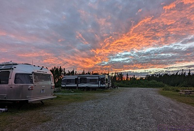
Sunset over our Airstream at the Country Inn Motel & RV Park. There were no fires in the area, this was strictly sunset color.
While I was working, an uninteresting sunset suddenly exploded with color. I grabbed my phone and took a few pictures. We did not have much sight-seeing planned for our last two days in Gander, and I planned to use some of that time to get caught up on the blog.
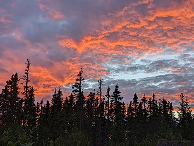
A close up of the most intense part of the event, because all good blog posts end with a sunset.
…