Category Archives: Historic Towns & Places

20231031_NTNP_14-14_End-of-the-Trace

Note:  This post contains 17 photos with captions, and some minor narrative.  Photos by me (Bruce) taken with a SONY alpha 6400 or Google Pixel 6 Pro unless otherwise indicated.  (Photos by Linda taken with a Google Pixel 6.)


TUESDAY 31 October 2023 — NTNP 14 of 14 — End of the Trace:  Emerald Mound (again) and the Town of Rocky Springs, near Natchez, MS


The only remaining wall of the Elizabeth Female Academy in Washington (West Natchez), Mississippi.  (See the next photo and caption.)


ELIZABETH FEMALE ACADEMY information sign.  Paraphrased from Wikipedia:  The Elizabeth Female Academy, founded in 1818 in the town of Washington (West Natchez), was the first female educational institution in Mississippi. It was named after Mrs. Elizabeth Roach (later Greenfield), who donated the land on which the school was located. The school closed in 1845, due in part to the relocation of the state capital from Natchez to Jackson, the general shift in the center of population, and several epidemics of yellow fever in the area. The site was reduced to ruins by a fire in the late 1870s. Part of a brick wall is all that now remains of the Academy buildings.

Learn more at:  Elizabeth Female Academy – Wikipedia


The small sign post at the lower left of the photo says Old Trace with an arrow pointing to the right.  This section of the old (original) trail starts at the opening on the left. 


We walked on identified sections of the original (old) Trace when we could.  We enjoyed the short hikes and admired the natural beauty of these places but also thought about the arduous journeys that so many people made along this trail so many years ago and the history that surrounds it.


Over time and thousands upon thousands of footsteps, the path of the Trace gradually wore down below the surface level of the surrounding landscape.  As shown here , the depth at this point is over twice Linda’s height.


EMERALD MOUND NATIONAL HISTORIC LANDMARK plaque.  We returned to Emerald Mound today as we only had a brief visit yesterday, mostly the find it.


The trail leading to the top of Emerald Mound was paved but steep.  This photo gives a sense of the height of the mound from the parking lot.


Linda on top of Emerald Mound heads towards a smaller mound and information sign.


This information sign and graphic provided a visualization of how archeologists think the structures atop Emerald Mound were arranged, appeared, and used.


Another section of the Old Natchez Trace.  Sections like this are sometimes labeled “Sunken Trace,” but if that was the case here, I did not document it.


A picture of me for scale (and just because) at a point where the Natchez Trace splits into two paths.  We rarely saw splits like this, and have no idea how common or rare this was on the original trail.


LOESS BLUFF information sign.  The loess bluff is the shear area behind the sign,  From MS Edge (Co-Pilot):  A loess bluff is a fascinating geological feature formed by the accumulation of windblown sediment known as loess.  Loess (pronounced LOW-ess) is a type of fine-grained, silty soil composed of particles deposited by the wind. It’s typically light yellow or tan in color.  During the Ice Age, glaciers covered the northern half of the United States. As these glaciers receded, they left behind vast expanses of bare land.  Continuous dust storms swept in from the western plains, carrying fine particles of dust and soil. These winds deposited the loess layer over the landscape.  The result?  Bluffs—steep, elevated landforms—made up of this windblown topsoil. Loess bluffs can be found in various regions around the world.  …  Mississippi also boasts its own loess bluffs, where nearly continuous dust storms during the Ice Age created a layer of sandy soil 30 to 90 feet deep.


THE TOWN OF ROCKY SPRINGS information sign.  The town was first settled in the 1790’s.  In 1860 it had a population of 2,616 people spread over a 25 square mile area.  Over 2,000 of those people were slaves who tended the fields of cotton, the main crop that made this town possible.


The historic Methodist church in Rocky Springs, Mississippi is the only remaining structure of Rocky Springs and continued to hold Sunday services until 2010.  The site and church are now maintained by the National Park Service.


MAGNUM SITE and GRINDSTONE FORD information sign.  The Magnum Site is a prehistoric mound and the Grindstone Ford was the threshold between civilization and wilderness on the Old Natchez Trace.


MAGNUM MOUND information sign.  Archeological excavation of this mound revealed much evidence about the prehistoric Plaquemine culture that was the precursor of the modern tribes of Louisiana and Mississippi.


A view of Magnum Mound from near the information sign.


GRINDSTONE FORD information sign.  The FORD marked the end of the old Natchez Trace District and the beginning of the (wilderness of the) Choctaw Nation.  But it was only “wilderness” in the eyes of the Europeans who were moving into and “settling” the area.


And that is the end of my 14th and last post on our trip down the Natchez Trace National Parkway.  It was a trip we had long talked about doing, and even planned for, and we were pleased to have finally done it.  Up next, our month in Gulf Shores, Alabama hanging out with friends.

20231030_NTNP_13-14_Emerald-Mound_GVNI_Natchez-MS

Note:  This post contains four (4) photos.  Photos by me (Bruce) taken with a SONY alpha 6400 or Google Pixel 6 Pro unless otherwise indicated.  (Photos by Linda taken with a Google Pixel 6.)


MONDAY 30 October 2023 — NTNP 13 of 14 — Emerald Mound and the Grand Village of the Natchez Indian, Natchez, MS


When we planned our trip, the itinerary included a 1-night stop for 31 October 2023 at The Great Mississippi Tea Company, another Harvest Host location, near Brookhaven, Mississippi.  We had stayed there once before and thoroughly enjoyed it.


EMERALD MOUND information sign.  Built on top of a hill, this flat-topped 8-acre mound was in use from 1300 to 1600 AD by the Mississippian Indians, predecessors of the Natchez Indians.  It supported temples, ceremonial structures, and burials for the civic and religious leaders of a complex society.  It is second in size only to Monks Mound in Cahokia, Illinois.


Besides being a nice place to camp for the night (strictly boondocking), the hosts/owners of The Great Mississippi Tea Company were delightful and very welcoming.  We were given a tour of the place—including the tea plants in the fields and the processing facility—and bought some things in their gift shop (of course).  But they also brought us a tea service in the morning of our departure.  That was a nice touch, very nice.


Another view of Emerald Mound from the parking lot and entrance to the trail that leads to the top.


We were very much looking forward to returning to The Great Mississippi Tea Company, but canceled the stop based on the weather forecast, which called for temperatures near freezing the night we would be there.  In previous posts, I have mentioned the various reasons we can’t really boondock in our Airstream travel trailer, but I didn’t mention one of the most important; it’s really not that well insulated, and that is especially a problem in cold weather.


In another part of Natchez, MS we visited the site of the Grand Village of the Natchez Indians.  The smaller mounds found at sites like this could be easily overlooked if care was not being taken to preserve them and tell their story to any/all who visit.  To learn more, visit the Wikipedia entry at this link:  Grand Village of the Natchez – Wikipedia


Before canceling our HH stay, however, we checked with the office at the River View RV Park & Resort to make sure we could extend our stay, as we could not check in at Luxury RV Resort in Gulf Shores, Alabama until Wednesday 01 December.  The park was not full and there was no difficulty extending our stay for an additional night (3 total).


A banner sign on the museum wall at the Grand Village of the Natchez Indians.


With that change in plans, we now had two full days to explore the southern end of the NTNP and the area around Natchez, Mississippi.


20231029_NTNP_12-14_Natchez-MS_Vidalia_LA

Note:  This post contains nine (9) photos.  Photos by me (Bruce) taken with a SONY alpha 6400 or Google Pixel 6 Pro unless otherwise indicated.  (Photos by Linda taken with a Google Pixel 6.)


SUNDAY 29 October 2023 — NTNP 12 of 14 — Natchez MS and Vidalia LA


Our truck and trailer backed into our wooded Boondockers Welcome parking spot at The HatchPad Off The Trace in the Farmhaven area of Mississippi.  No epic views, but a lovely, quiet spot in the woods that suited us just fine.  Our hosts’ house is farther back in the woods at the end of the driveway.  While not really visible in this photo, there is a shed to the right of their house with a washing machine and a dryer.  We were invited to use, and took advantage of the opportunity.  (Most commercial RV parks have laundry rooms, so we made use of those when available when needed.)


Today we completed our north to south transit of the Natchez Trace National Parkway at the south terminus in Natchez, Mississippi and then on across the Mississippi River to the River View RV Park & Resort in Vidalia, Louisiana, immediately across from Natchez.  In total, we drove all but about 10 miles of the 444-mile-long road, and that was only because a 10-mile stretch in/near Tupelo, MS was closed for construction/repairs.


Another view of our truck and trailer in our BW parking spot.  Barely visible near the center of the right edge of the frame is the electrical box where we were allowed to hook up to shorepower.


While not an “epic” trip, in comparison to some of the national scenic roads we have driven, it was a wonderful journey at a leisurely pace with light traffic and a nice mixture of scenery, culture, and history.  I mean, we took nine (9) days to pull our trailer from one end to the other a distance that we could easily have covered in two (2 days,) even with the trailer, or one (1) day without it.  But not on the NTNP, of course, which has a maximum speed limit of 50 MPH, with lower limits in some places.  No, this trip was an intentionally “slow roll” and was a kind of “bucket list” item that we had been trying to do for a while.


Natchez, Mississippi as viewed from Vidalia, Louisiana across the Mississippi River.  Most of the “downtown” area is to the left of the bridge.  The River level was very low.  The sand bar in the foreground is usually underwater and not visible.


As much as we would like to have the ability to dry-camp, our rig is only capable of doing that comfortably for a very short time in a very narrow temperature range.  We have two solar panels on the roof, but we do not travel with a generator, and our battery system is insufficient to run big loads.  We have propane for cooking, refrigeration, hot water heating, and forced-air space heating, but the last three appliances use DC power to run their control circuits, and the fan in the forced-air furnace is a real energy hog, precluding it’s use in cold weather precisely when we need i.  At the other extreme, we have two heat pumps which function as air-conditioners for cooling or can heat the rig efficiently in cool weather as long as it’s not too cold.  But they are 120VAC devices, and they still use a lot of power/energy.  Making the rig truly off-grid capable is something we discuss, but have not reached a conclusion on whether we will undertake the necessary modifications and upgrades.


There was a very nice walkway that went along the River by our RV park.  It extended up to and beyond the bridge, so we went for early evening stroll.


A closer view of the bridge with part of Natchez, MS visible on the horizon.


A barge being pushed (upstream, from right to left) by a tugboat (which seems backwards) passes under the bridge, being careful to stay in the center of the River in order to have sufficient underwater keel clearance.


Just beyond the bridge (on the north side) was the Vidalia Convention Center, a very nice-looking facility.


A selfie by the Vidalia Convention Center with Natchez, MS in the background.  I think the reason I never smile in selfies is that I am concentrating on framing the shot and also trying to remember to look at the lens, something both of us seem to have difficulty doing consistently.


Our site at River View RV Park & Resort on the western shore of the Mississippi River in Vidalia, Louisiana across the River from Natchez, MS.  And no, the name of the town has nothing to do with the onions, which get their name from Vidalia, Georgia.


While we were done traveling the NTNP with our travel trailer in tow, we were not quite done exploring the Trace, which I will cover in the post for tomorrow and the next day.

20231028_NTNP_11-14_West-Florida-Boundary_and_Vicksburg-MS

Note:  This post contains 11 photos with captions and a little narrative.  Photos by me (Bruce) taken with a SONY alpha 6400 or Google Pixel 6 Pro unless otherwise indicated.  (Photos by Linda taken with a Google Pixel 6.)


SATURDAY 28 October 2023 — NTNP 11 of 14 — West Florida Boundary and Vicksburg Civil War sites


Heading south on the Natchez Trace NP from our Boondockers Welcome site, our first stop was the West Florida Boundary parking area.  It was also a trailhead for a section of the Natchez Trace.  This photo provides a sense of scale to the trail and surrounding forest.


WEST FLORIDA BOUNDARY sign.  This image file is 1200×675 pixels and can be viewed a full-resolution on a suitable device.  The sign on the right with the map shows the territory known as “West Florida.”  The lower lower/narrow strip along the sea was the extent of the territory as of the end of the French and Indian War in 1763, at which time Great Britain gained control of the lands west to the Mississippi River.  The northern boundary of this area was set at 31 deg N latitude.  The region was quickly considered too restricted for settlement, and a year later (1764) the British (unilaterally) moved the northern boundary to 32 deg 28 min N latitude into the lands of the Choctaws and Creeks, approximately tripling its size.


This photo was taken at the Reservoir Overlook for the Ross R. Barnett Reservoir just on the NTNP near Ridgeland, Mississippi.  Our BW location was a bit northeast of here, closer to Canton, Mississippi.  The reservoir is on the Pearl River.  The photo is a composite of five images taken with the SONY alpha 6400.  It is 1200×327 pixels and can be viewed at full-resolution on a suitable device by clicking on the photo.


Another composite image from the Reservoir Overlook, this one taken with a Google Pixel 6.  (Photo by Linda)


The RESERVOIR OVERLOOK information sign.  The Ross R. Barnett Reservoir is formed by a large earthen dame and covers 50 square miles.  It is administered by the Pearl River Valley Water Supply District, an agency of the State of Mississippi.


Although our focus for this trip was the Natchez Trace National Parkway, we realized that we were close enough to Vicksburg, Mississippi that we decided to detour over there and have a look.  One of the major tourist destinations in the Vicksburg area is the Vicksburg National Military Park and the Vicksburg National Battlefield.  Once we were there, we discovered the USS Cairo Gunboat and Museum site within the NMP, and checked it out.  The museum was not open when we visited the site, but we found the ship, as shown in the following four photographs, fascinating.


USS Cairo Gunboat, Vicksburg National Military Park (NMP), Vicksburg, MS.


USS Cairo Gunboat, Vicksburg NMP.


Paraphrased from Wikipedia:  The USS Cairo was the lead ship of the City-class casemate ironclads built at the beginning of the American Civil War to serve as river gunboats for the Union.  Cairo is named for Cairo, Illinois. In June 1862, she captured the Confederate garrison of Fort Pillow on the Mississippi, enabling Union forces to occupy Memphis.  As part of the Yazoo Pass Expedition, she was sunk in the Yazoo River (a spur of the Mississippi River) on 12 December 1862 (near Vicksburg), while clearing mines for the attack on Haines Bluff.  Cairo was the first ship ever to be sunk by a mine remotely detonated by hand.  The remains of the Cairo can be viewed at Vicksburg National Military Park with a museum of its weapons and naval stores.


USS Cairo Gunboat, Vicksburg NMP.


USS Cairo Gunboat, Vicksburg NMP.


The remains of the ship were discovered in 1956 and salvaged in 1964-65.  It was listed in the National Register of Historic Places on 3 September 1971.  By 1980 Congress had authorized the National Park Service to accept the boat, move it to the Vicksburg NMP, and put in on display in conjunction with a museum to house the recovered artifacts and tell the story of the boat and its role in the Civil War.


One of the bunkers at the Vicksburg National Battlefield site.


This photo has nothing to do with the Civil War.  I’ve outlined the fuel economy readout on our F-150 instrumentation cluster.  Folks, you can’t make this stuff up; it really does say 29.1 (miles per gallon).  We had recently filled up the fuel tank and only traveled 39.3 miles, as shown in the lower left, so this was obviously light travel and slightly downhill.  Although this MPG is not sustainable under normal driving conditions, the number in the upper right indicates that we could travel another 747 miles before running out of fuel if we could maintain this MPG.


20231026_NTNP_9-14_Choctaw-Boundary

Note:  This post contains 8 photos.  Photos by me (Bruce) taken with a SONY alpha 6400 or Google Pixel 6 Pro unless otherwise indicated.  (Photos by Linda taken with a Google Pixel 6.)


THURSDAY 26 October 2023 — NTNP 9 of 14 — Choctaw Boundary


The JEFF BUSBY PARK information sign told us that Thomas Jefferson Busby, U.S. Congressman from Mississippi, introduced a bill on February 15, 1939 authorizing a survey of the Old Natchez Trace.  This was a direct result of the research and persistent lobbying of the Daughters of the American Revolution (DAR) to create the Natchez Trace National Parkway and resulted, four years later, in the historic road being designated a unit of the National Park System.  This park commemorates his role in the Parkway’s establishment.


Our explorations today of the Natchez Trace National Parkway (NTNP) included some of the section between Tupelo and Jackson, Mississippi, within reasonable driving distance of the campground, which is near Ackerman, MS.


These are Swamp Tupelo trees.  There might also be Bald Cypress trees in this swamp, at least we recall seeing both at one point along the NTNP.  The name Tupelo is of native origin.  From the National Forest Foundation website:  “The name “tupelo,” a common name used for several varieties of Nyssa trees, literally means “swamp tree” in the language of the Muscogee (Creek) Nation (ito ‘tree’ + opilwa ‘swamp’).”


CHOCTAW BOUNDARY  The map on this information sign shows the territory ceded to the USA when “…tribal leaders in central Mississippi signed the Treaty of Doak’s Stand, ceding rich cotton lands in the delta region east of the Mississippi River for approximately thirteen million acres in the Canadian, Kiamichi, Arkansas, and Red River watersheds in southeastern Oklahoma.  The history of the Choctaw Nation in Oklahoma began with the signing of this treaty on October 8, 1820 and ratified in Congress January 8, 1821.  To a much greater extent than we realized when planning this trip, the history of the Natchez Trace includes the history of the native people who occupied this land for a very long time prior to the arrival of Europeans in what became known as North America.


A trip down the NTNP is a trip through more than just American and native history.  Before the British and the eventual founding of the USA, the French and Spanish were here, as the following photo explains:


PEARL RIVER  This information sign tells that Pierre Le Moyne (Sieur) d’Iberville (a French soldier, explorer, colonial administrator, and trader) sailed into the mouth of this river in 1698 and discovered pearls, thus the origin of the name.  A hundred years later, the Natchez Trace avoided marshy lowlands by following a route between the Pearl and the Big Black Rivers for about 150 miles.  Since 1812, the last 75 miles of the river have served as the boundary between Mississippi and Louisiana.  D’Iberville is noted for founding the colony of Louisiana in New France.


Here’s the information sign explaining the TUPELO-BALDCYPRESS SWAMP.  These trees take root in summer when the swamp is mostly dry, but the seedlings have the somewhat unique ability to survive and thrive in water that that is deep enough to kill other plants.


CHOCTAW BOUNDARY (complete sign).  This image is 1200×742 pixels, and can be viewed full size on devices with suitable screen resolution.  In addition to the map shown in the third photo in this post, it includes the two wing signs, labeled INDIAN TREAT and DOAKS STAND.  The sign on the left indicates that a line of trees crossing the (now) Parkway just to the left marks part of the boundary that was agreed to in the aforementioned Treaty.


This FRENCH CAMP information sign tells yet another story of how a place got its name.  Around 1812, Louis Leflore first traded with the Choctaw Indians in the area northeast of the Trace.  Because he was of French nationality, the area was referred to as French Camp.  The name stuck and is still used today.  Interestingly, he married a Choctaw woman and their son, who changed his name to Greenwood Leflore, became a Choctaw Chief and a Mississippi State Senator.  The City of Greenwood and the County of Leflore are named for him.


This panorama shows another view of the Choctaw Lake Campground while Linda and I are out for an early evening stroll following our day exploring another section of the NTNP.


20231024_NTNP_7-14_Brices-X-road-NBF

Note:  This post contains 8 photos.  Photos by me (Bruce) taken with a SONY alpha 6400 or Google Pixel 6 Pro unless otherwise indicated.  (Photos by Linda taken with a Google Pixel 6.)


TUESDAY 24 October 2023 — NTNP 7 of 14 — Brices Cross Roads National Battlefield


Brices Cross Roads National Battlefield sign.

The Natchez Trace National Parkway (NTNP) passes through a part of the “deep South” that was heavily impacted by the Civil War.  From Wikipedia (paraphrased):  Brices Cross Roads National Battlefield site memorializes the Battle of Brices Cross Roads in which a U.S. Army force was defeated by a smaller Confederate force commanded by Major-General Nathan Bedford Forrest on June 10, 1864, but nevertheless secured Union supply lines between Nashville and Chattanooga, Tennessee.  The 1-acre site is a grassy park with a flagpole, a memorial monument, two cannons, and some information signs.  The monument and site are very similar to that at Tupelo National Battlefield.  Brices Cross Roads, however, is the only component of the National Park System designated a “battlefield site.”  I felt that last point was interesting in and of itself.


WITCH DANCE information sign.  The site of local lore, also part of the history of the Natchez Trace.


LINE CREEK information sign.  A long time ago a nearby creek that flows through this valley was accepted as the boundary between the Chickasaw and Choctaw nations, and remained so until both tribes moved to Oklahoma in the 1830’s.  The course of the creek has changed over the years, but the name has stuck.


OLD TRACE information sign.  A 200+ year old section of the “Old Trace” is preserved here, and we walked it.  The sign describes the difficulty of creating and maintaining a nearly 500-mile-long path through the wilderness and how readily nature seeks to reclaim the ground, as shown in the next photograph this section of the trail/road.


Maintaining this 10-foot-wide section of the Old Trace involves constant work.  Without continuous human intervention, nature would, it its own time, completely reclaim this path.


Elements of Exchange.  Although the type is too small to read in this photo, the map highlights the territories of the Eastern Woodland nations and discusses the materials that served as “currency” for trading purposes.


These are obviously mounds, and the photo was taken about 4 minutes after the previous one, so I know they were in the same general area, but we failed to photograph a sign telling me about their significance.


OLD TOWN CREEK information sign.  This gist of the historical factoid reported here is that in the early 1800’s ordinary Americans could not be bothered to learn the Chickasaw names for their villages and other landmarks and features.  Thus, a nearby village was dubbed “Old Town” and the name eventually became attached to the creek that runs through the valley.


20231022_NTNP_5-14_TN-AL-MS-state-lines

Note:  This post contains 13 photos.  Photos by me (Bruce) taken with a SONY alpha 6400 or Google Pixel 6 Pro unless otherwise indicated.  (Photos by Linda taken with a Google Pixel 6.)


SUNDAY 22 October 2023 — NTNP 5 of 14 — Tennessee-Alabama-Mississippi State Lines

Today was our full day at Fall Hallow CG/RVpark/B&B.  The weather was nice, and we took advantage of it to further explore the section of the NTNP from here south a way, having explored from here north yesterday.  Fall Hallow CG is in Hohenwald, Tennessee, but traveling south from here, the Trace cuts across the northwest corner of Alabama.  The first photo below is for Pharr Mounds in Mississippi.  Subsequent photos show the signs for the Mississippi and Alabama sides of their common border along the Trace.


PHARR MOUNDS information sign describing the largest and most important native American archeological site in northern Mississippi.  The pre-European tribes in this area where part of the much larger and more extensive Mississippian mound culture, whose center was in Cahokia, Illinois.


Ancient mounds co-exist with present day agricultural use of the land.


Part of the dashboard in our F-150.  Yup, it shows an average fuel economy of 28.4 MPG.  The F-150 is capable of this when not towing the trailer, the fuel tank has just been topped off, good driving, light traffic, and flat roads with no stops.  (Photo by Linda)


Crossing into Mississippi from Alabama on the NTNP.


I walked to the other side of the road to photograph the matching sign entering Alabama from Mississippi on the NTNP.


The terrain in this area was not all flat, and afforded views like this on occasion.


Information sign for ROCK SPRING TRAIL which crosses Colbert Creek and meanders through woodlands to get to Rock Spring.  The sign indicates that since 1977 numerous beaver dams have been built here and subsequently destroyed by high water.


This panorama of Rock Spring is a composite of four images made with Microsoft Image Composer.  The resolution if 1200×360 pixels, and can be displayed at full resolution on a device with a suitable monitor.


This is a bicycle repair station at one of the rest areas in this section of the NTNP.  It has a “rack” for hanging the bike, all of tools one might need (suitably tethered to the post), and an air pump with integrated air pressure gauge.  Although not yet mentioned in this series of blog posts, bicyclists were much in evidence all along the NTNP and this was not the only such repair stand that we saw.  Most of the cyclists were self-contained.  Some of them camped in the NTNP campgrounds while others stayed in motels just off the Trace.


A all-purpose, 3-way water/drinking fountain at the same rest stop as the bicycle repair stand; Left portion for filling water bottles, center for drinking, and bottom right for “Fido.”


2

STATE LINE information signs.  This set of signs describes the boundary between Tennessee (right, north) and Alabama (left, south).  The image is 1200×675 pixels, and can be displayed at full size on a device with appropriate resolution.


McGLAMERY STAND information sign.  It says that “a stand was an inn or trading post—sometimes both—established along a well traveled route.”  The one here was established in 1849.  It did not outlast the Civil War, but the nearby village still retains the name.


Linda picks her way carefully across a stone portion of trail where it crosses a very wet area.

20231021_NTNP_4-14_N-end_and_Meriwether-Lewis

Note:  This post contains 7 photos.  Photos by me (Bruce) taken with a SONY alpha 6400 or Google Pixel 6 Pro unless otherwise indicated.  Photos by Linda taken with a Google Pixel 6.


SATURDAY 21 October 2023 — NTNP 4 of 14 — North end NTNP and Meriwether Lewis

Today was a relocation day in which we moved the travel trailer from the Grand Ole RV Resort in Goodlettsville, Tennessee to Fall Hollow Campground, RV Park, and B&B in Hohenwald, Tennessee.  Again, we camped here for two nights.  As RV parks go, this was not a great place and we did not have a great site.  But we had a FHU site, and the campground was located the desired distance from our previous RV park, so it served its purpose of moving us on down the road and using the full day (tomorrow) to explore the next section of the Trace within reasonable driving distance of the RV park.


The Meriwether Lewis Memorial.


A reproduction of the Grinder House (I think) where Meriwether Lewis met his demise.

The Natchez Trace National Parkway is not just a pretty drive on a nice paved road; it is that, but it is much more.  Although 440 miles long between it’s northern and southern termini, it is sometimes narrow enough that you could throw a ball across it.  In the wider sections, it is still rarely even a mile wide.  It is also a trail (Trace is French for trail) through history, and that history includes the indigenous people that lived in this part of what became North American long before Europeans arrived on the continent, and were still very much here as the USA expanded westward in the many decades following the War of Independence.


A plaque marking the site of the actual Grinder House where Meriwether Lewis died.

We quickly discovered, but were not surprised, that the National Park Service had done their usual exemplary job of making an overarching view of this history available to those travelers who were willing to take the time to read information placards, walk the trails, and ponder the few remaining remnants of a past era.

And, as history is want to do, there were intersections with other aspects of USA history that we did not know about or expect.  One of those intersections had to do with Meriwether Lewis, of the Lewis and Clark Expedition, and the Louisiana Purchase.  Lewis, who was President Thomas Jefferson’s private secretary, ended up in this area of the Trace, very much in debt as a result of the expedition.  Despondent about the inability of the Government (congress) to reimburse him for expenses, he took his own life on October 11, 1809.  Perhaps we learned this in our high school American History class but if so, I did not recall it.  We did not learn why he came he, so that is a question left for the reader.

The following photos highlight a few additional aspects of this portion of the NTNP.


Information sign for the STEELE’S IRON WORKS site.  Dating from 1820, a charcoal burning furnace located here was used to make pig iron.  Metal Ford crosses the Buffalo River just beyond this sign.


Metal Ford was a natural rock ledge that made it possible to cross (ford) the River at this place by the Steele’s Iron Works.  Crossing creeks, streams, and rivers was one of the many challenges of transiting the Trace.


Linda captures a picture of me positioning myself to get a photo of Metal Ford at the Steele’s Iron Works site, NTNP.  (Photo by Linda.)


And here’s the photo I took of Metal Ford at the Steele’s Iron Works site, NTNP.


20230915-16_T20-21_C17_Honolulu-Oahu-HI_Home

Note:  This is the 16th of 16 posts about our 21-day trip that included a 17-day (16-night) cruise on the Norwegian Cruise Line (NCL) ship SPIRIT from Vancouver, British Columbia north along the inside passage to Sitka, Alaska, and then across the North Pacific Ocean to the Hawaiian Islands, before ending in Honolulu, Oahu.  This post has 13 photographs with captions and some narrative.  Photos by me (Bruce) taken with SONY alpha 6400 or Google Pixel 6 Pro unless otherwise indicated.  (Photos by Linda taken with a Google Pixel 6.)


FRIDAY 15 September 2023 — (T20-21,C17) Honolulu, Oahu, Hawaii and home

This was the 20th day of our trip, and the 17th and final day of our cruise.  We arrived in the early morning hours at the cruise port in Honolulu, Oahu, our final port-of-call in the Hawaiian Islands.  (It was a 21-day trip in total, as we would not arrive back at our home in Michigan until the following day, but I cover a few highlights of that at the end of this post.)

On the last day of a cruise, passengers must disembark fairly early in the day so the crew can “turn the ship around” and get it ready for the next set of passengers, who will start their embarkation by late morning.  When leaving from and returning to ports in the continental USA, we can usually arrange flights back to Michigan that allow us plenty of time to get to the airport without having to wait too long to board our plane after getting there.  In the case of this cruise, however, the most “reasonable” flight we could book departed at around 5 PM local time.  That meant we had to figure out what to do during the day, which included what to do with our luggage, a not insignificant issue.

The easiest solution was to book a motorcoach shore excursion that included transportation to the Honolulu International Airport, with our luggage safely stored onboard the motorcoach until we were dropped off at our terminal.  Yes, pre- and post-cruise shore excursions are a “thing,” as are pre- and post-tour transportation options.  Actually, any service a cruise line can provide, or product they can sell, to extract a bit more money from their customers is a thing.  In this case, however, it was an excellent option for us.  Although we had been to Pearl Harbor on our last visit to Hawaii, it was the shore excursion that best met the needs of passengers, like us, with flights departing after 3 PM local time.  And so, we went to Pearl Harbor.

Although still very much an active military base, the Pearl Harbor National Memorial is an interesting, historically important, and somber place that draws some 2 Million visitors every year.  Perhaps we were just tired from the cruise, but it seemed like half of those people were there today, or perhaps just half of the people from our cruise ship.  They weren’t, of course, but the place did seem crowed.  Since we had already seen many of the major sites that make up the National Memorial, we were not motivated to spend more money beyond our entrance fee just to stand in lines and deal with crowds to try to see them again.  We decided to just stroll the grounds instead, read placards, take a few photos, and find something to eat.  Our biggest problem was finding someplace to sit (at all, never mind comfortable) and stay out of the sun.  As we’ve gotten older, however, I think we’ve gotten better at just quietly “passing the time” when we find ourselves in situations that require it, or at least benefit from adopting that attitude.

Here are a few photos from that day, followed by an epilogue to wrap up our 21-day trip.


Our ship was already at the dock when I took this photo around 6 AM local time.


I am always interested in structures, machines, etc.  Shown here is a service ramp that has already been deployed from the terminal to the ship.


The famous Diamond Head (extinct volcano) at the far east end of Waikiki Beach, backlit by the sunrise around 6:30 AM.


Another view looking towards Diamond Head, which is towards the right edge of the frame at the horizon, showing some of the skyscrapers in this part of Honolulu.  These could be hotels, apartment/condos, or office buildings.  (Photo by Linda)


Since we had to disembark early, we were up and dressed early to get a bite to eat and have one last stroll around the ship.  At ~6:30 AM we had the walking track on Deck 13 (ABIR) to ourselves.  The pool has been covered with netting to keep people out, or catch anyone who might fall in.


A panorama composited from five (5) images of the harbor off the port side of the ship.


Another early morning photo from the starboard side walking track with the harbor behind Bruce.  (Photo by Linda)


Yes, this is a photo of the TV screen in our stateroom.

Regarding the above photo, the left side of the screen clearly shows the time to be 17:01 UTC and the upper right corner shows the time to be 07:01 (local) establishing the 10-hour time difference between Honolulu and Greenwich, England (where Greenwich Mean Time (GMT) and UTC are usually the same).

UTC (Universal Time Coordinated) is a time standard that never changes (no daylight savings time nonsense), while GMT is a time zone, in which Greenwich, England is located.  We live in the Eastern Time zone (EST or EDT, depending on the time of year), which is UTC minus 5 this time of year (Daylight savings time was still in effect in the USA).  By the time we arrived back in Michigan, our plane (and us) had been in six (6) time zones over ~ 9-1/2 hours in the air.

The screen also shows our position at 21 degrees 18.12 minutes North Latitude and 157 degrees 51.92 minutes West Longitude.  Linda captured an image (not shown here) of the lower left corner of the screen indicating that our total distance traveled (in the ship) was 4,502 nautical miles (5,180.8 statute miles).  The flight distance from DTW (Detroit) to YVR (Vancouver) is ~1,959 miles, and the flight distance from HNL (Honolulu) to DTW (Detroit) is ~ 4,475 miles.  Thus, the total distance traveled on this trip, not including excursions, was ~ 11,614 statute miles, or ~553 miles per day on average.


Welcome to the Pearl Harbor National Memorial, which includes Memorials for the USS Arizona, USS Oklahoma, and USS Utah, all lost on the December 7, 1941 attack on Pearl Harbor.


An anchor that was salvaged from the USS Arizona.


The low white building with the curved roof is the USS Arizona Memorial.  It straddles the ship in its final resting place and has a glass floor, allowing visitors to view the remains of part of the ship.  We visited this Memorial on our previous visit.  (Photo by Linda)


A circular courtyard that surrounds a relief map of Pearl Harbor, and has plaques with the names of the lost, provided some place to sit and contemplate the events of the day that pulled the USA into World Ward II.  (Photo by Linda)


A broader view of the grounds at the Pearl Harbor National Memorial.  The USS Arizona Memorial is visible at the left edge of the frame.  The site is beautifully maintained, as you would expect, and is accessible for those visitors with mobility issues.  I think the exception is the submarine tour, as it involves climbing stairs and, ABIR, ladders.  We toured the submarine on our previous visit to the National Memorial.

…..


Epilogue (T20-21) — Friday evening 15 September & Saturday 16 September

With our drop-off at the Honolulu International Airport around 3 PM, our NCL SPIRIT cruise was officially concluded.  We were no longer “cruisers,” just ordinary travelers waiting to fly home.  The drop-off point was a “back” entrance to the terminal and it was a bit confusing at first figuring out where to go once we were inside.  But we figured it out in short enough order, and began the process of checking our two larger suitcases, clearing through the TSA checkpoint, finding our gate, and waiting to be called to board the airplane.  The airport was busy;  the Hawaiian Islands are a popular tourist destination, and Honolulu International Airport is the major way most people arrive and depart.

Time zones are fascinating, and while travel across them can be interesting, it can also be challenging, especially as regards sleeping.  (As noted in several posts, I’ve also had an issue merging photos from three different devices in correct chronological sequence.  This has been due to different devices using different time references when naming and tagging image files.)  ABIR, our Delta Airlines flight was scheduled to depart at around 5 PM Honolulu time.  At 5 PM in Honolulu, it was already 10 PM in Detroit, Michigan, and within a couple of hours of taking off, it was Saturday, 16 September at home.

We had an approximately 4,500-mile trip ahead of us at an average (air) speed of ~500 mph, so roughly a 9-hour flight plus a 30-minute allowance for ground operations (takeoff and landing combined).  The actual time, gate-to-gate, could have been more or less depending on prevailing wind speeds and directions at flight altitude (which tend to be from west to east, so a favorable tailwind), or the need to detour around severe weather.  That put our estimated time of arrival at Detroit Metropolitan Airport (DTW) at 6:30 AM local time.  Realistically, that meant we should be off the plane, luggage collected, and ready for pickup by around 7:30 AM, but I no longer recall exactly what time we reached the gate.  Early, in any event, but not hugely inconvenient for our son, who lives about 30 minutes from the airport, and had agreed to fetch us upon our arrival.

As with past cruises, we had one of our children take us to the airport and pick us up upon our return.  That has usually been our daughter, but for this trip it was our son.  We drove our F-150 to his house on departure day and he chauffeured us from/to there.  Part of the reason for this, was that he and his wife wanted to get the truck “detailed” while we were away.  They had borrowed it during the summer, along with the Airstream travel trailer, to use for a family vacation and wanted to get it cleaned up as a “thank you” for letting them use it.  We did not expect them to do this, of course, but we were not going to say “no” either.  They also live closer to the airport than our daughter does.

Back at his house the rest of the family was awake, so we got to see our two youngest grand-daughters and tell everyone a little bit about our trip.  We eventually left for home and arrived to find Cabella (the cat who is not our cat, or so we say) waiting for us, even though she had lived outside for the entire duration of our trip.  (She is an outside cat who has become an outside/inside cat while we are trying to figure out how to take care of her in a way that works for her and us.)  Our neighbor, Mike, had kept an eye on the house (and the cat) while we were away, making sure she had water and refilling her automatic food feeder as needed.

I always like to launder all of the clothes we have had with us on any trip (short or long), but that was a task that would wait until tomorrow and get spread over a couple of days so as not to overload the septic system (or me).  What could not wait, was putting the water treatment system back in full operation.  I shut it off whenever we are gone for more than few days so the tanks do not regenerate, which puts a lot of water into the sump.  I recall that we talked about stopping at a Panera to get something to eat, but I don’t recall what we actually did for lunch or dinner.  I suspect we found something to eat for dinner in our refrigerator and/or panty as Linda usually plans for that when we go on shorter trips.  We had, after all, eaten out every meal for the last 21 days.  For longer trips, we try to use up any fresh food before we leave.

20230914_T19-C16_Hilo-Hawai’i-Hawaii

Note:  This is the 15th of 16 posts about our 21-day trip that included a 17-day (16-night) cruise on the Norwegian Cruise Line (NCL) ship SPIRIT from Vancouver, British Columbia to Honolulu, Oahu.  This post has 20 photographs with captions and some narrative.  Photos taken by me (Bruce) with a SONY alpha 6400 or Google Pixel 6 Pro unless otherwise indicated.  (Photos by Linda taken with a Google Pixel 6.)


THURSDAY 14 September 2023 — (T19,C16) Hilo, Hawai’i, Hawaii and Mona Kea

This was the 19th day of our trip, and the 16th day of our cruise and saw us arrive in the cruise port at Hilo, Hawai’i (the Big Island), Hawaii (the State of).  Our main activity was a shore excursion that stopped at Rainbow Falls Lookout before taking us to the observatories atop Mona Kea (also spelled “Muanakea”).

At 13,803 feet (4,207.3 m) AMSL, which is also its “wet prominence,” the summit of Mona Kea (Muanakea) is the highest point of land in the Hawaiian Islands, and the second highest island mountain summit on earth.  From Wikipedia:  “Because the Hawaiian Islands slope deep into the ocean, Mauna Kea has a dry prominence of 9,330 m (30,610 ft) (it’s height if the ocean was “drained” of water. This dry prominence is taller than Mount Everest’s height above sea level of 8,848.86 m (29,032 ft), so Everest would have to include whole continents in its foothills to exceed Mauna Kea’s dry prominence. …”  The highest summit on an island is Puncak Jaya in New Guinea, Indonesia, which stands at an impressive elevation of 4,884 meters (16,024 feet) above mean sea level.


Our first view of Hawai’i (the Big Island) and Mona Kea.  This panoramic photo is a composite of five (5) images.  Mona Loa is just visible at the left edge of the frame.


Sunrise lights up Mona Kea as the NCL SPIRIT slowly motors towards the cruise port in Hilo, Hawai’i, Hawaii.  The photo is 900×678 pixels and can be viewed at full-resolution on compatible devices.  (Photo by Linda)


A selfie at Rainbow Falls Overlook in Hilo, Hawai’i, HI.


A flower along the trail at Rainbow Falls Overlook.  (Photo by Linda)


We always try to take a photo of signs to identify where we are.  If we can get a photo with a clock in it, so much the better as it helps me time sync photos to local time.  (Photo by Linda)


Rainbow Fall in Hilo, Hawai’i, HI.


I’m holding grand-daughter Sadie’s “Apa and Ama” artwork to mark our location at the Mona Kea ranger station / store (the building behind me).  We are already at/above the level of the clouds.


The Mona Kea ranger station/store/museum with our tour van in the front parking lot.  From a web search:  “The Onizuka Center for International Astronomy Visitor Information Station (VIS) on Maunakea is open every day of the year from 9am to 9pm.  Located at the 9,200 foot (2,804 meter) level, they provide health, safety, and other information about Maunakea along with access control.  The road up the mountain is open to any/all visitors up this building.  Beyond this point, permission is needed and a 4-wheel drive vehicle is required.  Our tour van met both of those criteria.


The VIS has a store with various Mona Kea and astronomy related merchandise.  It is also a small museum focused on telescopes and other things astronomical.


One of the radio telescopes on top of Mona Kea.  (Photo by Linda)


The National Radio Astronomy Observatory is a joint operation of several universities under the auspices of the National Science Foundation.


Our tour guide presents information on the various rocks that make up Mona Kea.  (Photo by Linda)


Our tour guide had a Mauna Kea (Mona Kea) sign for photo ops for his customers.  Linda is holding grand-daughter Sadie’s “Apa and Ama” artwork.  (Photo taken with Linda’s phone, but obviously taken by someone else, probably our tour guide.)


A panoramic view of several telescopes made using the panorama feature of the Pixel 6 Pro.   This photo file is 1080×271 pixels and can be viewed at full-resolution on compatible devices.


This is a composite of two (2) images, showing several different types of telescopes on Mona Kea, how they are situated, and the road(s) that are used to access them.  Not all of the telescopes have a 360-degree clear view of the horizon.  They are situated based on available real estate and what part of the sky they need to be able to see.


By now it should be obvious that we were there, but here’s another selfie, just to prove the point.


The same two observatories as the previous photo without us in the frame.


This panorama is a composite of eight (8) images.  The photo file is 1920×363 pixels, so there is a lot of detail that can be seen on a device with appropriate screen resolution.  There are at least 15 telescopes of various kinds visible in the image, along with a portion of the amazing road system that winds up to and around the observatories and support buildings.


Last, but not least, a photo of the actual summit of Mona Kea, several hundred feet above where we are standing, and higher than the highest observatory on the mountain.  Why?  Because the summit is a sacred site to indigenous Hawaiians that is used for special ceremonies throughout the year.  As such, it is not open to the public at any time.


We are back on the ship in the theater at the conclusion of the evening’s entertainment at ~10:15 PM.  If was the final ensemble performance of the cruise and featured most of the performers who had entertained us throughout the last couple of weeks.  The performances were of a high enough caliber that we were always entertained.  This final performance was over, so cameras where very evident as passengers tried to capture the celebratory moment.  I took this photo to provide some context for the look of the theater.

20230913_T18-C15_Kahului-Maui-HI

Note:  This is the 14th of 16 posts about our 21-day trip that included a 17-day (16-night) cruise on the Norwegian Cruise Line (NCL) ship SPIRIT from Vancouver, British Columbia to Honolulu, Oahu.  This post has 20 photographs with captions and some narrative.  Photos by me (Bruce) using a SONY alpha 6400 or Google Pixel 6 Pro unless otherwise indicated.  (Photos by Linda taken with a Google Pixel 6.)


WEDNESDAY 13 September 2023 — (T18,C15) Kahului, Maui, Hawaii

Our ship arrived in the harbor at Kahului, Maui early this morning.  As was well-reported in the news, Maui had recently suffered a devastating fire in and around Lahaina.  This obviously impacted some of the planned shore excursions, but we did not detect anyone being upset about changes in planned offerings.  Indeed, tourists were being encouraged to visit Maui and support the local economy, but the Lahaina area was obviously off limits.  Any disappointment for cruise passengers was inconsequential compared to the loss and suffering of the impacted islanders.

Our main activity today was a shore excursion with “Hike Maui” east along the first portion of “the road to Hana.”  We were transported in vans and had an excellent tour guide.  There was a lot of walking, but it was mostly easy and it was nice to get off the ship and use our legs to walk around town and in the woods.


The NCL SPIRIT approaches Kahului, Maui, Hawaii at sunrise.  (Photo by Linda)


Linda soaks up the sunrise as it floods the port side of the ship inbound to Kahului, Maui.


The mountains loom behind Kahului, Maui and make their own weather, as mountains are want to do.


This sign says it all:  “Aloha, Welcome to Kahului, Maui, Hawaii” with the NCL SPIRIT in the background.  We enjoyed our time on this ship.  It’s the smallest ship in the NCL fleet, but it’s still pretty big.


I hold Sadie’s “Apa and Ama” artwork by a large map of Maui, Hawaii.  Notice how the island resembles a person in lying on their side with the head at the upper left and facing down and slightly left.  The cruise port at Kahului is in the curve of the neck on the back (north/upper) side.  Most of the head is high mountains.  The town of Lahaina, which suffered the worst of the recent fire, is more or less directly opposite Kahului on the other side of the central mountains.  Travel to that area was not allowed, of course, as the area is still recovering and rebuilding.  (Photo by Linda)


From a web search:  Maui is an island formed by two volcanoes: Haleakala and Mauna Kahalawai. Haleakala is a 10,000 foot shield volcano that means “House of the Sun” and had its recent eruptions between 1480 and 1600.  Maui is an island formed by two volcanoes: Haleakala and Mauna Kahalawai. Haleakala is a 10,000 foot shield volcano that means “House of the Sun” and had its recent eruptions between 1480 and 160012. Mauna Kahalawai is an eroded shield volcano also known as the West Maui Mountains (the “head”) that last erupted 320,000 years ago. Maui does not have any active volcanoes, unlike Hawaiʻi Island, which has two of the world’s most active volcanoes: Kīlauea and Maunaloa.


We went on a shore excursion with “Hike Maui.”  Our first stop was the town of Paia.  From a web search:  Pā’ia is  a census-designated place on Maui, Hawaii with a population of 2,470 as of the 2020 census.  It is home to several restaurants, art galleries, surf shops and other tourist-oriented businesses. It was formerly home to the Hawaiian Commercial & Sugar Mill from 1880 to 2000.  Pā’ia is the first town on the Hana Highway when heading eastbound towards Hana.  It was cute, inviting, and very walkable.  “Surf shops” were much in evidence.


We came across a ukelele shop while strolling around downtown Paia.  Yes, Ukuleles really are a thing in the Hawaiian Islands, and this shop had a lot of them!  They were all exquisite instruments whose craftsmanship was obvious, and are sold to customers all over the world.  They ranged in price quite a bit but some of them were, as you might expect, very expensive.


The front façade of the Mele Ukulele shop.  I had a nice conversation with the owner, as much about photography and cameras (he was also a SONY shooter) as about ukuleles and living on tropical paradise island.


“Hike Maui” has taken us to a bamboo grove.  Much of the bamboo was very tall, as shown in the next photo.  The tour provided water and a light lunch, which was appreciated.


The tour guide used Linda’s Pixel 6 to take this photo in which we are dwarfed by a stand of bamboo.  It was nice to have a photo of the two of us that wasn’t a selfie.  (Photo by Linda, sort of)


The plant life in Hawaii is remarkable; unique, diverse, beautiful and fragile (to outside negative influences).


Our tour guide stops to explain some plant life along the trail.  (Photo by Linda)


I just liked this plant, photographically:  An interesting backlit pattern in contrasting shades of green.


We pause on our way to the waterfall and wading pool for photo op.  (Photo by Linda’s phone, but someone else obviously took the photo.)


On part of a hike to a small waterfall and swimming hole we had to go through this tunnel of twisted branches.  This was one of just many interesting things that were part of the hike.


We always appreciate good signposts to help us get where we need to go.


This view seemed to be quintessentially Maui; a rugged coast with a white sand beach set off by beautiful blue and green water and a blue sky with some puffy clouds.  If you look carefully at the white sand beach, you will also see a large gathering of very large sea turtles.


A zoomed in view of a section of the beach showing the very large sea turtles resting on the sand.  This section of the beach was closed off and posted “No Admittance” but we saw people ignoring that, both from land and from the sea.  (Photo by Linda)


I included this photo to show that Hawaiians’ also have a sense of humor.


We are back on the ship and having diner around 7:30 PM.  We did not do specialty dining very often, but we got two dinner meals as part of our fare, so we apparently used our second one this evening to dine at Teppanyaki, the Japanese table side grill.  The food was excellent and the chef was very entertaining.  (Photo by Linda)

20230905_T10-C7_Sitka-AK

Note:  This is the 10th of 16 posts about our 21-day trip that included a 17-day (16-night) cruise on the Norwegian Cruise Line (NCL) ship SPIRIT from Vancouver, British Columbia to Honolulu, Oahu.  This post has 21 photographs with captions and some narrative.  All photos were taken by me (Bruce) using a SONY alpha 6400 or Google Pixel 6 Pro unless otherwise indicated.  (Photos by Linda were taken using a Google Pixel 6.)

As I am writing these posts some five (5) months after our trip, I have struggled with getting the correct local time stamp for each photo and thus establishing the correct time sequence for images within a post.  The issue is the intermixing of photos from two Pixel smartphones with photos from a Sony a6400 ILC camera while shooting in different time zones far removed from home.  I think I have the photos in this post in the correct order, but have avoided making any reference in the captions to the time of day an image was captured.


TUESDAY 05 September 2023 — (T10,C7) Sitka, AK

This was day 10 or our trip, day 7 or our cruise, and our final stop in Alaska before crossing the North Pacific Ocean to the Hawaiian Islands.  We arrived in the Sitka harbor early this morning.  The weather was hazy upon arrival, but quickly gave way to blue skies with nice puffy clouds over the surrounding mountains.  It was just cool enough to require a light jacket, which made for wonderful conditions to walk around the town and go on a guided shore excursion with a very good local guide.

Sitka is a fascinating city with a history that placed it at the center of a crossroads of cultures.  The area around Sitka has been the traditional home of the Tlingit people for thousands of years, and they are still here.  The Russians arrived in 1804 and forcibly established a colony with Sitka (New Archangel) as its Capital.  It later became the Capital of American Alaska when the Russians sold the territory to the United States in 1867.

The Tlingit maintain a vibrant culture here with a performance center in the style of a traditional community clan house; offerings include song and dance.  Traditional art abounds in the Center and various art galleries, as well as the many intricately carved totem poles in the National Park peninsula.  Russian influence is evident in the onion domed Cathedral of St. Michael and the Russian Bishop’s House, as well as the Russian Cemetery and the names of places, buildings, and streets.  Russian dance is performed in town by the New Archangel dancers, while Summer music festivals celebrate Jazz as well as other musical traditions.

Paraphrased from Wikipedia:  Sitka is a unified city-borough in the southeast portion of the U.S. state of Alaska. It was under Russian rule from 1799 to 1867.  The city is situated on the west side of Baranof Island and the south half of Chichagof Island in the Alexander Archipelago of the Pacific Ocean.  As of the 2020 census, Sitka had a population of 8,458, making it the fifth-most populated city in the state.   Although the City of Sitka is located on a two small islands, the borough encompasses a vast area.  According to the United States Census Bureau, the city-borough is the largest incorporated municipality by area in the U.S., with a total area of 4,811 square miles (12,460.4 sq km ), of which 2,870 square miles (7,400 sq km ) is land and 1,941 square miles (5,030 sq km ), comprising 40.3%, is water.

We enjoyed our short time in Sitka, as we did in Ketchikan, Juneau, and Skagway, but we sensed that we would enjoy returning here for a longer visit and the opportunity to explore the area more thoroughly.


This photo is from the day before around 4 PM as the ship was departing from Skagway.  (Photo by Linda)


We had slightly hazy weather for our arrival in the Sitka area, and the best scenery was to the ESE, into the sun.


After playing around with this photo for a while in post -processing, I decided it looked best as a black & white image.  (I got my first camera when I was 16 and started out shooting with B&W film and learning how to develop it and make prints using a darkroom that belonged to my parent’s best friends.  It still appeals to me.)


We were “anchored out” during our time in Sitka.  (It was never clear to me if this was due to a lack of adequate dockage for a ship our size, or a limited amount of such dockage that was already occupied by another ship or ships.)  A fuel ship prepares to come along side and refuel the SPIRIT in advance of our crossing the North Pacific Ocean.  (The fuel ship is not a barge as it is under its own power.)  (Photo by Linda)


As the NCL SPIRIT was anchored out, we had to tender in to the Sitka marina.  Shortly after disembarking from the tender, we were greeted by this very helpful sign with highlights marked on a map of the main downtown area.


I never tire of views where mountains meet the water.  This was captured from near the Sitka marina looking out towards our ship, which is just visible center frame where the mountains and water meet.


The “Welcome to Sitka” sign seemed like a good place to take a “Apa and Ama are here” photo for grand-daughter Sadie.  We tried to remember to take a photo in each place we visited and text them to her parents so she could follow our travels.  (Photo by Linda)


Linda holds the Apa and Ama artwork for another “we are here” photo.  This one is in Totem Square with the Sitka Pioneers Home in the background.  It might look like a hotel, but it’s actually an assisted living complex; one of the nicest we had ever seen (at least form the outside).


On June 14, 1879 the U.S.S. Jamestown (a sailing ship of war) arrived in the waters near Sitka to relieve the U.S.S. Alaska, and eventually moored near where this sign now stands.  From 1879 to 1881, she was the official seat of government for the Alaska District.  The Jamestown was relieved in August 1881 by the U.S.S Wachusett (a steam ship of war), which continued as the seat of government for the District of Alaska until the Civil Government was finally established by the Organic Act of 1884.


Our shore excursion today included a visit to the Sitka National Historical Park (aka Totem Park).


Our visit to Sitka NHP included a walk in the woods.  The tour guide (left) and Linda (right) are sporting their Tilley hats.  Linda’s lightweight hoodie says “Travel Park Connect.”  This was the motto of the RVillage social media platform.  I have one too.  It was a great idea and good platform for RVers that was very popular but did not survive.


While walking through Totem Park, we got to stop at a small footbridge over the Indian River, an active Salmon run.  Although not really visible in this photo (I couldn’t get a good one) the stream was thick with salmon swimming against the current, presumably trying to reach their spawning grounds.  It was quite a sight.  As I mentioned in a previous post, when I think of Alaska I think of Grizzly Bears, Bald Eagles, and Salmon.  I would add to that Eskimos and other indigenous people, totem poles, Polar Bears, Moose, Elk, Caribou, Whales, Bush planes/pilots, and oil production.


A shed at Sikta NHP / Totem Park where totem poles are repaired and restored.  (Photo by Linda)


This panorama of the Historic Campus of the Sika Fine Arts Camp is a composite of seven images.  The image is 1920 x 270 pixels; clicking on it will display it full size on a device with a suitable monitor.


The Sheldon Jackson Museum, founded in 1888, houses an exceptional collection of Alaska Native ethnographic material gathered by Presbyterian missionary and General Agent of Education for Alaska, the Rev. Dr. Sheldon Jackson.  It was purchased by the State of Alaska in 1985.


This charming and well-maintained building is St. Peter’s By The Sea Episcopal Church.  It was established on Thanksgiving Day in 1896, the same year the Klondike Gold Rush began.


The Russian Bishop’s House is now part of Sitka National Historical Park.  Given that Alaska was Russian territory for 68 years before being sold to the USA, it was not surprising to see Russian influences everywhere, including in the names of islands, streets, buildings and, of course, churches.  Next photo please.


Paraphrased from Wikipedia:  St. Michael’s Cathedral, also known as the Cathedral of St. Michael the Archangel, is a cathedral of the Orthodox Church in America, Diocese of Alaska, in Sitka, Alaska. The earliest Orthodox cathedral in the New World, it was built in the nineteenth century, when Alaska was under the control of Russia.  After 1872, the cathedral came under the control of the Diocese of Alaska.  It had been a National Historic Landmark since 1962, notable as an important legacy of Russian influence in North America and Southeast Alaska in particular.  An accidental fire destroyed the cathedral during the night of January 2, 1966, but it was subsequently rebuilt.  The new building’s green domes and golden crosses are a prominent landmark in Sitka.  Some of the icons date to the mid-17th century; two icons are by Vladimir Borovikovsky.


Our shore excursion guided walking tour ended atop Castle Hill.  Looking northeast, the green domes and golden crosses of the Orthodox Cathedral are visible  through the trees.


A view (probably from Castle Hill) of the mountains, and the east end of the harbor, south of Sitka, Alaska.  (Photo by Linda)


We departed Sitka Harbor in the late afternoon / early evening and were greeted by this spouting whale and fishing boat.  Fishing boats were numerous in the harbor and marina.  This was the last time we would see land until the morning of Monday 11 September when we arrived at the port in Nawiliwili, Kauai, Hawaii.

20230904_T9-C6_Skagway-AK

Note:  This is the 9th of 16 posts about our 21-day trip that included a 17-day (16-night) cruise on the Norwegian Cruise Line (NCL) ship SPIRIT from Vancouver, British Columbia to Honolulu, Oahu.  This post has 27 photographs with captions and some narrative.  All photos taken by me (Bruce) using a SONY alpha 6400 or Google Pixel 6 Pro unless otherwise indicated.  (Photos by Linda taken with a Google Pixel 6.)


MONDAY 04 September 2023 — (T9,C6) Skagway, AK — Miners Camp, Bar & Brothel, White Pass & Yukon Railroad

This was day 9 or our trip and day 6 of our cruise.  We had three shore experiences, but they were booked as one shore excursion that provided transportation between venues and ensured we met the starting times for each one, including getting back to the ship on time.

The excursion(s) started with a bus ride to the Liarsville Gold Rush Trail Camp & Salmon Bake, a private reproduction gold mining camp.  It was nicely done, but only provided a sanitized glimpse at what life must have been like during the Klondike gold rush period, which started in 1896.  The “camp” we experienced was certainly much cleaner than the reality of a by-gone era of fortune-seeking in the Alaskan wilderness.  Our visit to the camp included panning for gold (we didn’t get any), a show in the Hippodrome (which was very good), and a buffet lunch (with LOTS of salmon on offer along with lots of side dishes).

Back in town, we toured the Red Onion Saloon and Brothel.  It was a brothel in its day, but is now a museum (of course), although the saloon is still a functioning bar.  Again, a somewhat “sanitized” glimpse, but a glimpse nonetheless, into another aspect of frontier life in the Klondike Gold Rush era.

Our third experience, and one of the highlights of our entire trip, was a ride on the White Pass and Yukon Railway from Skagway, AK through White Pass Summit (mm 20.4) and ending in Fraser, British Columbia (mm 27.7). The return trip to Skagway was by motorcoach, which is much faster than the return trip by train, but also gave us different views.

Paraphrased from Wikipedia (and other sources):  The White Pass and Yukon Railway was completed in 1900.  The 3-foot “narrow gauge” railway extended from Skagway, Alaska to Whitehorse in the Yukon Territory of Canada, a distance of 177 km (~ 110 miles).  It was built in two sections; the first from Skagway, AK north to Carcross, BC (67.5 mi) and the other from Whitehorse, YT south to Carcross (42.9 mi).

When first built, the railway transported would-be miners, equipment, and supplies to the gold fields in the Yukon Territory, as well as points along the route.  It continued to service mines all along the route until metal prices collapsed and the railway closed on October 7, 1982.  The route reopened from Skagway to White Pass Summit in 1988 (20.4 mi) for tourist traffic only, to Fraser, BC in 1989 (an additional 7.3 mi for a total of 27.7 mi) and then to Bennett, BC in 1992 (another 12.9 mi for a total of 40.6 mi).  The reopening from Skagway north was at the urging, and with the active support, of the cruise line industry, which was already calling on Skagway and saw the potential for a unique onshore experience.  (The parent company of Carnival Cruise Lines is a major stakeholder in the current railroad operations.)

The hope has always existed that the entire route would reopen someday.  A train from Skagway, AK reached Carcross Station, YT in 1997 for the “Ton of Gold Centennial Celebration,” a distance of 67.5 miles (~110 km), and this is the currently active portion of the original line.  On October 10, 1997 a special passenger train (invitation only) ran from Carcross Station to Whitehorse, affirming that the rails were still intact and usable.

Here are some highlights of our day in photos and captions:


The entrance to Liarsville Gold Rush Trail Camp.  The “camp” is mostly based on tents displaying various aspects of camp life in the Klondike Gold Rush era.  “Rustic” permanent buildings on-site house a store, restrooms, and the Hippodrome entertainment venue.


Our Liarsville location photo for grand-daughter Sadie with her Apa and Ama artworks.  (Photo by Linda)


Signs to the most important places in the Liarsville camp (top-to-bottom): General Store, Brothel, and Restrooms.  (Photo by Linda)


The Liarsville Hippodrome; a covered entertainment venue (that would not have been part of an 1897 Gold Rush camp).  (Photo by Linda)


The young (to us) entertainers were very good.  (Photo by Linda)


Linda pans for gold.  (She didn’t find any.)


The Liarsville experience included a salmon bake luncheon.  Shown here is the Cookhouse.  It was here for tourists and employees and would not have been part of an authentic tent camp.


A view of the “back-room bar” at the Red Onion Saloon and Brothel.  The “madam” serves drinks to our tour group and “explains” the operation of the establishment.  The “rooms” are upstairs and we got to tour that area as well.


A massive snowblower used to clear the White Pass & Yukon Railway tracks.  My research indicated that it still works, and is still used, and is quite a sight to see in operation.  (Photo by Linda)


A rare selfie of the two of us.  We are in our Pullman-style train car as the train starts its journey up to White Pass Summit and Fraser, BC.  (Photo by Linda)


A view from of the left side of the train from in-between two of the passenger cars.  The views were constantly changing, and always amazing, but not always easy to capture from a moving platform with limited choices of shooting angle (and lots of other passengers also trying to take photos).  (Photo by Linda)


This a composite of two images that Linda shot with her phone.  The Coastal Range are some serious mountains.  (Photo by Linda)


The train approaches one of several trestle bridges that span deep gorges.  The construction of this rail line was quite a feat of engineering and labor.  (Photo by Linda)


In the area around White Pass Summit, the highest surrounding peaks are in the 6000 to 7000 ft AMSL category.  The highest peak anywhere near Skagway is Mt. Fairweather.  Located 89 miles to the SW of town, near the ocean coast, it rises to 15,325 ft AMSL.  It is part of a range with numerous peaks in the 10K, 11K, and 12K foot ASL categories, and must be quite a sight to see from the ocean.  (Photo by Linda)


Mountains, mountains everywhere, with snow still present in the highest elevations.  (Photo by Linda)


The WP&YR uses several different types of diesel-electric locomotives, and still operates a couple of steam engine locomotives.  Our locomotives were black with a red horizontal stripe, but I have been unable to identify the exact model.


If this photo is of the maintenance yard, it is out of order.  The sequence number (assigned by the camera), however, indicates that it is in the correct order, so I’m not sure what is being shown here, but I have included it anyway.


A view of our passenger car from the rear as Linda (closest person to the camera on the right) enjoys the scenery.


Somewhere along the White Pass & Yukon Route (the image has been manipulated, obviously).


Well, this is obviously a view from Rocky Point, which is mm 6.9, so we still had most of the trip ahead of us.  The day was obviously cloudy, but the views were spectacular nonetheless.


A jagged peak towers into the clouds.  Like I said earlier, the Coastal Ranges are serious mountains.


Our train crosses a gorge and disappears into a tunnel.  There are only two tunnels on the WP&YR route, Tunnel Mountain at mm 16.0 and a newer one (1969) at mm 18.8.  I was unable to determine which one this was after the fact.


The end of our train as it is about to cross a trestle bridge over a gorge and follow the rest of the train into a tunnel.


Distant views.


White Pass Summit and the monument marking the boarder between Alaska (USA) and British Columbia (Canada).  The Summit at White Pass is 2,864 ft AMSL.  The train starts in Skagway a few feet above sea level and climbs ~ 140 feet per mile traveled, on average.  That’s a 2.65% grade, on average.


The (old) North West Mounted Police (NWMP) station.  I think this was right after crossing into British Columbia, but I’m not sure of the exact location.


Our train ride ended in Fraser, British Columbia, where we cleared Canadian Customs before boarding a motorcoach for the return trip to Skagway via the Klondike Highway.


20230901_T6-C3_Ketchikan-AK

Note:  This is the 6th of 16 posts about our 21-day trip that included a 17-day (16-night) cruise on the Norwegian Cruise Line (NCL) ship SPIRIT from Vancouver, British Columbia Honolulu, Oahu.  This post has 14 photographs with captions and some narrative.  Photos taken by me (Bruce) with SONY alpha 6400 or Google Pixel 6 Pro unless otherwise indicated.  (Photo by Linda taken with Google Pixel 6.)


FRIDAY 01 September 2023 (T6,C3) Ketchikan, Alaska and Totem Bight State Historical Park


This was day 6 of our travels and day 3 of the cruise.  I’m not sure what time we arrived at Ketchikan, Alaska, but our first photos, taken from our balcony, appear to be from 6 AM local time.  If so, we were up early and dressed for the arrival.  The embarkation “sail away” is always a big deal, but we especially like arriving in a new port-of-call.  Cruise ships often arrive in ports very early in the morning to give their guests as much time as possible to go ashore (and spend money on shore excursions).  Departure is typically anywhere from mid-afternoon to early evening, depending on the distance/time to the next port.  These ships are able to set and course and speed and maintain it with considerable precision, so they have very accurate ETAs as a rule.   After a few photos, I presume we went in search of breakfast somewhere on the ship.


Proof of Arrival for grand-daughter Sadie.  The pony on the left (of the photo) is labeled “APA” (Grandpa Bruce) and the other one is labeled “AMA” (Grandma Linda).  (Photo by Linda)


We were docked starboard side in, so we had a view of most of Ketchikan from our stateroom balcony.  Most of the town is nestled between some small mountains and the water, and has an extensive waterfront.  This is a composite image of 4 photographs.


We booked a shore excursion to Totem Bight State Historical Park (TBSHP), which took up the late morning.  As we stepped ashore to gather by our tour bus, we were aware that this was the first time we had set foot on Alaskan soil.

One of things we noticed on the Coastal Alaska portion of this cruise was that many of the tour bus drivers/guides and venue guides were relatively young.  In conversation, we discovered that many of them were from Brigham Young University (Utah) and were here working seasonal jobs.  The reason is that BU has a semester schedule that makes it possible for students to take jobs in places like Alaska at times of the year when they are needed.  They also have a training program for tourist industry work, and many companies recruit from there as a result.  We were impressed that these relatively young folks had gotten their CDL-B (Commercial Driver’s License – Passenger Bus).


An information board on arrival at TBSHP.


A totem pole at the entrance into TBSHP.


The lovely, wooded entrance path into TBSHP.


The Lodge House at TBSHP.  Our tour guide provides scale for the carved figures that support the massive beams that support the rafter beams for the roof.


The Lodge House at TBSHP viewed from the entrance end.


A view of the Lodge House at TBSHP from the side, with several totem poles visible.


20

A view of the Lodge House at TBSHP from the side, with several totem poles visible.


Another interesting totem pole as we were exiting the TBSHP.


Upon return to the cruise ship dock, we walked the town for a while before returning to our ship well ahead of “all on board” time.


A view of one of the streets in Ketchikan.  Ketchikan was a neat little town, but busy with tourists and vehicles and difficult to photograph in an interesting or meaningful way.


This photo is from mid-afternoon, not long after leaving the dock in Ketchikan.  Seven images were composited to form this panoramic photograph.


These ships are part of the Alaska Marine Highway System, which is headquartered in Ketchikan, Alaska.  There is a major dry dock facility just out of frame to the left with a ship in it for repairs.

20230829_T3_Exploring-Vancouver-BC-2

Note:  This is the 3rd of 16 posts about our 21-day trip that included a 17-day (16-night) cruise on the Norwegian Cruise Line (NCL) ship SPIRIT from Vancouver, British Columbia to Honolulu, Oahu.  This post consists of four (4) photos with captions and some narrative.  All photos were taken with a Google Pixel 6 Pro by me (Bruce).


TUESDAY 29 August 2023 — (T3) Exploring Vancouver, British Columbia (CA) for another full day

This was the third day of our trip and the second of two full days we allocated to explore the City of Vancouver, British Columbia, Canada.  We were suitably impressed with our explorations yesterday and were glad we at least allowed a second full day.  Today we … well, I don’t know exactly what we did today, but I know what we did not do; we did not take very many photos.  As I am working on this blog post almost exactly 5 months after the fact, we are trying to recall highlights of the day.

Based on the available photos, it appears that we mostly consumed food but (ABWR) we mostly explored the area around our hotel on foot as our hop-on/hop-off passes expired sometime later in the day yesterday.  We recall walking along a street with a lot of shopping and food establishments in low-rise buildings and discovered a nearby Breka Bakery location.  Based on the time stamps on the photos, we returned there sometime in the evening and bought some bakery treats to bring back to our hotel room.  We vaguely recall that the weather was overcast with intermittent rain, which would explain why we took so few photos, or at least why we walked the area near the  hotel and I did not take any photos with the SONY alpha 6400 as I did not want to get it wet.


We had an early afternoon dinner at the restaurant in the downtown Vancouver Coast Coal Harbor Hotel.  L-2-R in the photo:  lettuce wraps, avocado dip & chips, and some kind of taco-like things (I think).  ABIR, they were very delicious and probably (mostly) vegan.  (Maintaining a plant-based diet is challenging when traveling, especially on a cruise ship. Meat and poultry can always be avoided, but fish, seafood, and dairy become more of a challenge.)


The time stamp on this photo is 03:51 (3:51 AM) on 30 August 2023.  The date/time stamp is UTC, and the local time in Vancouver is UTC minus 8.  That means this photo was shot at 7:51 PM on the previous date, i.e., 29 August.   Shown is a chocolate layer cake that Linda selected at the Breka Bakery outlet walking distance from our hotel.


This is what I selected from Breka Bakery.  It’s a crumb-topped cakey-thingy.  I do recall that it was delicious.  Knife and fork shown for scale.


This is a photo of the outside of the lid for the fold-up box that my crumb-topped cakey-thingy came in.  The packaging was as beautiful as the desserts.  Breka has seven (7) locations in the greater Vancouver BC area, and all of them are open 24 hours a day, 365 days a year.  It’s probably a good thing that we do have one of these near our home.  I think we discovered the one near our hotel while we were out exploring the area on foot, so that is apparently what we spent the day doing.

20230828_T2_Vancouver-BC-CA-1

Note:  This is the 2nd of 16 posts about our 21-day trip that included a 17-day (16-night) cruise on the Norwegian Cruise Line (NCL) ship SPIRIT from Vancouver, British Columbia to Honolulu, Oahu.  This post consists of 25 photos with captions and some narrative.  Photos were taken by me (Bruce) with a SONY alpha 6400 or a Google Pixel 6 Pro, unless otherwise indicated.  (Photos by Linda were taken with a Google Pixel 6.)


MONDAY 28 August 2023 — (T2) Exploring Vancouver, British Columbia (Canada)

This was the second day of our trip and the first of two full days we allocated to explore the City of Vancouver, British Columbia, Canada.  The city had been on our bucket list for some time, and it was exciting to finally be here.  We had read that it is an economically vibrant place that is very ethnically and culturally diverse, and looked forward to seeing and experiencing some of that in our relatively short visit before getting on a cruise ship.


A view of the skyscrapers near the Vancouver BC Coast Coal Harbor Hotel as we head out just after 7 AM to find coffee and a light breakfast.


A view from outside the downtown 49th Parallel Coffee Roasters.  The coffee shop was near our hotel and with excellent coffee and bread/pastry choices.  (Photo by Linda.)


IAs mentioned in yesterday’s blog post, the elevators in our hotel required our key card to access the floors various floors.  Not just the penthouse floors, but all of them.


I don’t recall what floor our hotel room was on; it was not the top floor (20), but it was fairly high up.  This is a panorama from the floor-to-ceiling window facing roughly south to slightly southwest.  Linda picked this hotel because it was a) close (walking distance) to the downtown train station and cruise port (Port of Vancouver), and b) not too expensive for its location.  It proved to be a nice hotel and a great location.


Our first destination today was Stanley Park, one of the “must see” things to do in Vancouver.  Located on the peninsula northwest of downtown Vancouver, it was walking distance from the hotel, but also accessible via the hop-on / hop-off bus.  This is a view from the park looking back towards downtown.


Linda photographed this map signboard to help us navigate this rather large (1,000 acres) park.  (Better/digital maps are available online from the City of Vancouver.)  The park was very green, with large trees and wonderful flower beds.  It is one of the premiere urban parks in North America and is a west coast rainforest ecosystem.  It has 17 miles of pathways and a 5.4-mile-long seawall.  It lived up to its billing, and was a wonderful place to spend a few hours and get in some “steps.”  (Photo by Linda.)


One of the highlights of Stanley Park are the authentic Totem Poles.


Another view of the Totem Poles in Stanley Park.  (Photo by Linda.)


Linda stands by the base of very large tree for scale.  Stanley Park is a west coast rainforest and has approximately 500,000 trees, many coniferous (Red Cedar, Hemlock, and Douglass Fir).  Although heavily logged in the late 1800’s, some of the trees are hundreds of years old, with the largest trees standing 249 feet tall.


The trees in Stanley Park are not all green.  There were scenes like this all along our walk through the park.


The flowering plants and shrubs throughout the park were also wonderful.


Another example of the beautiful flowering plants found along the paths.


The entrance to the Granville Island Public Market area.  From Wikipedia and Trip Advisor (via Bing):  “Granville Island is a peninsula and shopping district in the Fairview neighborhood of Vancouver, BC (Canada) across False Creek from Downtown.  Formerly industrial, today it is a posh artsy neighborhood filled with shops, eateries, breweries, and the Granville Island Public Market.  Arts and culture festivals are hosted here year-round.”  It was charming, and popular.


This photo of a street in the market area of Granville Island does not do justice to the place or how busy it was.  The Public Market was extensive, with lots of interesting vendors, but it was bustling with people, so we did not get a usable photo of the inside.


Our hop-on/hop-off tickets included access to the small ferries that go to various docks on False Creek.


We visited the Maritime Museum.  This is a view looking back towards downtown.


A panorama from the same vantage point.  Mountains surround the Vancouver metro area.  They are visible here, but often did not show up in our photos as the weather was hazy.  (Photo by Linda.)


Another view of skyscrapers (they are everywhere) from the ferry before landing at the Plaza of Nations dock and resuming on explorations by bus.


You have got to love a plant-based pizza and ice cream place named “Virtuous Pie.”  Being located in Vancouver’s Chinatown district was a bonus.  At least one source claimed it was the best pizza in North America.  We haven’t eaten every pizza in N.A., so we can not substantiate that claim but our meal, pictured here, was absolutely delicious.  Really good vegan pizza is not easy to make, but our pies were top shelf and their plant-based ice cream was also outstanding.


What you are looking at here is a steam-powered mechanical clock with four clock faces and most of the workings visible.  From AtlasObscura (paraphrased):  The clock is located in the Gastown district (central Vancouver), the city’s original/oldest neighborhood.  Vancouver has a central heating system that supplies steam heat to much of the city’s core, and the clock gets its steam from that system.


Another view of the steam clock, located in the 300 block of Water Street.  It was built in 1977 and sits atop one of the steam vents for the central heating system.  It is one of only a few functioning steam clocks in the world and is a “must-see” attraction, so we did.  There was a small crowd there along with us, which apparently is always the case, and the clock did not disappoint.  I actually shot a video with sound, but I am not posting it here (too many megabytes).


A composite image of the Disney Cruise Line ship WONDER as it departs the Port of Vancouver BC.  The large building center-left is the Vancouver Convention Center West.


The Canada Place portion of the Port of Vancouver BC Cruise Port Terminal.  The design of this port/terminal is suggestive of a ship, and allows the public to get an up-close view of docked cruise ships and watch them sail away and dock.  There is no admission charge as there are shops in the complex.


Looking west from Canada Place towards the Vancouver Convention Center West, the objects in the water to the right of the Convention Center are seaplanes.  These are not something we see very often where we live, but there were quite a few of them here, and we often saw them taking off or landing.


A view from the Canada Place portion of the Vancouver Cruise Port.  The Viking Cruise Line ship ORION is docked to the right.  As shown here, the public can get a very close-up look at the ship.

20230828-152232_A6401840_598x336  A view from the Canada Place portion of the Vancouver Cruise Port.  The Viking Cruise Line ship ORION is docked to the right.  As shown here, the public can get a very close-up look at the ship.

20230827_T1_Air Ice Water Fire Air

Note:  This is the first of 16 posts about our 21-day trip that included a 17-day (16-night) cruise on the Norwegian Cruise Line (NCL) ship SPIRIT.  Our trip started in Michigan with a flight to Vancouver, British Columbia where we spent a few days exploring the central/downtown area.  We then boarded the cruise ship and headed north along the inside passage to Ketchikan, Alaska.  We toured Glacier Bay and then made port calls in Juneau, Skagway, and Sitka, with interesting shore excursions in each port.  We then crossed the North Pacific Ocean to the Hawaiian Islands, visiting Kauai and Maui before ending in Honolulu, Oahu, again with interesting shore excursion in each port.

This post consists of 5 photos with captions and some narrative.  Photos were taken by me (Bruce) with a SONY alpha 6400 or a Google Pixel 6 Pro, unless otherwise indicated.  Photos by Linda were taken with a Google Pixel 6.


SUNDAY 27 August 2023 — (T1) Detroit, MI (USA) to Vancouver, BC (Canada)

The first leg of our Air – Ice – Water – Fire – Air trip was air travel from Detroit Metropolitan Airport to Vancouver International Airport via Seattle-Tacoma (SEATAC) International Airport.  Much like any other “vacation” travel that does not involve one of our RVs, we had the usual preparations for this trip.  There was trip planning, booking the ship, arranging the flights, deciding what to take (and what not to take), figuring out how to pack it, online check-ins, actually getting to/from our home airport and parking our vehicle (we used U.S. Park for the first time, and it worked well), clearing Customs and Border check-ins, physical check-ins for flights and the cruise, and navigating unfamiliar airports, train stations, cities, and a cruise port and.  All of that was work, of course, and although makes for an interesting experience, it doesn’t make for particularly interesting blog fodder.

What might be worth nothing, however, is that we originally planned to do this cruise in June 2024 from Hawai’i to Vancouver via the North Pacific Ocean and coastal Alaska.  This is sometimes referred to as the “Fire & Ice” cruise and we had booked it earlier in 2023.  Sometime during the year, however, we received an e-mail from NCL informing us that the cruise had been cancelled.  Disappointed, but undeterred, Linda found that the same cruise was available on the same ship starting in late August 2023, but sailing in the reverse order.


On the street in Vancouver near our hotel.

Well, alrighty then, apparently we were going on our second cruise of 2023!  We were excited about it, of course, starting with embarkation at the Port of Vancouver in Vancouver, British Columbia, Canada.  Vancouver would be a first time visit for us, and a place we had wanted to visit for some time.  Indeed, it was the first time we would be in any Province of Canada west of Ontario.  Although we plan to visit Alaska by RV in the next few years, this would also be our first time in Alaska, and we were aware that much of southeast coastal Alaska is best accessed by ship.


I have held a private pilot license since my early 20’s (a long time ago), and I enjoyed flying small planes, but I have no love for modern day airline travel, and Linda shares that feeling.  Flying out of Detroit Metropolitan Airport DELTA Airlines is our primary choice because Detroit Metro is a major hub for the airline and flies almost everywhere from there.  Their “service” seemed to be lacking this time, but we doubt that it’s any different/better with any other carriers.  We particularly dislike the luggage “self-check” system, which still requires us to interact with an agent, of which there never seem to be enough on duty to handle the number of passengers, resulting in long waits in long lines.  We do some of the work and DELTA gets to hire less people.

Adding to this annoyance is that they have special lines and agents for customers with higher loyalty levels, and these lines are often empty but the agents just stand around waiting for the next privileged customer to show up.  Once through the TSA security check-point (more on that in a minute) we object to people being allowed to bring suitcases/bags on a plane that are obviously too large to pass carry-on dimensions, even after being told (by public announcement) that this will not be allowed.  Add to that the small, cramped seats in the “main cabin”, a stupid loading order (front-to-back), and it’s just not much fun.  In fairness, our interactions with agents and cabin crew were pleasant and helpful, as usual, and things tended to work better once we are in the plane and in the air.  Until we have to deplane, which is always a zoo.  But again, to be fair, the other passengers tend to “play nice” and let people out of their seats as the plane empties out.


Another street view in our Vancouver hotel district.

The TSA security check-points are always a hassle, especially having to remove shoes, belts, etc. but on this occasion we encountered a new issue.  As we were getting in line (for the ordinary travelers, not those with TSA pre-check or other special security clearance credentials) the area was suddenly closed for a “shift change.”  Apparently the shift change involved a 100% rotation of personnel, necessitating the shut-down of the lanes.  We were directed to go through the check-point in the attached Westin Hotel; a considerable (1/2 mile) walk from where we were.  Once through security, we had an even longer walk (~ 1.0 mile) through the terminal to our gate.  Fortunately, we arrived at the airport plenty early to leave time for this kind of nonsense, but nonsense it was nonetheless.


A shot from the hop-on/hop-off bus.  Vancouver has some very interesting skyscrapers and other architecture.

When we have to fly, we typically have two roller cases each, one that just fits within the carry-on size requirements and one that is much smaller and fits easily under the seat in front of us if needed.  The airline rules do permit us to bring this combination on board, but we have taken to checking the larger bags and carrying the smaller ones onto the plane.  If we are going to be away for a long time, we will take one or two larger suitcases that must be checked.  As such, the smaller bags contain the essentials that we cannot afford to lose in transit: cameras, tablets, chargers, spare glasses, medications, personal toiletries, a change of underwear and socks, and our winter (down) jackets if required by the time of year and/or destinations.  If our larger bags on delayed or lost, the bags and contents are replaceable given some time to deal with the situation.  With that in mind, we always try to arrive at least one day ahead of embarkation for a cruise.  For this cruise, we arrived three days ahead of time, giving us two full days to explore a city we had heard so much about, and were excited to finally visit.


Another unusual skyscraper as seen from the hop-on/hop-off bus.

A direct flight from Detroit to Vancouver was not available, or at least not at a time that worked for us, and we ended up flying through SEATAC Airport in Washington (State) and changing planes.  Which was fine.  We had a bit of a wait for the second leg of our trip, but that was fine too.  Most importantly, our two checked bags arrived in Vancouver on the same plane that we did.

Once we had gathered our bags from the luggage claim in Vancouver, we made our way to the on-airport train station.  Vancouver has a train that runs from the airport to the train station in the heart of downtown.  The system was “self-serve,” and a bit confusing to us as first-time users, but we figured out quickly enough how to use a credit card to get through the entrance control gate and get on the correct train with our roller-cases.  The train ride was novel and fun, and we got our first ground level view of the Vancouver area.  Soon enough we were exiting the train at the downtown station.  The station was ~0.4 miles from our hotel and ~0.1 miles from the Cruise Port (in the opposite direction), putting our hotel only ~0.5 miles from the Cruise Terminal, which will be important a few blog posts from now.


Vancouver’s Chinatown was large and felt very authentic.  Vancouver is known as a cultural and ethnically diverse metropolis, and we saw clear evidence of that as we rode around on the hop-on/hop-off bus.  (Photo by Linda)

Linda had selected the Coast Coal Harbor Vancouver hotel for our three (3) nights in the city; partly for the reasonable cost and partly for its proximity to the train station and cruise terminal.  Rather than hail a cab or call an Uber, we walked to the hotel, rolling our suitcases as we went.  (If we were younger and more physically fit we might have opted for suitcases/bags that work like backpacks, but the wheeled cases were okay).  Once we arrived in what we thought was the correct location, it took us a few minutes to identify the entrance to the hotel, but once inside the check-in process was very smooth and the room, many floors up, was very nice with a view of some of the surrounding buildings.  It was the first time we had stayed in a hotel that required us to swipe our key card to use the elevator to access our floor.  This was true for all of the floors, not just the usual “penthouse” floor(s) at the top.


Our first impression of Vancouver was that it was an architecturally interesting, clean, vibrant city.  The hotel concierge gave us some brochures and suggestions about things to see and do during a relatively short stay, including places to eat (given our plant-based preferences).  He also suggested the “hop-on, hop-off” bus, which included a ferry service on False Creek, as the best way to quickly get acquainted with the city.  Vancouver is a large city, but its various districts and neighborhoods were very walkable.  We decided to have a first look at the city on the bus/ferry and then search out someplace to have dinner.


20230309-12 – Georgetown, Cayman Islands & a sea day

THURSDAY 09 March – Georgetown, Cayman Islands

This post consists of some narrative and 12 photos with captions.  ]

Our approach to Georgetown, Cayman Islands at first light.  (This image is 1920×862 pixels.  Clicking on the image might allow it to be viewed at full resolution on a device with sufficient resolution.)

Center frame; the tender dock and Port of Entry station at the heart of Georgetown, Cayman Islands as sunrise approaches.


Our penultimate port of call was Georgetown, Cayman Islands.  The port lacks a deep-water marina, so cruise ships “anchor out” and the guests “tender in.”  There are quite a few things to do on the island, and there were numerous shore excursions from which to choose.  This was not our first visit to Georgetown, however, and we were content to just go ashore and stroll around for a bit.  As port towns go it’s not very interesting.  Most of the things to see and do are elsewhere on the island(s).


Cloud figures; a horse plays with a hippopotamus on its back.

One of the tenders (shuttle boats) tied up alongside the NCL Joy.  Cruise ships are BIG; tender boats are small.

The NCL Joy is joined by the Carnival Glory cruise ship in the harbor.

Welcome to the Cayman Islands:  Nancy, Linda, and Paul.

Welcome to the Cayman Islands; Bruce, Nancy, and Paul.


The Cayman Islands in general, and Georgetown in particular, is known for its (offshore) banking industry.  We were here as part of our 2nd Holistic Holiday at Sea cruise in 2013, so we knew the town itself is relatively small, without too much high-rise architecture, and is very walkable, but without very much to see and do.  It seemed unchanged to us since our last visit.  The two most novel things about our time here were:  1) an actual police officer directing traffic, and;  2) the number of cruise ships in the harbor; four at one time (as best I recall).  The Joy departed at 5 PM for the final leg of our journey.


The Cayman Islands Parliament building and part of the plaza that it faces.  A lot of the buildings in Georgetown are white or light colored, so Paul is wearing his favorite tie-die shirt to add a splash of color.

When in Georgetown there isn’t any doubt as to its history and affiliation with England.  Even they way they post “NO PARKING” signs is very polite.

The Celebrity APEX cruise ship (left) has joined the NCL Joy (right) and Carnival Glory (center) in the Georgetown anchorage.  There’s a 4th cruise ship anchored here as well, but not visible in this photo.


In larger ports that can handle multiple cruise ships simultaneously, it’s a bit mind-boggling how many people they can disgorge into a waiting community.  Equally amazing, are the number of businesses (and people) that are in place at each port to service, and indeed depend on, these large number of visitors.  Cruise ships have their purpose, however, and we had thoroughly enjoyed our time on the NCL Joy and the places it stopped.  Perhaps someday we will return to some of these locations on our own, as well as others that our cruise skipped, and stay long enough to get a better sense of what they are really like.  But if not, at least we have experienced them, however briefly, and been keenly aware that we were in places that were very different from where we have spent most of our lives.


The NCL Joy puts its port side bow thruster to work to spin the ship 180 degrees around its mid-point.  Not shown (not visible from our port-side suite baloney) is that the starboard side stern thruster is also being used.

The Celebrity APEX has already completed it’s 180 degree turn and is headed out to sea as our ship completes its turn to do the same.


FRIDAY 10 March – At Sea

We sailed all evening on the 9th, all day on the 10th, and into the early morning of the 11th.  We had our last dinner meal aboard in the Haven restaurant on the 10th.  After dinner, we gave gratuities to the key crew who had made our trip extra special, namely:  Isidro (our Butler), Harold (our Stateroom Attendant), Patrick (the head Haven concierge), and Melody (the Assistant Concierge in charge of the Haven restaurant).  These gratuities were in addition to the ones that all guests pre-pay and are (presumably) divided up (in some equitable way) between the entire crew (except for the butlers and the Haven concierges, as we understood it).  These four people, however, had made our time onboard memorable in the best possible way.

Over the course of the day, I developed an irritated throat that got worse with time and eventually moved to my sinuses.  Not the way I wanted to end the cruise, but there wasn’t anything I could do about it except for symptomatic treatments, until we got ashore in Miami, Florida and back to Paul and Nancy’s place at MOSN in Polk City, Florida.

20230307-08 – Cartagena, Columbia & a sea day

TUESDAY 07 March – Cartagena, Columbia

This post has some narrative along with 22 photos with captions.  ]

After finishing our daytime transit of the Panama Canal on March 6th, we were at sea for the rest of the evening and overnight into March 7th, arriving at the cruise ship dock in the harbor at Cartagena, Columbia around 10 AM.

Our first full view of the harbor area of Cartagena, Columbia in the early morning haze.  We are already past the entrance in the breakwater into the outer harbor but have some ways to go before enter the inner harbor and get to the port/dock.

Linda takes in the upscale water-front area of Cartagena as the NCL Joy prepares to enter the inner  harbor.

The Holland America Zandam at the cruise ship dock.  We are pulling on the other side of the dock.  The Zandam is a big ship, but is dwarfed by the Joy.

Cartagena is a major shipping port.  This container facility is just one of many that we passed on the way into the dock.


The Zandam, a Holland America cruise ship, was already there when we arrived.  Cartagena is Columbia’s main Caribbean port.  It is mostly commercial, but the Columbian Navy has a base here, and there are marinas for pleasure craft and sightseeing boats.  We were amazed, however, at the number of containers stacked up in the shipyard and the number of gantry cranes that were in use moving them around.  Outside of the commercial and cruise ship docks, however, the city around the harbor is very modern and (we were told) has become a safe, inviting place for tourists.


This photo provides another view of the container shipyard adjacent to the cruise dock/port area, very close to a lot of commercial and residential buildings.  We counted at least 21 of the blue gantry cranes in this shipyard, and it seemed at times that most of them were busy moving containers around.  There was also a constant flow of tractors coming in to drop off or pick up containers.  (Photo by Linda.)

On our bus ride to the Old City, we saw lots of juxtapositions of old and new.  The old stone work in the foreground is 16th century.  The high-rise buildings in the background are late 20th to earl 21st century.

This photo was typical of the Cartagena streets that our excursion bus took to get to the Old City.  While the look and feel of the place was different from what have experienced for most of our lives, it was also fascinating.


Like Antiqua, Guatemala the Spanish presence in Cartagena dates back to the very beginning of the 16th century.  The Walled Old Town by the sea is still intact, and is another UNESCO World Heritage Site.  The four of us booked a shore excursion that involved a bus ride from the dock to the Old City, a walking tour of the Old City, and then a 1-hour boat ride around the harbor.  As part of the harbor cruise, we got a close-up look at the Caribbean fleet of the Columbian Navy base, which includes two small submarines and a 3-masted sailing vessel named Gloria (presumably for training cadets).  While on our cruise, we watched the Holland America Zandam back out from the dock, turn around and head for the ocean.


The entrance to the Old (walled) City.  This photo only provides a glimpse into the tourist crowd that awaited us inside the walls.

Many of the streets in the Old City were like the one pictured here, running straight for short distances before turning in a different direction.

Linda and Nancy enjoying a funny moment.  (They do this a lot.)  Paul is focused on something else.

The inside of the Cathedral in the Old City with its massive, carved altar.

A closer view of the altar with someone praying in the foreground.

There was a lot of variety in the architecture of the buildings in the Old City so it’s not really possible to say what was “typical.”  This style, however, was in the mix.

Cartagena was the seat of the Spanish Inquisition in the Americas, and it was administered from this building, now a museum dedicated to this part of Columbia’s history.

The Caribbean fleet of the Columbian Navy is based Cartagena, and moored in plain sight.

The Holland America Zandam backing out of its berth at the cruise terminal.  The NCL Joy is behind it, and difference in size is obvious.

A selfie on the little harbor cruise ship.  It appears that we were satisfied with the experience.  (Photo by Linda.)

It appears that Nancy and Paul also enjoyed the harbor cruise.  (Photo by Linda.)

A pair of Macaws at the zoo/shops that make up the entrance the cruise terminal.

Another pair of Macaws at the zoo/shops terminal entrance area.

The same pair of Macaws as the previous photo.  Such beautiful birds.


Following our harbor cruise, we were bused back to the cruise terminal, which we entered by walking through a small outdoor zoo and then past some gift shops.  Although farther north than Panama City, the climate, even at this time of year, was more tropical – warm and humid – and the birds reflected that.  We were always aware that we were getting a superficial “tourist eye’s view” of Cartagena, but nonetheless enjoyed our brief time in Cartagena, Columbia and felt like this was another port-of-call where an overnight stop might have allowed a closer, more relaxed acquaintance with the place and its people and culture.

The Norwegian Joy left Cartagena at 6 PM and headed for our next port, sailing all evening, all the following day, and overnight into March 9th.


WEDNESDAY 08 March – At Sea

We spent the entire day sailing NNW in the western Caribbean Sea, out of sight of land.  The weather was pleasant with blue skies and water and white, puffy clouds.  The only photo I’ve included shows the monitor in our suite.  Our present location is approximately half way to our destination of Georgetown, Cayman Islands.  The right end of the upper information banner shows that we have sailed 3,767.1 NM (nautical miles) from our starting point at the Port of Los Angeles.  We sailed overnight before finally sighting land around sunrise.


The monitor in our suite showing our current location, heading, and speed, along with other information, including our total distance sailed since departing the dock at the Port of Los Angeles.


While we enjoy seeing land from the ship, and getting off the ship at ports to explore, we also enjoyed our days at sea.  Far from being boring, sea days provided a chance to relax and explore/enjoy the many amenities the ship had to offer.  While cruise ships can take you to amazing places there is no doubt that the ships themselves (and especially the staff) are part of the experience.

20230306 PCC 9of12 – Transiting the Panama Canal

MONDAY 06 March – 51 miles between oceans on a ship

[  NOTE:  Most of this post consists of 36 photos with captions.  This is being posted more than 3 months after the fact – some of the details might be inaccurate and some of the photos might be out of sequence.  ]

Going through (transiting) the Panama Canal was the main reason for going on this cruise, and the experience did not disappoint.  The American Society of Civil Engineers considers it one of the seven wonders of the modern world.  (We have no seen all of the wonders of the world, ancient or modern, so we will take their word for it.)


The NCL Joy moving into the queue for entrance to the southern end of the Panama Canal.

The ocean in the vicinity of Panama City and the entrance to the Panama Canal was crowded with ships waiting to make the transit.  Ships can book a date/time to start the transit, but it is much more expensive than just waiting in line.  Ships with non-perishable cargo and less critical delivery timelines choose to wait their turn and get the lower price.  The fee for the NCL Joy to transit the Canal was approximately $750,000 USD.  The pricing structure for the Canal is very complicated.  (Photo by Linda)

The NCL Joy left the dock at 5 AM to be in position for the 8 AM scheduled start of our transit.  It was dawn by the time we were moving towards the entrance of the Canal and were opposite our starting point.  Part of the Panama City skyline forms the background of this photo, taken by Linda.

Starting into the marked channel that leads to the Panama Canal.  Our ship was docked in the harbor on the other side of the small hills to starboard (right).

The Norwegian Joy left the dock in Panama City at 5 AM and we were up to see it off.  We spent the entire transit in our front-facing 18th deck stateroom; usually on the balcony.  We even took our meals in our room, one of the few times we took advantage of this perquisite.

The Puente de las Americas (Bridge of the Americas) ahead.  Channel markers to the left and right of the ship are visible.  The hill on the right had the radio towers/antennas used to communicate with the ships using the Panama Canal.

Approaching the Puente de las Americas (Bridge of the Americas).  This bridge is considered the (unofficial?) southern terminus of the Panama Canal.  Note the crowd of guests gathered on the foredeck of our ship.  This area is normally only open to crew, whose quarters are located foreship near this level.

The Bridge of the Americas to port (left) of the ship just after our balcony passed under it.  We are now (officially?) in the Panama Canal, but still some way from the first set of locks.

Large commercial/cargo docks to starboard (right).

More commercial/cargo docks to port (left).


Ships transiting the Canal are queued up in the ocean and then proceed along a well-marked channel when cleared in.  The Bridge of the Americas is considered the southern terminus of the Canal and the Puente Atlántico (Atlantic Bridge) at Colon is considered the northern terminus.  Passing under either of these bridges is a cause for celebration on cruise ships.  And so, it was for us too; we finally opened our bottle of “welcome on board” champagne and toasted the moment.

The original 2-flight Miraflores Locks are to starboard (right).  The newer (2016) 3-flight Panamax class Miraflores West (Cocoli) Locks are to port (left).  We used the newer locks as the NCL Joy is too large for the original ones.  Both sets of locks are still referred to as the Miraflores Locks.

The NCL Joy lined up to enter the Miraflores West (Cocoli) Locks.  The tug boat is positioned to block the Joy from going in yet, and to render maneuvering assistance if/when needed.  (Photo by Linda)

The double lock gates are sliding open so our ship can move from the first to the second/middle basin.  The NCL Joy is just over 1,000 feet long; too big for the older/original locks at either end of the Canal, but much smaller than the maximum 1,400-foot length the new locks can accommodate.  A third phase of lock building is in the planning stages with locks that will accommodate even bigger ships.  (Photo by Linda)

As our ship entered the Miraflores West (Cocoli) Locks, we could see other ships to starboard (right) using the original Miraflores Locks.

The structure center-right in the photo is the sliding lock gate that will close behind the ship once it is fully in the lock basin.  The green surface on top is a road that allows Canal staff to get from one side to the other (when the gate is closed, obviously).  All of the new locks use these massive sliding gates.  The original locks using swinging gates.

The “Cocoli control tower” for the Miraflores West Locks.  We had one more basin after the one we are currently in.  Each of the basins is an “elevator) that works like a bathtub.  When filled with water any boat(s) in the basin are raised in elevation.  When the water is drained, they are lowered.  When the water level is the same on both sides of a gate, it can be opened or closed, allowing ships to enter or leave the basin.

Exiting the last basin of the Miraflores West (Cocoli) Locks northbound.  Miraflores Lake can be seen ahead to starboard (right).  Because of the geology of this part of the Canal Zone, the original southern lock system consists of two flights in the Miraflores Locks and then a single flight in the Pedro Miguel Lock.  The body of water in-between is named Lake Miraflores.  The new West (Cocoli) Locks achieve the change in elevation in a 3-flight (staircase) lock system.  The two channels reunite just north of the Pedro Miguel Lock.


There is a lot of information available online and in books about the Panama Canal.  It’s a long, complicated story, and not a happy one in most regards.  I was glad I had taken the time to read about this before being here (Panama Fever, by Matthew Parker).  The engineering is amazing, and the location is beautiful, but it has a context and only became a reality at enormous cost in money, lives, and political relations with the countries of Central and South America.


The Miraflores Locks Visitor Center and Control Room just left of center in the photo.

A smaller ship exiting the Miraflores Locks.


Regardless of which way you go through the Canal, the trip begins and ends with locks, three at each end, with Gatun Lake in-between.  The average sea level of the Pacific Ocean end of the Canal is only 20 cm higher than the average sea level on the Atlantic Ocean (Caribbean Sea) end.  Because this difference is so small, the original “vision” for the Canal was a sea level transit with perhaps one lock.  However, the tidal range on the Pacific Ocean end is 20 feet whereas on the Atlantic Ocean end it is 3 feet.  Thus, locks were going to be needed at each end just to account for this difference.  The fact that the Canal also had to cross the Continental Divide, ultimately meant that ships would have to change elevation by even more than the difference in sea levels, and the locks would have to accommodate this difference in elevation.

Gatun Lake is the largest man-made lake in the world, and was formed by damming the Rio Chagres.  The Rio Chagres was a raging river that would rise 20 feet during floods.  It had to be “tamed” (controlled) if the Panama Canal was ever to become a reality.  There are three locks at each end to accomplish the 85 ft change in elevation from sea level to the level of Gatun Lake.  New locks were built at each end, alongside the original ones, to accommodate larger ships and were opened in 2016.  Just north of the southern locks (Miraflores /  Lake Miraflores / Pedro Miguel are the old ones and Miraflores West (Cocoli) are the new ones.  I think Lake Gatun “officially” begins at the northern end of the Miraflores Locks complex.

Heading north from the Miraflores Locks area we came to the Culebra Cut.  Generally considered the most difficult part of building the Canal, it is a massively excavated passage through the Continental Divide.  The Canal was taken up 85 feet and through this area as it offered the best chance of actually getting through the divide.

The official length of the Panama Canal is 51 miles, which doesn’t seem like much, but it took the NCL Joy about 9 hours to make the trip, including the locks at each end.  As we sailed under the Atlantic Bridge we (officially) entered the Caribbean Sea (Atlantic Ocean) and continued on to our next port, sailing all night to get there by sunrise.

Following are the bulk of the photos from the transit:


The Centennial Bridge at the Culebra Cut.  (Photo by Linda)

Paul, Linda, and Nancy with champagne glasses ready to toast our passage through the Culebra Cut.  (Linda is holding my glass while I take this photo.)  The “cut” was dug through the Continental Divide, and was the most difficult part of the Canal to create.

The sides of the “cut” are terraced to prevent erosion, which was a huge problem during the excavation of this passage through the Continental Divide.  (Photo by Linda)

Panama is a beautiful place with lush flora.

Panama is also a place with a long and troubled history.  This compound to starboard (right) is where Manuel Noriega was held before being extradited to the USA for trial.  (Photo by Linda)

At this point, we are through the Culebra Cut and passing the town of Gatun on the right.  This town within the Canal Zone is the base of operations for much of the Canal maintenance.  Note the massive barge crane at the center-right edge of the photo.  This crane, named Titan (nicknamed Herman the German), is able to lift the older swinging lock gates for repair and maintenance.  A part of the history of the construction and operation of that Canal, Titan was built by Nazi for servicing U-Boats (submarines) during WW II.  At maximum height, the top of the boom is 374 feet above the water.  Like everything else connected with the Canal, it is massive.  (Photo by Linda)

We are passing a southbound cargo ship (tanker?) on Lake Gatun.  (Passing was always portside-to-portside.)  Most of the Panama Canal consists of Lake Gatun.  The lake was formed by a dam on the Rio Chagres near the northern end, and is still the largest man-made lake in the world.

Another view of Lake Gatun.  Channel markers are visible to port (left).  It was a generally lovely day for the transit with a mix of blue skies and clouds.  It was warm, but not uncomfortable on the deck (which always had a breeze from the movement of the ship) and we could go back into the stateroom if/when needed.

The clouds have filled in somewhat as we approach the northern end of the Canal and the end of the transit.

Approaching the new (2016 Panamax class) Gatun East Locks at the northern end of the Panama Canal.  The cargo ship that entered the Canal ahead of us this morning is in the locks.   The original Gatun Locks are off to the port (left) side out of the frame.

A small crowd of guests remains at the bow platform of the NCL Joy as we approached the Gatun East Locks and prepared to be lowered down to the level of the Caribbean Sea (Atlantic Ocean).  (Photo by Linda)

We are now close enough to the Gatun East Locks that a tug boat has taken up position on the port side of the bow to help guide the NCL Joy into the first basin.  (In a Q&A with the Captain of the NCL Joy, he was quite blunt about not needing the assistance of tug boats when maneuvering the Joy at docks, or elsewhere, and found their presence more bothersome than helpful.  I think he felt the same way about harbor pilots.)

As we entered the first basin of the Gatun East Locks, the ponds used as part of the system for emptying and filling the lock basins were visible on the port (left) side of the ship.  These ponds conserve some of the massive amount of water needed to operate the locks, where all of the water to fill the locks flows by gravity.

The water level in the first (Lake Gatun) basin has been lowered and the water lever in the second basin raised so that both basins are at the same water level, allowing the sliding gate to be opened so the NCL Joy can move to the second basin.

As the last lock gate opens, the NCL Joy has finally completed its journey from the Pacific Ocean, up and over (through) the continental divide, and back down to the Caribbean Sea (Atlantic Ocean).  It was quite a trip and we certainly had “the best seats in the house.”  (Photo by Linda)

As the NCL Joy exits the last basin at the current level of the Caribbean Sea, Paul points out the Puente Atlántico (Atlantic Bridge) and the Caribbean Sea beyond.

Passing under the Puerto Atlantic (Atlantic Bridge) and into the Caribbean Sea (Atlantic Ocean).


It was around 5 PM local time as we passed under the Atlantic Bridge, marking our transit time at 9 hours.  From here, the ship headed north (N) and then northeast (NE) for a short way  before turning East East North (EEN) on a fairly direct course for Cartagena, Columbia where we were scheduled to enter the harbor around sunrise.


As we pass through the breakwater that protects the harbor at Canal terminus at Colon, Panama we sailed into the Caribbean Sea and points east.


20230305 PCC 8 of12 – Panama City, Panama; Gateway to South America

[ This post contains 12 photos with captions. ]

SUNDAY 05 March – Panama City, Balboa, and the Panama Canal Zone


A photo from last night of the other cruise ship next to the NCL Joy just after leaving the dock.  It will head around to the right (west) and position itself in the queue to enter the Panama Canal tomorrow morning.  (Photo by Linda.)

The other cruise ship heading towards the Pacific Ocean entrance to the Panama Canal just before 8 AM for the beginning of its scheduled transit of the Canal.  The ship left the dock next to us last evening to queue up in Panama Bay for its transit this morning.  A lot of ships move through the Canal every 24 hours, and it’s imperative that ships with reservations arrive at the first lock (at either end) exactly on time.

Panama City was the only port where we stayed overnight; in this case for two nights, before transiting the Panama Canal.  This meant that passengers had a chance to go ashore last night and take in the life of the city after sunset.  It also meant that passengers (and some crew) had a full day today to explore the area, either on a shore excursion or on their own without fear of not getting back to the ship on time.


The road leading out of the port/dock area and onto the causeway to the mainland.  (Photo by Linda.)

Paul and Nancy arranged a private tour of Panama City while we signed up for one of the shorter ship-arranged shore excursions.  Our excursion was aboard a motorcoach with an excellent tour guide and focused mostly on the southeastern end of the Canal Zone in Balboa, now a NW suburb of Panama City.  (The Panama Canal runs from Panama City northwest to Colón at the other end.)  We had read about the history and operation of the Canal in the book Panama Fever (by Matthew Parker) before arriving here, and the history/technology of the Canal was what interested us most about the area.  The following, however, is excerpted from the Wikipedia entry “Panama Canal Zone”:


The Panama Canal Zone … was an unincorporated territory of the United States, located in the Isthmus of Panama, that existed from 1903 to 1979. It was located within the territory of Panama, consisting of the Panama Canal and an area generally extending five miles (8 km) on each side of the centerline, but excluding Panama City and Colón.  Its capital was Balboa.

The Panama Canal Zone was created on November 18, 1903 from the territory of Panama; established with the signing of the Hay–Bunau-Varilla Treaty, which allowed for the construction of the Panama Canal within the territory by the United States. The zone existed until October 1, 1979, when it was incorporated back into Panama.

In 1904, the Isthmian Canal Convention was proclaimed. In it, the Republic of Panama granted to the United States in perpetuity the use, occupation, and control of a zone of land and land underwater for the construction, maintenance, operation, sanitation, and protection of the canal. From 1903 to 1979, the territory was controlled by the United States, which had purchased the land from its private and public owners, built the canal and financed its construction. The Canal Zone was abolished in 1979, as a term of the Torrijos–Carter Treaties two years earlier; the canal itself was later under joint U.S.–Panamanian control until it was fully turned over to Panama in 1999.


(Photo by Linda.)  The Biomuseo (Bio-Museum) building.  From the Wikipedia entry “Biomuseo”:  “The Biomuseo is a museum focused on the natural history of Panama, whose isthmus was formed very recently in geologic time, with major impact on the ecology of the Western Hemisphere.  Located on the Amador Causeway in Panama City, Panama, it was designed by renowned architect Frank Gehry. This is Gehry’s first design for Latin America. The design was conceived in 1999 and the museum opened on 2 October 2014.  The Biomuseo highlights Panama’s natural and cultural history, emphasizing the role of humans in the XXI century. Its galleries tell the story of how the rise of the isthmus of Panama changed the world.” …


Although no longer under direct US control or military protection, the “Canal Zone” still exists as a highly secured area.  This is one of many entrance gates.  The lettering on the arch reads “CANAL DE PANAMA”.  (Photo by Linda.)

While the long-term goal is to have the Canal operated and maintained by Panamanians, it remains the case today that many of the people operating the canal are US citizens who are also training Panamanians to take over those roles.


Much of our shore-excursion focused on the infrastructure that was built to house the administration, construction, and health care facilities as well as the housing needed by the canal employees, and U.S. military bases and personnel.  These facilities remain in use today, some still attached to canal operations while others are being converted into private or other public uses such as housing, schools, and health care facilities.

One of the many housing areas in Balboa original built to house the thousands of U.S. workers who oversaw the building and operation of the Canal.


The main administration building of the Panama Canal Company, still in use for its original purpose today by the Panama Canal Authority, part of the Government of Panama.  The operation of the Canal is a large, technically complex endeavor, and generates a significant portion of the revenues that flow into the Government of Panama.  (Photo by Linda.)

A view of the Miraflores Locks from the Visitor Center observation building, looking back towards the Pacific Ocean.  Between the road and the lock basin are the train tracks for the “mules” that control the movement of the ships through these locks.  The Miraflores locks are the original ones but are still in use for all but the newest/largest ships, which do not fit the length, width, or draft limitations.  The new locks, which accommodate much larger ships, are out of sight to right in this photo.  (Photo by Linda.)


One of the control buildings for the Miraflores Locks.  The gates are closed, separating the basin on the left at a low-water level, from the basin on the right at a high-water level.  Water flows in and out of these basins by gravity.  The gates are only swung open when the water level on both sides is exactly the same.  This is conceptually the same technology that was used hundreds of years ago in Great Britain to create the canal system there; although the scale is much larger here.  The newer locks (opened in 2016) do not use swinging gates.  They use sliding doors (like pocket doors) instead.  (Photo by Linda.)


We were there!  (Photo by Linda.  Not photoshopped, promise.)


The U.S. Embassy.  The Torrijos–Carter Treaties treaty that returned sovereignty of the Panama Canal Zone to Panama as well as primary responsibility for its defense, nevertheless also preserved that right of the USA to intervene militarily if the Canal and its neutral operation (open to ships of all nations) should be threatened at any time in the future.  (Photo by Linda.)


A view of Panama City from the balcony of our stateroom.  The Joy remained at the dock until early the next morning, when it departed to queue up for the transit.


20230304 PCC 7of 12 – At sea & Panama City, Panama (Day 1)

[ This post has 25 photos with captions. ]


SATURDAY 04 March – Enroute to, and arrival at, Panama City, Panama

Again, our original itinerary had us stopping in Puerto Caldera (Puntarenas), Costa Rica but the revised itinerary skipped this stop and went directly to Panama City, Panama.  We would have liked to stop in Costa Rica, but recalled that shortly before NCL changed the itinerary in early October 2022, the US State Department had issued a travel advisory against visiting the country.  We don’t know if this was the reason for the change, but it seemed to be more than coincidental.  Something similar might have been true for Nicaragua, but we did not recall any advisories regarding travel there.  It was possible that the other changes in the itinerary might have been a domino effect from the loss of the Costa Rica stop, but we were never informed of the reasons for the changes.  And  it’s worth noting that these kinds of changes are always part of the booking contract; the cruise lines do not guarantee their itineraries.


We were at sea for most of the day, however, and made good use of the time.  This was the only day that the NCL Joy was doing “behind the scenes” tours of the ship.  We knew ahead of time that this experience would be very limited, and signed up for the tour (they treat it as a “shore excursion”) as soon as possible after we got on the ship in the Port of Los Angeles.  It turned out that they only offered the tour on this day while we were at sea, and only offered two groups, both of which were limited in the number of participants.  Here are some images of parts of the ship where I was allowed to take photos or there was something interesting to see.

A view of the main kitchen under the Manhattan dining room at the aft of the ship.

The Linda/Nan culinary team enjoying their tour of the NCL Joy main kitchen facilities.


A view of the laundry facility.  The machines to the right are used to press certain clothing items, such as officers’ uniforms.

Another view of the pressing portion of the laundry facility.


Some of the washing machines in the laundry facility.


This machine irons napkins.  The napkins shown here (with the blue banding) are unique to the buffet dining area.  The laundry facility handles approximately 6,000 of these napkins every day.


This machine irons and folds bedding.  The operator hangs the sheet and then the arms spread apart and feed it into the rollers.


Folder sheets coming off of the machine in the previous photo.


Our behind-the-scenes tour of the NCL Joy included a visit to the bridge.  Shown here is the helm/navigation station in the center (side-to-side).  The bridge covers the entire width of the ship at the forward end of Deck 14, and extend beyond the sides of the ship on both the port and starboard sides.  All of the bridge officers have their living quarters immediately aft of the bridge.  We also got to visit the engine control room (but not the engine room, for safety reasons).  I found all aspects of the ships operation to be fascinating, but the control room and bridge caught my interest in particular.

A view towards the port side wing station of the bridge.


The port side wing station looking aft.  The ship can be driven from this location, which is used when docking using the port side of the ship.  The pilot has a clear view of the port side of the ship, for and aft, as well as down through a glass portion of the floor.

There are a lot of controls at the port side wing station, and yet it had a beautiful, clean layout.


The view looking aft from the port side wing station of the bridge.


We were never south of the equator on this cruise, so that experience is still somewhere in our future.  While I did not make note of our most southern latitude, it had to occur somewhere between the southern tip of Isla Jicaron (7.2 deg N) and the southern edge of the peninsula southwest of Panama City that forms the western edge of the Gulf of Panama (also 7.2 deg N).


Prior to this, our furthest south latitude was around 16 deg N when we visited Roatán, Honduras on our second Holistic Holiday at Sea cruise on the MSC Poetia in March 2013.


An example of the map that was constantly available as part of the ship/route information on the monitors in our stateroom.  The NCL Joy’s location is the yellow arrow with the red circle, center bottom of the screen, heading north into Panama Bay.  Panama City is the orange area ahead of (N) and slightly to the left (NNW) of the ship.  The Pacific Ocean terminus of the Panama Canal is at Panama City (Balboa) and runs NW to it’s Atlantic Ocean (Caribbean Sea) terminus at Colon.  Gatun Lake is a major portion of the Canal.

This larger view of the area shows the location of our ship relative to both North and South America.  The ship’s track is shown from (just before) Acapulco, Mexico to Puerto Quetzal, Guatemala, and then to Panama City, Panama.  Our next port of call after transiting the Panama Canal will be Cartagena, Columbia, so it’s clear that our farthest south latitude was achieved as we rounded the peninsula to the southwest of Panama City.

I included this photo to give a better sense of our location relative to the equatorial portion of South America as well as the relative closeness of Africa.

Linda contemplates our arrival in Panama City.  The coast of Panama is faintly visible on the horizon.

Panama City sits on the northeast side of the Pacific entrance to the Panama Canal.  It is the capital of Panama, and has a modern, impressive skyline facing the ocean.  It is sometimes compared to the Miami (USA) shoreline, and has become a jewel of, and gateway to, South America.  And yes, it is considered to be in South America, the official dividing line between North and South America being the Panama Canal (which runs from SE to NW when going from the Pacific Ocean to the Caribbean Sea).

As we came into Panama Bay and approached Panama City, we saw more and more ships “anchored out”.  The number was impressive.  We eventually learned to many (most?) of them were waiting to transit the Panama Canal.  Ships transiting the Canal are able to make a reservation or can anchor in the harbors on either end and wait for an opening.  The wait can be as much as three (3) weeks, but is less expensive than a reserved entry time.

Coming into the cruise ship dock and terminal area.  This area is at the end of a long, man-made causeway, so Panama City proper is not really accessible by foot and requires some form of transportation to get into town.  A major improvement project was underway while we were there, but was not an issue.  A smaller cruise ship was already at the dock.  The ship in the distance has just exited the Panama Canal.

Panama City had lots to offer, however, and was the only port where we stayed overnight; in this case for two nights.  We are not “night life” people, and did not leave the ship this evening, but other passengers went ashore to explore and take in the life of the city after sunset.


The next day, Paul and Nancy arranged a private tour of Panama City while we signed up for a ship-arranged shore excursion, which I cover in the next post.  In the meantime, here are a few more photos from today:

A view of the Panama City skyline as Paul and I observe the docking process from our stateroom balcony.  (Photo by Linda.)

We were scheduled to arrive at the dock in Panama City around dinner time, so we opted to have dinner in our stateroom, allowing us to conveniently watch the whole process.  Panama City is visible through the doorwalls and the location map is showing on the monitor


A better view of our meal.  Salud!  (Photo by Linda.)


A composite image of 10 photos of the Panama City harbor skyline and the causeway that leads out to the cruise ship terminal and dock.  The water on the other side of the causeway leads (to the right) to the beginning of the Panama Canal.

The Centennial Bridge, visible in this photo, is usually taken as the official Pacific Ocean terminus of the Panama Canal.  (Photo by Linda.)

The Panama City skyline at night, as the other cruise ship leaves the dock to position itself in the Bay for its scheduled transit of the Panama Canal.


202303(02-03) PCC 6of12 – Puerto Quetzal & Antigua, Guatemala & a sea day

[ There are 23 photos in this post.  Most of the text is in the form of captions. ]


THURSDAY 02 March – Puerto Quetzal & Antigua, Guatemala

Arriving at the dock in Puerto Quetzal, Guatemala under the cover of darkness.  It was a tricky entrance, but the captain handled it like he was parking a small car in an empty parking lot.

One of the active volcanos we passed on the motorcoach ride from Puerto Quetzal to Antigua, Guatemala.  (Photo by Linda)

Antigua, Guatemala.  Our motorcoach was parked on this street, over the rise in the road, along with many others.  In the background, Volcán de Aqua towers over the city and was visible from most places.

We arrived at Puerto Quetzal, Guatemala around 7 AM.  Guatemala has a relatively short Pacific coast, and Puerto Quetzal is the only port of any size.  It is primarily an industrial port, but more than willing to welcome and accommodate cruise ships.


There was nothing of interest for tourists in the immediate port area, but that was OK.  We had signed up for a shore excursion to Antigua Guatemala, a 2-hour bus ride from sea level to 1545 m (5069 ft).  A relatively small old city nestled high up in the mountains, it is surrounded by volcanoes, some of which are still active.  To the south, Volcán de Aqua, dominates the skyline at 3,766 m (12,356 ft).  One of the volcanoes was “smoking” as we drove past.


A small slice of the Mayan history portion of the Jade Museum in Antigua, Guatemala.  Those of us walking the city on our own gathered here first to use the restrooms and learn a bit about history of the area and city.

Antigua was Guatemala’s colonial capital from ~ 1543 to 1773 when it was severely damaged by an earthquake and the Capital was moved to present day Guatemala City.  Many of the buildings were restored, however, and it is now a UNESCO World Heritage Site renowned for its Spanish Colonial architecture.


We did not do a guided tour, but merely wandered around the city soaking in the sites.  We also learned that there are still many people in Guatemala with Mayan ancestry, and 31 dialects of the Mayan language are still spoken here.  This corroborated what we had learned some years ago on our visit to the Mayan ruins at Tulum in the Yucatan peninsula.  We were definitely in a place that was different from any place we had ever been before, and we enjoyed our walk through history.


A street seller of hats crosses the central plaza in front of the main government building.


The main government building on the north side of the central plaza.

Proof that we were here.  The two of us in front of the government building.


This cathedral fronts the central plaza on the east side.

The central isle leading to the altar of the cathedral.


The entrance arch to the main cathedral complex.

On north side of the entrance arch looking back to the south.  Note how Volcán de Aqua to the south towers over the city of Antigua.


The front façade of the cathedral.  I believe the building to the left is the monastery.

As we walked the streets of Antigua, Guatemala, we often saw openings like this that appeared to lead into very inviting courtyards.  Some of them were hotels, some were retail spaces, and some appeared to be private residences.  The street-facing parts of most buildings had a very old and minimally maintained appearance, but we suspected that once away from public view, the interiors were much nicer.


I had to get a picture of this, as it was not something I’ve ever seen in the USA.  This van has Argentina plates and the wording under the window, “De Argentina Hasta Alaska” makes it clear what journey the owners are on.


A view down a less crowded street somewhat away from the center of the city.  Many buildings here were rebuilt/restored after he devastating earthquake of 1773, but not all of them.  There were several abandoned/decaying churches, like this on (on the right) throughout the city, but many others were still in use.

A view down another street, again away from the center of the city.  The closer we were to the center of the city the more the streets were choked with vehicles.  Most of the streets and avenues, however, where “Una Via” (one way), which they needed to be as there was usually only enough space for one vehicle to get through.

The remains of this church were not far from where our motorcoach was parked.  I believe it was one of the buildings damaged in the 1773 earthquake, and never rebuilt.

I am interested in motorcoaches, of course, but the main reason for this photo was to capture the shear number of these conveyances that had descended on Antigua the day we were there.  On the other side of the plaza there are ~10 motorcoaches on each side of the dead-end street.  (They all backed in.)  The street on our side of the plaza had a similar number of motorcoaches in the same arrangement.  40 motorcoaches times an average of 50 passengers each is ~2,000 people.  It sounds like a lot, but there were many, many more people than that on the streets of Antigua while we were there.

Because some of the shore excursions were of very long duration (over 8 hours) the NCL Joy did not leave Puerto Quetzal until after sunset.  Although tugboats were at the ready, the captain backed the ship out, reversing how he had brought it in early this morning in the dark.  Some very impressive maneuvering, indeed. (The Joy is over 1,000 feet long and (~130) feet wide.)

Since our stateroom faced forward (towards the bow) we were treated to a spectacular view of the commercial shipyard lit up and working.  The number of containers being handled here would only be exceeded by what we later saw in Cartagena, Columbia.  But that will have to wait for a few more days.


FRIDAY 03 March– At Sea

After leaving Puerto Quetzal, Guatemala, we continued cruising along the Pacific Ocean coasts of Nicaragua and then Costa Rica.  Land is just barely visible in the haze towards the left side of the photo, but I do not know how far south we were by this point.

Our original itinerary had us in San Juan del Sur, Nicaragua today but the revised itinerary turned it into another day at sea.  We were disappointed that Nicaragua was removed from the itinerary, but glad to have had the chance to visit Antigua, Guatemala.  Plus, our sea days were quite comfortable aboard the Joy.  It was during this leg of the trip that we saw occasional large pods of dolphins, flying fish, and a large number of sea turtles, singly or in small groups, float past the ship.  These were highlight experiences for us, but difficult to capture in photos.  We spent many hours of rapt attention focused on the water ahead of the ship, looking for the telltale signs of ocean life.

Dolphins off the port bow coming towards the ship!  Make that, a LOT of dolphins.

The ship had stumbled upon a superpod of dolphins and we had a front row seat to the show.  Some quick research revealed that dolphins usually live in family groups of 10 to 12 individuals, but sometimes these units gather in superpods.  Our best guess was that there were at least a couple of hundred individuals in this group.  We assumed they were hunting and had found a large school of fish, but we had no idea what kind.

2023(0228-0301) PCC 5of12 – Acapulco, Mexico & at sea

[ There are 8 photos in this post.  Much of the text is in the form of captions. ]


TUESDAY 28 February – Acapulco, Mexico

We arrived in the harbor at Acapulco, Mexico in the pre-dawn hours and proceeded to moor at the cruise ship dock under the first vestiges of the rising sun.  This is a composite image of 10 photos showing a 180-degree view from our stateroom balcony.  The image is actually 1920×418, so might be viewable at that resolution if clicked and displayed on an appropriate device.

The NCL Joy slowly nudges up to the dock at the cruise ship terminal.  The building with the open doors facing the water was eventually filled with motorcoaches waiting to take cruise ship guests on numerous shore excursions.


A view from the inside end of our front balcony.  You might be able to see through the glass at the right down into the Haven front lounge on deck 17 below.


A view of Acapulco looking forward from our stateroom balcony.

We arrived in Acapulco, Guerrero state, Mexico and docked at the cruise ship area.  We had not arranged a shore excursion here, opting instead to disembark and wander around on our own.  As a general rule, we would never wander very far on our own as the ship will not wait for us if we are late getting back.  With ship-organized shore excursions, however, you are guaranteed that the ship will not leave without you (as long as you don’t separate yourself from the excursion guide/group).

We disembarked from the Joy and strolled along the sidewalk between the main road and the shore towards the up-scale end of town across the harbor.

Looking back towards the NCL Joy from the promenade along the shore leading away from the cruise ship terminal.  You don’t really understand the size of these large cruise ships until they next to something that provides a sense of scale.

Acapulco was noticeably larger than Cabo San Lucas but we confined our walking to the area NE of the dock.  Once the hangout of Hollywood elites (a long time ago), the “party” had since shifted to Cabo.  There is still a lot of money and nice housing here, but we did not see those areas up close, and what we did see did not entice us to return.  We got the impression that Puerto Vallarta would have been more interesting, and were disappointed that it had been removed as a port-of-call from the itinerary.

A view of the Acapulco harbor as the NCL Joy heads back out to sea.  (This is a composite of 10 photos and might be viewable at 1920×294 if clicked on an appropriate device.)  We arrived this morning in the dark but departed around 5 PM.


WEDNESDAY 01 March – At Sea

One of the TV channels on the ship provided continuous information about the ship’s position, heading, and speed, as well as weather information.  We often had this on when we were in the stateroom, with the sound muted.  Even though the Joy was consistently doing 20 to 22 knots, the distance down Mexico’s Pacific Ocean coast is considerable.  One of the things we did not anticipate was that we rarely had clear skies at night.  I never discovered the actual reason for this, but my presumption was the warmer and somewhat more humid air the farther south we traveled.

Our last look back at Acapulco, Mexico  from the port side of our stateroom balcony as the NCL Joy leaves the harbor and heads out into the Pacific Ocean.

202302(26-27) PCC 4of12 – Cabo San Lucas, Baja California Sur, Mexico

[ There are 12 photos in this post.  Much of the text is in the form of captions. ]


SUNDAY 26 February – Cabo San Lucas, Mexico

A pleasant morning on the balcony heading towards Cabo San Lucas, Mexico.  In this view looking towards the center of the ship, the bulkhead at the far end of the balcony is the port side wall of the open space above the center of the Haven front lounge on deck 17.

We arrived in Cabo San Lucas, Baja California Sur (BCS) state, Mexico around 11 AM.  Cabo does not have a cruise ship dock, so we anchored out and took tenders to the NCL dock in the commercial/tourist marina area.


This was not the first time we had set foot in Mexico, having spent the 2014-15 snowbird season in Quartzsite, Arizona, and visiting Los Algodones in northern Baja California (on the California USA border).  It was also not the furthest south we had been, at ~N22.87o.


In the morning hours heading into the Cabo area, we finally saw whales!  Humpback whales, specifically.  Always an amazing sight, we never tire of seeing these magnificent mammals of the sea.


As part of our second Holistic Holiday at Sea cruise on the MCS Poetia in March 2013, we visited Playa del Carmen (N20.63o) and Tulum (N20.215o) in Yucatan state, Mexico (Yucatan peninsula), and Roatán, Honduras (N16.264o).  When I retired in 2012, we also got near the southern tip of the island of Hawaii (the big island) (we got to ~N19.058o).  (The farthest west we have been, to date, was the island of Oahu, Hawaii, ~ W158o)

More of our stateroom balcony looking to the port side of the ship.  It curves around and continues down the port side past the master bedroom/bathroom suite.  The first portion is accessible as part of this main/front deck.  A small portion farther aft is only accessible from the master suite.

With land now clearly in sight, Linda contemplates our journey to the southern tip of the Baja California peninsula and Cabo San Lucas.

Four photos were used to create this composite image of the main cruise terminal tender dock area in Cabo San Lucas, Baja California Sur, Mexico.  (You might be able to see it full size on an appropriate device by clicking on it.)  The harbor was deep enough for the NCL Joy, but there are no cruise ship docks.  Small boats (tenders) are used to transport guests and crew to/from shore.  This was our first port-of-call after leaving the Port of Los Angeles, and we were glad to see that crew members were allowed shore call, depending on their ship duties at the time we were there.

Another view of the main marina area, a bit further on around to the right from the previous composite image.  There were some big private yachts here, in addition to lots of more normal sized, but still very nice, pleasure boats.  There were also a lot of condo / timeshare developments here, and the port area was lined with shops and restaurants (of course).  Cabo has a reputation as a party town and can be noisy around the harbor until late into the night (according to some Youtube channels I follow).  We left around dinner time, so were not bothered by any of that.

Our ship, the Norwegian Cruise Lines (NCL) Joy.  (You might be able to see it full size on an appropriate device by clicking on it.)  As this is the port side, our stateroom is visible at the very front (bow/left) on the first enclosed deck down from the top.

These rocks are WSW of the port/marina portion of Cabo San Lucas.  El Arco (The Arch rock) is visible.  Our sightseeing boat got a bit closer, but the area was crowded with lots of smaller personal boats.

I noticed that many of the motorcoaches being used to bus cruise ship quests to their various venues had this unusual mechanism on their steer tires.  It appeared to be a tire inflation device designed to allow the wheel/tire to turn, but I have no idea if that was actually the case.

We had booked a shore excursion and made our way to the rendezvous point.  The excursion started with a boat trip around the harbor that included a view of El Arco (The Arch rock).  Back at the dock, our group was then escorted to a waiting motorcoach.


We visited a glass factory with a glass blowing demonstration.  The factory makes various objects, both functional and decorative, out of recycled glass and has been in operation for quite a long time.  From the glass factory, we visited a viewpoint on a headland across the harbor from the main port area, and had some light refreshments.  Our tour guide, bus driver, and the people operating the boat were all very gracious and spoke English well enough that we could understand them without difficulty.

The glass-blowing demonstration in progress.  We are sitting in the back/top row of a set of wooden bleachers.  The small parking lot was crowded with motorcoaches when we arrived, and was still crowded when we left.  There was another cruise ship in the harbor at the same time as us, and this is a popular shore excursion destination.

While the glass factory was interesting, and the viewpoint was nice, our general impression of Cabo was that we did not need to return anytime soon.


It has a reputation as a party town, with restaurants, bars, and timeshares crowded into and around the port/marina area.  The harbor is often crowed with boats and loud music can be heard late into the night.  At least that’s the impression I have gotten from Youtube videos.  All of this was congruent with our first-hand experience of the place.  Our stateroom in the Joy really did provide a “haven” from all of that.  The ship departed at 7 PM and continued south, so whatever partying might have occurred after dark, we were none-the-wiser.


MONDAY 27 February – At Sea

The final product of the glass-blowing demonstration; a turtle with a sombrero and bottle of tequila.

In early October, 2022 NCL changed the original itinerary for this cruise.  We were supposed to be in Puerto Vallarta, Mexico today, but spent the entire day at sea instead and overnight into the 28th.  This part of the cruise took us across the mouth of the Sea of Cortez and then along the Pacific Ocean coast of the mainland of Mexico.


The roof leading from the workshop/demonstration area to the showroom / retail market area.  The roof is a famous feature of this facility, and one of the reasons tourists visit this business.

Besides dining, on “at sea” days we took in the shows in the main theater and checked out The Social, a small venue with comedians and other entertainment.


We had almost all of our meals with Paul and Nancy, but on many of our “at sea” days, they had dinner in one of the specialty restaurants.  We did not make use of the specialty dining during the cruise and dined at the Haven restaurant or in the Garden Café (buffet style) on these occasions.  We found the buffet quite acceptable, and enjoyed the variety of things that were available, including vegan options.

A view of the harbor at Cabo San Lucas, Mexico looking southwest towards the main port/marina area from restaurant / event venue on a headland on the northeast side of the bay.


2016/03/31 (R) Historic Cocoa Village

2016/03/31 (R) Historic Cocoa Village

I got up briefly at 6:30 AM to close the roof vents as a stray rain shower drifted over Jetty Park (JP).  I got up again around 7 to put some fresh food in the cats’ bowls so they would stop trying to get us up and then went back to bed.  Linda was up around 7:30 AM to take her last steroid pill and I finally got up to stay at 8:30.  I walked over to the office around 9:15 but it was closed until noon for store inventory.  I knew that from yesterday but had forgotten.  I walked back to our coach and brewed a pot of Ethiopian Yirgacheffe half-caffe coffee, which was much better than the office coffee anyway.

It was sunny but humid this morning and by 10 AM it was up into the 80’s in the coach so we closed up and turned on the air-conditioners.  Linda has been doing accounting work for the bakery but was waiting on a document from the controller so she walked over to use the shower facilities.  I worked on filling in yesterday’s blog post until she returned and then I walked over to get my shower.  Back at the coach I exchanged text messages and phone calls with Vickie regarding plans for today while Linda exchanged text messages with Mara regarding a possible meetup next week.

A small part of downtown Historic Cocoa Village, Florida.

Pat and Vickie picked us up at noon and drove to Historic Cocoa Village on the mainland.  It was all boutique shopping and restaurants but still quaint and interesting enough.  Linda located The Garden of Eden Cafe and Bakery on Happy Cow but it was no longer in business and we ended up driving back to a Steak ‘n Shake on Merritt Island for lunch.  It was right on the 520 Causeway so it was very convenient.  Linda, Vickie, and I had garden salads and Pat had a hamburger.  I also ordered onion rings.  The salads were good but the onion rings were some of the worst I’ve ever had.  They were very greasy which was probably due to the fry oil not being hot enough.

We stopped at the Ron Jon Surf Shop (RJSS) in Cocoa Beach on the way back.  In the six years that Pat and Vickie have been coming to JP they had never visited the RJSS.  Linda wandered away from the group so I followed her, after which we could not find Pat and Vickie.  It turned out that they also got separated.  The store is big, with two floors, but not THAT big.  It is, however, crammed full of merchandise and the layout made it hard to see most of the store from any given vantage point.  It was also packed with people, which further obscured my view, but through text messages and phone calls we eventually all ended up in the same place and finally drove back to JPCG.

A little piece of Florida charm in Historic Cocoa Village, Florida.

It turned out to be a very warm, humid, partly cloudy day and we were glad we had closed up our coaches and turned on the air-conditioners before we left.  Jasper and Juniper were glad too, and also glad to see us.  I walked over to the office to see if any full hookup sites had opened up, but they had not.  There wasn’t anyone else in the lounge area so I switched the TV to The Weather Channel to get a sense of the national and local weather situation.  A line of strong to severe storms was draped from Michigan’s thumb all the way to the Gulf of Mexico at the Texas/Louisiana border.  It was moving east across the continent with numerous severe thunderstorm watches and warnings, and a few tornado watches and warnings, ahead of it.  The northern tip looked like it would pass through our hometown but be below severe intensity.

Back at the coach Linda had resumed working on accounting for the bakery.  I checked e-mail, replied to one from Gary at BCM, and then logged into RVillage to deal with another one.  Scott and Tami had requested to join the CCO group, which is private, so I had to approve their request.   I also updated our checkout date at JP to Wednesday, April 6.  I updated the Excel spreadsheet that I use to track water/tank/softener usage and was just finishing up when I spotted the Carnival Victory cruise ship coming down the shipping channel from its dock at Port Canaveral.  I grabbed the camera and hurried over while Linda locked the bus and followed me.

It was hazy due to the heat and humidity but I clicked off a few photos anyway.  We knew that one of the Disney cruise ships would also be setting sail shortly so we stuck around the channel and walked down towards the pier looking for a better/different vantage point.  These ships always leave between 5 and 5:30 PM heading east down the channel so it is not an ideal time of day to photograph them as we are looking northwest if we want to see the bow.  Once they pass us we are looking northeast with the sun over our left shoulder so the lighting is much better.  I might do better driving up to the Exploration Tower area of the Port and trying to photograph the Disney ships as the leave the dock.  There’s a lot more ‘stuff’ up there (boats buildings, cranes, etc.) to provide foreground and framing, but it might also just obscure the view.  I won’t know which it is unless I investigate it, which I probably will not do on this visit.

At 5:30 PM I spotted the Disney Magic coming out of its terminal basin into the main channel.  It took a while to get into position for the photographs I wanted to take.  After it cleared the shoreline and another set of buoys it turned southeast.  Linda checked the schedule latter and found out it was headed for the Bahamas on a three night cruise.  She also learned that the Magic and the Dream are the only Disney Cruise Line ships that sail from Port Canaveral, which explained why we saw them as often as we did.

A Little Blue Heron by the jetty and shipping channel. Jetty Park, Cape Canaveral, FL.

We headed back up the channel towards the west and stopped when I spotted the dorsal fin of a dolphin breaking the surface of the water by the entrance to the submarine turning basin.  We saw it three or four times as it headed back towards the ocean but then it disappeared.  While we were standing there chatting with a local resident a Little Blue Heron flew over and landed about five feet away from me.  It was looking for a handout, which we did not have, but I was able to walk around it and photograph it from different directions for a few minutes before it flew off in search of better prospects.

Back at our coach I worked on this post while Linda started preparing dinner.  She decided to make angel hair pasta with garlic, mushrooms, onions, and sun-dried tomatoes.  It’s a favorite “go to” meal that is relatively quick and easy to prepare but absolutely delicious.  Because of our late lunch, eaten between 2 and 3 PM, we did not have dinner until 7:30 PM.

After dinner we turned on the TV and put on our usual Thursday evening comedy programs.  I needed to proofread and edit a short article that someone else wrote for BCM but did not feel like doing it this evening.  I also needed to off-load today’s photos from my camera to my computer and Vickie wanted a picture of the manatees from the Merritt Island NWR, but I deferred all of that to tomorrow.  I did, however, fill in today’s activities in my blog post.  That is something I can comfortably do on my iPad while watching TV.

Around 9 PM it was still 76 degrees F outside but we turned off the air-conditioners and opened up the coach anyway.  The temperature was forecast to only drop to about 70 but we figured we would be comfortable enough, preferring fresh air and roof vent fan noise to recirculated air and the roar of the air-conditioner evaporator fans.

Around 10 PM Linda started the update of her iPad to iOS 9.3.  That took over an hour and when it finally rebooted her tablet she went to bed.  I watched channel 6.1 (CBS) long enough to see the weather forecast and then switched to 24.1 (PBS) to watch Charlie Rose.  At midnight I tuned in The Late Show with Stephen Colbert for a few minutes and then went to bed and fell asleep.


2016/03/24-26 (R-S) Cocoa-Beach-Historic-District ENT Dirty-Talk

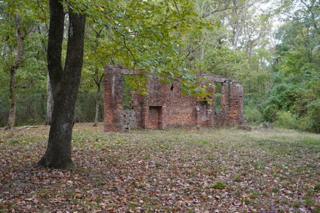
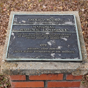
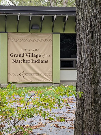
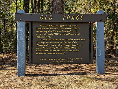
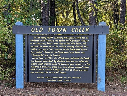
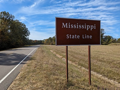
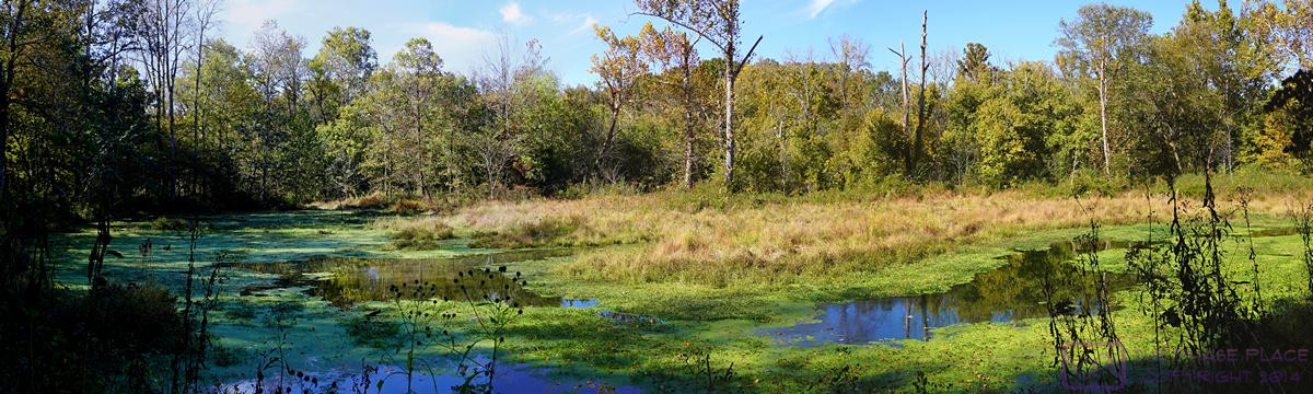
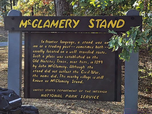
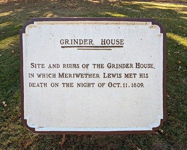
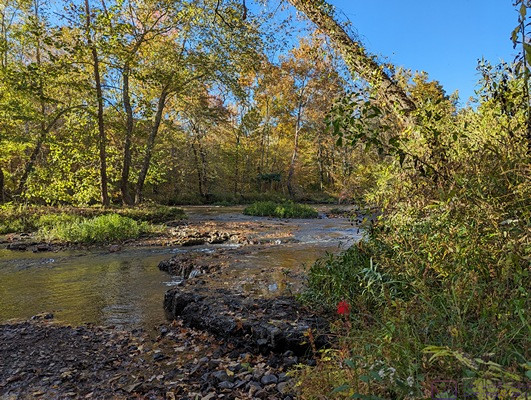
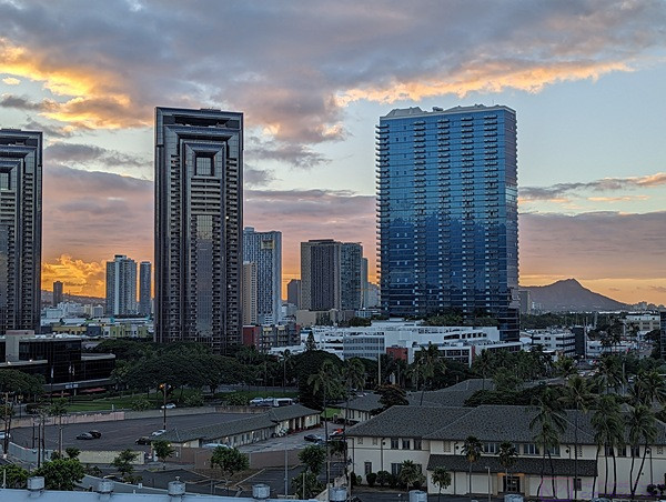
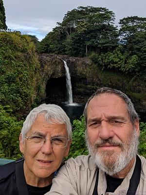
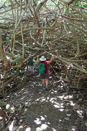
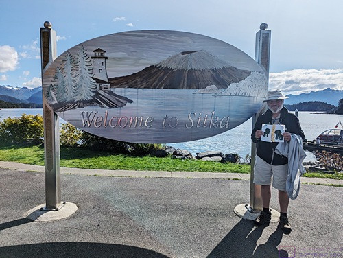
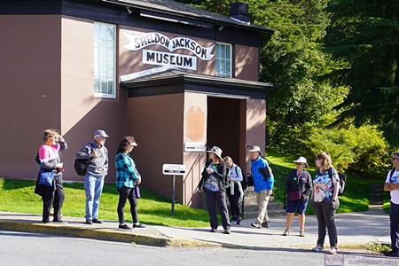
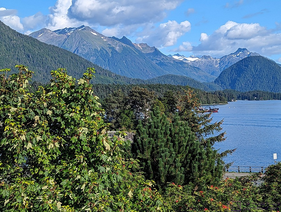
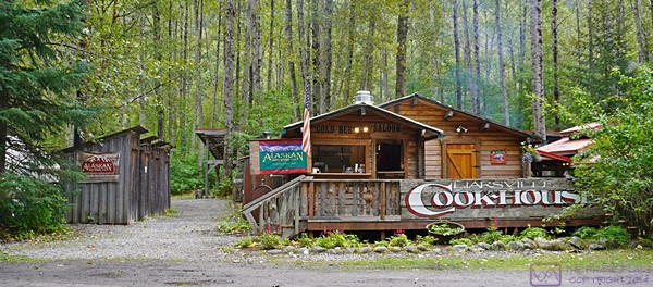
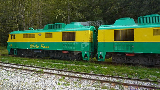
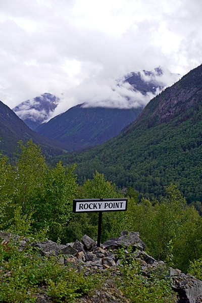
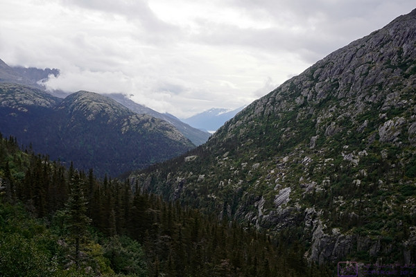
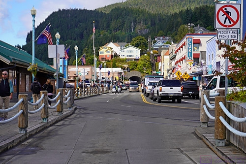
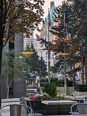
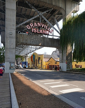
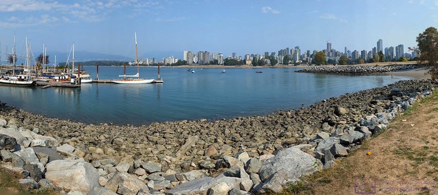
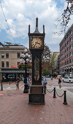
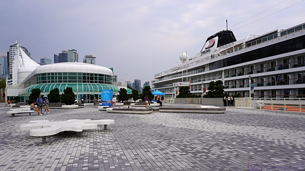
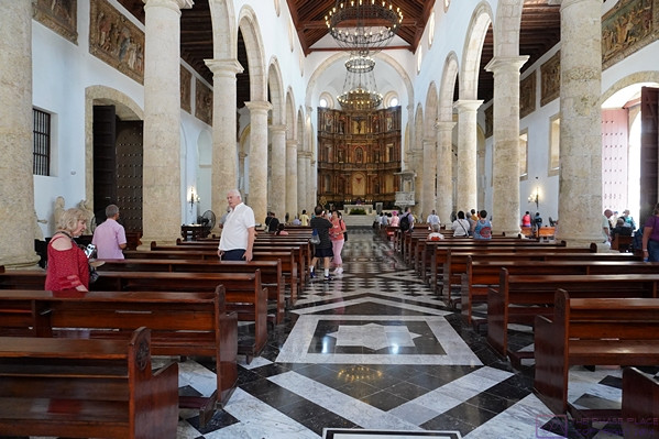
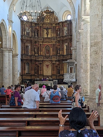
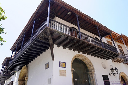
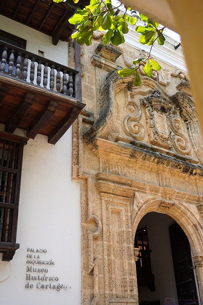
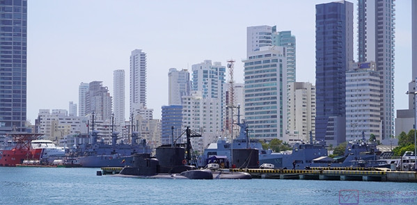
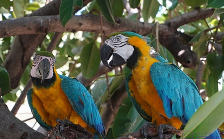
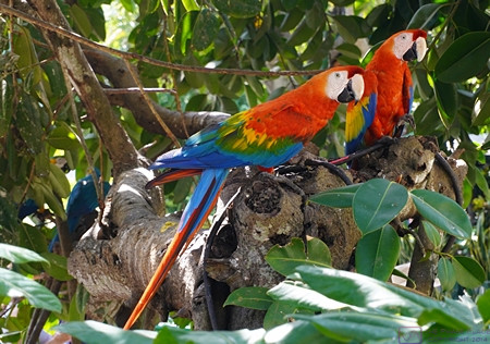
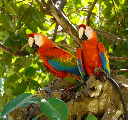
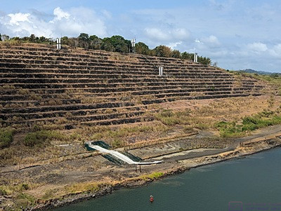
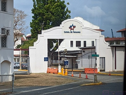
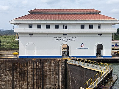
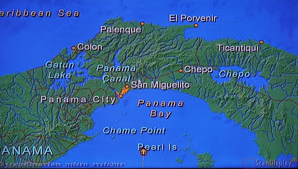
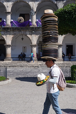
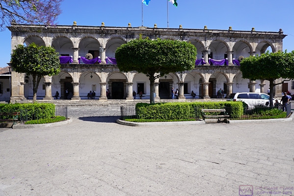
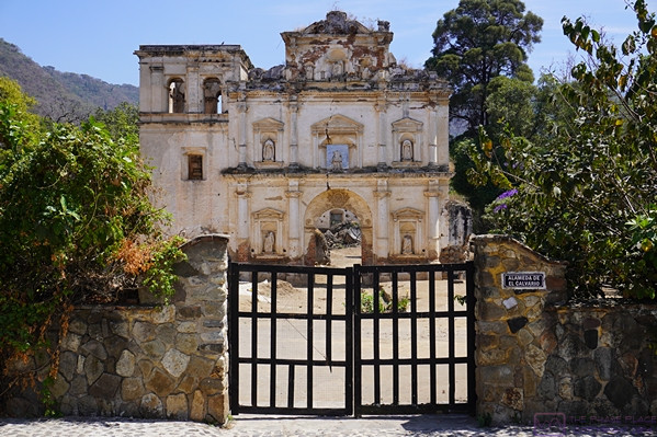
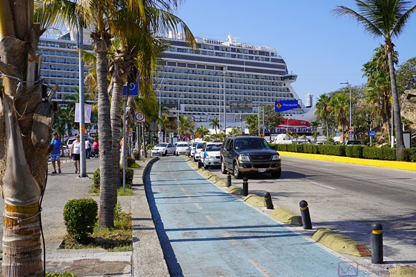
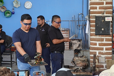
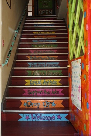
2016/03/24 (R) Cocoa Beach Historic District

I got up at 8:15 AM, put on my swim trunks that I use as a pair of casual shorts, and walked over to the campground office to get a couple of cups of coffee.  The coffee is not that good, but it’s hot and I don’t have to make it or clean it up.  While I was there I inquired about extending our stay.  Robert assisted me and found two full hookup sites in the same part of the campground where we are now that were available for three nights starting on the 29th and marked them on a campground map.

Linda was asleep when I left and still asleep when I got back so I gently woke her up to have some coffee.  She was feeling a little better.  Her sore throat was almost gone and she had regained a little of her hearing and speaking.  We checked the long-range weather forecast and it looked like next week’s weather should be good with moderate temperatures and low probability of rain.  We discussed the available sites and agreed that #358 looked like a great choice.  It is directly behind the site we are currently on (#352) and is large with good access.  It also faces northeast which is a plus.  We will have to remove the windshield covers in order to move the coach and the northeast orientation means we will not have to put them back on while we are here.

I walked back to the campground office and reserved site #358 for March 29, 30, and 31, with departure on April 1 by noon.  All things being equal (which they never are) we would rather not be driving on April 1st as there is, apparently, a mass exodus of snowbirds from Florida on that date and the northbound highways are bumper-to-bumper and very slow.  I can check with the office each day to see if there have been cancelations that would allow us to stay longer on one site.  We also discussed making a reservation for a few nights back at Williston Crossings and cooling our heels there before heading north.

I texted Vickie to let her know about our modified plan.  She and Pat were headed to the beach for a walk and Linda decided she wanted to go along.  While we waited for them I texted our children to let them know we had extended out stay at Jetty Park and that their mom was doing better.  Oops; apparently no one ever told them Linda was sick and my text message prompted a quick phone call from our daughter.

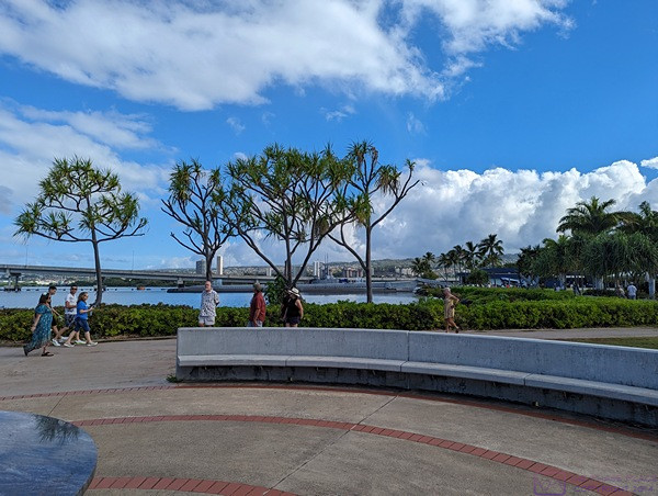
We walked along the ocean towards Cocoa Beach for 1.5 to 2 miles.  (We had three pedometers between us but each one recorded a different distance.)  Pat and I headed back while Linda and Vickie went a little farther before turning back.  The girls walk faster than we do and wanted to give us a head start.  They caught up with us just as we reached the boardwalk back into Jetty Park.

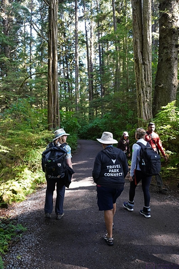
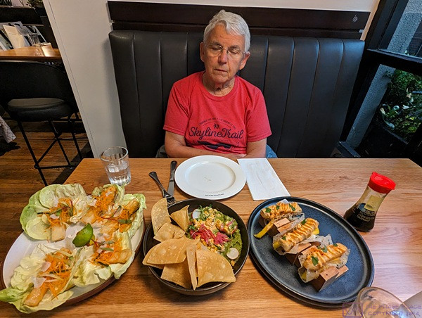
We were back at our coach at 11:45 AM and agreed to get back together mid-afternoon and drive to Cocoa Beach to see the Historic District.  None of us had eaten breakfast and Linda clearly needed a nap before doing anything else today.  I made a sandwich with mock deli slices, Daiya non-dairy cheese, raw onions, lettuce, and mustard and cut it in half for us to share.  I had a few pretzels with hummus and washed off the rest of the grapes and set them out.

I noticed yesterday that I had a critical update for Windows 10 but when I checked today it was no longer there.  My presumption is that it got downloaded and installed.  Linda had the same update still pending, along with the Visual C++ update that keeps trying to install but apparently does not do so correctly.

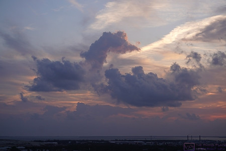
There was a magnificent full moon rising last night but we did not notice it until it was well above the horizon.  I tried to take a few pictures from in front of our coach but I spent most of the time messing with the camera’s controls and settings.  I suspected that I failed to capture the beauty of the moment and after I copied them to my computer to examine them my suspicion was confirmed.

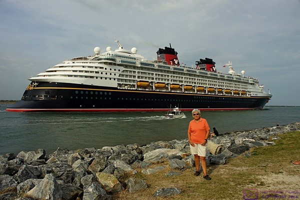
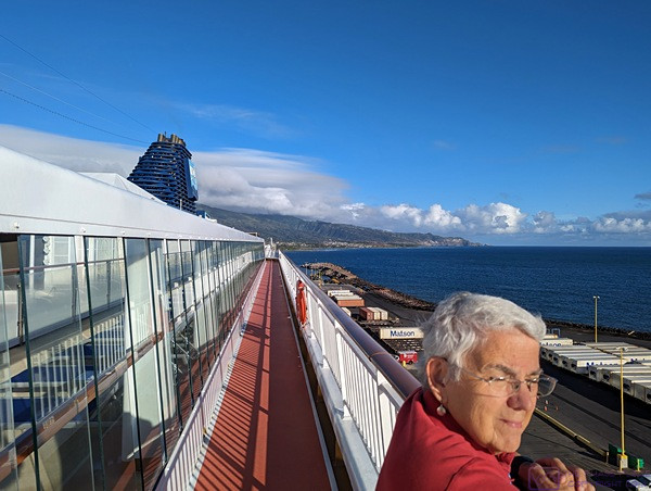
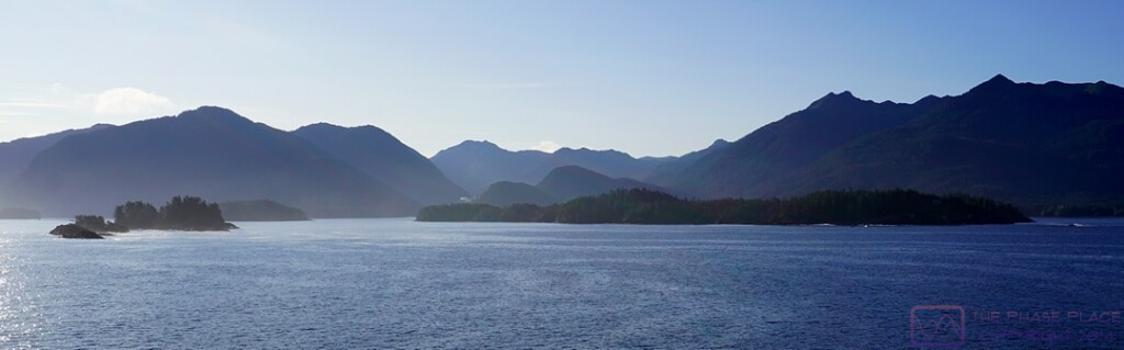
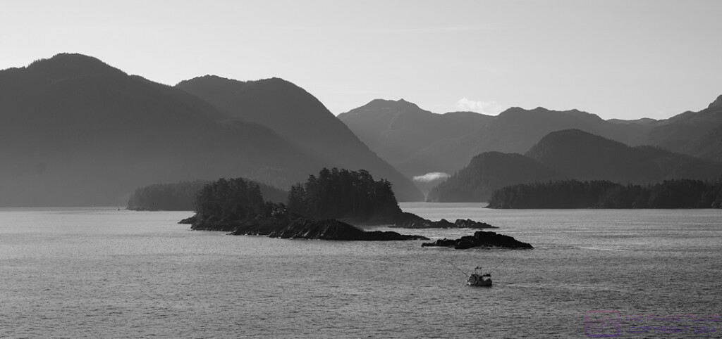
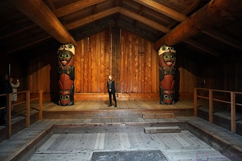
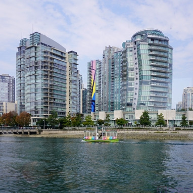
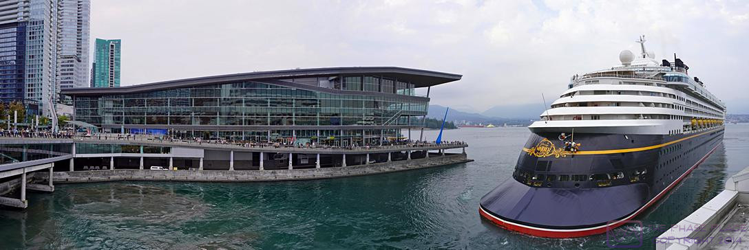
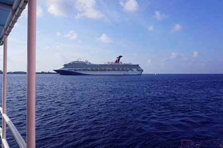
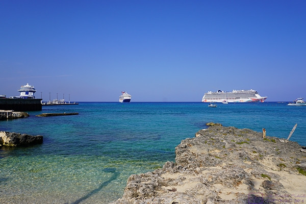
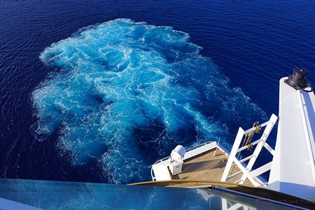
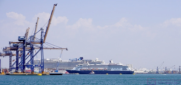
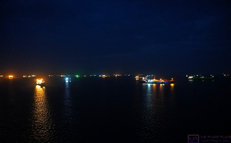
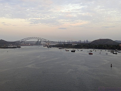
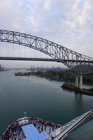
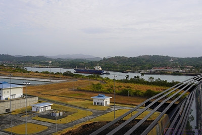
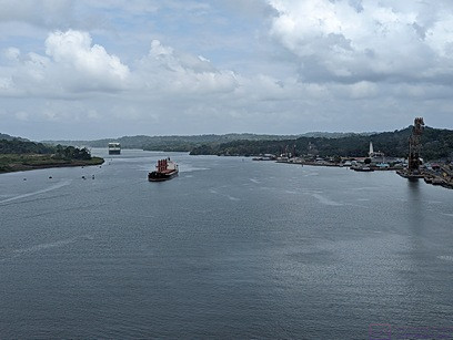
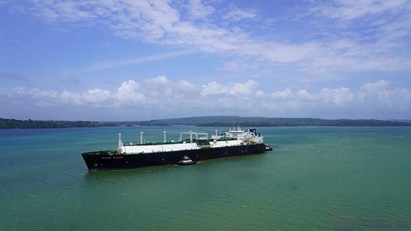
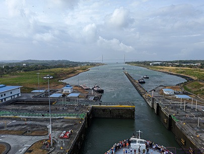
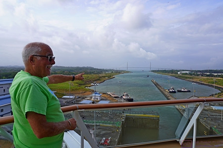
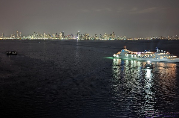
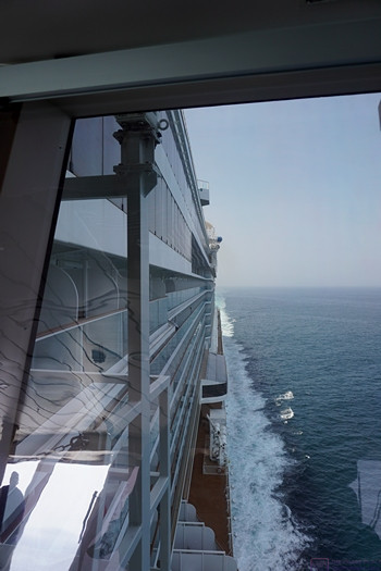
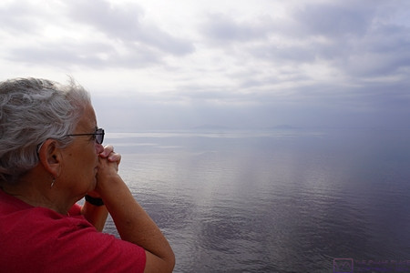
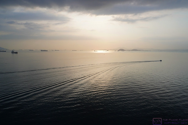
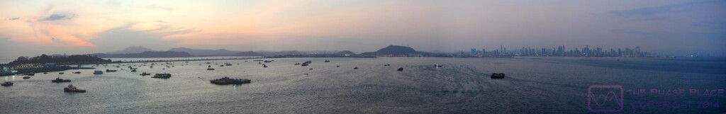
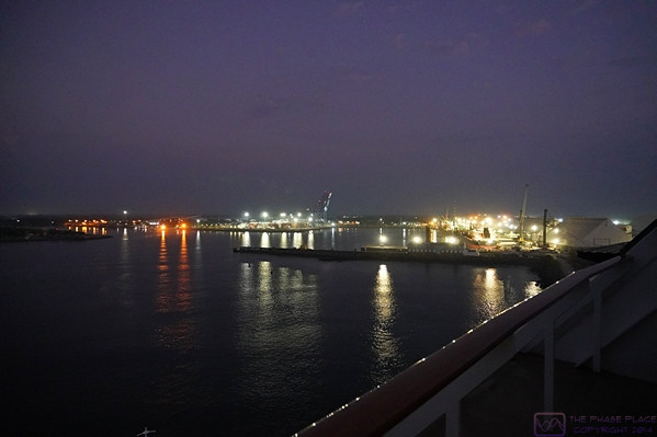
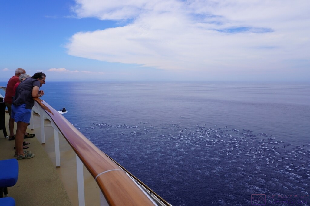
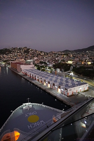
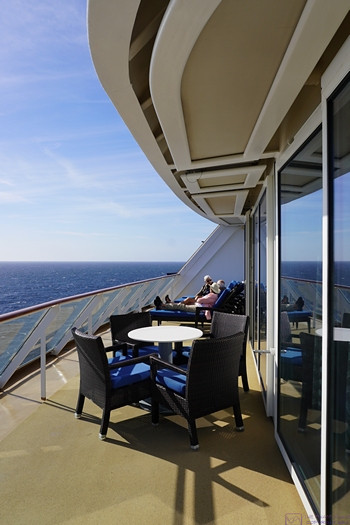
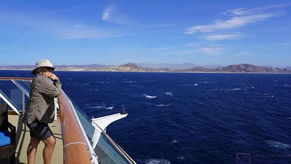
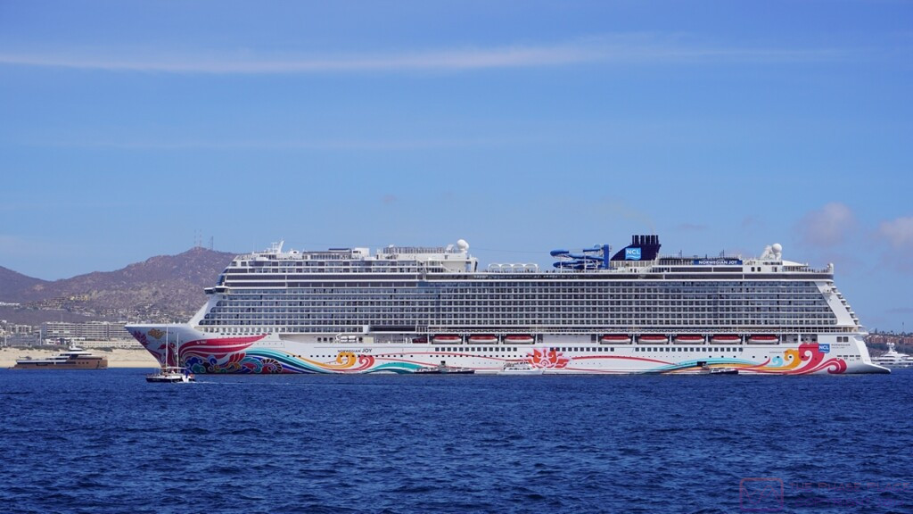
Linda takes a minute to pose while watching one of the Disney cruise ships (Magic?) leave Port Canaveral and head out of the channel into the Atlantic Ocean.

We both took naps but by 4 PM had not heard from Pat and Vickie.  I called Vickie but got Pat.  Vickie had a sore neck and they had decided not to venture back out today.  Linda’s sore throat has largely abated, and her voice has improved a little, but her hearing is still very impaired.  This afternoon she got very concerned about it and had me try to contact a local ENT.  The office was closed until Monday morning and the call was routed to an answering service.  The answering service gave me the number for another ENT in Titusville.  I called them and got their answering service.  They took my name, number, and some information and said the office would call me at 8 AM when they opened.

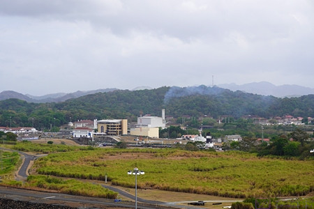
The weather forecast from 5 PM on was for an increasing probability of thunderstorms headed towards 100% by 11 PM.  The weather was moving from southwest to northeast along a front that appeared to be drifting slowly from west to east.  As a result air temperatures were hanging in the 70’s and the humidity was very high.  Rather than sit around the coach we decided to drive down N. Atlantic Ave. (FL-A1A) to/through Cocoa Beach just to have a look.  First, however, we closed up the coach and turned on the air-conditioners.

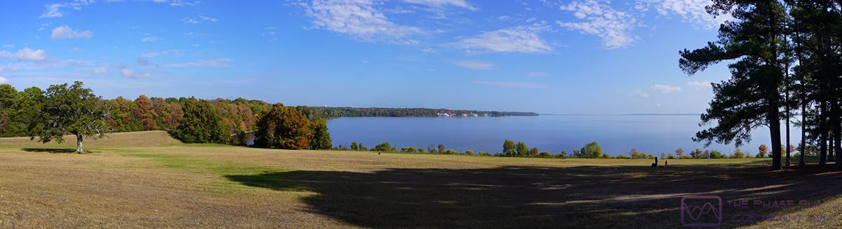
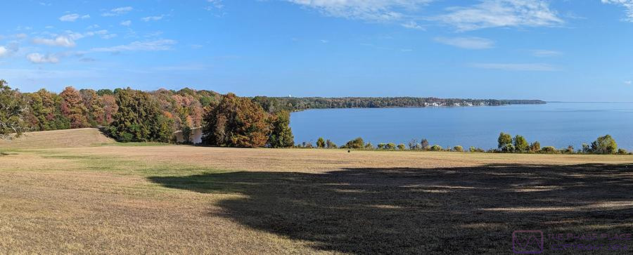
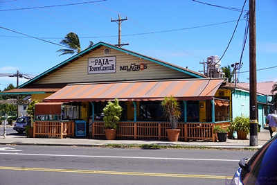
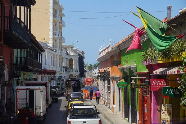
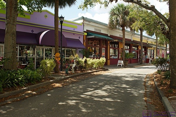
We had a nice, leisurely drive south through Cape Canaveral and then Cocoa Beach; first through the main business section and then through a more residential part.  In spite of the high-rise residential and resort buildings that dominate the ocean shore along the eastern edge of the Cape, the main avenue still has some of the look and feel of “old” Cocoa Beach, with the Ron Jon Surf Shop as a centerpiece.  Many of the beach houses are charming without being massive and lavish, like the ones we saw on Captiva Island on the Gulf Coast.

By the time I turned around to head back dark storm clouds had moved in and it had started raining intermittently.  We stopped at the CVS Pharmacy to see if they had an OTC medication that might help Linda’s right ear.  The pharmacist said the only thing he had was a pill that would promote drainage which might help remove infection and pressure but was certainly not a substitute for a prescription medication.  We bought a pack as it seemed like a better option than doing nothing.

We got back into the northbound flow of traffic, which was bumper-to-bumper and slow because the right hand lane was closed for construction.  Heavy rain had moved in, with reduced visibility and minor road flooding, which did not improve the traffic situation.  We weren’t in a rush, and it would not have mattered if we were, so we just took our place in the parade until I got to a traffic signal where I turned left and went into the Publix parking lot.  Linda stayed in the car while I went in to buy a few grocery items.  It was raining lightly when I came out of the supermarket.  I loaded the grocery bags in the back of the car and returned the cart to the front of the store.  In that short time torrential rains fell and I had to wait for it to abate before I could return to our car.  (In spite of the forecast we left the coach without our raincoats or umbrellas.)

Back at our coach we got the groceries inside and put away.  Linda felt like fixing dinner so she heated the vegan Italian sausage with sautéed onions and peppers and served it next to an arugula salad.  I cut up some of the strawberries we just bought and served those for dessert.

Our usual Thursday evening CBS TV programs were preempted by the NCAA basketball tournament but I found an interesting series of talks about “American Generations” on PBS.  The three hours covered, in order, Boomers (us), Gen-X (both of our children), and Millennials (both of our grand-daughters).  The basic point of the lectures was an updated and expanded version of the central concept of a presentation by a sociologist that I saw in the late 1970’s titled “What you are is where you were when…”

Our TV viewing was occasionally interrupted by severe weather alerts and a tornado warning, although the warning was not for our specific location.  We spent some time with our iPads trying to understand the implications for us and our rig and decided we were not in any imminent danger.  Lightning activity increased around 11 PM accompanied by some thunder and then rain.  The rain and lightning intensified as midnight approached and the leak around the bedroom vent fan reappeared but did reach severe levels and the winds were not an issue.  At midnight the channel 9.3 radar showed one cluster of storms pushing out to sea by us but another fast moving line sweeping across the Gulf of Mexico and stretching across Florida from north of Jacksonville to north of Tampa and moving our way.  It was all too obvious by this point that we had miscalculated the intensity and duration of the storm when deciding to leave our awnings out.  I finally tried to go to sleep not knowing if they would be OK in the morning.  The ENT office was supposed to call at 8 AM and we wanted to be up, dressed, and ready to go in case they could see Linda right away.

2016/03/25 (F) Orlando ENT Visit

With the thunderstorms last night I did not get a good night’s sleep.  The cats were nervous and wanted my attention but would not settle down and sleep.  When Juniper did finally settle down she curled up on my pillow. The roof vent/fan in the bedroom leaked on the foot of the bed so I had to deal with that.  I was also concerned about the two awnings we left out.  And last, but not least, I was concerned about Linda’s hearing loss.  Nonetheless, I was up at 7:30 AM and got dressed.  Linda was up shortly after me and got dressed.  She also did not sleep well for most of the same reasons.  We each had a quick bite for breakfast in case we had to leave on short notice.

I had not heard from Dr. Patel’s office in Titusville by 8:10 so I called them.  They were the backup for Dr. Widick’s office in Cocoa Beach which was closed until Monday morning.  Dr. Patel was not available today and would not be until Monday.  Some backup.  The receptionist was not able to refer us anywhere else.  Linda’s initial annoyance at not being able to hear had become a serious concern and melted briefly into a panic.  We both got online and started searching for ENTs in the Orlando area.

There were several dozen with no meaningful way to call all of them to find one that was open with an available appointment slot.  We were starting to think about going to a hospital ER when I spotted a listing for ENT services at Florida Hospital in Orlando.  I called the number and the operator wasn’t quite sure what to do with my call but then transferred me to the hospital’s physician referral service where Tim took the call.

Tim gave me the name of Dr. Lehman at Ear, Nose, Throat Plastic Surgery Associates P.A.  http://www.ENTOrlando.com/Portal 407.644.4883.  I called them and they were not going to be able to get Linda in to see Dr. Lehman, or any other ENT, until Tuesday.  I pleaded the desperation of our situation and they finally said we could see a P.A. in their Orlando clinic office at 1 PM.  The receptionist took some basic insurance information over the phone and told us to be there by 12:30 PM to take care of paperwork.  She also gave me the address and phone number of the clinic.

Our mapping apps indicated a 52 mile trip (one-way) that would take about one hour.  We decided to leave at 10:30 AM to allow plenty of time and still arrive early.  It was only 9 AM so rather than sit around I texted Vickie to let her know our plans for the day and that we were headed over to the office to get some coffee and kill a little time.  She and Pat met us there and provided a much needed distraction for Linda.

We knew that another round of thunderstorms was forecast to move through the Cape Canaveral area sometime during the afternoon so at 10:15 we headed back to our coach and retracted the patio awning and large driver side awning.  By the time we gathered up all of our stuff, which included our SunPass transponder, and pulled out of our site it was almost 10:45.  I headed south on N. Atlantic Ave. and stopped at the Shell station to top off the fuel tank.  A half mile later I headed west on Central Blvd. and then turned onto westbound Astronaut Blvd (FL-A1A).

The clinic was located at 44 W. Michigan St. southeast of downtown Orlando, Florida.  Approximately 40 miles of the 52 mile trip were on FL-A1A and FL-528 and somewhere between 30 and 40 of those miles were toll road.  The only traffic congestion we encountered was after exiting FL-528 near Orlando International Airport onto FL-428.  We arrived at the clinic before noon.

While Linda was filling out all of the paperwork I got a call from Butch.  They were on the move traveling north on I-25 in New Mexico and hoping to make it to Amarillo, Texas before dark.  I brought him up to date on Linda’s situation and we then discussed travel plans.  He thought they would be home by the end of next week, which is when we plan to pull out of Jetty Park.  Butch is willing to help me disassemble and rebuild the driver side tag axle caliper, if that’s what is needed, and I really appreciate that.  I am inclined, however, to get Linda and the cats back to the house and then take the bus to Butch and Fonda’s place.  I also need to have him work on the three CruiseAir air-conditioners and I cannot have the cats onboard while that work is taking place.  All of this might also depend on if/when Joe is in Michigan and available/willing to work on the bus.

At 1:15 PM someone came out and called for Linda.  It was the audiologist.  She took us back to a room with an anechoic chamber and tested Linda’s hearing.  We went to an interior waiting room while she complied the test results and were then taken to an examine room by a nurse who went over the information Linda had provided and filled in some details.  A few minutes later the Physician’s Assistant, Bibi Farida Hussain, PA-C came in with a nurse.

We immediately liked her.  She was friendly and upbeat but very professional; exuding a confident competence.  She went over Linda’s history, symptoms, and audiological test results.  Linda’s test results showed that her hearing in her right ear was well below normal and that her eardrum was showing limited movement.  Farida’s examination of Linda’s right ear revealed some wax build up that was obscuring her ability to see anything else, so she cleaned it.  She was then able to clearly see the inflammation and the presence of fluid in the middle ear.  The fluid was preventing the movement of the eardrum and Bibi was fairly certain that was responsible for the greatly diminished hearing.

Farida had Linda pinch her nose and blow gently to force a little air up the eustachian tubes to help displace some of the fluid.  She recommended that Linda do this about 10 times per day.  She also suggested that Linda continue to use the OTC 12 hour nasal decongestant pills as they were helping drain the eustachian tubes and middle ear.  She prescribed a six day course of steroids and sent the prescription electronically to the CVS Pharmacy in Cocoa Beach.  She also recommended OTC Flonase nasal spray and gave us a $5 off coupon for the 120 dose size.  Finally, she gave Linda a copy of the audiological test results and suggested that she follow up with her ENT back home (Dr. Michael Sideman) in two to three weeks.  We paid the estimated co-pay and were on our way by 2:15 PM with Linda feeling relieved and reassured that her hearing should recover substantially within a week with no long-term damage.

We did not have much for breakfast and decided to get some lunch before driving back to the Cape.  A POI search using our Garmin 465T GPS unit revealed that there was a Panera just 0.3 miles east of the clinic on Michigan St.  Perfect!  It was cold inside and pleasant outside so we ate outside.  As we were finishing our lunch around 2:45 PM, very dark and foreboding clouds blew in quickly from the west and we got a few rain drops.  We made it back to the car before the skies opened up, which they did shortly thereafter.

The entire drive back to Cocoa Beach was through a hellacious rain storm with strong winds, very limited visibility, water ponding on the roads, and generally reduced speeds.  We did not have to be anywhere by any particular time so I tried to move along at whatever speeds felt comfortable to me while not going so slow as to get rear-ended.  It was about 4:30 PM by the time we made it to the CVS Pharmacy in Cocoa Beach and picked up Linda’s Rx and OTC medications.

The northbound traffic on FL-A1A (Astronaut Blvd.) was bumper-to-bumper as we drove through Cape Canaveral into Cocoa Beach so I took side streets back to Jetty Park.  I know I’ve been someplace for a while when I can start to find alternate driving routes.  The rain had moved through and out to sea by this time and we had a nice drive through yet another pleasant part of the Cape.  We were back at our coach by 5:15 PM.  I texted Vickie to let her know and we agreed to meet around 6:30 PM to go for a walk around the campground and park.  I then texted Butch and Chuck with status updates while Linda texted both of our children with the same information.  People really do care, and were concerned, and it would be thoughtless to not let them know.

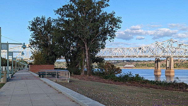
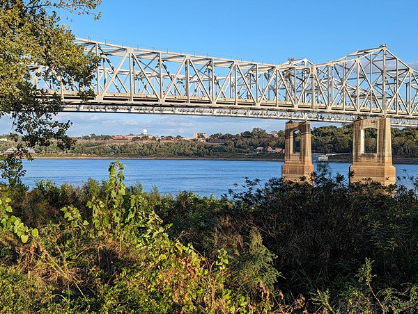
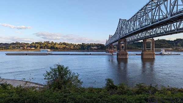
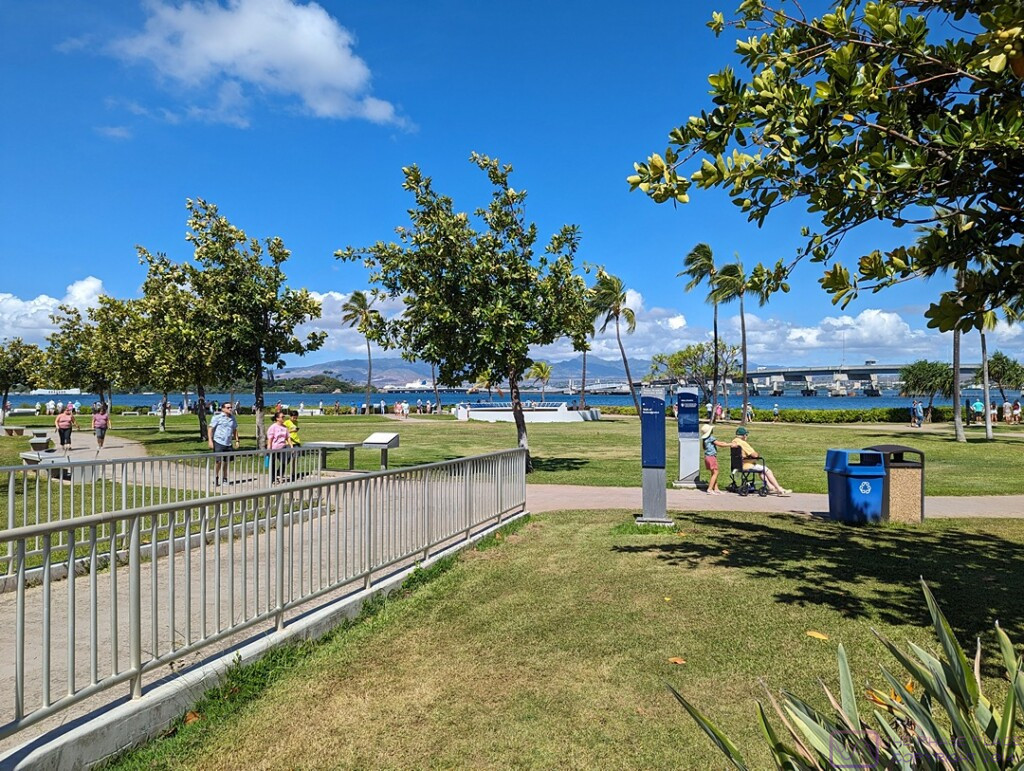
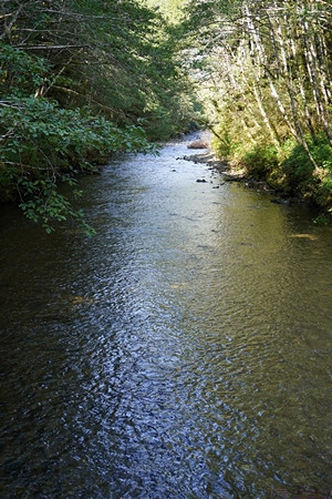
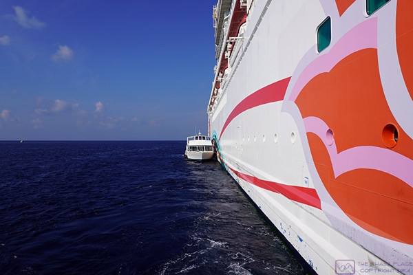
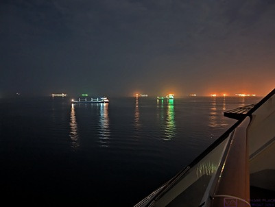
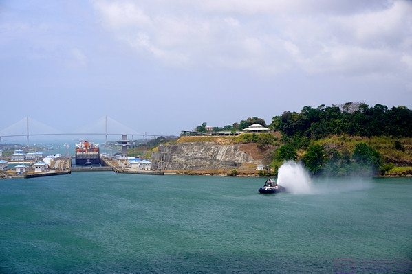
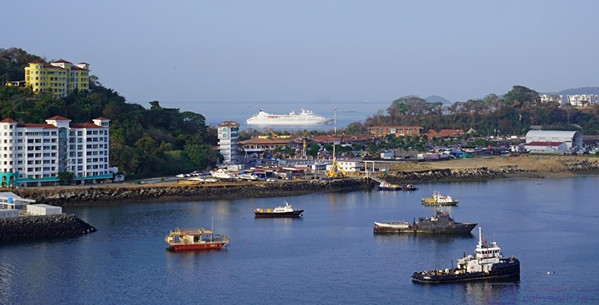
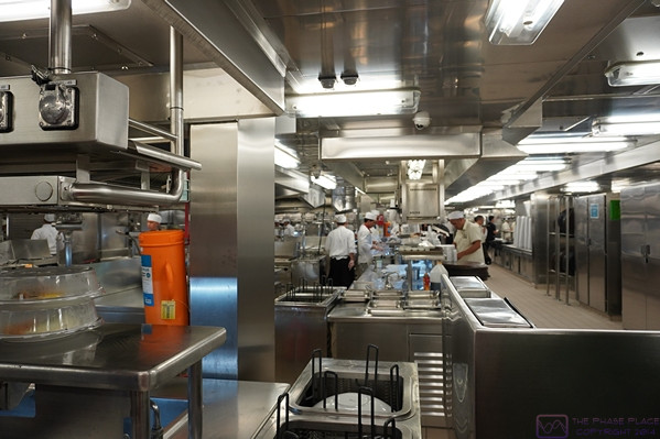
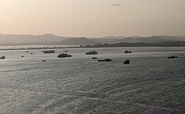
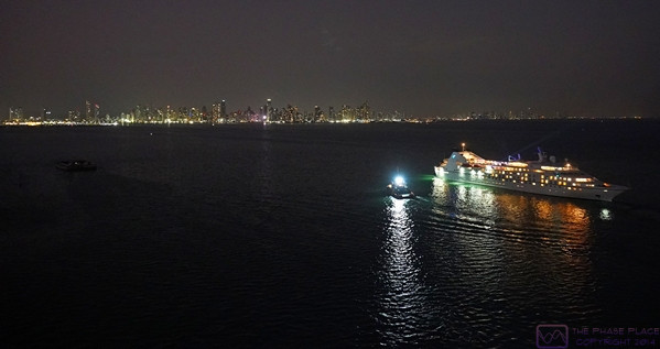
Having had a late, filling lunch we were not hungry so Linda doodled on her iPad while I took a short nap.  We met Pat and Vickie and walked out to a beach access/overlook where we saw the Victory casino ship heading out to sea.  I took a few pictures because, well … I had my camera and that’s what I do.  We then walked along the shipping canal where I took a few more pictures.  We stopped at the office for coffee and then walked to the laundry room closest to our site to check it out.  Linda was tired by this point so we said “good night” and headed back to our coach.

It was 7:45 PM and we both were finally a little hungry so we each had a sandwich.  We turned on the TV and flipped channels.  There wasn’t much on that we wanted to see until Linda noticed that Foyle’s War was on one of the PBS stations.  That was an excellent show that we really enjoyed when it originally aired.  The signal was intermittent but we watched it anyway.  I then tuned in the NCAA basketball tournament for Linda on CBS 6.1 (solid, steady signal) as she made ready to sleep in the captain’s chairs again tonight.  I went to bed, put on the TV, and wrote for a while before going to sleep around 11:30 PM.

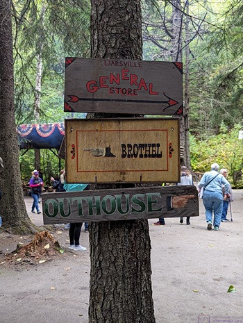
2016/03/26 (S) Let’s Talk Dirty

I woke up around 7:15 AM and was out of bed by 7:30.  Linda was still sleeping soundly, so I quietly got something to eat for breakfast and took my vitamins but did not make coffee, which involves using the coffee bean grinder and is fairly noisy.  Linda woke up around 8:30 and started taking her steroids.  After reading the package more carefully she realized she could have taken all six of the first day’s pills last night at one time.  That annoyed/frustrated her as she is anxious to get her hearing back ASAP, but there was no turning back the clock.

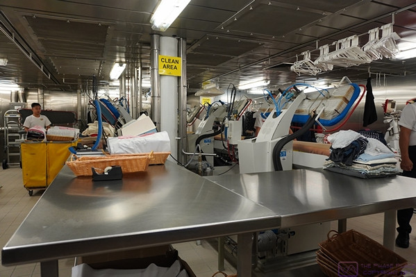
I needed to do laundry today and I also needed to mail two envelopes to my sister with various tax returns in them.  I searched online for laundromats in Cape Canaveral and Cocoa Beach and found several, but one in particular caught my attention; a full service laundry on N. Atlantic in Cocoa Beach named Let’s Talk Dirty.

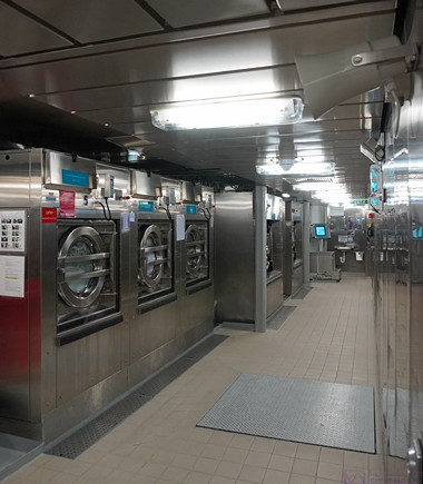
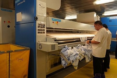
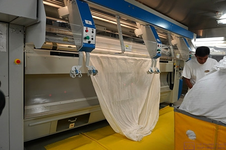
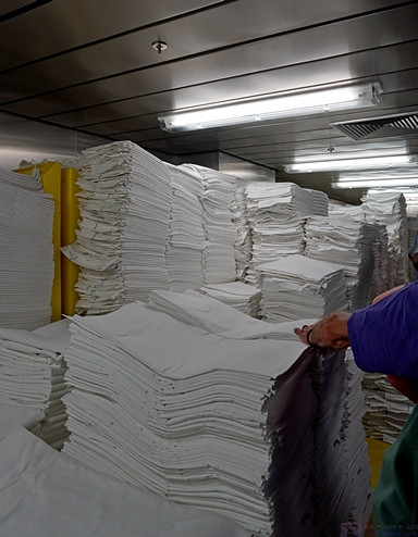
The shower/laundry buildings at Jetty Park Campground only have three washers and dryers each, but their main drawback is that you cannot drive your car and park near the buildings; the only way to get your laundry there is to carry it.  We have seen quite a few people using rolling carts to get their stuff to the beach and I suspect the long-term, regular campers also use them to get their laundry to/from the building.  We do not have such a cart and since I had to drive to the Cape Canaveral Post Office anyway I decided I would treat myself and let someone else wash, dry, and fold our laundry today.  It might cost as much as going out for a moderate dinner, but it’s been a hard week for me as well as Linda and I figured I deserved a break.

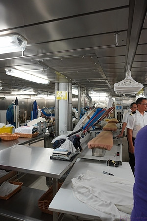
I gathered up the laundry, put it in the car, and took off, leaving Linda to rest.  I found the Post Office easily enough and got the two envelopes mailed Priority Mail with tracking.  I then drove another four miles south on FL-A1A (Atlantic Ave.) to the laundry service.  It was in a little strip mall just before Atlantic Ave. splits at the beginning of Downtown Cocoa Beach.  It was around 10:30 when I got there.  I had 29 pounds of laundry at a $1.05 per pound.  I had Jill wash everything “cold” but there was an extra $5 charge for splitting it into two loads, lights and darks.  I had to pay in advance, but that was OK.  Jill said it might not be ready until after 3 PM and let me know she was closing today at 5 PM.  No problem.

I enjoyed my drive back to Jetty Park and stopped at the Dunkin Donuts for a couple of coffees to go.  The place has always been empty when we have stopped there before but it was mobbed this morning!  But then, I guess that’s not really surprising for a Saturday morning on Easter weekend on the Cape.

Vickie texted me around 1 PM to see how Linda was doing and to let us know she was headed out to do some shopping and see if we needed anything.  She did not specify groceries but I presume that what she meant.  Linda was sleeping and we really did not need anything as we/I have been to Publix two or three times since we arrived at Jetty Park.  I was working on this post when Jill called around 1:30 PM to let me know our laundry was ready for pickup.  By this time Linda had a short grocery list from the last couple of days so we brainstormed a few additional items and I took it with me.

Atlantic Ave. was busy and congested near the Merritt Island Causeway. The “cause” of the backup was a large group of protesters at the intersection. As best I could determine their “cause” was saving the Indian River Lagoon, from which I gathered something was going on that the protesters believed threatened said lagoon in some way.  Their signs directed passersby to the group’s Facebook page for more information.  Once I was clear of that intersection the next congested section was by the public park farther south on the east side of the avenue.  It was closed to public use for a special function and there were a half dozen police cars there with their lights flashing.  The police had also placed cones along the lane markings and were directing traffic.  Everyone had to slow way down, of course, and occasionally stop.  Once I was clear of that obstacle it was easy sailing the rest of the way to the laundry.

It only took a few minutes to retrieve our laundry which was folded and bagged as advertised.  There was no way to avoid the traffic congestion at the park but once I was clear of that I kept an eye on my GPS unit for the first available opportunity to get off of Atlantic Avenue and over one street to the east.  That street begins/ends south of the causeway so I used it to bypass the congestion and demonstrators at that intersection.  I have nothing against protests and demonstrations; they are a sign of the health of our democracy, but I was already aware of their cause and not in the humor to sit in traffic.  Although there is an occasional stop sign and a 25 MPH speed limit, the side street is a lightly used, pleasant road that runs through a residential area.  When I was sufficiently far from the causeway intersection I returned to Atlantic Avenue and continued north to the Publix supermarket.

It was sometime between 2:30 and 3 PM by the time I was parked and headed inside the supermarket.  There have always been shoppers (and their cars) here on previous visits, but nothing like today.  The parking lot was 75% full, the aisles were crowded, and some of the shoppers seemed frantic.  Saturdays are busy at most supermarkets and other shopping venues but I could not discern to what extent these shoppers were residents with jobs doing their weekend chores, snowbirds doing their weekly grocery runs, or vacationers just arrived on the Cape and stocking up for the week.  It was also the Saturday before Easter Sunday and I only found out later that Publix would be closed tomorrow.  It was a perfect shopping storm.

I was back in my car with the groceries by 4 PM.  There’s a side street with access to the Publix parking lot that has a traffic signal on N. Atlantic Avenue so I always use it to make the left heading northbound.  Although Atlantic Avenue is four lanes with a center turn lane the speed limit is typically 35 MPH and it is lined with businesses on both sides.  Traffic moves slowly, and is frequently interrupted by vehicles leaving/entering the traffic flow, which causes it to be bumper-to-bumper and makes left turns across lanes especially difficult.

Back at the campground I got the clean laundry and groceries into our coach.  I put the clothes bags on the bed and then unpacked the groceries and put them away.  Linda was hungry and feeling well enough to make a salad with arugula, dried cranberries, slivered almonds, and Ken’s Sweet Vidalia Onion Dressing.  Yum.  I heated a can of Amy’s Vegetable Barely Soup, washed off some black grapes, and sliced up part of the baguette that was left over from our lunch yesterday at Panera.  It seemed like it was the first meal we have sat down and eaten at home in a while.

I thought it would be good for Linda to get out of the bus and go for an easy walk.  She was still experiencing some dizziness and nausea but agreed to go.  We walked over to Pat and Vickie’s coach, which we can see from ours’, and found them at home.  They had just finished dinner and we were all going to go for an easy stroll when I noticed dark clouds moving in from the west.  Pat pulled up the radar on his phone and, sure enough, a storm cell appeared to be headed our way.  Linda was tired anyway so the stroll was called off and we walked back to our rig.

In spite of being surrounded by some 60 TV channels there are only a few that we can receive strongly enough to lock in the digital signal and they do not generally include the two PBS affiliates.  Saturday evening TV programming tends to be a bit of a wasteland anyway and we ended up watching the NCAA Basketball Tournament.  I eventually tuned it in on the bedroom TV as well just to have something on while I unpacked the clean laundry, put it away, and made the bed.  Linda set up the living room captain’s chairs for sleeping, took her evening medications, and snuggled in for the night.  Sleeping in a sitting position minimizes the amount of coughing during the night, which leads to better rest.  I turned off the lights in the front of the coach and retired to the bedroom for the evening.