SATURDAY 30 July
Our drive yesterday from Channel-Port-aux-Basques to the Gros Morne – Norris Point KOA (near Rocky Harbor) took us along and through spectacular scenery. The towns of Norris Point and Rocky Harbor sit on the northeast shore of Bonnie Bay, which runs deep into the south end of Gros Morne National Park. The mountains that make up most of this park are the northernmost extent of the Appalachian Mountain chain. The highest peaks are in the 800 – 900 m (2,500 – 2,800 ft.) range. That does not sound that high, but the whole park is dotted with lakes, and the terrain plunges steeply wherever land meets water, including the ocean. It’s another amazing place managed by Parks Canada. Its nickname is “Canada’s Norway,” and it is the reason we booked 5 nights at this particular KOA. – Green Point Trail & Geologic Site, Gros Morne National Park (Parks Canada), NL.
Around 7:30 AM, we were sitting outside enjoying our morning coffee. A red pickup truck parked in one of the spaces across from us and guy got out of the driver’s seat. He walked over, introduced himself, and pulled up a chair. He was friendly enough and just wanted to chat. Fine by us. He was here with his family, on their way to a family reunion in Twillingate. Nothing unusual about that. But it there was something unique about him in our experience thus far. He had come over from Labrador on the South Labrador Ferry from Blanc-Sablon, Quebec to St. Barbe, Newfoundland. And, he had been born in Labrador, grew up there, and still lived and worked there as a carpenter. To the best of our knowledge, he was the first “native” Labradorian we had ever met (not native in the sense of a First Nation person).
Following coffee and breakfast, we were eager to start exploring the park, to the extent our physical abilities would allow. Our research had indicated several “must do” experiences. One was the Tablelands hike, where the earth’s mantle is exposed and you can walk on it. Another was a boat tour of Etang Western Brook Pond. But those were both things we needed to find out more about, and wanted to do on days when the weather would be nice. We also wanted to rest a bit from our exciting but tiring experience getting from Nova Scotia to Newfoundland on the ferry.
A temporary Parks Canada Visitor Center was located in Rocky Harbor, so we drove there. But first we stopped at the Pharmacy for incontinence pads. No, it’s not what you think. Juniper-the-cat has occasionally been peeing outside her litter tray onto the special mat we have for collecting litter off of her paws when she exits.
The Coastal Trail to Green Point along the Baker River.
There was a festival taking place in town with a main, fenced area set up behind the Visitor Center. Parking was a bit crowded, but the Visitor Center was not. One of the park staff talked us through the park map, map recommendations, and gave us a guide book. An important piece of information was a listing of the guided tours/hikes the park offers. Our best option for today was the Green Point Trail and Green Point Geological Site. The trailhead was only a 10-minute drive up the road and we headed there.
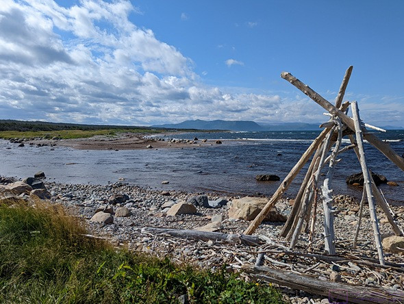
Someone built the frame of a teepee (wigwam) on the beach where the Baker River flows into the ocean (photo by Linda).
The trailhead was located right off of Hwy 430 on the north side of Bakers Brook. It was rated as an easy trail, and that proved to be the case. It followed the edge of the brook out to the ocean and then followed the seashore north. It was a 6 km “return” trail, which we now understood to mean it was an “out-and-back” trail and the total hiking distance was 6 km.
PHOTO – stitch
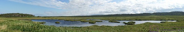
ONe of the many ponds in the marshlands along the Coastal Trail.
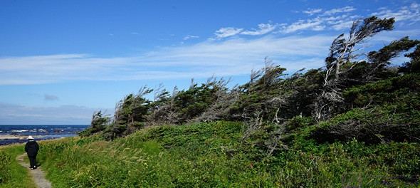
The trail followed the coastline to the north, usually along a low bluff set back slightly from the water’s edge and perhaps 15 feet above the level of the water. It was mostly exposed, with large areas of grass and marsh, dotted with ponds and small streams. There were also groves of Duck Amuck trees, small windswept, and entangled to form a sheltering canopy. Some groves had openings that allowed you to go inside. It was different and struck me as a suitable place for hobbits.
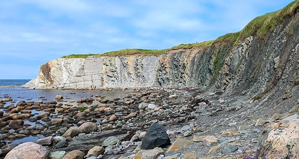
The Green Point Geologic Site at the north end of the Coastal Trail. This rock cliff has international significance to stratigraphy.
The wind was constant and strong, coming in over the ocean from the west. The trail was level, but offered quite a variety of surfaces, some which required careful and constant attention to foot placement. Towards the far end of the trail, it veered away from the coast and wound its way through balsam fir forest. The trail was supposed to end at a PC campground, but headed back before reaching it. The trail was busy, but not crowded. We often stopped and stepped aside to let other hikers get past us.
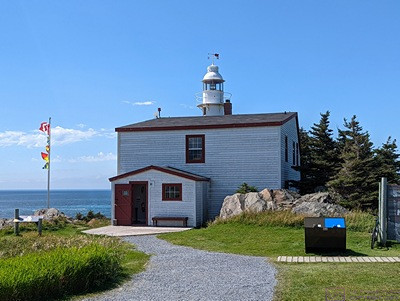
The keepers house and light at Lobster Cove Head, now part of Gros Morne NP (photo by Linda).
When we were almost back to the parking lot, we met a couple just starting the trail and walking their rather large, 11-month-old white Goldendoodle named Toby. They were from Pasadena, Newfoundland, just north of Corner Brook. We thought it was an unusual name for Newfoundland. It was founded, not that many years ago, by folks from Pasadena, California USA. They confirmed what we had noticed on maps, that almost everything in Newfoundland (and Labrador), whether trail or road, was a “return” route. Toby was very friendly and enjoyed all the attention we could give him. When we finally wrapped up our chat and started for the trailhead barked rather sharply and startled us. The husband apologized for not warning us that Toby does that when he wants to play and someone walks away. No harm, no foul; it was just unexpected.
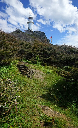
The Lobster Cove Head light seen from the cliffs below.
On the way back to camp, we stopped at the Lobster Cove Head Lighthouse. It was still operational, but no longer manned, and was park of the National Park. The keeper’s cottage was now a museum with a park staff person on site to answer questions. The museum was mostly about life along the shores of Bonnie Bay and the ocean in times past. Like all things National Park, it was well done.
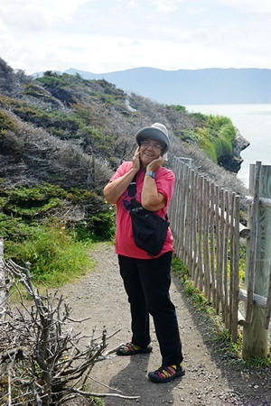
Lobster Cove Head trail. LInda holds her hat on (the wind was strong).
From the lighthouse it was just a short drive into Rocky Harbor. We drove along main street to the far end of town, just to have a look, and then back-tracked to Pond Road and took that up to W Link to stop at the pharmacy for some itch medication. (Something got Linda’s foot while we were hiking.)
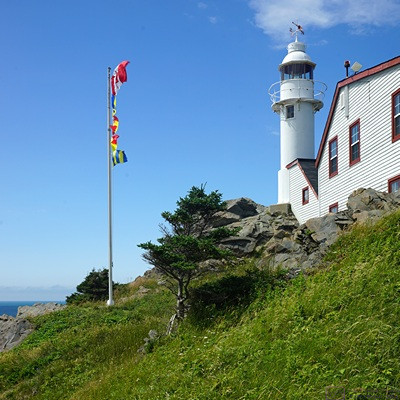
The Lobster Cove Head Light and House.
Back in camp, Linda made our reservations for the BonTour boat tour of Étang Western Brook Pond for Tuesday at 1:30 PM. It’s a 1-hour drive north on Hwy-430 to a trailhead and then a 45-minute easy hike to the boat dock, so we will have to leave camp well ahead of that departure time.
I was working inside and Linda was reading out on the patio when I heard her talking to someone. It was the couple, “Don” and “Sun”, we had met at the North Sydney / Cabot Trail KOA. They also have a recent model year Airstream Flying Cloud 25 RBT. Airstreamers, it seems, just naturally seek each other out. The iconic trailers are also magnets for the curious. We agreed to walk over to their site after dinner for wine and conversation, and perhaps a campfire. At least that’s what WE thought we had agreed to.
After dinner we were getting ready to walk over to Don and Sun’s site, when I noticed interesting cloud formations developing over the mountain ridge to our east. Naturally, I had to take photos of this phenomenon.
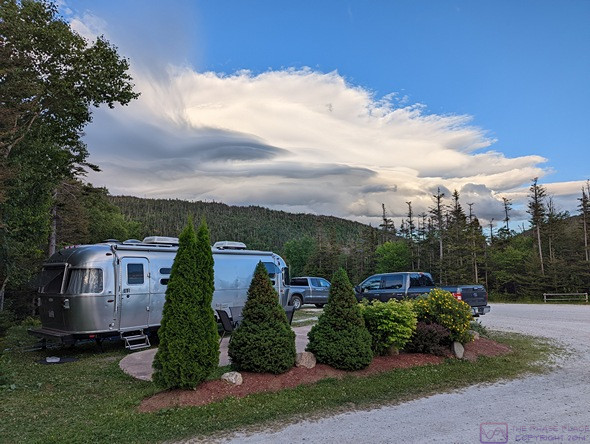
Unusual clouds form over/beyond the mountain ridge just to the east of the KOA.
We walked over to their site with two of our wine glasses and our bottle of Lavender Mead from the Honey Bee Meadery on PEI (I went back for our two camp chairs). That was when we discovered that they had prepared dinner. They did not know, of course, that we were vegan, but Sun quickly made a vegetable stir fry with oyster sauce while Don cooked their assortment of fish and seafood, purchased fresh that afternoon in Rocky Harbor. The stir-fry was delicious. They were not familiar with mead, but Sun seemed to like it. Don started a campfire in their mid-sized SOLO stove/firepit. After watching how efficiently it burned, we decided we should perhaps get the small version for camping, if we can figure out where to store it. The Lavender mead was excellent, by the way, better than our memory of it from the tasting at the meadery.
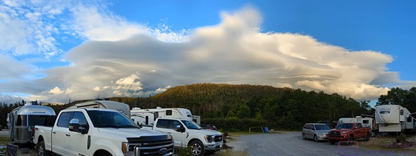
The same clouds from a different location in the campground. They were steadily changing.
Originally from South Korea, they were long time residents of the Vancouver, British Columbia area. Now retired and RVing, they had previously spent many years doing international hikes in almost 70 countries. They did one month at a time, several times each year, and it took them decades. Don took photos and Sun took notes as they traveled. Don owned/operated a Korean language newspaper in British Columbia, so the notes and photos became stories in the paper. We talked late into the evening (for us) and finally returned to our trailer at 11 PM. We passed several groups sitting around campfires and just enjoying the evening and each other’s company, but the campground was already very quiet.
…