Note: Most of the images from our visit to JTNP are in a separate Gallery Post with the same date.
We set an alarm for 6 AM (MST) and got up shortly thereafter. We had a few fresh strawberries for breakfast, gathered up the things we needed to take with us, and hit the road at 7:15 AM MST. We stopped at Albertson’s supermarket in Blythe, California for a few grocery items and a small bag of ice for the ice chest we borrowed from Butch and Fonda.
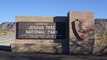
South/Cottonwood entrance to Joshua Tree National Park in California.
By 8 AM PST (9 AM MST) we had exited I-10 and were headed into the Cottonwood entrance to Joshua Tree National Park (JTNP). The visitor center did not open until 9 AM, but one of the volunteers suggested we drive down past the Cottonwood Campground to Cottonwood Springs. There is a grove of very large palm trees there due to an underground source of water that has seeped out of rocks for centuries. We hiked a short way up a much longer trail then hiked back to the car. The morning sun was still low enough in the sky to make a nice light for photographs. We returned to the visitor center, which was now open, and stamped our National Parks Passport.
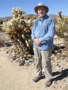
Bruce in the Cholla Garden, JTNP, CA.
We drove through the park towards the north entrance stopping along the way to read Point Of Interest signs and go on short hikes. The Cholla Cactus Garden was particularly interesting. The southern/eastern part of the Park is Colorado Desert (a portion of the Sonoran Desert). The north entrance is accessed from Twenty Nine Palms, California. We left the park, got fuel, and stopped at the visitor center to stamp our NP Passport.
We drove back into the park, backtracked slightly, and then headed for the NW entrance. The NW part of the park is Mojave Desert; higher and dryer than the Colorado Desert. We stopped and hiked the 1.3 mile Skull Rock Trail, which passed through the appropriately named Jumbo Rocks Campground. We then took a short spur and drove up to Keys View. From there we could see Indio and Palm Springs in the valley far below. Mt. Jaucinto formed the backdrop for Palm Springs and behind that we could see the snow-capped peak of Mt. Gorgiano, the tallest mountain in Southern California at over 11,000 feet. On the way back to the main road we saw a coyote. It decided to cross the road just in front of our car, so we got a very good look at it. Joshua Trees were everywhere in the northwest part of the Park as they favor the Mojave Desert climate. We stopped and hiked the Barker dam trail, another 1.3 mile loop through strange but beautiful rock formations.
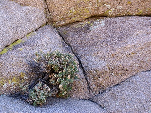
JTNP has lots of grand views of unusual rock formations, but there is also lots to see on a small scale.
I took a lot of photographs during the day. As we headed towards the northwest entrance it was getting late in the afternoon and we drove past roadside exhibits (information displays) and trail heads that we would have liked to hike. We exited the park into the town of Joshua Tree and headed west in order to get to Palm Springs. JTNP is high ground, especially the northwest part of the park where we were at 5,300 feet above sea level. Palm Springs is in a valley that eventually leads down to the Salton Sea, whose surface is 247 feet below sea level, so we had quite a bit of altitude to lose. CA-62 (29 Palms Hwy) heading west out of Joshua Tree goes through Yucca Valley and then drops in a straight line at a steep grade for miles passing through Little Morengo Heights and Morengo Valley and finally winding through Morengo Canyon before reaching the valley floor.
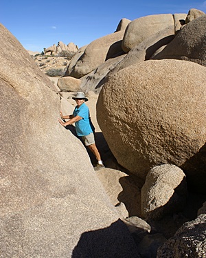
The hiking trail at the Skull Rock area of JTNP had a few challenges.
We turned left onto N. Indian Canyon Road which took us southeast and then turned south past the west edge of Desert Hot Springs and straight down into the west edge of Palm Springs. Our reason for coming here was food, specifically the Native Foods Cafe on E. Palm Canyon Drive. Now a small chain of vegan restaurants, the one in Palm Springs was the first to open. We both had the Reuben sandwich and split an order of cole slaw and sweet potato fries. Vegan cupcakes for dessert put a nice exclamation point at the end of a very tasty meal.
After dinner we drove to Indio and checked-in to our motel. It was nice to be able to take long, hot showers. We tuned the TV to the Weather Channel and watched back-to-back-to-back episodes of Prospectors. Our interest was a lot higher than it might have been because our friends, Butch and Fonda, have gotten interested in rocks and minerals. The air-conditioner was noisy in a way that made it difficult to sleep yet turning it off made the room stuffy. The alarm clock went off at 3 AM. The radio was not tuned to a station and the volume was all the way up. I was completely wide awake by the time I figured out what was going on and put an end to it. For what we paid to stay there it was not a very satisfactory experience. I would think that checking the alarm clock would be part of the housekeeping routine when turning a room but apparently not.