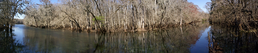
Manatee Springs Tributary to the Suwannee River, Florida. (MS-ICE composite of 7 photos.)
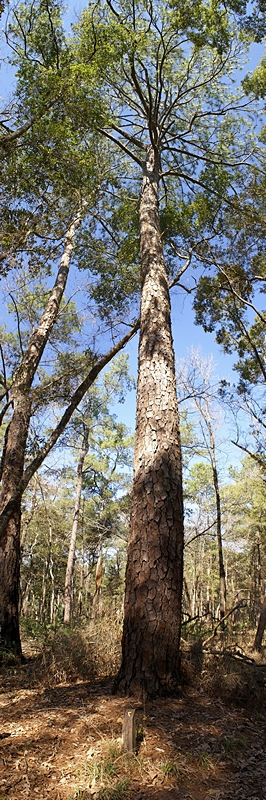
Loblolly Pine at Manatee Springs SP (FL). (MS-ICE composite of 4 photos.)
Another beautiful day here in the elbow of Florida. Seriously; look at the map. The panhandle is like an arm outstretched from the shoulder and the peninsula is like the rest of the arm from the elbow down. That places the area around Cedar Key and inland to the northeast towards Williston as the crook of the elbow. We left the WCRV Resort late morning and took US-27 Alt WNW through Bronson to Chiefland where it joins up with US19/US-98 N. By the time we got to Chiefland we had blue skies, little to no breeze, and temperatures were moving into the mid-70s. Just on the other side of Chiefland we turned on to FL-320 and drove the final 6 miles to the entrance to Manatee Springs State Park.
Manatee Springs is one of many springs that flow into and form the Suwannee River. Yup, that Suwannee River. From Manatee Springs the Suwannee River flows approximately 25 miles to the Gulf of Mexico. Like all of the springs fed by the Florida aquifer, Manatee Springs puts out millions of gallons of water every day at a constant 72 degrees Fahrenheit. Several visitors reported seeing two Manatees, a mother and a youngster, swimming upstream towards the headsprings, but we were not able to catch a glimpse of them. We did, however, see SCUBA divers. It turns out that this spring is popular for swimming and SCUBA diving. Consistent with our experience in other Florida State Parks, the developed areas were very nicely done. There was an excellent boardwalk that ran along the tributary and over swamp area that was obviously full of water at other times (high tide) and out to an observation platform at the Suwannee River.
When we were done at the headsprings we drove to the trailhead parking area for the Scenic Trail. As we have seen in other parks, there was an extensive trail system, but a specific combination of trails looped us back to our car after hiking approximately two miles. This trail, like others, took us through a woodland that underwent subtle, and not so subtle, changes with only minor changes in elevation. A trail guide keyed to numbered markers explained these changes as we went along. In the time we were on the trail we did not encounter any other hikers. These forests are beautiful, peaceful places, but the beauty is subtle rather than dramatic, and you have to slow your pace and elevate your senses in order to experience and fully appreciate them.
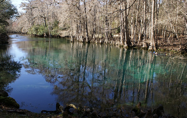
The headsprings at Manatee Springs SP (FL).
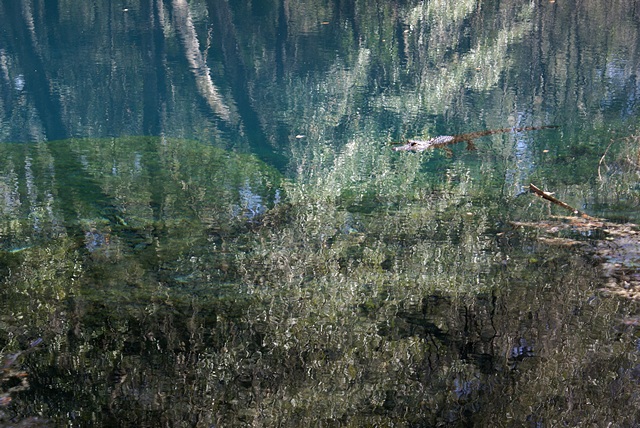
Small alligator in Catfish Hole Spring at Manatee Springs SP (FL).
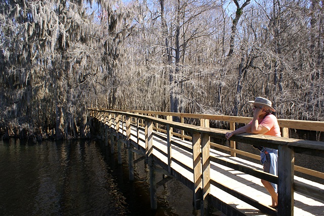
Linda on the Suwannee River Boardwalk at Manatee Springs SP (FL).
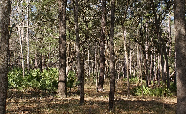
A view of the forest on the Scenic Trail at Manatee Springs SP (FL).
From Manatee Springs SP we returned to Chiefland and continued north on US-19/98/27A to the little town of Fanning Springs. The Suwannee River runs through the center of town and just before you get to the river is the entrance to Fanning Springs SP. This small park is set up as a place for people to swim, and during the warmer months it is undoubtedly overrun with people. But today there were only a few other people there, including a couple who were swimming in the headspring. I took a phone call from Pat, who was working on resetting the DDEC I engine computer on his bus, and then we walked out to the end of another wonderful elevated boardwalk, crossing over/though a cypress swamp before reaching the banks of Suwannee River. It was a very pretty place but challenging to capture in photographs. I took some, but I didn’t care for how they turned out, so I did not include any with this post.
There is another trail in this area named The Nature Coast Trail, but we did not hike it today. It was built on an old railroad bed and runs for over 31 miles, crossing the Suwannee River north of Fanning Springs on an old wooden trestle. The trail is available for use by hikers, bicyclists, and equestrians, and we will likely hike part of this trail, but not today. The drive back to Williston took approximately 45 minutes, not including a brief stop at the Winn-Dixie supermarket on the west edge of town for grapes and bananas. Dinner was green salad, Tofurkey brand vegan pizza, and a small glass of Blueberry-Rhubarb Wine from Forestedge Winery.