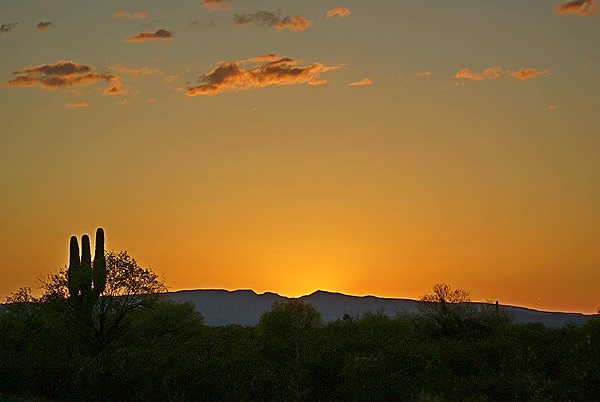
2015/04/16 (R) Carthage, MO to Edwardsville, IL
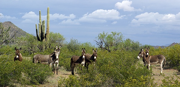
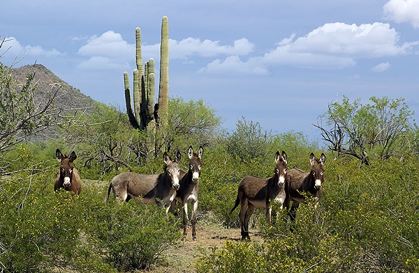
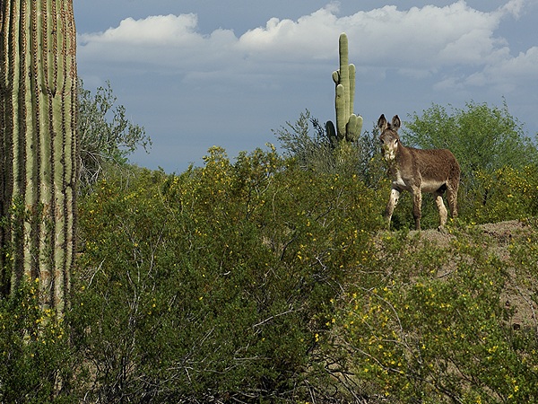
[Note: There are no photos for these posts.]
I was awakened from a light sleep this morning by a change in the sound of our auxiliary air compressor and the pneumatic systems on the bus. A valve that whines in a certain way as the system fills with air changed its tune and the compressor ran longer than it normally does and did not shut off. I got up, turned it off, turned it back on and it finally completed its cycle and shut off automatically. At that point I was up and wide awake so I got dressed. Linda was awake by that point too so I suggested that we just get an early start on today’s journey, and that is what we did. We pulled out of our site at the Coachlight RV Park at 7:30 AM and a few minutes later we were headed south on I-49. Less than a mile later we looped around the cloverleaf interchange onto I-44 headed east.
The sky was overcast and we ran in and out of fog and mist as we traveled up and down the rolling hills of southwest Missouri with spring in full bloom. The temperature was cool and the conditions made for easier driving than having a bright morning sun in my eyes. Traffic was light to moderate for the first 2/3rds of the trip, albeit heavier passing through Springfield and Rolla. About 200 miles into our trip we stopped at the Flying J at exit 226. I-44 was now six lanes and we were at the fringe of heavier urban traffic and encountered a center lane closure on a bridge which brought traffic to a halt. We patiently worked our way through that and a little farther along exited I-44 onto I-270 which became I-255 and took us across the mighty Mississippi River into Illinois, most of the St. Louis, Missouri metropolitan area to our north.
Once we crossed the river and traveled a few miles traffic thinned out but we bumped our way along as the road surface on this stretch of I-255 was very rough. We exited I-255 onto I-55N/I-70E and then stayed with I-55 when it split from I-70. It was a good thing, too, as I-70E was backed up all the way to the split with traffic stopped and a sign announcing long delays and advising motorists to seek an alternate route. A few more miles and we were at our exit for IL-143, crossed over the highway, did a 180 onto the service road, and drove the last mile to the entrance to the Red BaRn RendezVous RV Park just east of Edwardsville, Illinois.
The entrance to the RV Park was a bit narrow but wide enough that I was able to swing in off the service road. The interior gravel roads were also narrow, and I had to snake past the office, but they turned out to be just wide enough to accommodate an RV our size. The office was closed but there was a note on the door with our name and site number. The site had trees on either side that did not appear to be trimmed up high enough but it turned out that they were.
While not a destination park Red BaRn RendezVous is a nice little place in a location convenient to Edwardsville and Glen Carbon, Illinois, where Linda’s sister lives, and the Interstate highways that will get us to my sister’s house in 30 to 40 minutes. The office building has men’s and women’s restrooms with showers and a small but well equipped laundry. We had no commitments to visit anyone today and were in early enough that Linda gathered up the laundry and we carried it over to the laundry room.
Linda had some fresh blueberries that needed to be used so she made vegan blueberry pancakes for dinner. We do not have these very often but they are a real treat when we do. We were both tired and had headaches, unusual for me but not for Linda, and decided to drive into Edwardsville and find the Walmart. We wanted to buy a present for Lilly and it gave us a reason/place to stretch our legs. Back at the rig we located the OTA TV towers, oriented our front OTA TV antenna, and watched episodes of The Big Bang Theory while diddling on our iPads and computers. I hate to lose a block of potentially useful time but I was not up to working on photos and blog posts and diddling was the best I could manage.
The only “issue” we had with the bus today involved the behavior of the air system. There are three air pressure gauges in the cockpit—primary and secondary on the dashboard, and auxiliary to the side—corresponding to the three “systems” that operate the chassis (brakes and suspension), and accessories (belt tensioners, radiator shutters, air horns, step slides, and house components). The air from the main engine air compressor goes through a dryer that removes moisture and then goes to the primary, secondary, and auxiliary tanks. It sounds simple but it is a bit more complicated than that. I returned an earlier phone call from Butch and discussed this with him.
As best I understand it (and care to take time to explain it here) a valve, or set of valves, regulates where the compressed air goes and the top priority is the brakes. The primary tank/system supplies air to the rear brakes and the secondary tank/system provides air to the front brakes (or vice versa). Until the air requirements of the brake systems are satisfied air does not flow to the suspension or accessories. Once all of the systems are pressurized they are isolated from one another so that a failure of any component will not affect the other systems. It is a clever, fault-tolerant design that works well and has stood the test of time. The components are used on 18-wheelers, fire trucks, and all manner of heavy highway equipment, including commercial buses in passenger service.
When the system is working correctly this is what I normally see when driving. When the systems are fully pressurized the primary, secondary, and auxiliary air pressure gauges all read ~130 PSI. The primary and secondary gauges will stay at that pressure unless/until I apply the brakes. The auxiliary gauge, however, will drop over time due to small leaks somewhere that I have not been able to isolate. Once the pressure in any of the systems drops to about 90 PSI, which is almost always the auxiliary system, the main engine air compressor kicks in and brings the pressure in all of the systems back up to ~130 PSI.
What I saw for most of the drive today was different, and that is always a cause for concern and makes driving less enjoyable. All three gauges were showing a loss of pressure and the pressure in all three systems was the same. The compressor was still working and would kick in at ~90 PSI and bring all three back up to ~130 PSI, so that was good, but the behavior suggested that one or more isolation valves had “stuck” in a position that kept all three systems tied together, which was not good. Because of the larger volume of air being lost through the leak(s) in the auxiliary system it took a lot longer for the pressure to bleed down and it took longer for the compressor to bring it back up.
About four hours into our six hour trip we stopped for fuel at the Flying J Truck Stop at exit 226. When we resumed our travel I noticed that one of the gauges (primary or secondary, not sure which) was holding its pressure while the other one continued to drop along with the auxiliary gauge. An hour after that I noticed that both the primary and secondary gauges were holding pressure while the auxiliary gauge was cycling, and this behavior continued for the rest of the trip. Thus it appeared that whatever caused the abnormal behavior had self-corrected. My suspicion is that a stuck valve had gotten unstuck. Once we were parked and set up the auxiliary air compressor cycled on and off properly, confirming that the isolation valve(s) was(were) once again working correctly.
2015/04/17 (F) My Side
We were up between 7:00 and 7:30 AM, not because we had to be but because we were rested and awake. We had a quiet, relaxed morning enjoying our coffee and granola and using our iPads to check on the world (L) and work on yesterday’s blog post (me). We configured the bus to ensure the cats’ comfort while we were away and left at 10:30 AM to drive to my sister’s house in Bridgeton, Missouri. We stopped for fuel just short of her house and finally arrived around 11:30 AM.
We were greeted by Patty and Maggie, her one remaining dog. We visited for an hour and then went to a Panera (St. Louis Bread Company) not far from her house for lunch. We returned to her house to continue our visit and await the arrival of Ryan, Amanda, and Lilly, who showed up a little after 3 PM. They would have come earlier but Ryan had a routine work-related physical on which his continued employment depended. To everyone’s relief he passed so everyone was relaxed. Lilly was initially surprised to see us but immediately gave us a big smile and went to Linda’s outstretched arms. Lilly is 27 months old and is a cheerful, happy child who interacts easily with whomever is around.
Ryan and Amanda were hungry so at 4:30 PM we headed to El Maguey Mexican Restaurant for dinner. We had taco salads with beans instead of animal protein and everyone seemed to like their food. It is Amanda and Ryan’s favorite Mexican restaurant. Amanda and Ryan headed home with Lilly and we drove back to Patty’s house to wrap up our visit while we waited for rush hour traffic to subside.
Brendan called and Linda got to “chat” with Madeline and then each of us took turns talking to him. He had received his offer letter from Eastern Michigan University and acknowledged it, so he will start his tenure track assistant professorship in the art history department in September. The discussions about initial course assignments, however, have already started. He also mentioned that Shawna’s application for tenure at the University of Michigan Ann Arbor is looking very positive. Both of those pieces of information were very good news for us.
We took our leave at 7:30 PM and got back to our coach just before darkness settled in. Having spent a long day enjoying the company of family we settled in to watch a few shows on the local PBS station’s Create sub-channel before turning in for the night.
2015/04/18 (S) LF-M-LH Day 1
Yesterday Linda (LF) talked to Marilyn (M) briefly as we (B & LF) were driving back to the rig from Patty’s house and they (LF & M) agreed that we (LF & B) would arrive at Linda H’s (LH) house around 11 AM tomorrow, which is now today. (Hopefully the LF and LH designations will help keep straight which Linda I am referring to. Most of the rest of this post is about today not yesterday.)
We were up this morning at 7 AM and had our usual coffee and granola. It’s a good thing we will be getting home soon because we only have one day’s supply left of LF’s homemade granola. It is so good that we have stopped buying commercial granolas because they do not have any taste by comparison.
After a suitably relaxing start to our day I continued plugging away at editing blog posts and selecting/processing photographs to go with them. I dealt with some e-mails and then we gathered up our stuff and headed to (LH’s) and Marilyn’s house in Glen Carbon, Illinois. Glen Carbon and Edwardsville flow together to form a contiguous urban area but they are distinct municipalities with Glen Carbon being to the south of Edwardsville.
We are camped just to the east edge of Edwardsville on the edge of a corn field. The RV park is conveniently located to I-55 and just 10 minutes from LH and M’s house so we were there by 11:15 AM. LH and M had purchased various fresh ingredients for a salad and after sitting and visiting for a while Marilyn assembled the salad. There was something going on at the house across the street that resulted in the wife calling the police and three cars/officers being dispatched to the scene. LH said the husband was himself involved in law enforcement so that added a certain tension to the whole situation as he almost certainly had firearms in the house.
We spent the rest of the afternoon chatting until Marilyn had to leave for a gala fundraiser for a school that her Congregation supports. We decided to continue visiting with LH and stay for dinner. LH had a bag of shredded vegan mozzarella “cheese” so we ordered a mushroom and onion no-cheese pizza from Imo’s and she ordered a medium supreme. I drove into town and picked up the pizzas. When I got back we added the vegan cheese to ours and heated it in the oven long enough to melt it. It was very good.
In recent times Imo’s was our favorite pizza (after the demise of the Luigi’s restaurants in the St. Louis area many years ago) but the last time we tried one without cheese it was not very satisfying. The crust is thin and crisps nicely, the way we like it, and the sauce is slightly sweet and used sparingly, the way we like it, but their normal cheese, a mozzarella and provolone mix, is (apparently) what pulls together the pie’s uniquely fabulous taste. While the vegan mozzarella was not an exact replacement it made for a very tasty meal, bringing both taste and texture to the pizza.
We needed to do some grocery shopping so we took our leave at 7:30 PM and drove to the Dierbergs supermarket in Edwardsville. There are three grocery stores at the intersection of IL-159 and Governors Parkway, but Dierbergs was the most likely to have what we were looking for. Our shopping done we headed east on Governors’ Parkway almost to I-55 and took the service road back to our RV park. We gave our cats the attention they were seeking while Linda (LF) settled in with her e-book and I worked on the blog post for our two-day visit to Organ Pipe Cactus National Monument. I also proofread the final draft of the March 2015 issue of Bus Conversion Magazine and sent back my corrections. I uploaded the blog post and then went to bed to work on the posts for yesterday and today.
2015/04/19 (N) LF-M-LH Day 2
Linda (LF) was up at 6:30 AM, earlier than usual, and I got up at 6:50 AM. Before I had a chance to start making our morning coffee she pulled up the weather and showed me the radar. Rain had been forecast to start just after midnight, and continue all day today and into tomorrow, but it appeared that it had not rained last night. The radar, however, indicated that the rain was on our southern doorstep. I needed to dump our holding tanks and refill our fresh water tank, so I took care of that while Linda made the coffee and updated her cost-of-camping spreadsheet.
The dump and fill process took me about an hour but we now have enough waste tank capacity and fresh water onboard to get us home with room to spare. Based on Linda’s data our average nightly cost to “camp” this winter has been about $8.75. Not bad. Our average daily cost for our winter in Florida was over $20 which we felt was a very reasonable cost for wintering there. We drove more miles this winter compared to last, almost double in fact, so we spent the money we saved on camping buying diesel fuel. Fortunately diesel fuel prices in the central and western states where much lower than the prices in the southeast last year. They were, in fact, the lowest prices we have seen in years so that was a nice break.
I updated my water usage spreadsheet while Linda got caught up on our personal accounting and bills. Cell phones and cellular data, in conjunction with the Internet and electronic banking, have fundamentally transformed the full-time and extended-time RVing experience in ways that no one could have imagined 15 years ago. I had an e-mail from Dropbox that Kate had joined a folder I had shared with her so I sent her a short e-mail updating her on our travel plans. I also had an e-mail with the final draft of the print version of the March 2015 issue of BCM and verified that the corrections I uploaded last night had been made to my article. I consolidated my blog posts for March 22 and 23 and finished editing them. I had just started looking at the unprocessed photos for those posts when it was time to pack up and head to Marilyn and Linda’s (LH) house for the day.
The weather was overcast and gloomy and the rains eventually came, a perfect day to stay inside and eat, talk, and play games. Marilyn has been making a real attempt at moving to a vegan diet so she prepared tomato soup and black bean burgers for lunch. We then put the leaf in the dining room table and got out the Mexican Train dominoes game. We brought hummus and Linda (LH) had made vegan guacamole so we enjoyed those with a few Fritos corn chips. We also had fresh grapes and toasted almonds to munch on and a couple of bowls of popcorn. We played 16 rounds of Mexican Train starting with the double 15 tile in the center and ending with the double “zero” (blank) in the center. It was evening by the time we finished and everyone enjoyed having a whole day to hang out with family and friends with nothing more important to do than play a game.
We left just before 8 PM and drove through Edwardsville to get back to the RV Park rather than get on the Interstates. There was very little on TV that interested us and we ended up watching an episode of The Man from U.N.C.L.E. It was a very popular show in its day but is now very dated to the point of being almost silly.
Linda (LF) read and I selected/processed photos for my blog post about our visits to Ajo, Arizona on March 22nd and 23rd. I got the post and photos uploaded and then went to bed.
2015/04/20 (M) Edwardsville, IL to Twelve Mile, IN
Linda was up a little before 7 AM and I was up a little after. Today was a travel day, so we did not make coffee or have breakfast. We were not hungry anyway having had our fill of food, both good and junk, yesterday. We each had a cup of tea while we got our day started.
We started getting ready to leave around 9 AM and finally pulled out of the Red BaRn RendezVous RV Park at 9:50 AM. We had about 330 miles to travel to get from Edwardsville, Illinois to Twelve Mile, Indiana. Since the RV park is just off of I-55 we took I-55 north to I-72 near Springfield, followed that east to I-57 and then took that north to US-24. We followed US-24 east and moved from Central Daylight Time to Eastern Daylight Time sometime after we crossed into Indiana. US-24 joined up with US-35 to bypass Logansport, Indiana to its south and then split off to continue east towards Peru. We picked up US-31 just before Peru and took that north to IN-16 where we headed back west about five miles to Twelve Mile. It was 5 PM (EDT) when we arrived at Butch and Fonda Williams’ place. The bus ran well except for a couple of tattletale lights that started blinking briefly towards the end of the trip. The previous problem with the chassis air systems did not reoccur.
I checked the manual after we got parked and one of the lights was for a chassis battery voltage Hi/Low condition and the other was for the upper and lower 12 V strands of the chassis battery being out-of-balance. Both conditions, if true, might implicate the Vanner battery equalizer but the first diagnostic step will be to check the circuit breakers. The next step will be to check all of the battery connections, including the Vanner. One of the things on my To-Do list is to swap the upper and lower batteries as the “24V” gauge on the dashboard usually reads 29 V and the “12V” gauge usually reads 14 V or slightly less if I have the headlights turned on.
Butch and Fonda had to take his parents to medical appointments in Lafayette, Indiana today and got home just before we arrived. We did not realize they were there but that was OK; they knew we were coming and we have a nice level spot to park on concrete with a “50 A” electrical connection when we are here. (It’s a 240 VAC connection with a 50 A RV outlet but we can only draw about 30 amps on each leg.) Even though we left home on November 30, 2014 Twelve Mile feels like the place where our trip to the southwest U.S. began as we left from here in a caravan with Butch and Fonda on December 3rd.
We were settled in our spot and had our WiFiRanger connected to their Wi-Fi access point when Butch and Fonda either realized we were there, or that we were not going to knock on their door, and came over and knocked on ours instead. They came in our bus and we talked for over an hour at which point Butch needed to deal with a Facebook group admin issue. After they returned to the house Linda started preparing our dinner while I checked e-mail and then continued working on this blog post.
Linda sautéed onions, mushrooms, and garlic in a little olive oil and added torn spinach at the end. She cooked two baking potatoes in the microwave oven and served them with the sautéed vegetables as a topping along with some almond milk jalapeño pepper jack vegan cheese. A simple but satisfying dish on a cool, clammy evening. We also had some black grapes with the meal which were tasty and refreshing. We made two large cups of hot tea and took them to the house where we visited with Butch and Fonda some more. By 10 PM we were too tired to be good company so we returned to our coach and went to bed.