We were up a bit earlier today, anxious to be on our way to Yellowstone National Park (hereinafter YNP). I had been to YNP twice before today; once with my parents and sister in 1965 when I was 13, and again in 1989 with our son when he was about to turn 11. Today was my third visit, but what made it special was that it was Linda’s first.
US-14/16/20 on the way to the East Entrance of YNP.
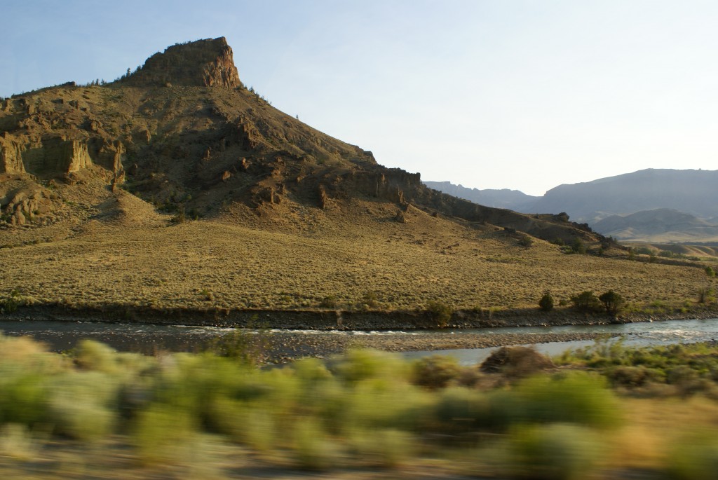
Most of the 32 mile drive from Wapiti to the East Entrance of YNP is through the Shoshone National forest. The road (US-14/16/20) follows the Shoshone River up through a deep, rugged valley of the Absaroka Range, climbing from 5,700 ft. ASL in Wapiti to 6,951 ft. ASL at the East Entrance. The Shoshone N. F. begins just west of Wapitii and is designated the Buffalo Bill Scenic Byway. It provides a spectacular scenic drive through the Absaroka Range. The road was very good and was easily drivable at the 50 MPH posted speed limit.
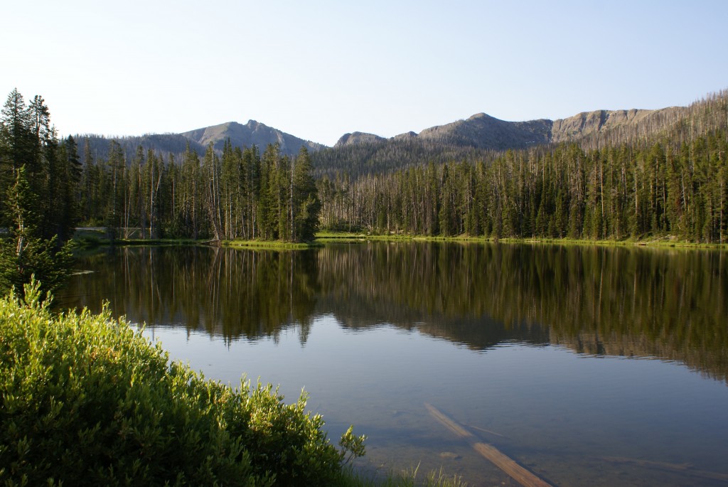
Sylvan Lake on the East Entrance road into YNP
After using Linda’s “Senior Access Pass” to gain entry to the park we continued on to the Fishing Bridge area 27 miles farther down the road, driving over 8,530 ft. ASL Sylvan Pass before the half way point. The road descends down to the northeastern shore of Yellowstone Lake and then runs along the edge to Fishing Bridge on the north shore of the lake.
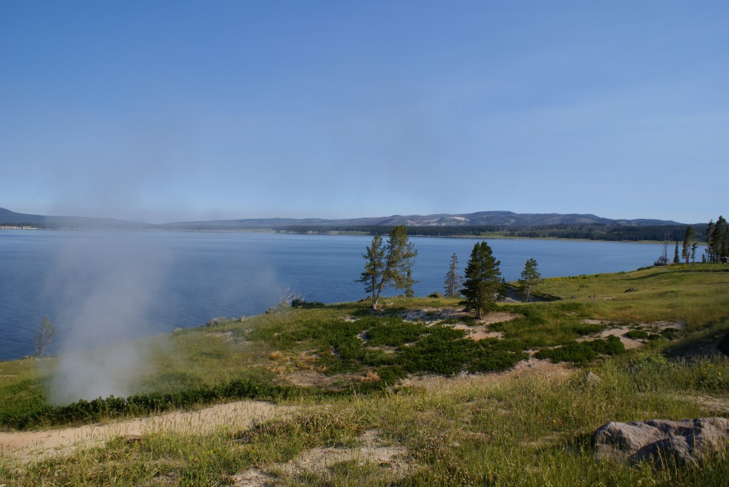
Yellowstone Lake looking NW towards Fishing Bridge. ~7700’ ASL.
Fishing Bridge is one of the four “developed” villages in YNP, and we stopped to check it out. It has a Visitor Information Center, General Store, filling station with auto/RV service, and an RV campground. Nearby is a long E-W bridge that crosses over the Yellowstone River as it flows north out of the lake. In times past folks were allowed to fish from this bridge, hence the name of this area, but no more. The waters in this area are a prime spawning ground for native Cutthroat Trout. Bridge fishing was decimating their population, and was halted many years ago, along with a ban on fishing the first six miles of the Yellowstone River.
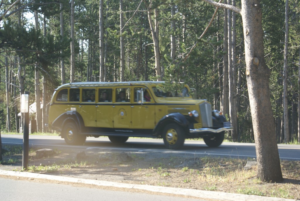
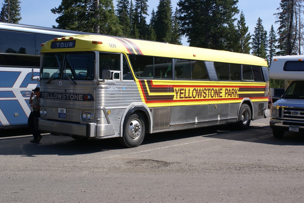
A vintage White Motors Yellowstone bus!
From Fishing Bridge we had access to the rest of the park. The road system in YNP consists of a large figure-8 in the center of the park, known as “The Grand Loop”, with entrance roads coming into it from the north, northeast, east, south, and west. For our first day in the park we decided to drive the lower half of the figure-8 in a clockwise direction. It is not possible in a blog post to describe everything we did, or include photos of everything we saw, in a single day in YNP, so I will simply outline our itinerary and include a few photos. Perhaps a Picasa web album will appear at some point in the future with a more compete visual record.
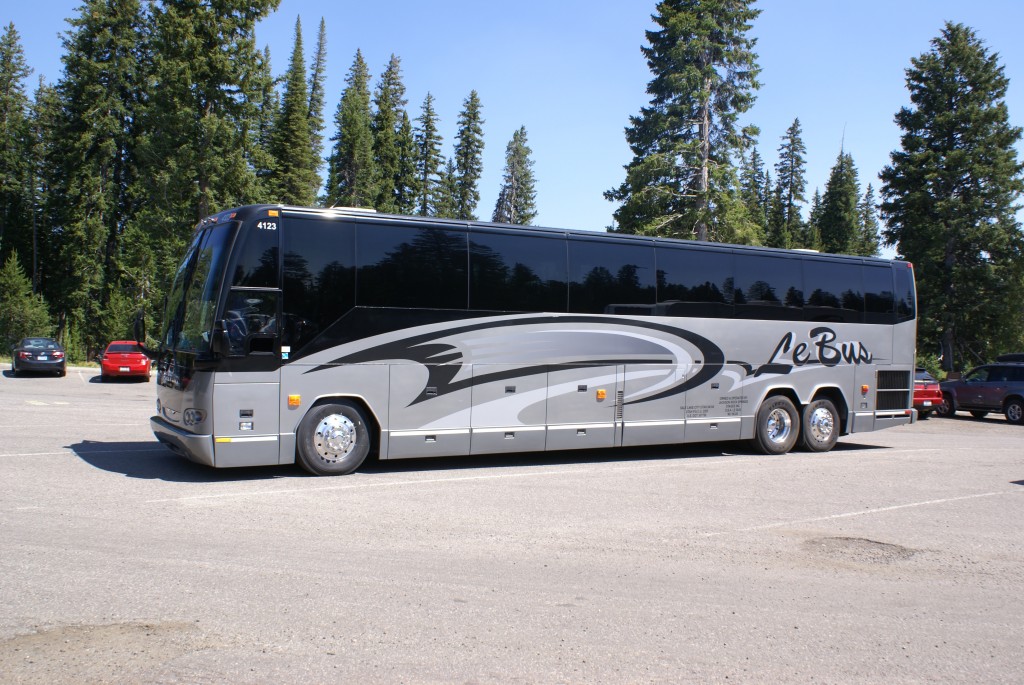
An MCI MC7(?) Yellowstone bus, one of six left in the fleet.
Traveling clockwise from Fishing Bridge we traveled southwest and then south along the west shore of the lake to the geothermal area just north of Grant Village. While here we saw a Yellowstone MCI MC7(?) park bus in the parking lot. The driver was a young lady and she told us that they had 30 of these buses at one time but only six are left and they are going to be sold next year. She thought they would sell for about $1,700 and she was saving up to buy one to convert to an RV! She thought they were going to replace them with MCI “D” models, but wasn’t sure if that meant 102D3s or something else.
An older Prevost H3-45 operated by Le Bus.
We saw a lot of 45′ tour buses in YNP. The vast majority were Prevost H3-45s, both 4- and 2-windshield vintage, although the 4-windshield coaches were newer than ours and almost certainly had DD Series 60 engines. We also saw a few Setra, VanHool, and MCI coaches.
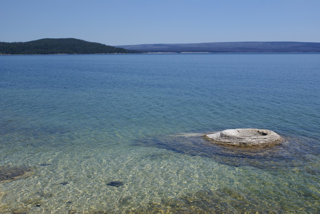
A geyser at the edge of Yellowstone Lake in the West Thumb area. Even the lake is geothermally active.
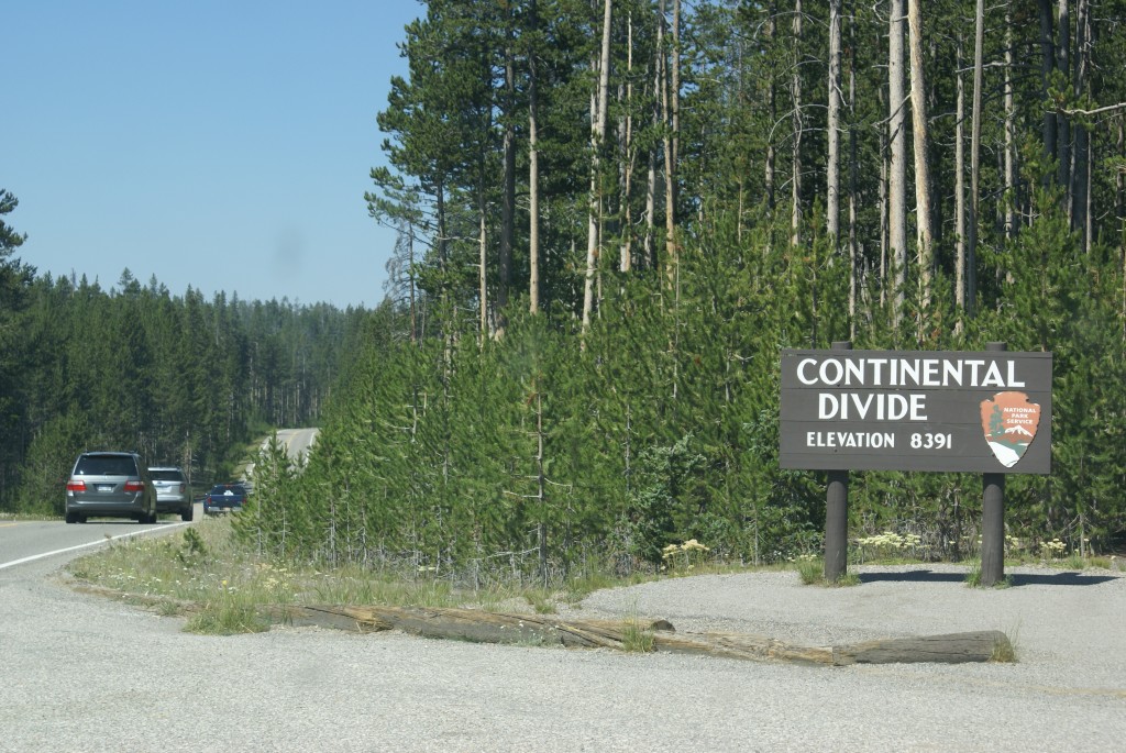
Crossing the Continental Divide.
Continuing on from the Grant Village area we drove to the Old Faithful area, crossing the Continental Divide, which runs from the southeast corner of the park to the western boundary south of the West Entrance. The Old Faithful geyser is the centerpiece and namesake of a geothermal basin that contains over 50% of the geysers in the world. It is also the most developed place in YNP, and the most crowded. I don’t know the actual figures, but it felt like most of the people in the park were there.
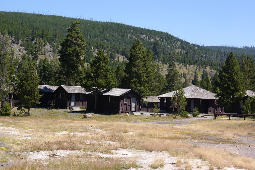
The cabins at the Old Faithful Lodge. I stayed in one of these 50 years ago.
We had lunch at the Old Faithful Lodge cafeteria. The cabins I stayed in 50 years ago are still there, behind and to the left of the Lodge, and are still NPS brown. We strolled around the area, finally selected a vantage point, and waited for the eruption of Old Faithful, and it was worth the wait.
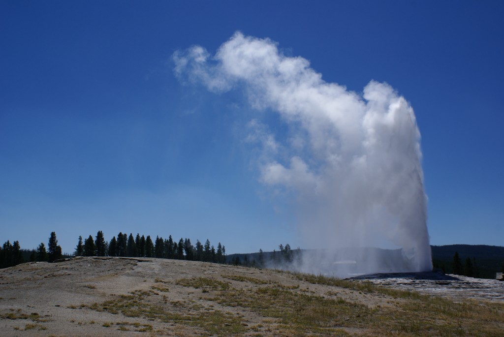
The Old Faithful geyser in action.
Patience is more than a virtue in YNP, it is an absolute necessity. We eventually extracted ourselves from the gridlock of people and vehicles at Old Faithful and continued on towards Madison. Just before getting to Madison we took a small one-way side road through Firehole Canyon. It was a “gorgeous” drive, in every sense of the word. We did not realize that towards the end of this road was the Firehole River Swimming area. Lots of people did, however, and it was mobbed with cars parked along the road such that it was barely passable.
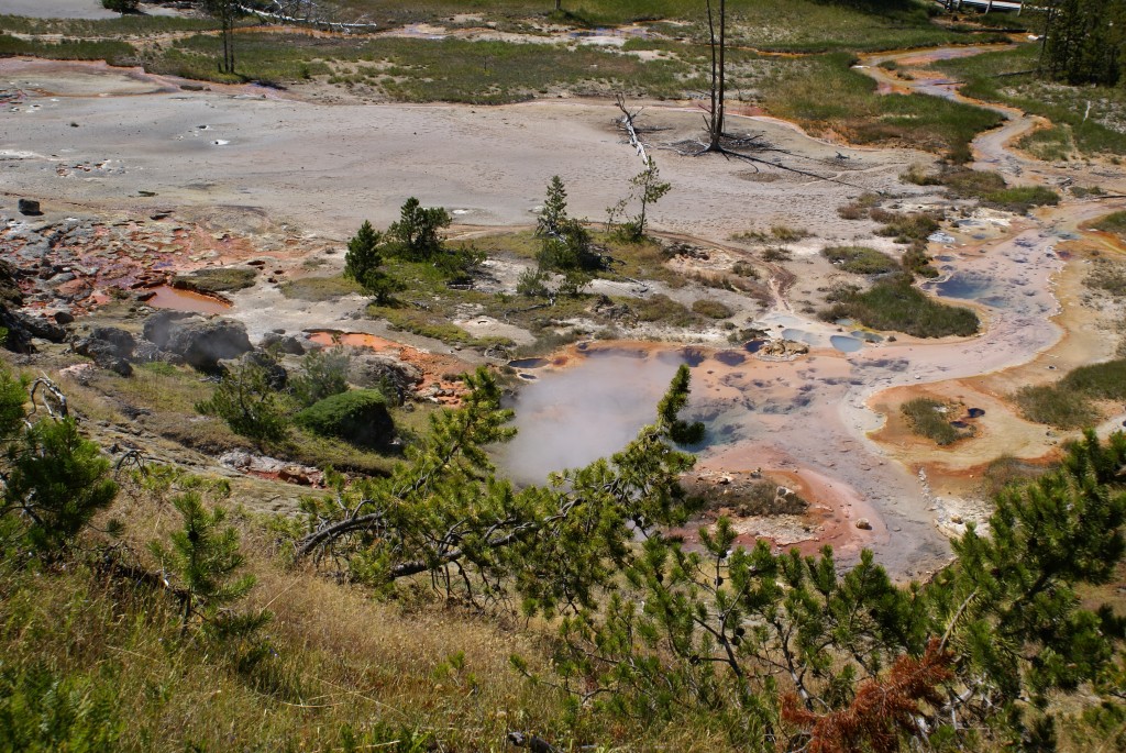
Artists Paintpots from above.
We did not stop at Madison and continued on north towards Norris. We stopped at Artists Paintpots and hiked up onto a high hill for a view down on the geothermal features. Like the Old Faithful area, Norris is also an extensive geothermal area within YNP, but apparently lots of the folks who were not at Old Faithful were at Norris. In other words, there was no place to park. (This turns out to be a common problem throughout the park at this time of year and even though park regulations do not permit stopping/parking on the roads people park wherever they can and sometimes impede traffic as a result, especially if there is a wildlife sighting.) One of the downsides to not staying in the park overnight is that it takes a certain amount of time to get to and from the place; in our case approximately 90 minutes from Wapiti to Fishing Bridge, our point of access to everything else. Even if you leave early and return late, this limits your time in the park, and pretty much rules out being there at dawn or dusk, which are ideal times to see the park (good light) and wildlife (that’s when they are most active). Although the park is open 24/7, and people are out driving on the roads at night, it is not a good idea, and this is when most accidents occur.
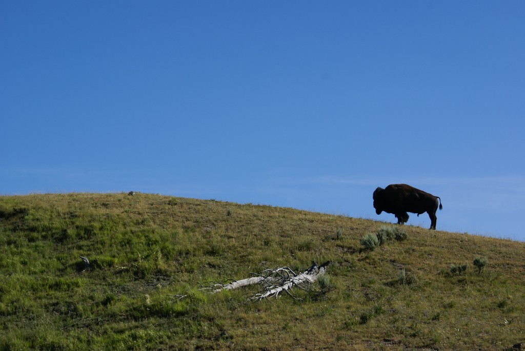
Lone Bison on a hill south of Canyon Village.
Twelve miles east from Norris is Canyon Village, and this leg of the Grand Loop is the crossover of the figure-8. On the drive over we took the Virginia Cascade side road. These side roads are usually narrow, twisty, and one-way. They provide an opportunity to get off of the Grand Loop road, away from the traffic and crowds, and close to some special feature. In this sense they are a more intimate experience, though not on a par with backcountry hiking. Canyon Village is the developed area just north of the Yellowstone Falls and Grand Canyon of the Yellowstone. These are major features of the park and require a significant amount of time to see. They are also best seen in the morning, so we headed south towards Fishing Bridge.
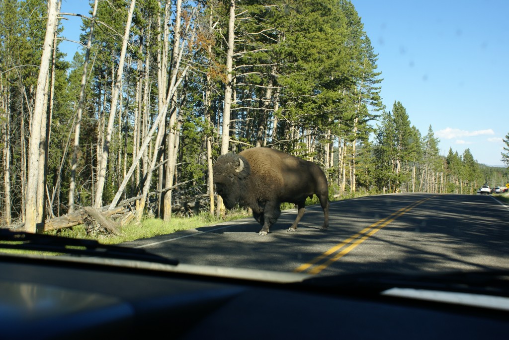
The Bison go where they want, when they want; it’s their park, not ours.
The Grand Loop runs along the west side of the Yellowstone River through a prime wildlife area, and we finally encountered a sizable bison herd at a spot where there is a broad grassy area. We also encountered a major traffic jam. Bison are certainly something that people come to see, but it took us about 40 minutes to go a mile or so. When we got to one of (overcrowded) pullouts we saw lots of people with spotting scopes and cameras with telephoto lenses, all mounted on tripods. Glancing in their general direction we finally saw the focus of their attention; a Grizzly bear moving north along the high bank. Although Bison are large, wild, unpredictable animals, and potentially very dangerous, it’s the Grizzly bear and the wolf that most capture the essence of Yellowstone as a wild place. (BTW: YNP is a truly international destination. We heard plenty of people speaking languages other than English, and Asian tourists were numerous, or at least more obvious based on appearance. We also talked to some of the young folks working food service, and except for the cashiers, most did not appear to be native English speakers.)
Eventually we got back to Fishing Bridge where we topped off our tank. On the way back to the East Entrance we took a side road up to Lake Butte Lookout, which we missed driving in. From this vantage point we were able to see the Tetons 80 miles to the south. The drive back to Wapiti was in the gradually fading light of evening, and it was dusk by the time we got back to our coach around 8:15 PM.