Tag Archives: Green Creek Inn & RV Park

2013_07_27 (Sat) Where We Go From Here

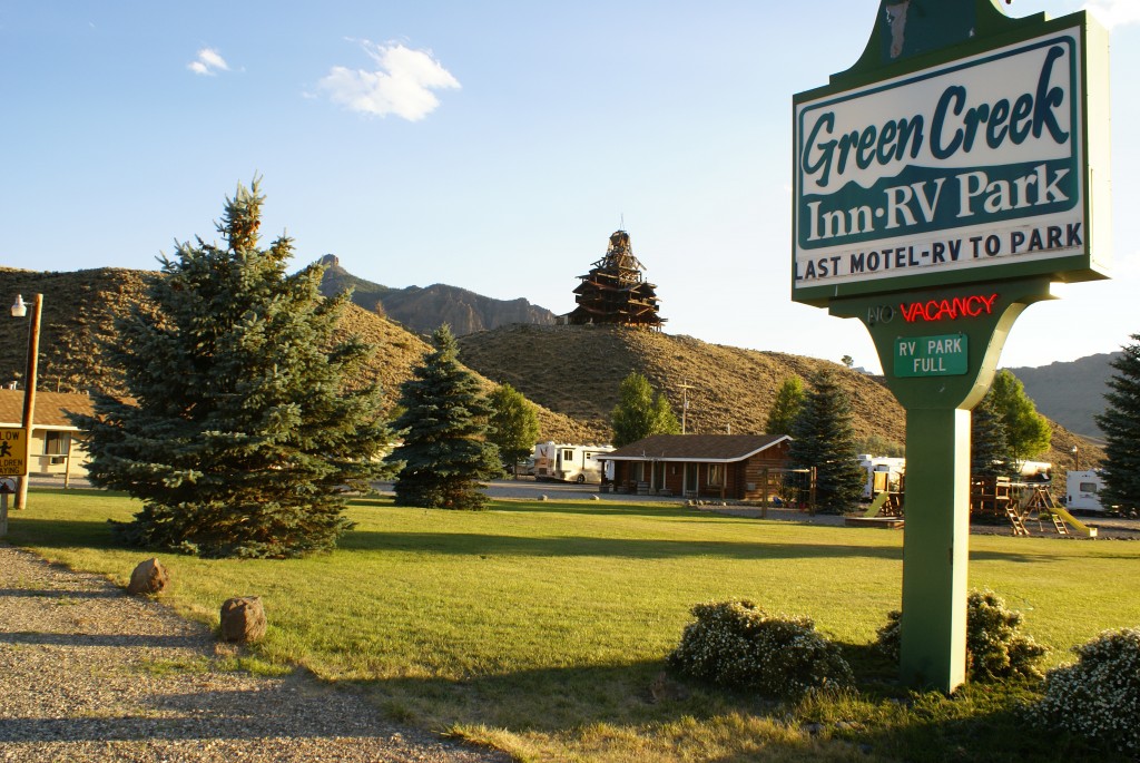
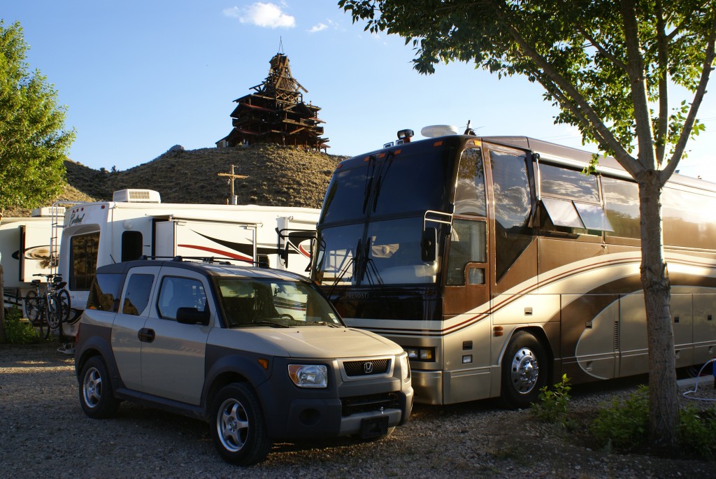
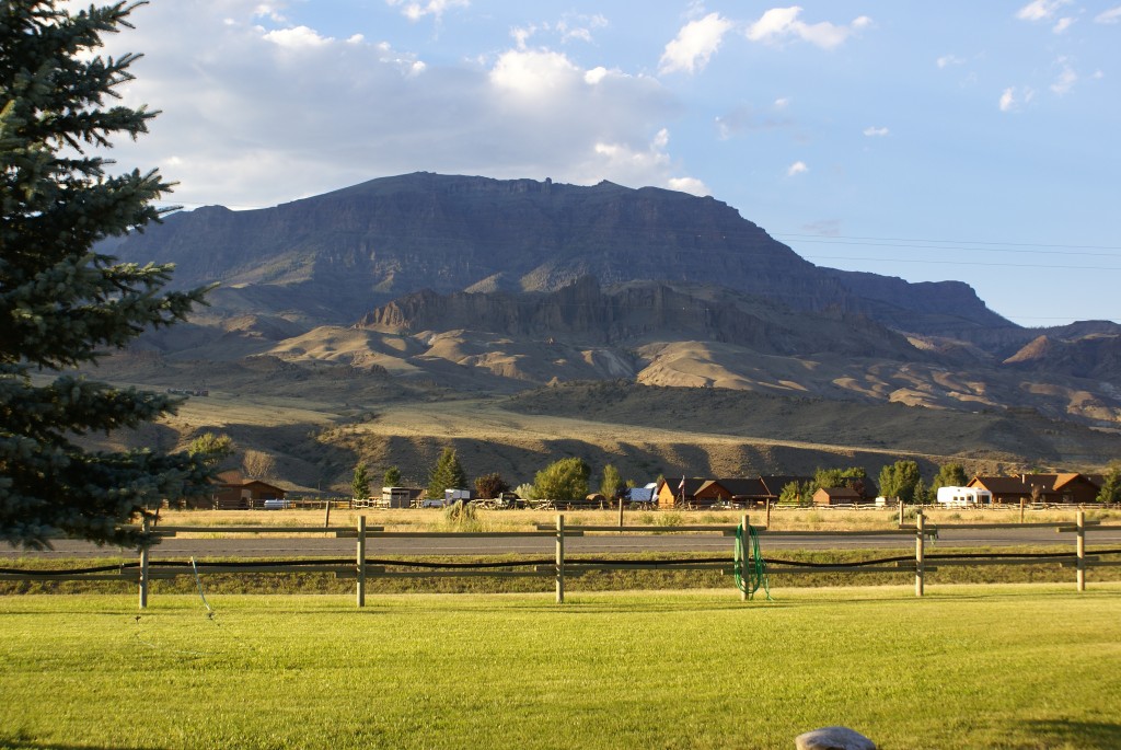
We have had an intense but wonderful week in northwest Wyoming and the Green Creek Inn and RV Park has been just the right spot for us to base camp.  The RV park is away from the hustle and bustle of Cody, yet close enough to be convenient for shopping and entertainment, and is close enough to Yellowstone N. P. and Grand Teton N. P. to make them accessible as day trips.  And although it’s a small RV park with only nine sites, we had excellent full hookups, laundry facilities, a WiFi connection to the Internet, and free popcorn.  Our 50 Amp site allowed us to run all three house air-conditioners all day while we were away to keep our cats safe and comfortable.  We needed to do this because of daytime highs in the mid-80’s with bright sunshine and constant wind that prevented us from using our awnings to shade the passenger side of the coach.

Although $45 per night is more than we generally pay to stay in an RV park, it was a fair price given the location and facilities.  The WiFi/Internet bandwidth was limited, but we were glad to have what we had as there was no useable Verizon 4G/LTE signal here, and even 3G EVDO was marginal for making phone calls.  The WiFi connection was generally very strong thanks in part to or WiFi Ranger Mobile Titanium, which has been working very well for us since we bought it at the FMCA rally in Gillette, WY last month.  Interestingly, the only OTA television signal we could pick up was Wyoming PBS from the general direction of Cody.  (Smile)

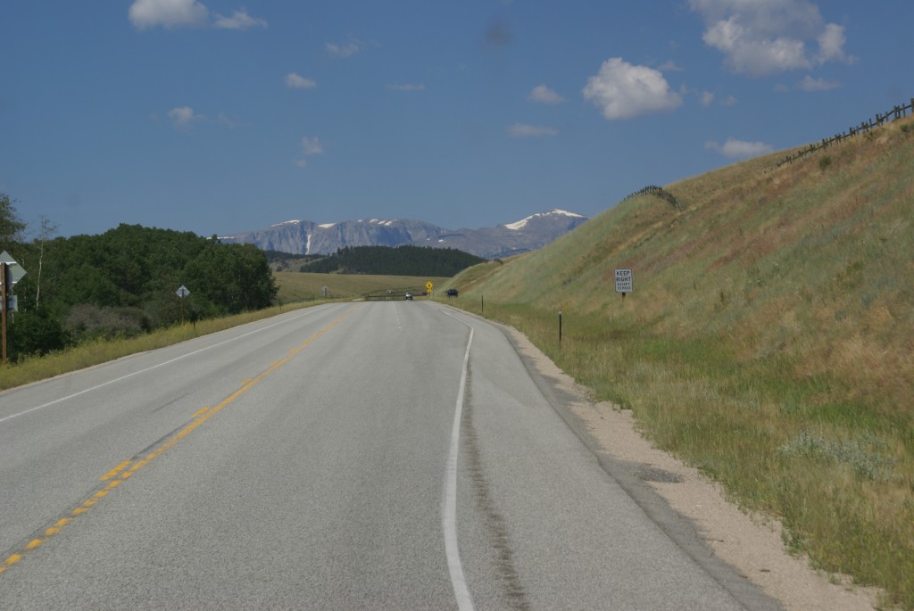
This was a quieter day for us, but by no means an idle one, as we needed to prepare for our departure tomorrow morning.  We noticed this morning that it was overcast, the first time since we arrived here a week ago.  We did have clouds today, and a few drops of rain, but Jeff informed us that the haze we were seeing was from the various forest fires burning in the west.

Linda drove to Cody in the morning to do our shopping.  The main attraction was the local Farmers Market, located, conveniently enough, in the parking lot of the Whole Foods Trading Company.  She came back with quite a few bags of stuff!

While she was gone I drained the waste tanks, stowed the hose, and added our Pine Sol / water / Calgon solution to the tanks.  I also drained the little bit of fresh water that was still in the tank, flushed it with a bit more, and then refilled it.  I left the fresh water shore line connected so we could use if until we depart, conserving our onboard water for use on down the road.  I also worked on getting our blog postings up-to-date.

When Linda got back she did the laundry.  At our house in Michigan this is usually my chore, but for some reason she seems to take care of it on the road.  Although we are trying to learn not to over-plan, we are not full-timers, and we have a house and family to which we have to return from time-to-time.  We knew the route we wanted to take back to S. E. Michigan, but the timing and overnight waypoints were still undecided.  We want to see the Theodore Roosevelt N. P. in western North Dakota, but the campgrounds there do not have any hookups and do not appear to be big rig friendly.  Medora, ND is the closest town, but it is 410 miles driving distance from Wapiti.  That is more than we care to do in one day, especially given our planned stop at Interstate Power Systems in Billings, MT to visit with Cherie and Chris of Technomadia.  (http://www.technomadia.com).

Using the online Good Sam campground finder we located the Meadows RV Park in Miles City, MT, 280 miles away, and made a reservation for tomorrow night.  That should give us a 5.5 -6.0 hour drive, leaving plenty of time to stop and visit in Billings.

I continued to work on our blog while Linda paid our bills and continued to research overnight stops.  We decided we would try to stay two nights at an RV park in Medora if we could find an opening.  And we did!  We made a reservation at the Red Trail RV Park just off I-94.  It is walking distance to downtown Medora and convenient to the Theodore Roosevelt N. P., which we will now have a day-and-a-half to explore.

Linda took time out to make wheat berry risotto with mushroom /garlic/onion /asparagus.  She used some of the Argentinean Malbec wine we had on board, and served the rest with the meal.  This was a fragrant, earthy dish with great “chew” that somehow fit the wildness of this past week.  When she has the time to cook we eat very well indeed.

While the risotto was cooking we pulled the tray on the passenger side of the bus that houses the chassis battery disconnect switches and the Vanner equalizers (we have two as it turns out).  We located the circuit breakers, and pushed them in to (possibly) reset them.  (This refers back to the BAL light that came on while traveling from Sheridan to Wapiti on the 21st of this month.)

Beyond Medora we hope to stay at a winery in Buffalo, ND about 30 miles west of Fargo.  It was personally recommended to us by Harvest Host founders Don and Kim Greene.  If they can accommodate us on the 31st, it will be our first use of our Harvest Hosts membership.

Along the same lines, we hope to stay the next night at the Forest Edge Winery in Laporte, Minnesota.  Forest Edge is owned/operated by members of the FMCA Freethinkers Associate Chapter.  Being a kind of “virtual” chapter in FMCA’s International Area (INTO) our members are spread out all over the United States, Canada, and Mexico.  Rallies are difficult to organize and most of our interactions are by e-mail.  We even hold our annul business meeting electronically.  Thus any opportunity to meet in person is a treat.  The fact that Forest Edge is also a Harvest Host business makes it easier and that much more special.

From Laporte we plan to head to Hibbing, MN to visit the Greyhound Bus Museum.  Beyond that, we will make our way across Minnesota, Wisconsin, and the Upper Peninsula of Michigan to St. Ignace.  From there we cross the Straits of Mackinaw (Mackinac) on the Mackinaw Bridge and head straight south on I-75 where we vector off on US-23 southbound to M-59, and home.  Depending on when we get there we will have been gone almost exactly two months.


2013_07_21 (Sun) On The Road Again

We slept in this morning.  We needed the extra rest before heading out.  Linda got the interior of the coach ready to travel while I prepped the exterior/systems.  I dumped the black and gray waste tanks and added fresh water to bring us up to 2/3 from 1/2 tank.  We try not to haul around the weight of waste water, but like to have enough fresh water on board that we could boondock unexpectedly for at least a few days if we the need arose.

Most of our Habitat For Humanity team planned to leave this morning, but none of them pulled out at sunrise (as many RVers are want to do).  Folks were out and about and wanted to have one last conversation, and one more chance to say “see you down the road”, before leaving.  There was talk of a reunion build next year, and I suggested that we all e-mail Steven and ask him to arrange that.  Peter D stopped by and thanked us for staying with him while working with HFH.  No matter how long the farewells, eventually there is nothing left to say or do except turn the key and drive away.  We pulled out of our spot at Peter D’s just before 10 AM MDT.

I had scoped out the Exxon station at I-90 exit 25 yesterday in case we needed to add diesel fuel.  They had just what we needed: convenient to the highway exit, a truck lane with easy access, dual large-nozzle pumps, and no overhead obstructions.  We had somewhere between 5/8 and 3/4 of a tank of diesel fuel.  I don’t like to get below 1/4 tank, so conservatively we had 3/8ths to 1/2 of a tank of useable fuel.  We have a 235 gallon tank, but I treat it as a 200 gallon one, so I figure 25 gallons per 1/8th tank.

Past calculations have indicated that we get about 6 mpg, so I figure on 5 mpg, again being conservative, and especially today as we have never driven the bus through high mountains before.  That works out to approximately 125 to 150 miles per 1/8th tank of fuel, or 375 to 450 miles based on what we currently had on board.  Our trip from Sheridan to Wapiti was calculated at 240 miles, so we had enough fuel on board to make that distance and still have sufficient reserves for an emergency detour or layover.  As we would be crossing the Bighorn Mountains, we did not want to carry unnecessary weight, so we decided we did not need to top off.

Perhaps it’s a holdover habit or frame of mind from when I used to fly airplanes 35 to 40 years ago, but I think such calculations are necessary when traveling in a vehicle that cannot just pull into the next filling station or convenience mart, assuming there even is one along the route, and fill up the fuel tank.  Generally speaking, the bus likes to stop here the big trucks do.  Not only is access good, but truck stops turn over their diesel fuel frequently, so it is generally fresh.

We got on I-90 at exit 23 and headed south to Buffalo where we picked up US-16 headed west over the Bighorn Mountains.  As previously posted, we had been advised not to take US-14 from Sheridan to Lovell as the grades are a little steeper and there are more switchbacks and hairpin turns, and fewer turnouts, than on US-16.  Having driven US-14 and US-14A in our car, we accepted the recommendation.

Going uphill into the Bighorns on US-16 west.

Going uphill into the Bighorns on US-16 west.

US-16 was a dramatically beautiful drive, but it was no walk in the park.  The road was good pavement with wide lanes, good signage, and lots of pullouts, albeit not always exactly where I needed or wanted them.  I had not driven the coach in mountains prior to this leg and US-16 started climbing as soon as we left Buffalo headed west.  It took me a while to figure out what gear to put the Allison 755CR (ATEC) transmission in, what RPM to try to hold, and what exhaust manifold temperatures, engine coolant temperatures, and vehicle speed to expect from that combination.  The engine got up to 210 degrees on this initial climb but I was able to find a pullout soon after and let it cool off.  That is the upper temperature limit for the heads, and I did not let it get that hot again.  The engine continued to run well all the way to our destination, so “no harm, no foul” (I hope).

Yes, that is snow on them thar hills.

Yes, that is snow on them thar hills.

With no prior mountain experience in this coach we really did not know what to expect from the Detroit Diesel 8V92TA engine.  Now we do, and I admit I was disappointed, which is to say, I was hoping for more performance.  It is, after all, a turbo-charged 450 HP 2-cycle diesel.  That sounds like a lot of engine, and it runs well on flatter ground, but in all fairness it was pushing a 40,000+ pound bus that was pulling a 4,000 pound car from 3,600 ft. ASL to 9,600 ft. ASL in a relatively short distance on a somewhat warm day.  On the plus side, it got us to Granite Pass at 9,630 ft. ASL, although I was in first gear turning 2,000 RPM and going about 20 MPH at that point.  Still, it got us there.

The altimeter app on Linda’s Samsung Galaxy S III; very cool, and so was the outside temperature.

The altimeter app on Linda’s Samsung Galaxy S III; very cool, and so was the outside temperature.

Going down the western side of the Bighorn Mountains on US-16, real slow

Going down the western side of the Bighorn Mountains on US-16, real slow.

What goes up must come down.  I have attended enough seminars at RV rallies to know that “whatever gear you use to climb the hill is the gear you use to descend the hill.”  I also knew the rule about braking on downgrades; “apply them hard to get your speed down quickly and then get off them to let them cool; do not ride your brakes or they will overheat and fail.”  I followed both rules coming down the western side of the Bighorns.  This stretch of US-16 has an 18 mile long section of frequent (perhaps continuous?) 6% grade.

Our engine has a two-stage transmission retarder instead of a Jacobs (Jake) Brake.  I have never driven a vehicle equipped with a Jake Brake, so I don’t know well they perform, but I rate the transmission retarder on our Allison transmission marginally effective.  At best it was not able to hold our downhill speed in check without the frequent application of the brakes.  At one point we started to get a slight bunt smell and I pulled into the next turnout to let the brakes cool.  I checked the passenger side front brake rotor with an infrared remote sensing temperature gun and got 750 degrees.  The passenger side tag axle brake rotor was about 600 degrees.  I couldn’t check the drive axle brakes because of the physical configuration of the dual wheels.  At another turnout I was slightly nose down and the emergency/parking brakes would not quite hold the coach, so I had to sit with my foot on the brakes while they cooled.

As on the climb up, I was often in 3rd or 2nd gear going down, and on the steepest descents I was in 1st gear going 16 to 20 MPH.  What I finally figured out was that I could let the RPMs get up to about 2,200, apply the brakes until the RPMs dropped to about 1,700, then let off the bakes and let the MPH and RPM creep back up, and then do it all over again, and again, and again.  The DD 8V92TA redlines at about 2,350 RPM, so that is a figure not to be exceeded, and is generally best avoided.

I have to admit that this was a stressful drive, not made any easier by the fact that it was past noon with bright sunshine heating up the front of the coach and no ability to use the OTR bus AC as we already lacked power for the climb.  Add to the mix that the chassis battery BAL (balance) light would flash on occasionally, indicating a possible problem the Vanner equalizer, and well…it was work.  But it was still beautiful.

We made it over the Bighorn’s and rolled through Tensleep headed for Worland.  We rolled through Worland too, but noticed what appeared to be a very nice museum.  It had a large statue of a Mastodon out front, so we presume the museum was dedicated to the natural wonders of the Bighorn Valley.  Apparently the Bighorn Valley has produced some world class dinosaur fossils.  Alas, we were anxious to make time and get to our destination, so we Nick Russell’d the museum and said we would have to return some day to see it.

The Bighorn Valley looks like the desert southwest in places.

The Bighorn Valley looks like the desert southwest in places.

US-16 joins up with US-20 at Worland whence they head north to Greybull.  This part of the drive was similar to the drive we did from Lovell to Greybull over a week ago.  The landscape is desolate but stunning and the road goes up and down long, rolling hills.  US-16/20 joins US-14 at Greybull and turns west towards Cody.  This part of the drive was relatively flat and visually less interesting than what we had seen up to that point.  It didn’t help that it was hot and I was tired, so I finally turned on the OTR bus AC.

We could see the Absaroka Range ahead of us, but it became more distinct as we neared Cody.  US-14/16/20 goes right through the heart of Cody, so we got a good look at the town as we drove through at 25 MPH, one of many RVs passing through.  Cody appeared to be a historic town with a modern vibe.  We decided we would take one of our days and drive to town and check it out.

US-14/16/20 continues west out of Cody and follows the Shoshone (Shoshoni) River through the Shoshone Canyon/Valley 50 miles to the East Entrance of Yellowstone N. P., where all three highways reach their western terminus.  Our destination, however, was the Green Creek Inn and RV Park in Wapiti, about 18 miles up the road from Cody.  Cody sits at 5,000 ft. ASL and Wapiti is at 5,700 ft. ASL, so we were climbing gently the whole way.

The three tunnels of Buffalo Bill Dam (middle tunnel not visible).

The three tunnels of Buffalo Bill Dam (middle tunnel not visible).

Not far out of Cody we drove through three tunnels in quick succession and reached the Buffalo Bill Dam and Reservoir.  We made a note to stop at the Visitor Center on a trip back to Cody (in the car).  The reservoir is large, with lovely water, surrounded by rock cliffs and dry, brown hillsides.  The contrast was striking.  There is a Wyoming state park along most of the north shore of the reservoir with two campgrounds, both of which were mostly empty.

Green Creek Inn & RV Park with Smith Mansion in the background.

Green Creek Inn & RV Park with Smith Mansion on the hill in the background.

Wapiti is more a dot on a map than an actual, distinct town, but it has a post office and one of the oldest continuously operating schools (currently K-5) in the nation. The Green Creek Inn and RV Park is on the far western edge of what is considered Wapiti, just past what claims to be the last filling station before reaching Yellowstone N. P.  It also sits in the shadow of the Smith Mansion, a very recognizable landmark on this route.

Parked in our site.  The Smith Mansion is right there!

Parked in our site. The Smith Mansion is right there!

We and another RV had to wait a short while to get into our sites while someone else finished unhooking and pulling out, but Jeff (the owner) got us both parked.  We then went about our usual arrival/encampment routine.  The Green Creek Inn and RV Park is a basic but nice place in a dramatic setting, and we have a 50A full-hookup site (one of two).  Our rig won’t fit in the campgrounds at Yellowstone N. P., so we will be driving there in our car.  Green Creek was the closest RV park to the East Entrance we could find.

The view to the north from our site.

The view to the north from our site.

The Smith Mansion was built by Lee Smith starting in 1973, and he worked on it until he fell to his death in 1992.  It is a log structure, more imagined than designed, and presents a striking image up on its hilltop setting.  Some of the timbers were harvested from nearby forests devastated by wild fires and it appears from a distance that other materials were probably salvaged.  It has fallen into serious disrepair over the last 21 years, made worse by vandals.  It is posted “private property” and is not open to the public at this time.  There is a trailer parked on the property with a caretaker/guard.  There is a foundation trying to raise funds to preserve, restore, and complete the house, as explained on their website.  The foundation was started by Smith’s daughter and her husband, but there is no indication of who actually owns the house/property, or who else is involved in the foundation.