Tag Archives: Cave City (KY)

2014/04/23 (W) Lincoln Birthplace

We were going to visit Bowling Green, Kentucky today but decided to put that off until tomorrow.  The overnight temperature dipped down into the low 40’s, and only rose to 66 degrees F for a high, but it was a clear sunny day and we decided to explore the area NNE of our campground.  This is the area of Kentucky where Abraham Lincoln, the 16th President of the United States of America, was born and spent his early childhood.

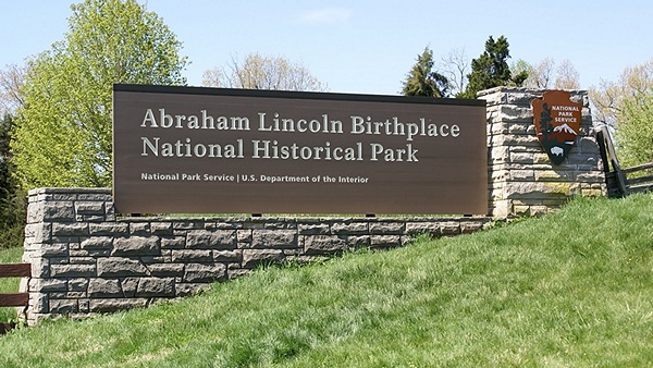
Entrance sign to the ALBNHP in Hodgenville, Kentucky.

Entrance sign to the ALBNHP in Hodgenville, Kentucky.

We left around 10:30 AM and took KY-70 to US-31E and headed north towards Hodgenville.  Just south of Hodgenville was the entrance to the Abraham Lincoln Birthplace National Historical Park (ALBNHP).  Admission was free.  In typical NPS fashion, the Visitor Center had excellent displays and a theater running a well made 15 minute documentary on Lincoln’s birth and early life.  And yes, one of the displays was “Lincoln Logs,” one of my favorite childhood toys.  One of the things we learned from the film was the difference between pioneers, like Daniel Boone, who forged trails into the Kentucky wilderness, and frontiersman, like Abe’s parents, who followed the pioneers and settled at the edge of the expanding nation.

Lincoln’s ancestors, as recently as his grandparents, had been true pioneers, coming through the Cumberland Gap with the likes of Daniel Boone, but his parents were not.  When he was born on February 12, 1809 his parents had already purchased Sinking Spring farm and were working the land like many other families in the area.  Although they lived in a one room log cabin typical of the region at that time, Lincoln’s father, Thomas, was in the top 20% of taxpayers in the county.  Frontier life was hard and uncertain but Lincoln was not born into poverty.

From the Visitor Center a trail lead out around behind the building and gently climbed to the top of a hill where the Lincoln Centennial Monument is located.  The cornerstone was laid by President Theodore Roosevelt in 1909 and the completed monument was dedicated by President Taft.  Fifty-six granite steps, one for each year of Lincoln’s life, led up to the Monument from the Sinking Spring.

The monument houses a one room log cabin believed, at the time of the monument’s construction, to be the actual Lincoln family cabin where Abraham was born.  It was eventually established, many years later, that Lincoln was not born in this cabin as the trees used for the timbers first grew almost 40 years later.  The cabin, however, is absolutely authentic and representative of the design, materials, and building techniques used in the region at the time of Lincoln’s birth, and is now preserved in a climate-controlled building.  Over the years the cabin has become a treasured icon representing the moment and point of origin of the man many believe was the greatest leader the nation has ever had.

When Lincoln was only two years old his parents lost Sinking Spring in an ownership dispute and moved about eight miles northeast, up what is now US-31E, and rented a 30 acre farm on Knob Creek.  The site is now the Lincoln Boyhood Home Unit of the ALBNHP.  Lincoln said many years later that his first childhood memories were from the Knob Creek homestead.  He only had two years of formal schooling and they occurred while his family lived at Knob Creek.

It is known that Abe and his older sister, Sarah, walked two miles (one way) from Knob Creek to the schoolhouse in Atherton.  It was not uphill both ways but it was, apparently, a difficult journey for them.  Lessons were done by recitation as there were no writing supplies.  Abraham, however, was reportedly fascinated by letters and taught himself to write.  The two years that he attended this school were the only formal schooling he ever received.

Also of note from this time and place in Lincoln’s life was the existence of slavery and his family’s involvement with the strongly anti-slavery local Baptist church.  Although Lincoln’s association with Indiana, Illinois, Washington, D.C. and Gettysburg, Pennsylvania is undoubtedly better known it was clear from our visit that the region and circumstances of his birth and earliest years were the clay out of which his adult character was ultimately molded.  However, once his parents moved across the Ohio River to Indiana, again because of an ownership dispute with the Knob Creek farm, it appears that Abe never returned to the place of his birth.

While we were walking along Knob Creek we noticed a group of butterflies gathered on the ground busily engaged in something.  Only after we got back to our coach was Linda able to identify them as Eastern Tiger Swallowtail butterflies.  The behavior we observed was “puddling” in which the males (primarily) gather in groups to extract sodium ions and amino acids from damp or muddy soils and gravel.  Those were precisely the conditions we found along the edge of the creek.

We met a couple from Chicago in the parking lot who were staying in Bardstown, on up US-31E to the northeast, and suggested that it was worth the drive.  Along the way we saw the sign for the Abbey at Gethsemani, a Trappist Monk monastery, so we took KY-246 to the monastery entrance.  Descended from the monasteries of St. Benedict (ca. 1177) this was a Cistercian order of monks.  The grounds and buildings were beautiful, simple, and serene, as you would expect from a place devoted to a life of worship, contemplation, and simple manual labor.  The Visitor Center and gift shop featured items made by these and other monks to support their way of life. A small theater showed an informative 20 minute film about life at the monastery.  Unfortunately for us the monks at this Abbey make cheese and fudge, neither of which we eat.

We continued on to Bardstown and found a place to park on the traffic circle surrounding the building that houses the visitor center and county offices.  Bardstown is an old (late 1700’s) but happening city, the largest we have visited since arriving at Cave Country RV CG.  The region around Bardstown is the center of the Kentucky Bourbon industry.  Barton’s 1792 Bourbon distillery is located on the south edge of town and Maker’s Mark distillery is only 16 miles to the southeast.  We Googled Whiskey vs. Bourbon and found out that Bourbon IS whiskey, but made to very specific criteria.  Bourbon is made mostly from corn mash and comes only from the U. S.; mostly from Kentucky.  Scotch is whiskey made in Scotland.  Irish whiskey is whiskey made in Ireland.  There are lots of subtle variations on this, but that’s the gist of it.

We checked out The Talbott Tavern, which dated from 1796 and is still in operation.  We would have loved to have lunch or dinner in this authentic and quaint setting, but our only menu option would have been a salad, so we strolled through town instead.  There were many old houses dating from 1790 – 1820, and the commercial buildings on the streets around the circle were mostly pre Civil War.  Crume drug store had been in continuous operation for over 150 years.

We headed back towards Cave City on US-31E but rather than retrace our route we took KY-84 west just south of Hodgenville and then headed south on KY-357 to Munfordville.  Along the way we stopped at an IGA and bought a bag of Romaine salad greens and a couple bottles of water.  We picked up US-31W in Munfordville and followed it south through Horse Cave to Cave City where we took KY-70 back to Cave Country RV Campground.

For dinner Linda pan-fried firm tofu slices (~1/2″ thick) with onions until caramelized, added a sweet bar-b-que sauce, and served it open-faced on some whole wheat hot dog buns we still had.  A simple green salad and small glass of sangria made it a meal.  Afterwards Linda read while I worked on this post and edited photographs of our visit to the land of Lincoln’s birth.
 

2014/04/22 (T) MCNP Photos

Here are some photos from our visit to Mammoth Cave National Park (MCNP) in Kentucky.  Click on each thumbnail image to view the full image.  Maximum size in either dimension is 800 pixels.  Enjoy!

2014/04/22(T) Mockingbird

Cave Country RV Campground has northern Mockingbirds.  Similar In size to Robins, they are grey and white, and masters of song.  We had at least one, maybe more, hanging around our rig early this morning and they started vocalizing at the first hint of daylight, long before sunrise which comes early on the eastern edge of the Central Time Zone.  And they sang, and sang, and sang, almost nonstop for more than three hours, and often in plain view of our coach windows where we could watch them.  There are other birds here as well, but the Mockingbirds were a real treat as I do not recall ever hearing them around either of our houses in Michigan even though their year-round range covers all of the lower 48 states.  The cats are also enjoying this spot, having a good view of all the birds on the ground and in nearby small trees.

We had some rain overnight and woke to completely overcast skies and a temperature of 62 degrees F with 100% humidity.  Perhaps a bit surprisingly it was very comfortable inside the rig.  We had a leisurely morning and Linda made her wonderful blueberry vegan pancakes served with real organic maple syrup.  We don’t have these very often and they are a real treat when we do.

We called the Livingston County Road Commission this morning to see when the seasonal load restrictions would be lifted and found out that they “hoped” to check conditions again tomorrow or Thursday.  Counties south of us (Wayne and Washtenaw) were planning to lift the restrictions late this week and the county to the west (Ingham) was planning to lift them next Monday.  In a “normal” season these restrictions would have been lifted on April 16th.  So as of this morning it appears that we will be delaying our return beyond this Thursday when we had planned to pull in to our driveway around mid-day.  Full- and extended-time RVers are fond of saying their plans are “written in Jell-O” and this is just another example of what that means.  (Linda checked the LCRC website later in the day and it had been updated to indicate that the restrictions would be lifted at 6 AM on Monday, April 28.)

Late morning I returned a phone call from Gaye Young.  She chairs the FMCA’s (national) Education Committee, to which I have recently been appointed.  It was our first conversation.  Among other things the committee will be studying RVillage and developing recommendations for FMCA’s involvement.

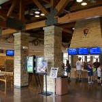
At noon we headed over to the Mammoth Cave National Park Visitor Center.  We were here seven or eight years ago, but it did not look familiar.  Once inside we learned why; the building had been constructed in 2010 on the site of the former visitor center.  The former adjacent administration building was now a fabulous museum connected to the new visitor center.

Admission to MCNP is free but entrance to the cave is not.  There are now over 400 miles of known/mapped passageways in Mammoth Cave making it the longest cave in the world by a big margin.  Unexplored parts exist for sure and the total extent of the cave is unknown.  We did a cave tour the last time we were here.  Today we were more interested in hiking and photography so we got a trail map and some recommendations from one of the rangers.

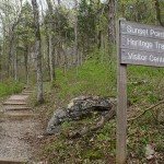
From the Visitor Center we took the foot bridge that goes over the ravine, with the trail down to the Historic Entrance to the cave, to the hotel/restaurant building.  We picked up the Heritage Trail and followed it past the hotel rooms and Sunset Terrace rooms to the “Old Guide’s Cemetery” and then to Sunset Point.  From Sunset Point we took a steep switchback trail down to the Echo River Spring Trail and followed it a short distance to its northern terminus where the River Styx emerges from the cave and flows to the Green River not far away.  From here we picked up the Green River Bluffs Trail which eventually returned us to the Visitor Center parking lot.  It was a good hike through the forest with wild flowers and occasional distant views.  I got a few nice photos along the way and will put them in a separate gallery post.

After our hike we had lunch at the hotel coffee shop and recalled having eaten there before.  We ordered a veggie wrap with potato chips and a black bean burger with fries.  Not a completely healthy meal, but still vegan.  We split everything and had a nice variety of food for our late lunch, all of which was very good.

MCNP is large at 53,000+ acres and has extensive “back country” with 70+ miles of trails.  Development, however, is mostly confined to a small area around the Visitor Center, which includes the modern campground, and two additional cave entrance sites. The campground has an entrance station, so we were not able to drive through and have a look.  We both recalled driving through the campground the last time we were here but could recall camping here.  And yet we must have, as we were traveling to Bowling Green, Kentucky in our Itasca Sunrise motorhome to attend the Life On Wheels program.  To paraphrase Wallace Stegner (1983), the National Parks really are “America’s Best Idea.”

We returned to our campground in Cave City and walked around a bit more, taking photos in the late afternoon light.  I spent a little time at the east end of the campground by the train tracks trying to get some photos of a passing train, but I could not get a good vantage point.  Later we had leftovers for dinner, turned on the TV for a while, responded to a volunteer questionnaire for the GLAMARAMA in June, responded to e-mails and RVillage posts, and worked on processing the photos from today.


2014/04/21 (M) Cave Country (KY)

We only had 191 miles to travel today, so we were in no particular hurry to leave this morning.  We were up early enough to have a couple of cups of coffee and a banana and take showers.  RV parks, like motels, usually have posted times for departure (latest) and arrival (earliest).  If the park is not crowded, or not expecting to be, you can usually hang around a little beyond check-out time or arrive a little before check-in time; but if you push the limits on this you may be asked to pay for an extra day or wait in a holding area until check-in time.  I walked up to the office of Northgate RV Travel Park to let the owner, Wes, know that we planned to leave around 10 AM and he seemed fine with that.  I also checked the park egress to US-31 to make sure we could leave the way we planned.  Wes’ dog, Dottie, followed me around for a bit.  Dottie looked to be at least part Border collie, and was very sweet.

We chatted with our neighbor for a while.  He and his wife were Royal Canadian Air Force mechanics who had been full-timing for the last three years since they retired from military service.  We had also chatted some with Eric yesterday.  The only long-term resident of the RV park, Eric is a young EMT for whom Wes has provided a small trailer to live in.  We also met and chatted with some other RVers on our strolls through the park, all of them passing through like us.  One younger couple was from Wyandotte, Michigan, an old community south of Detroit where one of our best friends grew up.  His “Big M” (University of Michigan) hat was the conversation starter.  They were headed to Pensacola, Florida to visit the Naval Air Station and see the Blue Angels.  Their kids were on (presumably) on spring break.  They were familiar with Wayne RESA, from which I retired in June 2012, which surprised me.  We always seem to meet interesting people in RV parks.

We pulled out of Northgate RV Travel Park at 10:30 AM, turned onto northbound US-31, stayed to our left and almost immediately were on the entrance ramp to northbound I-65.  Fifteen miles later we were in Tennessee.  I-65 in Alabama, at least the part we traveled, was an excellent road through attractive countryside and that continued to be the case in Tennessee.  In fact the road got even better as entrance ramps were usually longer, forming an entrance lane that eventually merged in to the right hand lane of the Interstate.  At larger interchanges, and near cities, there were often double entry lanes that merged down into a single lane and then into the traffic flow.  The total distance for these merge lanes was often 1/2 mile, plenty of distance and time to get up to speed and merge.

Getting through Nashville was the only tricky part of the drive, and it wasn’t that bad (hey, we made it).  Traffic was congested, made a bit worse by some construction, but it moved along.  To stay on I-65 we had to negotiate at least five places where the road split, alternating “keep left, keep right, etc.” but our Rand McNally RVND 7710 GPS provided lane information in navigation mode, and Linda was watching the route on a map and her smartphone, so we knew where we had to be.  Actually, what we did was get in the center lane with all of the long-haul trucks, slow down, and follow them.  The center lane generally allowed us to go either left or right as required and had the added advantage of keeping us out of the right hand lane with all of the exiting and entering traffic.

We stopped at a Pilot truck stop at Exit 6 in Kentucky and put 86 gallons of #2 diesel in the tank bringing the tank level up to 3/4.  That was enough fuel to get us home where we can put in additives and top off the tank with fuel blended for the cooler Michigan climate this time of year.  The fuel stop added 20 minutes to our trip and we finally pulled off I-65 at exit 354 at 2 PM CDT.  It was less than 1/2 mile to Cave Country RV Park from the exit.  Linda got us checked in and the woman in the office escorted us around to our site in a golf cart.  The normal route in was blocked by a disabled motorhome being hooked up to a wrecker for towing.  We heard it was an electrical problem, but it doesn’t really matter; RVers always feel for their fellow travelers when equipment problems develop.  As an interesting side note, the woman in the office was a seasonal worker who had been at Williston Crossings RV Resort for the big Carriage 5th wheel rally that took place the last week or so that we were there.  IN some ways RVing is a small world and people who have been on the road for quite a while tell us that this sort of thing happens more than you would expect.

We had a mixed greens salad and an Amy’s Roasted Vegetable Pizza for dinner and then went for a walk around the RV park before taking a quick drive through town to locate the grocery store.  In spite of its location near the entrance to Mammoth Cave NP, Cave City did not appear to be a prosperous place.  Many business were closed, the buildings vacant and for sale.  Most of the newer/nicer businesses (motels, restaurants, filing stations) were right at Exit 354, including Cave Country RV Park.

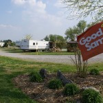
Cave Country RV Park is a well kept basic park (good gravel interior roads, no swimming pool) conveniently located to I-65 and the entrance to Mammoth Cave National Park.  It has a laundry, restrooms, and a lounge with a pool table, a big comfy couch, and a TV.  The office has a small store with the usual essentials, such as electrical and sewer adapters.  It is located next to a major CSX rail line, but we like the sound of trains, so that was OK with us.  (It is not unusual for RV parks convenient to highways to be adjacent to railroad tracks.)   Given that it is the Monday of Easter week it seemed odd that the park wasn’t even half full, although rigs continued to arrive after sunset.    Rain was in the forecast for the overnight and it rained briefly for the first time just before 9 PM.  We were able to pick up CBS over the air, presumably from Bowling Green, Kentucky to the southwest, and watched a little TV before turning in at 10 PM.