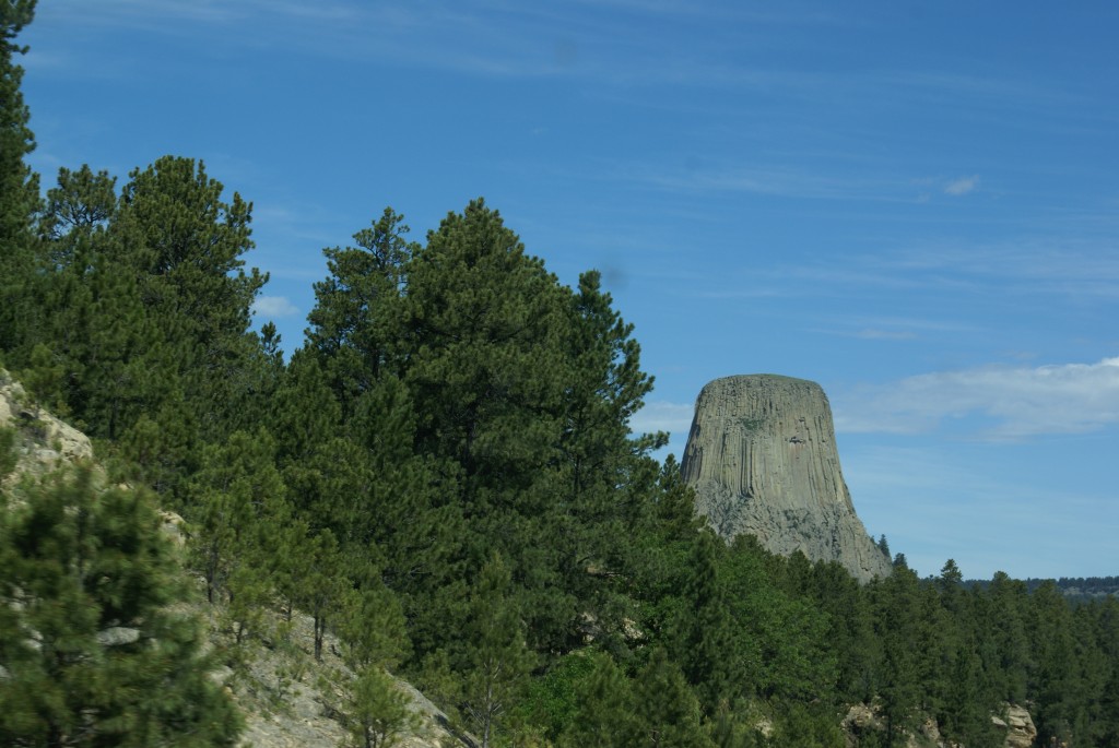
We had decided last night that we would switch to tourist mode today and drive over to Devil’s Tower National Monument. I had been there twice before; first with my parents when I was about 10 years old, and then with our son when he was the same age (25 years ago). It was Linda’s first visit, however, and we were both excited to be going there.
Devil’s Tower N. M.
It is only 61 miles from Gillette to the monument, and we had a nice morning for a drive. We headed out around 9:00 AM and were there by 10:30 AM. We stamped our NPS “passport” and then hiked the 1.3 mile trail around the tower at the base of the boulder field. This is a paved trail with some up and down. It is mostly shaded by the pine forest that surrounds the tower, but there are sunny stretches as well. The base of the tower is actually higher in elevation than the surrounding Belle Fourche river valley, and the trail afforded a number of nice vistas. There are resting spots with benches and a couple of spotting tubes as well. The weather was nice for hiking and photography, with blue skies and wonderful clouds. We finished our hike around noon, and left the monument headed for Hewlett to the north.
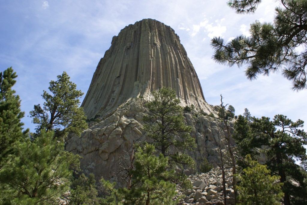
A view of Devil’s Tower from the trail around the base.
Hewlett is a very picturesque little town with an “old west” look to it. We were there because we had a tourist map that showed a number of different loop drives in the area. One of them appeared to use a road from Hewlett south to Sundance, but the map must have printed incorrectly as the road did not exist as near as we could tell. Instead continuing on to Aladdin, whose main (only) attraction is the general store, we decided to back track past the monument to Sundance. It’s always interesting driving a road in the opposite direction as the views are different, and we had some very good ones of the tower.
The Crook Co. Museum is in the basement of the county courthouse in Sundance. A fellow RVer had been there early last week and recommended it. It’s free, which is always a bonus. Some of the exhibits have to do with Harry Longabough, AKA “The Sundance Kid”, who was tried and sentenced to 18 months in jail in the Crook County court. This was the kind of small/local museum that Nick & Terry Russell often visit and write about in The Gypsy Journal, their RV travel newspaper. The old high school building is being refurbished to serve as the new home of the museum. It should be very nice when finished, and worth a return visit if/when we are back in the area.
We headed back to Gillette and decided to take a quick auto tour of the main downtown area. In so doing, we came acres the Rockpile Museum, so named because of the large, natural rock formation at its entrance which served as a landmark for a nearby lake in earlier cattle-drive days. This museum told the story of the settling of Campbell County, of which Gillette is the county seat. It was yet another instance of a nice small/local museum with free admission.
On the drive back to Gillette I studied the official Wyoming state highway map (Linda is doing the tourist driving) and pondered how we would get from Sheridan to Wapiti (Waa pity) on July 21st. The most direct route is US-14, but our neighbor John said they had been told to avoid US-14 and take US-16 out of Buffalo instead. Both routes cross the Bighorn Mountains, and US-16 has the slightly higher pass (9,665 ft vs. 9,033 ft), but when it comes to mountain roads altitude isn’t everything. We got online and searched for information and found the RVCruiser website, which had a detailed discussion of the various routes around and through the Bighorn Mountains. The information there confirmed what John had been told; the grades on US-16 are long/gradual, the turns moderate, and there are areas to pull off and admire the scenery while the engine or brakes cool off. Not so on US-14, which has hairpin turns, steeper grades, and few if any pull outs. After US-16, the alternatives were end-arounds (very long detours) to the north or south.
While researching this route we also saw a reference to “three tunnels” as you head west on US-20 from Cody towards the east entrance to Yellowstone National Park. Tunnels? Yikes! Again we went online looking for information on width and height restrictions but had trouble finding anything official. I checked the website for the Green Creek Inn & RV Park where we will be staying, and it mentioned the tunnels as well. A quick call to them confirmed that we would be able to clear the tunnels without difficulty. With our minds put at ease, we turned in for the night.