Tag Archives: US-27 Alt

2014/02/11 (T) Manatee & Fanning Springs SPs (FL)

Manatee Springs Tributary to the Suwannee River, Florida.  (MS-ICE composite of 7 photos.)

Manatee Springs Tributary to the Suwannee River, Florida. (MS-ICE composite of 7 photos.)

Loblolly Pine at Manatee Springs SP (FL).  (MS-ICE composite of 4 photos.)

Loblolly Pine at Manatee Springs SP (FL). (MS-ICE composite of 4 photos.)

Another beautiful day here in the elbow of Florida.  Seriously; look at the map.  The panhandle is like an arm outstretched from the shoulder and the peninsula is like the rest of the arm from the elbow down.  That places the area around Cedar Key and inland to the northeast towards Williston as the crook of the elbow.  We left the WCRV Resort late morning and took US-27 Alt WNW through Bronson to Chiefland where it joins up with US19/US-98 N.  By the time we got to Chiefland we had blue skies, little to no breeze, and temperatures were moving into the mid-70s.  Just on the other side of Chiefland we turned on to FL-320 and drove the final 6 miles to the entrance to Manatee Springs State Park.

Manatee Springs is one of many springs that flow into and form the Suwannee River.  Yup, that Suwannee River.  From Manatee Springs the Suwannee River flows approximately 25 miles to the Gulf of Mexico.  Like all of the springs fed by the Florida aquifer, Manatee Springs puts out millions of gallons of water every day at a constant 72 degrees Fahrenheit.  Several visitors reported seeing two Manatees, a mother and a  youngster, swimming upstream towards the headsprings, but we were not able to catch a glimpse of them.  We did, however, see SCUBA divers.  It turns out that this spring is popular for swimming and SCUBA diving.  Consistent with our experience in other Florida State Parks, the developed areas were very nicely done.  There was an excellent boardwalk that ran along the tributary and over  swamp area that was obviously full of water at other times (high tide) and out to an observation platform at the Suwannee River.

When we were done at the headsprings we drove to the trailhead parking area for the Scenic Trail.  As we have seen in other parks, there was an extensive trail system, but a specific combination of trails looped us back to our car after hiking approximately two miles.  This trail, like others, took us through a woodland that underwent subtle, and not so subtle, changes with only minor changes in elevation.  A trail guide keyed to numbered markers explained these changes as we went along.  In the time we were on the trail we did not encounter any other hikers.  These forests are beautiful, peaceful places, but the beauty is subtle rather than dramatic, and you have to slow your pace and elevate  your senses in order to experience and fully appreciate them.

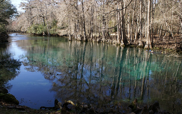
The headsprings at Manatee Springs SP (FL).

The headsprings at Manatee Springs SP (FL).

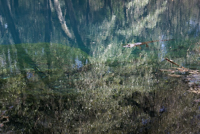
Small alligator in Catfish Hole Spring at Manatee Springs SP (FL).

Small alligator in Catfish Hole Spring at Manatee Springs SP (FL).

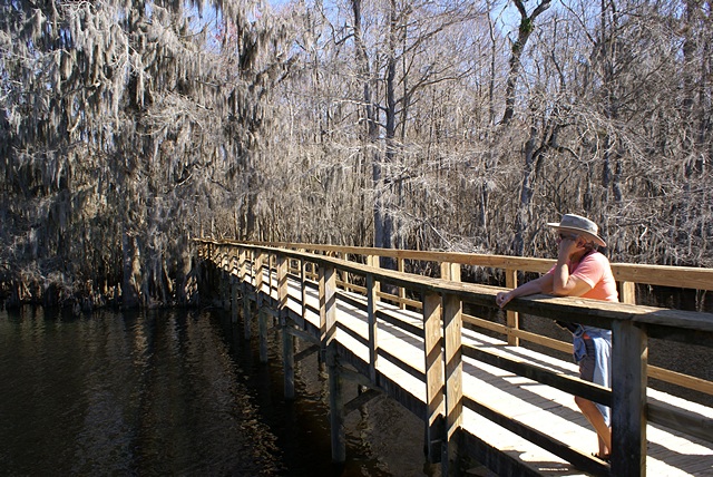
Linda on the Suwannee River Boardwalk at Manatee Springs SP (FL).

Linda on the Suwannee River Boardwalk at Manatee Springs SP (FL).

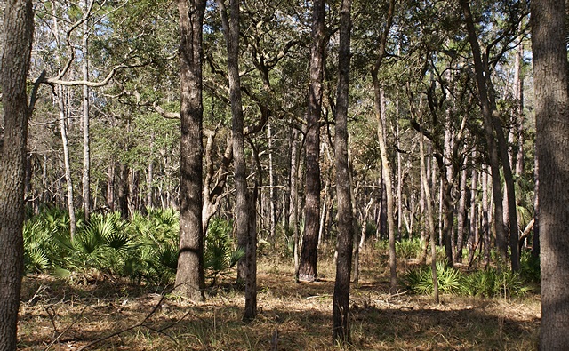
A view of the forest on the Scenic Trail at Manatee Springs SP (FL).

A view of the forest on the Scenic Trail at Manatee Springs SP (FL).

From Manatee Springs SP we returned to Chiefland and continued north on US-19/98/27A to the little town of Fanning Springs.  The Suwannee River runs through the center of town and just before you get to the river is the entrance to Fanning Springs SP.  This small park is set up as a place for people to swim, and during the warmer months it is undoubtedly overrun with people.    But today there were only a few other people there, including a couple who were swimming in the headspring.  I took a phone call from Pat, who was working on resetting the DDEC I engine computer on his bus, and then we walked out to the end of another wonderful elevated boardwalk, crossing over/though a cypress swamp before reaching the banks of Suwannee River.  It was a very pretty place but challenging to capture in photographs.  I took some, but I didn’t care for how they turned out, so I did not include any with this post.

There is another trail in this area named The Nature Coast Trail, but we did not hike it today.  It was built on an old railroad bed and runs for over 31 miles, crossing the Suwannee River north of Fanning Springs on an old wooden trestle.  The trail is available for use by hikers, bicyclists, and equestrians, and we will likely hike part of this trail, but not today.  The drive back to Williston took approximately 45 minutes, not including a brief stop at the Winn-Dixie supermarket on the west edge of town for grapes and bananas.  Dinner was green salad, Tofurkey brand vegan pizza, and a small glass of Blueberry-Rhubarb Wine from Forestedge Winery.

2014/01/20 (M) Cedar Key (FL)

[Note:  I had enough photographs from today that I put them in a separate Gallery Post with today’s date.]

With a forecast of sunny skies and high temperatures in the mid 60’s we decided to head to Cedar Key today.  Mid-morning I e-mailed Cherie that we were headed that way and would drop by the Sunset Isle RV Park and Motel mid-afternoon after checking out the town.

From Williston we took US-27 Alt WNW to Bronson and then took FL-24 SW to Cedar Key, a total distance of 45 miles and approximately one hour driving time.  FL-24 is the route of the old rail line.  Just before getting to Cedar Key we saw a sign for the Suwanee National Wildlife Refuge which is located some miles north of the Cedar Keys area.  When we got to Cedar Key we headed to the Cedar Key Museum State Park where our annual park pass covered the $2 entrance fee for each of us.

We had a nice chat with the park volunteer and learned about the vast amount of land, marsh, tidal flats, and water that is reserved, preserved, and protected along the Florida Gulf Coast stretching far to the north and south of Cedar Key.  We walked through the small but informative museum and then toured the Whitman house which had been moved to the Park as a well-preserved display of housing and domestic life from a bygone era in that part of Florida.  Mr. Whitman was an avid shell collector, and part of his collection was on display the house.

The park was small but had a nice trail that got us down to the shore.  The tide was out allowing us to see exposed oyster beds and large animal footprints leading into the water.  Probably just someone’s dog, but…  We also spotted a mature Bald Eagle soaring overhead.  We then met a woman walking a dog who told us that just down the street behind the museum was the Bald Eagle nest (aerie) up in a large pine tree.  We walked quietly and slowly in that direction.  Bald Eagle aeries are enormous and it was easy to see.  To our delight and good fortune there was an adult eagle clearly visible in the nest.  I took a few photographs and then we left the way had come.

Although the Bald Eagle has been removed from the endangered species list, it is still highly protected as our national bird.  Of more significance to us, however, is that the presence of Bald Eagles is still a marker of wilderness as they require a large area of specific habitat and generally stay away from populated areas.  While Cedar Key is certainly a very remote and relatively small community surrounded by a vast area of protected habitat, the fact remains that this aerie, and what we must presume was a nesting pair of Bald Eagles, decided to live in someone’s backyard.

We drove back to the main downtown/waterfront part of Cedar Key, parked the car, and explored on foot.  Cedar Key is not a big place, but it is old, and very charming, and even a bit “funky.”  We stopped at the only grocery store we had seen, bought some lunch munchies and beverages, and had a quick lunch in the car.  We then headed back towards Sunset Isle RV Park which is actually on a small island just before you get to the main island where most of Cedar Key is located.

We parked in front of the motel and walked around back to find Chris and Cherie’s bus.  (Chris and Cherie blog and write under the name a Technomadia.)  We spotted it right away, but before we got that far we spotted another familiar RV; a beautiful Spartan trailer that belonged to Forrest and Jeri Bone of the Tin Can Tourists.  We first met them at the Arcadia Bus Rally when we attended Forrest’s presentation on the TCT’s and later toured their Spartan trailer during the open house.  Forrest and Jeri actually hail from Gregory, Michigan not far from where our house is located.

We went on down to the Technomadia bus and Forrest came down shortly thereafter.  Chris and Dani then stopped by (they are part of the NuRVers group that converged at Sunset Isle this January) and we had a good visit, Cherie demonstrating a project that she and Chris are working on.  Forrest left to help Jeri do the laundry and Chris/Dani headed back to their rig (a Westphalia camper) to work.  We eventually wandered over to the Tiki Bar at the Low Key Hideaway three “doors” south and hung out there while the bar filled up and the sun went down.  The bar was neat, the people were neat, and the sunset was neat; long and colorful.  We bid farewell to our old and new acquaintances and headed back to Williston.  A quick stop at the Winn-Dixie supermarket for soy milk and the Sunoco filling station for fuel and we were home in time for dinner and some PBS before bed.