At 1:30 AM (Tuesday, April 15) my cell phone issued a severe weather alert tone. The message from the Weather Channel app was an emergency notification that a flash flood warning had been issued for Freeport and advised us to seek higher ground but to not drive through water. If we had not already been awake, we were now! But then, that is the point of having your cell phone set up to alert you to dangerous and threatening conditions with a sound that announces an imminent nuclear attack. As if that wasn’t enough, the leak at the passenger-side rear corner of our bedroom vent-fan reappeared. I had applied a liberal coat of Dicor self-leveling lap sealant to the outside of that vent-fan back at Williston Crossings and it had not leaked during two subsequent heavy rain events, so I thought I had taken care of that problem. Either I missed a spot or the water got in somewhere else.
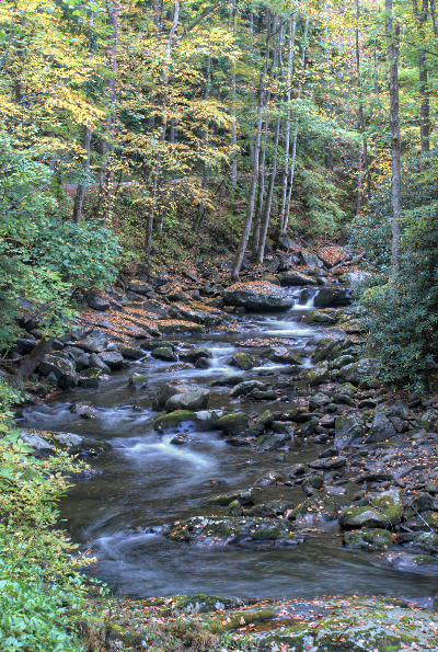
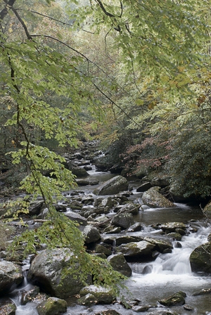
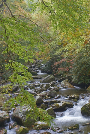
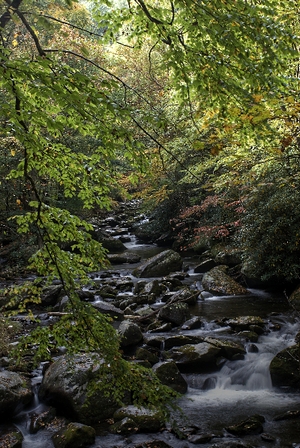
Although Live Oak Landing is on the Choctawhatchee River it is on ground that is noticeably higher than the water level and the RV sites are not right at the bank. I figured we were safe as we could see the east end of Choctawhatchee Bay from the front of our bus. Ocean water levels rise and fall with the tides, but oceans don’t flood. The interior roads and sites are paved, so they were not going to get washed out by the rain and we were not going to be mired in soft ground.
We had a lull in the rain between 3:00 and 5:30 AM and I used the time to work on blog posts covering the 12th through the 14th and keep an eye on the weather. I prefer doing one post per day, and uploading it before I go to bed, but that is not always possible. When I first started blogging I would often write the rough draft in bed on my iPad, e-mail it to myself, get up early the next morning, finish it, and upload it. I still do that sometimes, but just as often I end up several days behind. BTW: The WiFi at Live Oak Landing is very good. We have been able get connected and do what we needed to do, even when it was raining. We also have an acceptable Verizon 4G/LTE signal here.
The rain resumed briefly at 5:30 AM but without the previous intensity and fanfare. It started again at 6:50 AM. I checked the radar on my iPad Wundermap app and it showed the cold front just a few miles to our west and another fetch of rain beginning to come on shore and positioned to train over us. It was not severe, however, and the band ultimately drifted east of us before coming onshore. The rain event in most of the panhandle was done by 8:30 AM. The end of the rain event, however, was not the end of the weather warnings. Flash floods occur during and shortly after heavy rain events, but rivers can rise above flood stage long after the rains have moved through as large volumes of water upstream try to make their way to the sea.
There was no sunrise today, just a gradual change from night to muted, grey light that continued through the morning. By mid-morning the cold front had passed by us, the winds had shifted from southwesterly to due north, and the temperature had dropped. A low pressure center had moved directly over Atlanta, Georgia with the cold front trailing SSE into the Gulf and the rainy weather shifted to northeast Florida, downeast Georgia, and up the Atlantic coast. A wider view of the continent showed the heaviest weather farther north. The cold front stretched along the Appalachian Mountains, up through Quebec and then wrapped around through Labrador and into the Labrador Sea. There were four additional low pressure centers located in northeast Pennsylvania, southwest of Montreal, over the middle of Labrador, and just off the coast in the Labrador Sea. Behind the front was cold and snow; in front of it, rain.
Linda checked the weather back home. The 3+ inches of snow recorded overnight in Detroit, Michigan pushed the total for the season to a new record of over 94 inches. The old record was established in 1880/81. This has been a historic winter with records broken across much of North America.
By early afternoon the storms were gone and the day was struggling to become partly cloudy instead of all cloudy. The temperature barely broke 60 and it was windy so it still felt like winter’s last hurrah. Linda discovered last night that the dish soap we bought at Publix never made it into one of our grocery bags. It happens. We needed more toilet paper, so we headed back to Publix in the early afternoon and stopped at the customer service desk with receipt in hand. Mary said it was “no problem, just pick up the soap and tell the cashier that Mary said it was OK.” It was only a $0.69 item, but we appreciated that Publix took our word for it.
With our shopping taken care of we decided to drive west on US-98 about eight miles to Destin, Florida. The closer we got to Destin the more developed the area became. We saw a sign for a Panera at a premium outlet mall and decided to go there for lunch. Destin is a very upscale, resorty kind of place. We crawled through traffic, and some of the worst engineered traffic signals we have ever encountered, to get to the mall and the restaurant.
The parking lot was packed and so was the Panera. Apparently the stormy weather had prevented the residents from getting their maximum daily dose of high-end shopping, and they were all out on Tuesday afternoon making up for lost time. In spite of the crowd it did not take long to place our order and receive our food and it was the same good quality we have come to expect at Panera wherever we find one. Unlike Watercolor, which seemed vibrant but relaxed when we drove through yesterday, Destin seemed crowed and almost frantic; not our kind of place. The traffic lights were so stupidly set up I concluded that the traffic engineers must hate rich people and were using them to inconvenience them to the maximum extent possible. Being neither wealthy nor tolerant of stupidity, we finished our lunch and got out of town.
Before returning to Live Oak Landing we drove past Topsail State Park, a former commercial RV park, and through the very upscale community of Santa Rosa Beach right on the Gulf of Mexico. We then drove to Freeport just to check it out since Live Oak Landing has a Freeport mailing address. It was a one intersection town without anything special to recommend it. Been there, done that, no reason to go back.
Back at our coach we were both very tired, having had very little sleep last night, and took a nap. Naps are a great thing. I used to consider them a luxury, but I’m seriously considering making them a part of my daily routine. When we finally woke up Linda made a green salad and re-heated the spicy quinoa and black bean dish from the other night. A beautiful sunset suddenly developed and I grabbed my camera to try to get a view shots. This kind of lighting situation really requires a tripod and the use of the high dynamic range (HDR) technique, but I did not have time for either of those, so I got what I could hand held.
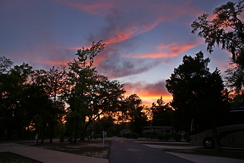
Sunset at Live Oak Landing. Our coach is lower right. (This photo has more image manipulation than normal because of the extremely high contrast lighting.)
Live Oak Landing has cable TV but we were able to pick up a surprising number of channels over the air (OTA). We watched a couple of shows while I worked on blog posts. The forecast low for early tomorrow morning was 39 degrees F, so we closed the ceiling vents and windows before we turned in for the night.