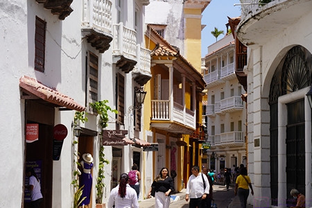
2016/02/01 (M) Tabbed
We had coffee and then granola with blueberries and bananas for breakfast. After breakfast we gave Jasper his nose drops. Linda then went for a walk that took her to Walmart where she picked up a few grocery items. I continued working on photos for Dave Aungier’s BCM article.
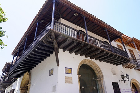
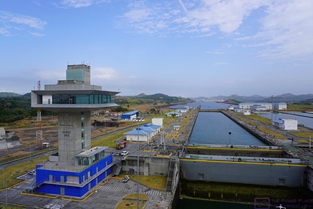
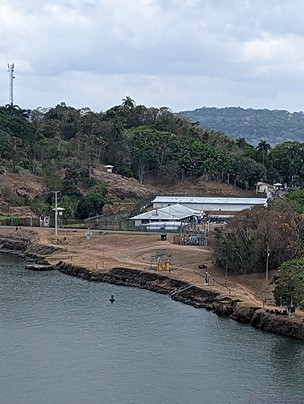
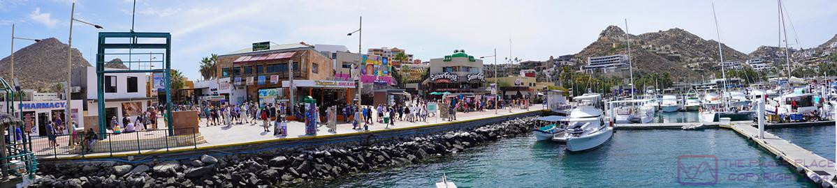
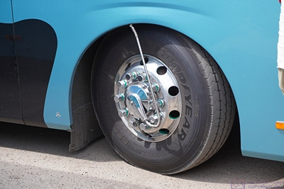
When Linda got back I decided to put the new tabs on the license plates (car and bus). We were able to renew the registration/tabs online and have them mailed directly to the RV resort. Putting the new tabs on was a bit more work than just peel and stick as I keep protective plastic covers over the license plates and secure them with “tamper proof” bolts and Nylok nuts. That required special tools which I had to get out.
Once I got the plates off the vehicles and separated from the covers I washed them and stood them up to dry. While they were drying I washed off the areas of the vehicles where the plates mount. I peeled four layers of old tabs off of each plate so I could put the new tabs directly on the plates. I reassembled the protective covers on the plates, mounted them back on the vehicles, and put the tools away. The final step was to remove the expired registrations from our wallets and replace them with the new ones. The whole process took about an hour but it felt good to have it done.
While I was outside I drained the auxiliary air system water separator (which I do every few days). I also opened the drain on the auxiliary air tank but it was dry. That was good, and meant the water separator is doing its job.
Linda made peanut butter and jelly sandwiches for lunch. She read for a half hour and I continued working on photos while we digested our lunch before changing into our swim suits and walking over to the pool. There were quite a few people in the pool so we stayed in the shallow end, walking and swimming from side to side. When we were done exercising we spent a few minutes in the spa (hot tub / whirlpool) and then showered and changed into dry clothes that we brought with us.
We stopped at the mail room and found our electric bill for January in our mailbox. Linda walked back later and paid the bill and also our rental fee for February but realized later that they did not charge us enough. She thought they might have charged us for someone else’s campsite. When I checked my e-mail I had one from Gary at BCM. He forwarded one from Jorge with a Dropbox link to a draft of the March 2016 issue and a request to proofread both of my articles and provide any needed corrections ASAP. I finished the task before dinner, uploaded the PDF file, and e-mailed them back.
For dinner Linda made Farro with dried cranberries, onions, garlic, greens, and hot pepper flakes. We finally finished the Franzia Crisp White boxed wine, which went well enough with the dish. After dinner I washed some of the grapes that Linda bought today and we settled in to watch the PBS Newshour, the X-Files, Lucifer, and NCIS Los Angeles. We went to bed and tuned in PBS for coverage of the Iowa Caucuses before going to sleep. I don’t recommend political coverage as a way to fall asleep peacefully.
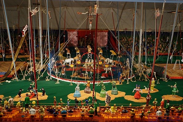
A small piece of the enormous Tibbels miniatures circus model at the Ringling Museum complex, Sarasota, FL.
2016/02/02 (T) Mara Arrives
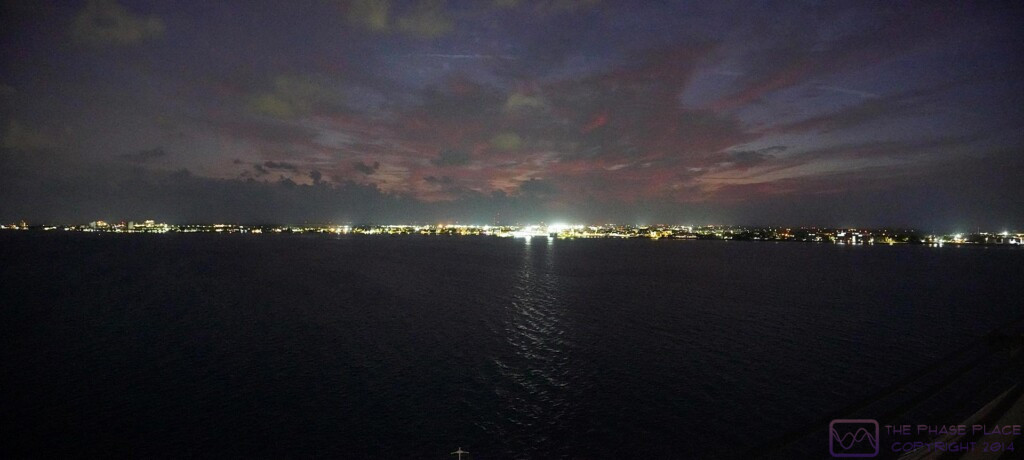
The humidity rose sharply as the temperature dropped last night. That made for cool, but sticky, conditions at bedtime; the one combination that we do not have a way to counteract. We woke around 7:30 AM to dense fog and were less than fully rested, but a nice pot of coffee at least cleared away the cobwebs. The fog disappeared soon enough to reveal partly cloudy skies. The sun was bright and hot but there was a mild breeze, making the morning feel somewhat tropical. We had toast and jam for breakfast with our usual orange-grapefruit juice.
Linda went for a walk after breakfast and stopped at the office to correct our rental payment for February. While she was walking I resumed my work on Dave Aungier’s article for Bus Conversion Magazine. I finished selecting, processing, and inserting photos for the print version of the article and then set it aside. It had been nine days since I dumped the waste tanks and filled the fresh water tank and we were down to 1/6th of a tank of fresh water. That’s about 20 gallons so we could have gone one more day, but we are not boondocking and do not have any reason to run the tank all the way to empty. Besides, the water pump works a lot better when the tank is full.
Linda stopped at Walmart on her walk and returned carrying four small bags of groceries while I was servicing the tanks. She also got a text from Mara indicating that she was about to pull out and head our way. Once the fresh water tank was full I left the water hose turned on and added the tank treatment to the toilet and sinks while Linda did the dishes. Once we were done I shut off the shore water and we returned to operating off of the fresh water tank using the onboard pump.
As long as I was doing chores I cut the power to the coach, waited 30 seconds, and turned it back on to reset the Progressive Industries EMS Previous Error (PE) Code 2 (open ground). This error occurred during the last storm while we’re away from the coach.
With our chores done Linda thought we should go for a swim so we changed into our suits and walked over to the pool. Some of the Quebec residents were playing Petanque (pronounced “p’tunk”) and there was a shuffleboard tournament about to commence. I gathered from the instructions being given to the teams that Big Tree Carefree RV Resort was hosting teams from another RV park. There was no one else at the pool when we arrived and we had it to ourselves for about 10 minutes. A woman showed up and asked if it was OK with us if she put on her water aerobics music and did her exercises. Sure! Why not. Linda joined in and eventually a third woman joined them. I went to the deeper end of the pool and swam back and forth from side to side.
I got out of the pool while the ladies were still exercising, took a quick dip in the hot tub, and then showered. I changed into my other pair of swim trunks (XXL) and cinched them tight. They make a very comfortable pair of shorts for warm days and it doesn’t matter if they get wet
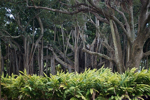
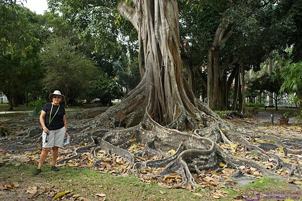
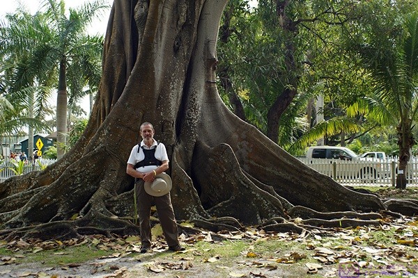
Massive Banyan Trees at Ca’ D’Zan, John and Mabel Ringling’s former winter estate on Sarasota Bay, now part of the Ringling Museums complex, Sarasota, FL.
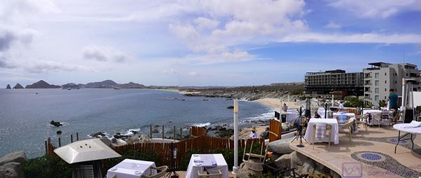
We were back at our coach by 2:30 PM and Barb, across the street, invited us to hang our suits and towels on their clothesline, which we did. Linda made roll up sandwiches with garlic hummus, onion, and lots of dark, leafy greens for a later-than-usual lunch. After lunch she sat outside and read while I updated my water usage spreadsheet. Linda got another text from Mara that she had arrived so we moseyed over to her site behind the swimming pool. Mara passed us in her motorhome going the other way as she was being led away from the office to her site. We stopped at the office on the way to make sure they had cleared up our February billing correctly and to check our mailbox. They had; no mail. The Québécois were done playing Petanque for the day but the shuffleboard tournament was in full swing. The parking volunteer was just getting Mara backed in as we arrived at her site. We left her alone while she blocked and leveled her motorhome, extended the slides, shut down the engine, plugged in the shorepower cord, and deployed the awnings and windshield sunshades. Good RV etiquette is to not bother people while they make/break camp.
We visited briefly but did not stay. Mara had stopped at the Walmart for groceries before entering the resort and needed to put them away and then have something to eat. Linda invited her to come down for dinner and she accepted.
When we got back to our coach the inside thermometer read 89 degrees F. That was just a bit too hot for my comfort, and for the cats too. I turned off the electric heating element for the domestic hot water. We closed up the coach and turned on the front and center air-conditioners, but not the one in the bedroom. The front and center units are on separate legs of the 240/120 VAC system. Even before I turned the units on the voltage was 115 VAC on L1 and 112 VAC on L2 with very little current draw. With A-C units on these voltages dropped to 112 and 109 respectively. That is very marginal for our PI EMS, especially the L2 voltage. This was the first situation we have been in where I wished I had a Hughes Autoformer boosting transformer.
I opened the bottle of Beringer Red Moscato that we have had in the refrigerator for a while and Linda and I had a glass while we waited for Mara. Linda called Mara at 7 PM and she was not sure how to find our coach in the dark so I walked over to the activity building at 7 PM to meet her and we walked back together. We gave Mara the grand tour of our remodeling efforts and then poured some more wine. Both cats allowed Mara to interact with them, which was unusual and perhaps a sign that Jasper’s health was finally improving.
For dinner Linda made a salad, seitan stroganoff, and fresh strawberries for dessert. We chatted before, during, and after dinner about where we had each been and what we had been doing since we last crossed paths in July and what our plans were for 2016 and beyond. By 8:45 PM we had covered a lot of ground but had not been for our after dinner walk.
It had been a long day for Mara and she was ready to get back to her cats so we walked back to her rig with her and extended our walk through the Resort before returning to our coach. We watched a fascinating program on the assassination of President James Garfield and then turned off the air-conditioners, opened a couple of bedroom windows, opened the roof vent-fan in the bathroom, and turned the fan on in exhaust mode. We went to bed and watched Charlie Rose before finally turning out the lights and going to sleep.
2016/02/03 (W) Laundry Swimming
Jasper woke me up early with his sniffles and sneezing and I had trouble falling back asleep. Our little guy is obviously uncomfortable with whatever it is that he has and I stroked his back and scratched his chin for quite a while. I finally got up a little after 7 AM and walked over to the Wednesday morning coffee, as much out of curiosity and to have something to do as anything else. I noticed as I was leaving that the gasket in the rear vertical edge of the entry door window was coming out at the top again and made a mental note to fix it later today.
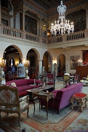
The living room at Ca’ D’Zan, Ringling Museums complex, Sarasota, FL.
While I was gone Linda got up, got dressed, stripped the bed, and decided to go for an early morning walk. I know, because I met her about half way back to our coach. I ground the coffee beans and prepped the coffee pot. When I saw her walking down Front Street towards our site I started brewing the coffee so it would be ready shortly after she arrived. We had granola with blueberries for breakfast but did not have fruit juice or take our pills. Later.
It was already 72 degrees F outside and anywhere from 75 to 79 degrees F inside, depending on which thermometer or thermostat I looked at. I don’t believe any of them anymore but I figured collectively it was somewhere between 74 and 80 degrees F in the coach. The forecasted high for today was 86 degrees F and based on the low level clouds streaming in from the south looked to be a humid day as well. It’s always better to keep a space cool and dry than it is to try to cool it off and dehumidify it after the fact. I turned off the bathroom ceiling exhaust fan and closed the roof vent and closed the two open windows in the bedroom. I noticed that the bottom horizontal gaskets on these windows are not staying in their mounting grooves. Ugh. I love our old bus, but there are some aspects of it that I seem to have to keep fixing, which is not my most favorite thing to do. Oh well, at this point we are definitely “in for a dime, in for a dollar.”
We doodled on our iPads until it was time for Linda to walk to the swimming pool for the 10 AM water aerobics class. While she was exercising I selected and processed a couple of photos for her to use with her weekly postcard to Madeline. She normally takes care of this on Tuesday.
We will be away from the coach and Resort the next two days so I needed to do laundry today. While I was gathering up the soiled clothes and linens I got a call from Dave Aungier. He was following up to see that I got the draft of his article from Bonnie. I brought him up to date on the status of the work, which I hope to have finished before I go to bed this evening.
I also had an e-mail from Jorge with the correct Dropbox link for the final version of the March 2016 issue of BCM. I needed to do a final proofread on my two articles and get back to him by the end of the day.
Linda got back from exercising and swimming just as I was getting ready to leave for the laundry room. The washers and dryers were all in use and I had to wait a while for washing machines to open up. Linda texted to see if I needed help and walked over to assist. I brought my computer and continued working on Dave Aungier’s BCM article while our clothes were being washed and dried. I got all of the digital edition bonus photos selected and processed, so I should be able to wrap the article up tonight and make it available for Dave to proofread. I also got two small Windows 8.1 updates downloaded and installed, but the Internet connection was not fast so that’s all I was able to do.
Exterior detail of Ca’ D’Zan, Ringling Museums complex, Sarasota, FL.
We folded and hung all the dry clothes and loaded them in the car, which I drove back while Linda walked (no room to ride). We were back at our coach by 2:45 PM, three hours and 15 minutes after I left to take care of this chore. After putting the clean clothes away Linda walked back to the pool to look for her Tilley hat. While she was gone I checked the level of the kitchen counter. It was level, so starting the engine and re-leveling the coach was not something I had to do today. Linda returned, hat on head, so we avoided the inevitable sadness of a lost Tilley hat.
The two front air conditioners were not able to keep up with the heat, in large part because the middle unit is not working very well. Presumably it needs to be charged, but Butch has done that before so the root cause has to be something that needs to be repaired, such as a refrigerant leak and/or a bad seal that is reducing the pumping effectiveness of the compressor. A secondary problem is that we cannot run the bedroom A-C unit at the same time as the front one since they are on the same leg (L1) and the voltage at our coach is already too low with just the one unit running.
At 4 PM we walked to the pool for an afternoon swim. When we returned to our coach I retrieved the latest, and hopefully final, draft of the March 2016 issue of BCM and proofread my two articles. I had one minor correction for each article and e-mailed them back to the publisher and layout person. While I was working on this I got an e-mail from Kristine Gullen with a question for Linda which resulted in a group text message conversation. We received a “hold the date” notice at our house, which our daughter let us know about, for the October 22 wedding of Kristine’s son Nickolas. We will make a point of being back by October 15 from our trip to the Canadian Maritimes and New England.
For dinner we had a salad and the left over Farro with cranberries and seitan stroganoff. After dinner we retracted the large patio awning as a precaution in advance of rain and possible thunderstorms forecast for tomorrow in association with a cold front approaching from the northwest. We then emptied out the back of the car and removed the passenger side rear seat and the wooden storage structure to allow the driver side rear seat to be lowered into position and secured. We rearranged the things stored in the front bay of the bus to make room for the car seat, and several other things that were stored in the car, moving a few things to the passenger side engine bay. We should have done this earlier in the day when it was light but doing it in the morning would have been a disaster. We should have done this as soon as we got settled at Big Tree RV Resort but it wasn’t pressing then and we got busy with other things.
We went for a stroll around the resort and dropped off the trash along the way. Back at our coach we had a glass of Beringer Red Moscato wine and watched Nova on PBS. Mara sent Linda a text indicating that Sabra (one of her cats) was still having issues and she had decided not to go with us tomorrow to the Ringling Brothers museum in Sarasota.
After Nova we put the linens back on the bed. I then converted Dave Aungier’s article from Word to PDF, uploaded it to a folder in our Dropbox, and sent him an e-mail with the link. I caught some news, weather, and Charlie Rose and then went to sleep.
2016/02/04 (R) A Ringling Birthday
We were up by 7:15 AM this morning but I did not make coffee and we did not have breakfast. We got dressed for a day away from our coach and I repacked the camera bag. We left at 8:30 AM and stopped at the local Dunkin Donuts for coffee and a bite to eat. We were on our way to Sarasota a little before 9 AM. We took FL-70 west to I-75 and headed south to the University Blvd. exit. We headed west to the end of the road at Bayshore Drive, and arrived at the John and Mabel Ringling Estate at 10 AM. Steve and Karen arrived just ahead of us and we parked right next to them.NOko
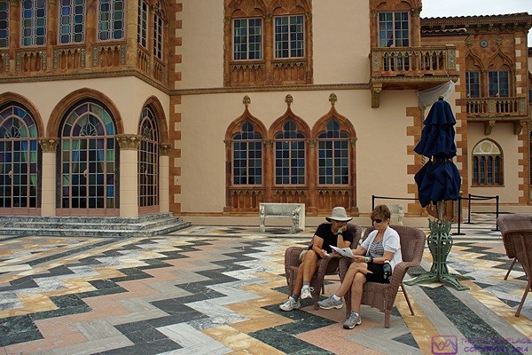
Linda and Karen rest on the patio of Ca’ D’Zan and study the map of the Ringling Museums complex, Sarasota, FL.
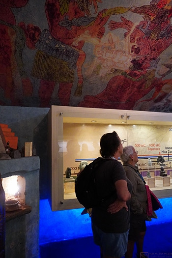
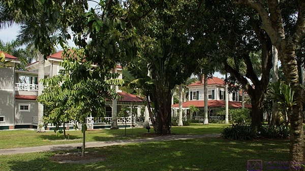
The 66 acre estate was the location of John and Mabel Ringlings’ winter home, Ca’ D’Zan, starting in 1926 when it was finished. Mabel died three years later and John continued to use the house until 1936 when he passed away. John was one of the seven Ringling brothers of circus fame. In addition to their 36,000 square foot home the estate includes an amazing art museum to house their extensive collection. There is also a circus museum and a building that houses the Tibbels scale model circus that Howard Tibbels spent 60 years creating. John and Mabel did not have any children and the entire estate was left to the people (State) of Florida when John died. The entire estate is now part of The Florida State University and the Ringling Art Museum is the official art museum of the State of Florida.
Ca’ D’Zan sits on Sarasota Bay and is a wonderful home in the Venetian Gothic style. We went on one of the longer, guided tours, so we got to see more of the house than we would have on a self-guided tour but not as much as the even longer (and more expensive) “behind-the-scenes” tour.
The Tibbels circus model is 1/16th scale, i.e., 3/4″ to the foot. The model covers a large area and illustrates every facet of an early 20th century major circus of the type that traveled from town to town by rail. Not only is the model an amazing thing to see, and an amazing thing for one man to have created, but it gave us an understanding of how a major circus of this period functioned. The logistics involved were impressive to say the least.
We finished our day at the Ringling Museums complex around 4:30 PM with a visit to the gift shop where Linda bought a book for Madeline for Valentine’s Day. Back at our cars we drove north on US-41 (Tamiami Trail) about three miles to Vertoris’ Pizzeria for my birthday dinner. Vertoris’ turned out to be a small, unassuming place with seating for maybe 24 people. They offered quite a variety of pizzas, including vegetarian, vegan, and gluten free, but had lots of other Italian dishes. I had vegan butternut squash ravioli, Linda had a vegan pizza, Karen had baked ziti, and Steve had the largest piece of lasagna I have ever seen. Karen and I had a glass of Chianti, and Linda had a different Italian red (but did not recall the name when we got home). The restaurant had vegan cupcakes so Linda, Karen, and I each had one while Steve had a cannoli.
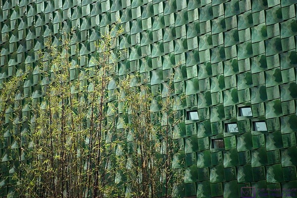
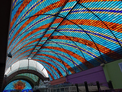
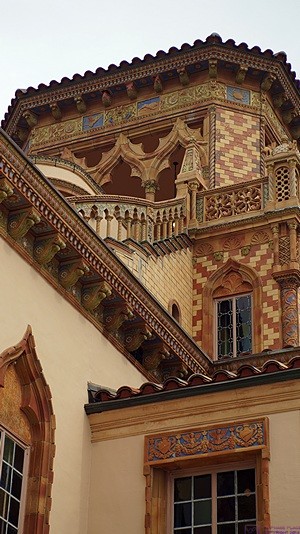
Detail view of one exterior wall of the modern addition to the Ringling Art Museum, Sarasota, FL.
Our son called last night to wish me happy birthday and our daughter texted me at 3:40 PM today to do the same. I saw the text at 5 PM after we were at the restaurant and texted her back. My phone battery was depleted, which is unusual for my phone, so I turned it off.
We were done with our meal by 6:30 PM, made arrangements for our next get-together, and went our separate ways. Steve and Karen headed south on Tamiami Trail 28 miles back to Nokomis and we headed north three miles to FL-70. Three tenths of a mile shy of FL-70 we encountered a serious traffic backup and I could see a large assemblage of emergency vehicles up ahead. We were already in the right hand lane and eventually got to FL-70 (53rd St.) and made the turn. US-41 beyond the intersection was blocked by the police. We did not slow down to gawk, which I find really annoying, and all we saw were emergency vehicles; lots of emergency vehicles.
It was raining when we left Vertoris’ and it got a lot heavier as we traveled east on FL-70. Somewhere east of Myakka City we drove out of the rain and did not encounter any more the rest of the way home. We arrived around 7:45 PM to find the grass at our RV site was wet, so we knew it had rained at some point. After bringing our stuff in from the car we started our Verizon Mi-Fi, started up our various technology devices, and I plugged in my phone to charge. Linda texted Mara to see if she wanted to go with us to Ed and Betty’s tomorrow morning. Mara replied that she did so Linda communicated the plans and timing for the morning.
Linda checked the weather and the rain was moving our way from whence we had just come. It was forecast to arrive around 9 PM, which it did, and be done by 11, which it was. In between in oscillated between heavy and light.